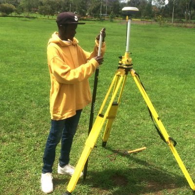
Everyone from different parts of the world are in Kenya for the climate summit. Show them the real issues on ground I’ll start


In a remarkable archaeological discovery, a 15-foot-long dugout canoe was unearthed in the depths of Wisconsin's Lake Mendota. This ancient vessel, shrouded in mystery, offers a unique glimpse into the past as it was meticulously scanned and carbon-dated, revealing its origins to…

10 YouTube Documentaries to Watch 👇🏾👇🏾👇🏾 1. The Credit Card Game —PBS Frontline 2. Arming Against Putin — DW Documentary 3. Fleeing Poverty in Venezuela & One Way Ticket to Ganglands — Free Documentary 4. Blood Business: The New Cannibalism— Moconomy 5. Secrets of our…
#altmetric #remotesensing 📢Individual Tree-Crown Detection and Species Identification in Heterogeneous Forests Using #Aerial #RGB Imagery and #DeepLearning by Mirela Beloiu, Lucca Heinzmann, Nataliia Rehush, Arthur Gessler 👉Read the full article: mdpi.com/2072-4292/15/5…

Python libraries for geospatial data visualization compiled by Milan Janosov, which one have you interacted with? #gischat

What do you know about cut and fill and other site earthworks? Share with us @mr_right_og @mutethia_karuma

Name 4 softwares you use in your work without telling us what you do. I will go first Manage engine Secure CRT PRTG Air control. Add yours 😊😊
United States Tendenze
- 1. Cheney 57.5K posts
- 2. First Take 43K posts
- 3. Sedition 108K posts
- 4. Mark Walter N/A
- 5. #ExpediaChat 1,112 posts
- 6. Treason 66.9K posts
- 7. Cam Newton 3,015 posts
- 8. Buss 5,900 posts
- 9. Stephen A 39.5K posts
- 10. SEDITIOUS BEHAVIOR 20.5K posts
- 11. Nano Banana Pro 18.2K posts
- 12. Jeanie N/A
- 13. Trump and Vance 31.6K posts
- 14. #Geeksgiving25 N/A
- 15. Bush 57.4K posts
- 16. Commander in Chief 39.2K posts
- 17. #AcousticPianoSnowGlobe 2,115 posts
- 18. Shayy 8,268 posts
- 19. UNLAWFUL 58.9K posts
- 20. Constitution 90.2K posts
Something went wrong.
Something went wrong.


