
Jonathan B. O'Rear
@JonathanBORear
Amateur radio operator, weather enthusiast, man of God and all around good man.
You might like


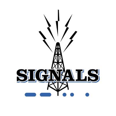
April 26th , 2024 Meeting Huntsville Amateur Radio Club – Weekly Meeting- SIGNALS Museum 7:30pm AGENDA: -FIELD DAY Location “FINAL DECISION”- -Quick- Business Meeting Mini DXpedition Trip by N4DVR Kevin Hoerburger Meeting is always on ZOOM

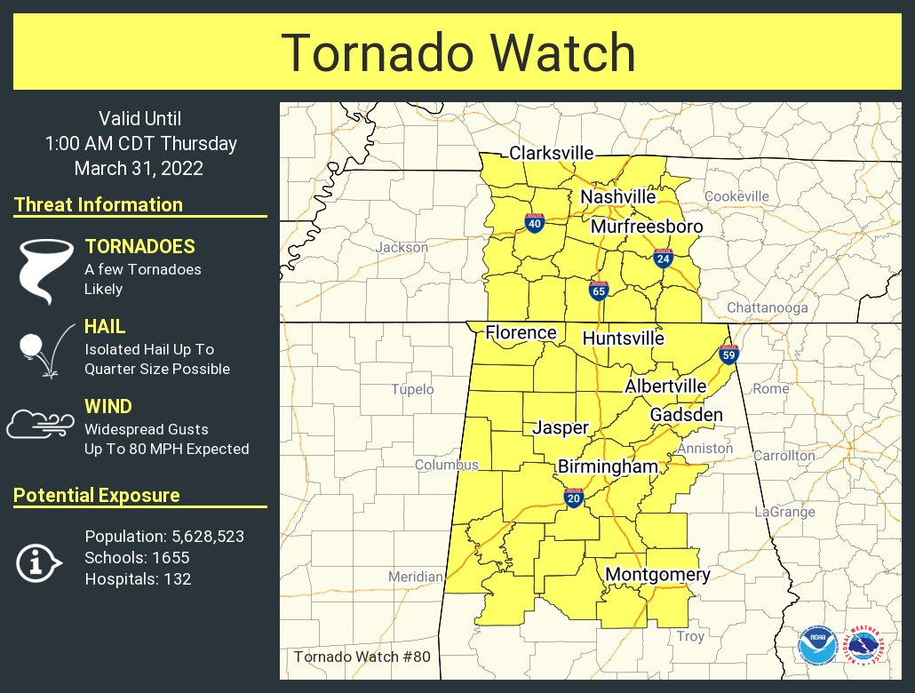
NWSHuntsville: A tornado watch has been issued for parts of Alabama and Tennessee until 1 AM CDT
New event. Winter Storm Warning from 3/11/2022 9:00 PM to 3/12/2022 9:00 AM CST for Morgan County, AL, Colber... bit.ly/3vYnIDi
New event. Tornado Watch from 2/22/2022 5:16 PM to 2/23/2022 12:00 AM CST for Morgan County, AL, Colbert Coun... bit.ly/3HpbKFb
[1231 PM]: Interested in severe weather? Want to become a Skywarn Storm Spotter? Join us for our online basic storm spotter training class TONIGHT at 6pm! Register here. register.gotowebinar.com/register/71317… #HUNwx
Activation of storm spotters and Emergency Management Personnel will be possible Thursday and Thursday night
New event. Tornado Watch from 1/25/2021 5:53 PM to 1/26/2021 1:00 AM CST for Morgan County, AL, Marshall Coun... bit.ly/3qNyRBh
The north Alabama Southern Middle Tennessee Skywarn network will be activated at 10:30 p.m. Central Standard Time by request of the National Weather Service
Spotter activation may be needed Wednesday night. Please relay any information about observed severe weather to the NWS while following all local, state, and CDC guidelines. $$
Skywarn activated for tornado watch number 75 until 4 a.m. Central Standard Time
Activation of storm spotters and Emergency Management Personnel is possible later tonight
Activation of thorn spiders and Emergency Management Personnel is possible late tonight
Skywarn is now activated until 10 p.m. for 22 watch number 61
Aldot. Treating elevated sections of i-565 in Huntsville
New Weather Alert ...SIGNIFICANT WEATHER ADVISORY FOR WESTERN MARSHALL...MADISON... EASTERN (cont) tl.gd/n_1sr20ij
New event. Severe Thunderstorm Warning from 10/26/2019 12:34 PM to 1:00 PM CDT for Tishomingo County, MS. bit.ly/2Wf5nhH

Heavy rain and cooler temperatures are ahead for the South and Lower Mississippi Valley: bit.ly/35V7yLN


10 AM CDT: Here are the Key Messages for Tropical Depression 17. For local information, see products issued by your local @NWS office at weather.gov
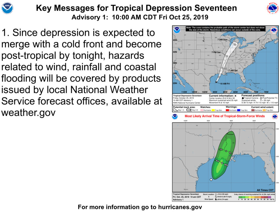
Local hazard information on TD 17 can be found at @NWSHouston @NWSLakeCharles @NWSNewOrleans @NWSMobile


United States Trends
- 1. Minneapolis 541 B posts
- 2. Minneapolis 541 B posts
- 3. George Floyd 22,8 B posts
- 4. FAFO 73,6 B posts
- 5. Murder 223 B posts
- 6. Noem 137 B posts
- 7. Insurrection Act 18,6 B posts
- 8. Justified 42 B posts
- 9. Gestapo 31,6 B posts
- 10. Wizards 15 B posts
- 11. Blackrock 45,3 B posts
- 12. National Guard 76,3 B posts
- 13. Casemiro 6.763 posts
- 14. Blackstone 17,3 B posts
- 15. LEOs 2.066 posts
- 16. Ashli Babbitt 111 B posts
- 17. Self Defense 89 B posts
- 18. HELLUVATOOZ 3.894 posts
- 19. The Mayor 191 B posts
- 20. Zion 29 B posts


Something went wrong.
Something went wrong.