
MPN Weather
@MPNWeather
Providing accurate forecasts for Maryland, Pennsylvania and New Jersey
You might like


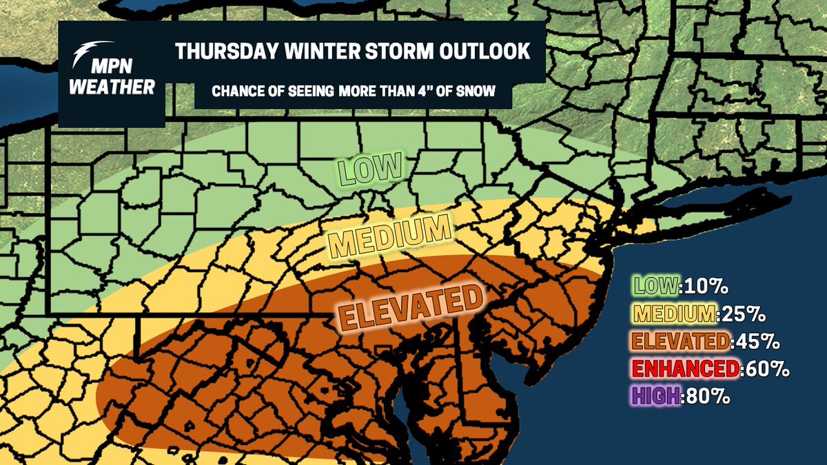
Early look at Thursday's winter storm threat. Too early for amounts, so just highlighting the areas most at risk as of right now. This can and probably will change
Well the 06z NAM jumps north. Too early to discern if this is a trend or not but would fit the short range of every system this year. Snow map out later today
Gonna wait to put out a snowfall map till the inevitable NW trends kicks in tomorrow
How long till people start worrying about suppression for the Thursday storm just for it to trend NW in the short range?
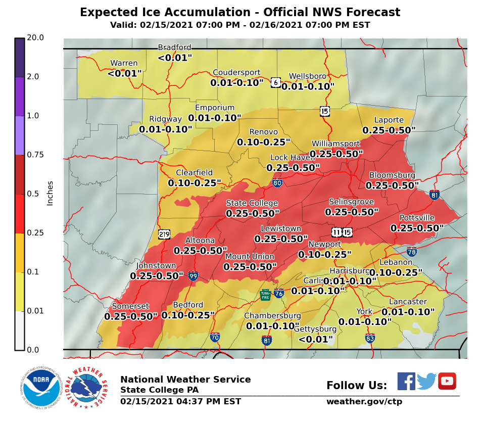
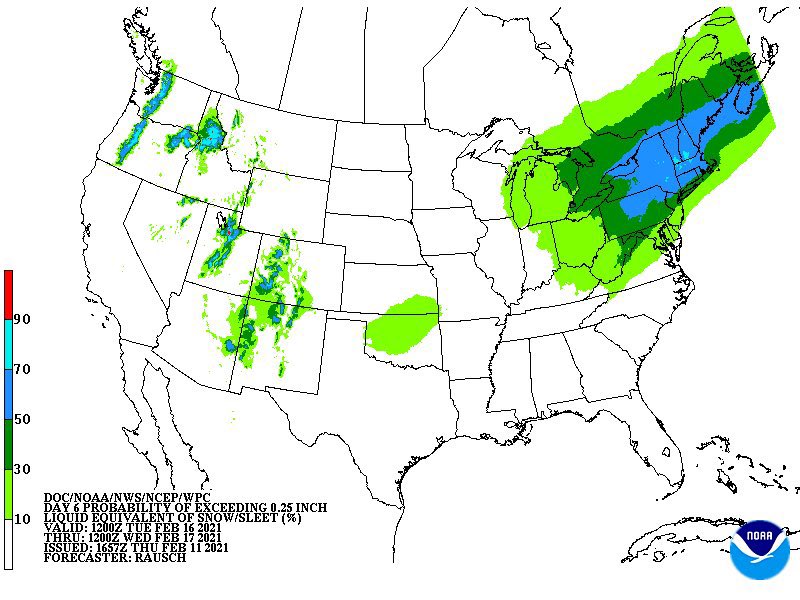
If you’re under an Ice Storm Warning (dark purple), get where you need to be by sundown and be prepared to stay there for a while in addition to potential power loss. Ice is not good!

LOL if you thought tomorrow’s ice was the last storm in this stretch
Looks like this is happening
Think this ice threat is gonna trend NW over the next 12 hours or so
Think this ice threat is gonna trend NW over the next 12 hours or so
Yuck. There are gonna be some BIG problems across the interior Monday-Tuesday
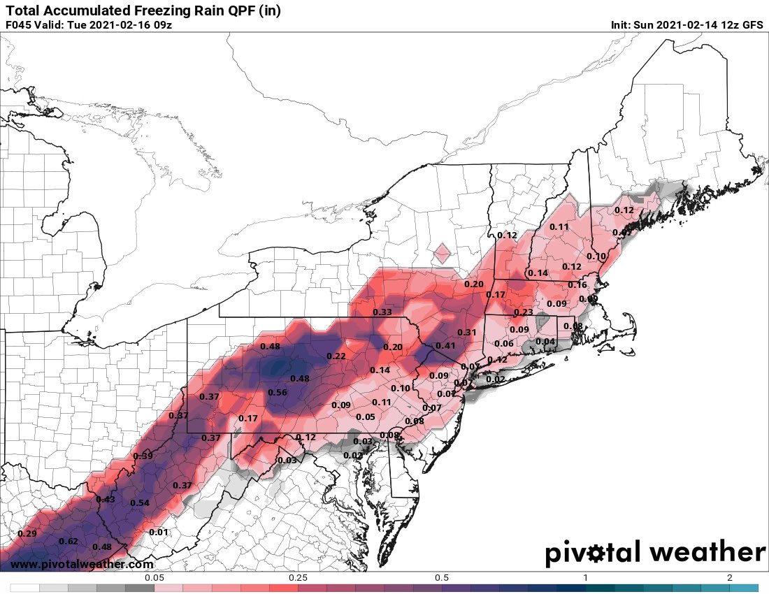
Not gonna be a fun time for many in the Northeast next week. Big ice potential
Still a while out and I’m watching the current storm unfold, but I’m growingly concerned about multiple freezing rain events across the region starting this weekend
Don’t forget we have more storms to track after tomorrow’s event. Still watching the Friday wave which should slip south. Then the weekend. Then next Tuesday. Then next Thursday. Busy times
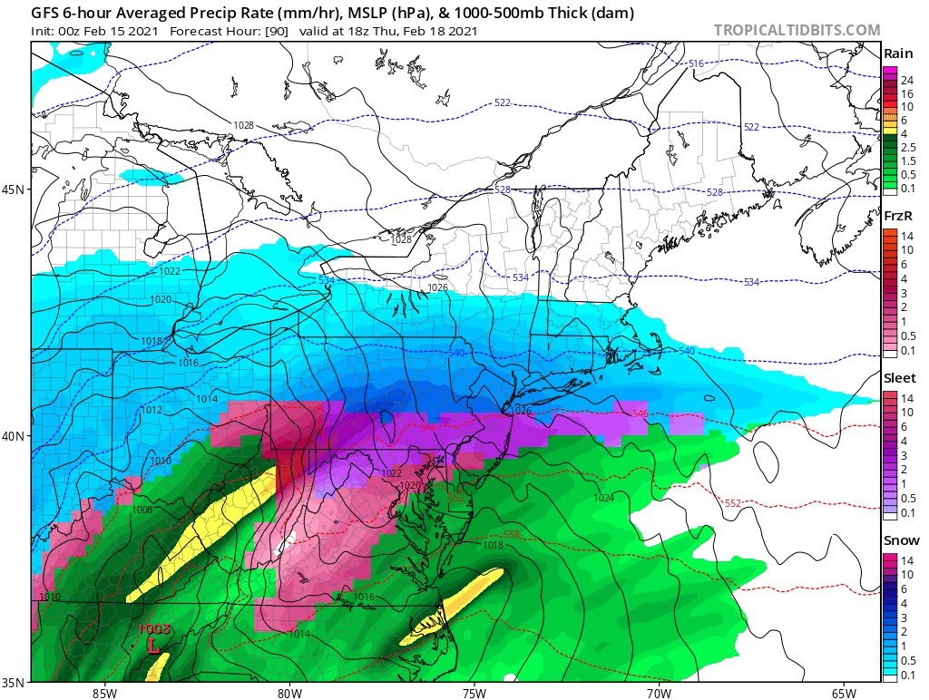
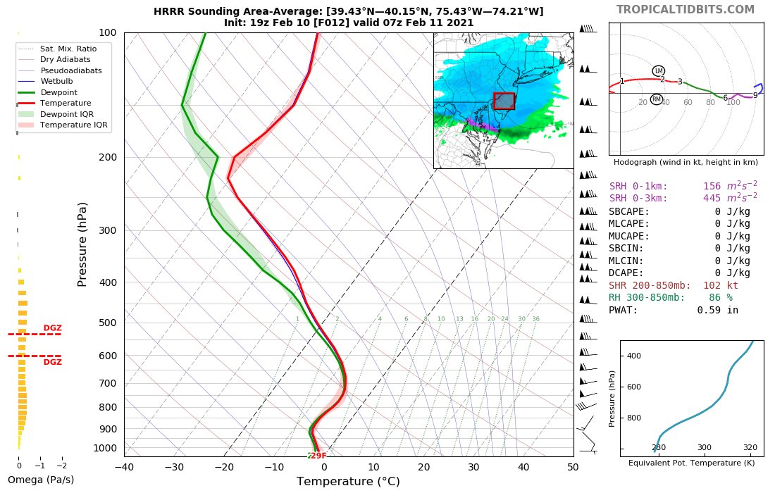
I'm a bit aggressive in the northern extent of some of the heavier accumulations. Why? Snow growth looks really good and ratios will be higher than 10:1
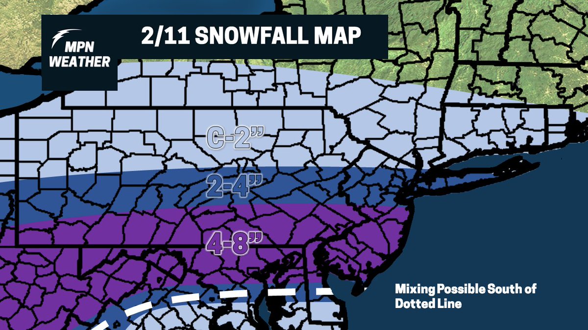
Here is my snowfall map for tomorrow. First and final call. As per usual, things hop a bit north. Sorry DC snow lovers

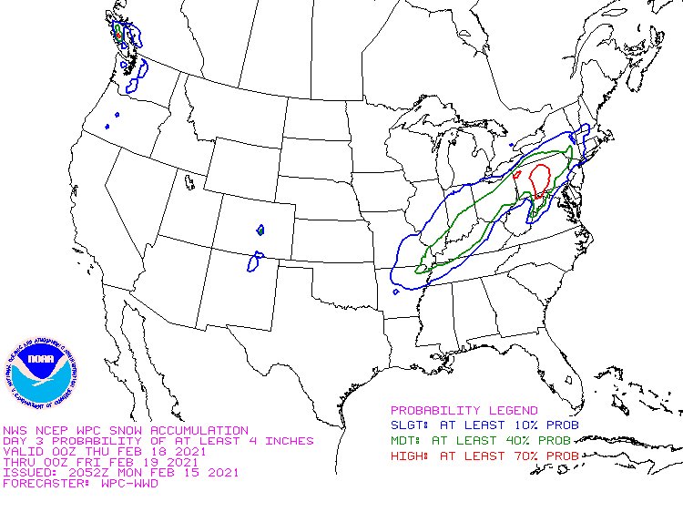
Models taking a jog north this morning for tomorrow’s snow event. I’ll have a snow map out later. Threat map from earlier still stands


United States Trends
- 1. Philip Rivers N/A
- 2. benson boone N/A
- 3. Ryan Wedding N/A
- 4. FINALLY DID IT N/A
- 5. Lobo N/A
- 6. #FursuitFriday N/A
- 7. March for Life N/A
- 8. #Supergirl N/A
- 9. AMERICAN GIRLS N/A
- 10. Cameron Smotherman N/A
- 11. #FanCashDropPromotion N/A
- 12. Bricillo N/A
- 13. Jason Momoa N/A
- 14. Season 2 Weight Loss N/A
- 15. Marc Anthony N/A
- 16. #FridayVibes N/A
- 17. Jeff Saturday N/A
- 18. #UFC324 N/A
- 19. Deion N/A
- 20. Jim Jones N/A
You might like
-
 Laurenthestormchaser
@Laurenthestorm -
 Jonathan Polmatier
@JpolmatierW -
 Curt Yowell
@Storm11275 -
 Max.wx27
@Max2797_ -
 Stephen Szulborski
@Stebo_Wx -
 Oliver K
@KnaptonOliver -
 Matt Muller
@wxwithmatt -
 Cade Sutton Wx
@CadeSuttonWx -
 Montgomery County Weather
@AtlanticWx -
 Robbie Christian
@RealRobbieC540 -
 KCWX
KCWX
@b3nile
Something went wrong.
Something went wrong.