
Ethan Rogers
@CTforecasting
Storm Warning Meteorologist at @AccuWeather, Penn State Meteorology Alum, Map Enthusiast
You might like


Here is my final project for my GIS class! It's a tornado vulnerability index I created, and includes a mean tornado intensity (with frequency factored in), mobile home %, Population density (people/km^2) and income statistics. Dixie Alley, not surprisingly is the most vulnerable

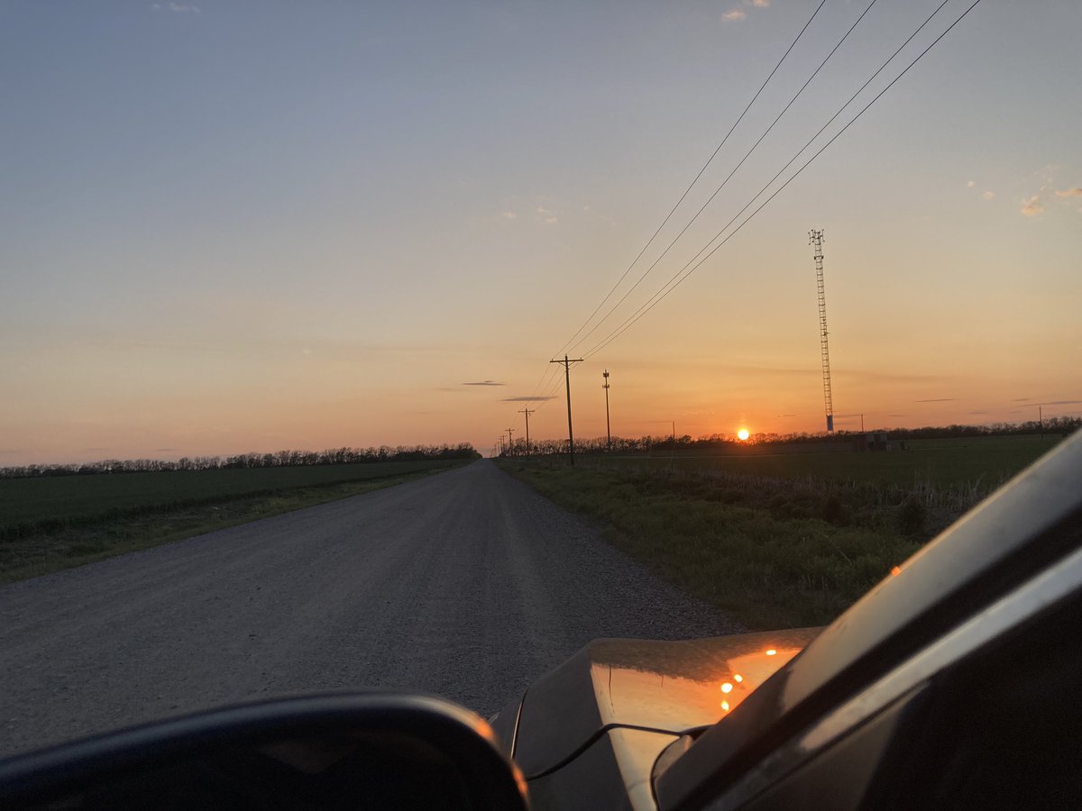
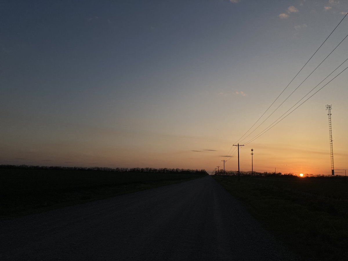
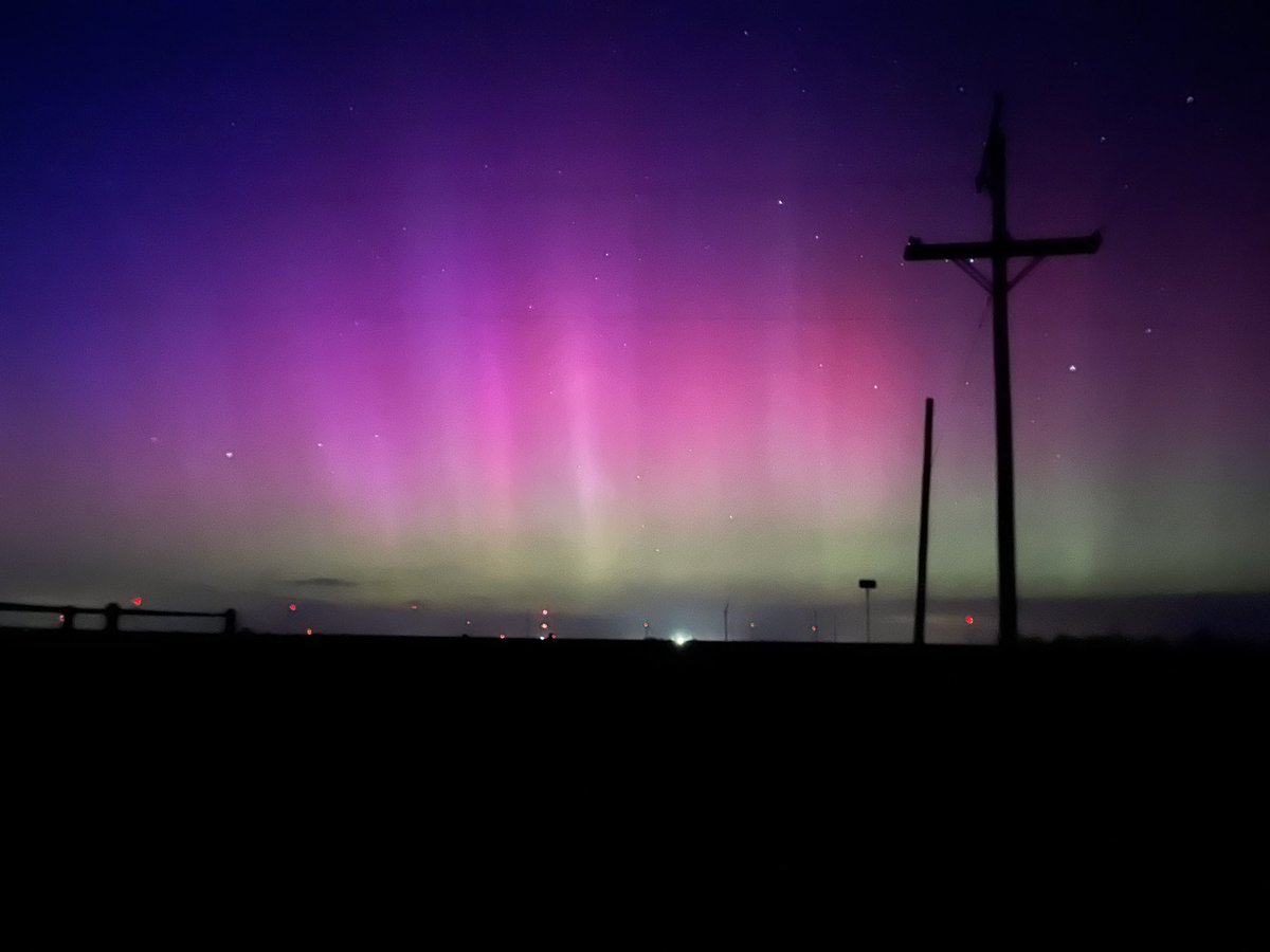
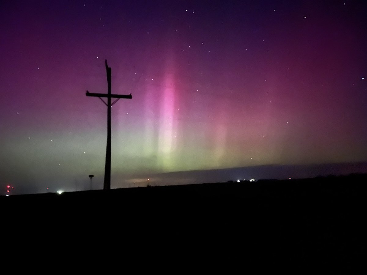
Happy belated Earth Day! Unedited pictures from a couple drives in Andover, KS (sunset) and Florence, KS (#aurora) yesterday! #kswx
I was not gonna let you get stranded in Denver through Christmas 😤❤️
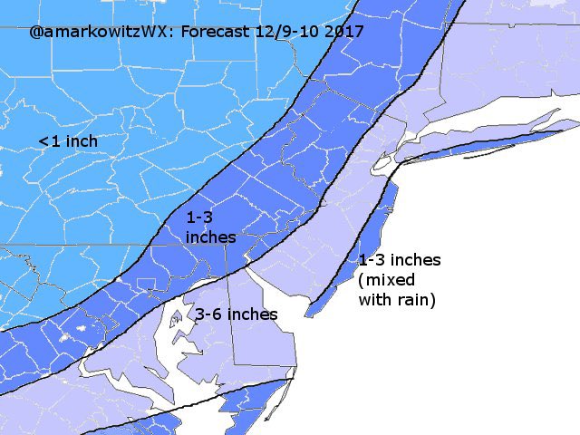
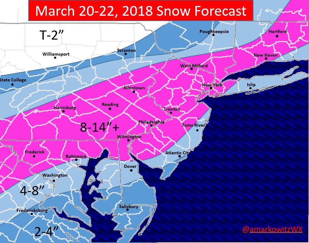
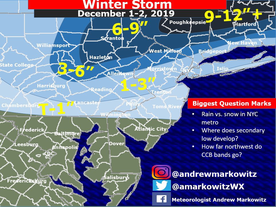
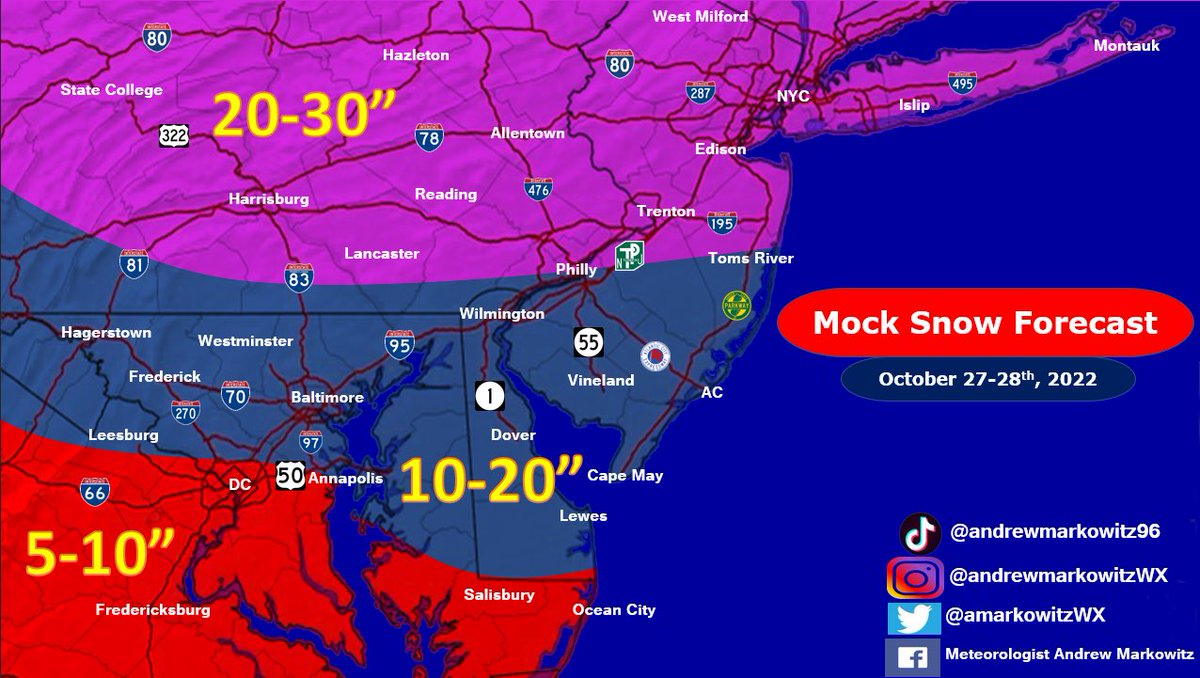
You could say I’ve come a long way when it comes to graphic design. With today’s first snow, I decided it was finally time to create some fresh new snow map templates for this upcoming winter (including for DEN). Big thanks to @CTforecasting and @CristCacewx for the assistance.

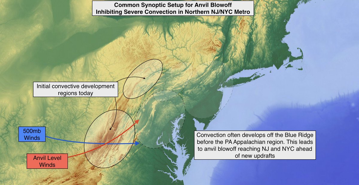
Parts of NJ and the NYC Area can sometimes see a relative minimum in severe convective coverage during synoptic setups similar to today. Anvil level winds steer clouds from earlier developing convection off the Blue Ridge into the region ahead of local severe storms.

The first image from the Webb Space Telescope represents a historic moment for science and technology. For astronomy and space exploration. And for America and all humanity.


Large-hail-producing thunderstorm over southeast Colorado impressive in GOES-East 1-min VIS with inflow feeder bands, above anvil cirrus plume, and even a hail swath, all evident. #cowx

Steve Kerr on today's tragic shooting in Uvalde, Texas.


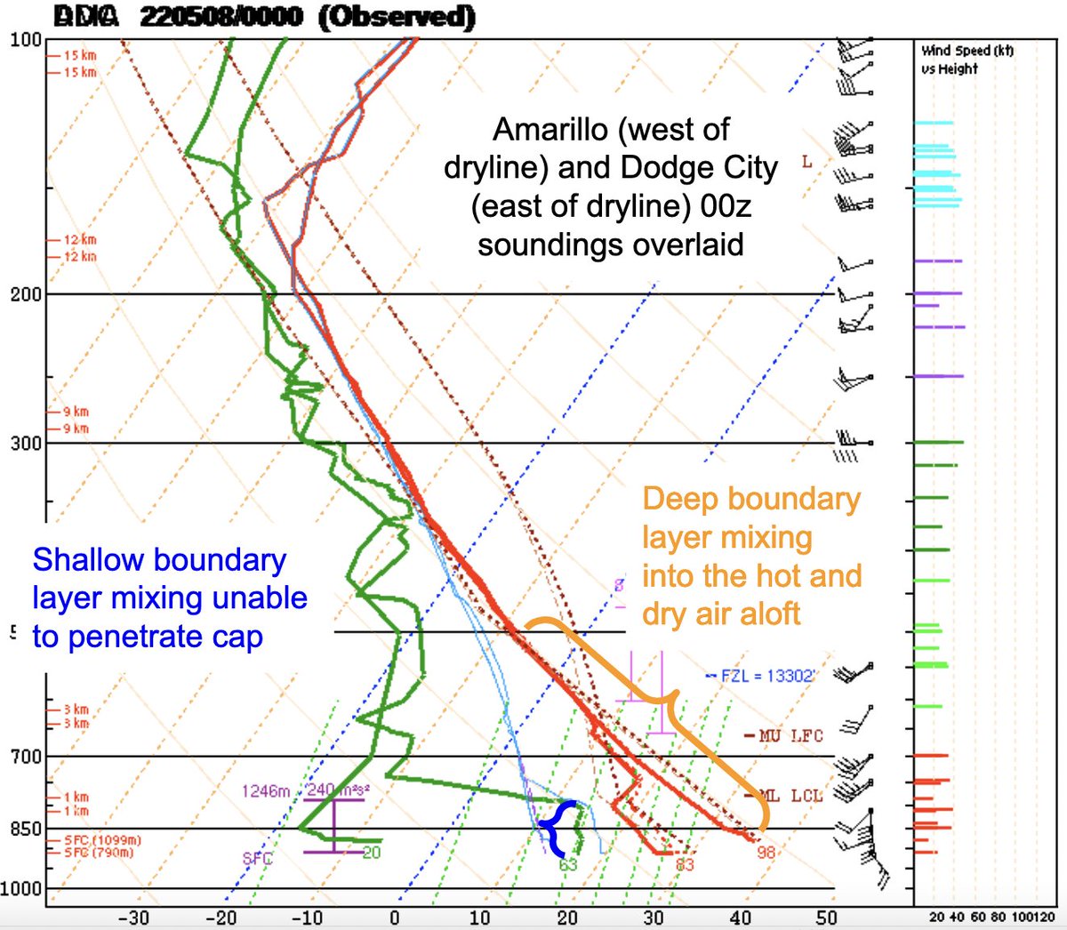
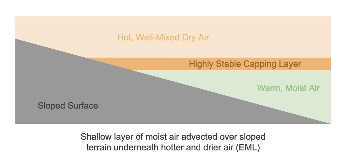
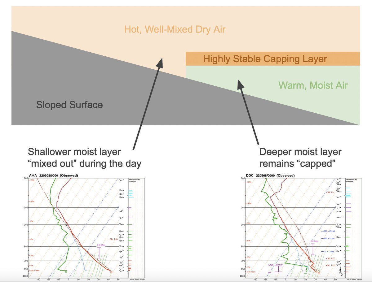
Last night's 00z soundings do a good job illustrating 1) The role that terrain plays in the formation of the dryline 2) That drylines are chiefly driven by differences between boundary layers on either side

Here ya go! 😀 Shoutout to the SOOs who worked with me on developing this!
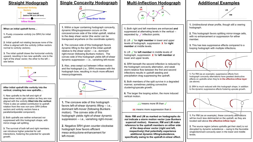

Say, hypothetically, you had a hodograph "field guide", that told you everything you wanted about what that hodo does. What's in that field guide?

Cap break forecasting techniques: 1) Is the flow near the LFC strong and orthogonal to initiating boundary? If so, parcels tend to detrain and CI may fail. Weak flow more parallel to the dryline will keep parcels within the dryline circulation longer and the cap can be overcome


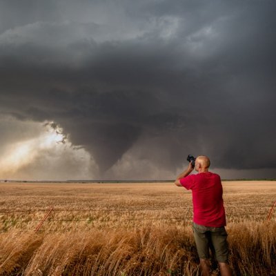
#INCREDIBLE up-close #tornado suction vortices crossing US-400 in #Andover #Kansas #KSwx @breakingweather @ReedTimmerAccu @MikeCollierWX
Destructive tornado tearing through Andover KS minutes ago


United States Trends
- 1. Tomlin N/A
- 2. Scott Adams N/A
- 3. $PIKZ N/A
- 4. AFC North N/A
- 5. Zac Taylor N/A
- 6. Dilbert N/A
- 7. Pittsburgh N/A
- 8. Brian Flores N/A
- 9. Jim Jordan N/A
- 10. Semenyo N/A
- 11. Ford N/A
- 12. Clintons N/A
- 13. Daboll N/A
- 14. Deadpool N/A
- 15. Cowher N/A
- 16. Steve Bisciotti N/A
- 17. Supreme Court N/A
- 18. Newcastle N/A
- 19. Shavers N/A
- 20. #ErfanSoltani N/A
You might like
-
 Tucker Antico
@tuckerweather -
 Andrew Markowitz
@amarkowitzWX -
 Chris Bouzakis
@ChrisBouzakis -
 Grant LaChat
@GLaChatWx -
 Quinlan Mulhern
@Mulhern_Wx -
 Marshall Moss
@MarshallMoss -
 Denys⚡️🏃
@denysk02 -
 Alex Klucher
@AlexKlucher -
 Jacob Morse
@JacobMorseWX -
 Logan Giles
@LoganGilesWx -
 Cristopher Cace
@ccace_wx -
 Matt Hoenig
@MattHoenigWMUR -
 Rudy's weather
@rudy_weather -
 J.P. Tracey
@WX_JPTracey -
 Nick Chiarappa
@wx_virginia
Something went wrong.
Something went wrong.