
MapExcel
@MapExcel
The free Mapcite Excel addin is now available from the Microsoft App store! Fully interactive maps react directly within your spreadsheet. Use link below.
Tal vez te guste


Despite government support throughout the pandemic, businesses are losing money every day and unemployment is skyrocketing. Who will pay the price for these losses and lack of income? Read more here: bit.ly/economicburden #COVID19 #governmentfunds #property #economicrecovery
mapcite.com
COVID-19: Where Will The Economic Burden Fall? - Mapcite
We have all seen the huge sums of money the Australian government has applied in an effort to keep businesses afloat and people working. Despite those
Consider this: a CRM system that attributes data to a single address. SpatialCRM changes the system paradigm to make an address the focal point to provide better customer insights. Read more here: bit.ly/Spatial-CRM #spatialcrm #data #location #analytics #crm #CRMSoftwares
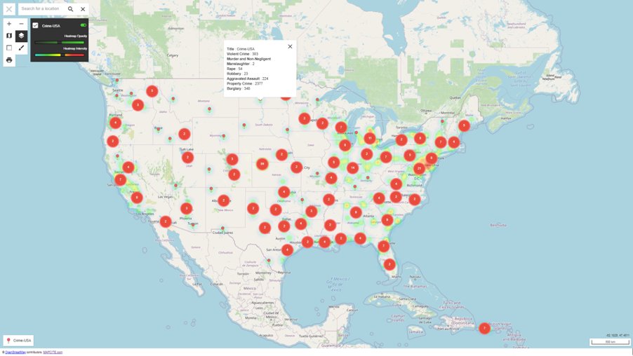
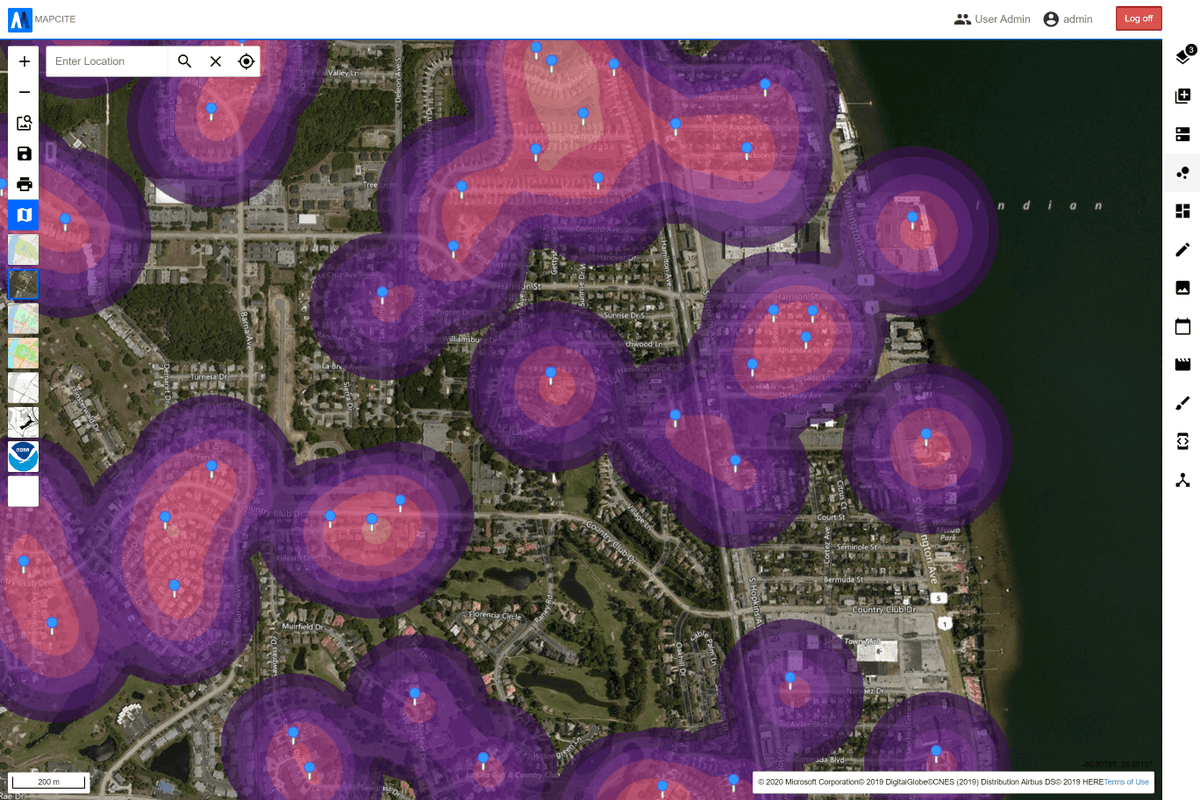
Mapcite Publisher gives users a way to create detailed data visualisations through Excel & then publish them to the web, making sharing maps even easier. Explore an interactive map highlighting USA crime trends from 2018 here bit.ly/USA-crime #data #mapping #excel #crime
Have you heard about Mapcite Publisher? It's a new feature in our Excel Addin allowing you to publish your detailed map straight to the web, making sharing even easier. Check out more about this awesome new feature here: bit.ly/MapcitePublish…
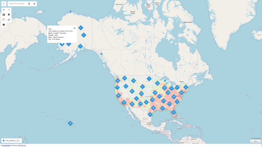
We've created an #interactivemap using #mapcite #exceladdin #publisher feature exploring the #policedeaths in the #USA. Take a look for yourself here bit.ly/PoliceDeathsUSA Check out our blog and learn about our @MapExcel tools to dive deeper into this data.

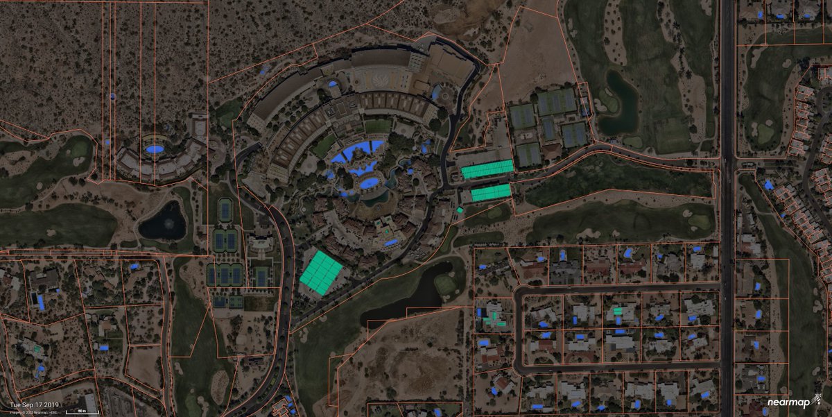
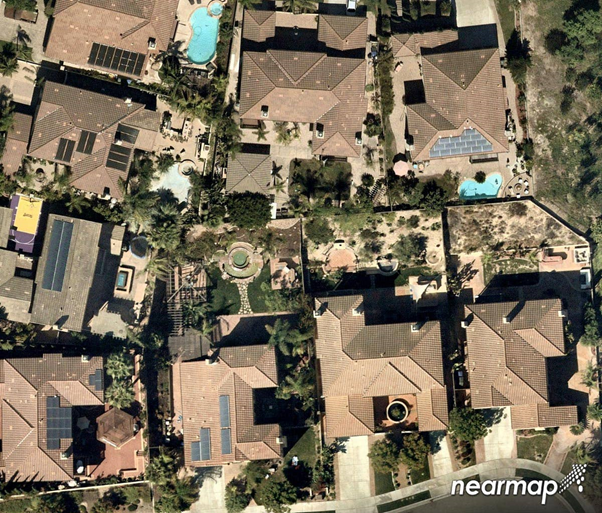
Exciting news! Today we have officially launched the general availability of #NearmapAI on Mapbrowser! Automatically identify ground features, track changes and verify insights against current aerial imagery at massive scale. Check it out at nearmap.com/ai

A new breed of GeoTech start-ups are taking powerful geospatial analysis functions and distilling them into easy to use solutions. Find out more from Richard Crump, @MAPCITE's Head of Consulting Services: ow.ly/O7Bg50zSDKy #everythinghappenssomewhere


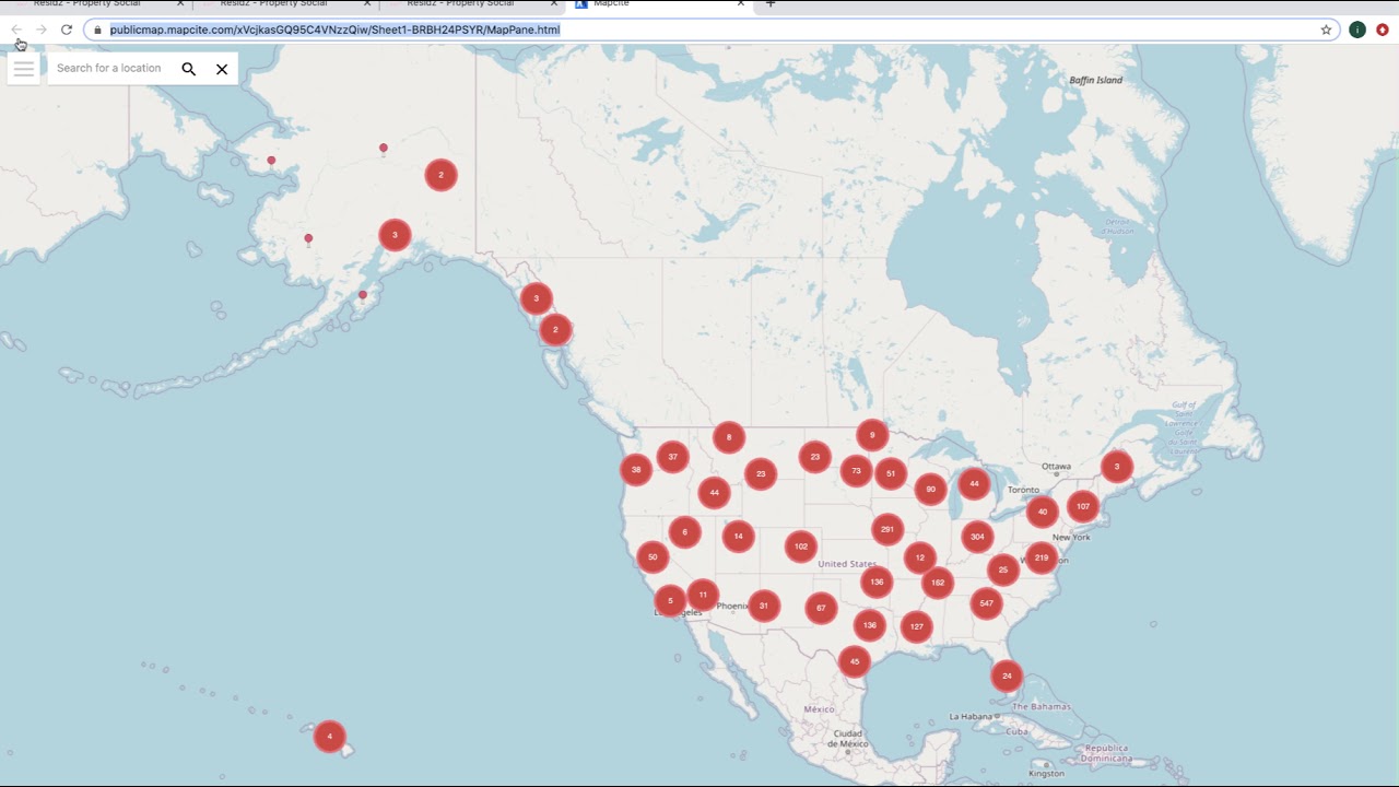
Do you like mapping? Would you like an easy way to make a map? youtu.be/u-eFfqvHTlY Here is a map i just created publicmap.mapcite.com/xVcjkasGQ95C4V…
youtube.com
YouTube
Creating a Web Map Direct from Excel
A new breed of GeoTech start-ups are taking powerful geospatial analysis functions and distilling them into easy to use solutions. Find out more from Richard Crump, @MAPCITE's Head of Consulting Services: ow.ly/kxi050zH62E #everythinghappenssomewhere

Do you like mapping? Would you like an easy way to make a map? youtu.be/u-eFfqvHTlY Here is a map i just created publicmap.mapcite.com/xVcjkasGQ95C4V…
youtube.com
YouTube
Creating a Web Map Direct from Excel
Did you miss last week's #Covid19 webinar? Hear from our partners @esriuk, @MAPCITE and @basemap to find out how OS data can support responses to the pandemic: ow.ly/Zlmp50zEaXw

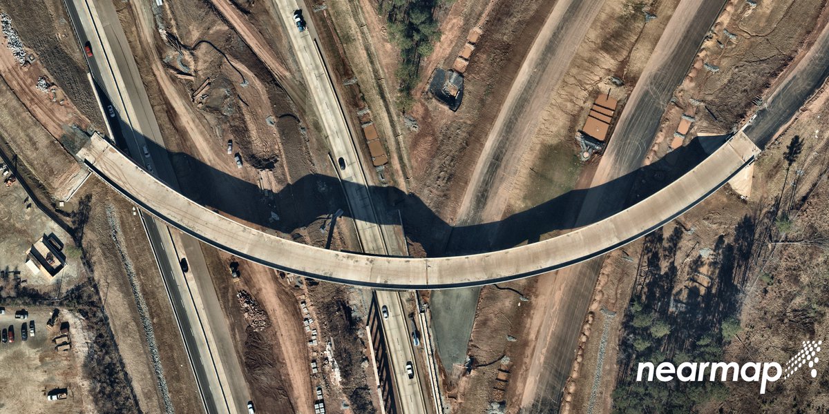
Check out this customer story from Durham Public Works @CityofDurhamNC and see how high res, up to date aerial imagery can step up your project efficiency! ow.ly/5rs750zCeQd
The Elevation of the Concept of Where for Business Continuity mapcite.com/2020/05/12/the… via @mapcite
mapcite.com/2020/05/01/why… Ever tried smelling your data? Just as smell helps you place memories, location can help you place data. Not convinced? Read more ...
mapcite.com
Why You Should Smell Your Data - Mapcite
Did you know that smell is the most powerful of the senses for triggering memories? Apparently the offactory system is in the same part of our brain that
ow.ly/wlKN50zp72v Are You Making The Most of Your Data? The more people empowered to see data, the sooner a business can see valuable trends. Use #Mapcite to uncover business intelligence.
ow.ly/b3v850zp7lQ #GeoSpatial #poi #OrdnanceSurvey Need location data during COVID-19? Access Free Ordnance Survey Data for first responders.

ow.ly/wNtu50zq7KJ #retail #data #location What does a 'clicks and bricks' retail future look like after COVID-19?
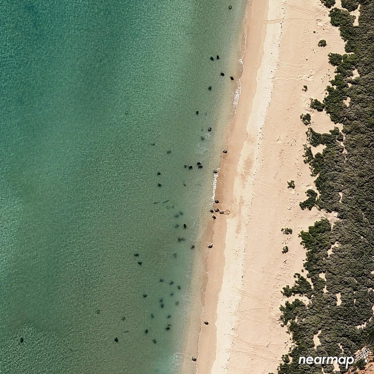
Wanted to send you off to your weekend with this sensational seaside #aerial capture of turtles 🐢 relaxing on the shores of #Australia! * Learn more-> ow.ly/IZyu50yYcNA

Geofencing Software Market Is Trending massively With Leading Key players – MAPCITE, com., Apple Inc, LocationSmart, … #geofencing #SaaS #LBS bccourier.com/geofencing-sof…


United States Tendencias
- 1. #ใครในกระจกEP5 9,307 posts
- 2. #happybdayTYGA N/A
- 3. GeForce Season 3,922 posts
- 4. $APDN $0.20 Applied DNA N/A
- 5. Peggy 36K posts
- 6. $LMT $450.50 Lockheed F-35 N/A
- 7. $NVDA 48.9K posts
- 8. Sonic 06 3,371 posts
- 9. Comey 49.5K posts
- 10. Martha 17.5K posts
- 11. Jason Crow 1,167 posts
- 12. Halligan 21.5K posts
- 13. Stargate 5,255 posts
- 14. MLB TV 1,729 posts
- 15. Cory Mills 40.9K posts
- 16. Dearborn 414K posts
- 17. Sidwell N/A
- 18. Sumrall 1,379 posts
- 19. Berseria 6,196 posts
- 20. Zeraora 19.2K posts


Something went wrong.
Something went wrong.