
Pat’s Path Predictor
@PatsPredictor
Reporting Extreme Weather The U.S. and the Pacific and Atlantic Oceans During Hurricane Season.
You might like


LET'S GO!!!!!!! CORREA AND JP3 WILL BE REUNITED!

BREAKING: The Minnesota Twins are trading shortstop Carlos Correa to the Houston Astros, sources tell ESPN.
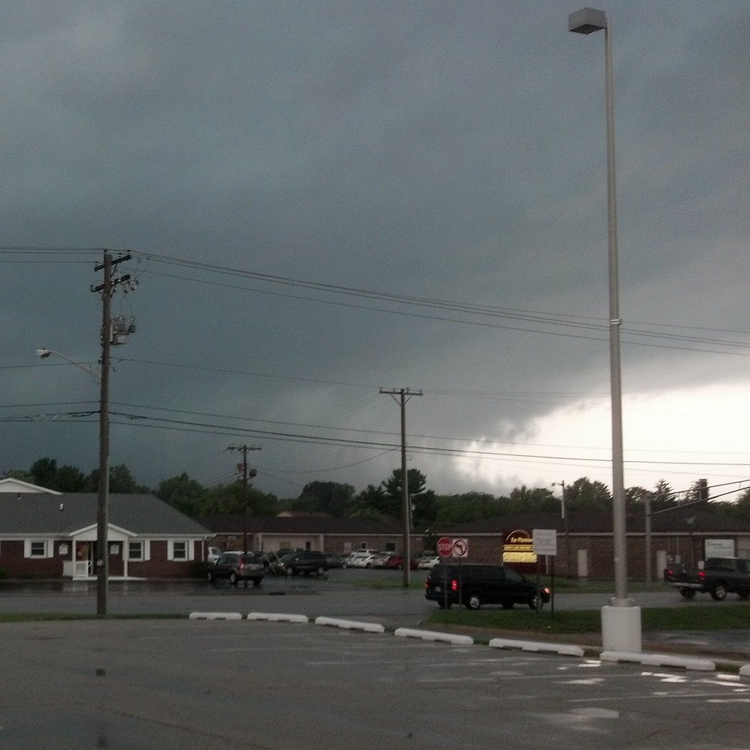
Moderate Risk Issued for parts of the Mississippi River Valley including St. Louis, which is right in the epicenter of the risk. 45% Hatched Wind Risk is driving the Moderate. This will be a very big next two days.


Looks like I’m be returning. Video tomorrow at 4/3 C

8 pm EDT Sat, Oct. 26: A broad area of low pressure is likely to develop over the SW Caribbean Sea around the middle of next week. Some gradual development of this system will be possible through the end of the week while it meanders or drifts northeastward over the SW Caribbean…

Proud of you, David!

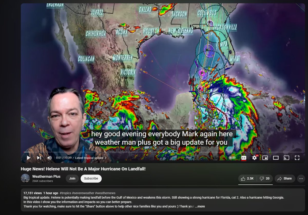
Good evening everybody after hearing all the devastation regarding hurricane Helene‘s aftermath. Buildings swept into rivers, trees falling on top of peoples homes, roads being washed away, sinkholes developing, is just devastating and depressing to hear that a lot people have to…

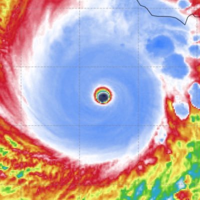
Already down to 990 mb?! This is escalating quick!
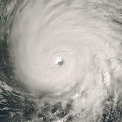
Conveniently located buoy near #Helene has its pressures dropping quickly. Down to 992mb, implied 990mb minimum pressure including the wind! With the new central convection this suggests more rapid intensification has already begun, recon about to go in and confirm


Weatherman Plus became a downcaster for once, lol Still pretty bad considering that we are in the early stages of rapid intensification.
00Z Hurricane Runs want #Invest97L to get into at least the 930's mb and at least Major Hurricane strength. This is a situation that we need to watch closely.


That’s the latest 00Z GFS run and my reaction to it. Keep in mind, this one model, it’s still early, nothing is set in stone. But Tampa Bay and areas north especially need to watch this. These Gyre systems are no joke.


What did I come back to? The Tropics are actually active?!

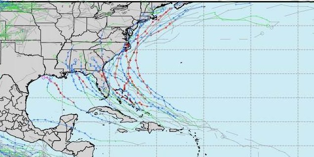
The 12Z Euro ensembles massively uptrended on the threat for tropical development. Everyone from the Lesser Antilles to Florida need to watch out!


Please subscribe to this channel if you like videos and live streams like covering hurricane activity in the Atlantic and Gulf of Mexico. youtube.com/@PatsPathPredi… #Subscribe
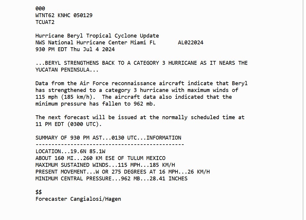
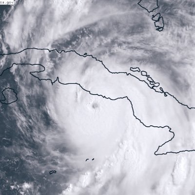
A lot of people laughed at me over this, but its happening. Beryl has restrengthened into a Major Hurricane and is expected to strike the Yucatan Peninsula as a Category 3 Hurricane, but rapid intensification before landfall cannot be ruled out.


United States Trends
- 1. Cloudflare 225K posts
- 2. Gemini 3 30.4K posts
- 3. #AcousticPianoCollection 1,307 posts
- 4. Saudi 137K posts
- 5. Piggy 66.1K posts
- 6. Jamal Khashoggi 3,497 posts
- 7. Salman 39.7K posts
- 8. Antigravity 2,755 posts
- 9. Olivia Dean 4,329 posts
- 10. #LaSayoSeQuedóGuindando 1,334 posts
- 11. La Chona 1,660 posts
- 12. CAIR 27.6K posts
- 13. Taco Tuesday 15.5K posts
- 14. Presidential Walk of Fame 3,132 posts
- 15. Lane Kiffin 15.4K posts
- 16. #ONEPIECE1166 4,976 posts
- 17. Merch 67.6K posts
- 18. Anthropic 8,997 posts
- 19. #MSIgnite N/A
- 20. #tuesdayvibe 3,304 posts


Something went wrong.
Something went wrong.