
Polygon Fails
@PolygonFail
Pointing out the flaws in the NWS polygon warning system since 2015
You might like


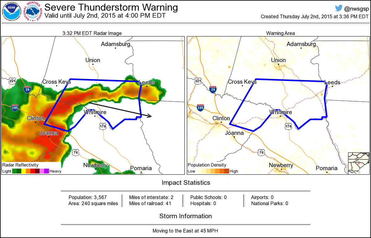
Severe Thunderstorm Warning including Sedalia SC, Carlisle SC until 4:00 PM EDT
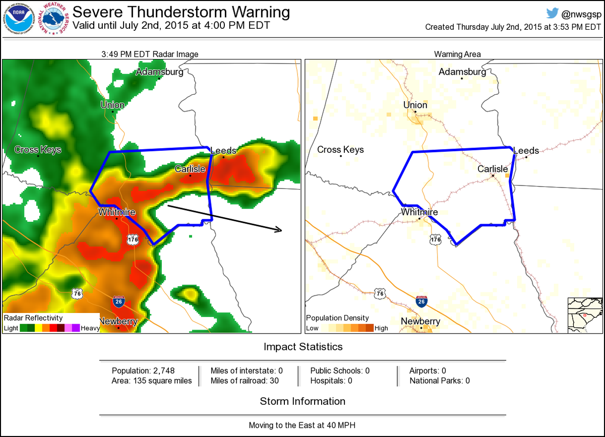
Severe Thunderstorm Warning including Carlisle SC until 4:00 PM EDT
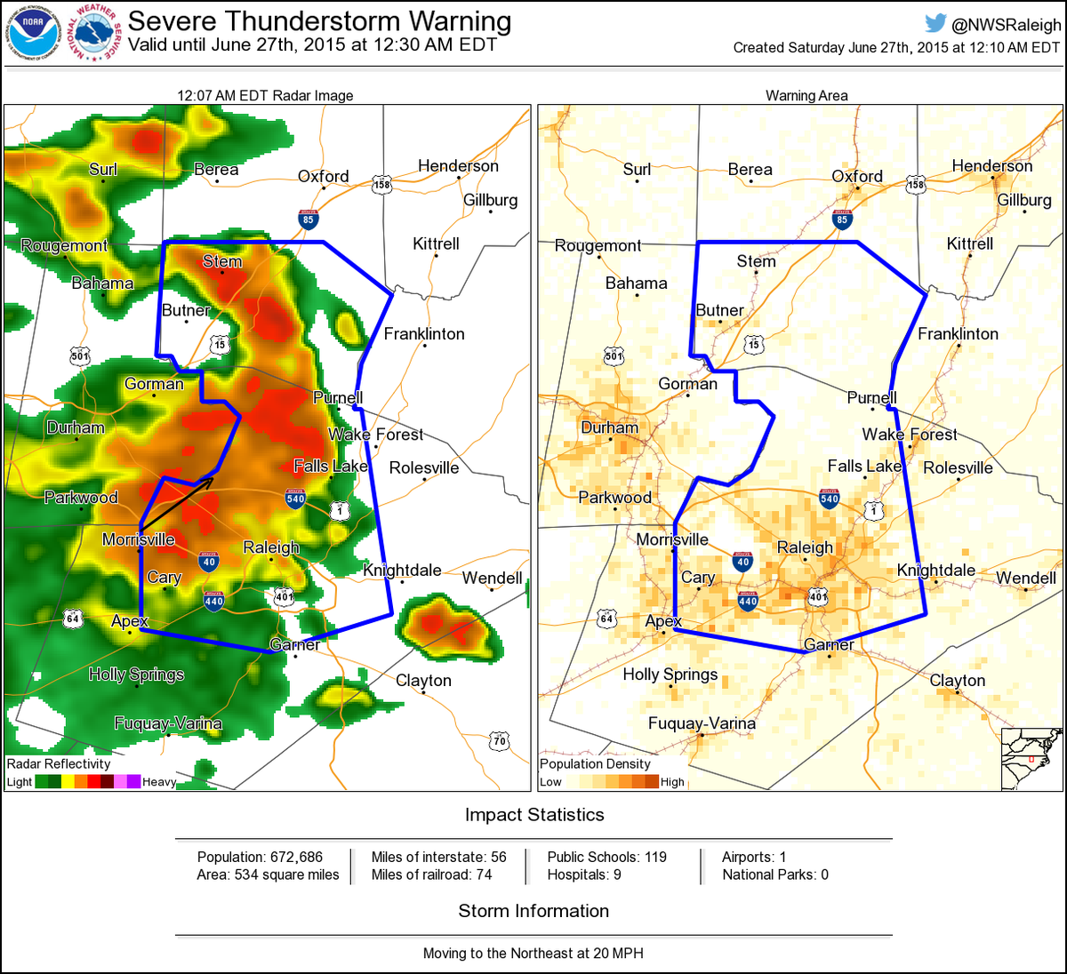
Severe Thunderstorm Warning including Raleigh NC, Cary NC, New Hope NC until 12:30 AM EDT
Severe Thunderstorm Warning including Woodbridge VA, Franconia VA, Fort Belvoir VA until 3:45 PM EDT
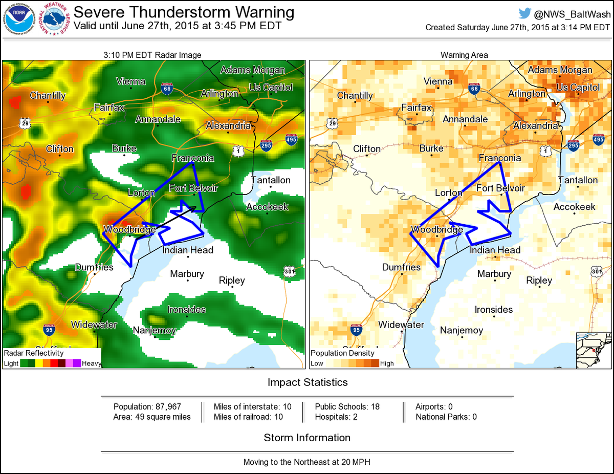
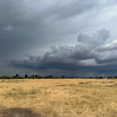
So many times a simple wedge would accurately convey storm motion and impacts, not geographical boundaries.
For my new followers- I know 99% of the time the forecaster is bound by policy and technical limitations.
I'll leave this here.
Severe Thunderstorm Warning including Carrollton KY, Williamstown KY, Dry Ridge KY until 7:00 PM EDT
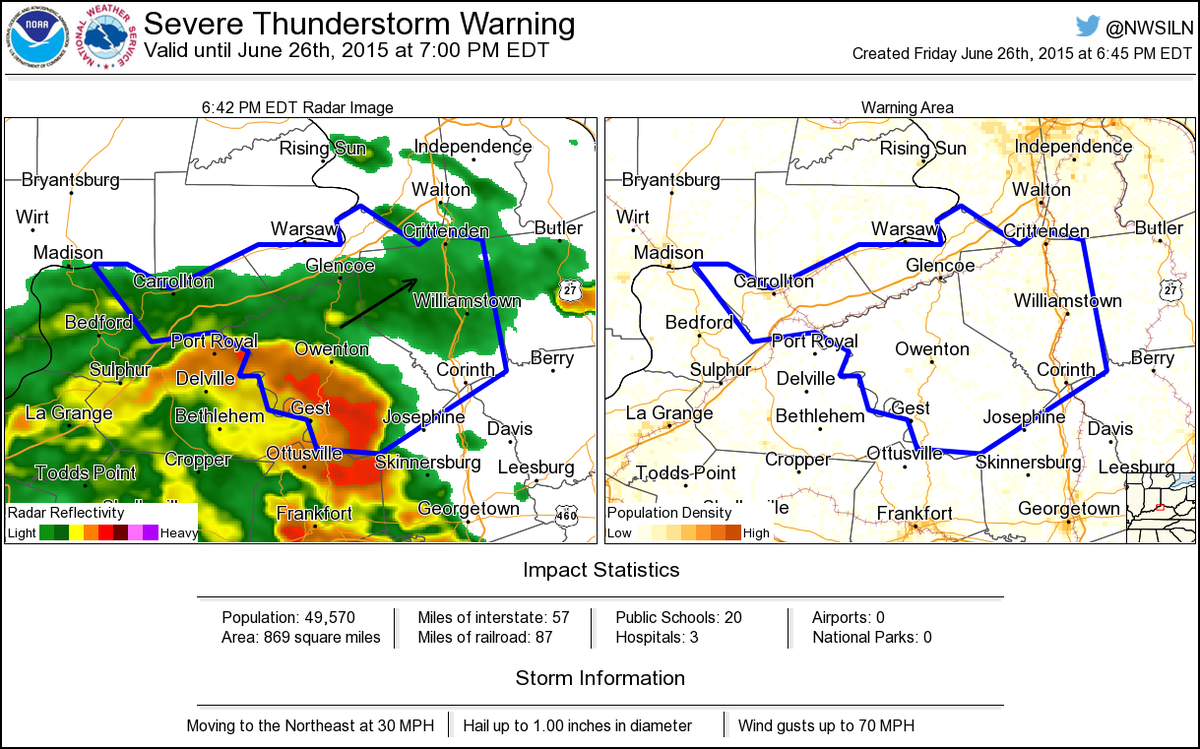
This storm will become severe at the county line.
Severe Thunderstorm Warning including Waverly TN, New Johnsonville TN, Mcewen TN until 7:15 PM CDT
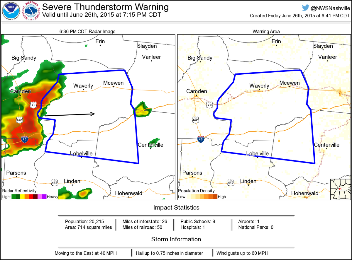
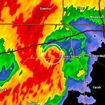
Fail, or interesting storm shape?
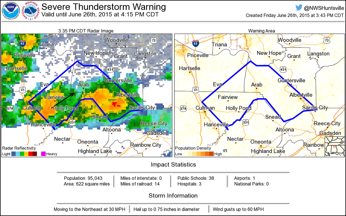
Severe Thunderstorm Warning including Albertville AL, Boaz AL, Arab AL until 4:15 PM CDT
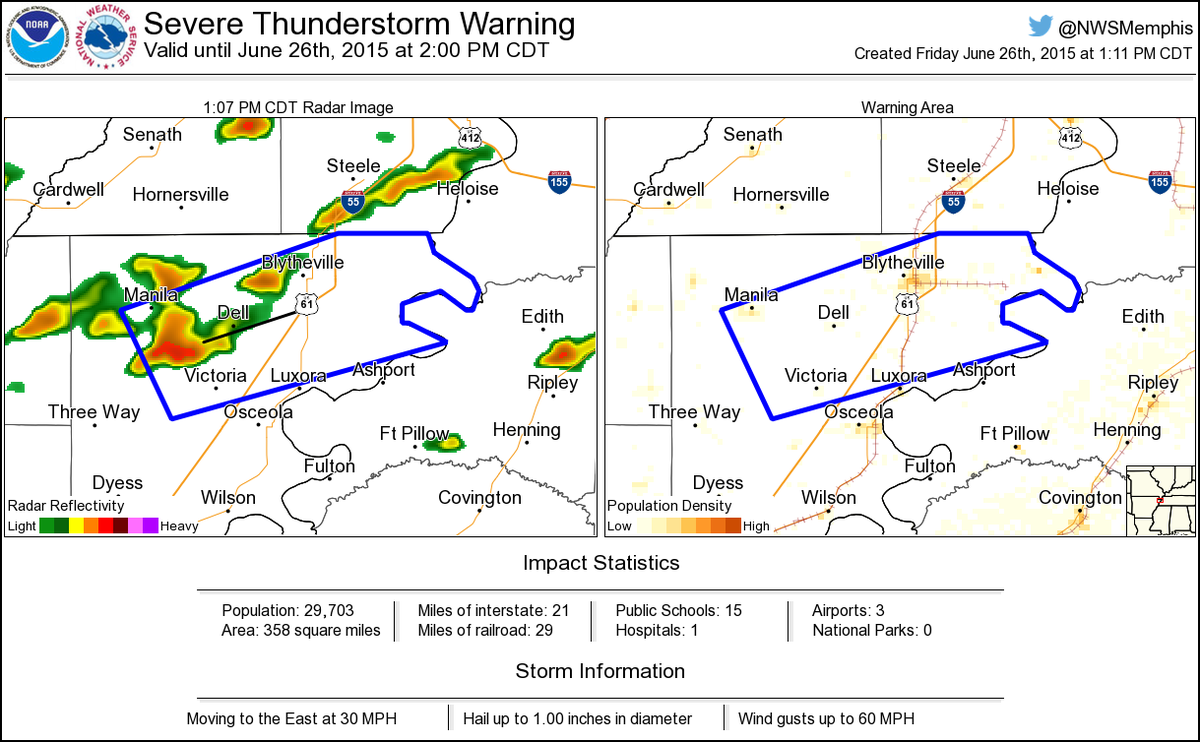
Severe Thunderstorm Warning including Blytheville AR, Gosnell AR, Manila AR until 2:00 PM CDT
It's not just me noticing this stuff people.

What does this convey that a quadrilateral or pentagon can't? #HonestQuestion
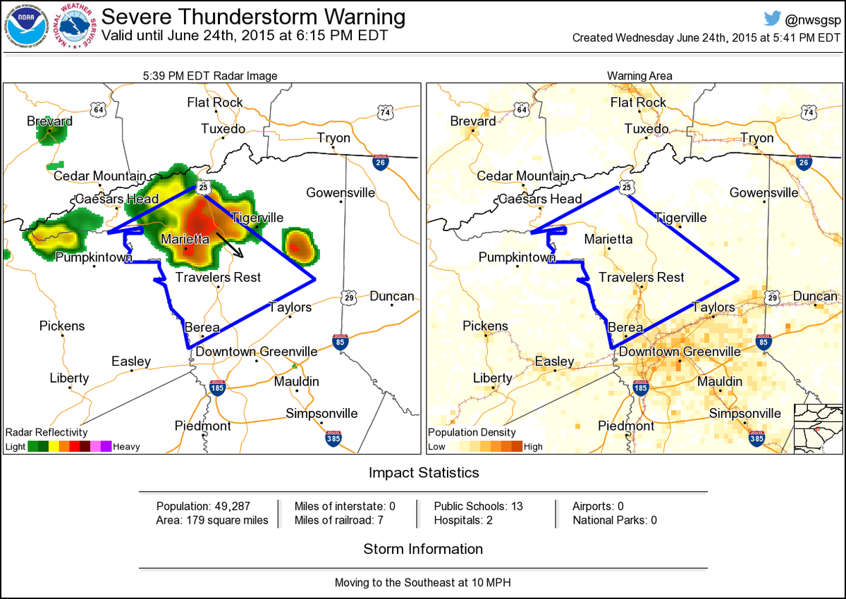
Severe Thunderstorm Warning including Berea SC, Travelers Rest SC, Marietta SC until 6:15 PM EDT
Is the area in the middle safe? Or is this just geographic boundary? How is your average person going to know that?
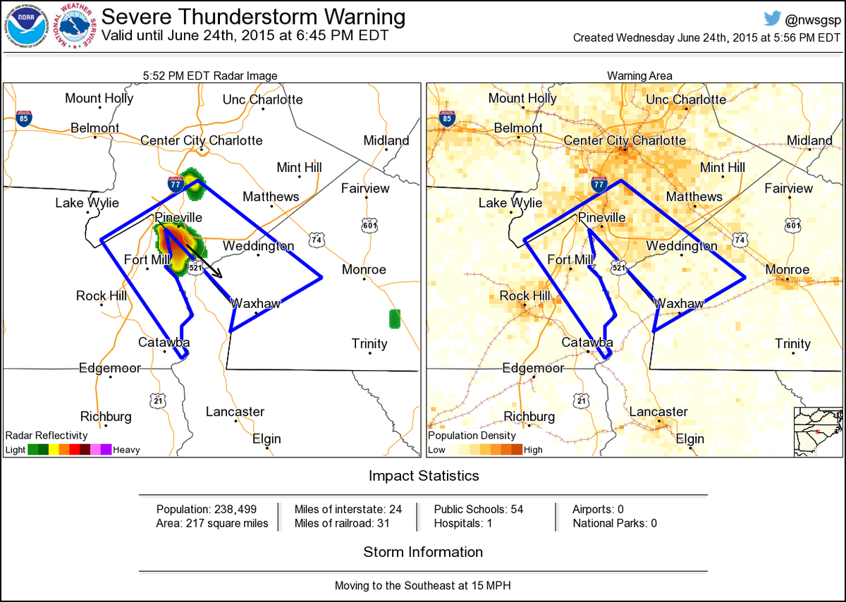
Severe Thunderstorm Warning including Weddington NC, Pineville NC, Waxhaw NC until 6:45 PM EDT
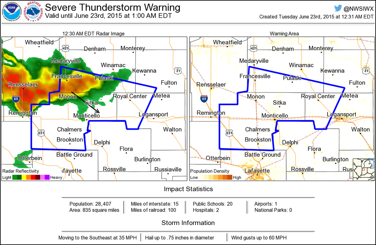
Severe Thunderstorm Warning including Monticello IN, Brookston IN, Monon IN until 1:00 AM EDT
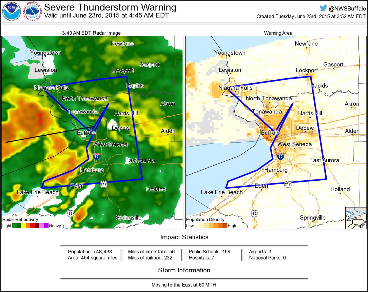
Severe Thunderstorm Warning including Cheektowaga NY, Tonawanda NY, Niagara Falls NY until 4:45 AM EDT
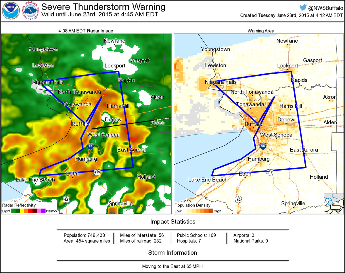
Severe Thunderstorm Warning including Cheektowaga NY, Tonawanda NY, Niagara Falls NY until 4:45 AM EDT
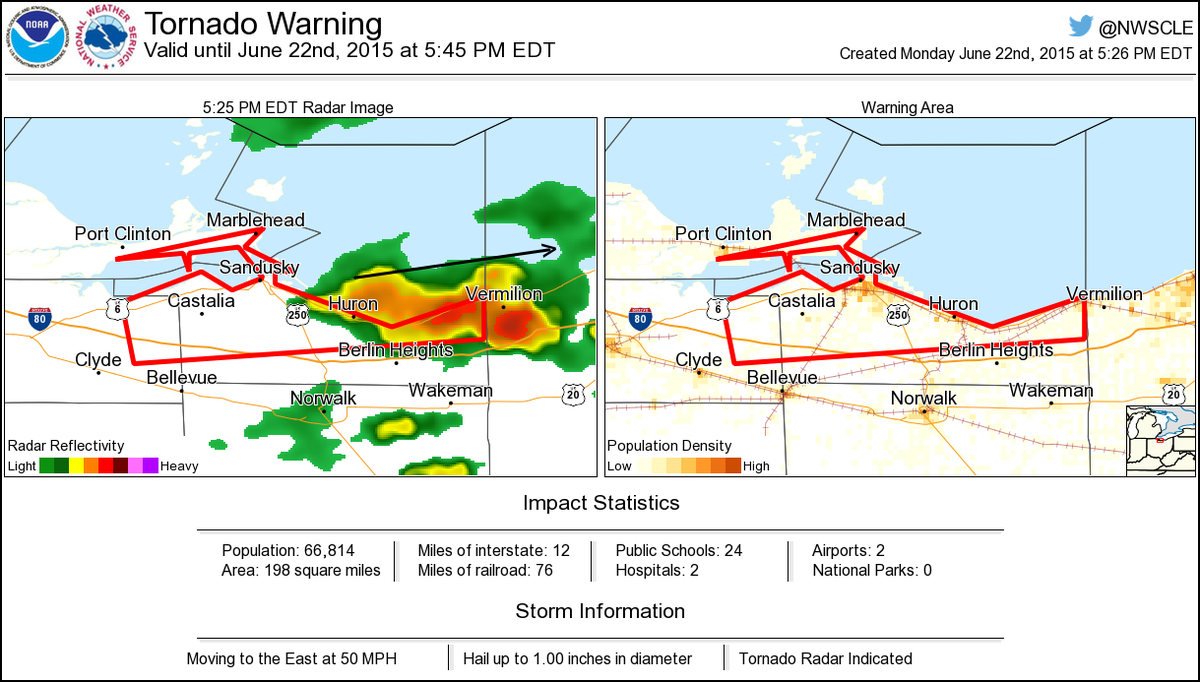
Tornado Warning including Sandusky OH, Huron OH, Sandusky South OH until 5:45 PM EDT
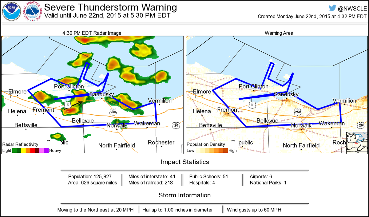
Severe Thunderstorm Warning including Sandusky OH, Bellevue OH, Port Clinton OH until 5:30 PM EDT


United States Trends
- 1. Scott Adams N/A
- 2. The Jupiter N/A
- 3. FINALLY DID IT N/A
- 4. Dilbert N/A
- 5. #TicTacToe2026 N/A
- 6. Arenado N/A
- 7. Clintons N/A
- 8. Disgraced N/A
- 9. Bill Clinton N/A
- 10. People Magazine N/A
- 11. Diamondbacks N/A
- 12. Deadpool N/A
- 13. #IranMassacre N/A
- 14. Jim Jordan N/A
- 15. Arlington N/A
- 16. Victoria Edel N/A
- 17. Hillary Clinton N/A
- 18. NL West N/A
- 19. #BTSComeback2026 N/A
- 20. Jack Martinez N/A


Something went wrong.
Something went wrong.