
You might like


LIVE: Tracking a rotating severe storm near Miles City, Montana. Watch at severestorms.com.au


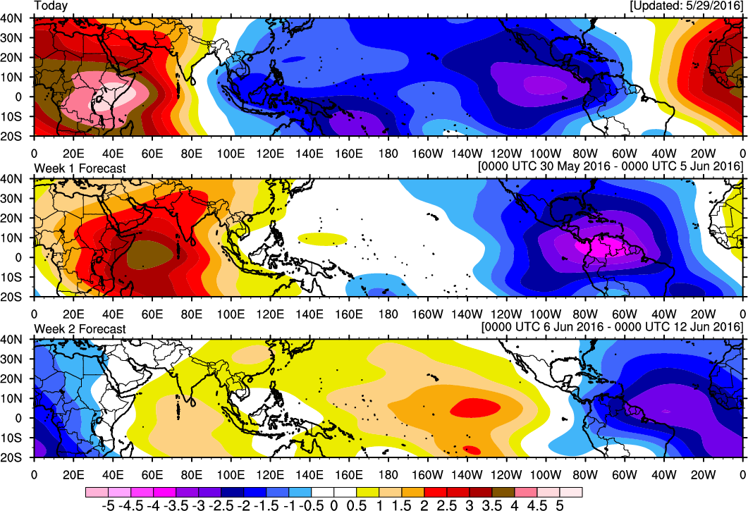
Potential for tropical development in early june as MJO pulse moves into Western Atlantic.

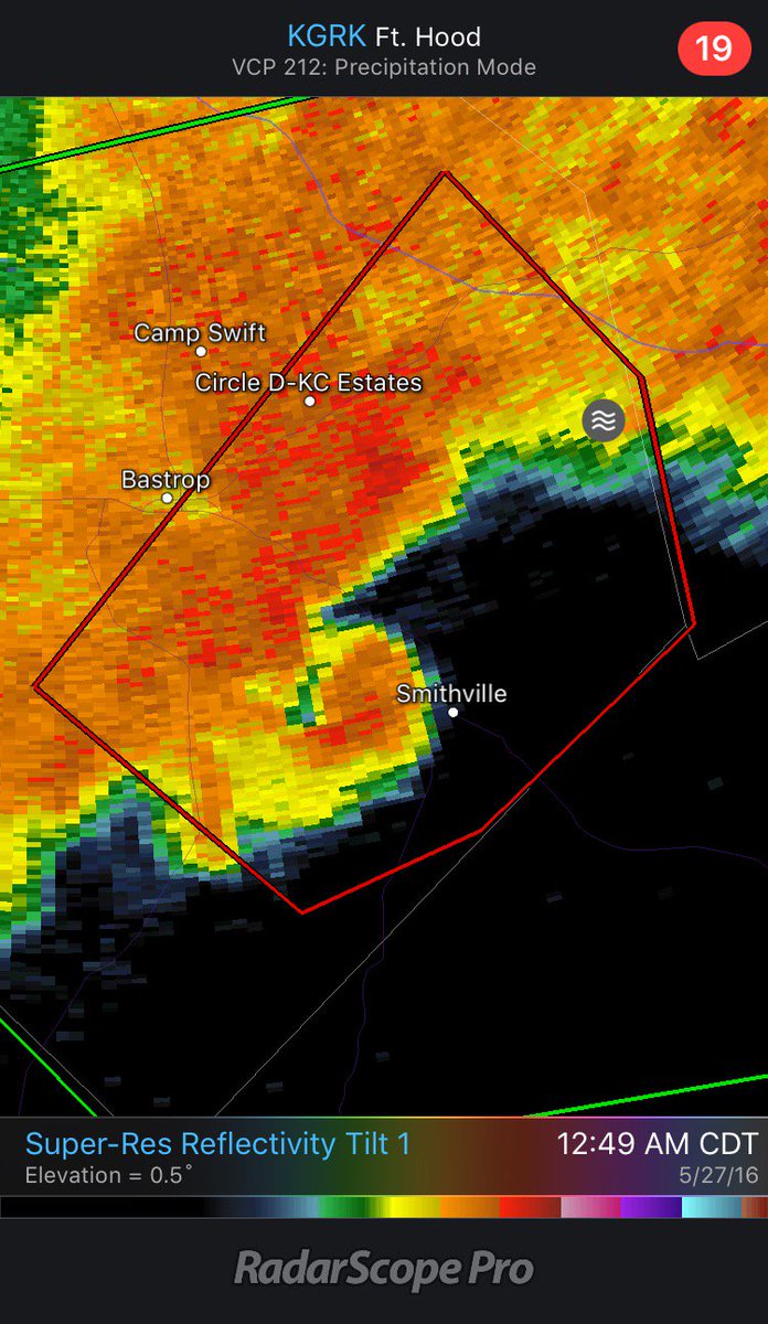
Radar indicated tornado near Smithville, TX at 12:50am CDT


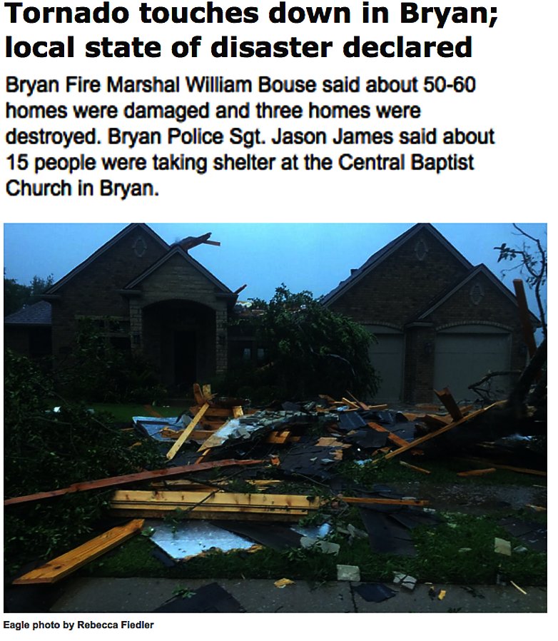
Update: 50-60 homes were damaged, 3 destroyed in earlier #tornado in #Bryan #Texas goo.gl/GSeSyx #TXwx

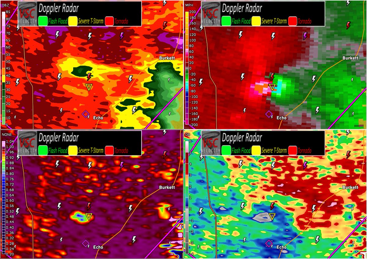
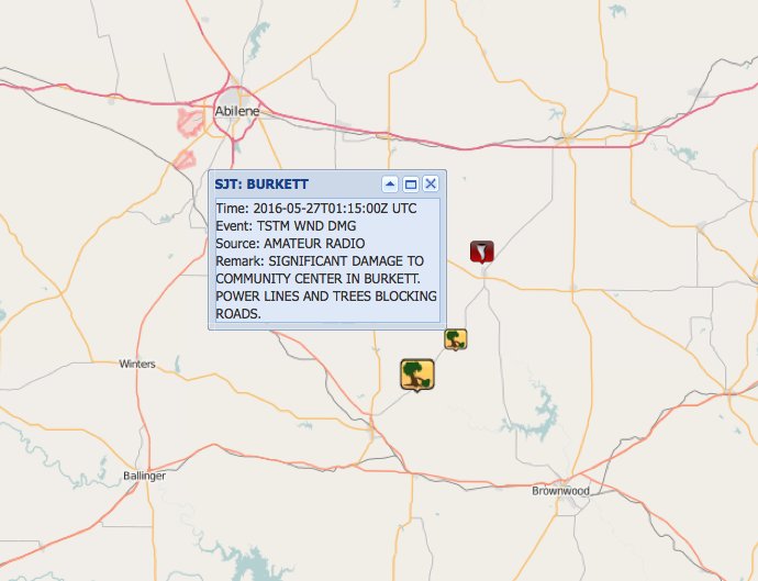
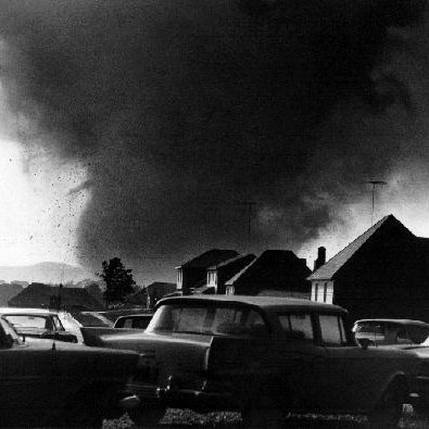
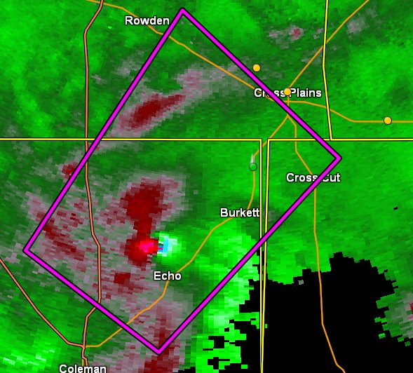
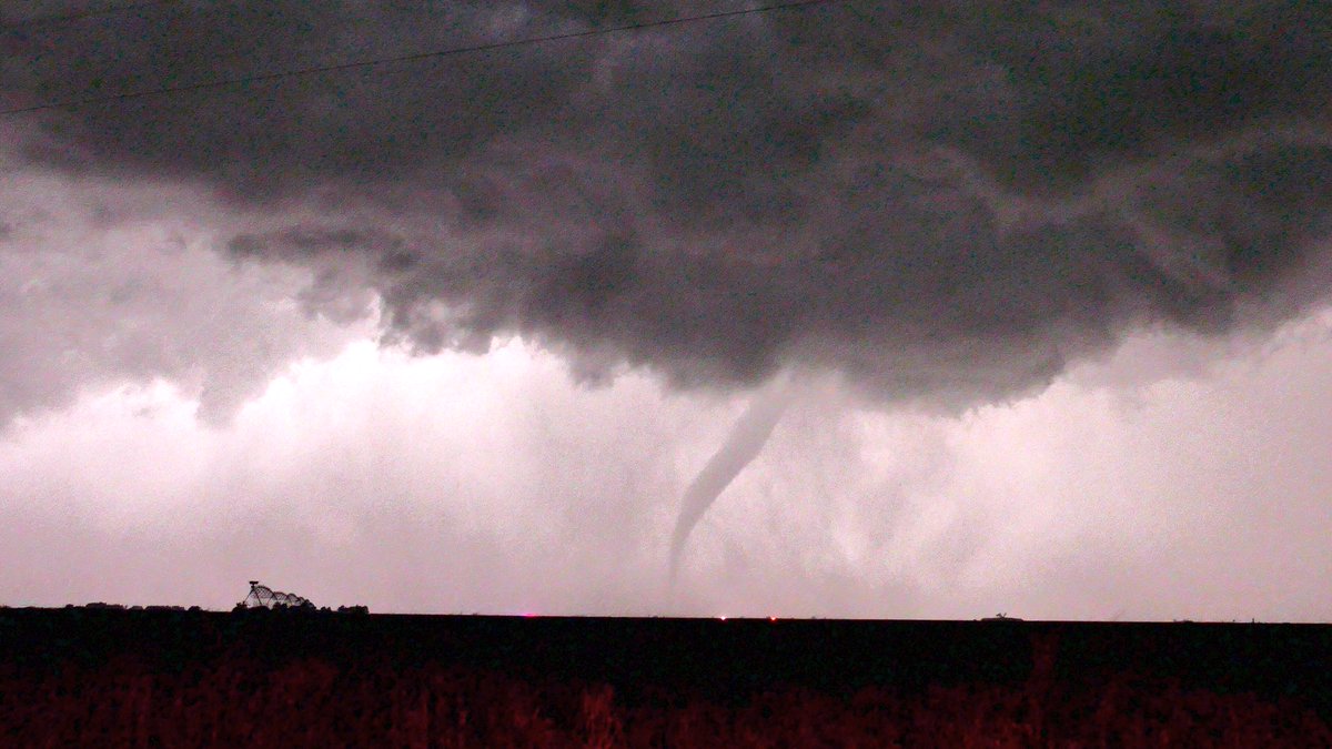
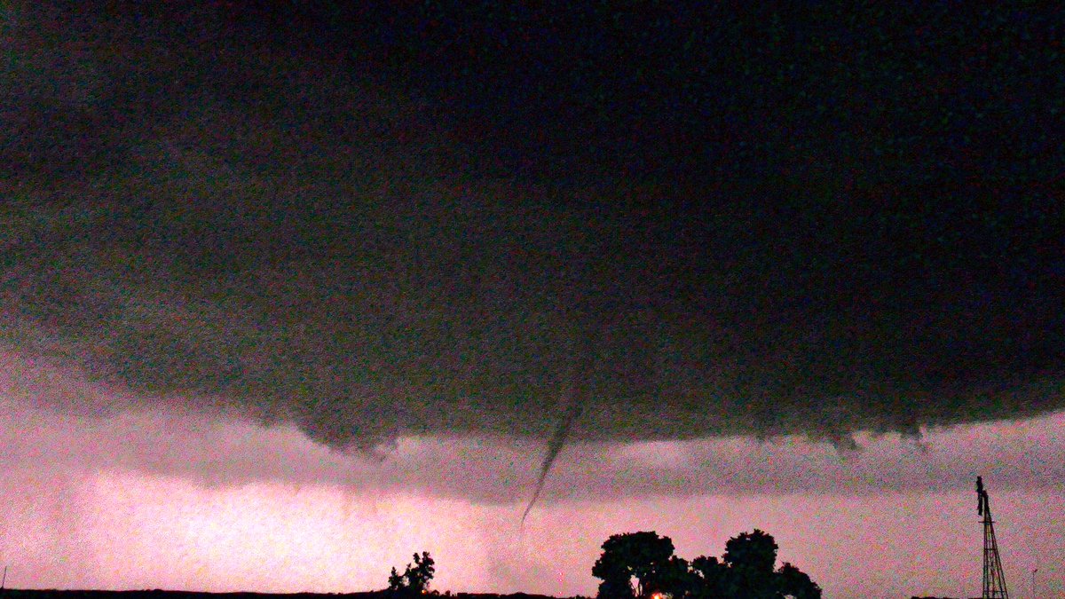
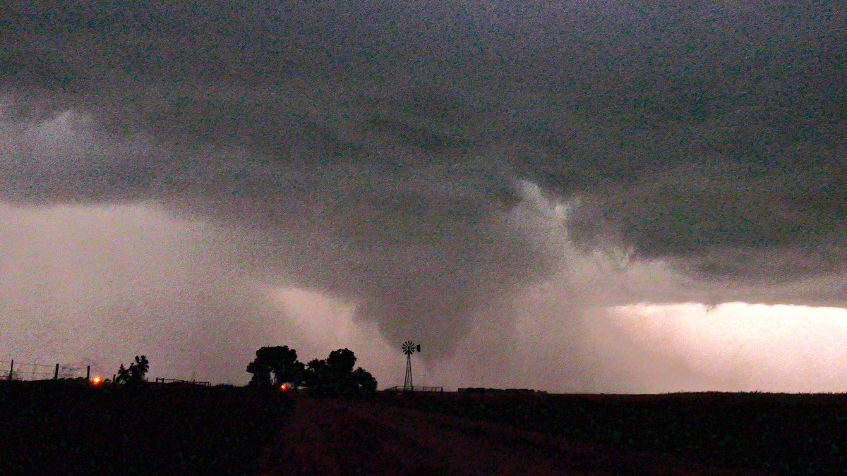
Update: Significant damage reported in #Burkett #Texas after earlier #tornado-warned storm (8:15 PM CDT) #TXwx
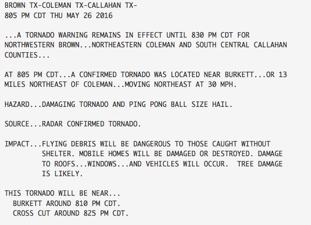
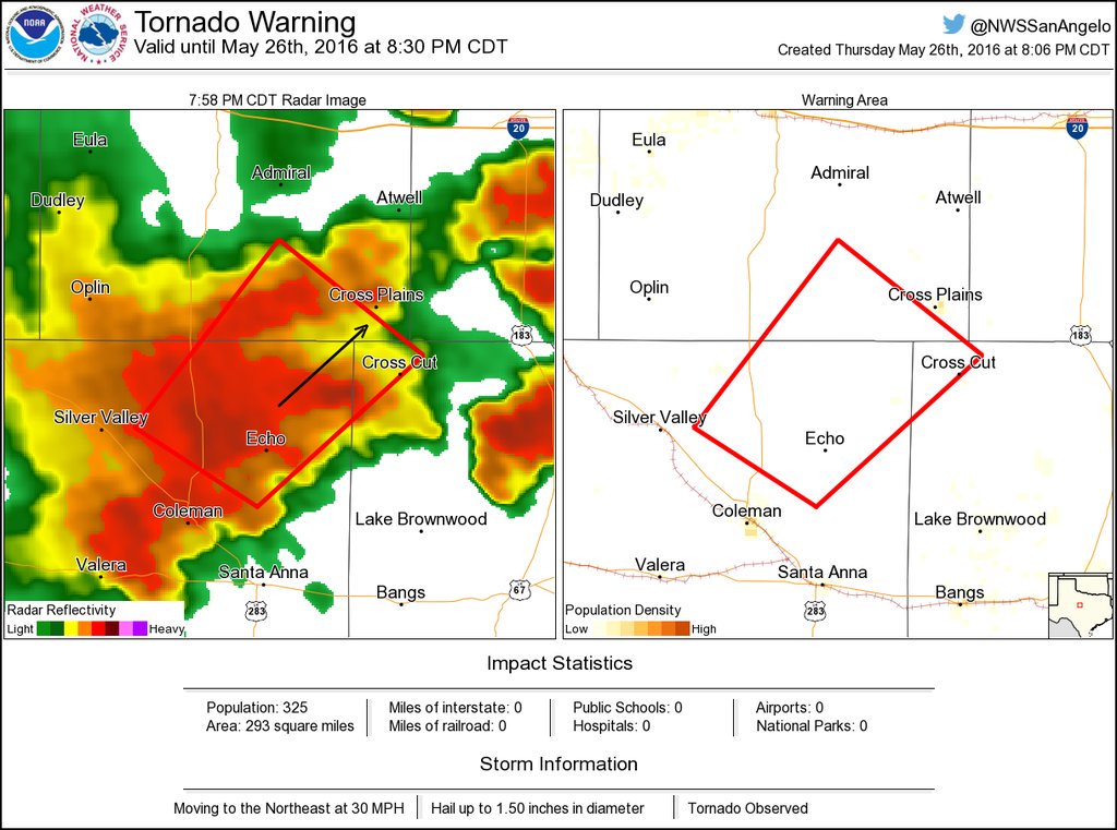
Developing: Radar-CONFIRMED #tornado was located near #Burkett #TX, moving NE at 30 mph (8:05 PM CDT)
Tornado with debris signature moving ENE in Coleman County, Texas as of 8:10 CDT. #txwx

College Station area #Texas

Looks like a tornado touchdown crossed highway 6. Multiple power flashes

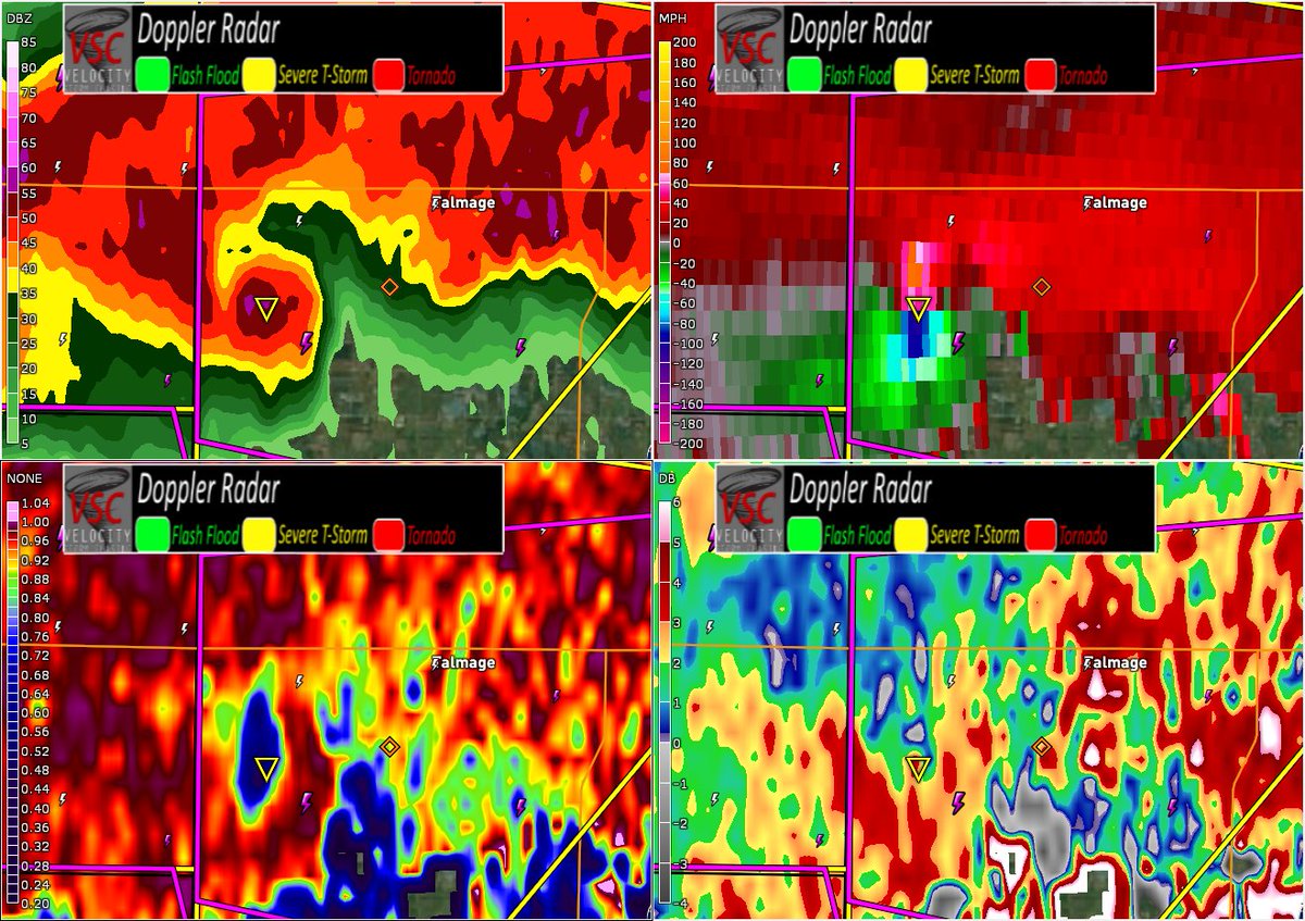

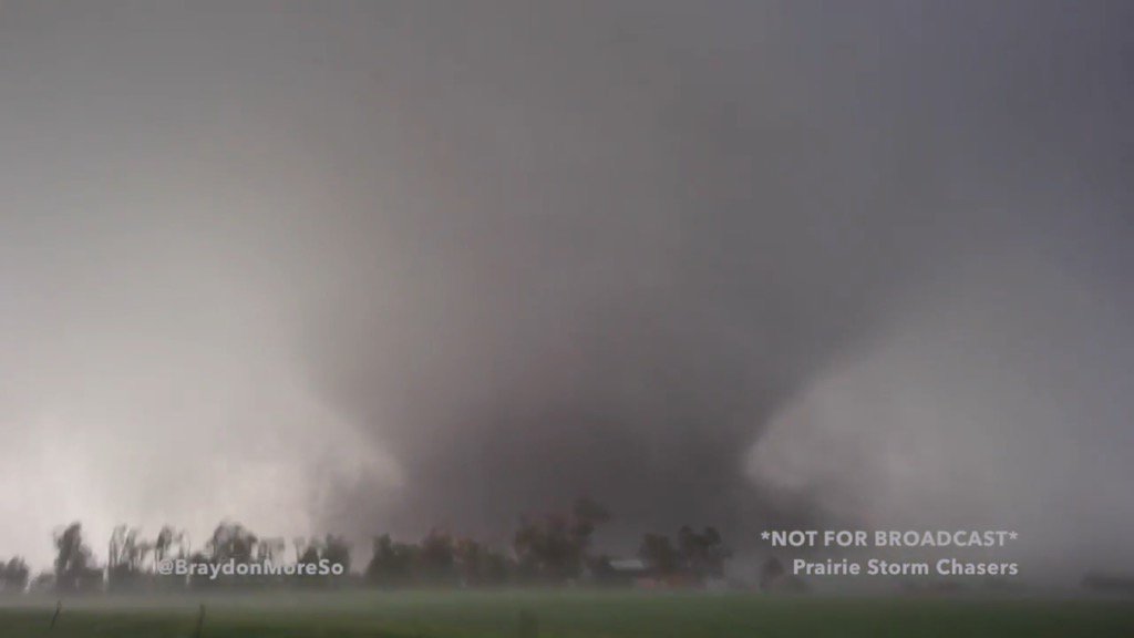
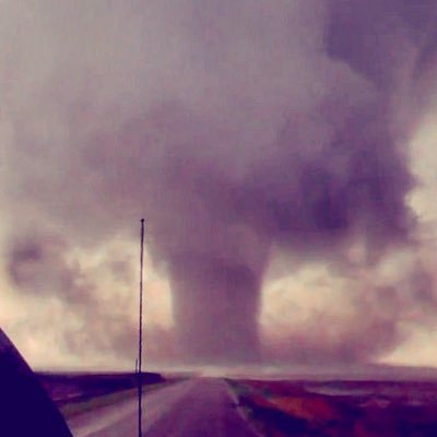
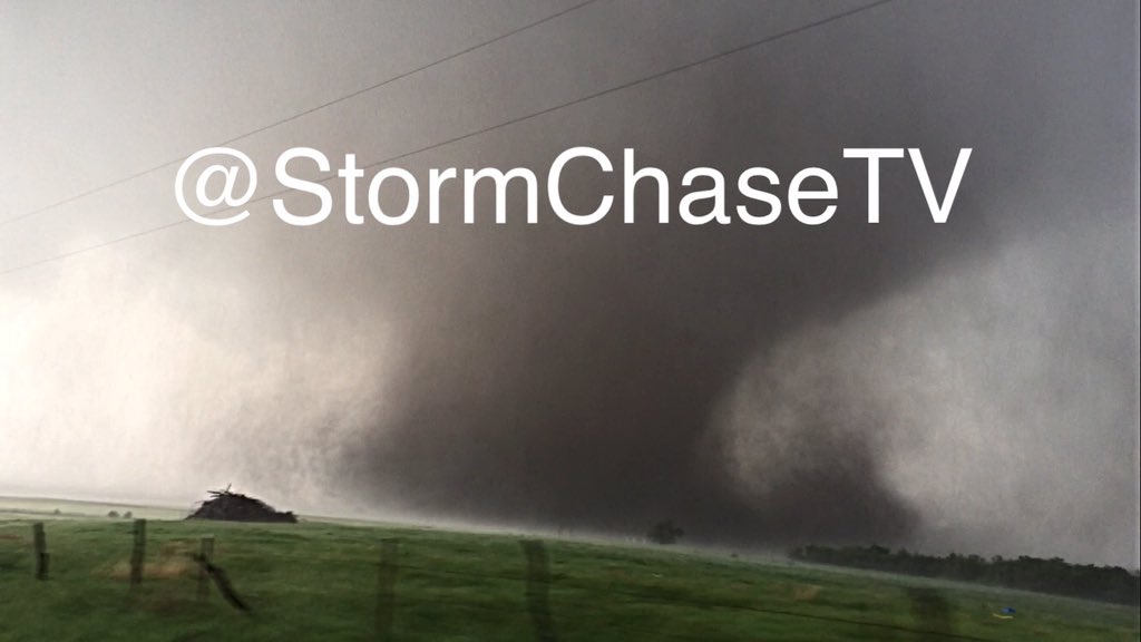
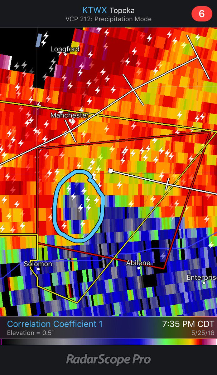
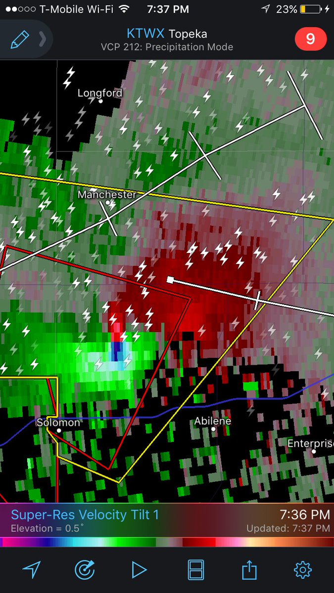
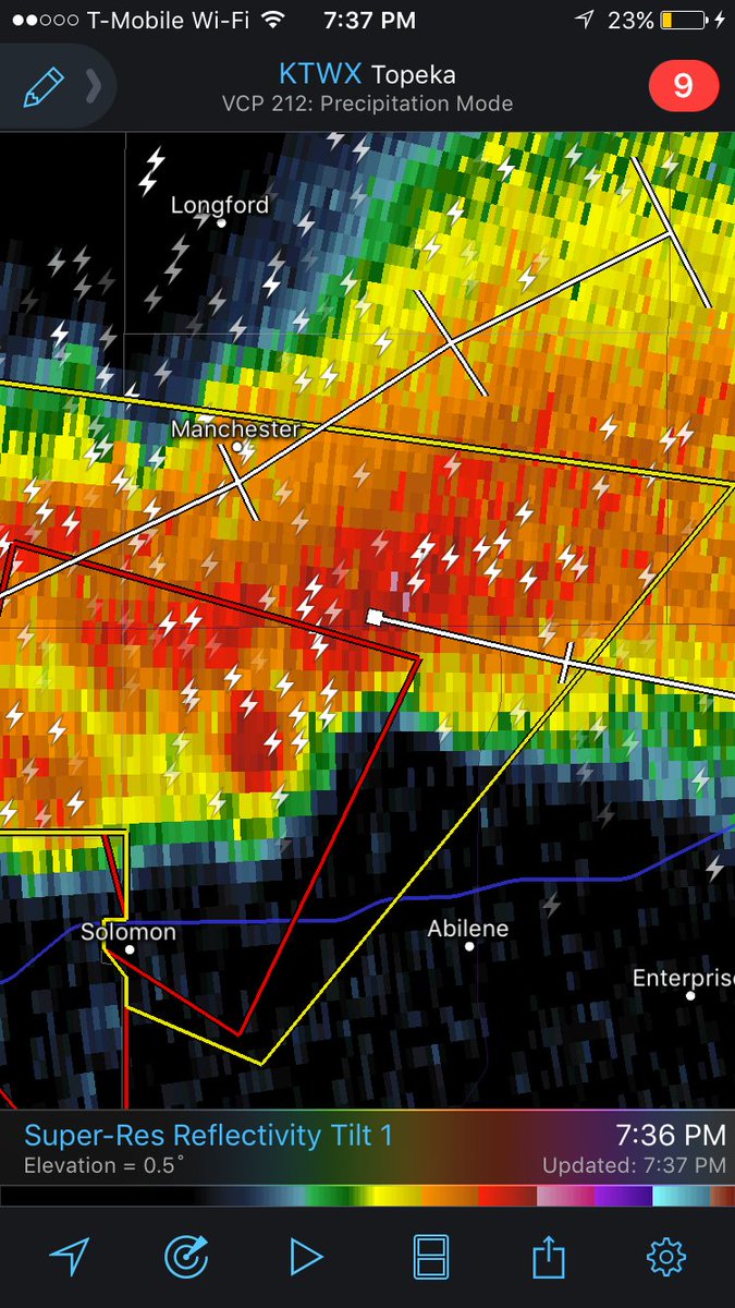
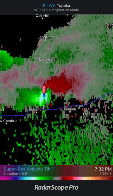
NEW: video of massive, long-track #tornado Bennington to Chapman, KS by @BraydonMoreSo youtu.be/wfvEiGc92qY #kswx


United States Trends
- 1. Herbert 68 B posts
- 2. Chargers 89,4 B posts
- 3. #GoldenGlobes 1,88 Mn posts
- 4. Greg Roman 11,5 B posts
- 5. Powell 185 B posts
- 6. Patriots 174 B posts
- 7. Before Ossenna 1.267 posts
- 8. After Ossenna 1.294 posts
- 9. Pats 25,1 B posts
- 10. Sinners 94,9 B posts
- 11. Drake Maye 28,4 B posts
- 12. Hamnet 18,1 B posts
- 13. #BaddiesUSA 12 B posts
- 14. The Fed 146 B posts
- 15. #GenshinMoonInvitation 14,7 B posts
- 16. #Game2Give2026 N/A
- 17. Milton Williams 3.368 posts
- 18. AJ Brown 41 B posts
- 19. Jalen 48 B posts
- 20. Jim Harbaugh 3.364 posts


Something went wrong.
Something went wrong.