
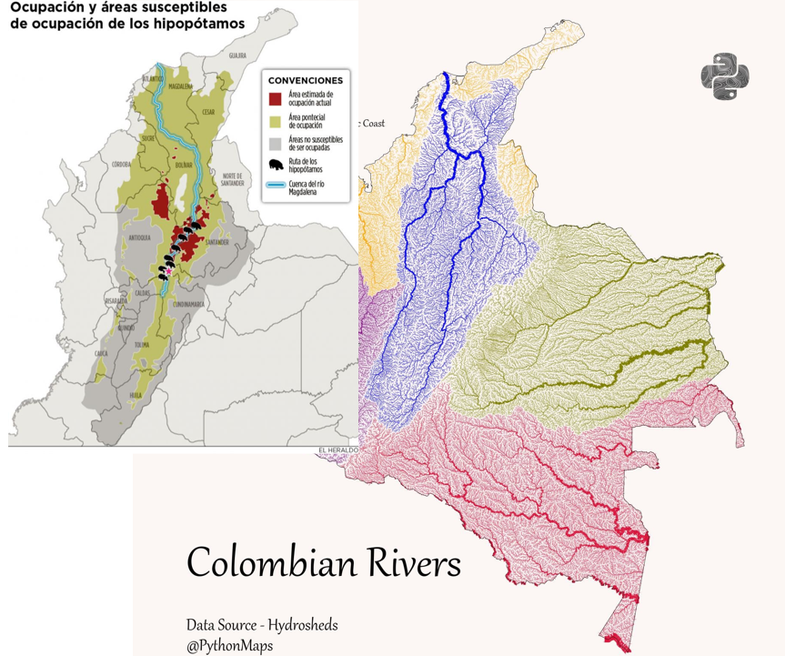
Colombian rivers! Coloured according to their drainage basin, and scaled by discharge. #SouthAmerica #Colombia #Rivers #DrainageBasin #Python #Geography #DataViz
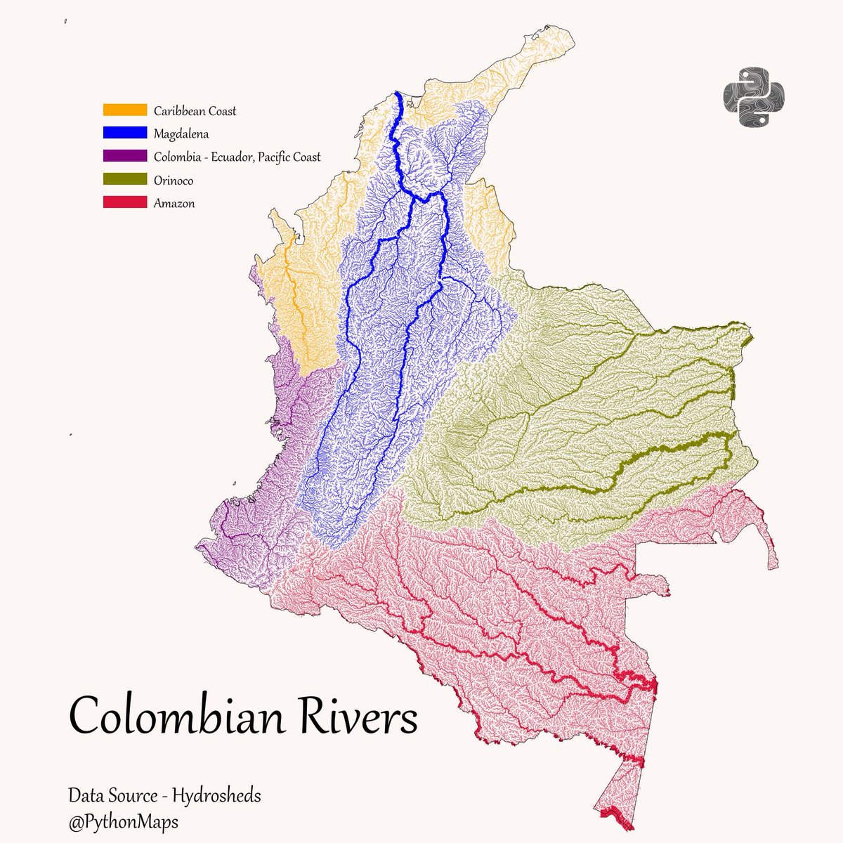

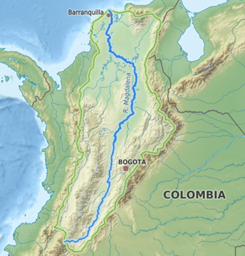
Los ríos que pasan por Colombia son increíbles, toda su hidrografía lo es HILO 10 Ríos 1⃣ Magdalena El más importante y navegable de COL, pasa por 22 de los 32 departamentos, tiene más de 1600Km e incide en las condiciones culturales, sociales y económicas del país

Hola, nos encantaría tener está imagen en alta calidad para ponerla en el Jardín Botánico del Magdalena, cómo podríamos acceder a ella?

Where do you get the data from for all those river maps? Really cool.


Hey, really interesting! Could you share the source for these rivers? Basins or direction of flow?
Lástima que no los cuidamos 🙁 se necesitan muchas campañas educativos para concientizarnos del grave riesgo en el que estamos si los seguimos maltratando


De manera que la mayor parte del Chocó está en la cuenca del Caribe.

¿Qué limita que los hipos pase a la cuenca del Orinoco y/o del Amazonas?

What about making a map out of this kind of data for Colombia and why not other lands like USA
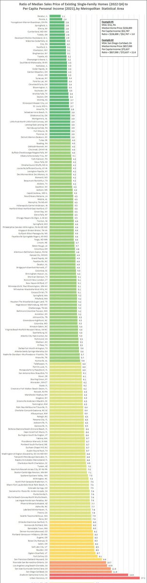


Ok estos mapitas me estan gustando mucho... Uno Especificando Valores Numéricos de ELEVACIONES POR FAVOOOOOR!


Cómo dijo Eduardo Galeano....las venas abiertas de América latina


The east upper zone is also part of the Caribean sea 'cause it goes to the Maracaibo golf at Venezuelan coast, they are the rivers of North Santander departament.

The blue one is the Magdalena & Cauca rivers basins… the Cauca river is also important 💦💪🏼


and my lector told me ,that wat u show, is this....ask the giver? that gave u, that drawing, no topo grafic. map

United States 趋势
- 1. Thanksgiving 2M posts
- 2. Packers 36.7K posts
- 3. Thankful 389K posts
- 4. #GoPackGo 5,740 posts
- 5. Wicks 4,081 posts
- 6. Jordan Love 5,370 posts
- 7. Goff 5,980 posts
- 8. #GBvsDET 2,763 posts
- 9. Jameson Williams 1,510 posts
- 10. Jamo 3,117 posts
- 11. #OnePride 5,331 posts
- 12. Turkey 260K posts
- 13. Amon Ra 2,207 posts
- 14. Tom Kennedy N/A
- 15. Jack White 1,201 posts
- 16. Brian Branch N/A
- 17. LaFleur 1,958 posts
- 18. CeCe Winans N/A
- 19. Ray J 2,866 posts
- 20. Carrington Valentine N/A
Something went wrong.
Something went wrong.