
Santa Cruz Co. FCD
@SCCFCD
Goals & Objectives: Minimize flood & erosion damages to residents, property & infrastructure through flood control & nat resource management activities.
You might like


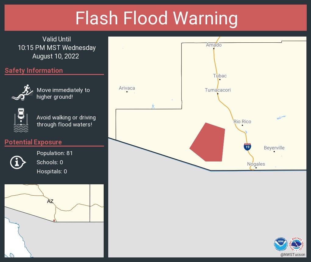
Flash Flood Warning continues for Santa Cruz County, AZ until 10:15 PM MST
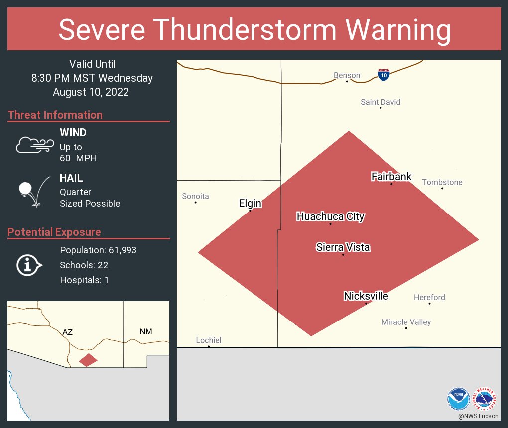
Severe Thunderstorm Warning including Sierra Vista AZ, Huachuca City AZ and Elgin AZ until 8:30 PM MST
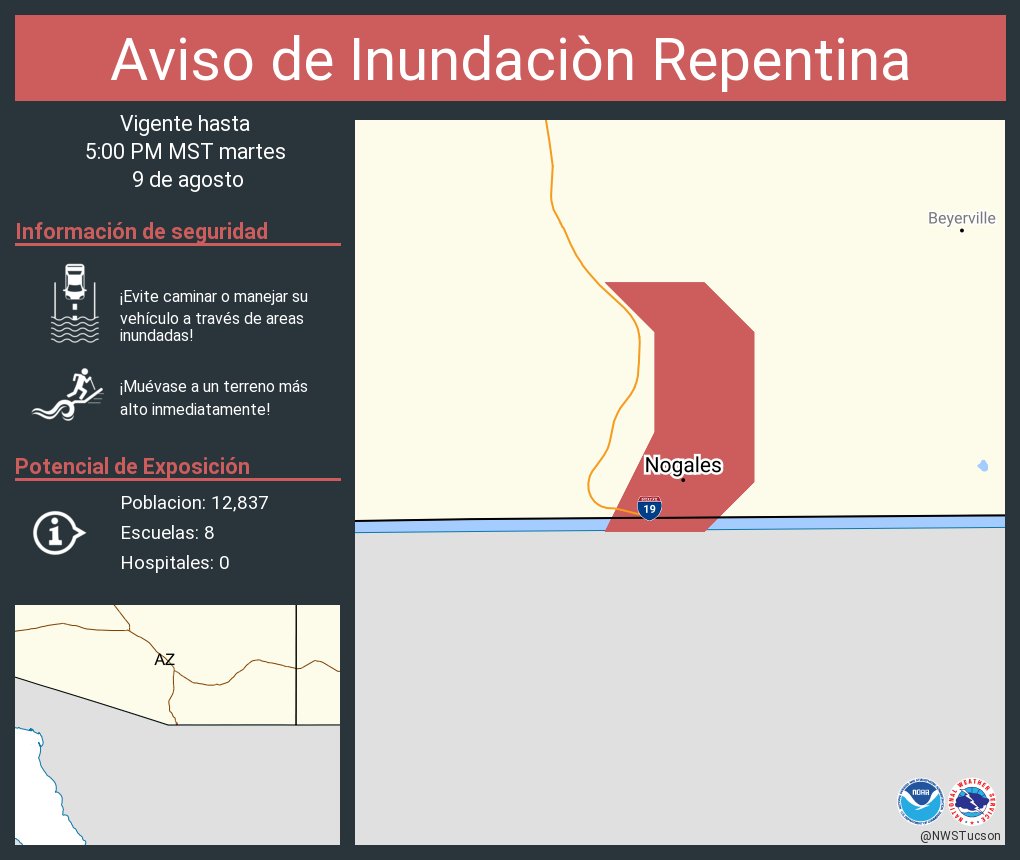
Flash Flood Warning including Nogales AZ until 5:00 PM MST
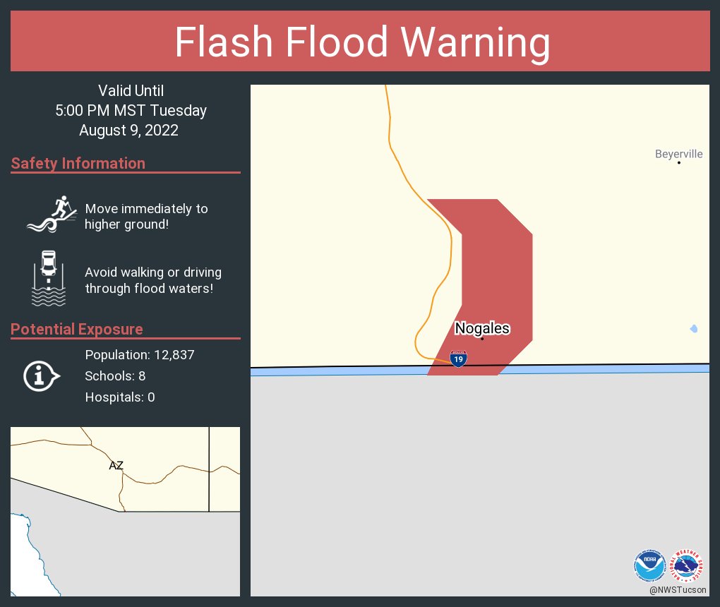
Aviso de Inundacion Repentina incluye Nogales AZ hasta las 5:00 PM MST
Be advised
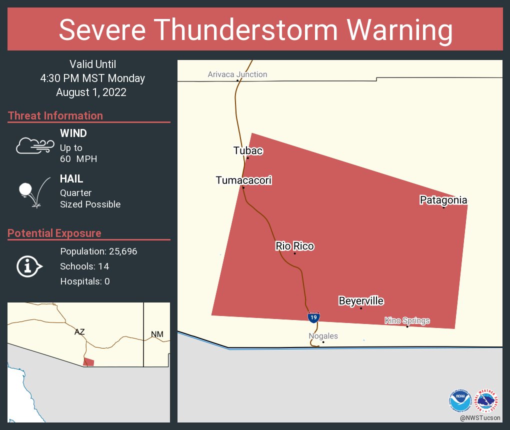
Severe Thunderstorm Warning including Rio Rico AZ, Tubac AZ and Patagonia AZ until 4:30 PM MST
Please be advised
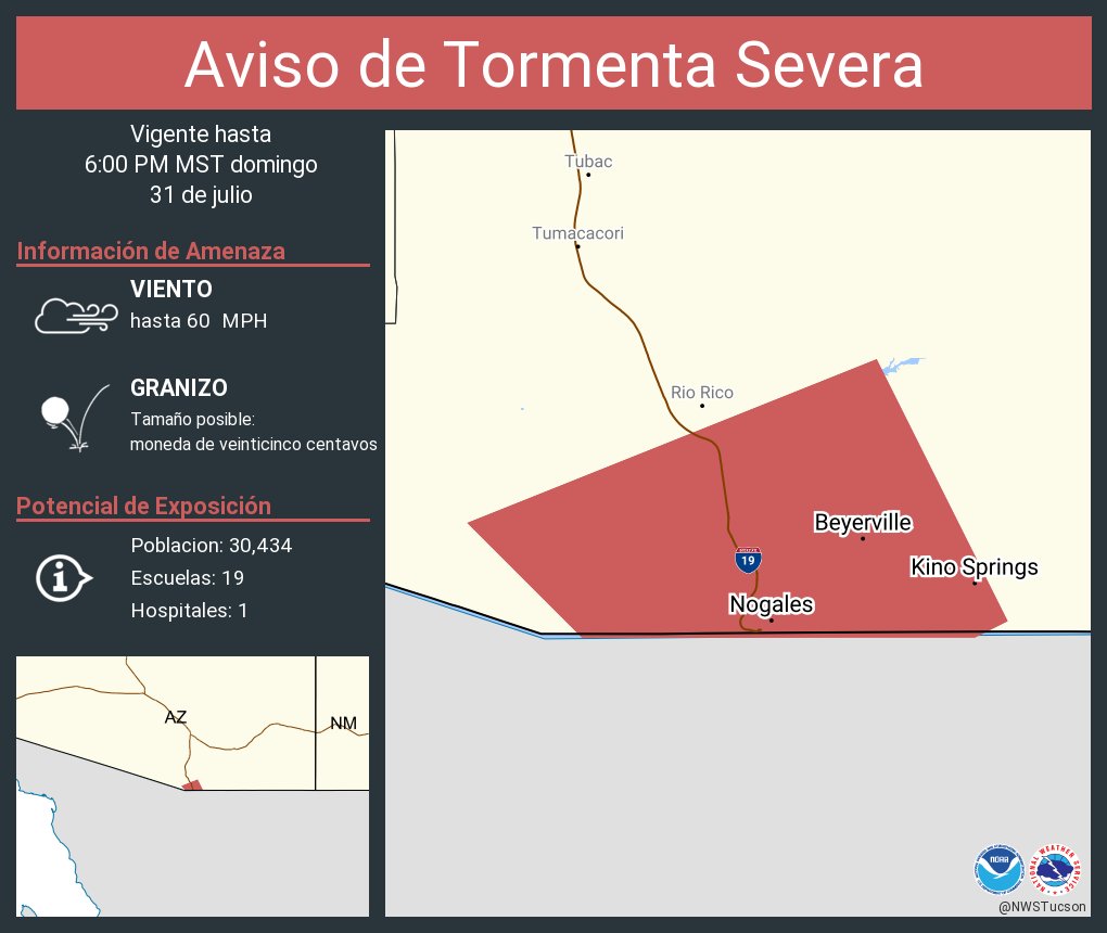
Aviso de Tormenta Severa continua Nogales AZ, Beyerville AZ, Kino Springs AZ hasta las 6:00 PM MST

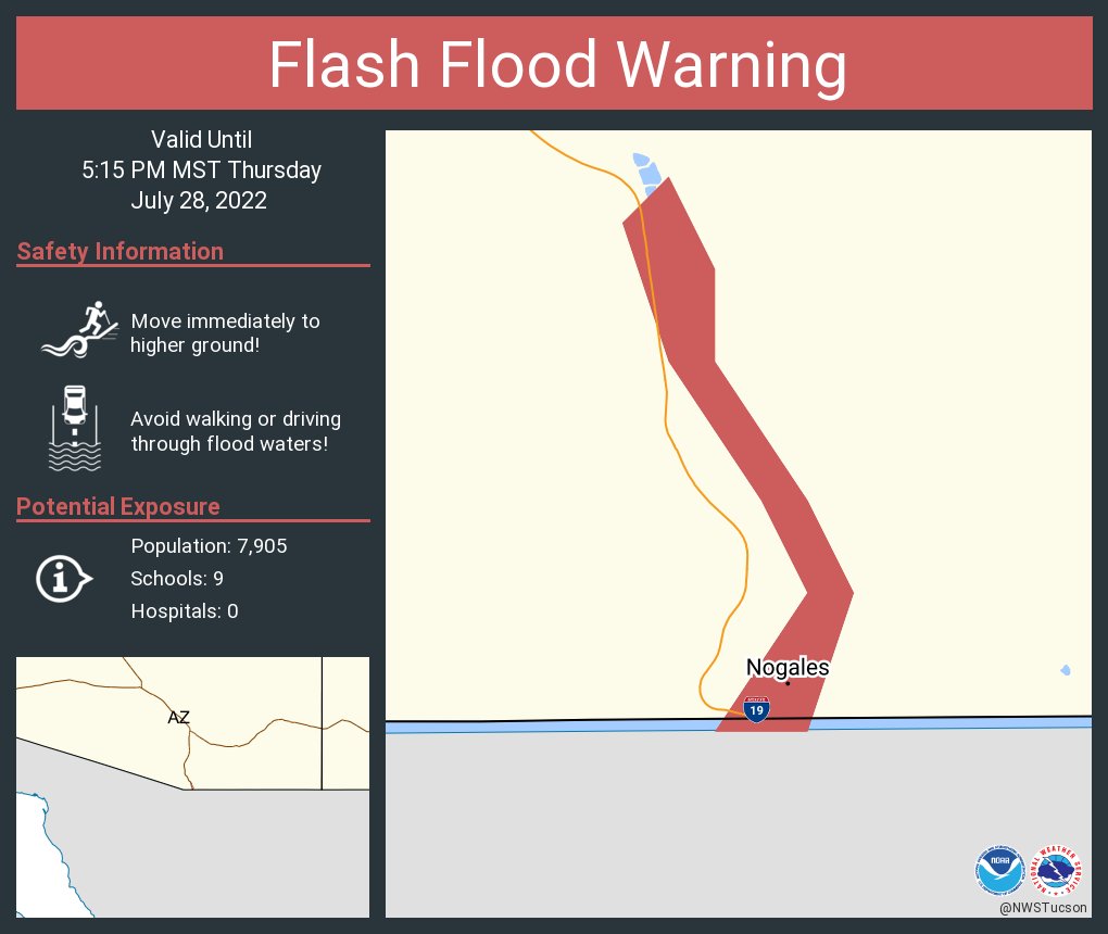
TWC issues Flash Flood Warning [flash flood: radar and gauge indicated, flash flood damage threat: considerable] for Santa Cruz [AZ] till Jul 28, 5:15 PM MST mesonet.agron.iastate.edu/vtec/f/2022-O-…
![KVOAWeather's tweet image. TWC issues Flash Flood Warning [flash flood: radar and gauge indicated, flash flood damage threat: considerable] for Santa Cruz [AZ] till Jul 28, 5:15 PM MST mesonet.agron.iastate.edu/vtec/f/2022-O-…](https://pbs.twimg.com/media/FYyVl8dUUAAZdPO.jpg)
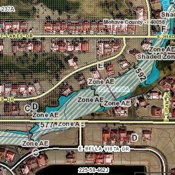
Flash Flood Warning along the Nogales Wash and Potrero Creek. Heavy rains, 0.75 inches, has fallen in last hour in Nogales Sonora.
Just a reminder you can help prevent flooding by simply capturing and using or soaking water into the ground when it rains. If everyone did a little, it can add up to a lot. Please see our Sponge Initiative for ideas on water harvesting and soil health. cleargov.com/arizona/santa-…
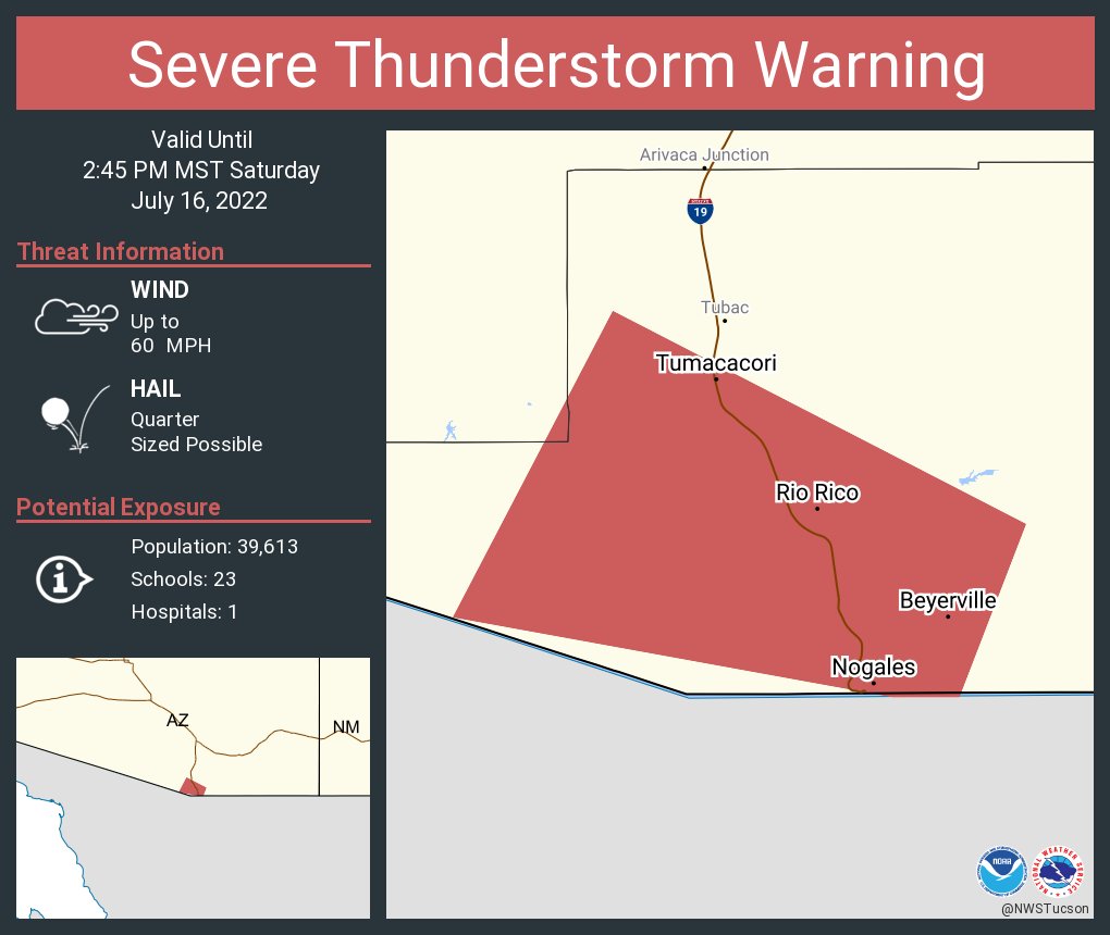
Severe Thunderstorm Warning including Nogales AZ, Rio Rico AZ and Tumacacori AZ until 2:45 PM MST
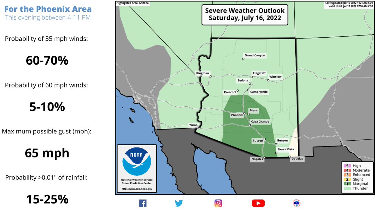
Looks like it could be an active day

Here are the probabilities of wind gusts in excess of 35 and 60 mph this evening for the Phoenix area. The stronger storms could also kick up dust leading to lower visibility. #azwx
Remember you can see rainfall, stream flow information and radar for Santa Cruz County through our ALERT System online at santacruz.jefulleralert.com/jefmap/?fbclid…
FYI


#Monsoon2022 is a good time to start to think about how you can capture and use rain water. Reduce your water bill, protect yourself from local flooding, help prevent floods downstream. #ThinkSponge cleargov.com/arizona/santa-…
#Monsoon2022 is here. #flooding is bound to happen. Are you prepared? Are you #FloodAware ? Get your Flood Hazard Information Sheet for your property in #SantaCruzCounty #Arizona at survey123.arcgis.com/share/b2281713…
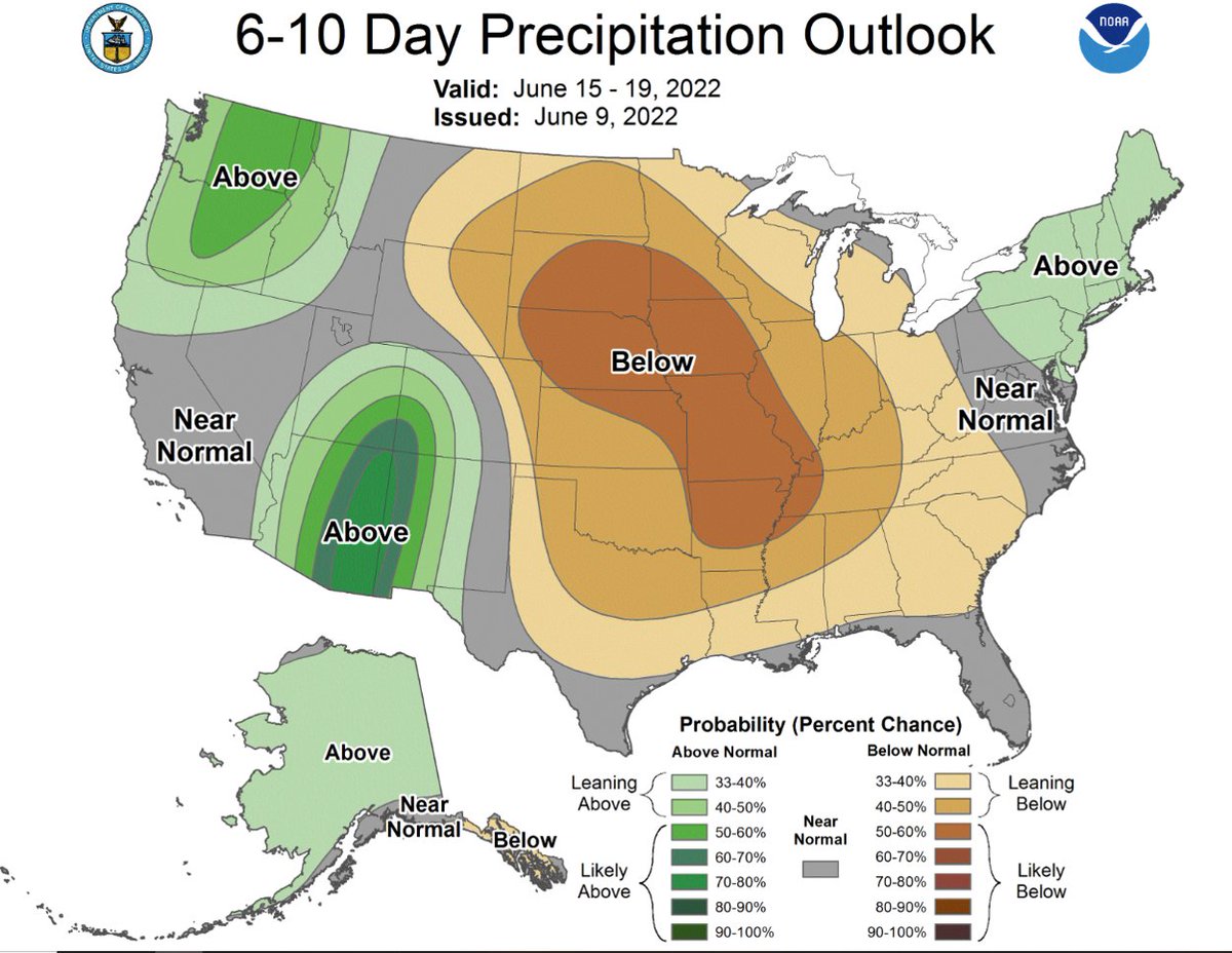
Let’s hope so, we need the rain.
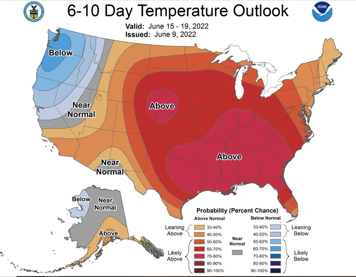
Moisture on the way? The Climate Prediction Center does have our region quite heavily favored towards a wetter-than-normal period. Modestly favoring warmer-than-normal temps. #azwx @NWSTucson @NWSFlagstaff
Look out for heat this week and the possibility of lightning sparked thunderstorms Wednesday and Thursday
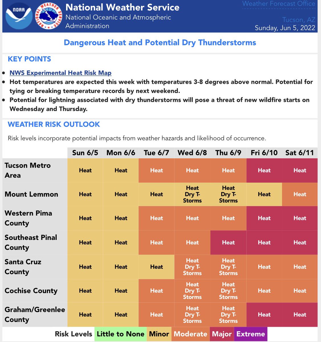
Just a reminder that before the monsoons, we get the heat, and unfortunately heat can and will kill, in mere minutes.

For those that need to know.

The following are shelter resources for those being affected by the fire near Upper Elgin and Lower Elgin Rd:

Please be advised.
The following are the road closures in the Sonoita/Elgin area due to the fire:


United States Trends
- 1. Grammys N/A
- 2. Good Monday N/A
- 3. Bad Bunny N/A
- 4. #GroundhogDay N/A
- 5. #MondayMotivation N/A
- 6. Trevor Noah N/A
- 7. Nicki N/A
- 8. Cher N/A
- 9. Jelly Roll N/A
- 10. Billie N/A
- 11. $Purch N/A
- 12. Benito N/A
- 13. Kendrick N/A
- 14. Conquered N/A
- 15. Punxsutawney Phil N/A
- 16. #LinglingkwongxCalvinklein N/A
- 17. sabrina N/A
- 18. Luther Vandross N/A
- 19. Gaga N/A
- 20. Tyler N/A
You might like
-
 Green Valley News
@greenvalleynews -
 Cochise County Fire & Incident(SE AZ)
@CCFirenIncident -
 Trico Electric Co-op
@TricoElectricAZ -
 Yavapai Co Sheriff's Office
@YavapaiSheriff -
 Coconino County
@CoconinoCounty -
 Town of Sahuarita
@Sahuarita_Az -
 City of Avondale, AZ
@AZAvondale -
 Goodyear, AZ
@GoodyearAZGov -
 City of Sierra Vista
@SierraVistaAZ -
 City of El Mirage
@ElMirageArizona -
 Golder Ranch Fire
@GRFDAZ -
 Greater Nogales Santa Cruz County Port Authority
@PortNogales -
 City of Maricopa
@CityofMaricopa -
 Buckeye Arizona
@BuckeyeAZGov -
 Nogales-SCC Chamber
@NogalesChamber
Something went wrong.
Something went wrong.