#azwx search results

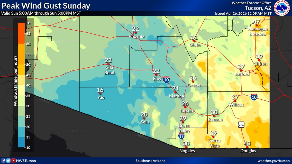
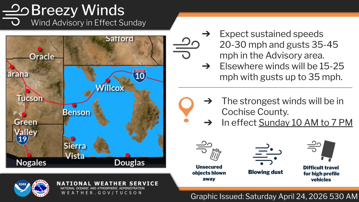
Breezy to windy day and cooler as a cold front moves across the area. Southwest winds 15 to 30 mph with gusts up to 45 mph, especially across Cochise county where a Wind Advisory is in effect from 10 am to 7 am. These gusty winds may produce areas of blowing dust. #azwx


Rain chances are highest across the Southern Great Basin today, with isolated thunderstorms possible over Central Nye and Lincoln Counties. Showers taper off from west to east this evening 🌧️ #nvwx #azwx #cawx

Showers continue for some areas this morning, decreasing by afternoon. Snow levels fall to 6500-7000 ft with light accumulation possible this morning. Drier and gradually warmer weather arrives Mon-Wed before another weather disturbance brings a chance of showers late week. #azwx

Radar at 3 AM MST Sunday indicates showers continuing to spread into the area. Snow levels will fall to around 6500-7000 feet through the morning, with some slick spots possible on area roads. #azwx


Late evening AZ Wx Update: Mtn showers change to windy, cool Sunday statewide. 9PM EIR sat loop shows Pac storm spinning over C CA headed to S UT Sunday. Radar loop shows showers in AZ mtns. Most precip is along RIM/NW AZ. Nice Mon/Tue wx b4 next storm rains on AZ Thu. #azwx.

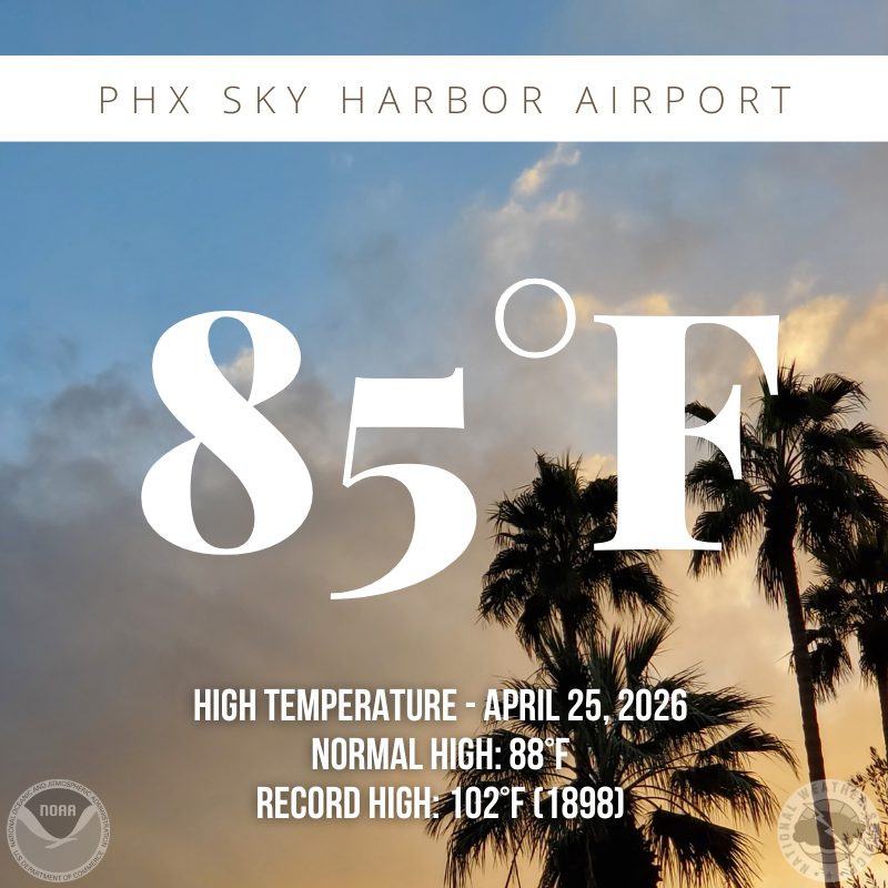
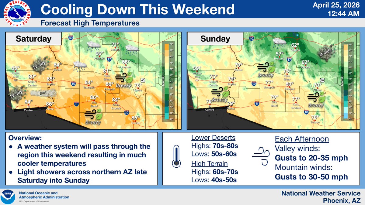
The high temperature at Phoenix Sky Harbor this afternoon was 85 degrees, which is 3 degrees below the daily normal of 88 degrees. Even cooler temperatures are expected tomorrow with highs struggling to reach 80 degrees. #azwx

If this house doesn’t cool down into the 70’s soon I’m turning on my air conditioner. #azwx

Haha you wind you may have sheared the top of us with your almost 40 mph but we're still standing! It just took Saturday morning for my Mexican sunflower to renew itself, overcast skies make flower colors pop. Last days gardening before the heat. #LakeHavasu #azwx #cawx #nvwx


Seems odd but it is still spring, it's river time however with this weather pattern temps along the river are not like the backcountry. If I'm bundled up on #LakeHavasu Saturday a.m. you will need a jacket out there off-roaders! Maybe a little winter gear. #azwx #cawx #nvwx
I hate to be a party pooper but it’s 75’ cloudy ☁️ and I’m freezing 🥶 #azwx
Morning lows were several degrees above normal for the date, as abundant high clouds overspread the area and winds stayed elevated overnight, particularly in SE CA. Expect afternoon highs in the mid 80s across the lower deserts & breezy to locally windy conditions. #azwx #cawx

A low pressure system will bring scattered showers and isolated thunderstorms to the the region tonight through Sunday. Some snow is possible above 6500 feet by Sunday morning, most accumulations less than 1 inch. #azwx

Closer look at 7-day precip chances: This weekend's precip chances will take form of showers/t-storms in AZ mtn abv 4kft. Snow will mix with thunder abv 8.5kft, especially Sun. Wed-Fri Pac storm will bring widespread showers/t-storms statewide. Amts forecasts may change. 🤔 #azwx


☀️ Scottsdale, AZ — April 25, 2026 🌡️ High: 84°F / Low: 62°F 💨 Wind: 12 mph 🌧️ Rain: 10% ☀️ UV Index: 4 🌬️ AQI: 50 (Good) 🌻 Pollen: Grass 3/5 · Tree 1/5 · Weed 0/5 #Scottsdale #AZwx #ScottsdaleAZ #AZWeather #ScottsdaleWeather #DesertWeather

Breezy to windy weekend as a weather system moves into Arizona. Critical fire weather conditions today mainly east of Tucson. Southwest winds today of 15 to 30 mph with gusts up to 40 mph. Stronger winds Sunday, especially across Cochise county with gusts up to 45 mph. #azwx

Your weekend forecast: 📉Below normal temperatures 🍃Breezy to locally windy conditions 🌧️Rain chances across northern Arizona #azwx #cawx

A Wind Advisory has been issued for Sunday from the Mogollon Rim and White Mountains northward. Southwest winds gusting from 40 to 55 mph are forecast for that area, beginning in the early morning and persisting through mid evening. #azwx


Something went wrong.
Something went wrong.
United States Trends
- 1. Good Sunday N/A
- 2. President N/A
- 3. Secret Service N/A
- 4. Staged N/A
- 5. Cole Allen N/A
- 6. Muhammad Qasim N/A
- 7. WHCD N/A
- 8. Butler N/A
- 9. Sabastian Sawe N/A
- 10. Ballroom N/A
- 11. Ballroom N/A
- 12. London Marathon N/A
- 13. POTUS N/A
- 14. Steve Schmidt N/A
- 15. Sean Penn N/A
- 16. Blessed Sunday N/A
- 17. #SundayVibes N/A
- 18. #SeductiveSunday N/A
- 19. Mueller N/A
- 20. Melania N/A