
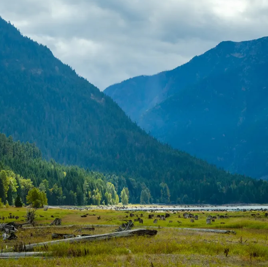
I came across photos by Eric Tsoi. You may know(of) him. Eric lives in Vancouver BC and has gathered images from so many places that I’ll admit, an hour went by as I travelled with him for a minute. → skagiteec.org/blog #erictsoi #upperskagitwatershed #rosslake #rossdam
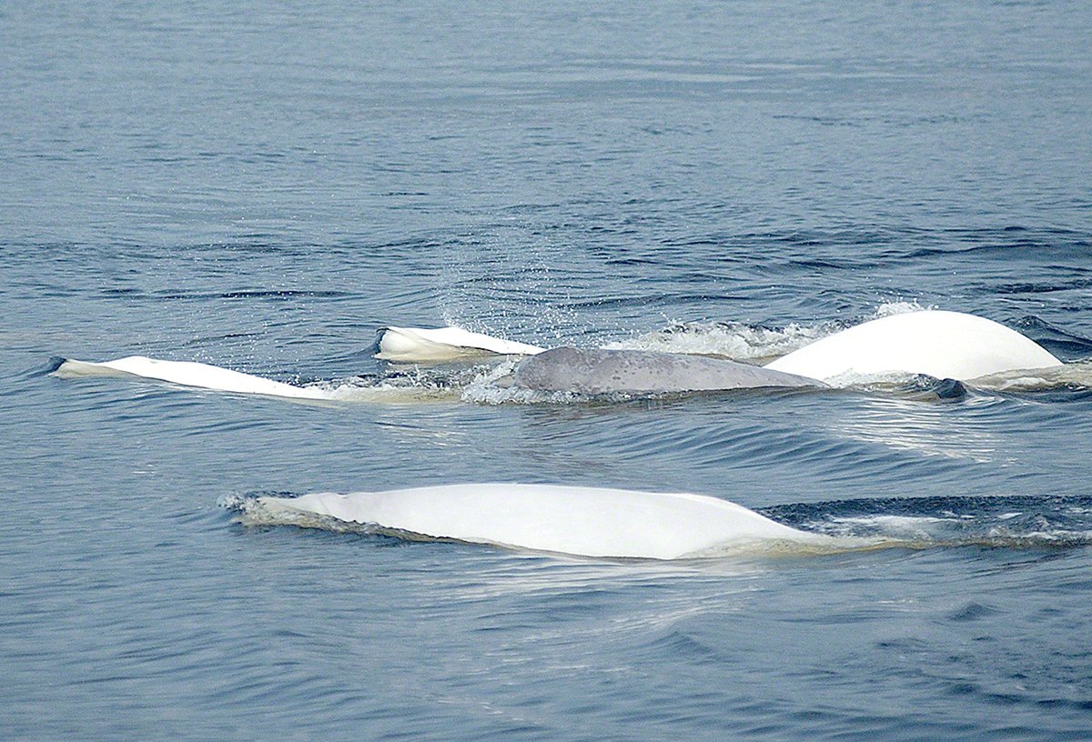
The action plan for the St. Lawrence Estuary beluga has been posted. Learn more: ow.ly/qXqR50XyGvN

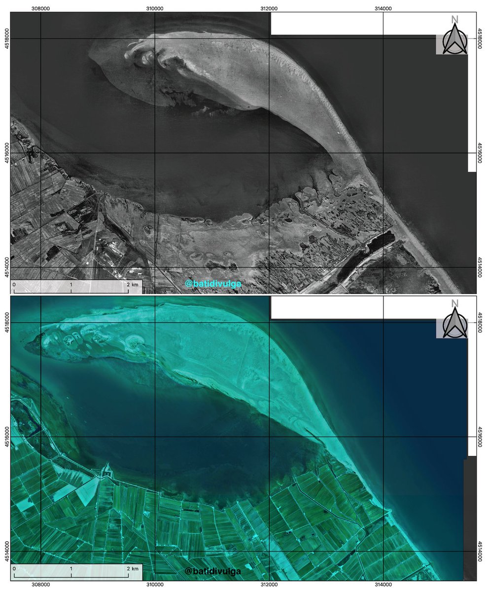
El Fangar is the northern spit of the Ebro Delta. We're working on it there and, with an article in mind, I prepared these prelimary maps showing the awesome evolution of the zone since 1945. @DeptDto @geologoenapuros @IGME1849 @gemar_ieo @PDE @IGeociencias @mauri_francesc

Landsat 🛰️ captured the snowy landscape of the north central U.S. following ❄️ over the weekend. The EarthNow! Landsat Image Viewer streamed this area of central South Dakota and the Missouri River contrasting the new bright snow cover. Visit: ow.ly/vphK50XAAUj #Landsat
Real-Time Water Levels for Transboundary Basins @SharedWatersGIS, @IJCsharedWaters The International Joint Commission is now leveraging Esri’s Living Atlas “Live Stream Gauges” service to monitor real-time water levels across U.S.–Canada shared basins. These gauges pull hourly…

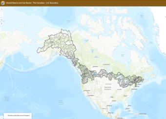
New IJC application release! Explore harmonized U.S.–Canada transboundary basins and HUC-8 sub-basins, built from aligned WBD + NHN data and enriched with CEC rivers and lakes. A seamless view of our shared waters for science, policy, and collaboration — now on the IJC AGOL.…
#Maritime #Traffic - #USCG Sector Eastern #GreatLakes received notification that due to current #Weather the #WellandCanal will be suspending #Navigation due to high winds. Anticipated reopening is on the afternoon of Nov. 28. There are currently eight vessels impacted. #Delay

Planning your will is one of the simplest ways to bring peace of mind to the people you love, and to support the nature you care about. NCC supporters can create a will for free with Epilogue. Start your plan today and help protect nature for the future: brnw.ch/21wXUpk

#Maritime #Traffic - #USCG Sector Eastern #GreatLakes received notification that due to current #Weather the #WellandCanal will be suspending #Navigation due to high winds. Anticipated reopening is on the afternoon of Nov. 28. There are currently eight vessels impacted. #Delay

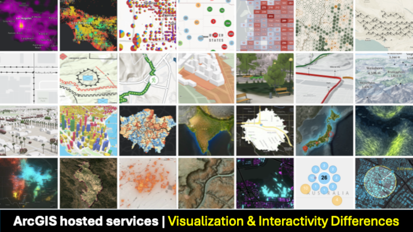
Take your ArcGIS app to the next level! Understand the visualization and interactivity differences between hosted data services to create engaging experiences. 📈💡 #ArcGIS #DevTips Learn more ➡️ ow.ly/oOVx50XhJmp

⏰Deadline coming up! Apply for #EcoAction funding by December 4, 2025.
🚨 Funding alert! Do you have an idea to help protect #FreshWater and the health of our #ecosystems? Apply now to the #EcoAction program on Community-led Freshwater Action across Canada: ow.ly/1wQI50XqMwe Take action before December 4, 2025!
Just Launched? Here's your first stop! We're thrilled to spotlight the International Joint Commission's powerful presence on ArcGIS Online — a goldmine for anyone working in transboundary water data between Canada and the U.S. From watershed dashboards to real-time hydrology &…
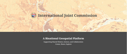
#SharedWatersGIS - is an initiative dedicated to mapping and delivering GIS-ready geospatial products and data for the transboundary water geography shared between Canada and the United States, as exemplified by the International Joint Commission's updated ArcGIS Online platform…
NEW: The IJC’s Updated AGOL Platform Is Live 🌎💧 If you work in cross-border water management, this is big. The International Joint Commission of Canada & the U.S. has released a fully updated ArcGIS Online environment built around new authoritative Hosted Feature Layers &…
Just Launched? Here's your first stop! We're thrilled to spotlight the International Joint Commission's powerful presence on ArcGIS Online — a goldmine for anyone working in transboundary water data between Canada and the U.S. From watershed dashboards to real-time hydrology &…


United States 트렌드
- 1. Brian Cole 5,599 posts
- 2. Walter Payton 7,300 posts
- 3. #Kodezi N/A
- 4. Chronos 1,041 posts
- 5. Price 266K posts
- 6. Merry Christmas 68.3K posts
- 7. #25SilverPagesofSoobin 30.5K posts
- 8. The FBI 108K posts
- 9. #WPMOYChallenge 11.7K posts
- 10. #NationalCookieDay N/A
- 11. Good Thursday 38.6K posts
- 12. #thursdayvibes 2,866 posts
- 13. yihe N/A
- 14. $META 12.1K posts
- 15. GLOWING FAYE AT RED SEA FILM25 62.1K posts
- 16. Dealerships 1,819 posts
- 17. The Blaze 5,617 posts
- 18. Tong 16.9K posts
- 19. Metaverse 8,095 posts
- 20. Somali 248K posts
Something went wrong.
Something went wrong.