
Hurricane Weather Center
@TCWxCenter
ALL FORECAST ARE OUR OPINIONS, DOES NOT REFLECT NHC: Just two weather enthusiasts providing accurate hurricane forecasts for the Atlantic, to your screen.
Vous pourriez aimer


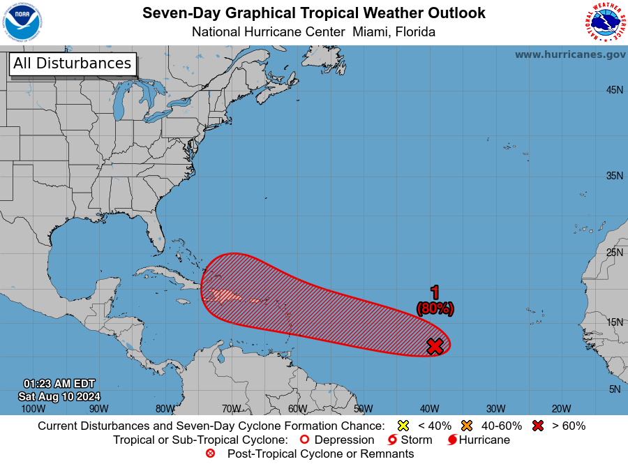
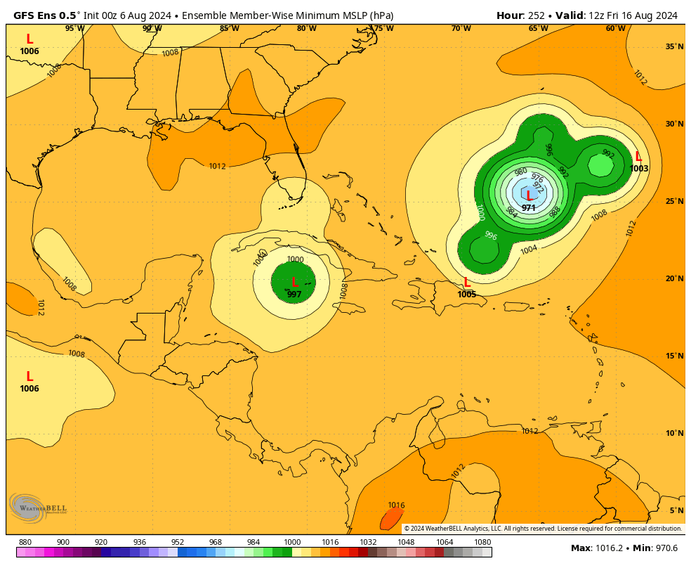
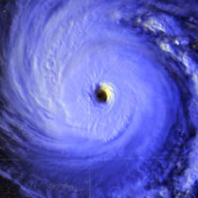
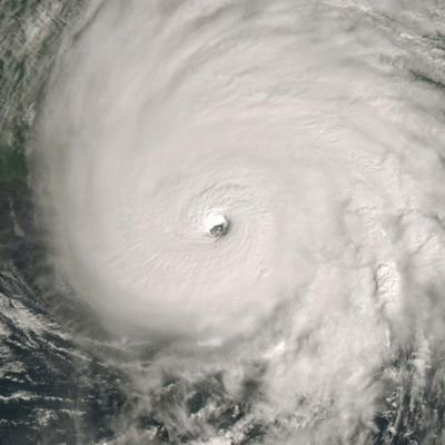
UPDATE: NHC has yet again increased odds for #98L to develop, 80% over the next week and 20% over the next 2 days. Interest in the Windwards, Greater Antilles, U.S. Virgin Islands should monitor the progress of #98L and stay tuned to the NHC for the official real-time updates.
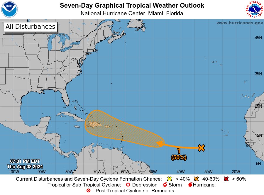
NHC has increased probabilities for tropical development on our Central Atlantic wave to 70% over the next week and 10% over the next 48hrs.


NHC has increased probabilities for tropical development on our Central Atlantic wave to 70% over the next week and 10% over the next 48hrs.
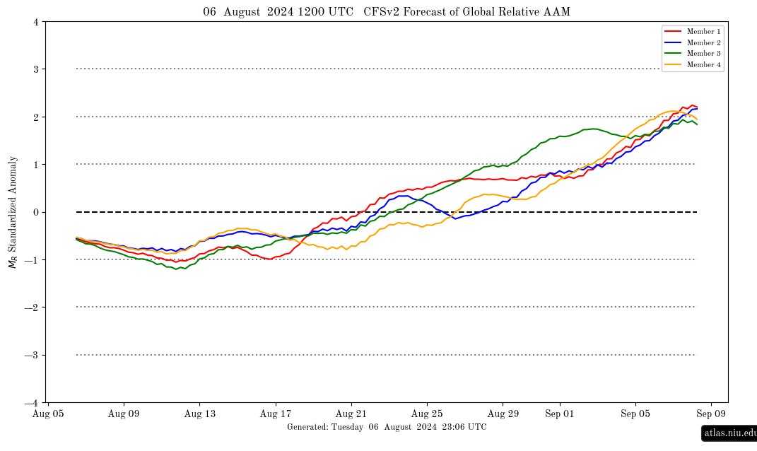
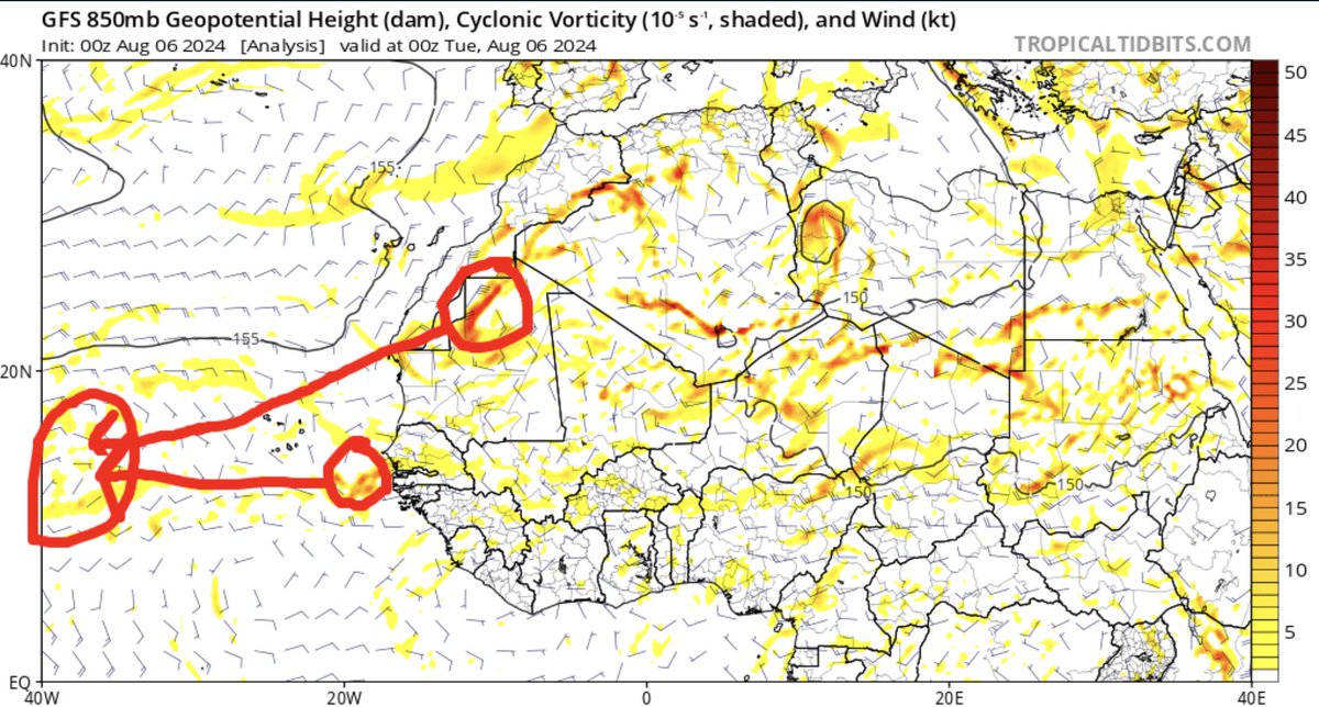
With GAAM turning positive, the hemispheric pattern may act more like an El Niño thus allowing troughing to be present over the east coast which may have a bigger influence on future storm tracks of various AEWs we see..
The NHC has increased odds for development of the wave over the eastern part of the central Atlantic, up to 50% over the next 7 days.
We folks at the TCWxCenter are watching 3 systems noted by the models over the next week the first wave is the utmost important system to watch for now. Environmental conditions are expected to become favorable for tropical development throughout the Atlantic.

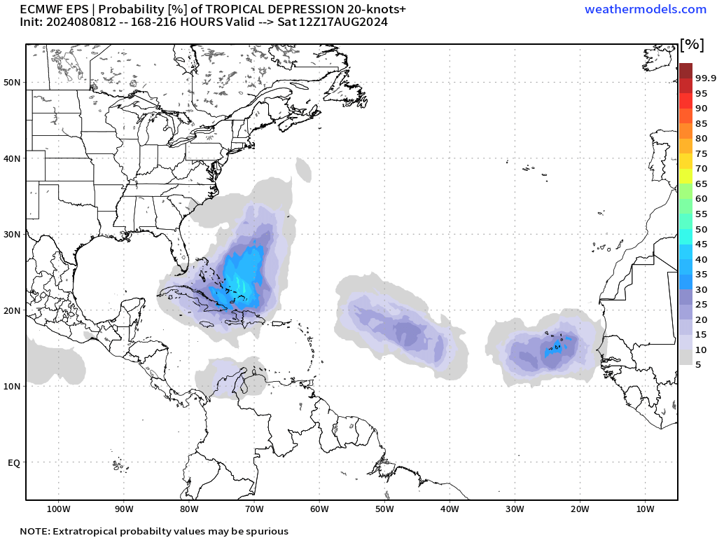

While #Debby is at our utmost concern over Florida, we are watching ahead into the 6-10 day timeframe for a potential tropical cyclone. This system does have deterministic and ensemble support, the area of interest is over Africa set to splash down over the Atlantic by Thursday.


United States Tendances
- 1. #Kodezi N/A
- 2. Walter Payton 3,608 posts
- 3. Chronos N/A
- 4. Merry Christmas 65.6K posts
- 5. Good Thursday 35.5K posts
- 6. $META 11.2K posts
- 7. #25SilverPagesofSoobin 14.1K posts
- 8. Metaverse 7,456 posts
- 9. #thursdayvibes 2,389 posts
- 10. Yihe 2,579 posts
- 11. #WPMOYChallenge 3,242 posts
- 12. #スビンの存在がMOAの宝物 10.4K posts
- 13. Happy Friday Eve N/A
- 14. Somali 238K posts
- 15. Dealerships 1,407 posts
- 16. RNC and DNC 4,277 posts
- 17. DNC and RNC 4,346 posts
- 18. Hilux 10.2K posts
- 19. The Blaze 5,118 posts
- 20. Toyota 31.9K posts
Vous pourriez aimer
-
 Northeast Weather
@NortheastWx -
 Boston Weather Consulting (by Owen)
@BostonWxConsult -
 🌞 Henry Swenson 🌱
@HenrySwenson -
 Matthew Ferreira | MassachusettsWx
@MassachusettsWx -
 Logan Giles
@LoganGilesWx -
 SNE Weather Coverage
@SNEWeather -
 Rudy's weather
@rudy_weather -
 New England Weather
@newenglandwx1 -
 NJ Weather
@NJWeather13 -
 Nick McElroy
@hurricanemac93 -
 StormchaserJS
@stormchaserjs -
 Derek Adesso
@derek_adesso -
 Alex Klucher
@AlexKlucher -
 Cristopher Cace
@ccace_wx -
 Maines Abominable SnowBART
@MESNOWman1
Something went wrong.
Something went wrong.