
WIFR First Alert Weather
@WIFR_FirstAlert
Get the latest forecasts and alerts from the WIFR First Alert Weather team.
قد يعجبك


New model runs are in and Meteorologist DJ Baker takes a look at what they are suggesting for snow Saturday.
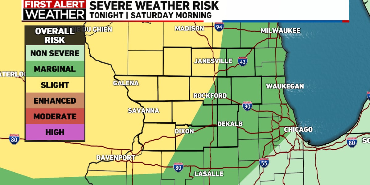
A winter storm watch has been issued across the region for Saturday. Meteorologist DJ Baker has a look at the latest forecast below.
A winter storm will impact northern Illinois and southern Wisconsin very early Saturday morning through Sunday morning. Preliminary snow totals range from 4-7" a this time.
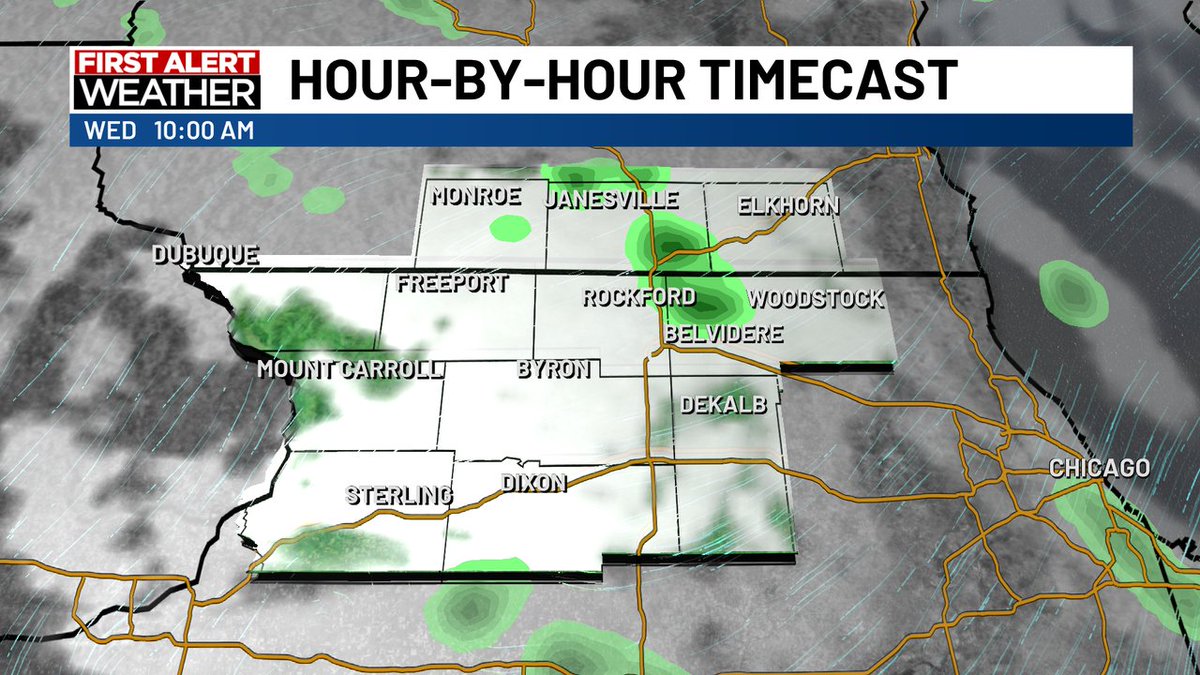
Wind gusts up to 50 mph are in the forecast for Wednesday, with a few flurries or snow showers. A more impactful snow event is taking shape this weekend, with the potential to see widespread snow across northern Illinois and southern Wisconsin.
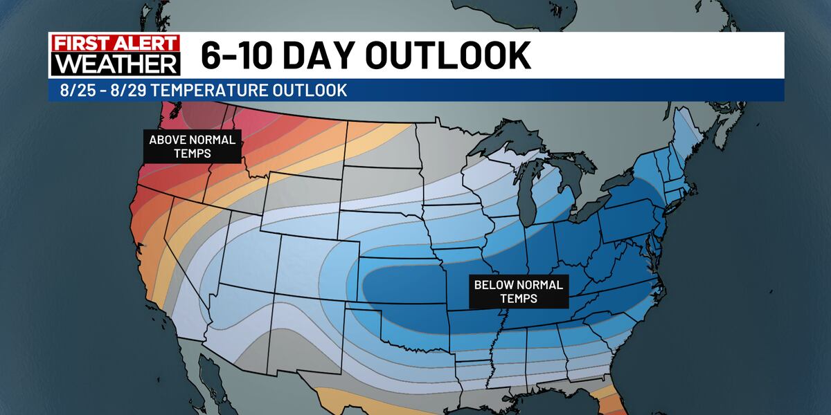
Temperatures will remain below average for the rest of the week, with a slight warm up as we head into Labor Day weekend. Our next and only opportunity for rain, looks to arrive overnight Wednesday and intoThursday as a cold front moves in from the north.
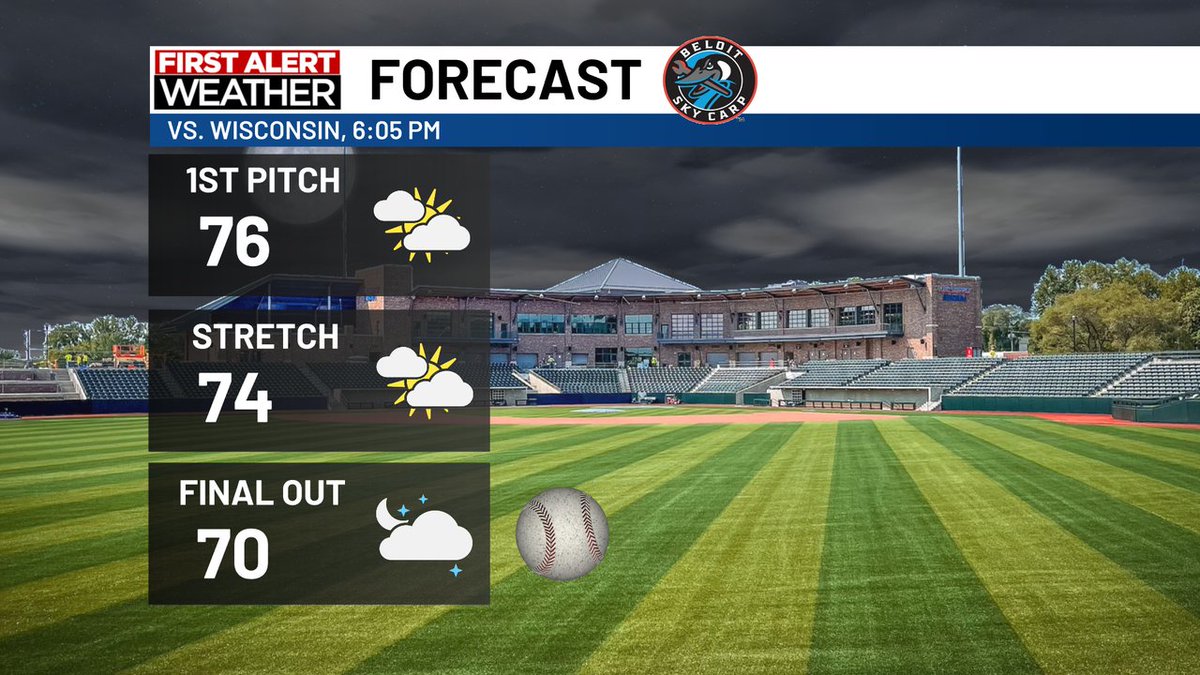
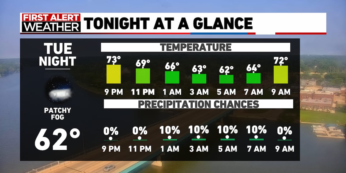
Heading out to Sky Carp game tonight? Should be a comfortable night with increasing clouds and temps in the 70s.
A foggy start to Friday, will lead to a warm but mainly dry day. wifr.com/2025/08/22/fog…
Our first taste of fall is just around the corner, as unseasonably cool air moves into the stateline. wifr.com/2025/08/21/dry…
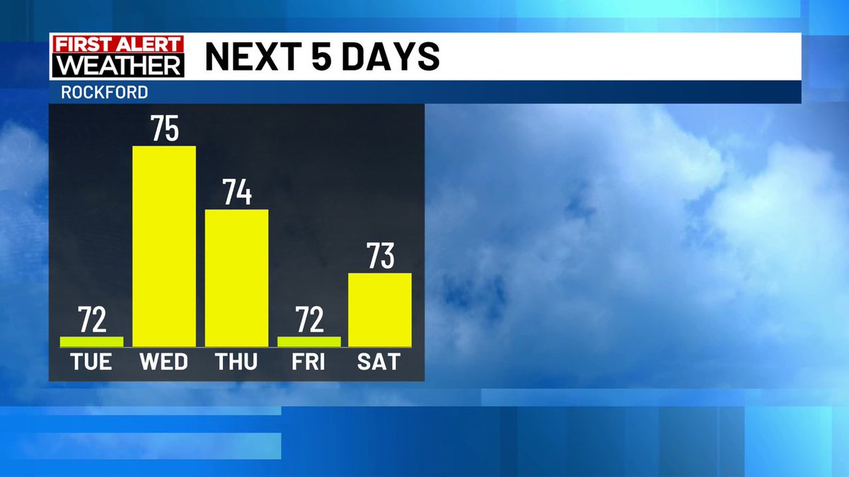
As winds turn more to the northeast, a few sprinkles or light showers will be possible through mid day Wednesday. Otherwise, expect a mix of sun and clouds during the afternoon with highs near 80°
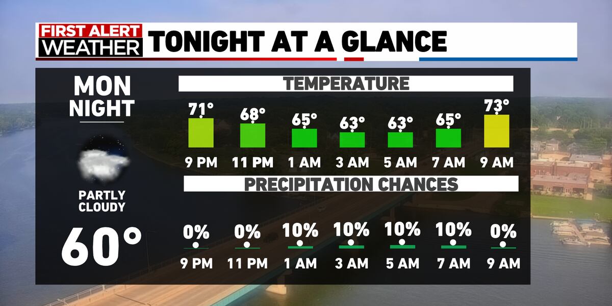
Temperatures stay seasonable through Friday, before much cooler weather moves in for the weekend. wifr.com/2025/08/20/str…
wifr.com
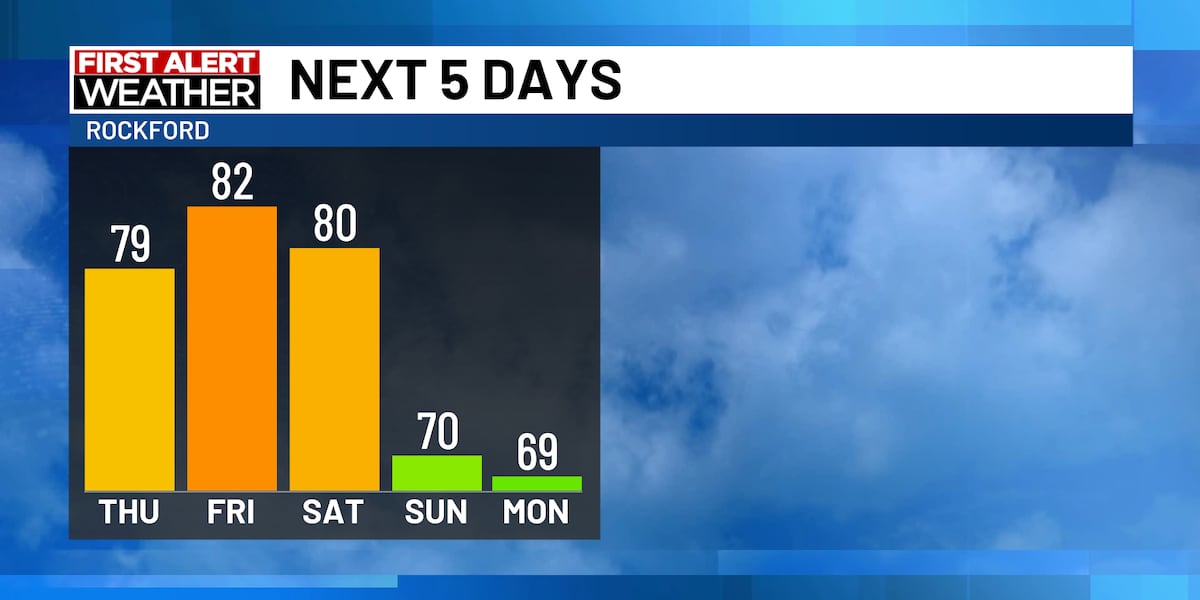
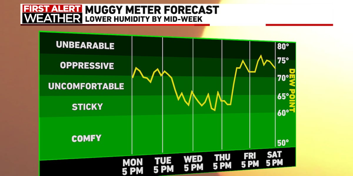
A dry stretch continues, with cooler air by the weekend
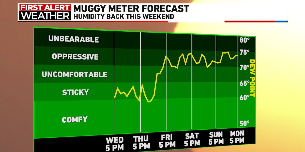
Heat and humidity increases, with storm chances by the weekend
On and off showers and storms will remain in the forecast through early next week, with cooler and drier weather by next Wednesday wifr.com/2025/08/16/occ…
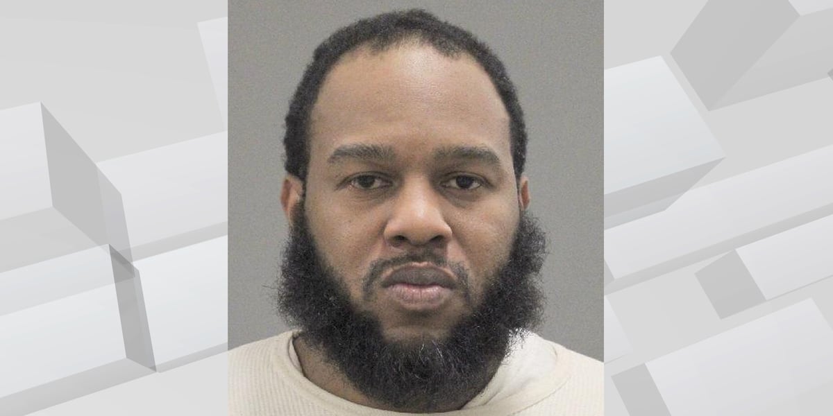
A 40-year-old man is sentenced to 10 and a half years in federal prison after violating the terms of his court-supervised release while in Rockford. wifr.com/2025/08/15/con…
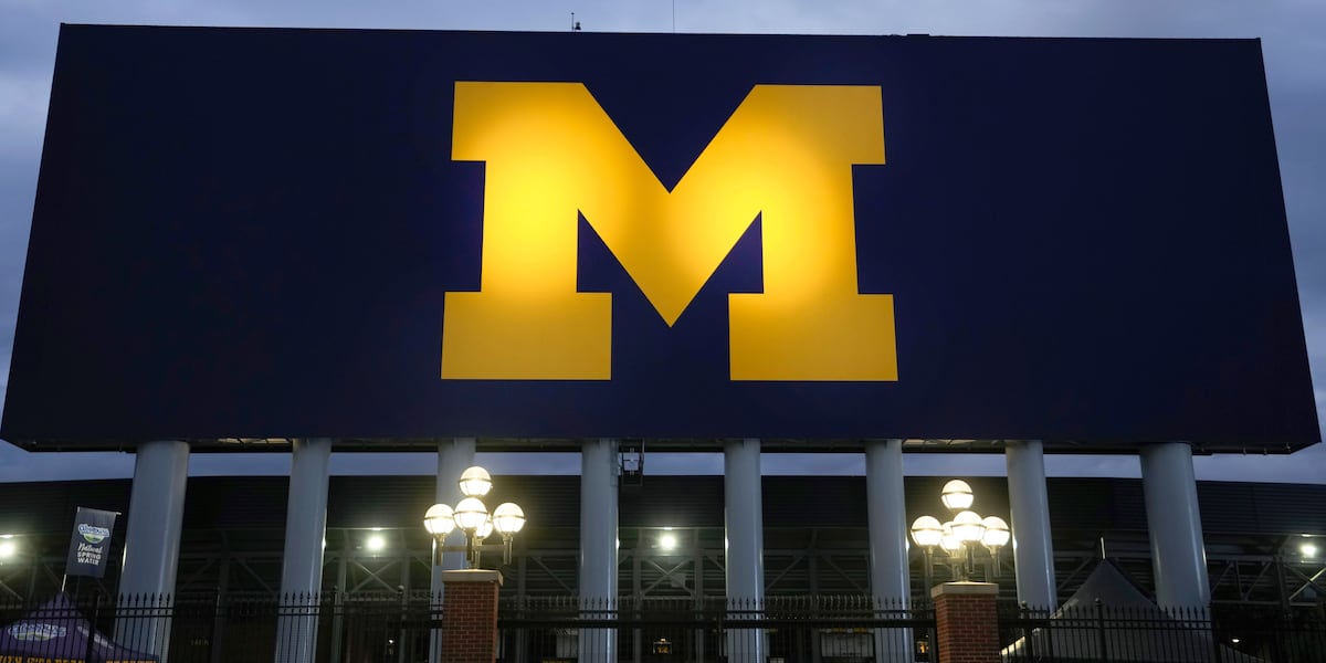
The NCAA fined Michigan tens of millions of dollars Friday for a sign-stealing scandal that has loomed over college football program for nearly two years. wifr.com/2025/08/15/mic…
Our weather stays pleasant through Thursday, with more heat and humidity by the end of the week. wifr.com/2025/08/14/tur…
Showers and storms will stick around through Tuesday, with more comfortable conditions by Wednesday and Thursday. wifr.com/2025/08/12/sho…
After a few hot and humid days, strong to severe storms return to the stateline over the weekend, with the potential for strong damaging wind gusts, hail, and flash flooding. wifr.com/2025/08/09/hot…
An isolated shower or storm can't be ruled out tonight, but drier and hotter weather is expected for Friday with heat index values approaching 100°. wifr.com/2025/08/08/hot…

Temperatures will be rising to above average values with the hottest days being Friday and Saturday with heat index values close 100°. Storm chances will also be on the rise through early next week. wifr.com/2025/08/07/tur…
Temperatures are expected to rise throughout the week with the heat index hitting the upper 90s this weekend. wifr.com/2025/08/06/hea…
Warmer and more humid weather returns by mid to late week with temperatures running well above average for this time of year. wifr.com/2025/08/05/tem…


United States الاتجاهات
- 1. Thanksgiving 2.33M posts
- 2. Lions 93.4K posts
- 3. Dan Campbell 6,753 posts
- 4. #GoPackGo 10.6K posts
- 5. Wicks 10.8K posts
- 6. Jordan Love 15.3K posts
- 7. Micah Parsons 10.5K posts
- 8. Goff 11.1K posts
- 9. Jack White 9,169 posts
- 10. McDuffie 2,793 posts
- 11. Watson 15.4K posts
- 12. Kenneth Murray N/A
- 13. #ChiefsKingdom 3,504 posts
- 14. #GBvsDET 4,701 posts
- 15. Green Bay 8,788 posts
- 16. Caleb Wilson N/A
- 17. Jamo 5,138 posts
- 18. #OnePride 6,758 posts
- 19. Gibbs 8,836 posts
- 20. Turkey 298K posts
قد يعجبك
-
 Eyewitness News WTVO/WQRF
@MyStateline -
 WIFR
WIFR
@WIFRTV -
 Rockford Register Star
@rrstar -
 City of Rockford
@CityofRockford -
 13 WREX
@13WREX -
 First Warn Weather
@FirstWarnWX -
 Rockford Scanner
@RockfordScanner -
 Winnebago Co Sheriff
@winnsheriff -
 Rockford Fire
@RockfordFire -
 Coronado Theatre
@Coronado_815 -
 Rockford Parks
@rpdfun -
 Rockford Police Department
@RockfordPD -
 Mark Henderson
@MARK_HENDERSON -
 Tinker Swiss Cottage
@Tinker_Cottage -
 Rockford Library
@rockfordpublib
Something went wrong.
Something went wrong.