
Michael Stingo
@_stingo
I’m just here for the memes...and the conspiracies.
You might like


#ramtrucked Ohio State vs Northwestern 6:30 in the 1st quarter, Ohio State running back hit on the defender
The day is finally here! #SWSoV apple.com/newsroom/2023/…
apple.com
Apple introduces Shop with a Specialist over Video
Today Apple launched Shop with a Specialist over Video, a new live shopping experience on apple.com for customers in the U.S.

This baby is visually impaired, and then he was given additional glasses, so he could see clearly. His smile when he saw his mother and father clearly😍

.@AusPublicHealth is awaiting results from the @CDCgov on a presumptive Travis County monkeypox case kvue.com/article/news/h…


Wowza!


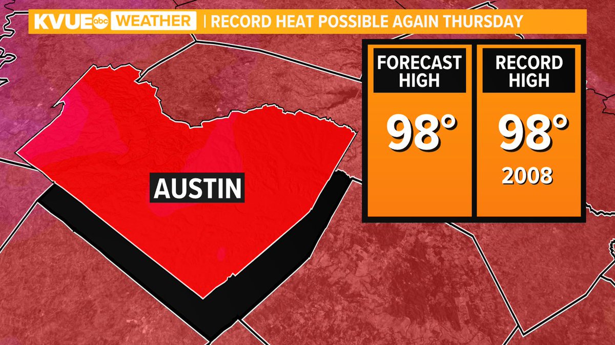
Back in record contention this afternoon, but we're tracking big changes for next week with rain chances and cooler temps. Join us now on Daybreak for the full forecast. #kvue #atxwx
I want a smoker so badly @MeatChurch these look amazing. @JSCHMIDTMBA you down for a long weekend/road trip to Waxahachie?? youtu.be/heY7oXxTCPs
Wow
Ted Hunsberger, 77, had gone skydiving 850 times, but hadn't done it in 20 years. On a trip with his assisted living facility, he changed that kvue.com/article/featur…


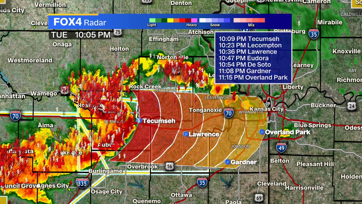
The squall line blasting into KC is associated with a powerful “northern bookended vortex,” or counterclockwise swirl on northern end. Southerly winds ahead of storms are “advecting,” or dragging in, warm moist air. That’s making the line of showers preceding band.@MyRadarWX

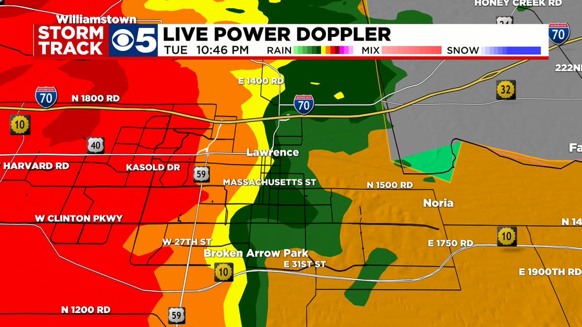
Quarter sized hail and wind gusts of 50-60mph moving into Mass Street in Lawrence right now... This storm will be grabbing attention the next half hour over Douglas County. Stay connected with @kctv5 StormTrack5

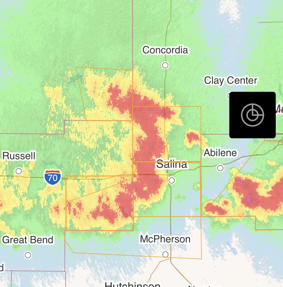
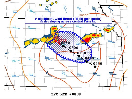
NEW: derecho-like impacts are possible in east central Kansas in the coming hours as a “bow echo” gobbles up instability, or juice. Widespread 60-90 mph wind gusts are possible. Notice the backward-C shape. That’s where severe winds have pushed out the bow. I-35 soon!
10:10 PM Update: This storm moving through the Topeka area is cranking out 60-65 MPH winds...moving eastwards into Douglas and southern Jefferson Co...high wind threat with storm...perhaps some hail as well...and torrential rains. JL #kswx


United States Trends
- 1. #MeAndTheeSeriesFinalEP N/A
- 2. Good Saturday N/A
- 3. Taemin N/A
- 4. #OrmBlossominShanghaiEvent N/A
- 5. ORMKORN BA BLOSSOMIN N/A
- 6. Jayda N/A
- 7. #FreenFanSignInTIANJIN N/A
- 8. Michael Cohen N/A
- 9. Manchester City N/A
- 10. SAROCHA AT TIANJIN EVENT N/A
- 11. McBride N/A
- 12. The Rip N/A
- 13. Smart Money N/A
- 14. #JustinStrong N/A
- 15. AI Summary N/A
- 16. Hannity N/A
- 17. #DragRace N/A
- 18. Sean Penn N/A
- 19. baekhyun N/A
- 20. Gibbs N/A
You might like


Something went wrong.
Something went wrong.