
Andrew Muehr
@andrewtornado11
🇺🇸 OU ‘25, CSU M.S. I study the atmosphere. Former OWL Monday night shift leader :) Goldwater Scholar. Milwaukee native.
คุณอาจชื่นชอบ


My lead author supercell paper with James Ruppert, @mattnado, and @UpdraftwMax is now out in final form in Journal of the Atmospheric Sciences! journals.ametsoc.org/view/journals/…

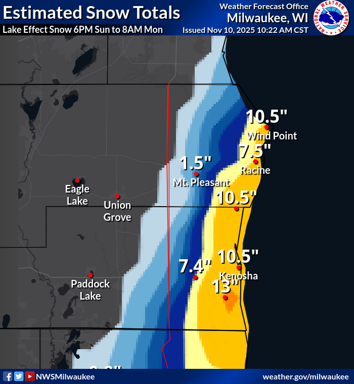
Here are the estimated snowfall totals from the lake effect snow event from last night. #wiwx

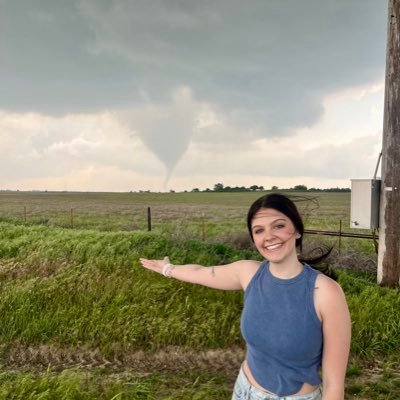
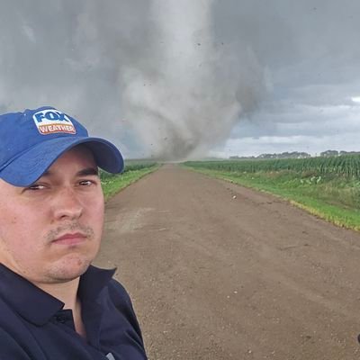
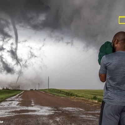
a strong tornado near Henry, South Dakota on July 27th of 2025 - I can’t wait to be in this position again
Widespread flooding impacts in Milwaukee Co. First three videos/images are at the Whitnall Park Beer garden in Greendale, near the Root River. The shipping container was moved about 100 yards. Last photo shows what many streets around town look like. @NWSMilwaukee @BrianNizTMJ4
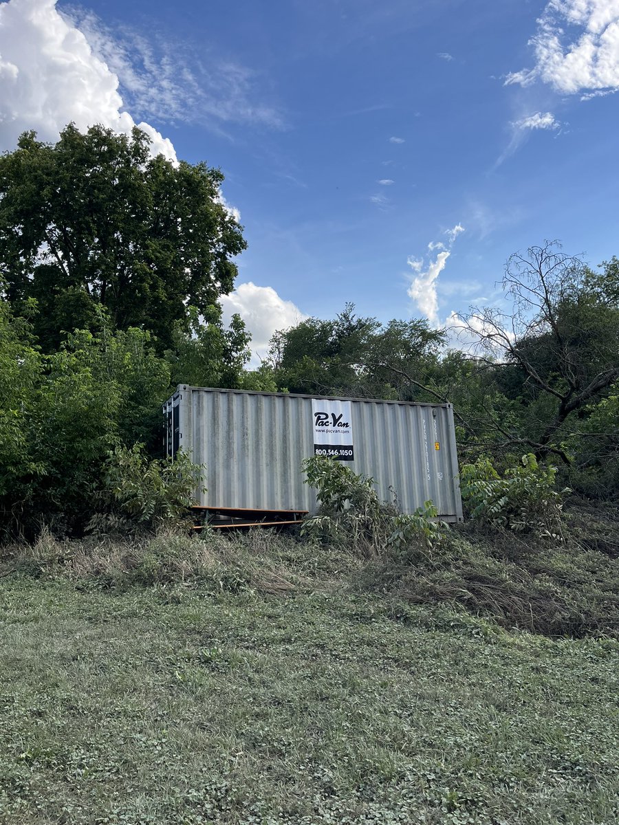
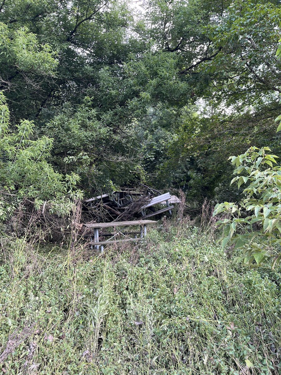
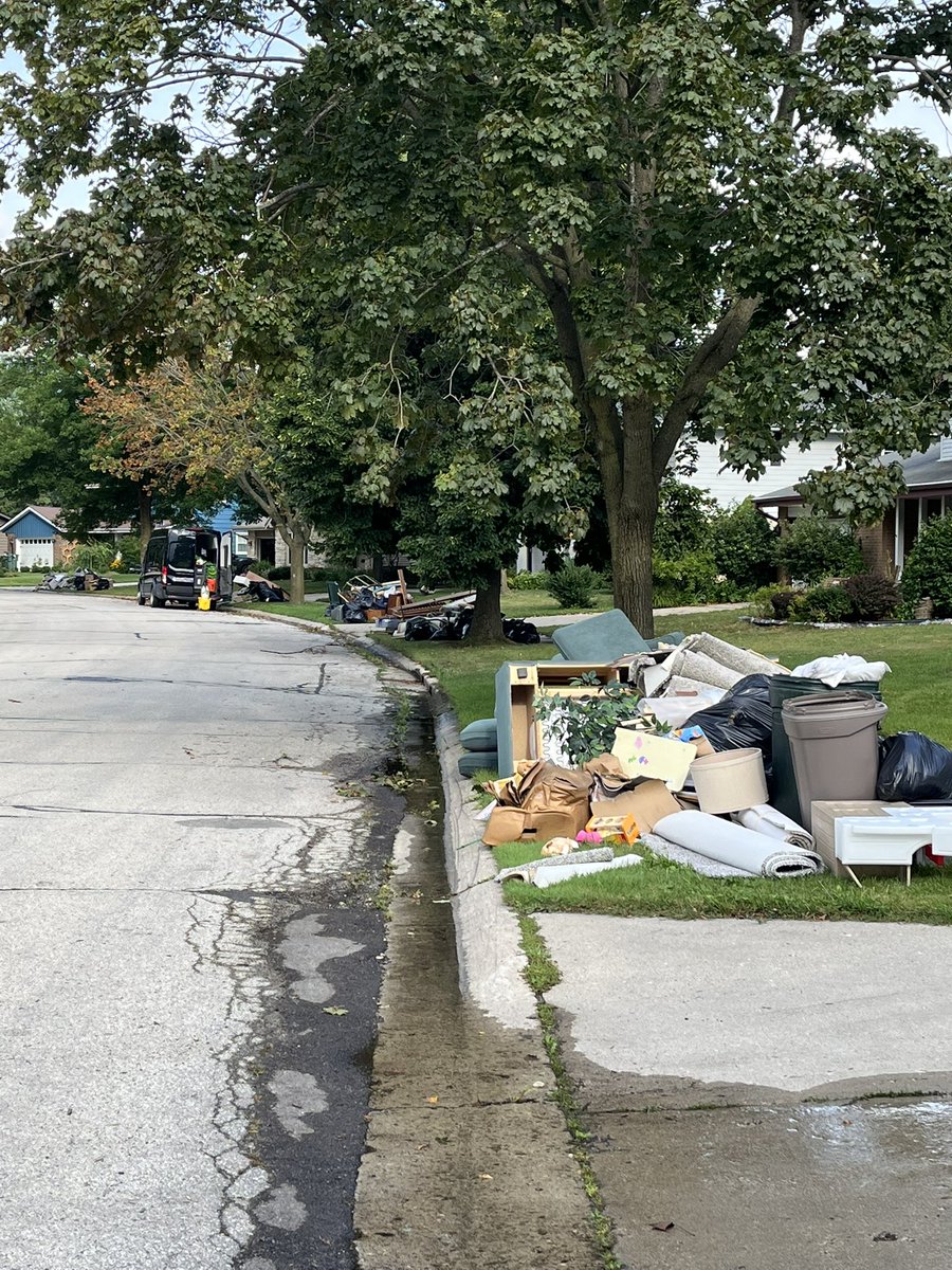

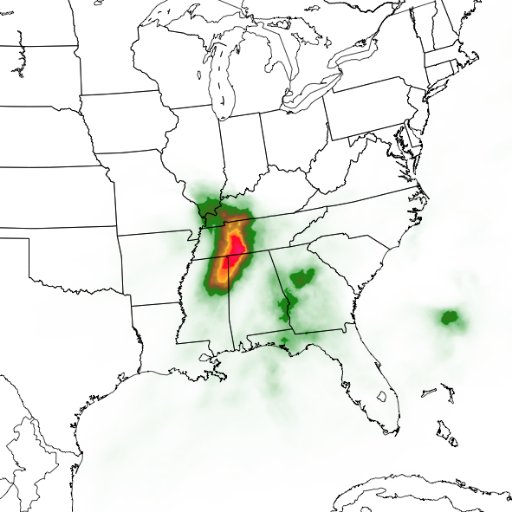
Extreme rain event centered on Milwaukee overnight, more than 14” locally recorded with additional downpours moving through. Probably one of the biggest in state history. Very well forecasted by the local WFO and the WPC, who issued a moderate risk despite so-so model support.
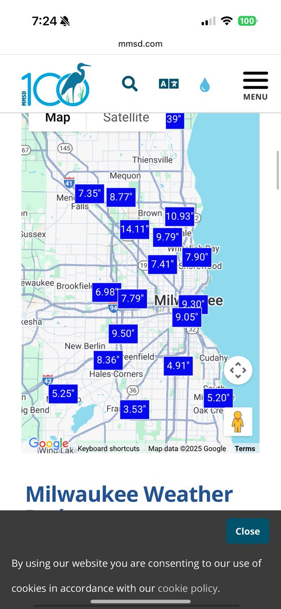
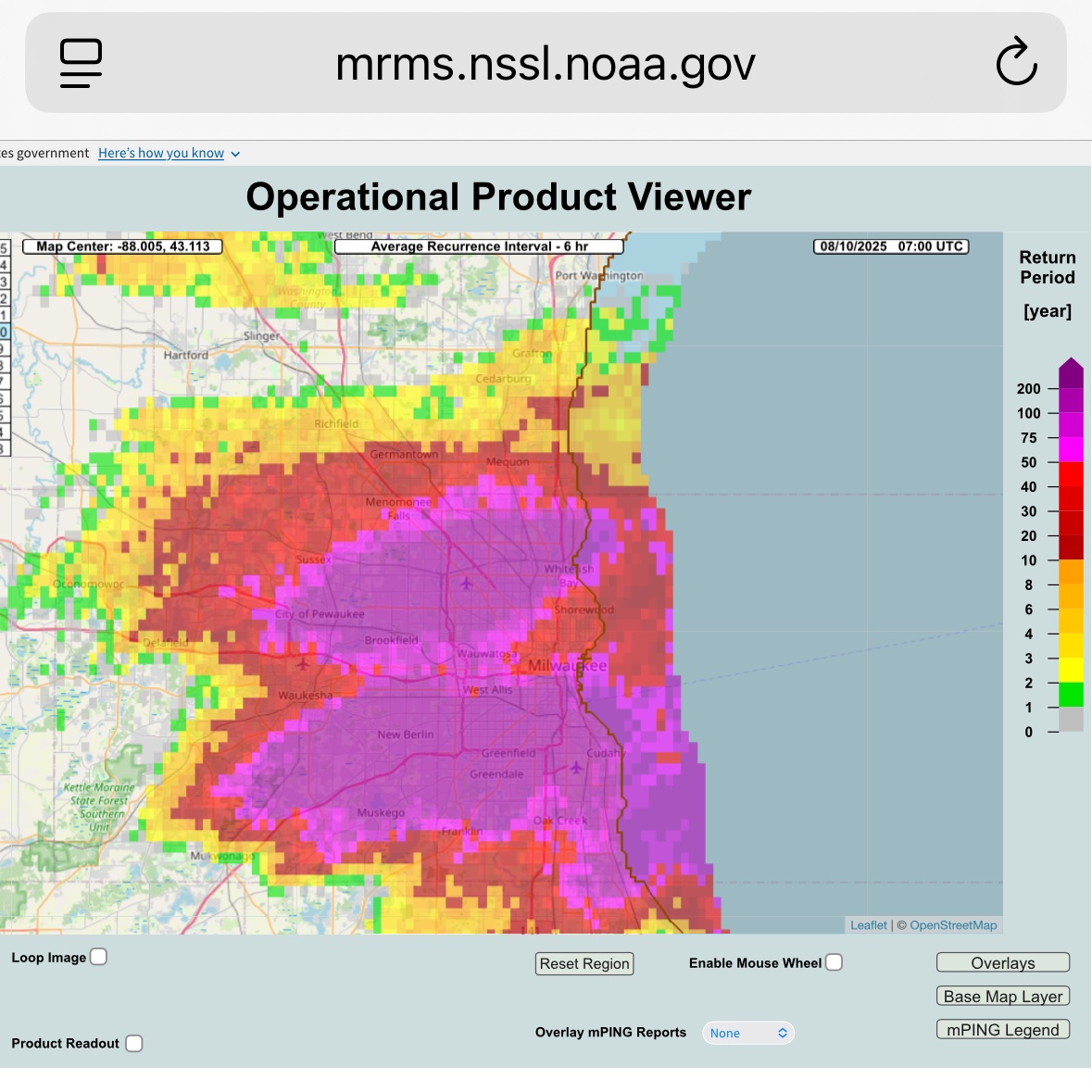


The Milwaukee River at Estabrook Park and the Root River in Franklin have both broken the old flood stage records. The Fox River in Waukesha will also reach record flood stage later today. To say this is a historic and unprecedented flood isn't hyperbole. It's a fact.

Here is the video clip where I thought I was going to witness multiple chasers die in the Henry, SD #tornado #sdwx after getting too close as the farm disintegrated and flew over them. @MichaelGordonWX @SimonStormRider @JustonStrmRider @scottmcpartland @mikebettes @parkertwc
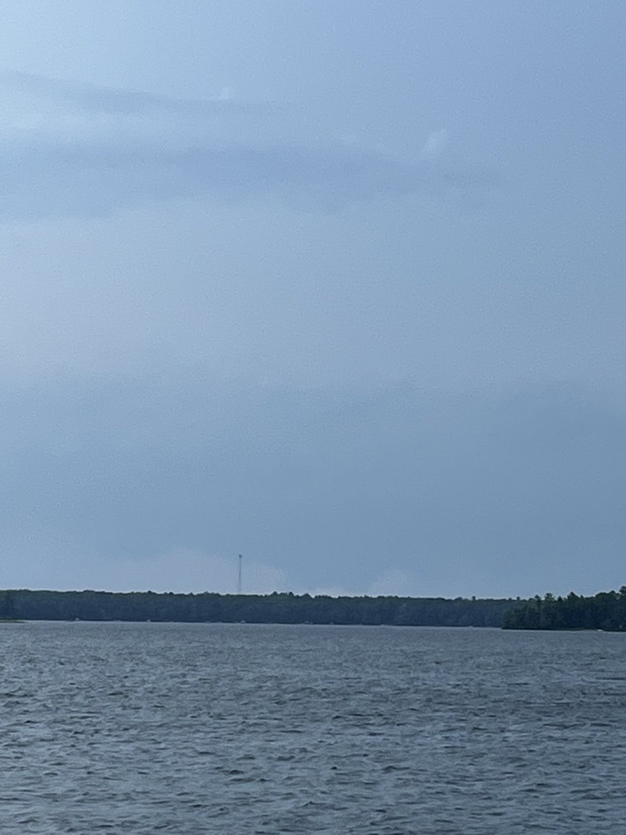
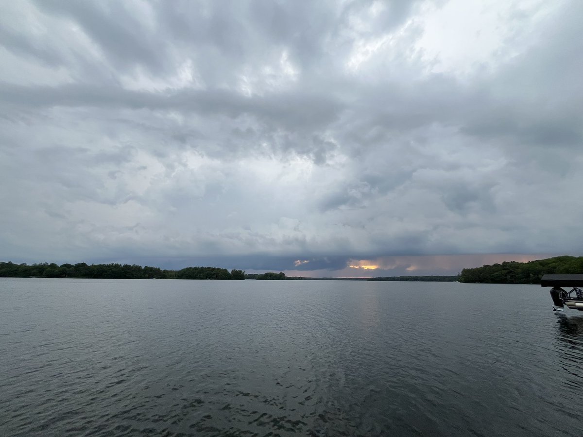
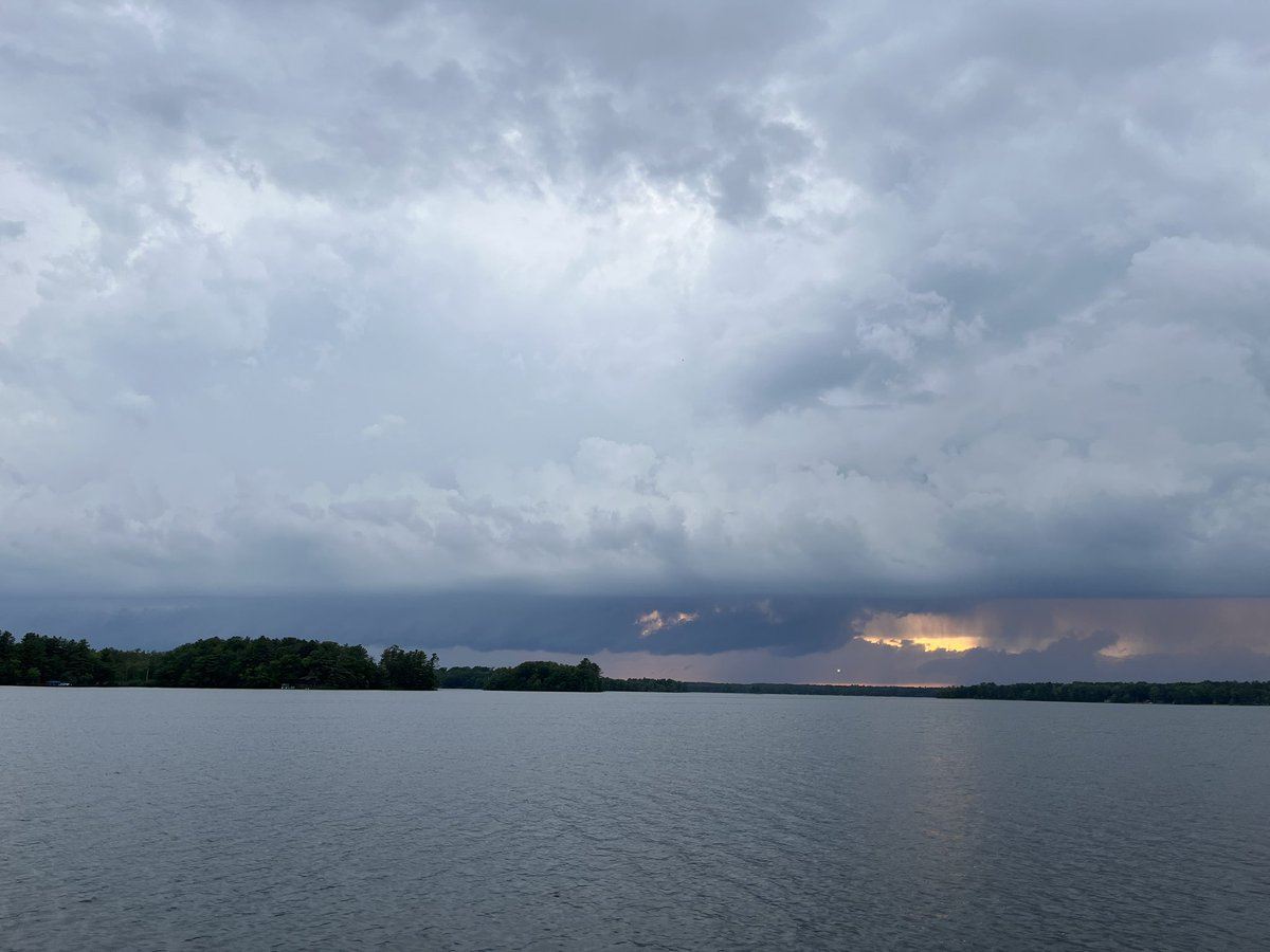
Supercell near Trego, WI with a wall cloud. Viewed from Big Sissabagama Lake, south of Stone Lake @NWSduluth

The most insane #tornado intercept of my 30 year storm chasing career - WATCH FULL VIDEO: youtu.be/yu7AbeQoFfQ?si…


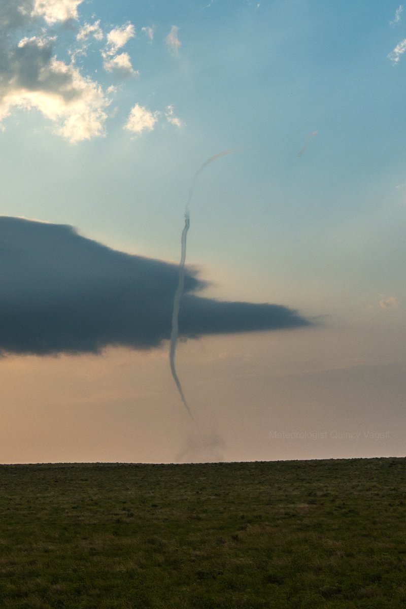
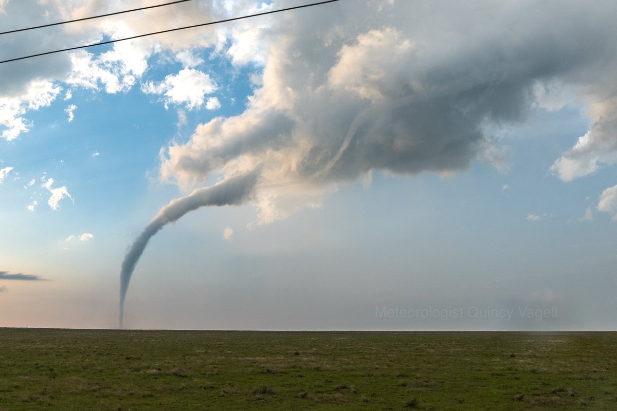
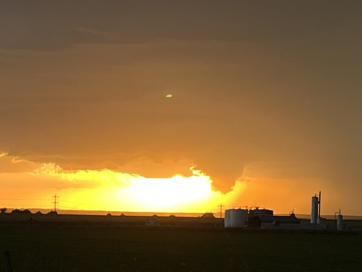
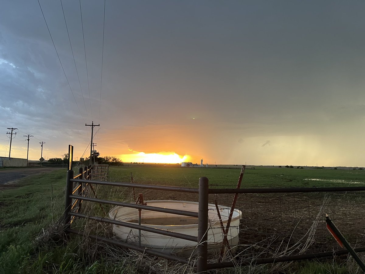
Various rope-out stages of tonight’s tornado near Kit Carson, CO @NWSGoodland

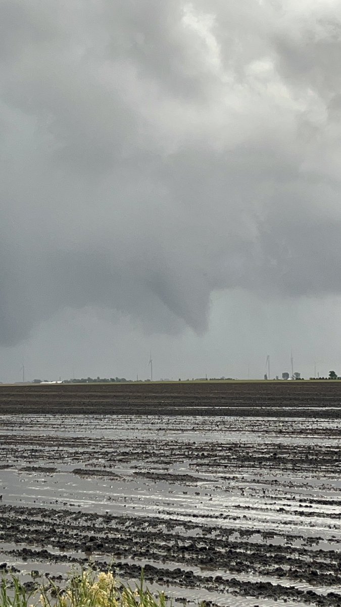
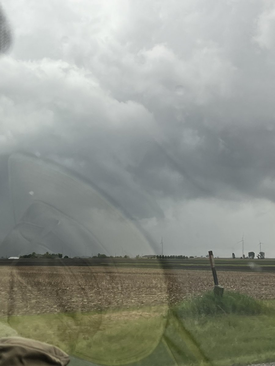
Some shots of what might have been a brief tornado just south of Penfield, Illinois yesterday. First video was taken at 5:07-5:08 pm, last photo was at 5:11 pm CDT. In the first part of the video there appears to be a couple faint swirls at the ground. @NWSLincolnIL
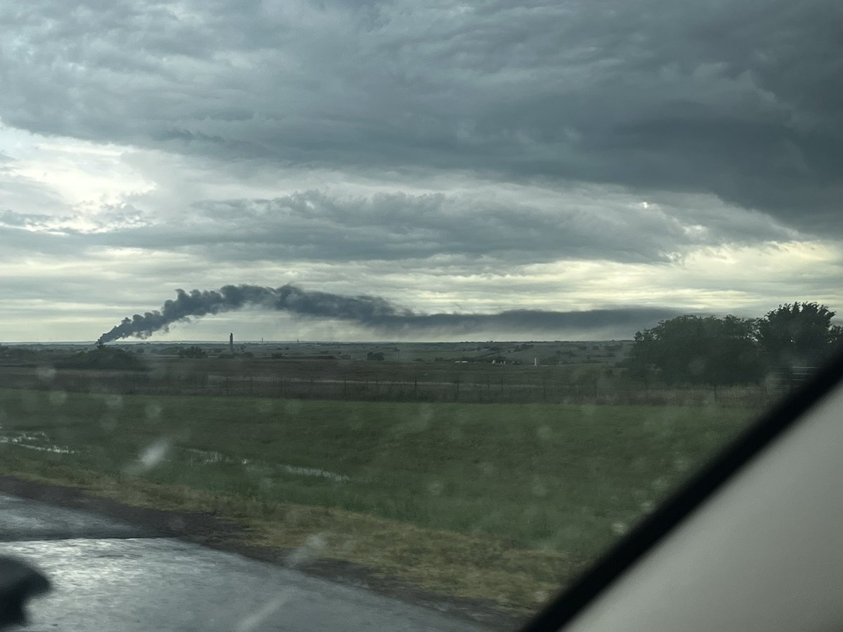
Years of training in the OU SoM program has prepared me for this moment: identifying the smoke plume behavior

Wildfire smoke plume west of I-44 near Mile Marker 87


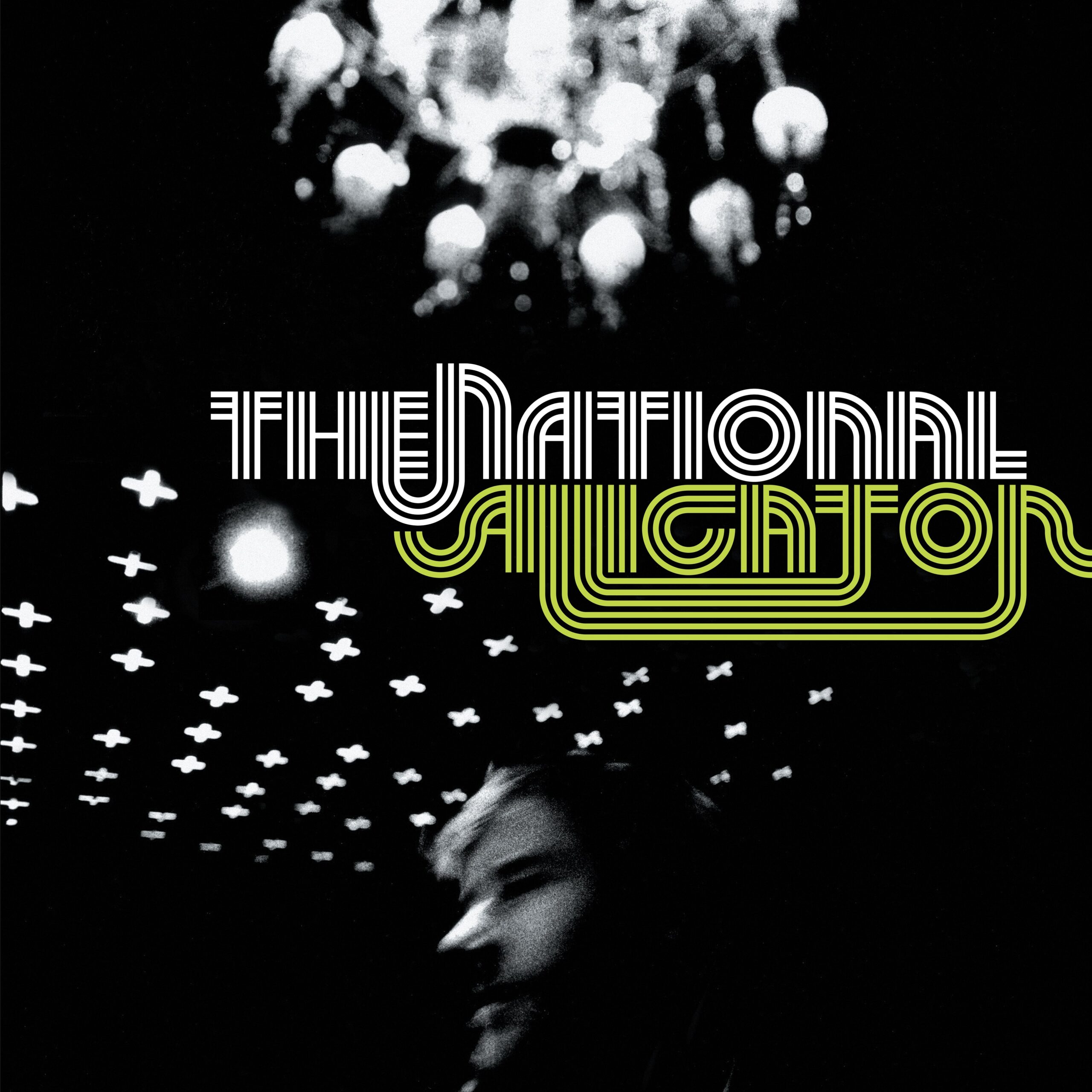
.@TheNational's first masterpiece 'Alligator' turns 20 years old tomorrow, so let's look back together stereogum.com/2303762/the-na…
Let us take you to the OWL Lab! Please consider helping support us and all we do. Donate to owl at givesooner.org 🦉 #OUGivingDay

Not something you see in SW #okwx in April. Snow-capped Wichita Mountain range.

From a pure synoptic perspective, today's dryline has a lot going for it w.r.t. convective initiation. It can be tough to get both strong convergence and long parcel residence times along the same dryline.


United States เทรนด์
- 1. Thanksgiving 319K posts
- 2. Good Wednesday 28.4K posts
- 3. #wednesdaymotivation 4,554 posts
- 4. #Wednesdayvibe 2,266 posts
- 5. #PuebloEnBatallaYVictoria 1,704 posts
- 6. Colorado State 3,261 posts
- 7. Nuns 7,644 posts
- 8. Mora 21.6K posts
- 9. Hump Day 11.2K posts
- 10. Stranger Things Day 3,135 posts
- 11. Hong Kong 10.4K posts
- 12. Happy Hump 7,522 posts
- 13. Gretzky N/A
- 14. Karoline Leavitt 25.9K posts
- 15. Luka 70.1K posts
- 16. Food Network N/A
- 17. Brett Favre 1,059 posts
- 18. Clippers 20.2K posts
- 19. Witkoff 183K posts
- 20. The God 412K posts
คุณอาจชื่นชอบ
-
 Sam Brandt
@sambrandt99 -
 Liam Llewellyn
@LiamLTWX -
 Nolan Meister
@Nolan_Meister -
 Matthew Davies
@MatthewDaviesWx -
 Andrew Justin
@andrewjustinWX -
 Danielle Crutchfield
@danielle__wx -
 Matthew Varela
@MatthewVarela_ -
 Preston Roesslet
@prestonroesslet -
 Robby Frost
@robbyfrostwx -
 Parker Alvstad
@alviewx -
 Matthew Brown
@Rhapsodyinbrown -
 Colin Welty
@weltywx -
 Ben Kassel
@ben_kasselwx -
 Emily Barbini
@barbini_wx -
 FirstWARN Tri-Cities
@FirstWarnTRI
Something went wrong.
Something went wrong.