DroneX Mapping & Education
@dronex_me
- Portal de Notícias & Informações 🛰🚀🌐 - Cursos, EAD 💻📱📚📒 - e-commerce Drone, VANT, RPAs e acessórios 🧾💳💰 https://linktr.ee/droneX
You might like


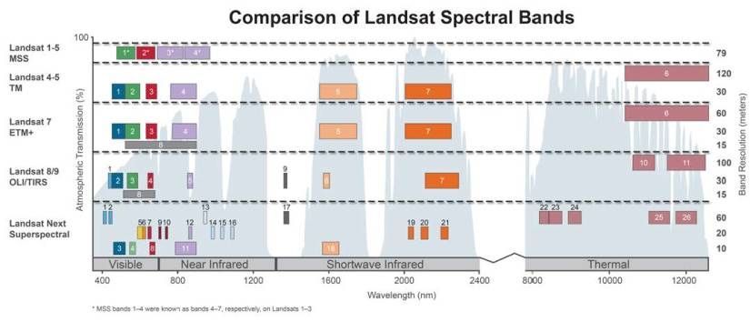
Landsat Next: The New Constellation Set to Replace Landsat 8/9 buff.ly/3VyhiYp

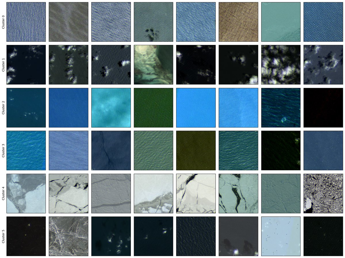
Introducing Hydro -- A Foundation Model for Water in Satellite Imagery. There are many foundation models for remote sensing but nearly all of them focus on imagery of land. The earth is made of ~71% water. ML 4 Water needs some more love and attention.
Confesso que isso aqui me deixou fascinado. Espero que os “velhinhos” da F1 adotem nas suas transmissões. Drone da Red Bull redefine a experiência visual na Fórmula 1 Em colaboração com os Dutch Drone Gods, a Red Bull apresenta um drone personalizado que desafia os limites da…
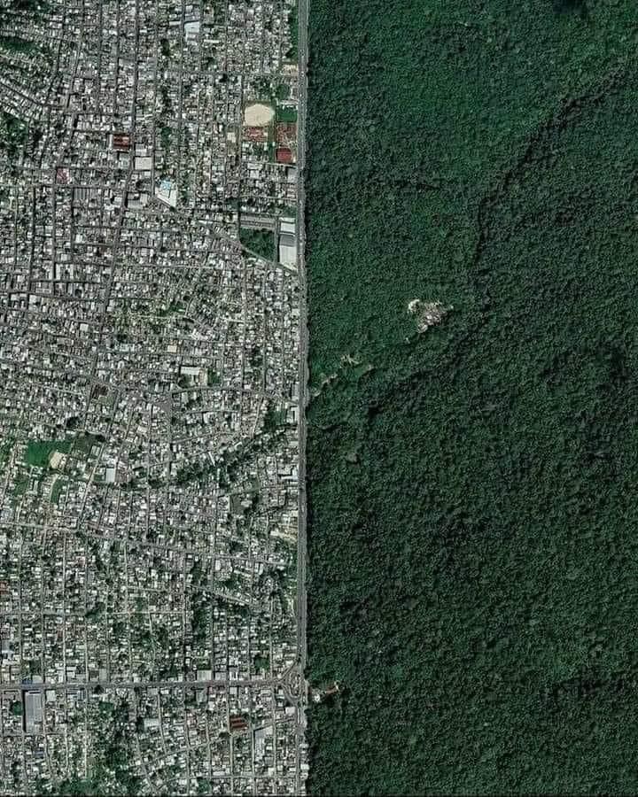
Manaus, Brazil, is located in the center of the Amazon rainforest. This is Avenida Margarita, a kind of border between the city and the forest.

High-resolution satellite images can be insanely expensive to buy. So here's a list of free datasets you can access. These datasets can be used to build foundation models, super-resolution models, or for segmentation.

Diferencias entre los sistemas de coordenadas geográficas y proyectadas mappinggis.com/2022/02/difere… #EPSG #sistemasdecoordenadas #SRID
mappinggis.com
Diferencias entre los sistemas de coordenadas geográficas y proyectadas
Existen dos tipos de Sistemas de Referencia de Coordenadas: Coordenadas Geográficas y Coordenadas Proyectadas o Planas.

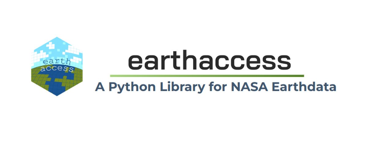
A new #Python application programming interface (API) library simplifies NASA Earth science data discovery and access with a few lines of code. ➡️Learn how you can incorporate earthaccess into your data workflow: go.nasa.gov/494NoOY

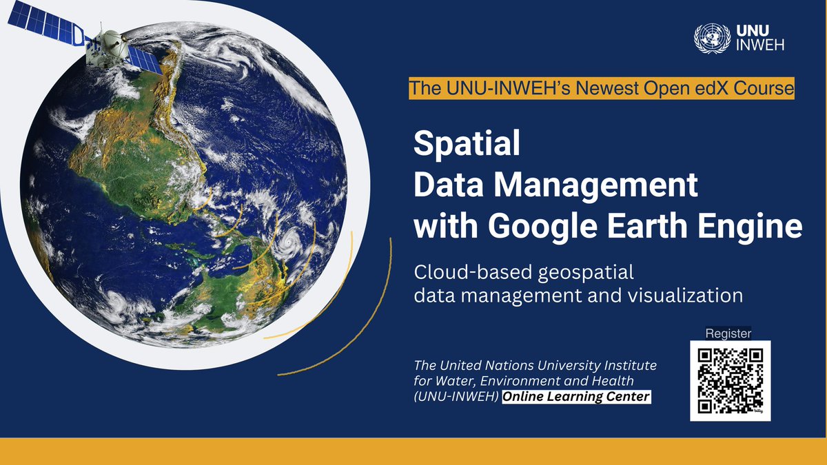
🌍🌱 My #EarthEngine course is now available on the United Nations University Open edX platform! Enroll now and earn a certificate upon completion of the course 📚🎓 wlc.unu.edu/courses/course…
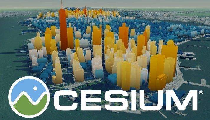
Visualizar edificios #3D con #Cesium #OSM Buildings mappinggis.com/2020/11/visual… #CesiumOSMBuildings

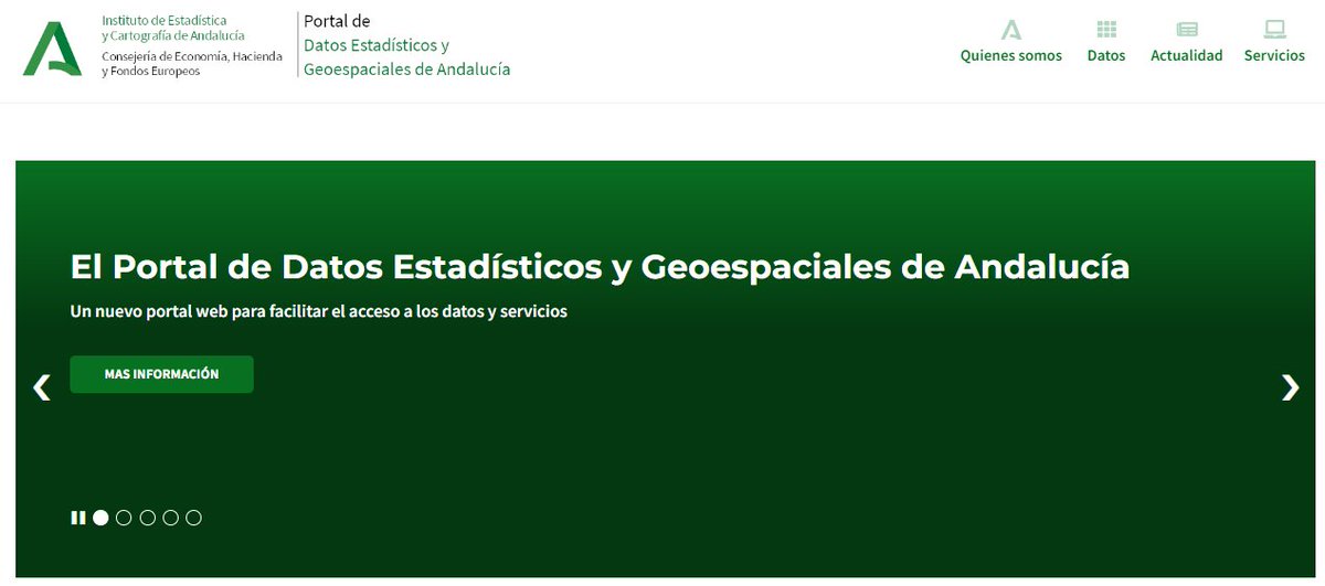
🌐➡ El Instituto de Estadística y Cartografía de Andalucía pone a disposición de los usuarios el Portal de Datos Estadísticos y Geoespaciales de Andalucía (Portal DEGA). Enlace: juntadeandalucia.es/institutodeest… #IDEEs #cartografía
🛰📥➡ En esta entrada os dejamos una web de acceso libre para la descarga gratuita de imágenes de satélite de la NASA. Leer más: bit.ly/web_descarga_N… #imagensatélite #NASA #teledetección #Satélite #Descarga
cursosteledeteccion.com
Descarga gratuita de imágenes de satélite de la NASA
En esta entrada vamos a conocer un recurso web “open source” de gran aplicación para la descarga de composiciones de imágenes de dos satélites lanzados por la NASA, los satélites Terra, Aqua y Suomi.

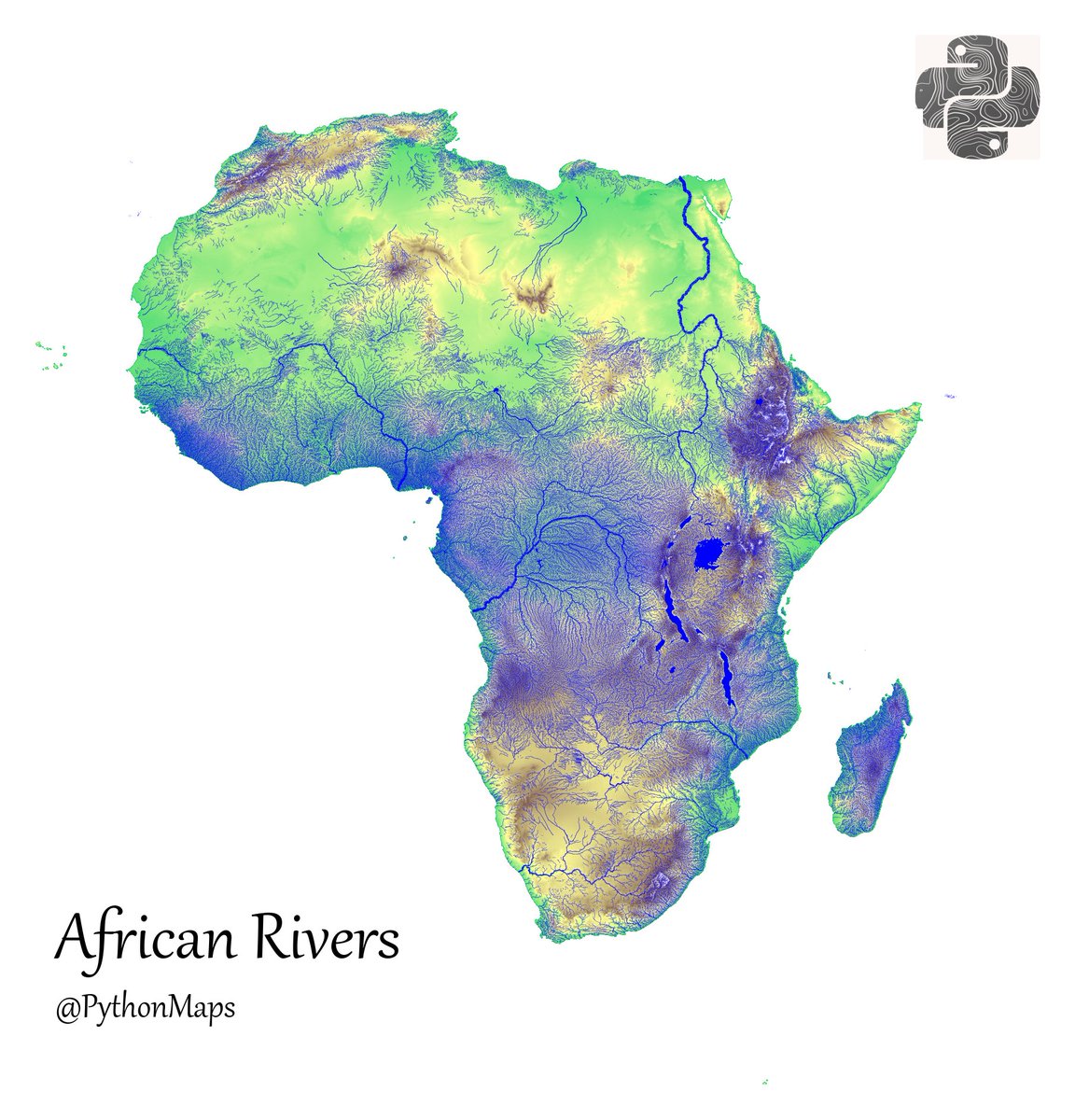
Rivers of Africa plotted on top of a topography map.
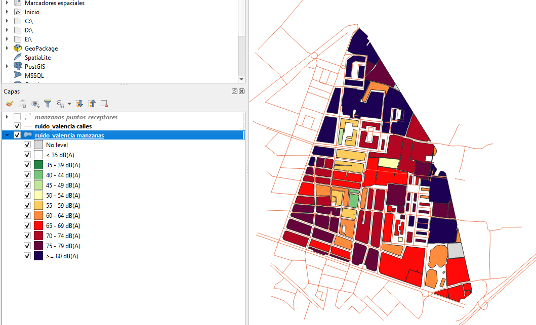
Cómo generar mapas de #ruido con #QGIS mappinggis.com/2020/09/como-g… #opeNoise
Cómo crear mapas #3D en #QGIS con el plugin Qgis2threejs mappinggis.com/2021/10/como-c… #threejs
mappinggis.com
Cómo crear mapas 3D en QGIS con el plugin Qgis2threejs
Te enseñamos a crear un mapa 3D con QGIS y Qgis2threejs: el caso de la erupción volcánica de La Palma. Datos del IGN y opendata de La Palma

El otro día quedamos en que los mapas de metro no se ajustan al territorio. Pero de hecho sus esquemas pueden ser de varios tipos ya establecidos: geográfico (~real), ortoradial, octilineal, etc. LOOM muestra cómo serían los mapas de transporte según el tipo de esquema escogido:

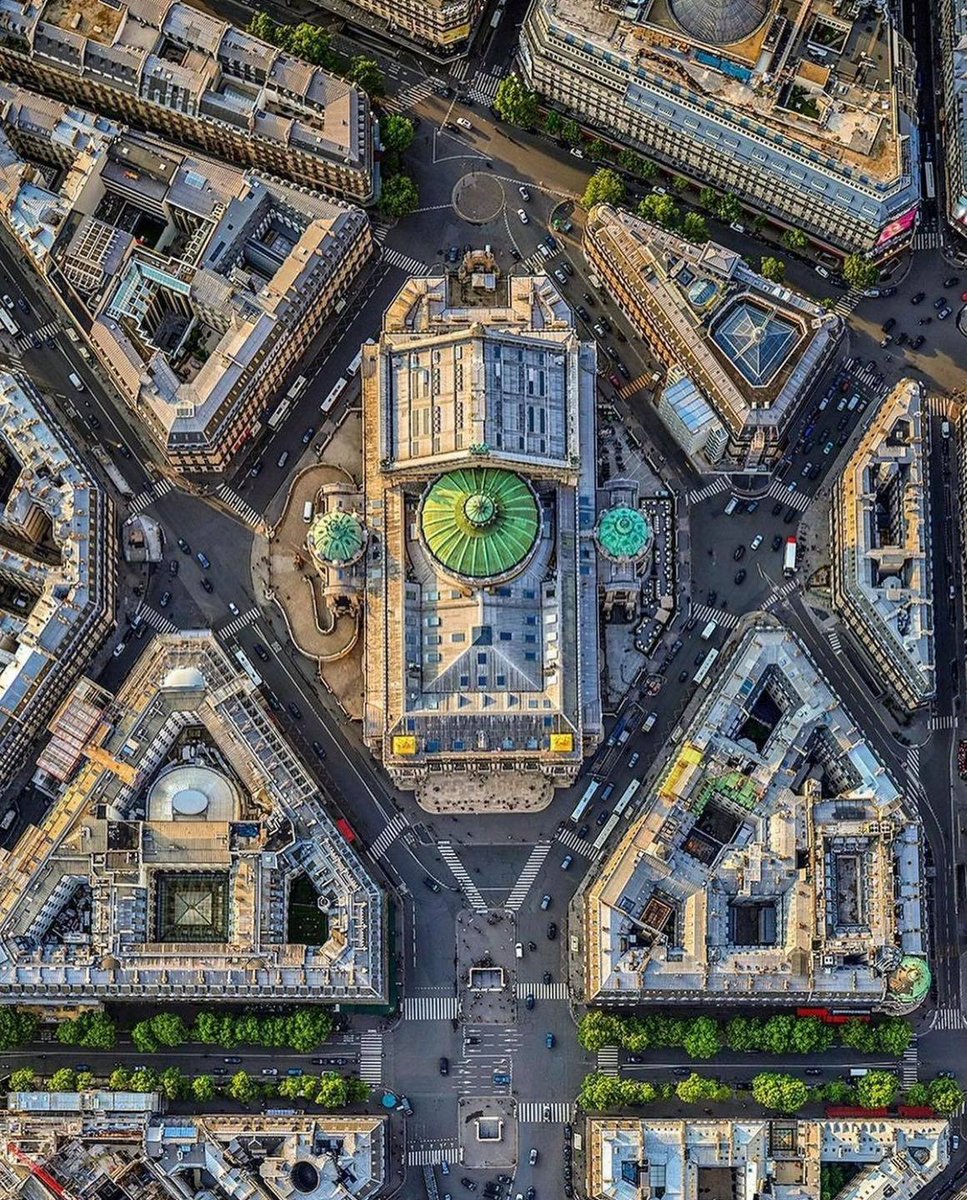
L’ #Opéra de #Paris de Charles Garnier oui mais comme on ne le voit jamais, de haut... depuis 1875... paris-visites-guidees.com

Pues esto es lo que se escondía en la bodega del portaviones @HMSPWLSF El dron Mojave de @GenAtomics_ASI operando desde su cubierta. Era solo cuestión de tiempo...
📳🗺️🚀QField 3.0 'Amazonia': nuevas características y repaso a las más relevantes de las versiones anteriores: mappinggis.com/2023/11/qfield…
mappinggis.com
QField 3.0 'Amazonia': nuevas características
El equipo de OpenGIS.ch acaba de lanzar una nueva actualización de una de las app más populares para tomar datos en campo: QField 3.0 🚀🌍📱


United States Trends
- 1. Thanksgiving 403K posts
- 2. Golesh 2,697 posts
- 3. Camp Haven 7,526 posts
- 4. Fani Willis 17.8K posts
- 5. #WipersDayGiveaway N/A
- 6. NextNRG Inc 1,242 posts
- 7. Trumplican 3,481 posts
- 8. Khabib 7,394 posts
- 9. Hong Kong 88.5K posts
- 10. Denzel 3,577 posts
- 11. Tom Hardy 1,862 posts
- 12. Wine 40.2K posts
- 13. Mendy 5,372 posts
- 14. Stranger Things 170K posts
- 15. Africans 27.6K posts
- 16. Bayern 142K posts
- 17. Riker N/A
- 18. Idris 8,001 posts
- 19. Breyers 2,662 posts
- 20. Fassbender 1,196 posts


Something went wrong.
Something went wrong.