You might like


New remote sensing datasets combined with scalable spatiotemporal analytics can help utilities stop wildfires before they start. Read this deep dive blog from @OmniSci's in-house expert @geodesigntech for more. omnisci.com/blog/modeling-…
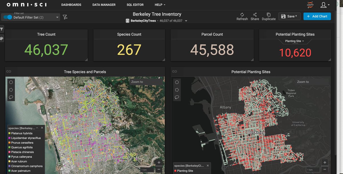
Starting local on the @trillionTreesIn...thanks to Berkeley's open data program, can quickly visualize potential planting locations in #omnisci. Trying to catch up in the #30DayMapChallenge!
On my way to @foss4g Bucharest. Director's cut of my blog on big geotemporal data was just updated. Thanks @geoworldmedia!: geospatialworld.net/blogs/visualiz…

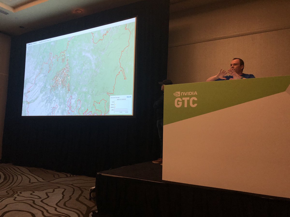
At @NvidiaAI GTC, supporting @OmniSci presenting next-gen wildfire analysis with ML. Interactive dashboards show data from multiple satellites relating defensible space and structure survival
This sounds pretty interesting. spatial.usc.edu/events/brown-b…

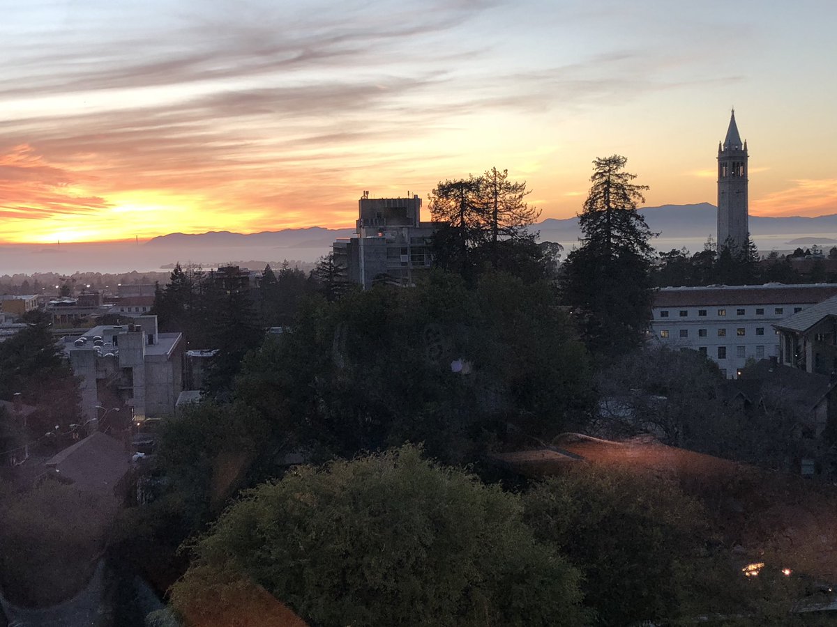
The evening is young and here with the #omnisci team preparing for #calhacks5 as the sun sets of Berkeley
“More than half of the Earth’s historic soil carbon has been released into the atmosphere by unsustainable farming”. Come join us or livestream panel on solutions: Biological Sequestration: The Role of Soil, Forests, and Farms in Carbontech meetu.ps/e/FRPsP/1pFhf/a
Enjoying #calgis2018 with #omnisci colleague Veda Shankar. Presenting on use of GPU databases to wrangle big geodata, including #lidar. Conference slides should be available in a few weeks from #urisa or pm me
I'm excited to present the LiDAR part of LIDAR, Virtual Reality, and Augmented Reality - AICP/CM Approved 1.5 at GIS-Pro in Palm Springs next week. Hope to see some of you there!
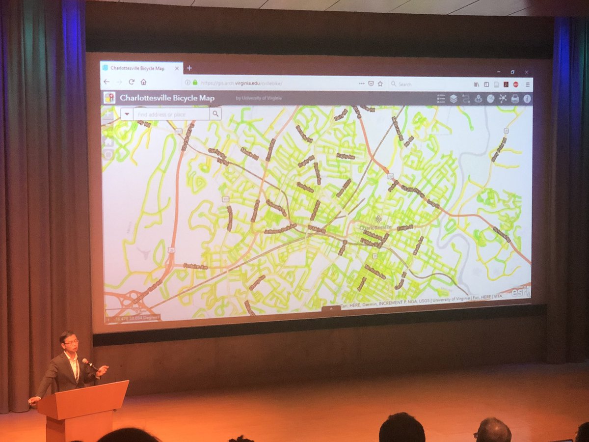
5 minutes to better urban design? I love how bicycle performance metrics are instant and available by default. Building Better Streets with CityEngine! Insight into the "Complete Stre... youtu.be/ybWQvy7RKgQ via @YouTube
youtube.com
YouTube
Building Better Streets with CityEngine! Insight into the "Complete...
If you liked my post on 2d #LIDAR analysis in @MapD, you’ll love Dipti Kothari’s work extending this to 3D for #slr impact analysis. mapdtech.io/a5lt60
GeoGentrification? Nice example of serious webgis - interactive storymaps with analysis and (almost) projections. carto.com/blog/impact-am…
Check out my first guest blog post... using a GPu database to wrangle huge geodata! mapdtech.io/7kh18z
“‘Data is only as valuable as the decisions it enables.’” — @HamedAlemo medium.com/radiant-earth-…

What's more beautiful than a rainbow or a waterfall? How about a rainbow in a waterfall. Awesome is an overused word, but this really is awesome!

Beautiful! Unusually high winds turned California's Yosemite Falls into a cascading rainbow.
Enjoying Tim Bailey’s #FOSS4G2018 talk on using Carbon Cap and Trade to avoid “the long emergency” of unsustainable forest practices.

This insurance company actually deserves the name Progressive! bloomberg.com/amp/news/artic…


United States Trends
- 1. harry styles N/A
- 2. The PENGU N/A
- 3. Insurrection Act N/A
- 4. #PMSSEATGEEKPUNCHAHT N/A
- 5. #BLACKWHALE N/A
- 6. The Jupiter N/A
- 7. Karoline Leavitt N/A
- 8. Kuminga N/A
- 9. Grizzlies N/A
- 10. FINALLY DID IT N/A
- 11. Lara Croft N/A
- 12. #BTS_ARIRANG N/A
- 13. Kiss All The Time N/A
- 14. InfoFi N/A
- 15. Arrest Tim Walz N/A
- 16. Casa Blanca N/A
- 17. Franz N/A
- 18. Mahmoud Khalil N/A
- 19. The Great Healthcare Plan N/A
- 20. Sophie Turner N/A


Something went wrong.
Something went wrong.