
You might like


#STLBlues Chairman Tom Stillman says on @McKernanShow if St. Louis City and St. Louis County don't unify, "we are going to get left behind." Listen to the entire interview on @insideSTL or by clicking here: itunes.apple.com/us/podcast/the…

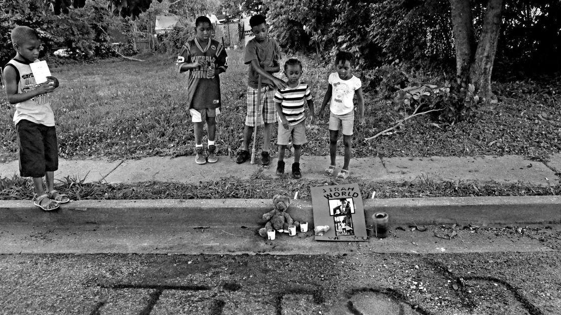
Scene from #Ferguson #municourt this AM:"So many people, so depressing. What’s depressing is that this is just a normal day in court. It’s full w only standing room. Overwhelmingly black but all white staffers. The lady behind me just said, “and they said they stopped all this.""

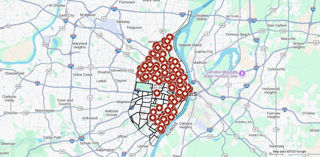
St. Louis Homicides 2017 by Neighborhood - drive.google.com/open?id=1TPjcg…

The 1st social teaser for #TheGhostWhoWalks from Director #CodyStokes is here! Follow us at @__GhostWhoWalks for updates on the film. #SupportIndieFilm #indiefilm #cinema #STL #filmmaking #CodyStokes
St. Louis Homicides 2017 - drive.google.com/open?id=1TPjcg…
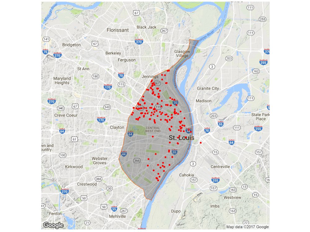
Currently looking up latitude and longitude with addresses from the @SLMPD downloadable crime files. Anyone know if there an easier way to find map-able homicide data?
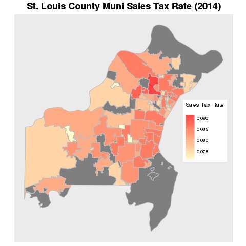
STL County sale tax rate by muni via @BTstl . Top 5 - Berkeley, Edmundson, St. Ann, Woodson Terrace, and Brentwood. bettertogetherstl.com/studies/public…

National think tank questions one St. Louis suburb's 'continued existence as a municipality' stltoday.com/news/local/gov…
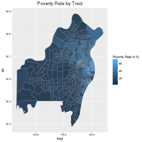
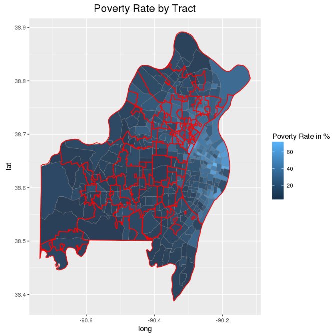
Poverty rate by census tract with municipality borders. Data - Food Access Research Atlas ers.usda.gov/data-products/…
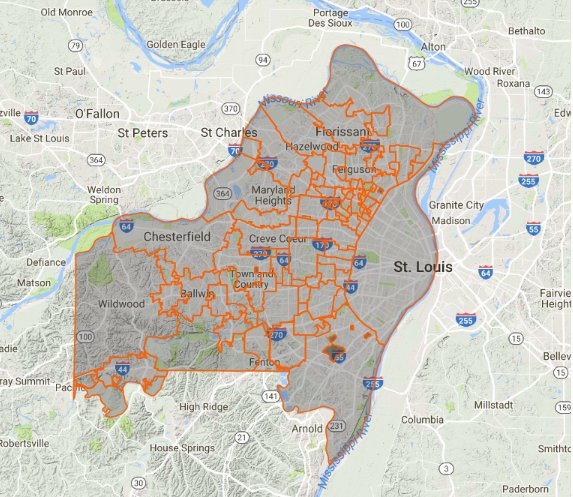
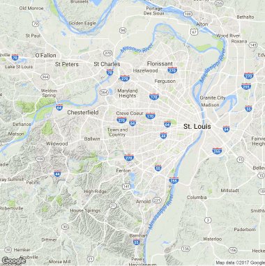
St. Louis City and County where roughly 1.3 million people call home. 89 individual municipalities. 1 city. #STL #OneHome
Greater St. Louis - 20th largest Metro Area in the United States with a population of roughly 2.8 million stlregionalchamber.com/regional-data/…


United States Trends
- 1. Wirtz 58.7K posts
- 2. East Wing 144K posts
- 3. Elander 3,449 posts
- 4. Hamburger Helper 1,381 posts
- 5. $TSLA 45.3K posts
- 6. Rosneft 4,463 posts
- 7. SNAP 642K posts
- 8. Danny White 2,962 posts
- 9. Estevao 49K posts
- 10. Juve 21.1K posts
- 11. Tony Vitello 12.7K posts
- 12. #YesOnProp50 9,029 posts
- 13. Brooksby N/A
- 14. Ajax 80.6K posts
- 15. Atalanta 17.4K posts
- 16. Frankfurt 56.6K posts
- 17. Vini 22.3K posts
- 18. Tosin 8,511 posts
- 19. Goodell 3,863 posts
- 20. Without the 2nd N/A


Something went wrong.
Something went wrong.