


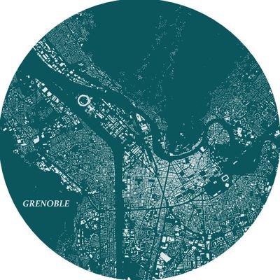
What's NextGIS really❓🤔 Here’s the deal: * Store, manage, and publish your spatial data * Seamless QGIS integration * Access ready-to-go spatial data packages for any area on 🌍 * ... ... wait, there's more. Welcome to our brand new nextgis.com!
Data for Business Intelligence and Geoanalytics We are pleased to introduce a new dataset available through NextGIS Data – points of interest. Use this dataset to get insights for market analysis, site selection, planning and development. Learn more: nextgis.com/blog/poi/

Painless QGIS plugin development with a new DevTools plugin for QGIS. Connect and debug with VSCode or Visual Studio github.com/nextgis/qgis_d…
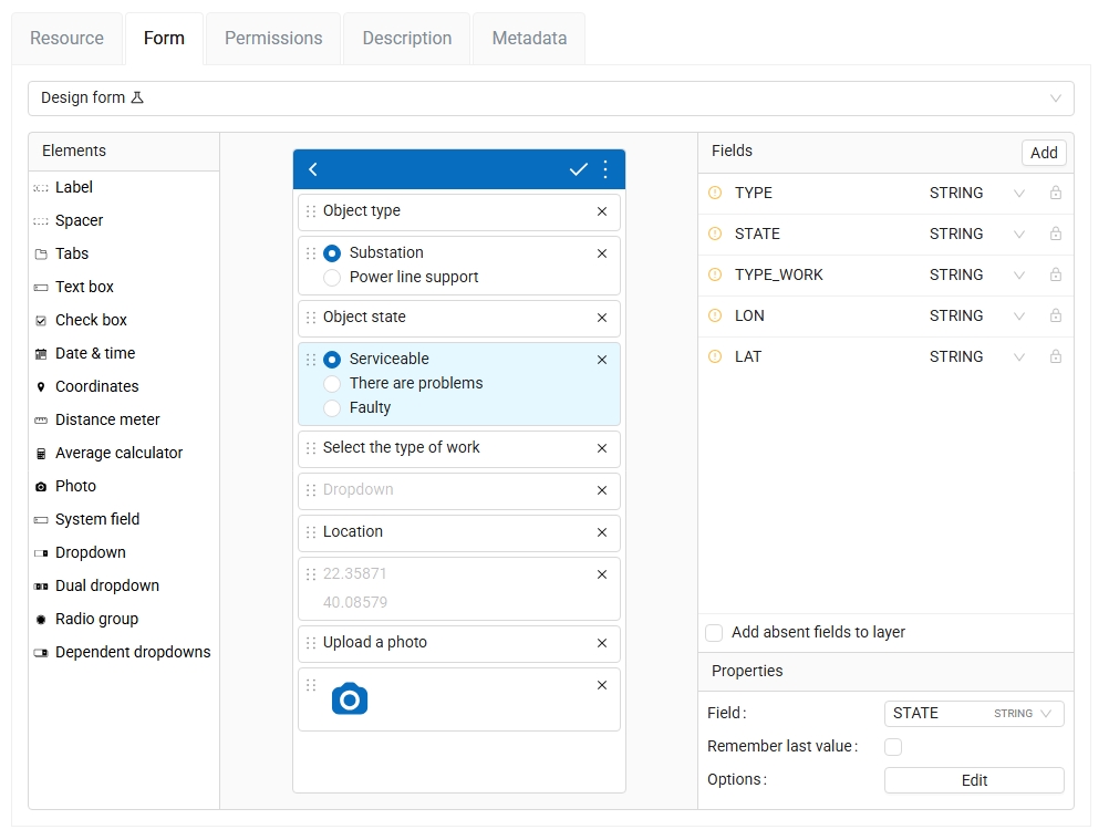
Create mobile forms in your web browser With the recent NextGIS Web update you can choose between several ways to create a data collection form for your mobile app: — Build a form directly in Web GIS — Upload a NGFP file — Create a form+new layer from desktop Formbuilder
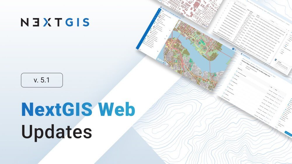
NextGIS Web 5.1 We're excited to introduce the latest version of NextGIS Web! We invite you to explore the new features and would love to hear your feedback and suggestions. Learn more: nextgis.com/blog/ngw-5-1/

Today, it's fast and easy to access building footprint data using AI-mapped solutions. One quick and affordable option is offered by @nextgis at a very low cost: data.nextgis.com/es/region/cust… #OpenData #AI #DisasterResponse #GIS #HumanitarianTech

Following recent flooding in Mokwa, central Niger State, Nigeria, @hotosm is sharing building footprint data covering approx. 15,700 buildings. Based on AI-mapped estimates, this represents about 85% of the total buildings in the area. Explore on HDX: data.humdata.org/dataset/hotosm…

MOLUSCE 5 released! We have updated MOLUSCE – QGIS tool to analyze and predict land cover changes. The most important update in MOLUSCE 5.0 is the ability to use different spatial variable layers during the training and prediction stages. youtu.be/GVrk_uLJbuA

youtube.com
YouTube
MOLUSCE 5 — New Features: Separate spatial variables for simulation...
🌎 Global Landcover Data on NextGIS Data! Three high-resolution (10m) global landcover datasets are now available on NextGIS Data. Choose from ESRI Land Cover, ESA WorldCover, or Dynamic World. Learn more: nextgis.com/blog/landcover…
Wurman Dots 2.0 for QGIS We added a new mode that generates a grid based on cell count. Now you have two options how to create a grid: — define the size of a cell; — or define the number of cells (along the shorter side of the input point layer's extent).

Projects for ArcGIS Pro on NextGIS Data Now you can get a ready-to-go project for ArcGIS Pro when you order OSM basemap data in Geodatabase format. Soon this option will be available for the other data set types too. Order data: data.nextgis.com/en/

Add multiple styles at once By popular demand, now you can add several vector layers to a Web Map at one go, even if they are in different groups. Navigate between groups and select styles. Our new picker remembers all the selections, so you only need to do it once.
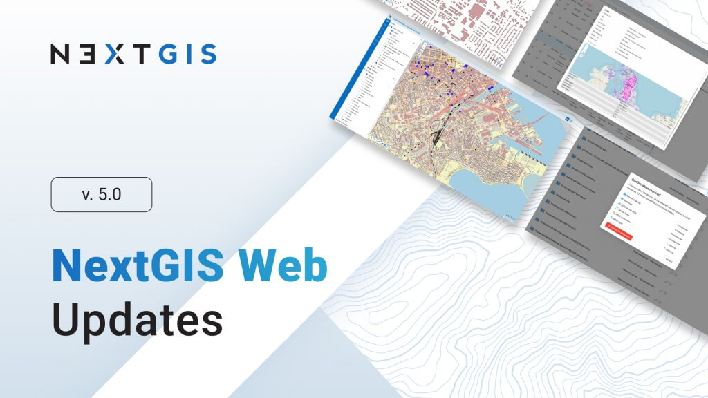
🆕 NextGIS Web 5.0 New version of NextGIS Web is available for on-premise users! Find out all about the latest improvements in our post: nextgis.com/blog/ngw-5_0/?…
NextGIS Tracker: a simple tool to record and publish GPS tracks ✅ Record your movements as GPS tracks ✅ Auto-sync them with a cloud-based or on-premise Web GIS ✅ Export tracks as GPX files Get a Google Play link or an APK on our website: nextgis.com/nextgis-tracke…

Ever seen this? Updated QuickMapServices now uses internal QGIS Network Access Manager. Hopefuly less problems with connectivity.

Spatial data for cultural heritage sites now available on NextGIS Data! Select any area of the world and order data in a format of your choice. With the data you get a ready-to-go GIS project. Learn more: nextgis.com/blog/heritage-…

📱NextGIS Mobile 2.9.2 & NextGIS Collector 1.9.0 – Time to Update! The new version allows you to view photo attachments added earlier to the features and stored in the cloud. We've also fixed some issues to improve app performance.


Improvements in NextGIS Connect for QGIS are in full swing! That’s why version 2.6.0 arrived so quickly. What’s new: — You can now search for resources by URL. — The authentication dialog has been simplified. Learn more about NextGIS Connect: nextgis.com/nextgis-connec…


Welcome to Map Style Gallery! A collection of ready-to-use beautiful styles: nextgis.com/map-styles/?ut…
Add Coordinates to Images Using Track Introducing our online tool that adds location data to your photos using a GPX track of your route: nextgis.com/blog/gpx2exif/…


United States 趋势
- 1. Dick Cheney 13.8K posts
- 2. Election Day 79K posts
- 3. Good Tuesday 24.5K posts
- 4. #tuesdayvibe 1,317 posts
- 5. Rolex 15.3K posts
- 6. GO VOTE 67.4K posts
- 7. George W. Bush 7,131 posts
- 8. #WeTVAlwaysMore2026 1.4M posts
- 9. #Election2025 2,081 posts
- 10. Halliburton 1,054 posts
- 11. iPads N/A
- 12. Hogg 6,774 posts
- 13. Jonathan Bailey 44K posts
- 14. Comey 92.8K posts
- 15. Nick Smith Jr 15K posts
- 16. Nino 48.9K posts
- 17. Jake Paul 5,731 posts
- 18. #LakeShow 3,496 posts
- 19. Ben Shapiro 72.2K posts
- 20. Pacers 14.7K posts


Something went wrong.
Something went wrong.