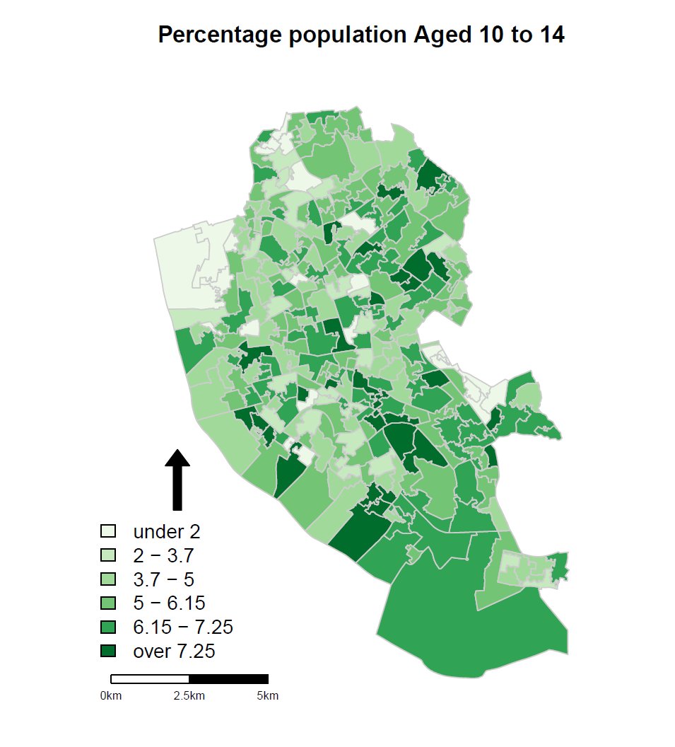
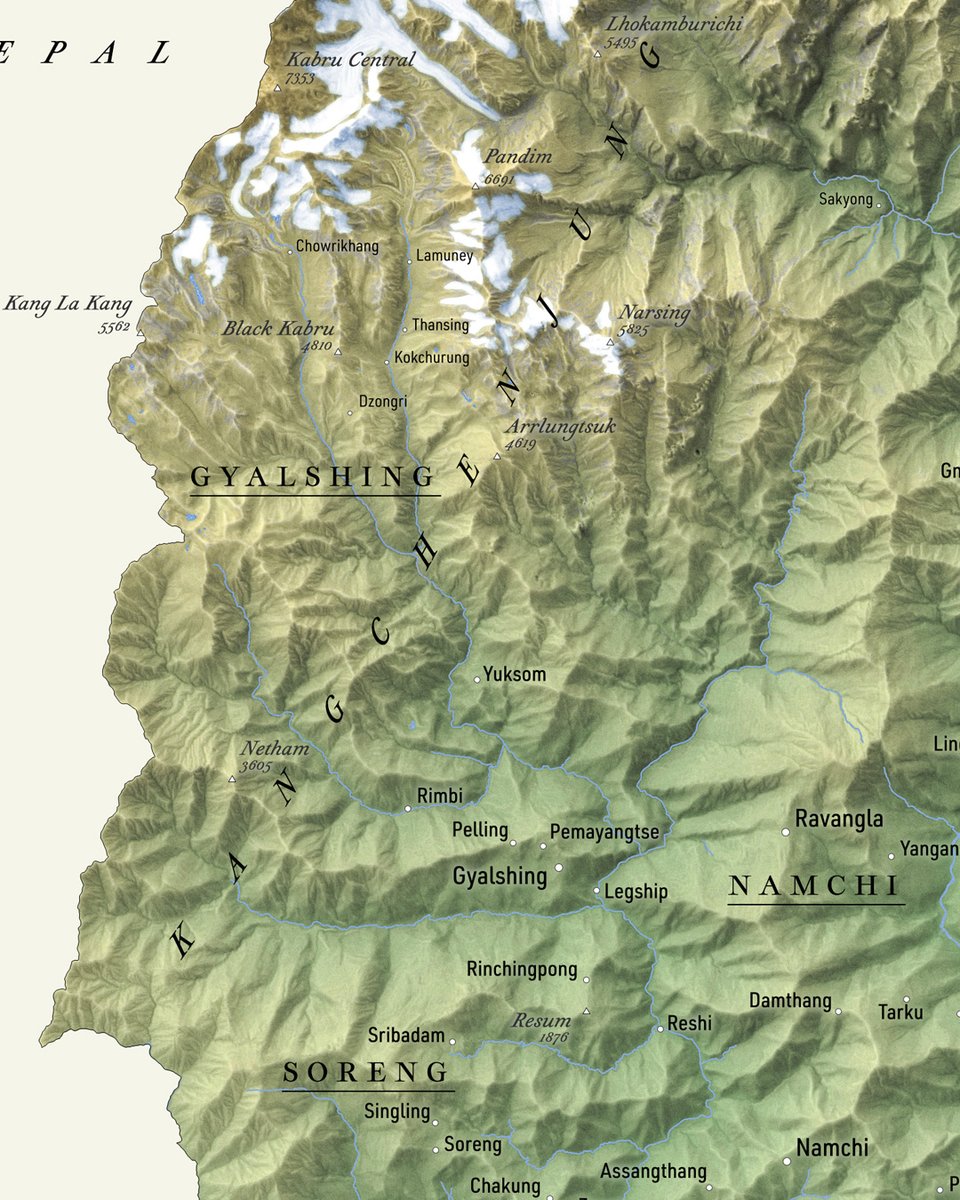
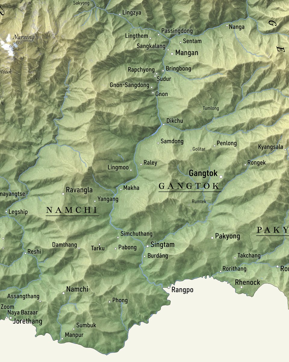
#gis search results

Wet and Dry seasons water body extraction using Google Earth Engine. full tutorial link: youtube.com/live/WvlEVVkms… #RemoteSensing #googleearthengine #GIS #geospatial #GeospatialTechnology

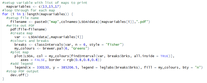
Want to learn how to visualise and analyze spatial data? My #R #GIS courses are coming up in Apr-May 2026, starting next week: Intro to using R as a GIS - No prior knowledge needed! Advanced R as a GIS - For those ready to dive deeper nickbearman.com/training-cours…


اختيار القمر الصناعي ليس تفصيلاً تقنياً… بل قرار يحدد مصداقية تحليلك بالكامل. • زراعة → Sentinel-2 • غيوم/فيضانات → Sentinel-1 (SAR) • دقة فائقة → WorldView-3 • تغير يومي → PlanetScope السر الحقيقي؟ لا تعتمد على قمر واحد… اجمع بينها. #GIS #الاستشعار_عن_بعد #GeoAI


👉👉 Parametric #GIS and #HBIM for #Archaeological Site Management and Historic #Reconstruction Through #3D Survey Integration ✍️ Marco Limongiello et al. 🔗 brnw.ch/21x1RGw


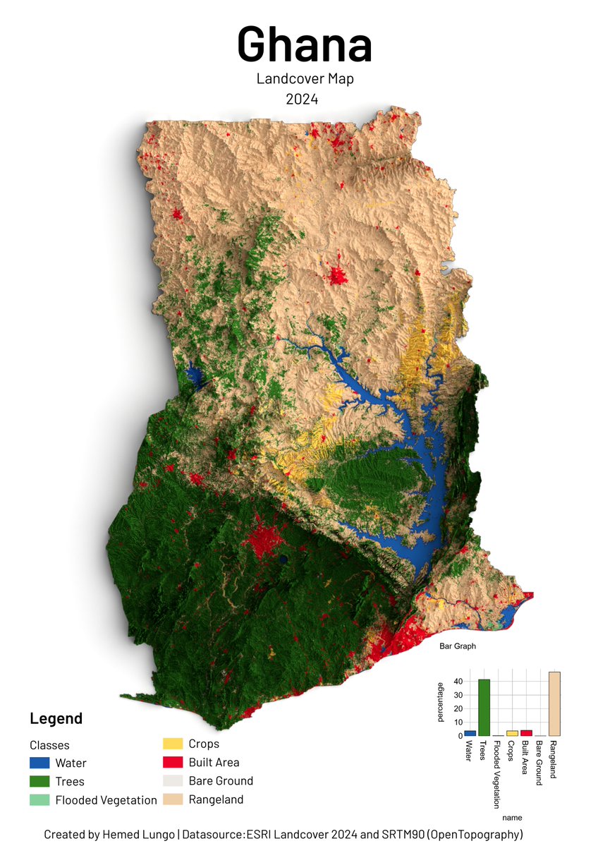
🌍 Ghana Landcover Map 2024 🇬🇭🗺️ From tropical forests to northern savannas — Ghana's landscape mapped using ESRI Landcover 2024 by @impactobservatory & @esri, and SRTM90 DEM by @opentopography. 🛠️ QGIS · Blender 🧭 Hemed Lungo #GIS #Cartography #Ghana #Landcover #Geospatial

Utility inspection isn’t limited by opportunity. It’s limited by clarity. When pathways across #FieldJobs, #GIS, and engineering aren’t clear, candidates stall. We break this down in the blog. Link in the comments. #EngineeringCareers #UtilityInspectionJobs #RCSInsights


紙やExcelでは追いきれなかった災害対応。 ArcGIS Onlineによる情報一元化が、公費解体という超複雑な事業をどう変えたのか。 災害対応×GISのリアルな成功事例は必読です。 #GIS #ArcGIS #建設DX #防災 buff.ly/iEgifly

في عمق الجغرافيا الخريطة ليست مجرد رسم، بل هي لغة بصرية تحكي قصة المكان. في نظم المعلومات الجغرافية، نحول البيانات الأولية إلى حكمة مكانية. أسأل طلابي دائماً: لا تنظروا إلى الطبقات الرقمية كمجرد نقاط وخطوط، بل كشرايين حياة وعلاقات إنسانية واقتصادية. gisarabi.com #GIS


#SaveTheDate for a virtual conference on the science, tech, and innovation behind our geospatial data. 🌎 Join Census Bureau geographers, fellow data users, and geospatial practitioners for the two-day event. Explore the agenda: census.gov/programs-surve… #GIS #GIS


.السلام عليكم معكم مختص نظم المعلومات الجغرافية للمساعدة فى : حل واجبات إنجاز مشاريع إنتاج خرائط التعامل مع لغة البايثون اعطاء دورات GISو بايثون وبشهادة معترف بها للتواصل على الخاص #نظم_المعلومات_الجغرافية #نظم_معلومات_جغرافية #GIS #ArcGIS #ArcGISPro #QGIS


Cómo descargar e instalar #QGIS en Windows paso a paso rviv.ly/qK4fge #Descarga #GIS #Instalación #SIG

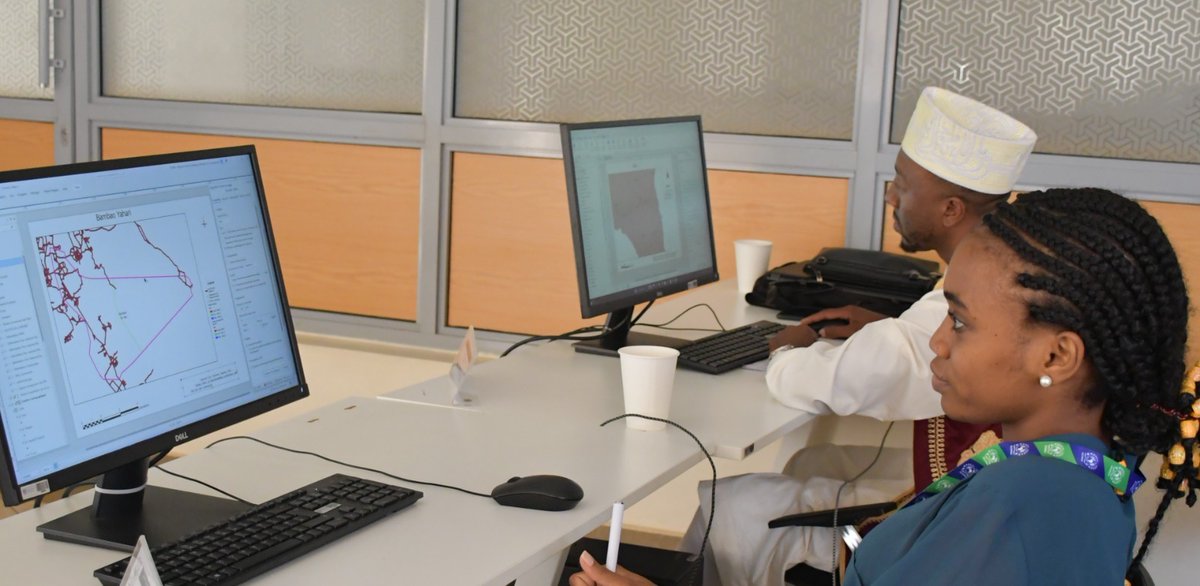
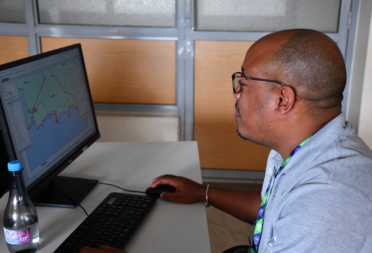
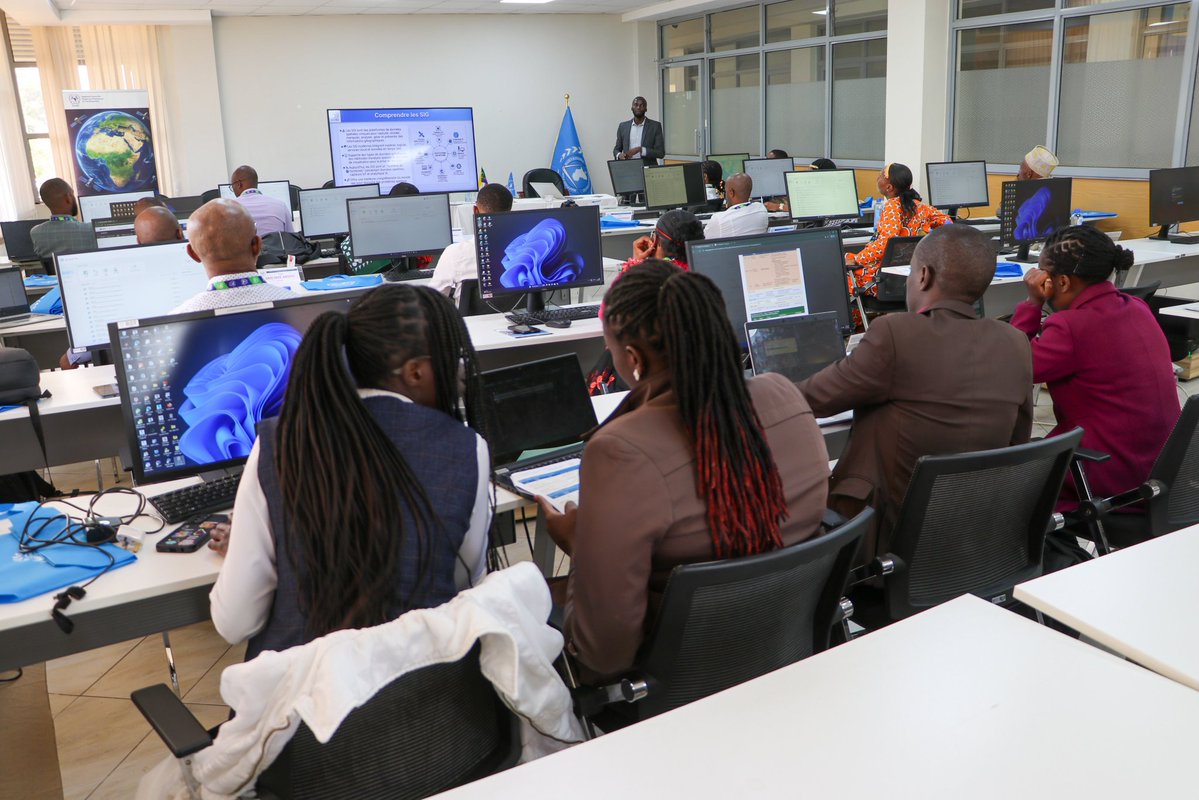
Geospatial technologies are becoming essential for effective planning, resource management, and decision-making. The Advanced GIS Training Programme is strengthening practical skills in #GIS, Remote Sensing, Web #Mapping, and Drone Technologies for real-world application.The


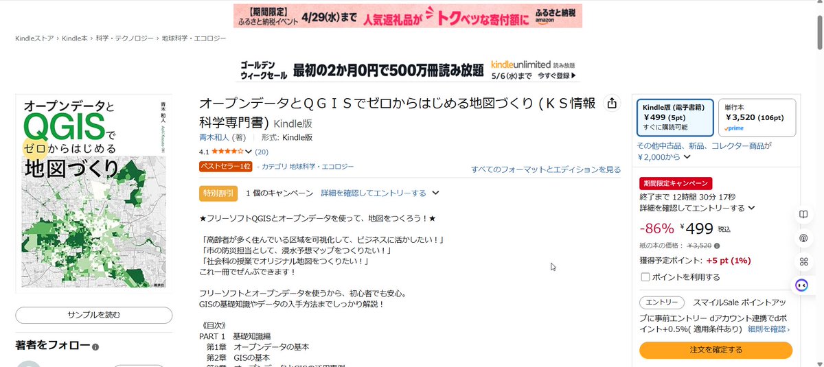
拙著 オープンデータとQGISでゼロからはじめる地図づくり が期間限定キャンペーンで、なんと499円で、お安くお求めいただけます! この機会に是非、ご購入ください! #GIS #オープンデータ #登記所備付地図 amazon.co.jp/gp/product/B0C…
I haven't done maps of Aleutian islands. So today I changed that. Rather simple map with island names and high peaks. Also just by inverting the image made quite an interesting image. #Alaska #Aleutians #GIS


OpenAI Investors—Nvidia, Oracle, More—Fall After AI Giant Reportedly Misses Revenue Target go.forbes.com/wwTePZ


JUST IN: 🇨🇳🇺🇸 China says the Strait of Hormuz was closed because of US and Israel's "illegal" war against Iran.


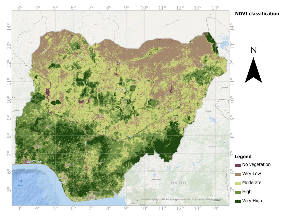
🌍 Vegetation Health Across Nigeria – NDVI Insights Registration link: studyhacksgeospatial.com/product/google… #remotesensing #NDVI #GIS #climatechange #Geospatial #nigeria #EarthObservation #EnvironmentalMonitoring

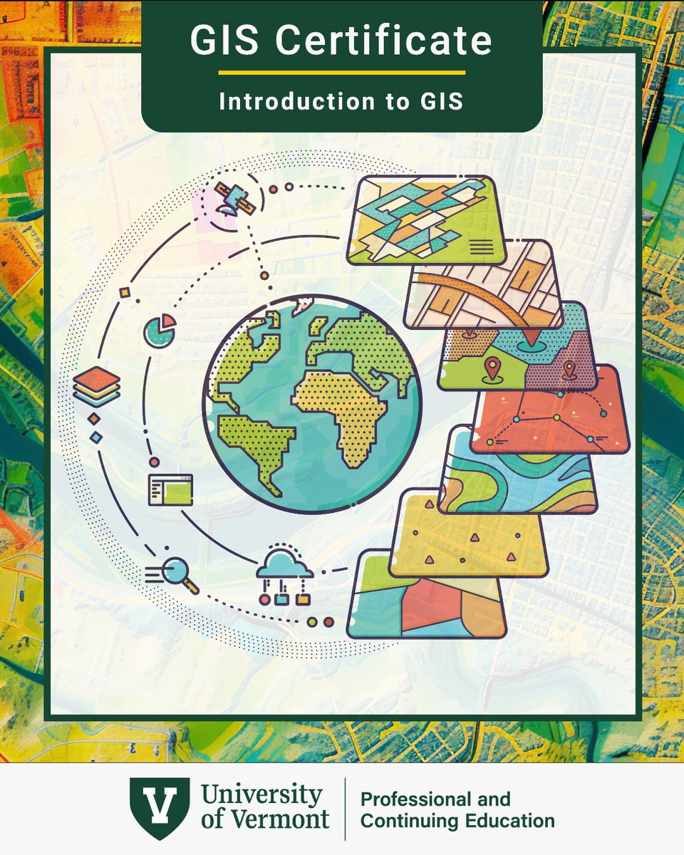
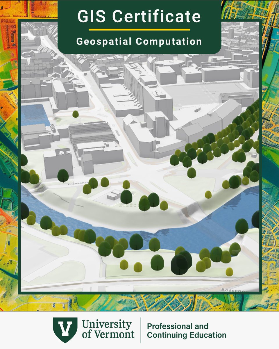
Geographic Information Systems (GIS) is the connective tissue of modern data analysis. Build advanced skills in subjects like Remote Sensing, Geospatial Computation, and Data Visualization. Fall courses start in August and are fully online. bit.ly/4w3FrpD #DataViz #GIS


Think GIS is just maps? Think again. From #Planning to #DisasterResponse, #GIS drives real decisions. Here are 5 uses you should know 👇 At @GEOinovo, we build #GeospatialSolutions, from #UtilityMapping to #Dashboards, that turn data into action. #Geospatial #DataDriven


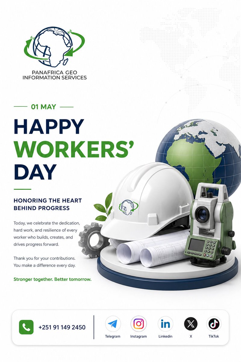
🌍 Happy Workers’ Day! Celebrating the hard work and dedication driving innovation and progress across Africa. Proud to support the future with GIS & GeoAI solutions. 📞 +251 91 149 2450 #WorkersDay #LaborDay #GIS #GeoAI #PanafricaGIS #AfricaInnovation
.السلام عليكم معكم مختص نظم المعلومات الجغرافية للمساعدة فى : حل واجبات إنجاز مشاريع إنتاج خرائط التعامل مع لغة البايثون اعطاء دورات GISو بايثون وبشهادة معترف بها للتواصل على الخاص #نظم_المعلومات_الجغرافية #نظم_معلومات_جغرافية #GIS #ArcGIS #ArcGISPro #QGIS
Learn how to monitor water quality using remote sensing techniques in Google Earth Engine (GEE). 🌍💧🛰️ Tutorial Link: youtube.com/live/j5yPtPHG0… Registration link: studyhacksgeospatial.com/product/privat… #googleearthengine #remotesensing #GIS #turbidity #TSS #EnvironmentalMonitoring #geospatial


🗺️Turn your #maps into effective storytelling tools. Configured popups, simple legends, and clear labels—each technique has a big impact on your audience's experience. Learn them all in the May 2026 Issue of StoryScape: ow.ly/OlPl50YTyYk #StoryMaps #GIS

🗺️Turn your #maps into effective storytelling tools. Configured popups, simple legends, and clear labels—each technique has a big impact on your audience's experience. Learn them all in the May 2026 Issue of StoryScape: ow.ly/OJNQ50YTeRB #StoryMaps #GIS

youtu.be/n7BnsIWpQMg?si… GIS provides double benefits to our world: My video. #gis

youtube.com
YouTube
Our Earth

📰 #ArcGIS Blog: How to create an accessible story structure in ArcGIS StoryMaps esri.com/arcgis-blog/pr… _ #Esri #GIS #Geospatial #MetaMapping
esri.com
How to create an accessible story structure in ArcGIS StoryMaps
Learn how to create a structure using ArcGIS StoryMaps' built-in tools to make your story accessible to everyone and meet accessibility standards.
#SaveTheDate for a virtual conference on the science, tech, and innovation behind our geospatial data. 🌎 Join Census Bureau geographers, fellow data users, and geospatial practitioners for the two-day event. Explore the agenda: census.gov/programs-surve… #GIS #GIS

How to reduce cost, improve accuracy, and accelerate deployment with GIS?driven planning. shorturl.at/ttpae #GIS #Network


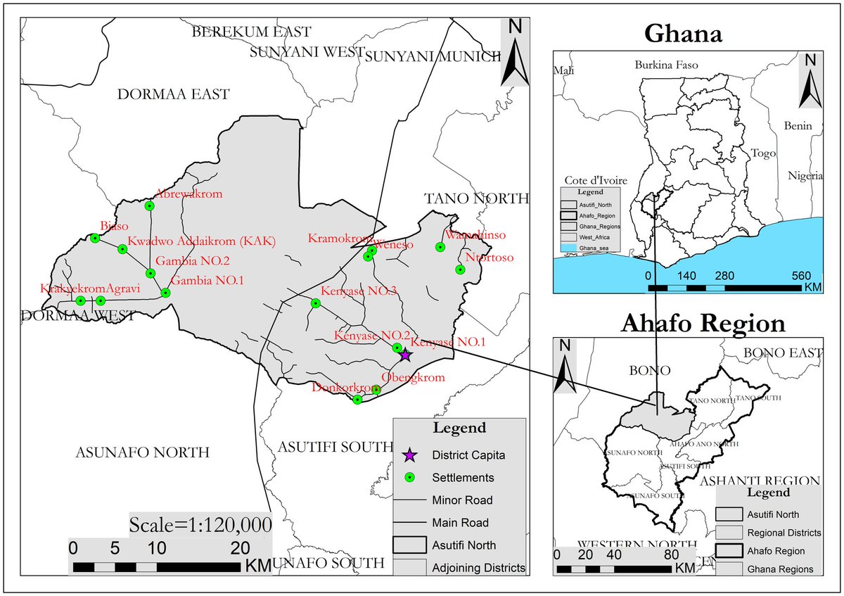
Day 01: #30DaysMapingChallenge Study Area Map of Asutifi North Municipality #GIS #GeographicInformationSystems

Protect your sensitive #GIS data! Learn about authentication methods in #ArcGISEnterprise, including built-in identity stores, SAML, OIDC, LDAP, and IWA. Understand how to choose the best authentication option for your organization. Learn more ➡️ ow.ly/vJBI50YSwKN

ليست مجرد خرائط… بل اختبار حقيقي للذاكرة📍 اكتب مساحة كل قارة دون تردد؟ هذا النموذج يحوّل الحفظ إلى تحدٍ بصري ممتع، ويجعل الطالب يكتب المعرفة بيده لا أن يراها فقط. جرّب، وراقب الفرق في ترسيخ المعلومة. 🌍✍️ تابعونا على 👇 #جغرافيا #GIS #تعليم #تعلم

الجغرافيا لم تعد تكتفي بسرد ما حدث… بل أصبحت تتنبأ بما سيحدث. مع GeoAI ننتقل من تحليل الفيضانات بعد وقوعها إلى رسم خرائط المخاطر قبل حدوثها، حيث تلتقي البيانات مع الخوارزميات لصناعة قرارات أذكى ومدن أكثر استعدادًا. 🌍🧠 #GIS #الذكاء_الاصطناعي #الجغرافيا


ليبيا ليست مجرد صحراء… بل متحف مفتوح تحت السماء. من لبدة الكبرى إلى شحات (قورينا)، تمتد حضارات تروي قصة المتوسط والصحراء معًا. خريطة واحدة تكشف لك أين يبدأ التاريخ… وأين ينتظرك. 🗺️ #ليبيا #جغرافيا #GIS

📰 #ArcGIS Blog: ArcGIS for INSPIRE Classic Retirement Announcement esri.com/arcgis-blog/pr… _ #Esri #GIS #Geospatial #MetaMapping
esri.com
ArcGIS for INSPIRE Classic Retirement Announcement
ArcGIS for INSPIRE Classic retires August 1, 2026. Understand the impact and plan your shift to modern, EU Open Data delivery.


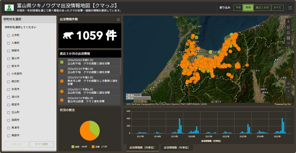
🐻🌸 先日、Esriジャパンのクマ出没情報ページに富山県の【クマっぷ】 が追加されました。 春になって暖かくなってきたから、冬眠していたクマが動き始めた…のかも?🤔 地図で最新の出没状況をチェックできます。 buff.ly/p7xHgXn #クマ出没情報 #GIS #ArcGIS #防災
👉👉 Parametric #GIS and #HBIM for #Archaeological Site Management and Historic #Reconstruction Through #3D Survey Integration ✍️ Marco Limongiello et al. 🔗 brnw.ch/21x1RGw
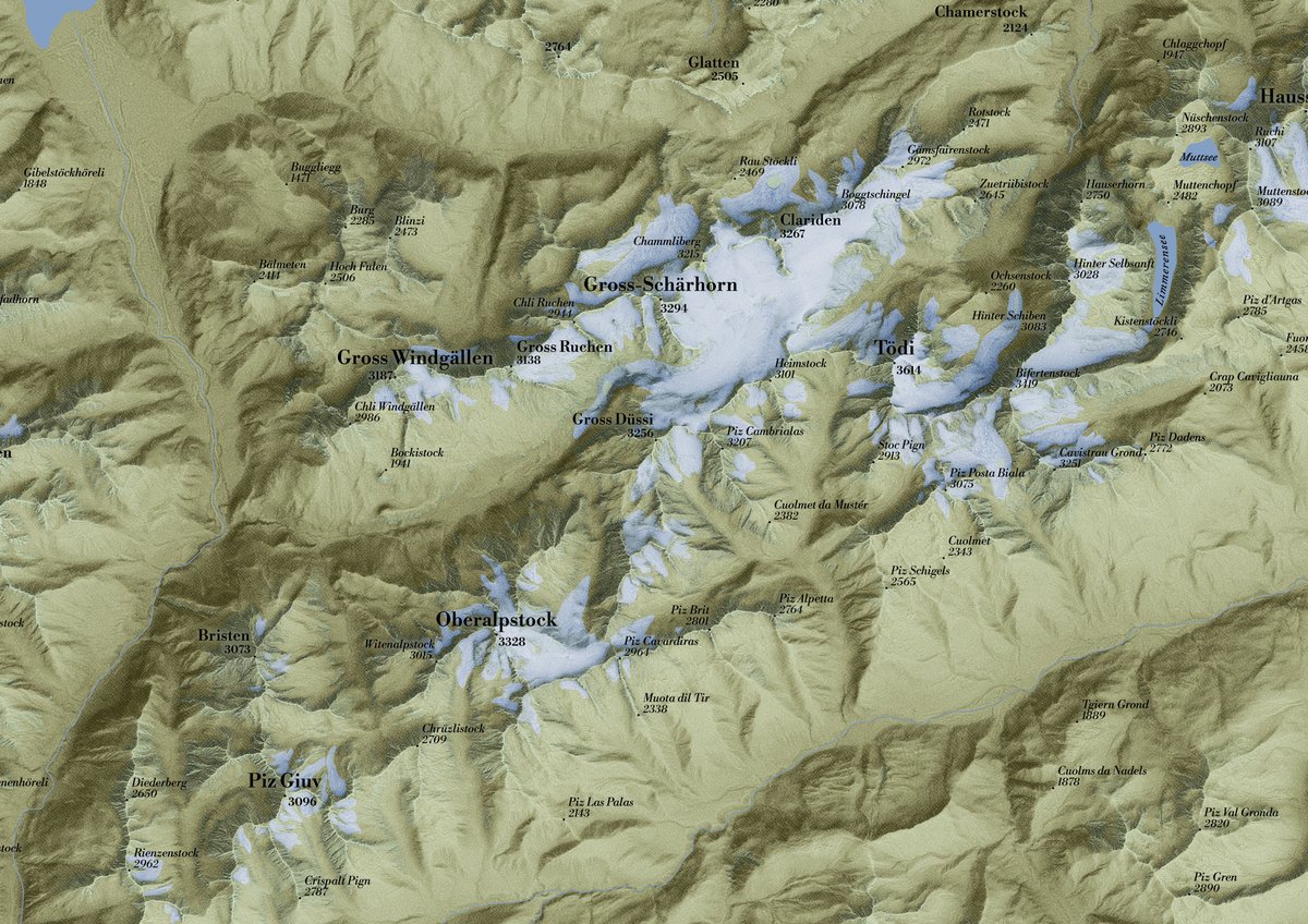
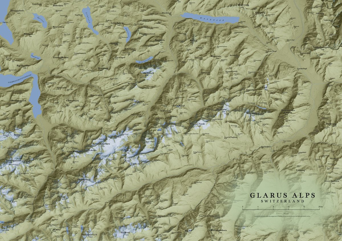
Glarus Alps in Switzerland. First version is with traditional NW lighting. Second one is SE lighting. SE-lighting does not look weird unless you put a NW version right next to it. So it's alright to try different lighting options. Rendered with Blender. #Switzerland #Alps #GIS


紙やExcelでは追いきれなかった災害対応。 ArcGIS Onlineによる情報一元化が、公費解体という超複雑な事業をどう変えたのか。 災害対応×GISのリアルな成功事例は必読です。 #GIS #ArcGIS #建設DX #防災 buff.ly/iEgifly
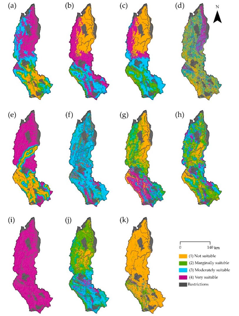
👉👉 Land Suitability for Pitahaya (Hylocereus megalanthus) Cultivation in #Amazonas, #Perú: Integrated Use of #GIS, #RS, F-AHP, and #PROMETHEE ✍️ Katerin M. Tuesta-Trauco et al. 🔗 brnw.ch/21x1gSF

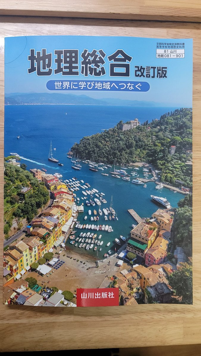
昨日買った山川出版社の『地理総合 改訂版』教科書を前(二宮書店時代)のと読み比べていますが、「#地図 と #GIS の活用」の章はかなり補強されていまた。 #ヌル島 #空想地図 #トムリンソン が教科書に登場していてニヤリとしてます。 やるなヤマカワ!
I haven't done maps of Aleutian islands. So today I changed that. Rather simple map with island names and high peaks. Also just by inverting the image made quite an interesting image. #Alaska #Aleutians #GIS
الجغرافيا لم تعد تكتفي بسرد ما حدث… بل أصبحت تتنبأ بما سيحدث. مع GeoAI ننتقل من تحليل الفيضانات بعد وقوعها إلى رسم خرائط المخاطر قبل حدوثها، حيث تلتقي البيانات مع الخوارزميات لصناعة قرارات أذكى ومدن أكثر استعدادًا. 🌍🧠 #GIS #الذكاء_الاصطناعي #الجغرافيا
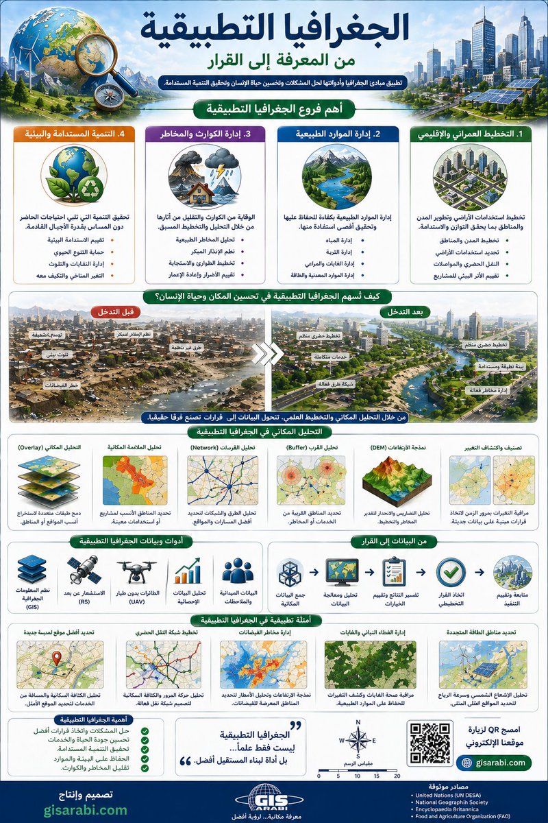
الجغرافيا التطبيقية ليست نظريات… بل قرارات تُغيّر الواقع. من تحليل البيانات إلى اختيار المواقع وإدارة الكوارث—هنا تتحول الخرائط إلى أدوات فعلية للتخطيط والتنمية. حين تفهم المكان… تستطيع أن تُعيد تشكيله بذكاء. gisarabi.com #جغرافيا #GIS #تحليل_مكاني #تخطيط
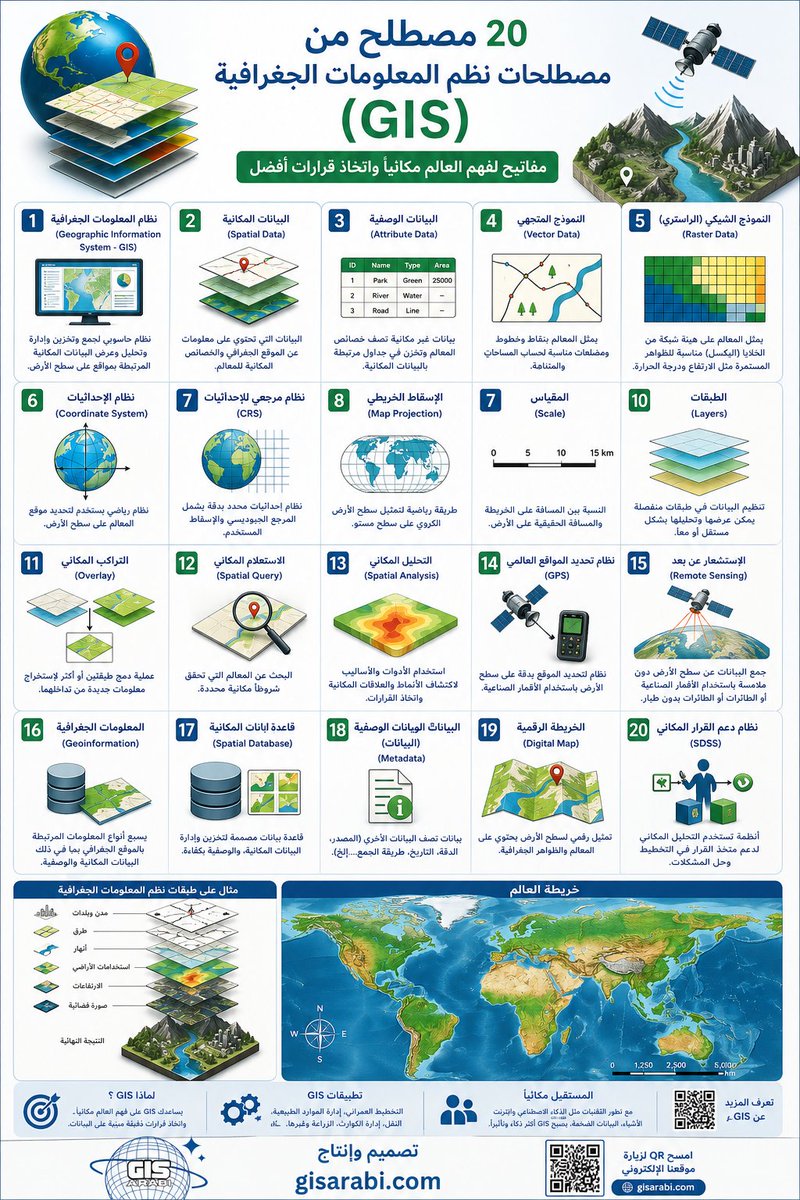
في نظم المعلومات الجغرافية GIS لا نتعامل مع خرائط صامتة… بل مع منظومة تفكير مكاني متكاملة. من البيانات إلى التحليل، ومن الطبقات إلى اتخاذ القرار—كل مصطلح هو أداة لفهم أعمق للعالم من حولنا. ابدأ بفهم المفاهيم… لتتقن التحليل. #GIS #جغرافيا #تحليل_مكاني #الاستشعار_عن_بعد
🌍 Ghana Landcover Map 2024 🇬🇭🗺️ From tropical forests to northern savannas — Ghana's landscape mapped using ESRI Landcover 2024 by @impactobservatory & @esri, and SRTM90 DEM by @opentopography. 🛠️ QGIS · Blender 🧭 Hemed Lungo #GIS #Cartography #Ghana #Landcover #Geospatial
#SaveTheDate for a virtual conference on the science, tech, and innovation behind our geospatial data. 🌎 Join Census Bureau geographers, fellow data users, and geospatial practitioners for the two-day event. Explore the agenda: census.gov/programs-surve… #GIS #GIS
Map showing Africa's terrain— from the lowlands till on top of Mount Kilimajaro . 📊 Data: Gebco bathymetry #gischat #Africa #GIS #Cartography

في عمق الجغرافيا الخريطة ليست مجرد رسم، بل هي لغة بصرية تحكي قصة المكان. في نظم المعلومات الجغرافية، نحول البيانات الأولية إلى حكمة مكانية. أسأل طلابي دائماً: لا تنظروا إلى الطبقات الرقمية كمجرد نقاط وخطوط، بل كشرايين حياة وعلاقات إنسانية واقتصادية. gisarabi.com #GIS
Want to learn how to visualise and analyze spatial data? My #R #GIS courses are coming up in Apr-May 2026: Intro to using R as a GIS - No prior knowledge needed! Advanced R as a GIS - For those ready to dive deeper nickbearman.com/training-cours…

الاستشعار عن بُعد ليس مجرد صور فضائية… بل علم يقرأ الأرض عبر الطاقة والبيانات. من الطيف الكهرومغناطيسي إلى تحليل الغطاء النباتي والكوارث—نرى ما لا تراه العين المجردة. ومع GIS تتحول هذه الرؤية إلى قرارات دقيقة. gisarabi.com #GIS #الاستشعار_عن_بعد #تحليل_مكاني #جغرافيا

Want to learn how to visualise and analyze spatial data in the social sciences? My #R #GIS courses are coming up in Apr-May 2026: Intro to using R as a GIS - No prior knowledge needed! Advanced R as a GIS - For those ready to dive deeper nickbearman.com/training-cours…

Something went wrong.
Something went wrong.
United States Trends
- 1. May Day N/A
- 2. GameStop N/A
- 3. $EBAY N/A
- 4. Spirit N/A
- 5. #SteinerMathDay N/A
- 6. The Villages N/A
- 7. Dan Marino N/A
- 8. Dr. Phil N/A
- 9. #LightningStrikes N/A
- 10. Baeza N/A
- 11. Corporate Power N/A
- 12. #Dont_Let_Go_Of_SevEN N/A
- 13. CUBS WIN N/A
- 14. Daily Wire N/A
- 15. #TrumpsGasCrisis N/A
- 16. Rebel N/A
- 17. McNabb N/A
- 18. #Financial_Boycott_BELIFT_HYBE N/A
- 19. Jacob Webb N/A
- 20. Boston Richey N/A