


Push alert! There have been some delays in the book process since March 2020 due to reasons, but now: ⭐️Part I for Python basics is soon ready at pythongis.org! ⭐️Dev version for all sections always available at python-gis-book.readthedocs.io/en/develop/
Introducing you to the basics of Python programming & geographic data analysis! Latest version available at pythongis.org, physical copy in 2021 by @CRCPress


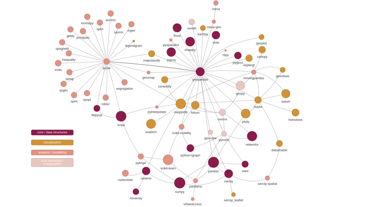
#2 attempt to map the #GeoPython #PythonGIS ecosystem for our @pythongis project. Currently 123 libraries covering a broader spectrum of pkgs. Thanks a lot for everyone who answered the call and helped! 🙏😎 Will produce separate for vector+raster & interactive ones to play with.

My first attempt to map the #GeoPython #PythonGIS ecosystem (currently n=69) for our @pythongis project (vector+raster) 🤓 𝐇𝐞𝐥𝐩 𝐧𝐞𝐞𝐝𝐞𝐝: What packages do I miss? I'm sure there are plenty of interesting libraries escaping my radar 🧐 @geopandas @pysal_devs @xarray_dev
My first attempt to map the #GeoPython #PythonGIS ecosystem (currently n=69) for our @pythongis project (vector+raster) 🤓 𝐇𝐞𝐥𝐩 𝐧𝐞𝐞𝐝𝐞𝐝: What packages do I miss? I'm sure there are plenty of interesting libraries escaping my radar 🧐 @geopandas @pysal_devs @xarray_dev

Time to wrap up those pre-covid projects! Happy to advance the #opensource @pythongis book with @dave_whipp & @tenkahen while learning new tricks😊.
My first attempt to map the #GeoPython #PythonGIS ecosystem (currently n=69) for our @pythongis project (vector+raster) 🤓 𝐇𝐞𝐥𝐩 𝐧𝐞𝐞𝐝𝐞𝐝: What packages do I miss? I'm sure there are plenty of interesting libraries escaping my radar 🧐 @geopandas @pysal_devs @xarray_dev
Part 4 will include useful information on how to work efficiently with Python: how to use version control with git, how to write and use Python script files and manage your projects, and tips for testing and debugging your code.

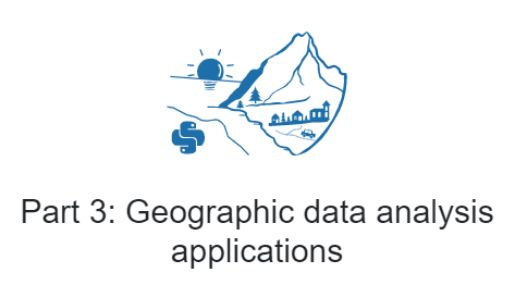
Part 3 will introduce several real-world examples of how to apply geographic data analysis in Python. It assumes that you understand the key concepts presented in previous parts.
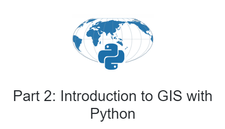
In Part 2 we will provide essential skills and building blocks for processing, analyzing and visualizing geographic data using modern open source Python packages such as @geopandas #shapely #rasterio to mention a few.
Part 1: New to Python? In this part will teach you the fundamental concepts of #programming using #Python. No previous experience required! Our materials draw inspiration from various geographical phenomena, hence it’s a perfect starting point if you’re a “geo-minded” person!

The book has four parts: 1) Python essentials, 2) Introduction to GIS with Python, 3) Geographic data analysis applications, and 4) Appendices. We combine our online courses: geo-python.github.io & autogis.github.io into a single ultimate learning-package for beginners.

What is even cooler is that all the materials will also be available for FREE to anyone at pythongis.org! We also develop all the materials openly in GitHub and hope for engagement with wider community ❤️ #openeducation #opensoftware #openscience #opendata
Introducing you to the basics of Python programming & geographic data analysis! Latest version available at pythongis.org, physical copy in 2021 by @CRCPress
Stay tuned for updated materials about #Python for Geographic Data Analysis! Very happy to be part of this #pythonGISbook project with @tenkahen and @dave_whipp. All materials are developed openly online, and the book will come out in 2021.
The book has four parts: 1) Python essentials, 2) Introduction to GIS with Python, 3) Geographic data analysis applications, and 4) Appendices. We combine our online courses: geo-python.github.io & autogis.github.io into a single ultimate learning-package for beginners.
Feeling excited to reveal our new book project "Introduction to Python for Geographic Data Analysis" together with @vuoggis & @dave_whipp which will introduce the basics of Python programming & geographic data analysis for all geo-minded people.🤓🌍Published in 2021 by @CRCPress


United States 趨勢
- 1. Lakers 32.1K posts
- 2. Michigan 115K posts
- 3. Spurs 27.2K posts
- 4. Sherrone Moore 57.4K posts
- 5. #AEWDynamite 24.1K posts
- 6. #Survivor49 4,477 posts
- 7. Godzilla 16.9K posts
- 8. Erika 162K posts
- 9. Candace 205K posts
- 10. Keldon Johnson 1,014 posts
- 11. Grayson Allen 3,256 posts
- 12. Thunder 28.3K posts
- 13. Stuart Scott 5,888 posts
- 14. Doug Dimmadome 2,082 posts
- 15. Kornet 2,155 posts
- 16. Gabe Vincent N/A
- 17. Kyle Fletcher 1,882 posts
- 18. Marcus Smart N/A
- 19. Rizo 1,924 posts
- 20. DeBoer 8,186 posts


Something went wrong.
Something went wrong.