
Scott Overpeck
@scottao11
Meteorologist helping people make good weather/water decisions | Texas A&M | Creighton | Sports | Love God Love People | Tweets my own-standard disclaimer|
You might like


Here is the flow at the Lincoln/Otero County line. SIGNIFICANT FLOODING IS OCCURRING. #nmwx

Significant rainfall has continued on the Ruidoso burn scars. Over 1” has likely fallen, and rapid water and debris flow is beginning to occur. Move to higher ground immediately! #nmwx
A FLASH FLOOD EMERGENCY has been issued for the Ruidoso area! Significant rainfall and water/debris flow is occurring! This is a life-threatening situation, move to higher ground immediately! #nmwx
Another 30 minutes later and it's hard to tell where the riverbed is. The river is now in major flood stage at over 15 feet. Stay away from the river! Seek higher ground NOW! #nmwx

The flood wave on the Rio Ruidoso has reached the Hollywood gage. Stay away from the river! This is a look at the change in the river depth in just 30 minutes, courtesy of the USGS! #nmwx


The Rio Ruidoso at Hollywood reached a provisional crest of 20.24 feet this afternoon while significant flash flooding was occurring . If this is confirmed, it would be a record high crest (compared to last year's crest of 15.86 feet on July 20th). #NMwx


One thing I'll add to this is mesoscale and tropical modeling is the only type of weather modeling that gives us any chance of getting these extremes, even if they aren't perfect and need a lot more work. The U.S. has been a world leader in mesoscale and hurricane modeling even…

Based on some of the reactions and comments I am absorbing by average people and elected officials, I think there needs to be a serious explanation and lesson on what the limits of predictability are for floods like the one in Texas.

The remains of Barry produced 20.33" of rain 4 miles northwest of Streeter TX. Barry is the 20th tropical cyclone (or remnant) since 1913 to cause 15"+ across Interior Texas. The loop below shows the other 19. Tropical Cyclone Rainfall Climatology: wpc.ncep.noaa.gov/tropical/rain/…
Tomorrow it’s going to be a busy day at the ABQ weather bureau. Monsoon moisture surge = flash flooding.
The season's first monsoon plume of moisture continues the heightened risk of flash flooding thru central and eastern NM tonight thru at least Wednesday. Area burn scars, notably the Ruidoso area burn scars are at risk of life threatening flash flooding. #NMwx


A storm dropped extremely heavy rainfall northwest of Roswell Sunday evening. The heavy rain caused flooding on the normally dry Berrendo Creek. One weather station recorded 5"+ of rain in the area! This is a preview of what's to come this week. Courtesy of Donald Wenner. #NMwx

#Roswell #flood video courtesy of Robert Holcomb A report of over 5” of rain in Roswell Avoid all water-covered roads! @koat7news koat.com/weather/radar #FlashFlood #SevereWx #NewMexico #Monsoon #NMwx
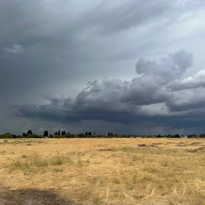
Such a cool shot! Captain RK Smithley, Tanker 912, captured this picture of the storm clouds rolling into Albuquerque at the 10 Tanker Air Carrier base at the Sunport today! #NMwx

Thanks for your sharing of information and your observations of the tornado with @NWSAlbuquerque #hattip

Thanks to @foxweather for inviting me on to talk about my recent tornado chase experience in New Mexico. Here’s the full interview:
The amount of work that goes into these damage surveys should not be under appreciated. I may only do one a year but the offices that do more always get my respect. It’s been a long couple of days and this was relatively easy. I’ll add…tornado damage could have been worse.
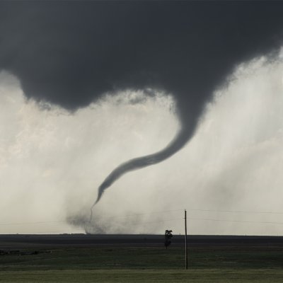
Damage survey found EF-1 damage from the tornado near Floyd NM on May 25, 2025. The start of the tornado was about 3mi SW of Floyd & then tracked NE over open fields crossing road NM-267 about 1.5mi SE of Floyd snapping power poles. Tornado lifted before impacting a dairy. #NMwx


THE CREIGHTON BLUEJAYS ARE BIG EAST BASEBALL TOURNAMENT CHAMPIONS‼️ TICKET OFFICIALLY PUNCHED🎟️ The last year of Ed Servais is straight goosebumps. NOT DONE YET. #RDJ🔵⚪️


it looks amazing at the east mountain 🏔️view from uptop to looking down to cedar crest weigh down below which would be 9miles straight down ⛅️ it always snows in May up here 🚠🚡 #newmexico #newprofilepic #usa #america #nm #southwest


United States Trends
- 1. Veterans Day 368K posts
- 2. Woody 12K posts
- 3. Toy Story 5 15.7K posts
- 4. Nico 139K posts
- 5. Luka 83.1K posts
- 6. Gambit 40.6K posts
- 7. Travis Hunter 3,673 posts
- 8. #stateofplay 2,680 posts
- 9. Payne 11.8K posts
- 10. Sabonis 3,720 posts
- 11. Mavs 32.4K posts
- 12. Vets 32.5K posts
- 13. Wike 117K posts
- 14. Pat McAfee 5,245 posts
- 15. SBMM 1,351 posts
- 16. Jonatan Palacios 2,271 posts
- 17. Battlenet 3,758 posts
- 18. Jay Rock 3,814 posts
- 19. Antifa 188K posts
- 20. #JonatanVendeHumo 3,543 posts
You might like
-
 Tom Bradshaw
@SoonerTom -
 Dan Reilly
@DReillyWx -
 Charlie Woodrum
@ChuckWx -
 Jared Guyer
@JaredGuyer -
 Trevor Boucher
@ZombieTrev5k -
 Jeff Evans
@jeffryevans -
 Mike Johnson
@wall_cloud -
 Kim Runk
@KimRunk -
 Matthew Dux
@MatthewDux -
 Tyler Castillo
@tjc_12 -
 Brian LaMarre
@blamarre -
 Brian Hoeth
@bhoeth -
 Nick Hampshire
@nhampshire
Something went wrong.
Something went wrong.