
NWS Albuquerque
@NWSAlbuquerque
Official X account for the Albuquerque National Weather Service. Details: https://www.weather.gov/nws_x
You might like


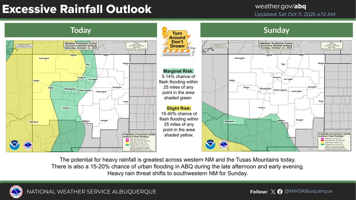
The risk for flash flooding shifts to southwest/south central #NM on Sunday; however, more tropical moisture returns for Monday/Tuesday. There is a MARGINAL (5-14% chance) to SLIGHT (15-39% chance) risk for flash flooding in western and central NM during this period. #TADD #nmwx

High flows are forecast on the Animas and San Juan Rivers in northwest #NM on Sunday. While river flooding is not anticipated at this time, bankfull conditions may cause bank erosion. Please avoid recreational activities in the river during these high flows. #nmwx

Tired of the wet weather? The 8-14 Day Outlook favors near to below normal precipitation across the region as the primary storm track appears to shift north of New Mexico. #nmwx

Animas River at Farmington will approach bank-full (9.0') by Sun afternoon. River flooding is not anticipated, but will be contingent on additional rainfall. Be alert to the latest forecasts and avoid recreational activities while the river is experiencing high flows. #nmwx

A broken line of showers is moving east into the middle & lower RGV this afternoon and will likely begin to produce a few lightning strikes. Expect moderate to occasionally heavy downpours & wind gusts to 40mph. #nmwx
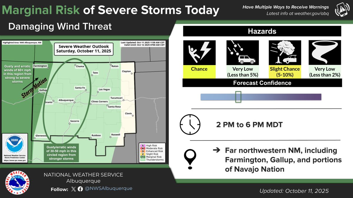
Afternoon Severe Weather Update: A few afternoon storms along the #AZ border may turn severe with wind gusts of 60+ mph being the main hazard. Meanwhile, a few of the stronger storms between the Cont. Divide and the central mountains will be capable of gusts of 30-50 mph. #nmwx
A broken line of showers will bring moderate to occasionally heavy rain to the #Albuquerque and #SantaFe Metros between 1-4PM this afternoon. No lightning at this time, but don’t be surprised to hear a rumble of thunder! #nmwx
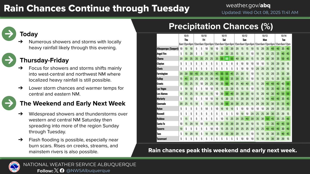
- Flash Flood Watch remains in effect for NW NM thru 6pm. - A few afternoon thunderstorms along the Arizona border could also turn severe. - A back-door cold front and a renewed tropical moisture tap expand the flash flooding threat area again Monday into Tuesday.


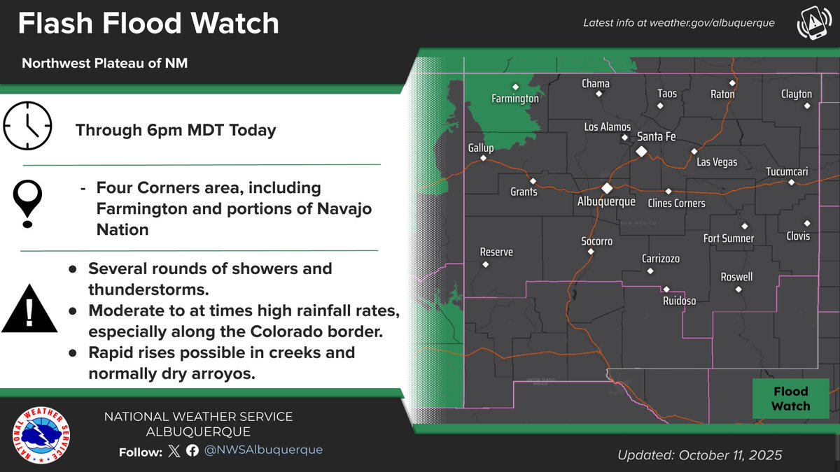
- Flash Flood Watch for far northwest NM today into Sat. - Wet pattern continues into early-mid next week, with daily risk of flash flooding. - Back door cold front brings cooler temperatures for Monday.


Two storms moving northwest across NE #Albuquerque this evening toward the #AIBF. Heavy downpours, occasional lightning and pea size hail are likely, #nmwx
Rainfall chances will be increasing over the next several days. 5-day rainfall amounts will be heaviest over northern and western NM. Here's a breakdown thru Saturday. #nmwx


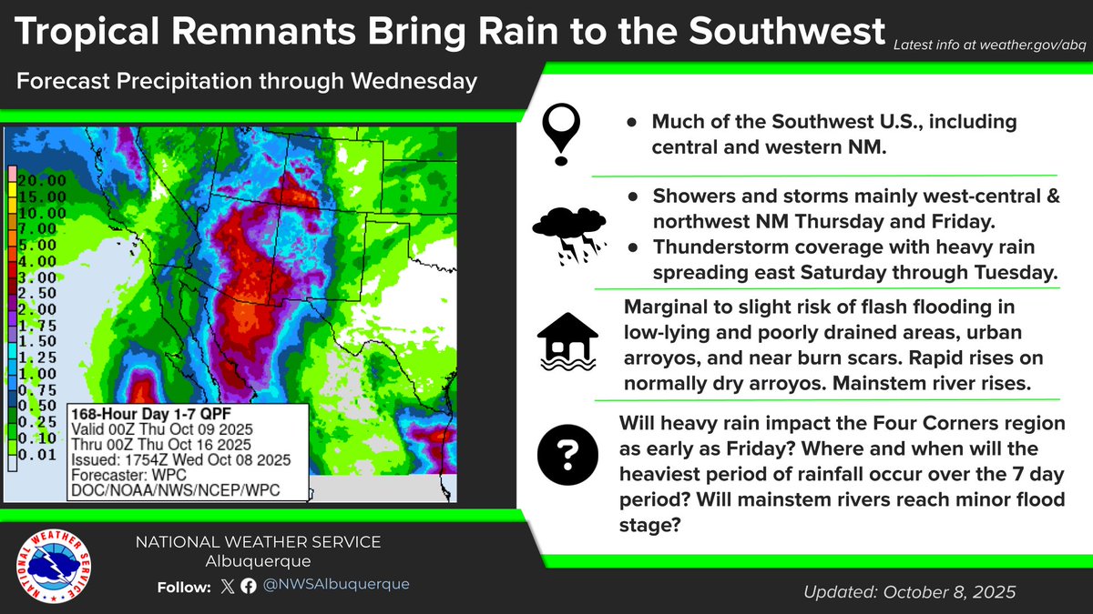
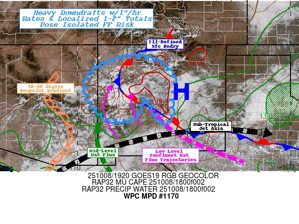
Abundant moisture is likely to spread across the southwest U.S. through early next week as the tropics remain active in the eastern Pacific #nmwx

#WPC_MD 1170 affecting West-Central to Central NM... Adjacent Northeast AZ..., #nmwx #azwx, wpc.ncep.noaa.gov/metwatch/metwa…
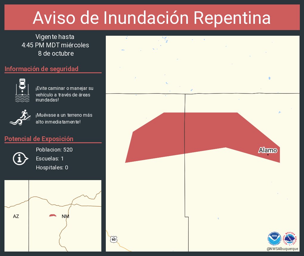
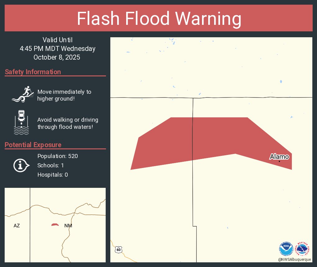
Aviso de Inundación Repentina incluye Alamo NM hasta las 4:45 PM MDT
Aviso de Tormenta Severa incluye Alamo NM hasta las 2:00 PM MDT


United States Trends
- 1. Auburn 45.2K posts
- 2. Brewers 64K posts
- 3. Georgia 67.9K posts
- 4. Cubs 55.7K posts
- 5. Kirby 24K posts
- 6. Arizona 42.1K posts
- 7. Utah 24.7K posts
- 8. Gilligan 5,878 posts
- 9. #AcexRedbull 3,760 posts
- 10. Michigan 63K posts
- 11. Hugh Freeze 3,218 posts
- 12. #BYUFootball N/A
- 13. #Toonami 2,586 posts
- 14. Boots 50.8K posts
- 15. Amy Poehler 4,387 posts
- 16. #GoDawgs 5,566 posts
- 17. #byucpl N/A
- 18. Kyle Tucker 3,176 posts
- 19. Dissidia 5,642 posts
- 20. Tina Fey 3,370 posts
You might like
-
 Albuquerque Journal
@ABQJournal -
 KOAT.com
@koat7news -
 KRQE News 13
@krqe -
 APD Traffic
@ABQTraffic -
 Albuquerque Police Department
@ABQPOLICE -
 Albuquerque Business First
@ABQBizFirst -
 City of Albuquerque
@cabq -
 Albuquerque City Council
@ABQCityCouncil -
 Governor Michelle Lujan Grisham
@GovMLG -
 KOB 4
KOB 4
@KOB4 -
 NWS Lubbock
@NWSLubbock -
 ABQToDo
@ABQtodo -
 New Mexico TRUE
@NewMexico -
 NMSP
NMSP
@NMStatePolice -
 ABQ BioPark
@abqbiopark
Something went wrong.
Something went wrong.