Vexcel Data Program
@vexcel_data
Aerial imagery & geospatial data for government and businesses.
Potrebbero piacerti


Our Gray Sky team collected imagery following a severe hailstorm in Queensland, Australia, recently. Imagery captured offers detailed before/after high-res ortho and oblique views of damaged properties. Learn more about Vexcel's Gray Sky program 🌩️hubs.la/Q03SgqYg0

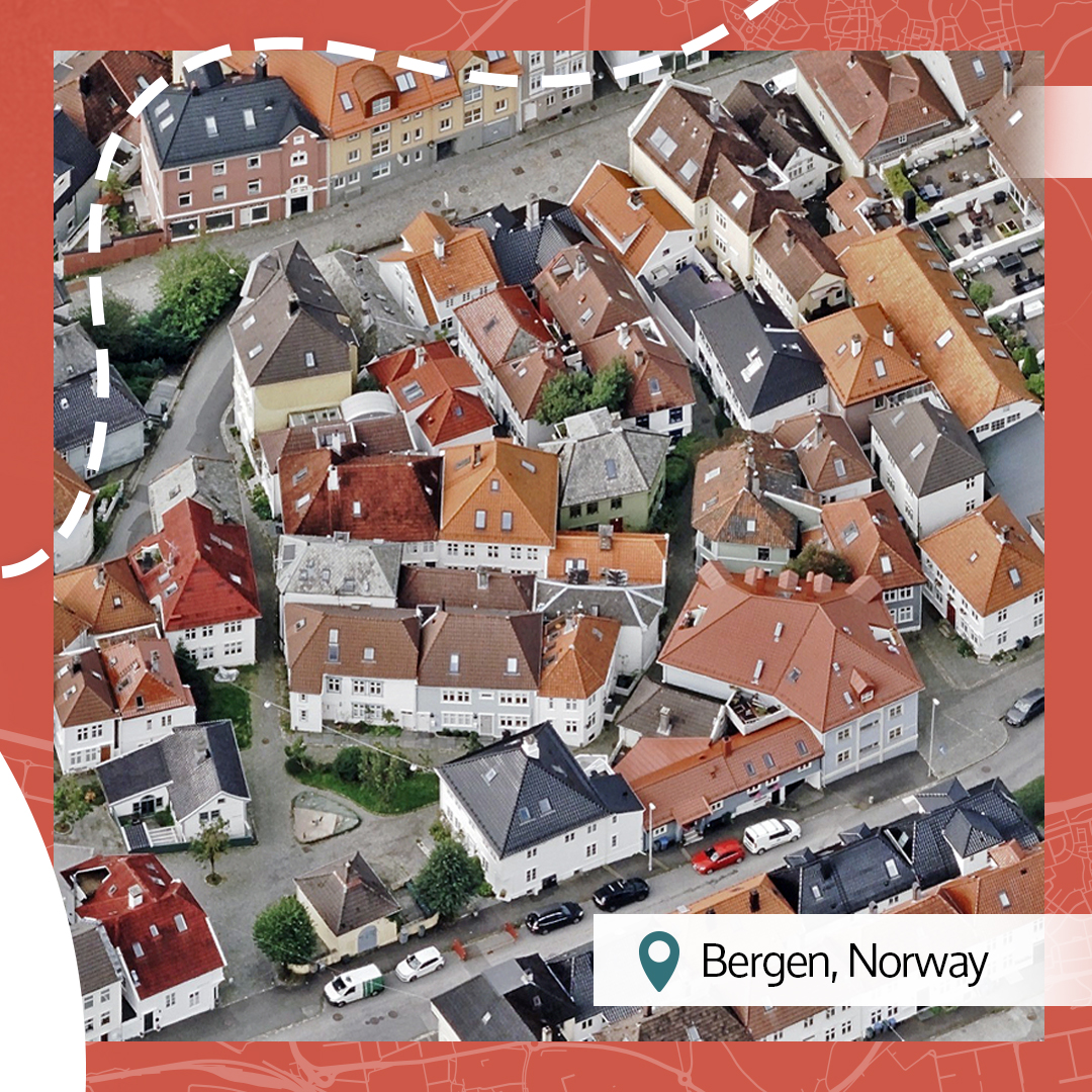
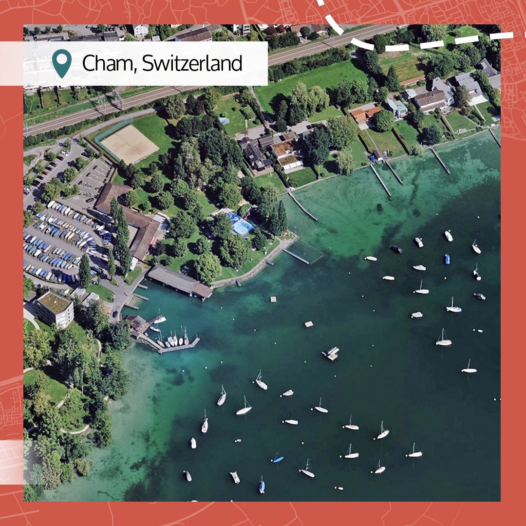
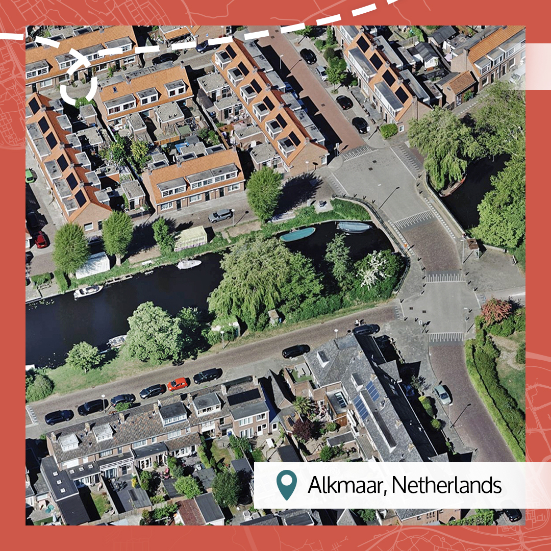
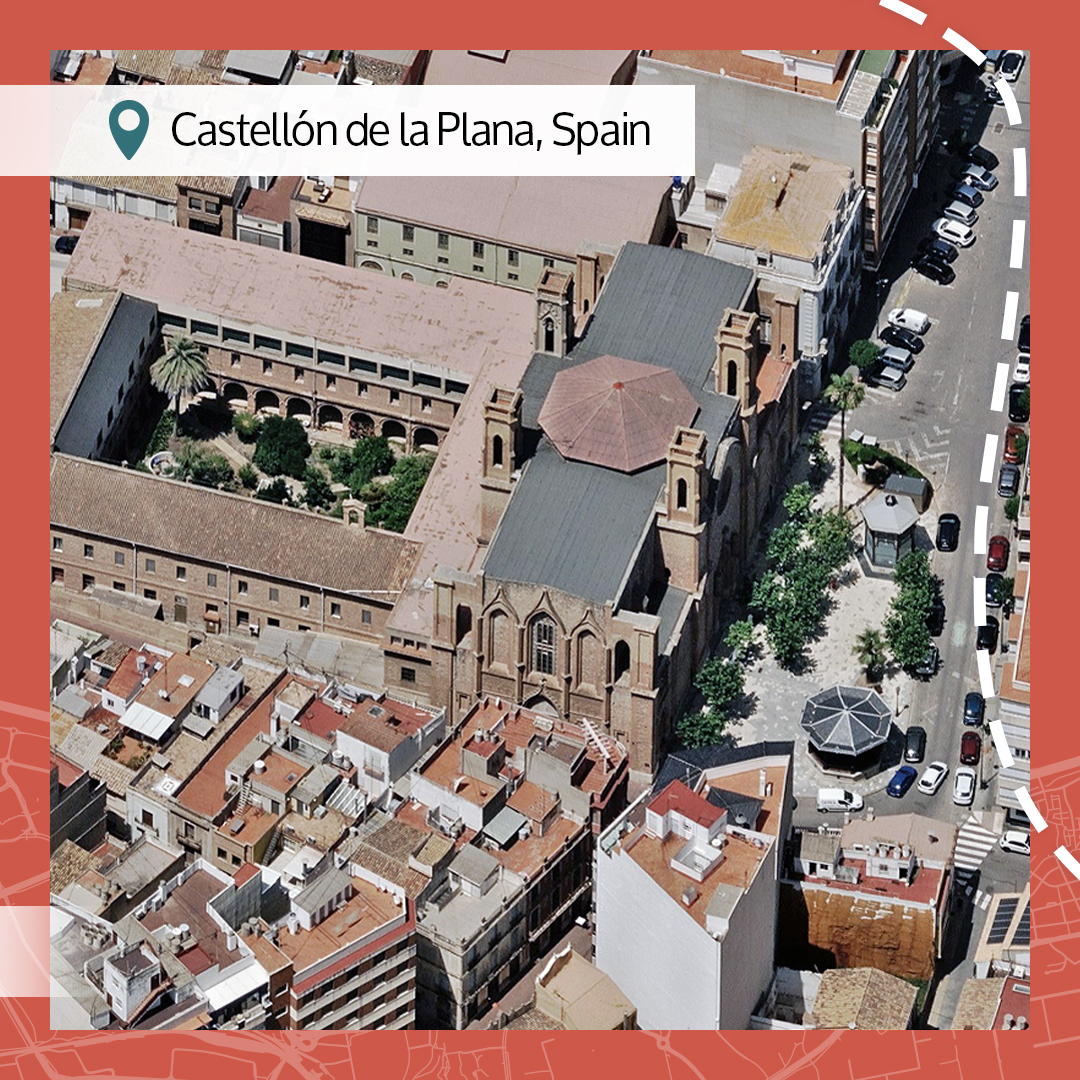
This week's beautiful earth images take you inside the remarkable beauty we find in some of the 150,000 images we publish daily. What catches your attention? Is there a place you'd rather be? #BeautifulEarth #AccuracyMatters #AerialImagery 👉hubs.la/Q03ScP5T0


Storms bring uncertainty and stress to utility managers. There's the unknown element of how it might affect power grids. So what are utilities doing to better prepare or storm-proof their grids? Discover 5 ways utilities use Vexcel data to reduce risk 👉hubs.la/Q03S4rJH0

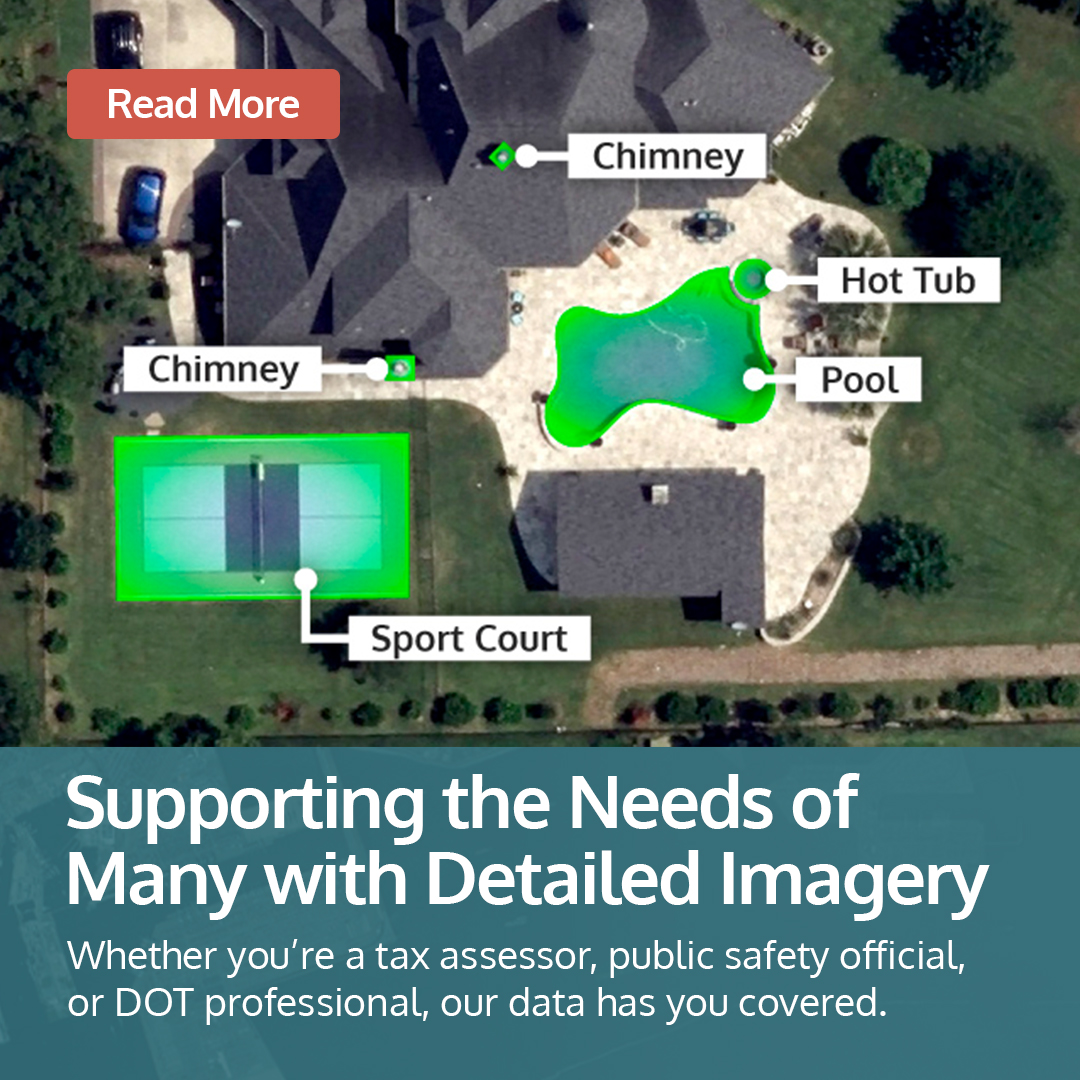
Satellite imagery can't deliver the high-res details we can. Need to understand the features on a roof? How many vents are in an ac unit? Roof condition and more? Seeing it in stunning clarity gives you those answers. Discover more: hubs.la/Q03S1mn80

We're at the Texas GIS Forum today and tomorrow, ready to meet with you and show you our state-wide coverage of the Lone Star State. Drop by Booth #25 until 7 p.m. today and tomorrow until 4 pm to get your questions answered. See our Texas coverage 👉hubs.la/Q03RQgrh0

What does it look like to fly-through the Golden Gate Bridge in San Francisco? We can show you with our 3D data. Immerse yourself in your projects and see what's possible with Vexcel data. 👉hubs.la/Q03Rm6xt0 #3Dmodel #AccuracyMatters #DigitalTwin #SmartCities
We are in Kansas, Dorothy--in fact, we cover all 105 counties in high-resolution. Need to see imagery from Wichita to open farmlands? Check out our coverage map and the variety of imagery products available in Kansas. 👉hubs.la/Q03Rfwks0


Cities never stop changing. That’s why frequent aerial coverage matters. See how Vexcel captures up to 3× a year to keep urban insights fresh. 👉hubs.la/Q03RfvPT0

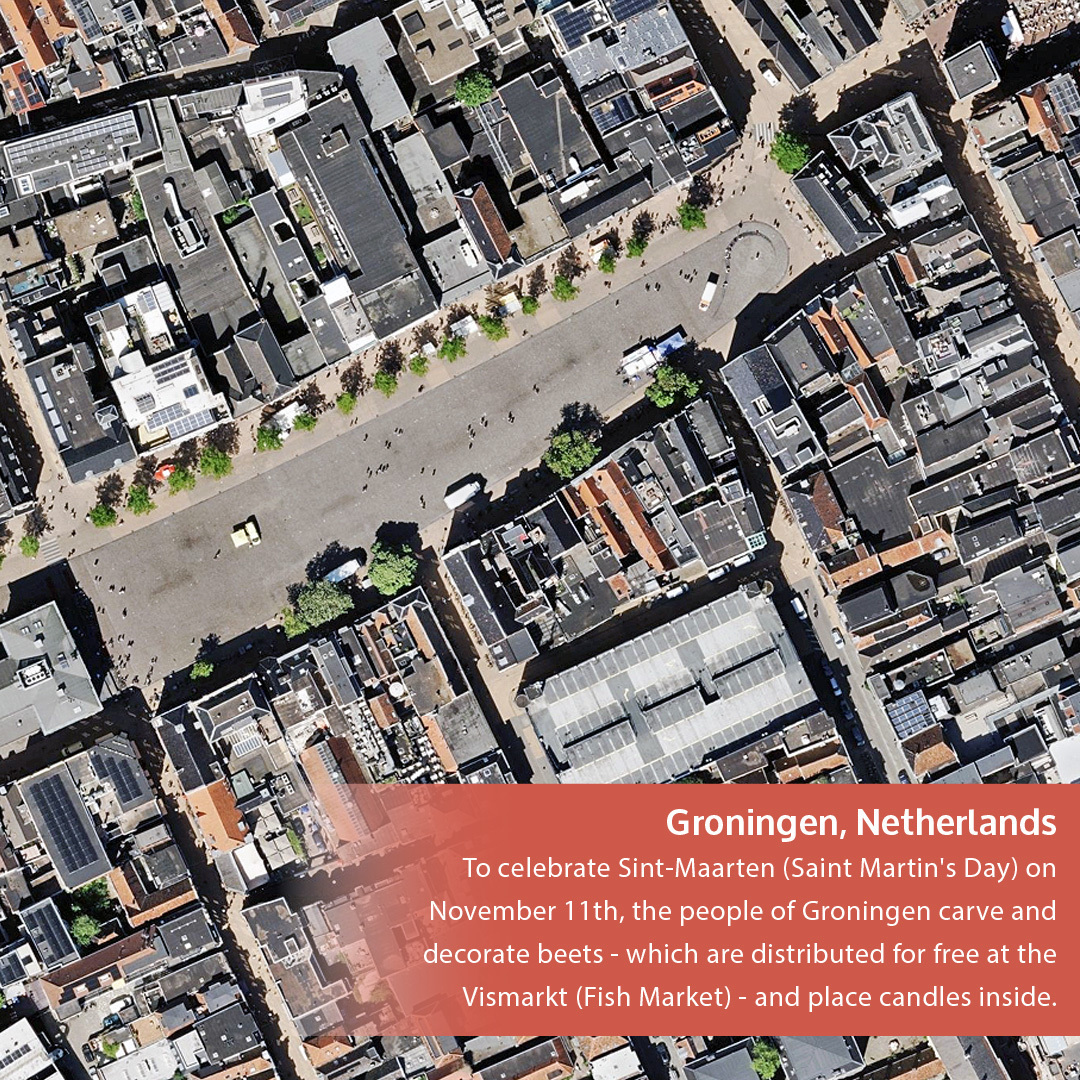
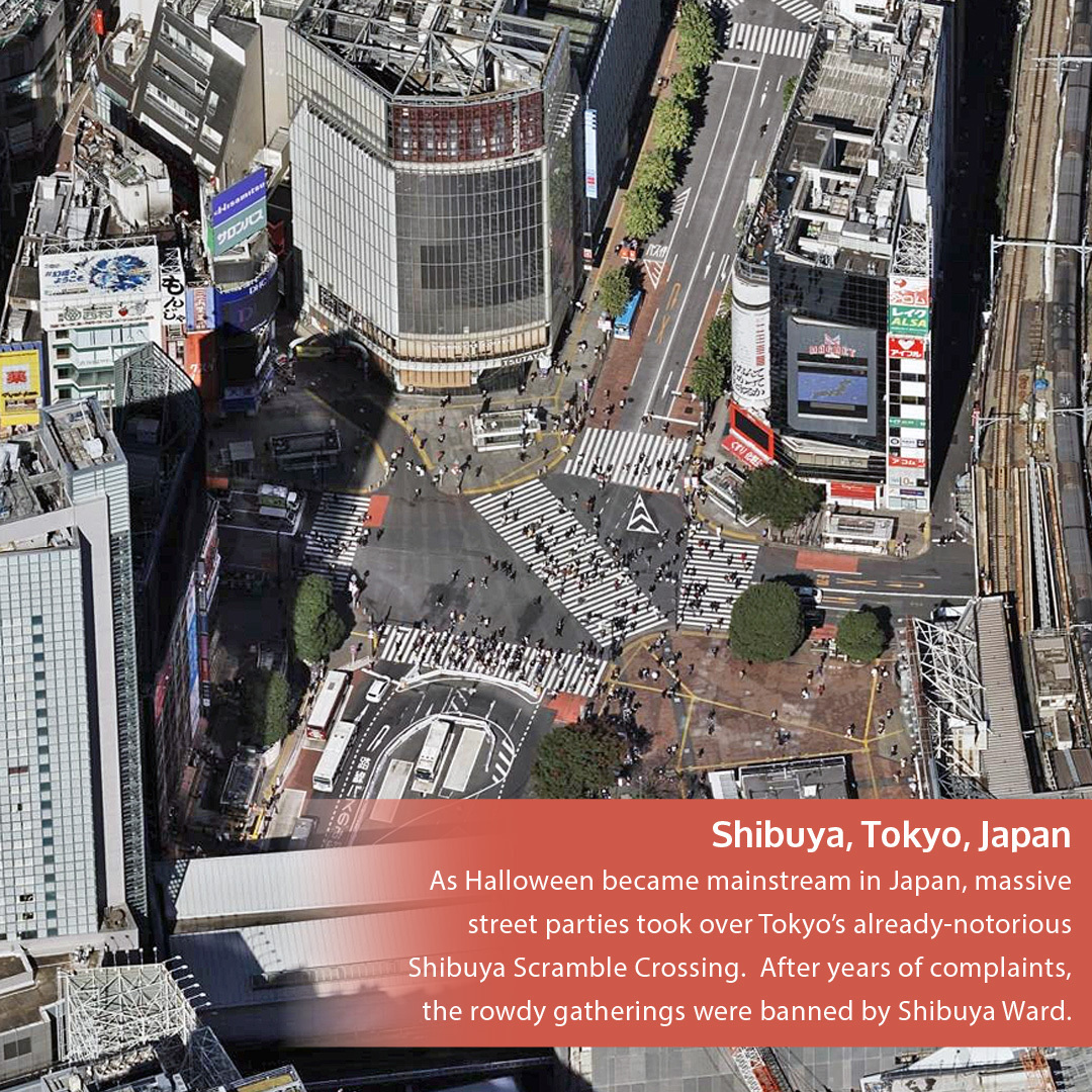
It's October 31, All Hallow's Eve, or Halloween if you prefer in the U.S. 🎃 But around the world, these "Day of the Dead" celebrations are quite varied! Take a look at some of the cultural country traditions around this themed holiday. 👉hubs.la/Q03R1VMD0 #AerialImagery


When it comes to Missouri, we know people are asking, "Show Me the imagery!" So we will happily oblige. Check out our state-wide coverage, covering 114 counties in high-resolution, multiple imagery and data products available. 👉hubs.la/Q03QvDk90


One source. Many uses. Stronger communities. Why juggle multiple data sources when one trusted imagery library can power assessment, safety, and infrastructure? Vexcel’s imagery helps governments work smarter with less duplication, more alignment. 👉hubs.la/Q03Q84F70
Beach or mountains? Relaxation or challenging climbs? What's your pick? Tell us whether you see yourself basking in the Australia sun or summiting mountains in Colorado! (p.s. there are no wrong answers) #AerialImagery #AccuracyMatters #BeautifulEarth 👉hubs.ly/Q03Q0P2l0

Every community wants to feel safe but it takes planning, insight, and reliable data. With high-resolution aerial imagery from Vexcel, public safety teams, DOTs, and city planners can see risks before they become emergencies. Read more 👇 hubs.la/Q03PWgDD0

You haven't seen Amsterdam in 3D like this before. Immerse yourself in this fly-through and experience the city's intricate canals, iconic architecture, and dense urban landscape brought to life in stunning detail. Want more info on our 3D Cities? ⬇️ hubs.la/Q03PPGqN0
Seeing your state in high-res is a benefit, whether you need urban coverage or rural views. Take Virginia. We collect #aerialimagery in all 95 counties at a resolution of 7.5-15cm. From Richmond to Arlington, Norfolk to Lexington, we've got you covered. hubs.la/Q03PwNyf0


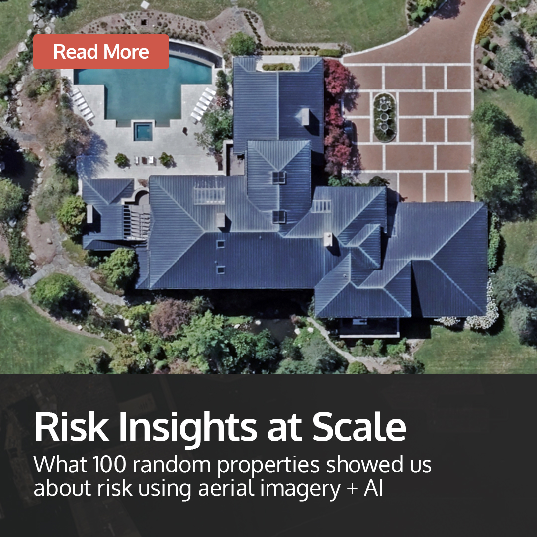
What can 100 random properties tell you about risk? A lot more than you’d think. Using high-resolution aerial imagery and AI-powered property analytics, see how data from above is transforming how insurers, lenders, and portfolio managers assess risk. 👉hubs.la/Q03Plq4D0
There seems to be a color theme we've spotted in many of our Beautiful Earth images this week. Orange you glad we find such eye-popping imagery to share? 👀 Just a small handful of the 150,000+ images we publish daily. 👉hubs.la/Q03N_pMM0
Last day at ITC Vegas and we've already been out and about sharing just how our high-res imagery, AI property analytics, and geospatial data support insurers across the policy lifecycle. Want to learn more? Stop by Booth 1718 before 5 p.m today! 👉hubs.la/Q03N_cBy0
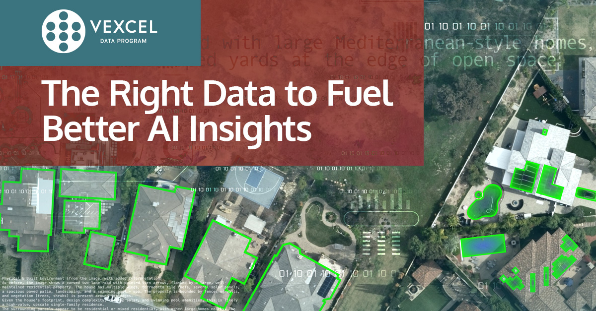
AI models crave clean, consistent, and complete data. You don't want your AI guessing which is why our geospatial data helps create the trusted baseline AI models need to produce reliable, real-world results. Better inputs. Smarter outputs. 👉hubs.la/Q03NWTlK0


United States Tendenze
- 1. #Worlds2025 42.4K posts
- 2. #TalusLabs N/A
- 3. Doran 17.5K posts
- 4. #T1WIN 27.7K posts
- 5. Sam Houston 1,607 posts
- 6. Oregon State 4,826 posts
- 7. Boots 29.6K posts
- 8. Faker 32.4K posts
- 9. Lubin 5,842 posts
- 10. Keria 10.9K posts
- 11. #T1fighting 3,519 posts
- 12. #Toonami 2,725 posts
- 13. Option 2 4,217 posts
- 14. Louisville 14.4K posts
- 15. Hyan 1,413 posts
- 16. Emmett Johnson 2,665 posts
- 17. Frankenstein 126K posts
- 18. Oilers 5,328 posts
- 19. UCLA 7,841 posts
- 20. Bama 13.9K posts
Potrebbero piacerti


Something went wrong.
Something went wrong.