


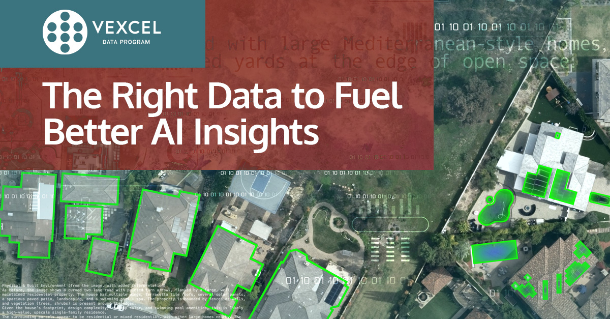
AI models crave clean, consistent, and complete data. You don't want your AI guessing which is why our geospatial data helps create the trusted baseline AI models need to produce reliable, real-world results. Better inputs. Smarter outputs. 👉hubs.la/Q03NWTlK0
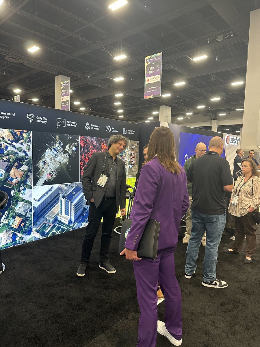
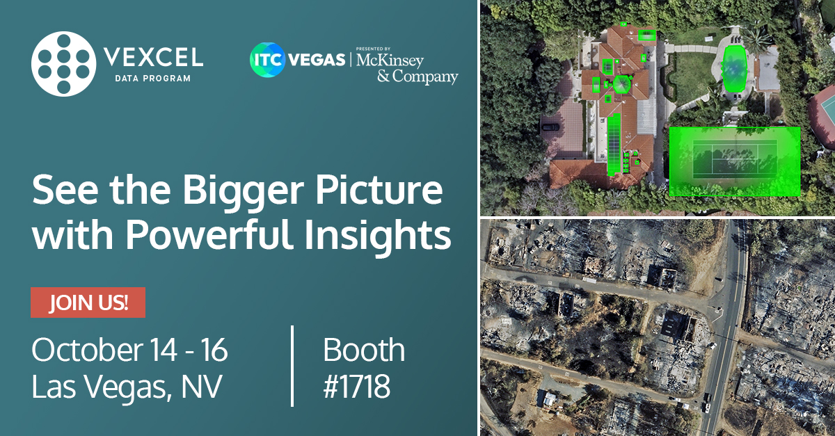
We're here at ITC Vegas, already connecting with so many wonderful people. Did you happen to hear the presentation earlier from Ryan Bank? Or perhaps you're looking for our team and booth? Come find us at #1718! Find out how we support insurers 👇hubs.la/Q03NQnjY0


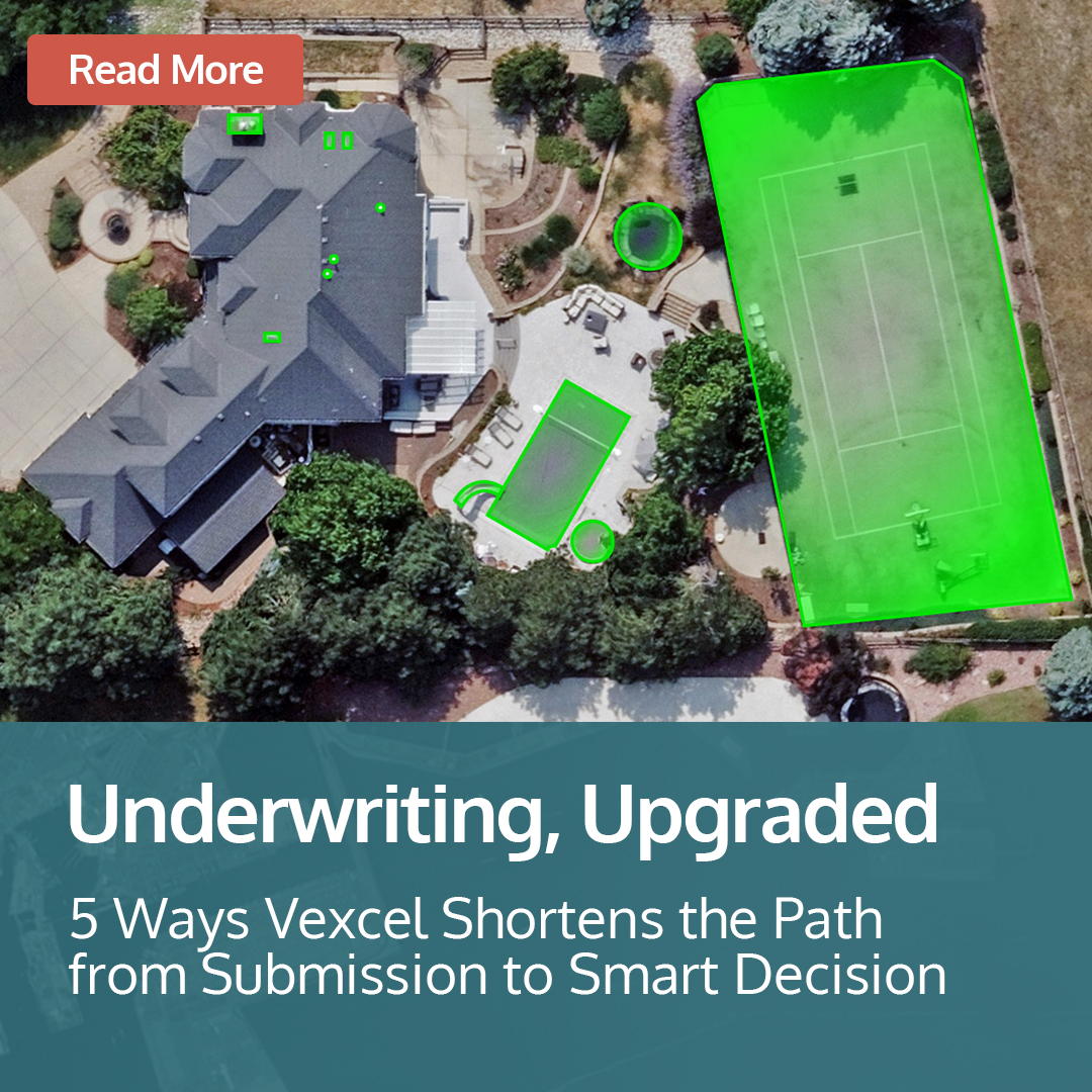
Underwriters, are you ready to close the gap when it comes to premium leakage? Discover five ways Vexcel helps you streamline the underwriting process so you have faster reviews, fewer errors, and smarter portfolio growth. 👉hubs.la/Q03NLy8m0
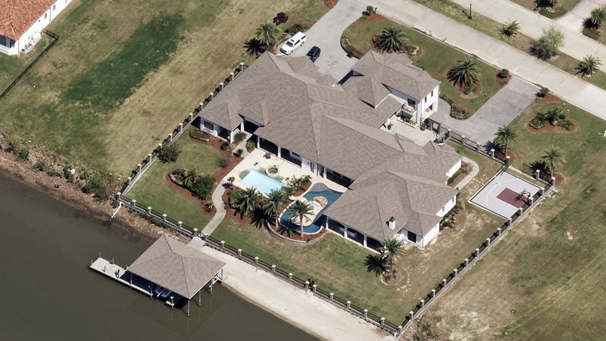
From the bayous to Baton Rouge, Vexcel captures Louisiana in remarkable detail. Our high-resolution aerial imagery brings clarity and consistency to every corner of the state—helping insurers, governments, and utilities make smarter, faster decisions. hubs.la/Q03Nv_r60
Insurtech runs on data—and we deliver it with unmatched clarity. From AI-ready aerial imagery to nationwide coverage, Vexcel fuels smarter underwriting, risk analysis & property insights. See the bigger picture at #ITCVegas 2025. #Insurtech #AI #GeospatialData
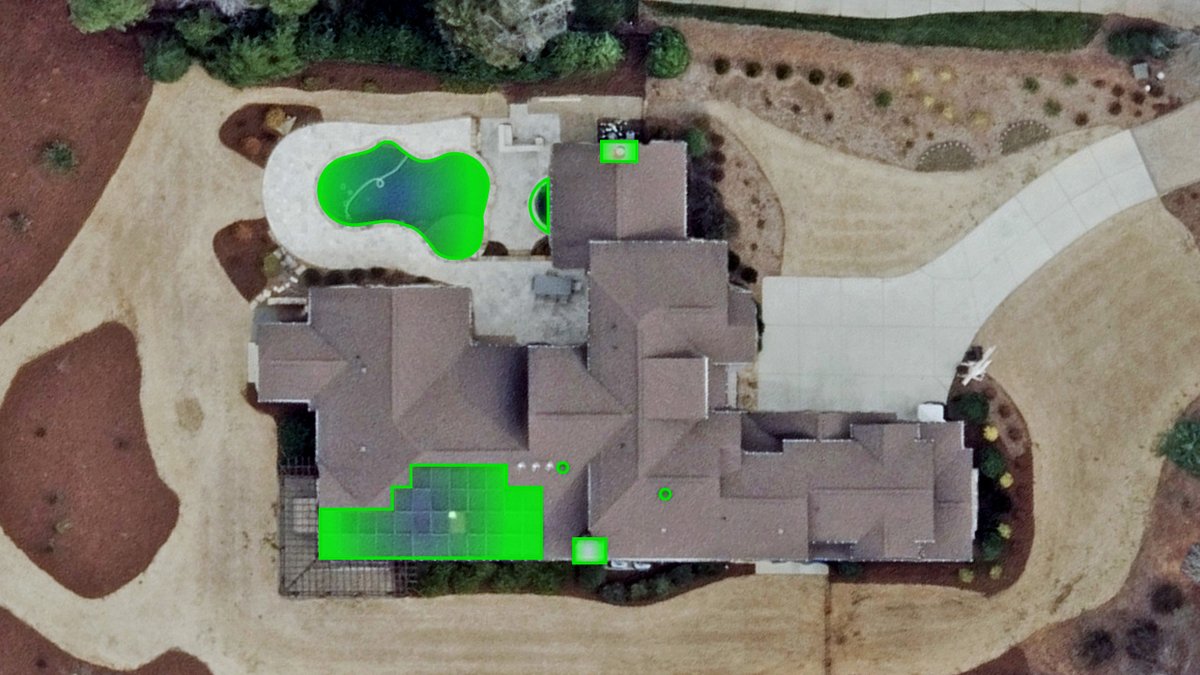
Don’t let fraud walk in unnoticed. Learn how to leverage high-resolution aerial imagery to protect your bottom line. Learn how Central Insurance used Vexcel imagery and data for their SIU claims and resolve issues. 👉hubs.la/Q03Nj55K0

When perusing through the 150,000+ images we process daily, there's always a special few that catch our eye. What did we find this week? Check out our gallery of Beautiful Earth images below. View more images: hubs.la/Q03N0HJ00


Looking for state-wide coverage in Idaho? We've got you covered with a variety of #aerialimagery and #geospatialdata products. See where we collect in our coverage map and check out just a few examples of aerial data products. 👉hubs.ly/Q03MX_t20


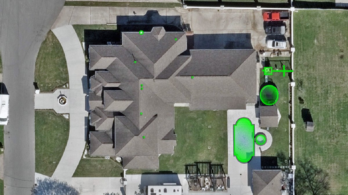
Early insight = smarter decisions. Learn how Vexcel #aerialimagery gives portfolio managers the visibility to spot distressed assets and reduce risk faster. 👉hubs.la/Q03MP-jZ0 #PortfolioManagement #FinancialServices #AccuracyMatters

Attending GeoCon 2025 in Virginia this week? Make sure to connect with our team in Booth #15 to get all your questions answered about our #aerialimagery and #geospatialdata. Want to see our state-wide coverage for Virginia? hubs.la/Q03Mzfls0 #GIS #AccuracyMatters

We're at Intergeo in Frankfurt the next few days! Make sure to drop by Booth #0F100 to connect with our team. Want to see where we collect #aerialimagery and #geospatialdata? 👀hubs.la/Q03Mt7hc0

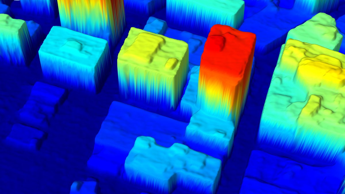
What if you could step inside a city instead of just viewing it from above? Discover how Vexcel's high-resolution imagery and ready-made 3D city models are transforming urban planning, simulations, and smart city design. 👉hubs.la/Q03Mk3Qq0

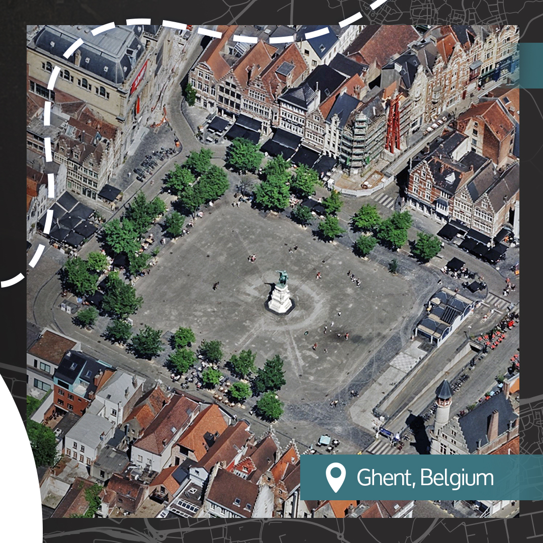
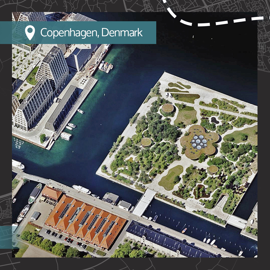
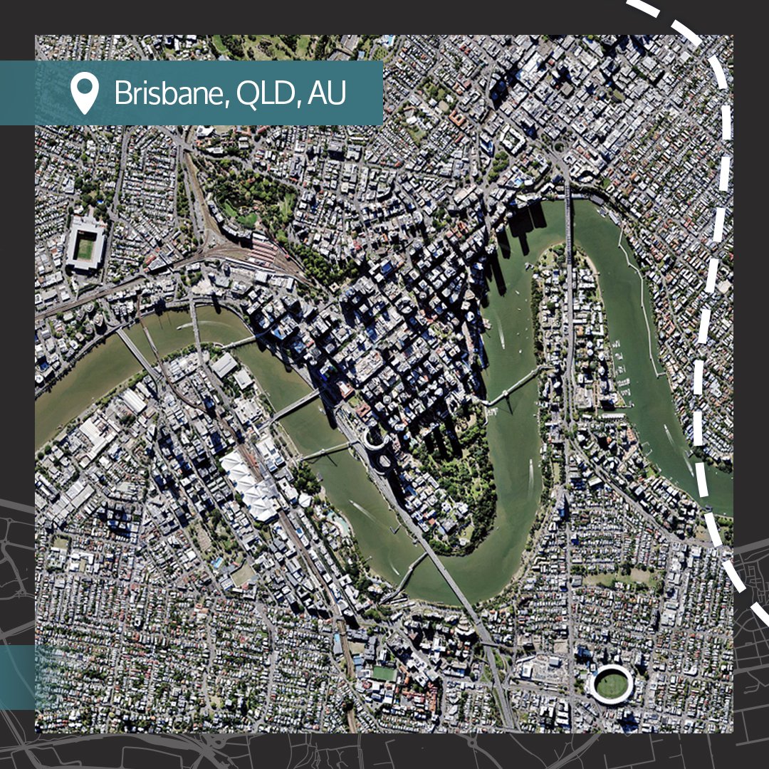
There's a myriad of patterns and shapes to be found in this week's #BeautifulEarth imagery. What place or area catches your eye the most? 🌎 Did you know we collect #aerialimagery in 40+ countries in high resolultion? 👉hubs.la/Q03M0dkB0

See us at ITC Vegas in 2 weeks! Learn how Vexcel is supporting insurance innovation with: 💡AI-derived property insights 💡Gray Sky disaster response program 💡Detailed high-res imagery 💡Broad coverage across the U.S. and in 40+ countries Learn more 👉hubs.la/Q03LXmzL0

When it comes to #aerialimagery, scale changes everything. Especially when comparing imagery collected by aircraft vs. drone. You need more than just a quick view; you need a reliable baseline. Found out why 👉hubs.la/Q03LJ9Hy0 #imagery #AerialvsDrone #AccuracyMatters

Wondered what our #aerialimagery looks like in Hawaii? We collect imagery in urban areas across the islands, helping you see the Aloha State like never before. Check out our coverage map of Hawaii and view available products 👇hubs.la/Q03Ly9WT0


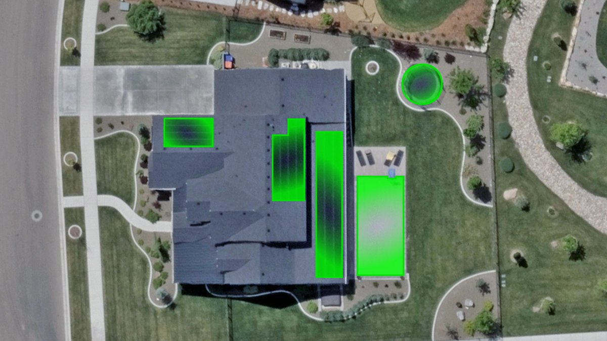
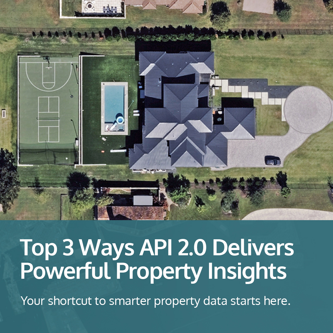
Vexcel's API 2.0 helps turn aerial imagery into instant property intelligence. From real-time access to seamless integration and scalable search, it’s changing how many industries unlock AI-powered insights. Discover the top 3 ways it delivers 👉hubs.la/Q03LlrMg0
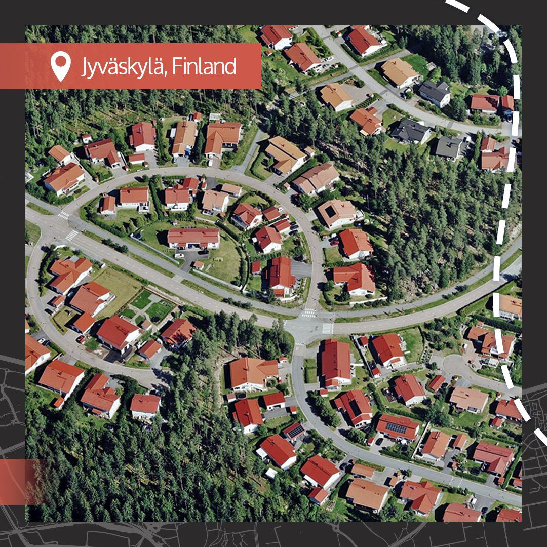
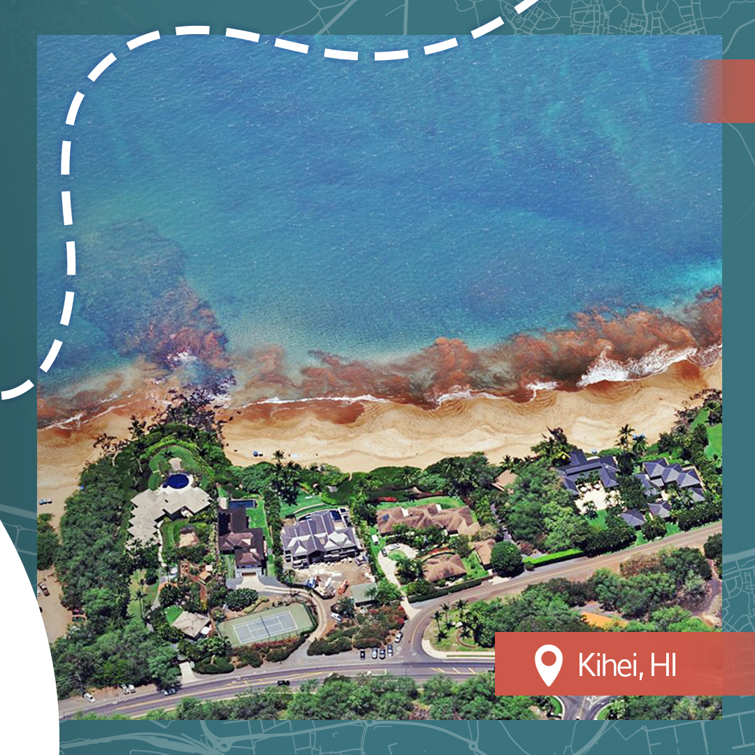
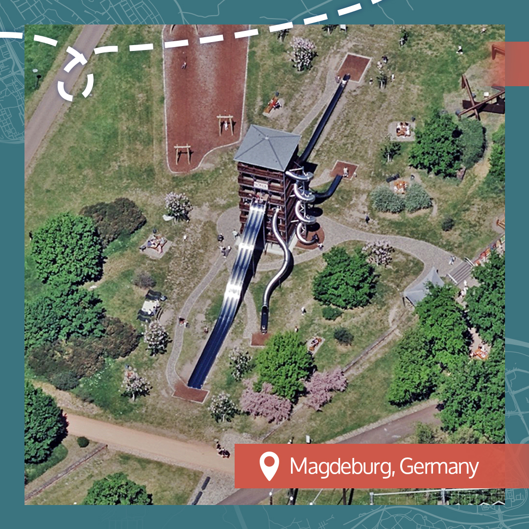
For Beautiful Earth we're saying aloha, bonjour, and hallo to this week's discovered locations. 👉hubs.la/Q03L4DXD0 #BeautifulEarth #AccuracyMatters #AerialImagery


State coverage in the U.S. is a key benefit to our #aerialimagery program. We collect in the Lower 48 plus urban areas in Hawaii. Have you seen our coverage in North Carolina? We collect in all 100 counties at a resolution of 7.5-15cm. 👉hubs.la/Q03KQ1V20


Keeping up with property change is hard. Vexcel makes it easier. Discover how Vexcel helps tax assessors modernize with high-res aerial imagery and AI insights that reveal what's new, what's changed, and what matters most. 👉hubs.la/Q03KCFKw0


United States 趨勢
- 1. #KonamiWorldSeriesSweepstakes N/A
- 2. #2025MAMAVOTE 1.53M posts
- 3. Mitch McConnell 12.9K posts
- 4. Tyla 22.7K posts
- 5. Term 192K posts
- 6. #TrumpShutdownBadForUS 2,061 posts
- 7. Budapest 10.4K posts
- 8. No Kings 154K posts
- 9. Somalia 31.8K posts
- 10. Yung Miami 1,769 posts
- 11. Caresha 1,420 posts
- 12. Deport Harry Sisson 29.8K posts
- 13. Miguel Vick N/A
- 14. Chanel 26.2K posts
- 15. Spencer Dinwiddie N/A
- 16. ErgoChair X N/A
- 17. President Putin 22.5K posts
- 18. Brian Cashman N/A
- 19. #SpiritDay 2,130 posts
- 20. Carter Hart 1,613 posts


Something went wrong.
Something went wrong.