#ancientmap résultats de recherche

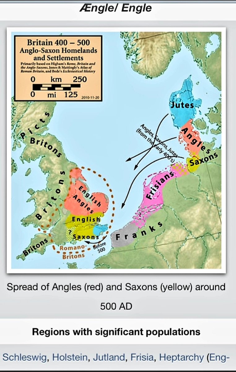
Fascinating map of #ancientBritain /Briton of the Angles, #ancientMap of homelands of settlers & other tribes.

A very simple map I did to illustrate the three major civilizations of Ancient Greece. I may go back in and add a few more city-states. #ancientgreece #historylovers #ancientmap #ancientworld #classicalage #minoan #mycenean #troy #iliad #odyssey #bronzeage


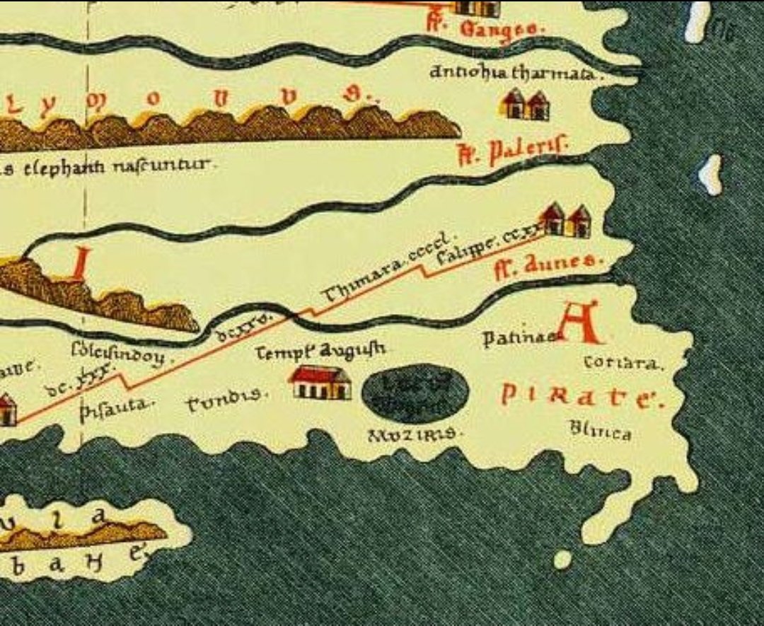
Peutinger's Tabula showing Muziris & Tyndis,ancient Indian seaports famous for their spices . 🌊🌶 #ancient #ancientmap


La Porta del Borgo in un illustrazione stilizzata nella antica piantina del Joan Blaeu. #ancientmap #fabriano

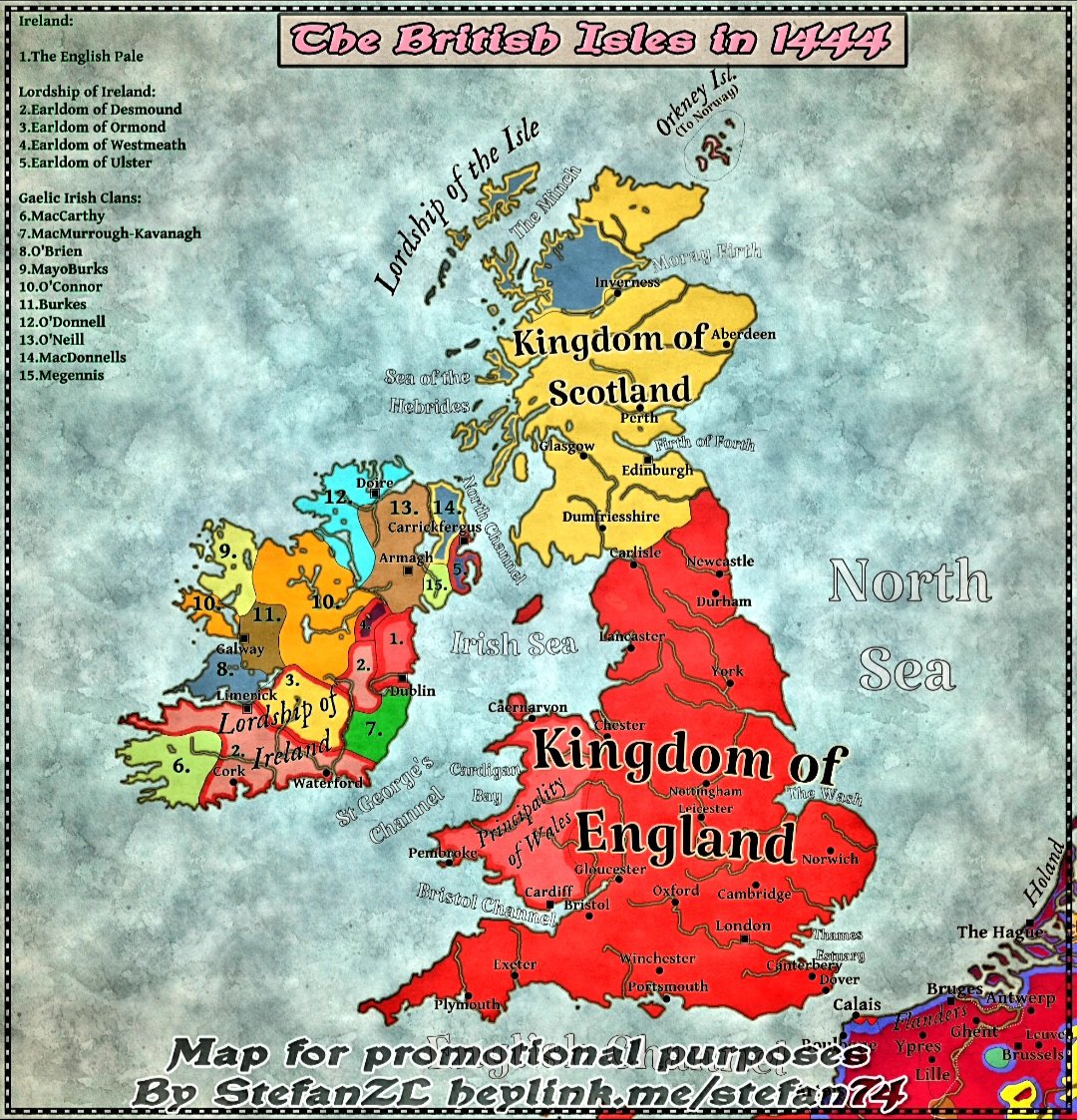
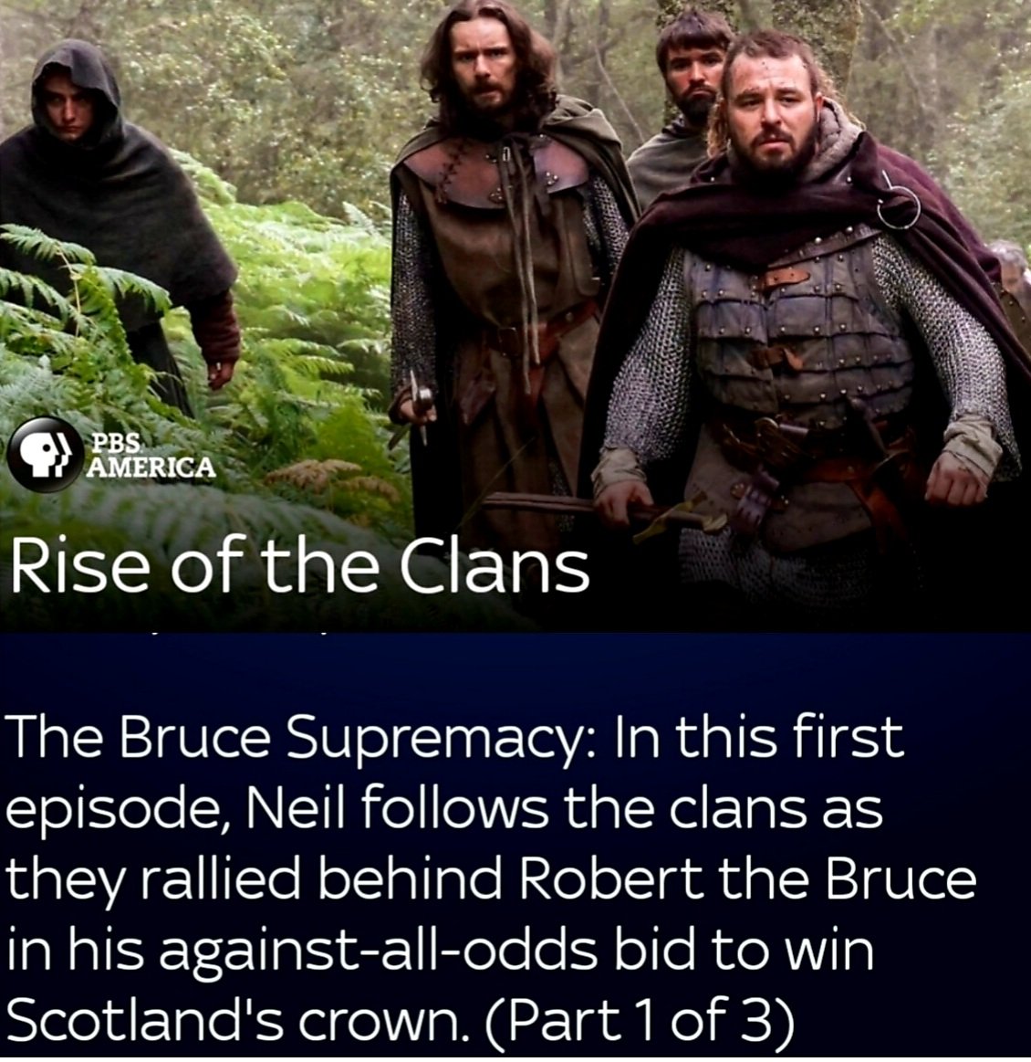
Learnt of Gaelic #IrishClans, had known abt. Scottish clans. Superb #ancientmap @StephanZL98. Checked why titled 'British Isles.' Stated-'This is purely a geographical term.'

اكتشف الخريطة البوذية التي يبلغ عمرها 1000 عام والتي تتحدى التاريخ والعلم. 🗺️ Discover the 1000-year-old Buddhist map that defies history and science. 🗺️ #egyptflatearth #truthseeker #AncientMap #الأرض_المسطحة

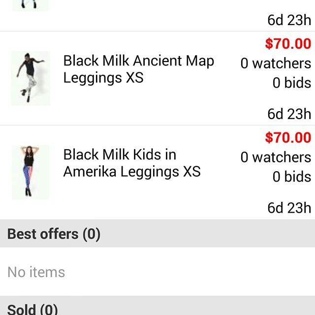
#blackmilk #BM #ancientmap #kidsinamerika #bmancientmapslegs #bmkidsinamerikalegs #blackmilkclothing by kalinakarou…

Regions of Ancient Greece (to the nearest hex). Maybe I'll do one with the cities and important locations on it... I'll see if there is interest among my patrons. Commissions available #ancientgreece #greece #ancientmap #ancientworld #hexmap #rpgmap #dndmap #dnd #dnd5e #osr


[Post-15] The ancient flood may be the mythological story but climate and land changes proof suggested by the ancient maps are indicating that event likely happened. tathastuu.com/2019/11/climat… #ancientmap #ancientaliens #ancienthistory #Antarctica
![ancientory's tweet image. [Post-15]
The ancient flood may be the mythological story but climate and land changes proof suggested by the ancient maps are indicating that event likely happened.
tathastuu.com/2019/11/climat…
#ancientmap #ancientaliens #ancienthistory #Antarctica](https://pbs.twimg.com/media/ESnJQ8fWAAIgbBw.jpg)


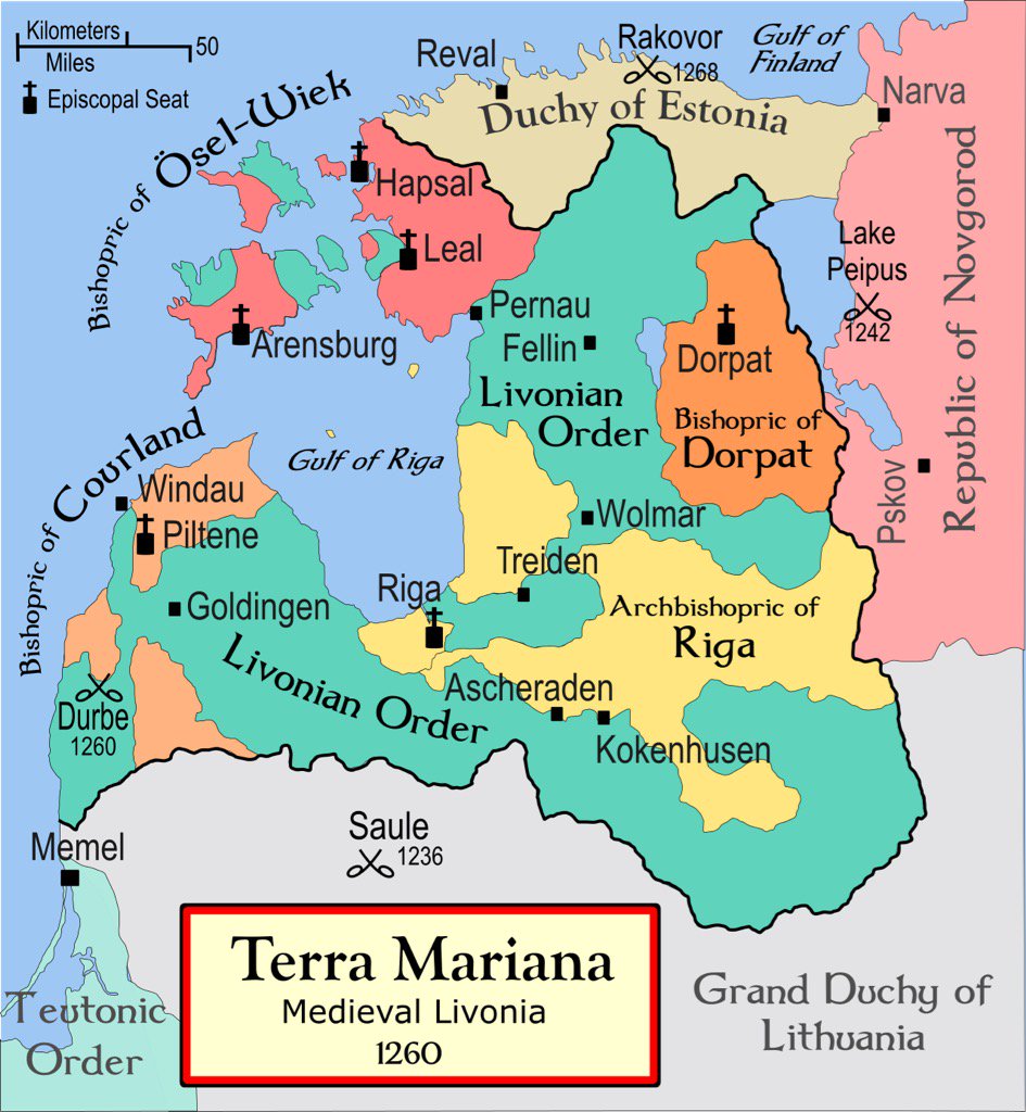
An #AncientMap of #Latvia known as medieval #Livonia, #TerraMariana. Fascinating piece of #historicalFact


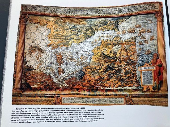
Map & Art - Change my world's view A very rare map of Mediterranean Sea, "A Conquista de Tunes", produced in Brussels between 1548 and 1554. Source: Mappa Mundi #art #artmap #ancientmap #mediterraneansea #mediterranee #reversedmap #historicalmap
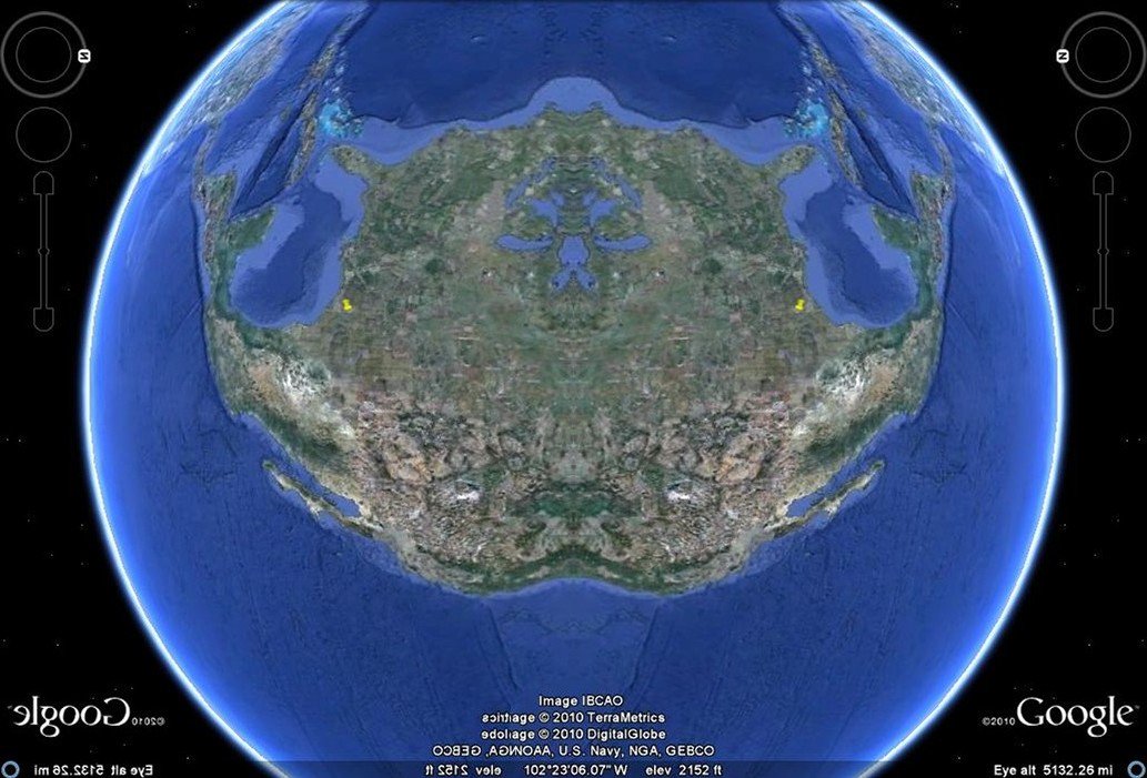
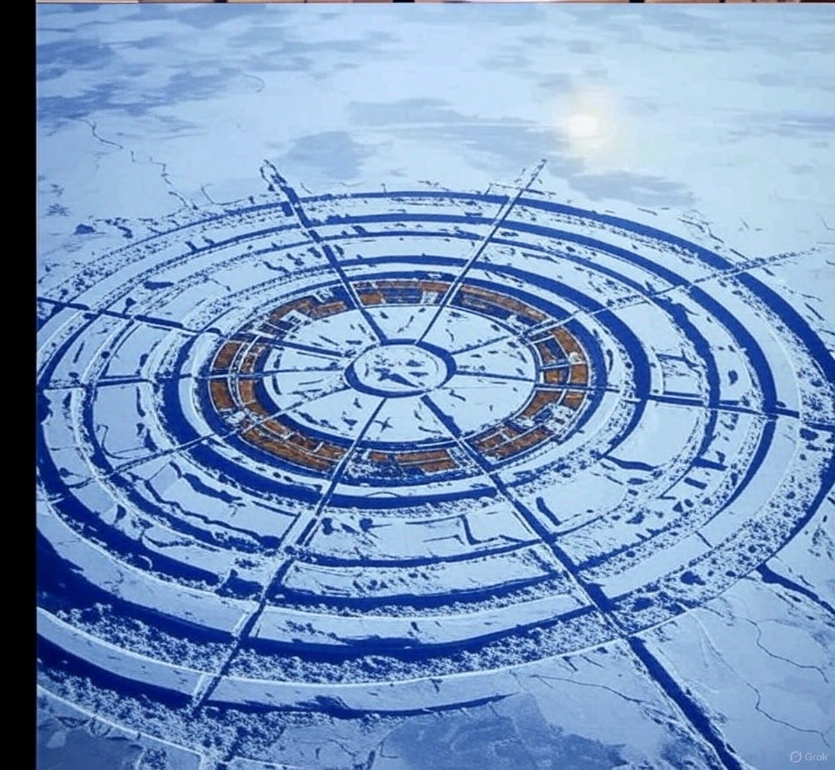
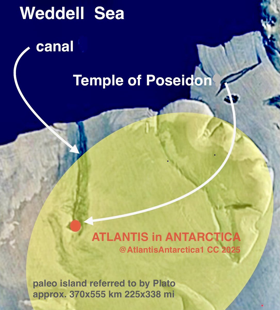
The 2002 map shows the paleocanal leading to the port of #Poseidon; #ancientmap of one of the oldest global ports located on the way to Africa was found by @atlantisantarctica1 among Konkan petroglyphs in #India. #Antarctica #AtlantisAntarctica #Konkan #petroglyph #Teslatheory
اكتشف الخريطة البوذية التي يبلغ عمرها 1000 عام والتي تتحدى التاريخ والعلم. 🗺️ Discover the 1000-year-old Buddhist map that defies history and science. 🗺️ #egyptflatearth #truthseeker #AncientMap #الأرض_المسطحة
Old World 1587 Urbano Monte Map | Vintage World Map | Ancient Map of Discoveries - VINTAGE MAPS AND PRINTS vintage-maps-prints.com/collections/vi… #worldmap #urbanomonte #ancientmap

Amazing Ancient Map! Check out my map collection linda-howes.pixels.com/featured/tribe… #Palestine #Israel #AncientMap #Wallart #AntiqueReligiousMap #ThePromiseLand #ReligiousMaps #historicMap
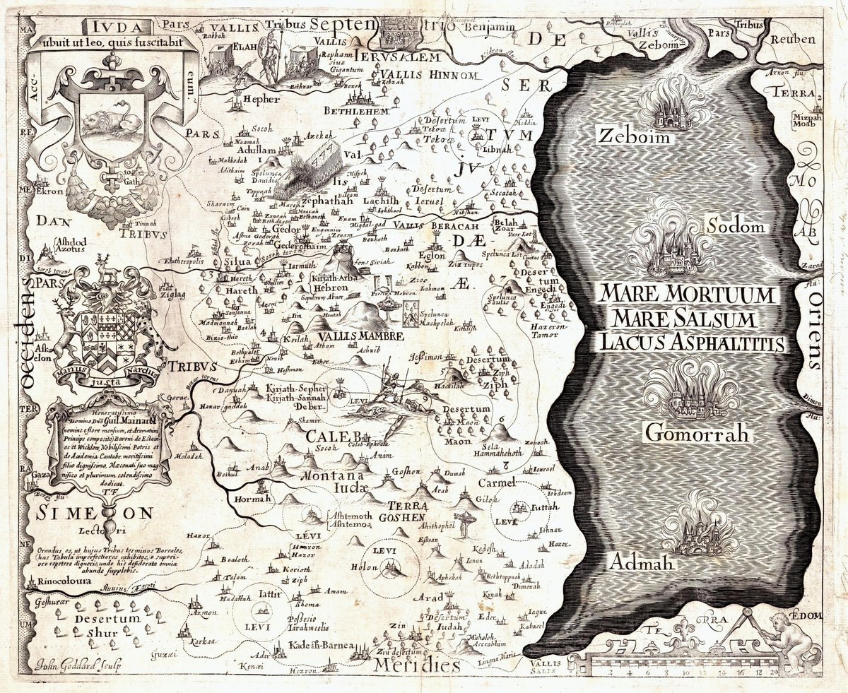

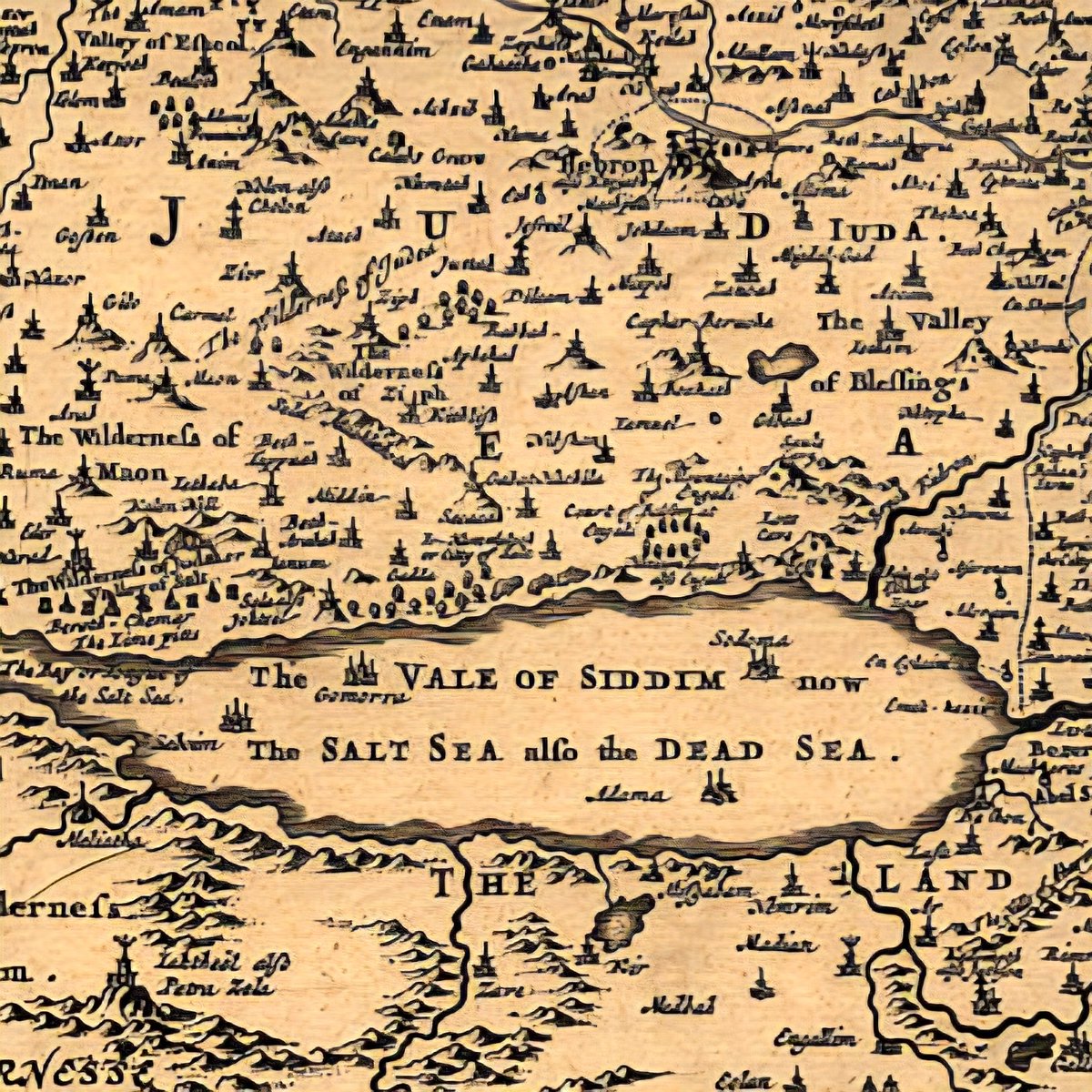
1. Ancient Maps Show Cities Inside the Dead Sea A 1650s map by Joseph Moxon labels: 🏰 “The Vale of Siddim” 🏰 “The Salt Sea also the Dead Sea” 🏰 Castle icons inside the sea. Other 1600s–1700s maps do the same — hinting these weren’t myths, but memories. #DeadSea #AncientMap

🌍🔍 Discover the untold stories of the South China Sea! Ancient maps reveal its historical significance, showcasing trade routes, cultural exchanges, and territorial claims. Let's dive into the past to understand our present! #HistoryMatters #AncientMap… ift.tt/OYRvZhI
newspaperamigo.com
Ancient Maps Reveal South China Sea’s Historical Roots 🌍🔍 - 🌍NewspaperAmigo – Your Global News...
Google Maps' renaming controversy sparks debate as ancient Western maps reveal historical ties to China's South China Sea claims. 🌊🗺️
Learnt of Gaelic #IrishClans, had known abt. Scottish clans. Superb #ancientmap @StephanZL98. Checked why titled 'British Isles.' Stated-'This is purely a geographical term.'

A discovery by Bashkir scientists reveals an intriguing finding that challenges traditional views of human history: 120-million-year-old stone plates containing a relief map of the Ural region. #AncientMap #Prehistoric #AncientTech #History #Archaeological #Ancient

I don't know what connection ancient civilizations might have had with seas or the world map as perceived by marine creatures, but this map definitely seems to depict traces of fragments from some ancient maps. Have you ever looked at it from this perspective? #ancientmap


A very simple map I did to illustrate the three major civilizations of Ancient Greece. I may go back in and add a few more city-states. #ancientgreece #historylovers #ancientmap #ancientworld #classicalage #minoan #mycenean #troy #iliad #odyssey #bronzeage
Peutinger's Tabula showing Muziris & Tyndis,ancient Indian seaports famous for their spices . 🌊🌶 #ancient #ancientmap
[Post-15] The ancient flood may be the mythological story but climate and land changes proof suggested by the ancient maps are indicating that event likely happened. tathastuu.com/2019/11/climat… #ancientmap #ancientaliens #ancienthistory #Antarctica


Fascinating map of #ancientBritain /Briton of the Angles, #ancientMap of homelands of settlers & other tribes.
#AncientMap prior to partitioning into countries. An #explorationMap used during continued invasion. 📷: Nat.Geo.


昨日アップした地図と合わせて。 #SriLanka #SriLankaOldMap #AncientMap #SriLankanAncientMap #スリランカ #スリランカの地図 #スリランカの古地図
An #AncientMap of #Latvia known as medieval #Livonia, #TerraMariana. Fascinating piece of #historicalFact

I have a map made in 1630 by Hondius depicting the State of California as an Island. #ancientmap #geography #california #phantomisland #cartography #map #island

Map & Art - Change my world's view A very rare map of Mediterranean Sea, "A Conquista de Tunes", produced in Brussels between 1548 and 1554. Source: Mappa Mundi #art #artmap #ancientmap #mediterraneansea #mediterranee #reversedmap #historicalmap

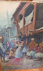
Available from the arts of the ancient east, the dancing girl by the plastic artist Medaht Al-Hinawi, 100 * 145 cm Direct sale 13700$ #artforsale #artwork #ancientmap #arteast #AuctionUpdate #Auction


Ancient Map PROVES The Lost City of Atlantis is The Eye of The Sahara – Ancient Civilization #ancientcivilization #AncientMap #Atlas #Herodotus #Mauri #TheEyeofTheSahara #TheLostCityofAtlantis greeknewsondemand.com/2018/11/02/anc…

1. Ancient Maps Show Cities Inside the Dead Sea A 1650s map by Joseph Moxon labels: 🏰 “The Vale of Siddim” 🏰 “The Salt Sea also the Dead Sea” 🏰 Castle icons inside the sea. Other 1600s–1700s maps do the same — hinting these weren’t myths, but memories. #DeadSea #AncientMap
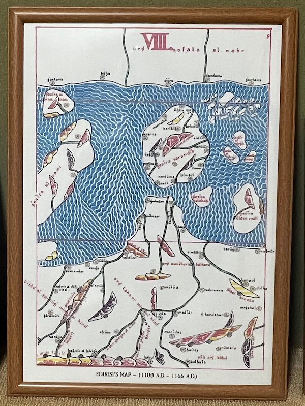
02-EDIRISI'S MAP-(1100 A.D.-1166 A.D.) #SriLanka #SriLankaOldMap #AncientMap #SriLankanAncientMap #スリランカ #スリランカの地図 #スリランカの古地図
Something went wrong.
Something went wrong.
United States Trends
- 1. #happybdayTYGA N/A
- 2. $SENS $0.70 Senseonics CGM N/A
- 3. $APDN $0.20 Applied DNA N/A
- 4. $LMT $450.50 Lockheed F-35 N/A
- 5. Peggy 34.8K posts
- 6. Sonic 06 2,968 posts
- 7. Comey 43.7K posts
- 8. Zeraora 17.1K posts
- 9. Berseria 5,613 posts
- 10. Stargate 3,873 posts
- 11. #ComunaONada 4,358 posts
- 12. Cory Mills 34.9K posts
- 13. Dearborn 396K posts
- 14. Halligan 16.1K posts
- 15. $NVDA 46.9K posts
- 16. Ryan Wedding 7,120 posts
- 17. Rick Hendrick 1,556 posts
- 18. #BoldandBeautiful N/A
- 19. Randy Jones 1,233 posts
- 20. Cooks 10.6K posts