#cartography search results

Nepal. I got tired of searching for a database showing places with new population data so I just did a basic OSM layer of cities and towns. I'm still not sure how professionals do this. It's both terrible and wonderful to figure it out on your own. #Nepal #Cartography #QGIS


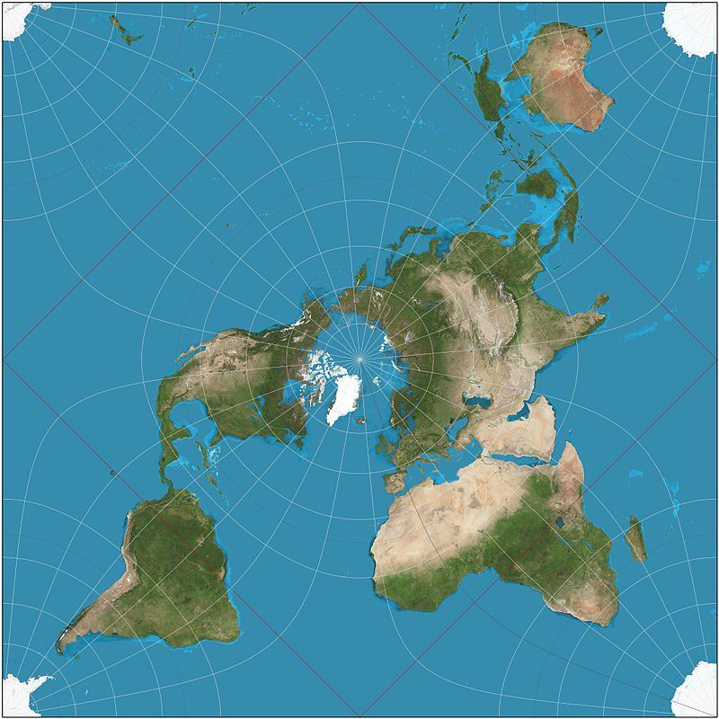
In #cartography the Peirce quincuncial projection might not be very practical but it is very pretty! ow.ly/LVWT307mgm5

Looking to brush up on your #cartography skills in 2026? Learn how to make a stylized 2.5D extract of the ocean using #ArcGISBathymetry in this blog from #Esri expert @John_M_Nelson: ow.ly/UAWW50XSbmU

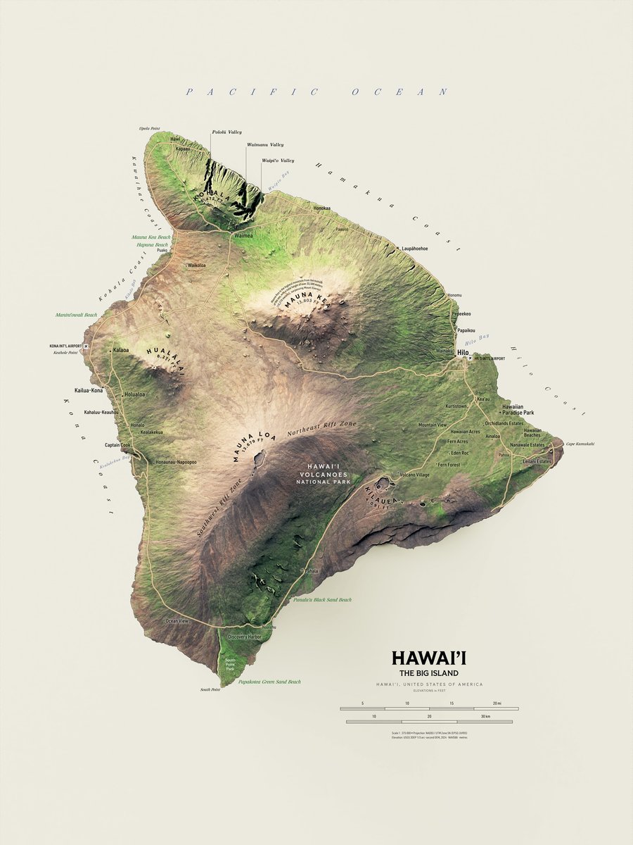
Hawai'i, the Big Island. Work very much in progress. Relief turned out fine, pretty dark on purpose. Wonderful and terrible task to choose what to label comes next. I like the major peaks labels now though. #Hawaii #Cartography #GIS

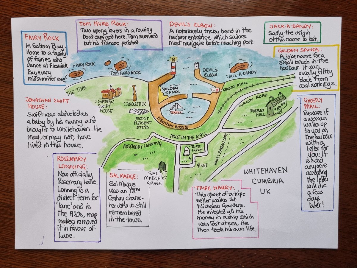
A quick sketch of the very local place names in my home town, including Tom Hurd Rock and Wheelbarrow Lane - plus a couple of ghosts! #Cartography #MappaMonday
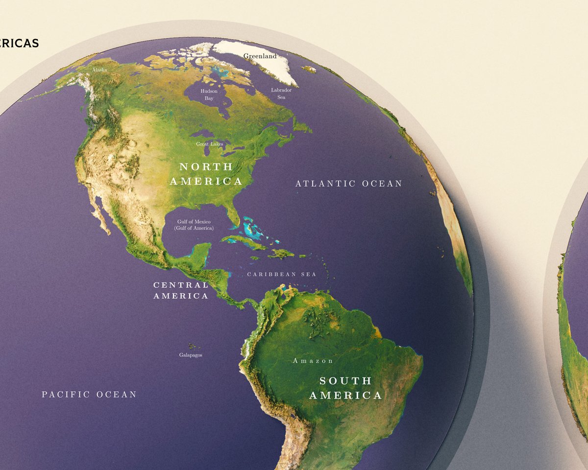
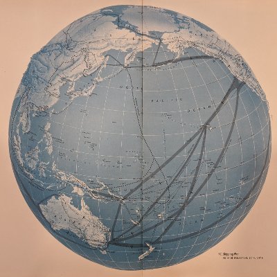
Earth. I don't particularly enjoy making world maps, that's why I haven't made a decent attempt to do one. But this was enjoyable to make and looks great to me. #Earth #globe #cartography


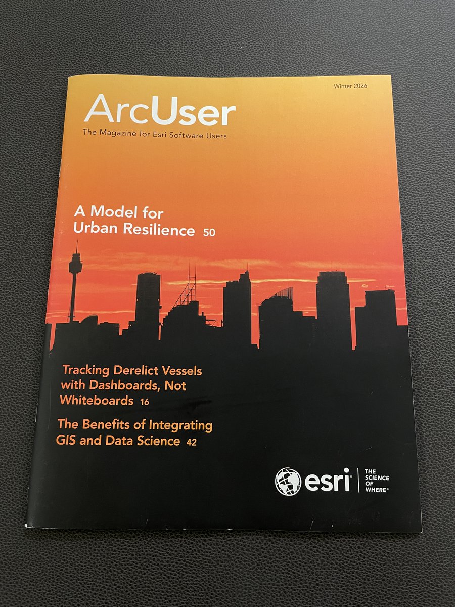
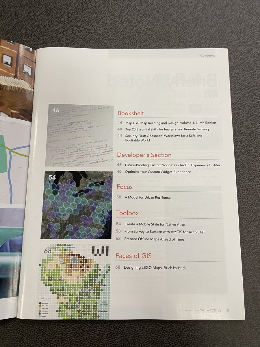
So happy to receive the printed #ArcUser! Seeing my work in a magazine that reaches hundreds of thousands feels exciting and humbling. Thanks again @Esri for helping this little #LEGO #cartography reach more people. Grateful for readers’ kind messages too! esri.com/about/newsroom…


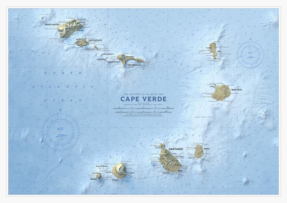
WIP Cape Verde. Another faraway place. Added bathymetry features as well to this one, bunch of depth soundings, contours and light ocean floor elevation raster. I hear it's nice over there in Cape Verde, I wish I could see it myself. #CapeVerde #GIS #cartography

Diagonal panning video from a very detailed shaded map of Genova, Italy. The full map is 36000 x 16700 pixels with 0.5 m resolution and is available at shadedmaps.github.io Data source: mappe.comune.genova.it [Comune di Genova]. #maps #shadedmaps #cartography #shadedrelief
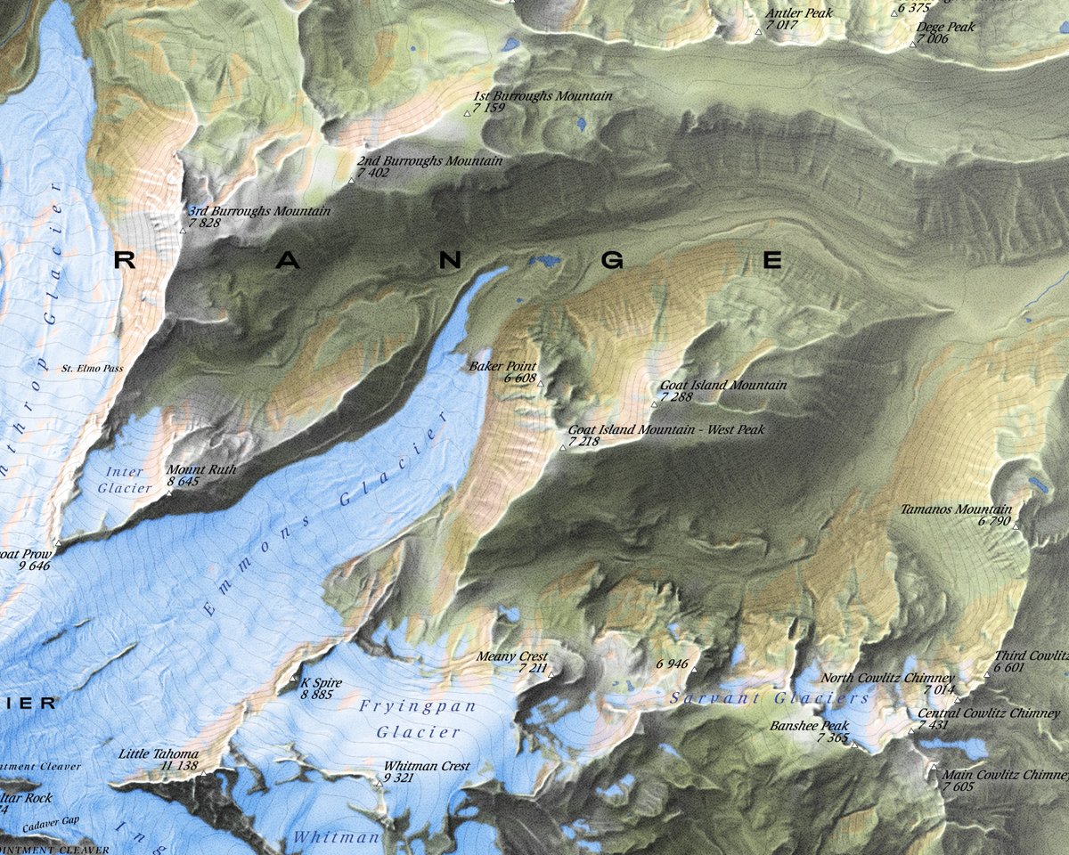
Mount Rainier. It's no big secret that I like vintage look in maps. And now I think I've come as close to my old timey favourite cartographers as I possibly can with digital tools. #MountRainier #Cartography #Vintage


Diagonal panning video from a very detailed shaded map of Riga, Latvia. The full map is 20000 x 20000 pixels with 0.5 m resolution and is available at shadedmaps.github.io Data source: georiga.eu [GEO RIGA]. #GIS #cartography #maps #gischat #dataviz

Semiotic 3.1.0 is out and it gives you all the maps you ever wanted for static or streaming data visualization with or without an AI assistant. Features below in the🧵 #dataviz #cartography #maps
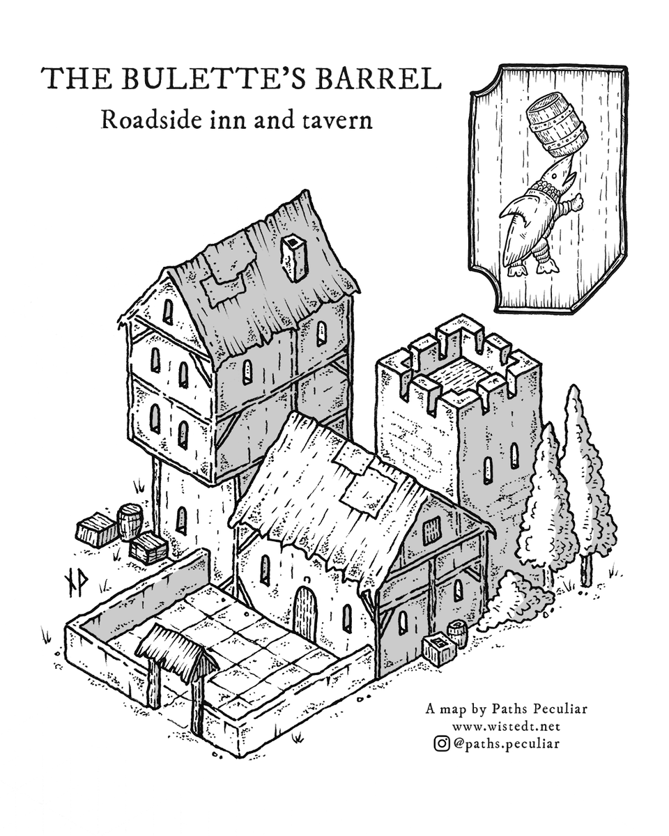
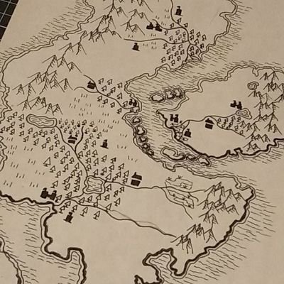
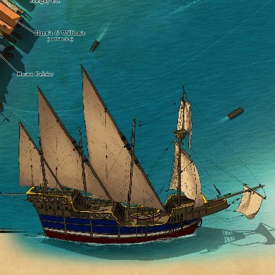
The Bulette’s Barrel was one of the first isometric drawings I made, and while it’s a bit crude I still have a soft spot for it. These old drawings were formative for the style I have today. #isometric #cartography #dnd #dungeonsanddragons #handdrawn

Russia vs South America — nearly identical in area! South America edges ahead at 17.7M km² vs Russia's 17M km². The Mercator projection makes Russia look far larger than an entire continent. — @MapPorn_Zone55 · link in bio #MapPorn #cartography


Tutorial Mapping with Python: How to export a map in PNG or PDF format using Python? Full tutorial link: youtube.com/live/oqHt7pa-f… #mapping #GIS #cartography #cartographer #geospatialdata #GeoAI #GeospatialTechnology

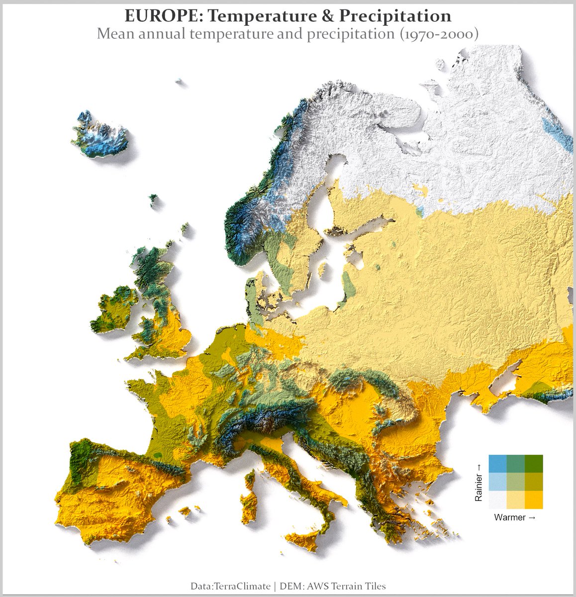
Europe’s climate is a battlefield between warm air, mountains, and moisture. My map combines mean annual temperature + precipitation (1970–2000): •warmer → (yellow) •rainier ↑ (blue/green) What region on this map is the sweet spot for you? #milosmakesmaps #cartography

Become a Free member and get: - 41 Free Adventures - A series of amazing collaborations with other TTRPG creators - Universes Collide. A series of pop-culture characters turned into fun D&D statblocks patreon.com/posts/freemium… #TTRPG #cartography #dnd5e #battlemaps #isometric

My map shows life expectancy at birth across Europe, and the gap is stark. What do you think explains the biggest differences: income, healthcare access, diet, pollution, or something else? #GIS #Mapping #Cartography #DataViz #Europe #LifeExpectancy #Health #Inequality

Russia vs South America — nearly identical in area! South America edges ahead at 17.7M km² vs Russia's 17M km². The Mercator projection makes Russia look far larger than an entire continent. — @MapPorn_Zone55 · link in bio #MapPorn #cartography

📘Evaluating Cartographic Communication in Croatian National Parks: User Perceptions of Pictograms By Iva Cibilić and Vesna Poslončec-Petrić 👉See the paper: mdpi.com/2220-9964/14/2… #touristmap #maps #cartography #pictograms #nationalparks

Save the date - May 28th 2026! 🥳 Get ready to start your adventure in Map Map – A Game About Maps 🗺️📍 We’re beyond excited to release our very first title. Thank you all so much for your support 🤗 #gamedev #indiegame #cartography
Diagonal panning video from a very detailed shaded map of Riga, Latvia. The full map is 20000 x 20000 pixels with 0.5 m resolution and is available at shadedmaps.github.io Data source: georiga.eu [GEO RIGA]. #GIS #cartography #maps #gischat #dataviz
A very detailed shaded map of Riga, Latvia. The full map is 20000 x 20000 pixels with 0.5 m resolution and is available at shadedmaps.github.io Data source: georiga.eu [GEO RIGA]. #GIS #cartography #maps #gischat #dataviz
![ShadedMaps's tweet image. A very detailed shaded map of Riga, Latvia. The full map is 20000 x 20000 pixels with 0.5 m resolution and is available at shadedmaps.github.io
Data source: georiga.eu [GEO RIGA].
#GIS #cartography #maps #gischat #dataviz](https://pbs.twimg.com/media/HGqTmGxWwAEbHB9.jpg)
![ShadedMaps's tweet image. A very detailed shaded map of Riga, Latvia. The full map is 20000 x 20000 pixels with 0.5 m resolution and is available at shadedmaps.github.io
Data source: georiga.eu [GEO RIGA].
#GIS #cartography #maps #gischat #dataviz](https://pbs.twimg.com/media/HGqTm3qWwAA1doU.jpg)
![ShadedMaps's tweet image. A very detailed shaded map of Riga, Latvia. The full map is 20000 x 20000 pixels with 0.5 m resolution and is available at shadedmaps.github.io
Data source: georiga.eu [GEO RIGA].
#GIS #cartography #maps #gischat #dataviz](https://pbs.twimg.com/media/HGqTnMuXMAAiFQC.jpg)
![ShadedMaps's tweet image. A very detailed shaded map of Riga, Latvia. The full map is 20000 x 20000 pixels with 0.5 m resolution and is available at shadedmaps.github.io
Data source: georiga.eu [GEO RIGA].
#GIS #cartography #maps #gischat #dataviz](https://pbs.twimg.com/media/HGqTng9XEAAqWIg.jpg)
We’re part of today’s @SecondWindGroup showcase, and we’ve got some BIIIIIIG news to share! 😯 Make sure to tune in on YouTube at 10 PM CEST so you don’t miss it 🤗 youtube.com/watch?v=p8b5hT… #gamedev #indiedev #cartography

youtube.com
YouTube
Second Wind

#بوسترات_تعليمية_جغرافية الكارتوغرافيا (Cartography): علم وفن تصميم الخرائط بطريقة دقيقة وجذابة. 🔹 #Cartography #Maps #GIS


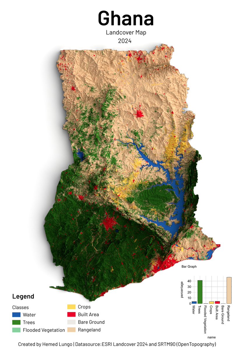
🌍 Ghana Landcover Map 2024 🇬🇭🗺️ From tropical forests to northern savannas — Ghana's landscape mapped using ESRI Landcover 2024 by @impactobservatory & @esri, and SRTM90 DEM by @opentopography. 🛠️ QGIS · Blender 🧭 Hemed Lungo #GIS #Cartography #Ghana #Landcover #Geospatial
A very detailed shaded map of Copenhagen, Denmark. The full map is 25000 x 25000 pixels with 0.5 m resolution and is available at shadedmaps.github.io Data source: dataforsyningen.dk [Danish Agency for Data Supply]. #lidar #shadedrelief #cartography #gischat #geography
![ShadedMaps's tweet image. A very detailed shaded map of Copenhagen, Denmark. The full map is 25000 x 25000 pixels with 0.5 m resolution and is available at shadedmaps.github.io
Data source: dataforsyningen.dk [Danish Agency for Data Supply].
#lidar #shadedrelief #cartography #gischat #geography](https://pbs.twimg.com/media/HGgv4BHXsAAbVER.jpg)
![ShadedMaps's tweet image. A very detailed shaded map of Copenhagen, Denmark. The full map is 25000 x 25000 pixels with 0.5 m resolution and is available at shadedmaps.github.io
Data source: dataforsyningen.dk [Danish Agency for Data Supply].
#lidar #shadedrelief #cartography #gischat #geography](https://pbs.twimg.com/media/HGgv5sRXgAEomf2.jpg)
![ShadedMaps's tweet image. A very detailed shaded map of Copenhagen, Denmark. The full map is 25000 x 25000 pixels with 0.5 m resolution and is available at shadedmaps.github.io
Data source: dataforsyningen.dk [Danish Agency for Data Supply].
#lidar #shadedrelief #cartography #gischat #geography](https://pbs.twimg.com/media/HGgv68cXcAAE60h.jpg)
![ShadedMaps's tweet image. A very detailed shaded map of Copenhagen, Denmark. The full map is 25000 x 25000 pixels with 0.5 m resolution and is available at shadedmaps.github.io
Data source: dataforsyningen.dk [Danish Agency for Data Supply].
#lidar #shadedrelief #cartography #gischat #geography](https://pbs.twimg.com/media/HGgv8L7XAAE9vwc.jpg)

This collaboration has been a journey of mutual growth, while, as they expand every year their luxury footprint, I continue to evolve my craft as a cartographer. #cARTography #MakingMapsPretty #QGIS #AdobeIllustrator

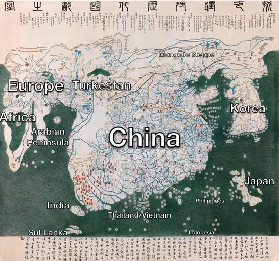
Exploring the Kangnido: 1402 World Map from Korea Read more: linkedin.com/feed/update/ur… #GeoICT #cartography #historicalmaps #mapanalysis #Korea ©️ Joseon dynasty, Public domain, via Wikimedia Commons

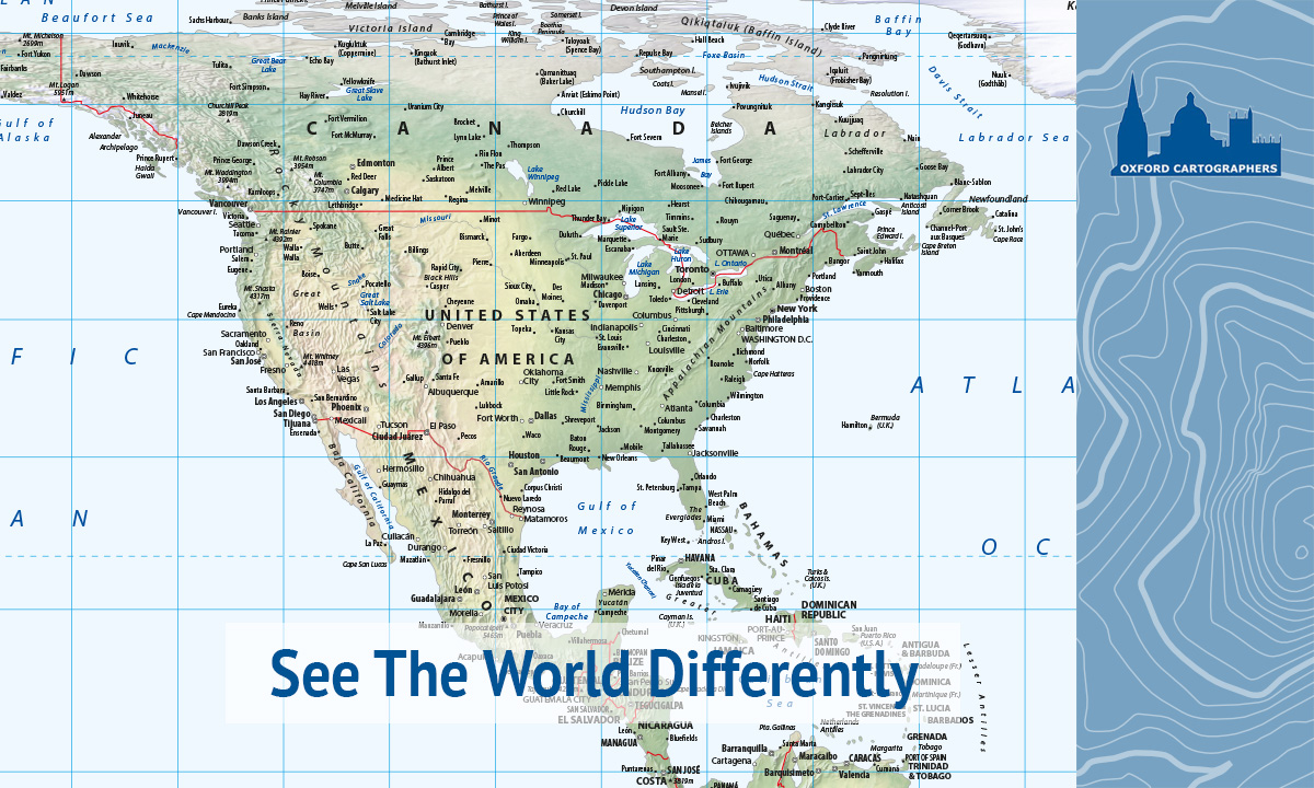
The new Hobo-Dyer Equal Area World Map is here - now with detailed physical relief shading and two typographic styles to choose from. Updated for 2026. Find out more: oxfordcartographers.com/new-hobo-dyer-… #HoboDyer #WorldMap #Cartography #OxfordCartographers #EqualAreaMap
Saudi Arabia emits ~20t CO₂ per person — more than the combined per capita output of Brazil, India, and Nigeria. Oil wealth leaves a massive carbon footprint. — @MapPorn_Zone55 · link in bio #MapPorn #cartography


These unique cartographic treasures offer insight into historical geography, cultural heritage, and the evolution of regions over time – showcasing how our understanding of the world has changed through centuries. #UniversityofSzeged #History #Cartography #CulturalHeritage
Rare Historic Maps at the University of Szeged📜 Discover a fascinating glimpse into the past through a special collection of rare historic maps presented by the University of Szeged. u-szeged.hu/news-and-event… #UniversityofSzeged #History #Cartography #Research #CulturalHeritage
Rare Historic Maps at the University of Szeged📜 Discover a fascinating glimpse into the past through a special collection of rare historic maps presented by the University of Szeged. u-szeged.hu/news-and-event… #UniversityofSzeged #History #Cartography #Research #CulturalHeritage
The US GDP per capita (~$80K) is more than the bottom 100 countries combined in average wealth per person. One red country dwarfs an entire dark continent. — @MapPorn_Zone55 · link in bio #MapPorn #cartography


In Cartographica 61.1, explore studies that challenge conventional mapping frameworks, and expand your understanding of how mapping intersects with technology, social justice, and cultural heritage. Read the full issue: bit.ly/CART611 #Geography #Cartography


#MeTVBatman #cartography 4 the map nerds like me, #NewGuernsey is a spoof of #NewJersey; "Old" Jersey is in the #ChannelIslands (off the coast of #France, not #California. #Guernsey is the other island.
My #LEGO map collection was on display (4/9-4/16) at the lounge of Environmental Sciences Department, @EmoryUniversity, coordinated by Prof. Xiao Huang. 🗺️ #Map #Cartography #MOC #Emory
Niger's median age is ~15 years — younger than every country in Europe by more than 25 years. Half of Niger's population hasn't finished primary school age yet. — @MapPorn_Zone55 · link in bio #MapPorn #cartography


🌍 Ghana Landcover Map 2024 🇬🇭🗺️ From tropical forests to northern savannas — Ghana's landscape mapped using ESRI Landcover 2024 by @impactobservatory & @esri, and SRTM90 DEM by @opentopography. 🛠️ QGIS · Blender 🧭 Hemed Lungo #GIS #Cartography #Ghana #Landcover #Geospatial
Nepal. I got tired of searching for a database showing places with new population data so I just did a basic OSM layer of cities and towns. I'm still not sure how professionals do this. It's both terrible and wonderful to figure it out on your own. #Nepal #Cartography #QGIS
Earth. I don't particularly enjoy making world maps, that's why I haven't made a decent attempt to do one. But this was enjoyable to make and looks great to me. #Earth #globe #cartography
Hawai'i, the Big Island. Work very much in progress. Relief turned out fine, pretty dark on purpose. Wonderful and terrible task to choose what to label comes next. I like the major peaks labels now though. #Hawaii #Cartography #GIS
A quick sketch of the very local place names in my home town, including Tom Hurd Rock and Wheelbarrow Lane - plus a couple of ghosts! #Cartography #MappaMonday
Mount Rainier. It's no big secret that I like vintage look in maps. And now I think I've come as close to my old timey favourite cartographers as I possibly can with digital tools. #MountRainier #Cartography #Vintage
In #cartography the Peirce quincuncial projection might not be very practical but it is very pretty! ow.ly/LVWT307mgm5
WIP Cape Verde. Another faraway place. Added bathymetry features as well to this one, bunch of depth soundings, contours and light ocean floor elevation raster. I hear it's nice over there in Cape Verde, I wish I could see it myself. #CapeVerde #GIS #cartography
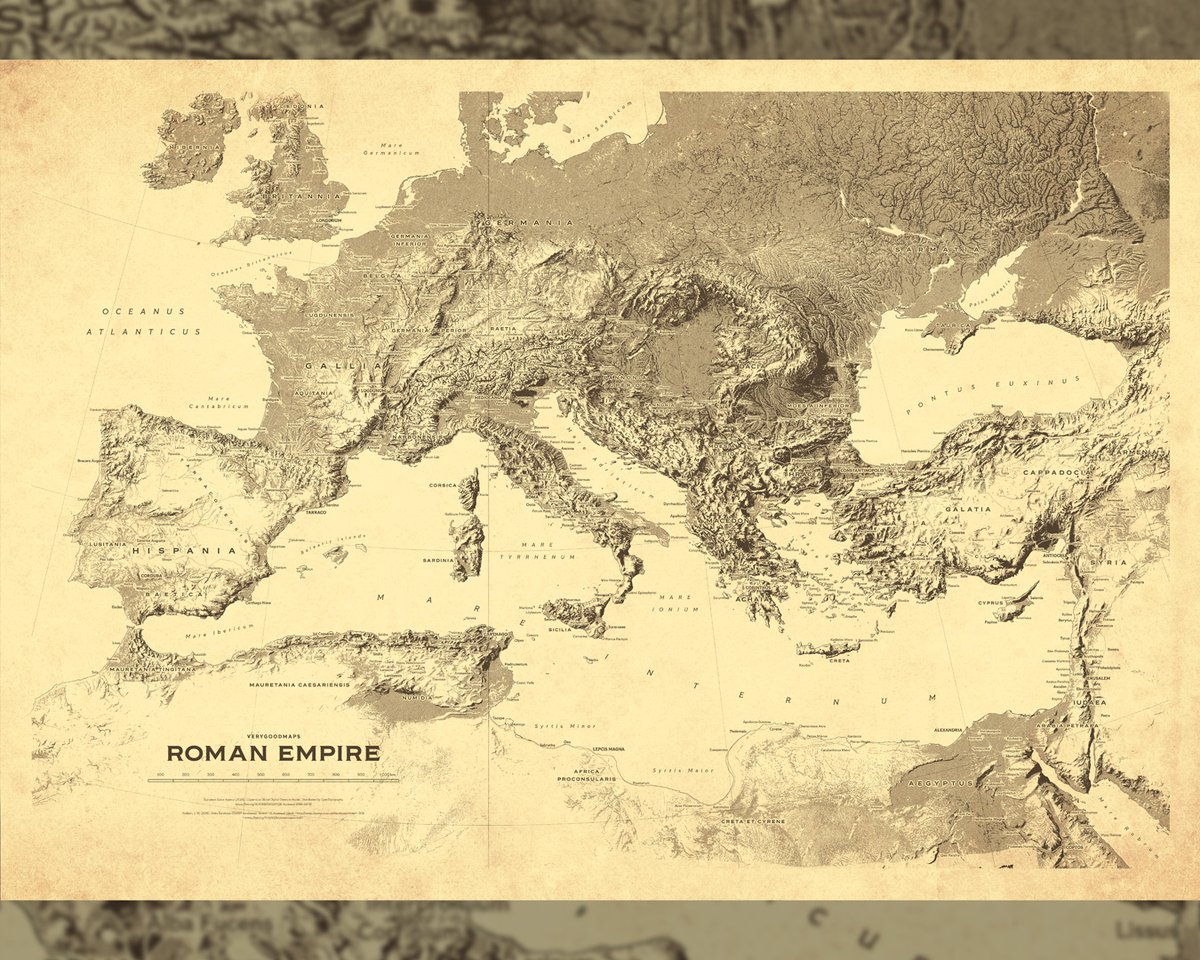
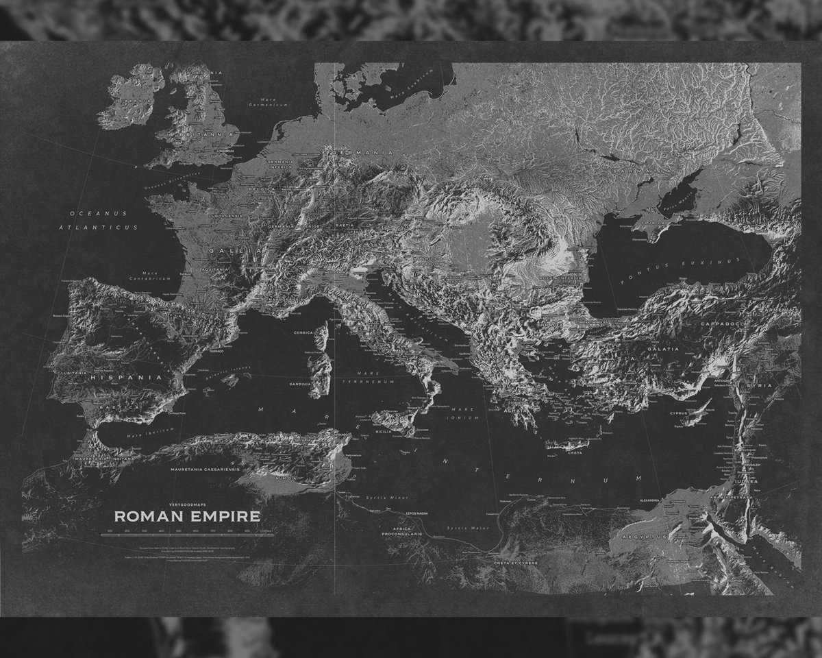
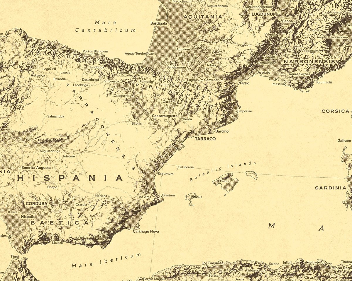
I wanted to make something to decorate my own walls so I developed a specific style. I will call it 'Yellow Pages-style'. I also made an inverted and desaturated version that also pleases me very much. And they will look great as 100x70 cm posters. #rome #empire #cartography

The Bulette’s Barrel was one of the first isometric drawings I made, and while it’s a bit crude I still have a soft spot for it. These old drawings were formative for the style I have today. #isometric #cartography #dnd #dungeonsanddragons #handdrawn
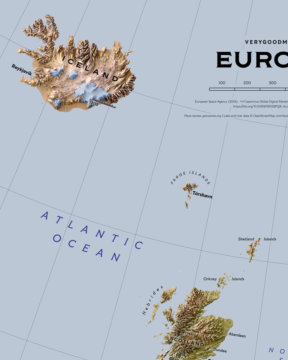
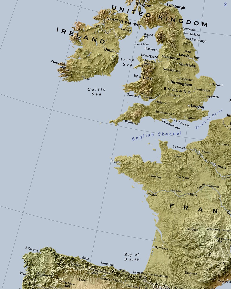
Europe map (70x100 cm) in store at verygoodmaps.com I guess many people make Europe map a horizontal one but this is the way I roll. #europe #map #cartography

Looking to brush up on your #cartography skills in 2026? Learn how to make a stylized 2.5D extract of the ocean using #ArcGISBathymetry in this blog from #Esri expert @John_M_Nelson: ow.ly/UAWW50XSbmU

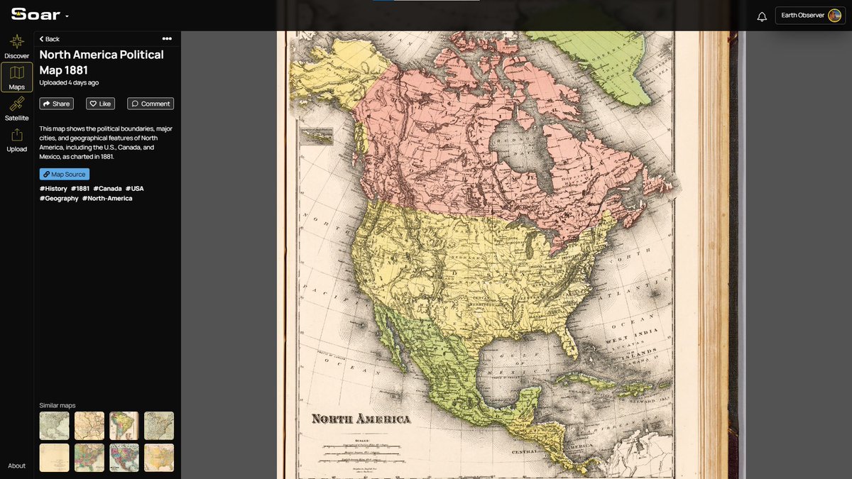
American politics sure has changed over the years. Travel back to 1881 and see the boundary lines of America, where even names have shifted with time and culture. Map: soaratlas.com/maps/north-ame… #Maps #Cartography #History #OldMaps #NorthAmerica #Geography #MapNerds

When your work shows up in someone else’s map, you feel the spark twice, once in making, and once in witnessing. Huge thanks to Janhavi for the mention and for this beautiful #30DayMapChallenge piece. #GIS #Cartography #Mapping #DataViz #30DayMapChallenge


#TimesEvoke | 'Traditional #cartography holds power - #radicalmapping brings people's voices onto the grid'. Michael Duggan, Lecturer in Digital Culture and Technology @KingsCollegeLon discusses new geographies with @srijanapiya17 in #TimesEvoke. Read here:

#بوسترات_تعليمية_جغرافية الكارتوغرافيا (Cartography): علم وفن تصميم الخرائط بطريقة دقيقة وجذابة. 🔹 #Cartography #Maps #GIS
My map shows life expectancy at birth across Europe, and the gap is stark. What do you think explains the biggest differences: income, healthcare access, diet, pollution, or something else? #GIS #Mapping #Cartography #DataViz #Europe #LifeExpectancy #Health #Inequality
Map Festival: This looks like a great event hosted by the National Library of Scotland @nls map room at Causewayside, on the 6th of February. Full details on their website. #mapfestival #maps #cartography #edinburghevent buff.ly/QeBePCH

Another Salish Sea map finds a home! Looks pretty happy to me! #cartography #salishsea #maps #wallart clarkgeomatics.ca

Something went wrong.
Something went wrong.
United States Trends
- 1. Invited Users N/A
- 2. Gen V N/A
- 3. Wyatt Sicks N/A
- 4. Nikki Cross N/A
- 5. The Boys N/A
- 6. Zoey Stark N/A
- 7. Custom N/A
- 8. Joe Gacy N/A
- 9. Kay Lee Ray N/A
- 10. Jayden Reed N/A
- 11. FFXIV N/A
- 12. Betis N/A
- 13. Alba Fyre N/A
- 14. Ray J N/A
- 15. Lucha Underground N/A
- 16. Vought Rising N/A
- 17. Tegan Kuhns N/A
- 18. Evercold N/A
- 19. Marie N/A
- 20. Far Cry N/A