#environmentalmapping search results

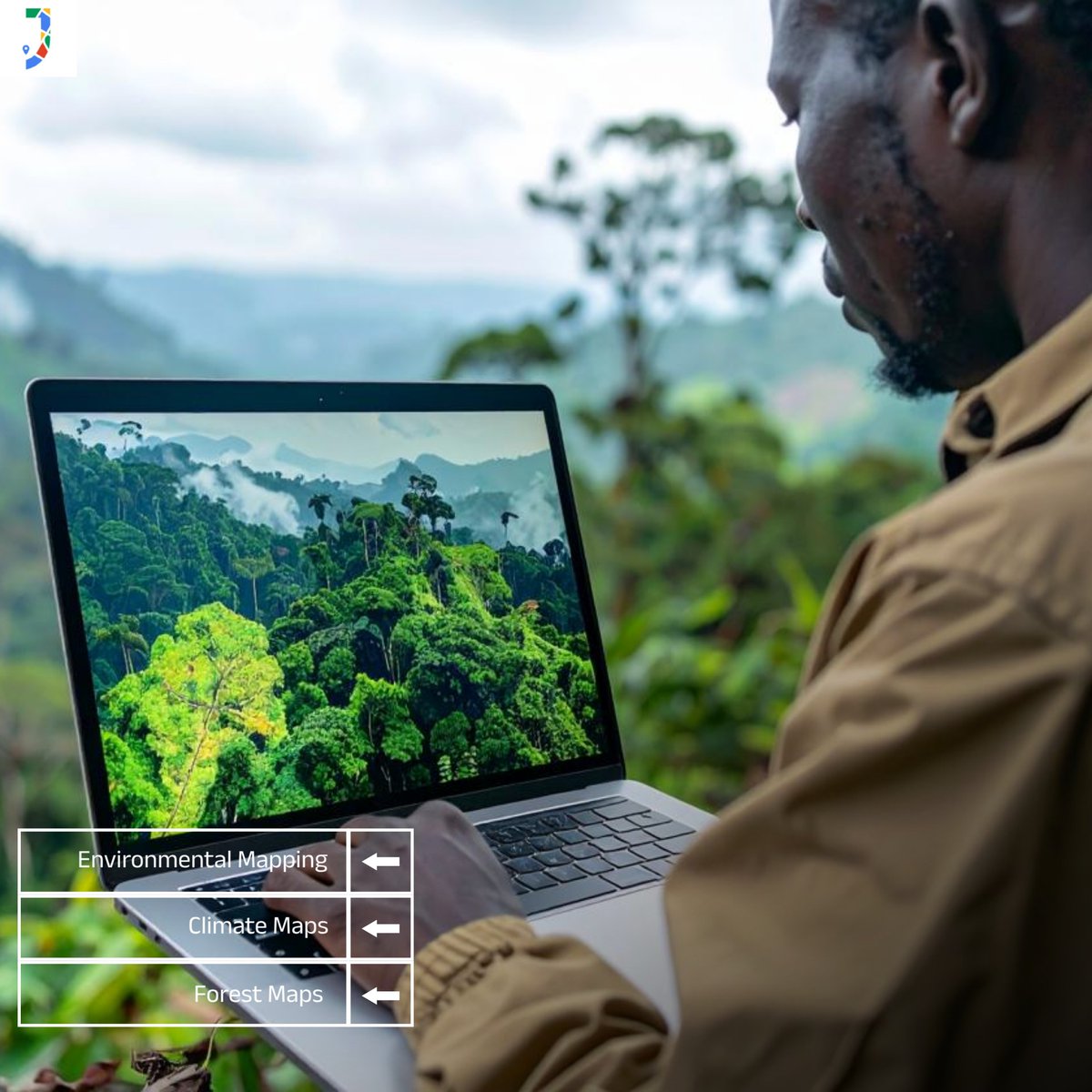
Environmental infographic and maps showing forests, pollution zones and conservation elements. #JapakGIS #EnvironmentalMapping #ClimateActionGIS #SustainableDevelopment
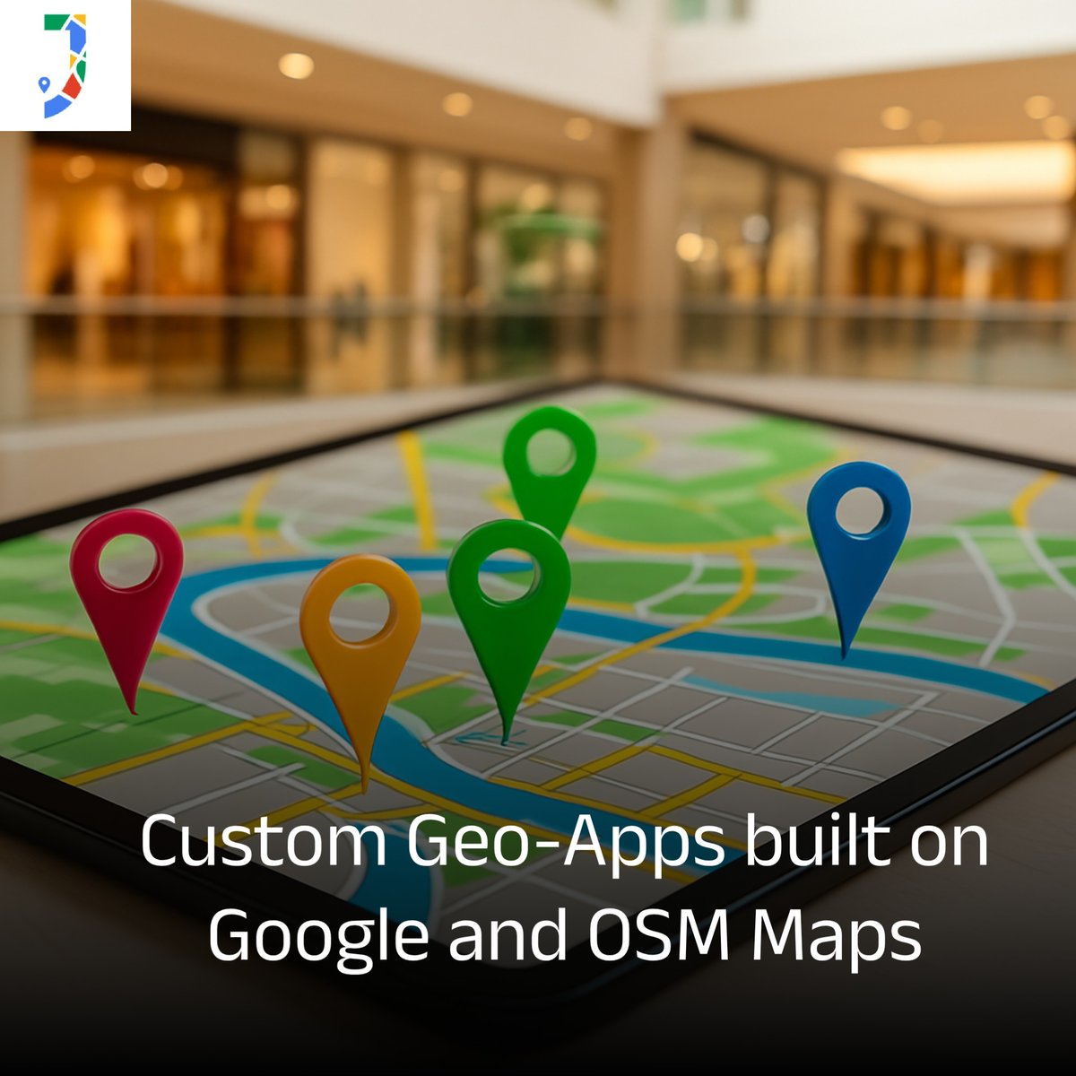
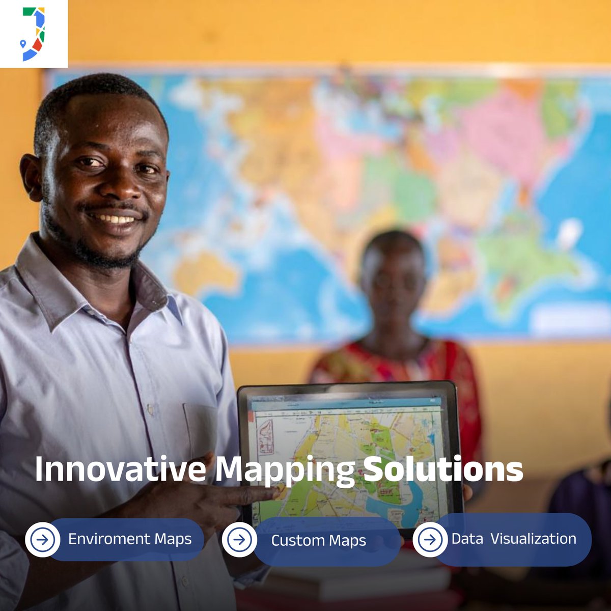
JapakGIS specializes in creating custom geo-apps that enhance decision-making across various sectors, including government, NGOs, and real estate. 📊 #JapakGIS #EnvironmentalMapping #ClimateActionGIS #SustainableDevelopment #RealEstateMapping #DevelopmentMapping
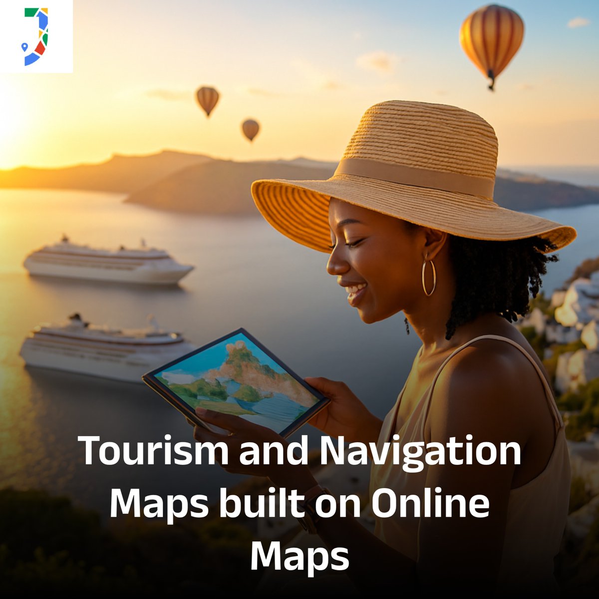
Cruise lines and resorts use Maps to visualize shuttle routes and manage guest logistics efficiently. 🌍 #JapakGIS #EnvironmentalMapping #ClimateActionGIS #SustainableDevelopment #RealEstateMapping #CapacityBuildingGIS #GISTraining #GeoForGood #DevelopmentMapping
Discover how JapakGIS leverages GIS and Remote Sensing for precise mapping activities. 🌍✨ #JapakGIS #EnvironmentalMapping #ClimateActionGIS #SustainableDevelopment #RealEstateMapping #CapacityBuildingGIS #GISTraining #GeoForGood #DevelopmentMapping
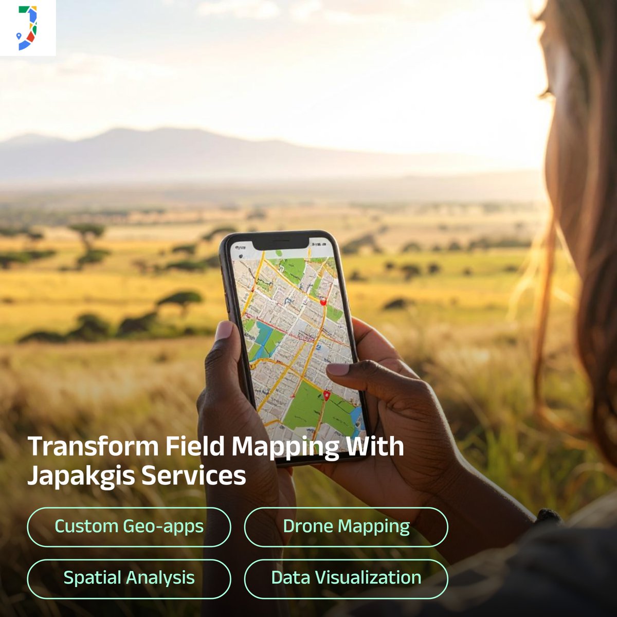
Discover how JapakGIS leverages field data to display live maps with GPS tracking, markers, and routes.. 🌍✨ #JapakGIS #EnvironmentalMapping #ClimateActionGIS #SustainableDevelopment #RealEstateMapping #CapacityBuildingGIS #GISTraining #GeoForGood #DevelopmentMapping
JapakGIS enhances water mapping using satellite imagery and aerial data for informed decision-making. 🌍✨ #JapakGIS #EnvironmentalMapping #ClimateActionGIS #SustainableDevelopment #GISTraining #GeoForGood #DevelopmentMapping

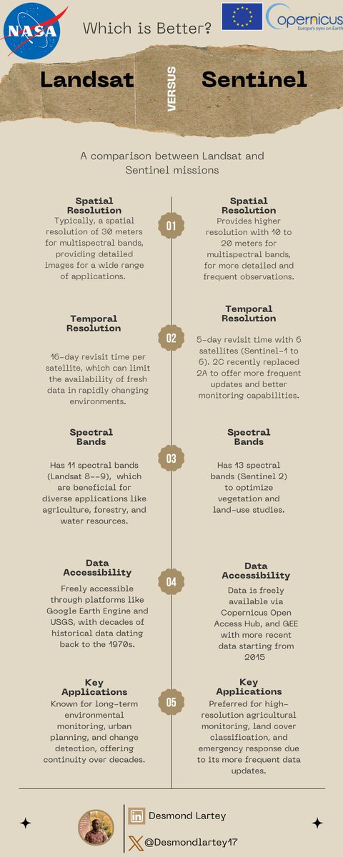
Geospatial Analysts - Which is better? Landsat versus Sentinel #RemoteSensing #EnvironmentalMapping #SatelliteImageryForGIS #MonitoringLandUseChange #GeospatialDataApplicationsToday #EarthObservationSatelliteDataAnalysis #LandsatAndSentinelComparisonForRemoteSensing

🗺️ We've supported a Scottish consortium to develop new standards for assessing the reliability of #AI & #MachineLearning in #EnvironmentalMapping The TAiM initiative sets clear benchmarks for trustworthy, real-world AI use, funded by #InnovateUK. More: ow.ly/poTK50VYLEg


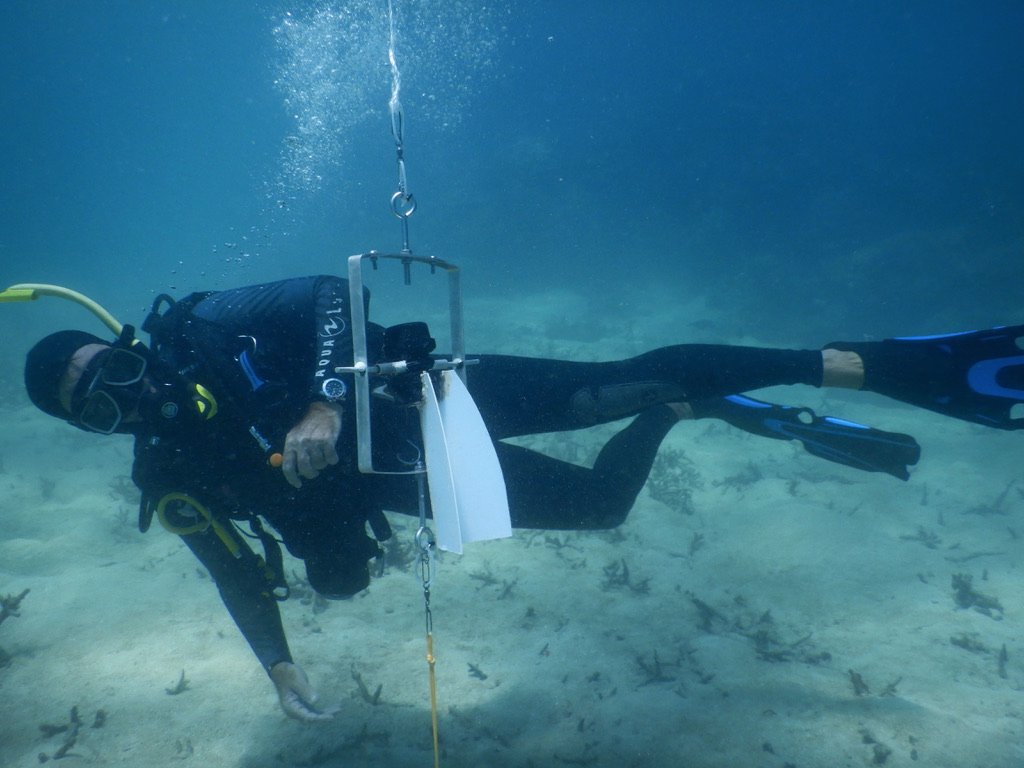
John @reefsnorkel getting horizontal to check out my loggers. Interested to see what data we can gather from this set up for some #environmentalmapping across reef sites. #trialanderror #DIY #bunningsVIPmember #lateralthinking @DavidJSuggett @emmafcamp @UTS_Science @uts_c3

Can Your Ai Do This? Spatial Reality AI: Redefining Immersive Experiences with AI. Discover.Ai/SpatialReality… Immerse #SpatialComputing #AugmentedReality #EnvironmentalMapping #MixedReality #DigitalTwins #SpatialAwareness #VirtualEnvironments #InteractiveSpaces #RealityCapture


Exploring geospatial platforms for mapping flood risks or carbon sinks? These tools are essential for understanding local impacts. #GeospatialAnalysis #EnvironmentalMapping 🌍 bit.ly/3HCiRA8


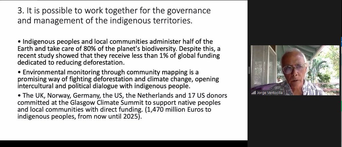
Jorge Ventocilla says we are in the fight of our lives, and we must fight it as one. #EnvironmentalMapping #IndigenousKnowledge #COP26

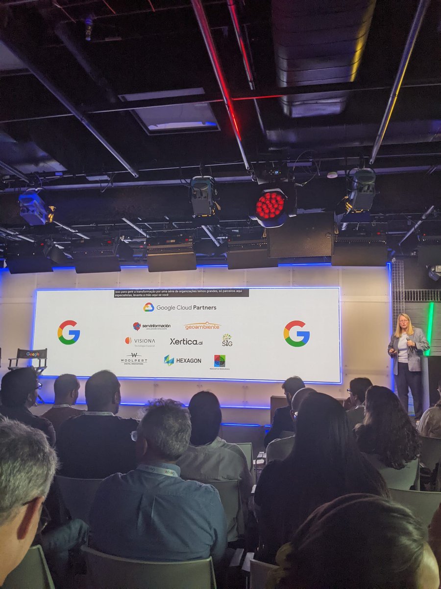
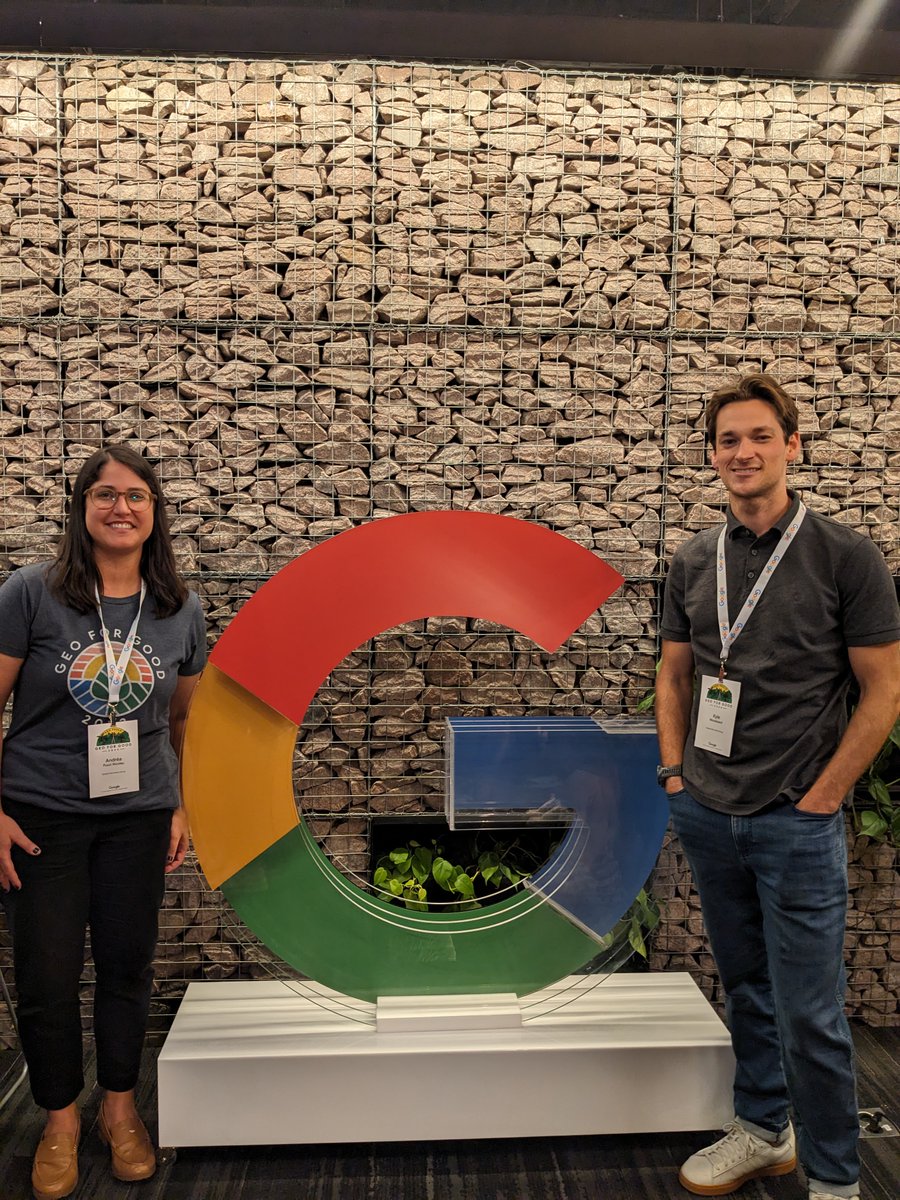
Our experts Andréa Puzzi Nicolau and Kyle Woodward are at the Geo for Good Mini Summit in São Paulo, sharing their expertise in multiple sessions. Proud of their work and learning from colleagues! #GeoForGood #EnvironmentalMapping #GISExperts

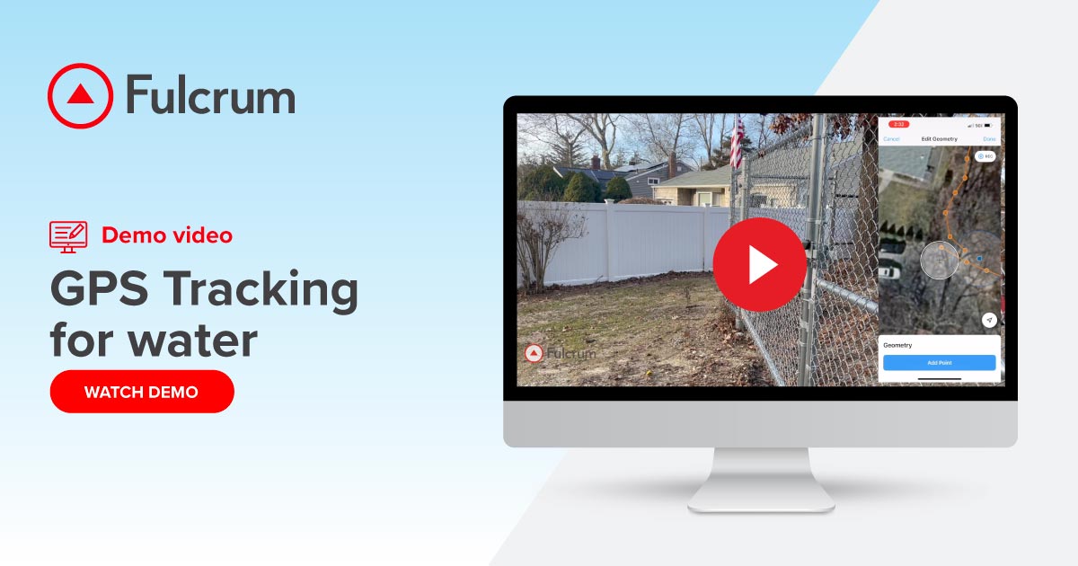
🚶♂️ Walk it. Map it. Trust it. See how Fulcrum simplifies environmental boundary mapping. Just walk the perimeter, pause/resume your track, and auto-link the final map to your field notes. tinyurl.com/z2xfkfzx #FieldData #EnvironmentalMapping #GPS

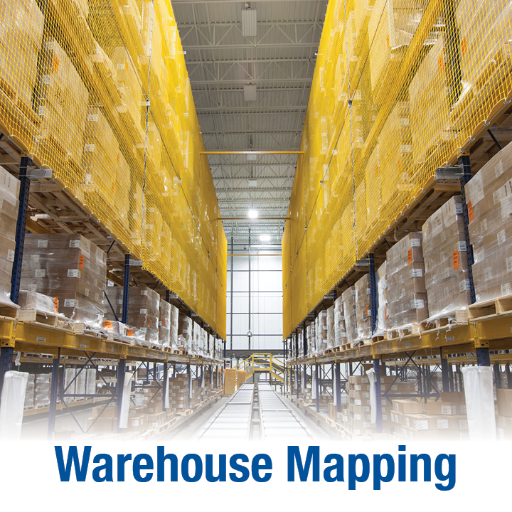
Want to see NEXA's Validation services in action? The team partnered with a leading medical supply distributor for a large-scale warehouse environmental mapping project. View the case study here: ow.ly/hBpB50Txwqm #NEXA #validation #environmentalmapping #warehousemapping

Central Alliance to use satellite technology to map South Wales coal tips climateglobalnews.com/central-allian… #SatelliteTechnology #CentralAlliance #EnvironmentalMapping #GeospatialAnalysis #SustainableDevelopment
climateglobalnews.com
Central Alliance to use satellite technology to map South Wales coal tips - Climate Global News
Ground engineering company Central Alliance is working with the Welsh Government on a project that will map and evaluate 83 South Wales coal tips, providing vital information on their topography and...
We're teaming up with @WorldResources for the #ForestDataPartnership to enhance our understanding of oil palm plantations. Together, we're coordinating with local image interpreters to generate oil palm reference data and develop fieldwork strategies.🌳🤝#EnvironmentalMapping
‘Google Launches New Sustainability Tools to Help Businesses and Cities Map Environmental Information Google has launched three new APIs from Google Maps' Read more here: esgnews.com/google-launche… #esgafricaconference #GoogleSustainability #EnvironmentalMapping

Today sees the 39th meeting of ALERC's board. Lots to celebrate over the last 9 years - not least the efforts of directors past and present - and much to which to look forward in the coming year... #anniversary #NetGain #EnvironmentalMapping

A pleasure to be back in South America and visiting Brazil for the first time with my former @IAEANA #NSIL colleagues on an @IAEATC mission sharing our experiences on using #UAV and #environmentalmapping. Looking forward to a week of interesting demo's and discussions!
🚶♂️ Walk it. Map it. Trust it. See how Fulcrum simplifies environmental boundary mapping. Just walk the perimeter, pause/resume your track, and auto-link the final map to your field notes. tinyurl.com/z2xfkfzx #FieldData #EnvironmentalMapping #GPS
Can Your Ai Do This? Spatial Reality AI: Redefining Immersive Experiences with AI. Discover.Ai/SpatialReality… Immerse #SpatialComputing #AugmentedReality #EnvironmentalMapping #MixedReality #DigitalTwins #SpatialAwareness #VirtualEnvironments #InteractiveSpaces #RealityCapture
🗺️ We've supported a Scottish consortium to develop new standards for assessing the reliability of #AI & #MachineLearning in #EnvironmentalMapping The TAiM initiative sets clear benchmarks for trustworthy, real-world AI use, funded by #InnovateUK. More: ow.ly/poTK50VYLEg
Want to see NEXA's Validation services in action? The team partnered with a leading medical supply distributor for a large-scale warehouse environmental mapping project. View the case study here: ow.ly/hBpB50Txwqm #NEXA #validation #environmentalmapping #warehousemapping
Geospatial Analysts - Which is better? Landsat versus Sentinel #RemoteSensing #EnvironmentalMapping #SatelliteImageryForGIS #MonitoringLandUseChange #GeospatialDataApplicationsToday #EarthObservationSatelliteDataAnalysis #LandsatAndSentinelComparisonForRemoteSensing
Our experts Andréa Puzzi Nicolau and Kyle Woodward are at the Geo for Good Mini Summit in São Paulo, sharing their expertise in multiple sessions. Proud of their work and learning from colleagues! #GeoForGood #EnvironmentalMapping #GISExperts
Central Alliance to use satellite technology to map South Wales coal tips climateglobalnews.com/central-allian… #SatelliteTechnology #CentralAlliance #EnvironmentalMapping #GeospatialAnalysis #SustainableDevelopment
climateglobalnews.com
Central Alliance to use satellite technology to map South Wales coal tips - Climate Global News
Ground engineering company Central Alliance is working with the Welsh Government on a project that will map and evaluate 83 South Wales coal tips, providing vital information on their topography and...
We're teaming up with @WorldResources for the #ForestDataPartnership to enhance our understanding of oil palm plantations. Together, we're coordinating with local image interpreters to generate oil palm reference data and develop fieldwork strategies.🌳🤝#EnvironmentalMapping

Special attention needed when summing large areas in DMSP/VIIRS data. These satellites use equal-angle projections, meaning pixels vary in area from the equator to mid/high latitudes. This can skew results significantly. #GeospatialData #ProjectionBias #EnvironmentalMapping

How do we collect and use atmospheric data? How are environmental models built? Come along to our Online Open Event on 31st January to find out how an MSc in #RemoteSensing or #EnvironmentalMapping can impact your future. #openevent #openday #studygeography #postgraduate
‘Google Launches New Sustainability Tools to Help Businesses and Cities Map Environmental Information Google has launched three new APIs from Google Maps' Read more here: esgnews.com/google-launche… #esgafricaconference #GoogleSustainability #EnvironmentalMapping
Environmental infographic and maps showing forests, pollution zones and conservation elements. #JapakGIS #EnvironmentalMapping #ClimateActionGIS #SustainableDevelopment
JapakGIS specializes in creating custom geo-apps that enhance decision-making across various sectors, including government, NGOs, and real estate. 📊 #JapakGIS #EnvironmentalMapping #ClimateActionGIS #SustainableDevelopment #RealEstateMapping #DevelopmentMapping
Cruise lines and resorts use Maps to visualize shuttle routes and manage guest logistics efficiently. 🌍 #JapakGIS #EnvironmentalMapping #ClimateActionGIS #SustainableDevelopment #RealEstateMapping #CapacityBuildingGIS #GISTraining #GeoForGood #DevelopmentMapping
Discover how JapakGIS leverages GIS and Remote Sensing for precise mapping activities. 🌍✨ #JapakGIS #EnvironmentalMapping #ClimateActionGIS #SustainableDevelopment #RealEstateMapping #CapacityBuildingGIS #GISTraining #GeoForGood #DevelopmentMapping
🗺️ We've supported a Scottish consortium to develop new standards for assessing the reliability of #AI & #MachineLearning in #EnvironmentalMapping The TAiM initiative sets clear benchmarks for trustworthy, real-world AI use, funded by #InnovateUK. More: ow.ly/poTK50VYLEg
JapakGIS enhances water mapping using satellite imagery and aerial data for informed decision-making. 🌍✨ #JapakGIS #EnvironmentalMapping #ClimateActionGIS #SustainableDevelopment #GISTraining #GeoForGood #DevelopmentMapping
John @reefsnorkel getting horizontal to check out my loggers. Interested to see what data we can gather from this set up for some #environmentalmapping across reef sites. #trialanderror #DIY #bunningsVIPmember #lateralthinking @DavidJSuggett @emmafcamp @UTS_Science @uts_c3
Geospatial Analysts - Which is better? Landsat versus Sentinel #RemoteSensing #EnvironmentalMapping #SatelliteImageryForGIS #MonitoringLandUseChange #GeospatialDataApplicationsToday #EarthObservationSatelliteDataAnalysis #LandsatAndSentinelComparisonForRemoteSensing
Discover how JapakGIS leverages field data to display live maps with GPS tracking, markers, and routes.. 🌍✨ #JapakGIS #EnvironmentalMapping #ClimateActionGIS #SustainableDevelopment #RealEstateMapping #CapacityBuildingGIS #GISTraining #GeoForGood #DevelopmentMapping
Can Your Ai Do This? Spatial Reality AI: Redefining Immersive Experiences with AI. Discover.Ai/SpatialReality… Immerse #SpatialComputing #AugmentedReality #EnvironmentalMapping #MixedReality #DigitalTwins #SpatialAwareness #VirtualEnvironments #InteractiveSpaces #RealityCapture
Want to see NEXA's Validation services in action? The team partnered with a leading medical supply distributor for a large-scale warehouse environmental mapping project. View the case study here: ow.ly/hBpB50Txwqm #NEXA #validation #environmentalmapping #warehousemapping
Our experts Andréa Puzzi Nicolau and Kyle Woodward are at the Geo for Good Mini Summit in São Paulo, sharing their expertise in multiple sessions. Proud of their work and learning from colleagues! #GeoForGood #EnvironmentalMapping #GISExperts
🚶♂️ Walk it. Map it. Trust it. See how Fulcrum simplifies environmental boundary mapping. Just walk the perimeter, pause/resume your track, and auto-link the final map to your field notes. tinyurl.com/z2xfkfzx #FieldData #EnvironmentalMapping #GPS
Jorge Ventocilla says we are in the fight of our lives, and we must fight it as one. #EnvironmentalMapping #IndigenousKnowledge #COP26
Exploring geospatial platforms for mapping flood risks or carbon sinks? These tools are essential for understanding local impacts. #GeospatialAnalysis #EnvironmentalMapping 🌍 bit.ly/3HCiRA8
Something went wrong.
Something went wrong.
United States Trends
- 1. Thanksgiving 355K posts
- 2. Trumplican 1,775 posts
- 3. Fani Willis 3,098 posts
- 4. #wednesdaymotivation 5,870 posts
- 5. Hong Kong 14.1K posts
- 6. Good Wednesday 33.9K posts
- 7. #Wednesdayvibe 3,054 posts
- 8. Mora 22.5K posts
- 9. Ruth 13.9K posts
- 10. Karoline Leavitt 27.2K posts
- 11. Golesh N/A
- 12. Gretzky N/A
- 13. #puebloenbatallayvictoria 2,881 posts
- 14. Nuns 9,361 posts
- 15. #StrangerThings5 18.8K posts
- 16. #BurnoutSyndromeSeriesEP1 248K posts
- 17. Colorado State 3,845 posts
- 18. BYOB N/A
- 19. 28 Years Later 2,343 posts
- 20. Ribs 11.3K posts