
Spatial Informatics Group (SIG)
@sig_gis
Spatial Informatics Group (SIG) is an Environmental Think-Tank working on Natural Hazards, Forest Carbon, Ecosystem Services, and Environmental Mapping
You might like


This Memorial Day, we honor those who made the ultimate sacrifice. Their courage enables our freedoms and our commitment to protect the environment. #MemorialDay #HonorAndRemember #SIGScience #InGratitude #EnvironmentalStewardship

🚁🔥 In 2025, 18 drone incursions reported—17 in CA! Drones endanger firefighting. Know Before You Fly! Learn more: knowbeforeyoufly.org/home #DroneSafety #WildfireResponse #FireYear2025 #AviationSafety #KnowBeforeYouFly #FirefightingOperations #WildfireSuppression #FirePrevention

🌲🔥 USDA boosts timber production to reduce wildfire risk. Read more: tinyurl.com/4d4rt6uu #WildfireResilience #ForestHealth #ClimateAdaptation #SIGScience #FuelReduction #TimberRestoration #USDA #ScienceBasedForestry #FireEcology
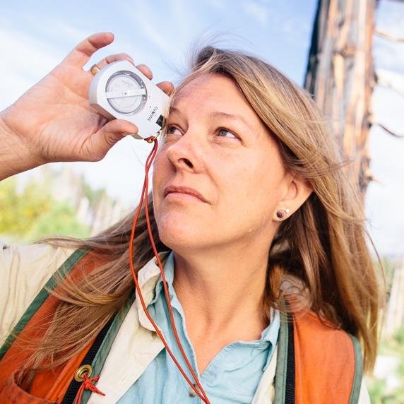
🔥🌍 SIG's Thomas Buchholz presented on wildfire dynamics at the FAO/UNECE session, promoting climate resilience. 🌲🌡️ Learn more: sig-gis.com/services/wildf… #WildfireResilience #ClimateAdaptation #ForestHealth #FAO #UNECE #FireEcology #LandscapeResilience #WildfireMitigation


🔥🌍 Wildfires reshape landscapes—destroying, renewing, and transforming ecosystems. 📖 Read more: usgs.gov/news/featured-… #WildfireEcology #FireScience #SIGScience
🔥💰Financing wildfire resilience at SF Climate Week 2025! Funding must follow fire science. 📖 Read more: tinyurl.com/38w6nfxj #WildfireResilience #AdaptationFinance #ClimateRisk #SIGScience #SFClimateWeek #FireEcology #ClimateAdaptation #ClimateInsurance #CommunityResilience
🔥🌲 Final report for the Placerville Community Wildfire Resiliency Strategy is live! Explore: eldoradorcd.org/placerville-wi… #WildfireResilience #CommunityPlanning #FireAdaptedCommunities #SIGScience #Placerville #WildfirePrevention #ForestHealth #ClimateAdaptation #GeospatialScience
🛰️🌲 ESA’s Biomass satellite is in orbit! It will map carbon in forests, crucial for climate action. 📖 Learn more: sig-gis.com/services/fores… 📡 Launch details: tinyurl.com/5du2fu6a #ForestCarbon #ClimateScience #BiomassSatellite #RemoteSensing #SIGScience #CarbonAccounting
esa.int
Biomass launched to count forest carbon
ESA’s groundbreaking Biomass satellite, designed to provide unprecedented insights into the world’s forests and their crucial role in Earth’s carbon cycle, has been launched. The satellite lifted off...
🌎🌧️ Climate crisis reshapes risk: droughts, wildfires, flooding. Learn how we build resilience: sig-gis.com/services/ 📚 Read the report: firststreet.org/research-libra… #ClimateRisk #FloodResilience #WildfireResilience #ClimateAdaptation #SIGScience #InfrastructureResilience

🌎💚 Thank you to all protecting our planet! Special thanks to our SIG team for their passion and dedication. Together, we create lasting impact! 🌱 sig-gis.com/about/our-team/ #ThankYouDay #ClimateAction #ClimateResilience #EnvironmentalStewardship #SIGScience #TogetherForTheEarth
🌎🛰️ Geospatial innovation is key for climate resilience! Learn more: planscape.org & pyrecast.org #GeospatialAI #ClimateTech #EarthObservation #SIGGIS #WildfireResilience #DataDrivenDecisions
🔥🌲 Big win for wildfire resilience! Governor Newsom signed legislation for $170M in prevention. 📄 Read: tinyurl.com/49wsyxcc #WildfireResilience #ForestHealth #FuelReduction #ClimateAdaptation #SIGScience #CaliforniaWildfires #PrescribedFire #ScienceBasedPolicy #FireEcology

🌍✨ Happy Earth Day from SIG! Every day, we protect the planet through science and innovation. #EarthDayEveryDay #SIGScience #ClimateResilience #WildfirePrevention #GeospatialTech #ForestHealth #ScienceForThePlanet #EarthDay2025

🌍 Check out how Google Earth Engine improves land classification! Read more here: medium.com/google-earth/c… #LandCover #EarthEngine

🌎🛰️ SIG at the XXI SBSR! Andréa P. Nicolau showcased RAMI, our platform for mining alerts in Peru. #RemoteSensing #SIGScience #RAMI #SBSR2025
🌍🧠 Geospatial AI evolves! Google's research links natural language and satellite data for faster insights. Dive in: research.google/blog/geospatia… #GeospatialAI #GenerativeAI #ClimateTech #GoogleResearch
🛰️🔥 New research by SIG's Nicholas LaHaye improves wildfire and smoke monitoring using machine learning! Learn more: tinyurl.com/24786484 #WildfireScience #MachineLearning
🔥🏡 Exciting pilot program in California links wildfire resilience with home insurance! 🌲💰 Learn more: nature.org/en-us/newsroom… #WildfireResilience #NatureBasedSolutions

🌍🔥🗻 New USGS StoryMap reveals how the 2021 Dixie Fire increased landslide risk. Explore: landslides.usgs.gov/storymap/dixie #PostFireRecovery #LandslideRisk #WildfireScience
🔥🌲 SIG Scientist Liz Luck presented on Mosquito Fire emissions at the California Forest Science Symposium. Her research highlights wildfire impacts on carbon. #FireScience #CarbonAccounting #MosquitoFire


United States Trends
- 1. Gameday 31.7K posts
- 2. Sesko 46.2K posts
- 3. #SaturdayVibes 4,868 posts
- 4. Ugarte 16K posts
- 5. De Ligt 26K posts
- 6. Texas Tech 7,916 posts
- 7. Good Saturday 33.5K posts
- 8. #Caturday 5,072 posts
- 9. Richarlison 21.5K posts
- 10. Trump Stadium 1,989 posts
- 11. Calen Bullock N/A
- 12. Amorim 66K posts
- 13. Cunha 25.3K posts
- 14. Vicario 1,991 posts
- 15. #TOTMUN 18.1K posts
- 16. Casemiro 24.3K posts
- 17. Insurance 192K posts
- 18. Goretzka 1,838 posts
- 19. Luis Diaz 22.7K posts
- 20. Odobert 4,874 posts
You might like
-
 GEDI
GEDI
@GEDI_Knights -
 Justin Braaten
@jstnbraaten -
 UMD GLAD
@UMD_GLAD -
 ForestSAT
@ForestSAT -
 SERVIR Global Collaborative
@SERVIRGlobal -
 Andréa P Nicolau
@puzzinicolau -
 ForestGEO
@ForestGEO -
 Dr. RMwebaza
@RoseMwebaza -
 Africa Flores
@africa_science -
 Valerie Pasquarella
@valpasq -
 Fire MDPI
@Fire_MDPI -
 Digital Earth Africa
@DEarthAfrica -
 Remote Sensing in Ecology & Conservation
@RSECJournal
Something went wrong.
Something went wrong.