#geospatialsolutions search results

PARTNERSHIP! 🛰️ #AWiSC2025 is excited to partner with @OakarServices! Boosting our focus on #GeospatialSolutions and #GIS. Network with industry experts! Register FREE NOW! 👇 womeninspace.ke/awisc-2025/

We successfully wrapped up our #GISDay2025 participation, showcasing our #DigitalTwin platform and advanced geospatial solutions. Thanks to all who visited—excited to drive smarter, data-driven development. #GeospatialSolutions #AssetManagement #DutcoTennantLLC


Check out how Geospatial Manager Randy Ortega maximizes efficiency! 👀 As a longtime TopoDOT user now leading his team at WGI, his feedback shapes TopoDOT and TopoShare. Watch his full interview on our YouTube channel! #TopoDOT #WGI #GeospatialSolutions #SeamlessCollaboration

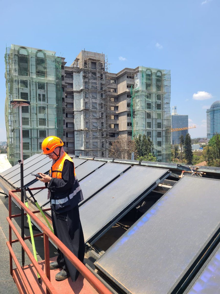
📍 Skymap Africa recently carried out a rooftop survey project, providing accurate measurements and geospatial data to support planning and construction needs. #SkymapAfrica #Surveying #GeospatialSolutions


Every map made is evaluated and graded according to some sort of prescribed criteria to determine it quality. The WORST map is one that doesn't get be made. #CartoMOOC #GeospatialSolutions


Geohazards such as slope instability, erosion, settlement, or seepage pose ongoing risks to critical infrastructure. Traditional ground surveys only provide periodic snapshots. Read more: hubs.ly/Q03KjMfP0 #GeohazardMitigation #InfrastructureResilience #GeospatialSolutions
Quickly discover, visualize, and extract critical info from geospatial data. NV5 will be at Modern Day Marine (April 29-May 1, Washington, DC) showcasing our mission-proven technology. 👉Visit booth #929 for live demos! #ModernDayMarine #GeospatialSolutions #DefenseTechnology


Looking for expert guidance? Ideal Solutions offers GIS Consultancy Solutions to help you navigate the geospatial landscape. Discover how we can support your GIS initiatives. Get in touch for a consultation! #GISExperts #GeospatialSolutions


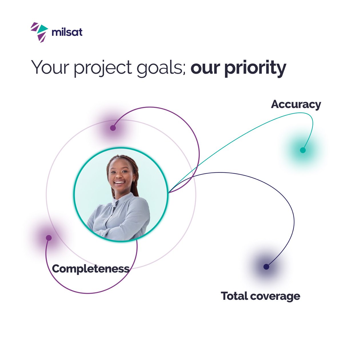
At Milsat, your project success is our utmost priority. Whether it's accuracy, completeness, or total coverage, we deliver with precision every time. Let us help you turn data into smart business decisions. Visit milsat.africa to get started #GeospatialSolutions #GIS

We're just a few days away from #EsriUC2024 in San Diego! If you're attending and are interested in learning about how Silvacom CS can empower your organization through #GeospatialSolutions, book a meeting on-site with Matt 👉hubs.la/Q02y8R5Z0


Intermap’s CEO visited our exceptional team in Jakarta, Indonesia! Our global talent delivers cutting-edge geospatial solutions as we innovate and execute around the clock and around the world. We’ll be growing the Jakarta team soon! #GeospatialSolutions #Teamwork #FutureGrowth


Acquisition of the company that brought software mindset to building #geospatialsolutions by the company that brought software mindset to building and #launchingsatellites newsletter.terrawatchspace.com/p/thoughts-on-…
newsletter.terrawatchspace.com
Thoughts on Planet's acquisition of Sinergise
Acquisition of the company that brought a software mindset to building geospatial solutions by the company that brought a software mindset to building and launching satellites

Revolutionizing insurance with AI-driven #geospatialsolutions for efficient, scalable assessments. Discover cutting-edge innovation for insurers. hubs.li/Q032Ncgg0
We successfully wrapped up our #GISDay2025 participation, showcasing our #DigitalTwin platform and advanced geospatial solutions. Thanks to all who visited—excited to drive smarter, data-driven development. #GeospatialSolutions #AssetManagement #DutcoTennantLLC
PARTNERSHIP! 🛰️ #AWiSC2025 is excited to partner with @OakarServices! Boosting our focus on #GeospatialSolutions and #GIS. Network with industry experts! Register FREE NOW! 👇 womeninspace.ke/awisc-2025/

Are you looking for accurate and reliable geospatial data? Look no further than KWGIS! Our team of experts is dedicated to delivering high-quality services to support development projects. #KWGIS #GeospatialSolutions #GeospatialData
We successfully wrapped up our #GISDay2025 participation, showcasing our #DigitalTwin platform and advanced geospatial solutions. Thanks to all who visited—excited to drive smarter, data-driven development. #GeospatialSolutions #AssetManagement #DutcoTennantLLC
PARTNERSHIP! 🛰️ #AWiSC2025 is excited to partner with @OakarServices! Boosting our focus on #GeospatialSolutions and #GIS. Network with industry experts! Register FREE NOW! 👇 womeninspace.ke/awisc-2025/
📍 Skymap Africa recently carried out a rooftop survey project, providing accurate measurements and geospatial data to support planning and construction needs. #SkymapAfrica #Surveying #GeospatialSolutions

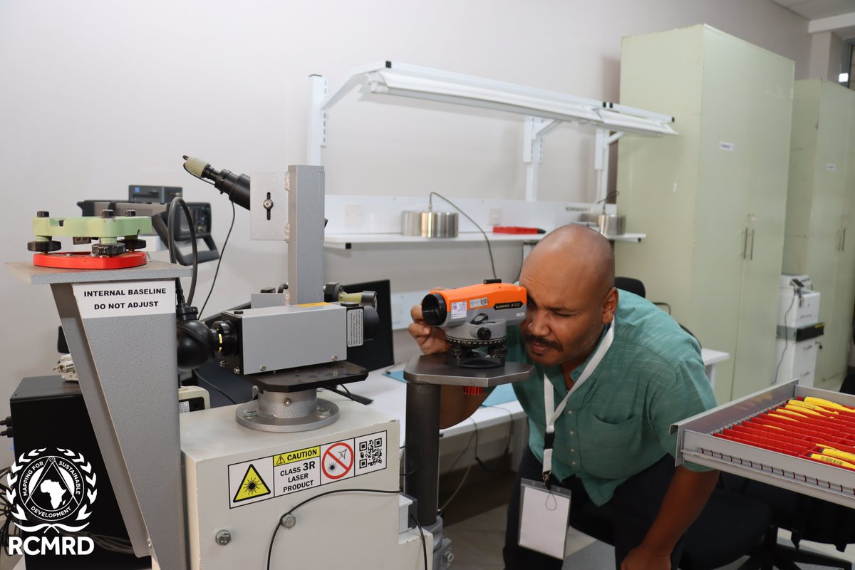
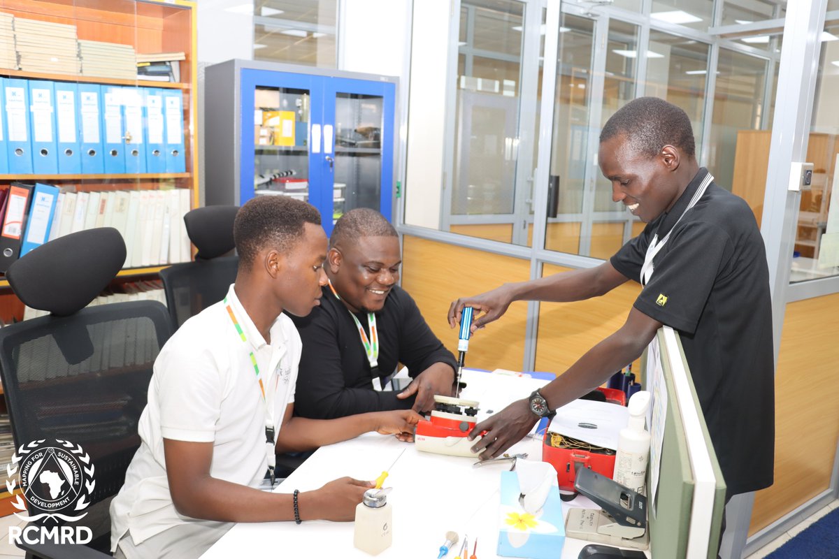
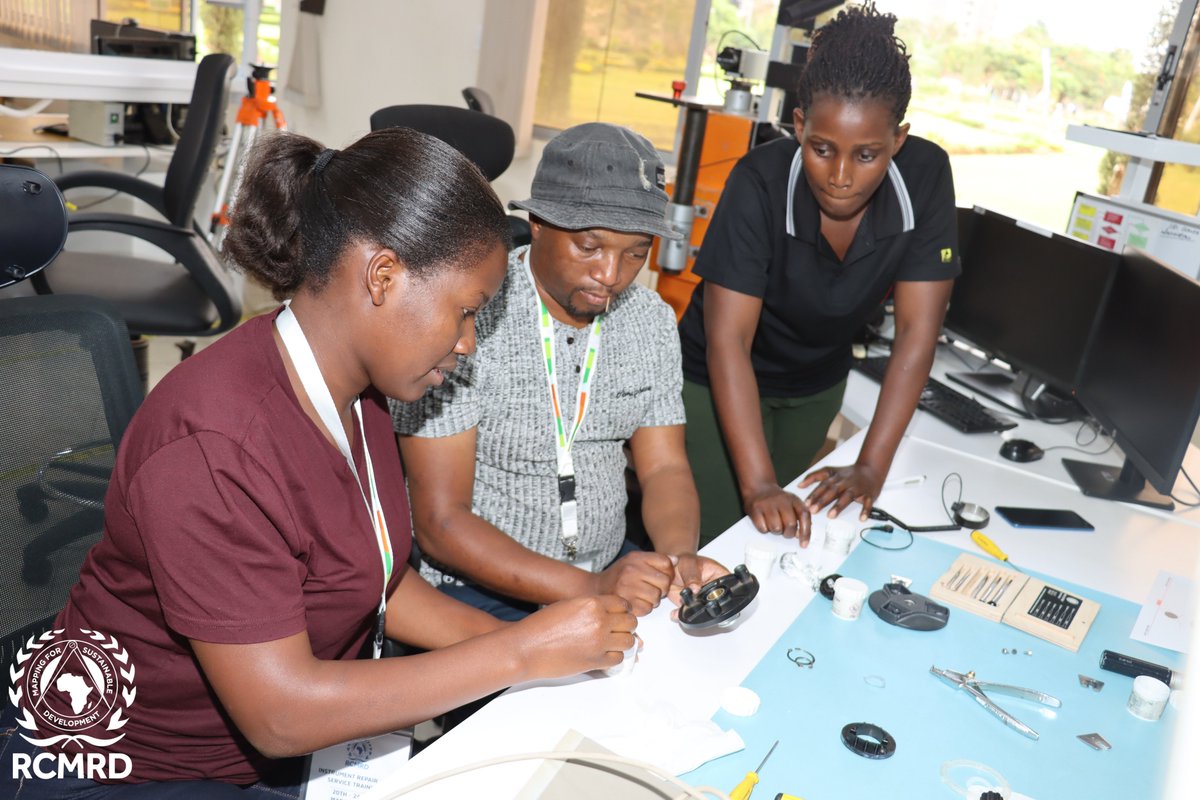
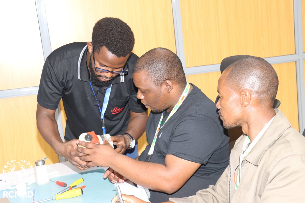
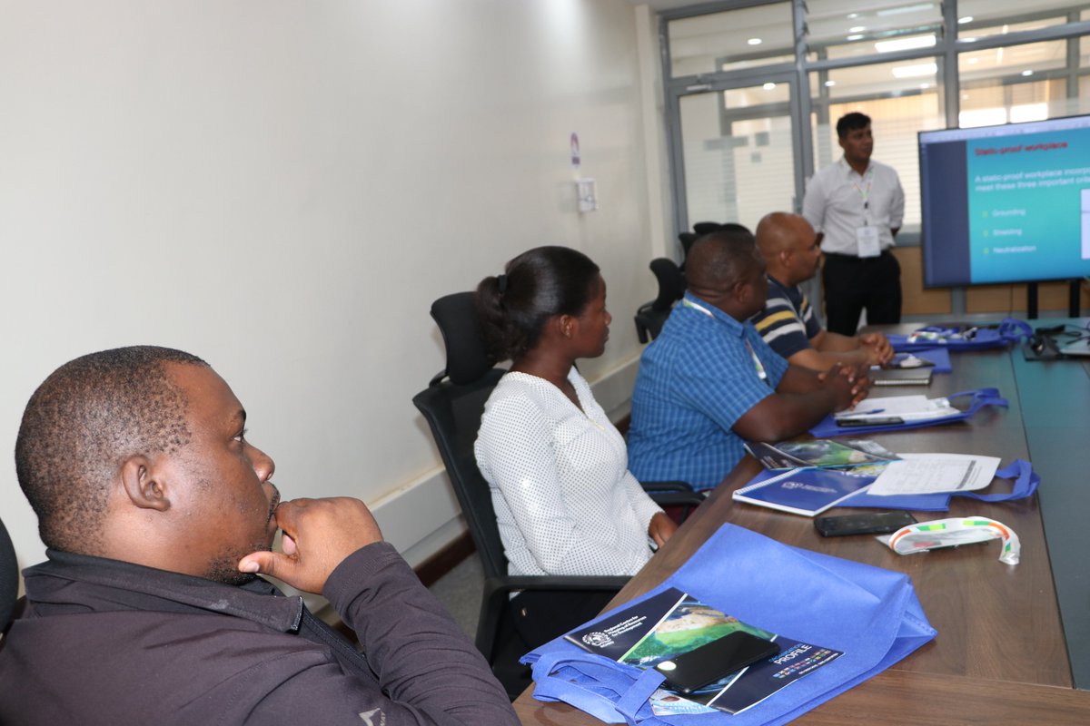
Day 2 of our #RCMRD Geospatial training is underway! Today, participants are learning about basic survey instrument maintenance and calibration techniques. These skills are essential in ensuring accurate data collection and analysis. #BuildingCapacity #GeospatialSolutions
Geohazards such as slope instability, erosion, settlement, or seepage pose ongoing risks to critical infrastructure. Traditional ground surveys only provide periodic snapshots. Read more: hubs.ly/Q03KjMfP0 #GeohazardMitigation #InfrastructureResilience #GeospatialSolutions
Exciting discussions on Day 1 of #RCMRD's Geospatial Training on service, repair, and calibration of surveying instruments! Looking forward to the next 4 days of learning, sharing, and building capacity!" #GeospatialSolutions #BuildingCapacity


Every map made is evaluated and graded according to some sort of prescribed criteria to determine it quality. The WORST map is one that doesn't get be made. #CartoMOOC #GeospatialSolutions

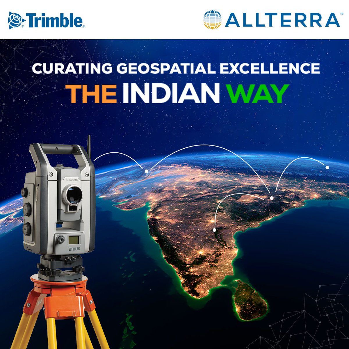
Elevate your Geospatial game with #AllTerraIndia! We're here to guide you through the diverse terrain of Geospatial needs. Our expertise in India's landscapes, challenges, and industry dynamics ensures tailor-made #GeospatialSolutions that leave a lasting impression. 📷

A full house today at the @bussynet Drone and Unmanned Aviation Conference with COO Heico Kühn taking the stage to bring iGlobes Solutions and Technologies to the industry leaders. #Drones #Geospatial #GeospatialSolutions #DataAcquisition


Quickly discover, visualize, and extract critical info from geospatial data. NV5 will be at Modern Day Marine (April 29-May 1, Washington, DC) showcasing our mission-proven technology. 👉Visit booth #929 for live demos! #ModernDayMarine #GeospatialSolutions #DefenseTechnology
Celebrating #WorldStatisticsDay! At #AllTerraIndia, we're proud of our accurate #geospatialsolutions, empowering professionals in various industries. With data and statistics, we map the physical world to create precise digital impressions, making a real difference! #GIS #GeoData

Something went wrong.
Something went wrong.
United States Trends
- 1. Cowboys 46.9K posts
- 2. Eagles 74.5K posts
- 3. Ceedee 12.7K posts
- 4. Browns 67.2K posts
- 5. Raiders 44.5K posts
- 6. Pickens 12.7K posts
- 7. Nimmo 14.6K posts
- 8. Tom Brady 7,674 posts
- 9. Saquon 4,679 posts
- 10. Trevor Lawrence 3,248 posts
- 11. Myles Garrett 7,718 posts
- 12. Mets 20.8K posts
- 13. Shedeur 69.1K posts
- 14. Jags 5,055 posts
- 15. Semien 9,371 posts
- 16. Jalen 20.6K posts
- 17. Giants 89.7K posts
- 18. Turpin 3,445 posts
- 19. Colts 41.1K posts
- 20. #PHIvsDAL 4,788 posts