#geospatial search results

Meta just released the Segment Anything Model 3 (SAM 3). Time to integrate it into the SAMGeo and/or GeoAI packages: github.com/opengeos/segme… Website: ai.meta.com/sam3 GitHub: github.com/facebookresear… #geospatial #SAM

🧵 Ever wondered how to supercharge your geospatial analysis in R? Enter tidyterra: the game-changer bridging tidyverse magic with terra's powerhouse for handling spatial data! Let's dive in—what it is, what it does, and why it's a must for GIS pros. #RStats #GIS #Geospatial 1/6


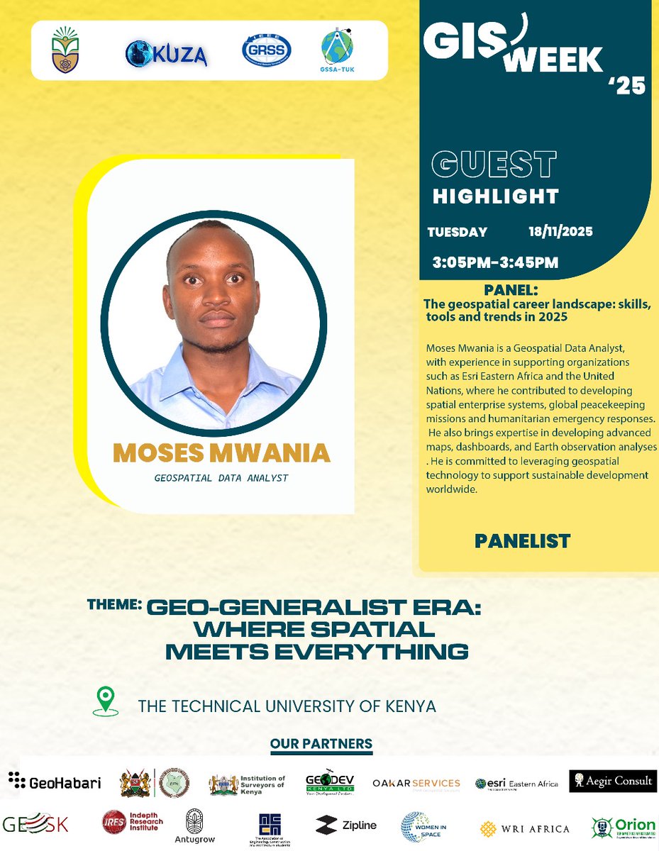
Honored to join GIS Week on Tuesday 18th 2025 at my almer mater @TU_Kenya as a panelist discussing the geospatial career landscape skills, tools, and trends shaping our field. 🌍 #GISWeek25 #Geospatial

FOSS4G Asia 2026 is heading to the captivating city of Nashik, Maharashtra, India! Nashik is a city that perfectly mirrors the spirit of open source: rooted in rich history, yet constantly evolving with modern innovation. #FOSS4GAsia2026 #FOSS4G #GeoSpatial #OSGeo #GIS


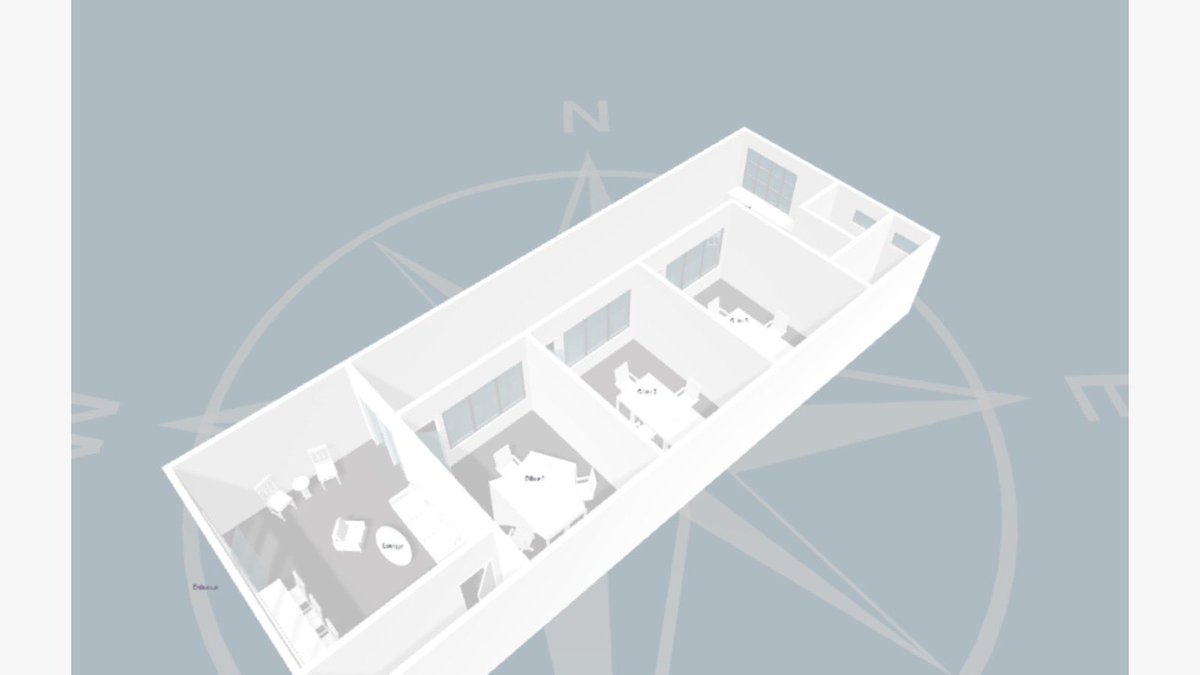
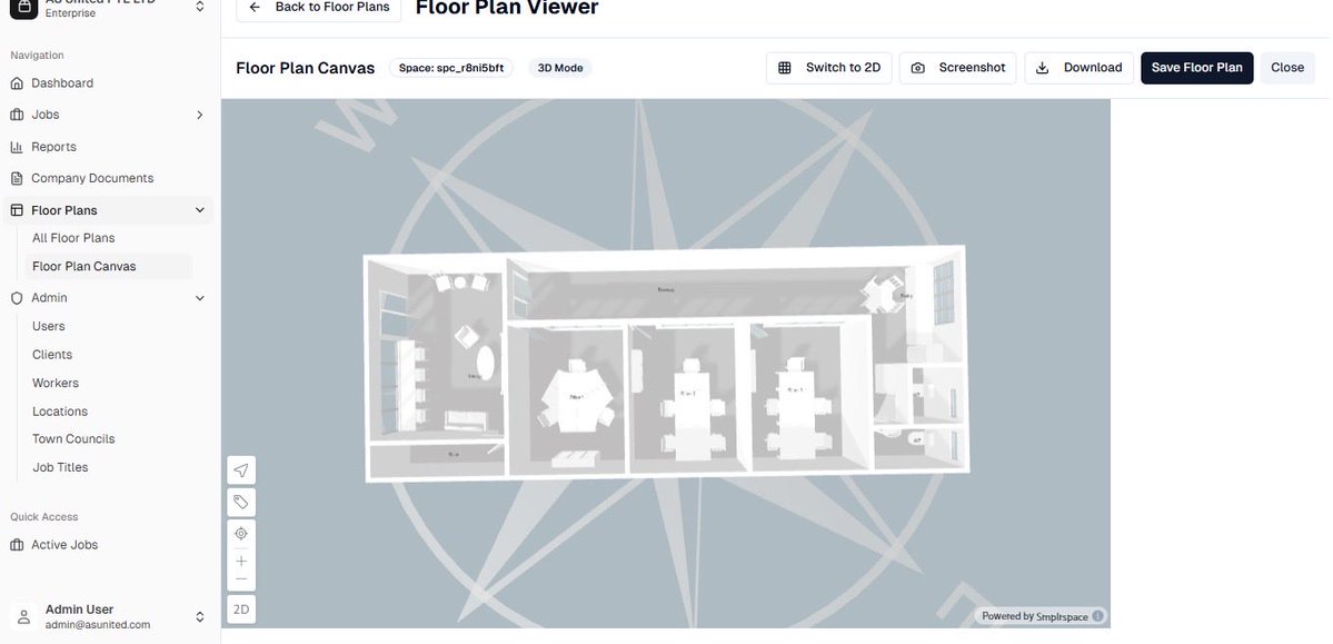
How cool…😍in love with what i do❤️🔥…Created this system - dynamic indoor mapping + interactive floor plan project support...incorporated with gis👌🏾 #gischat #geospatial


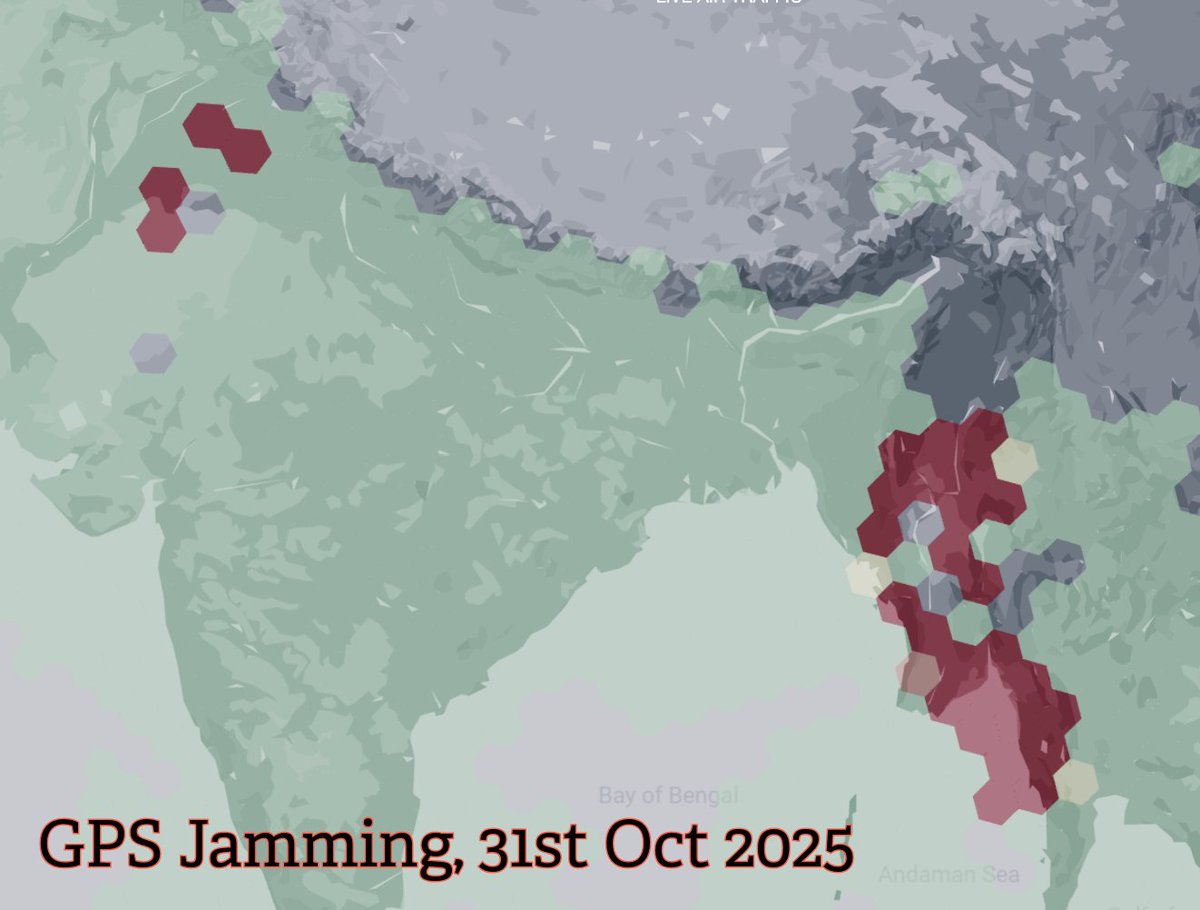
All eyes on GPS jamming at India–Pakistan borders, but the real jam’s in parts of Myanmar & Thailand. War-fueled GPS interference spilled into Thailand, grounding 60+ flights. When electronic warfare takes off, civilian skies lose their signal. #Geospatial #EW #GNSS #GPS…

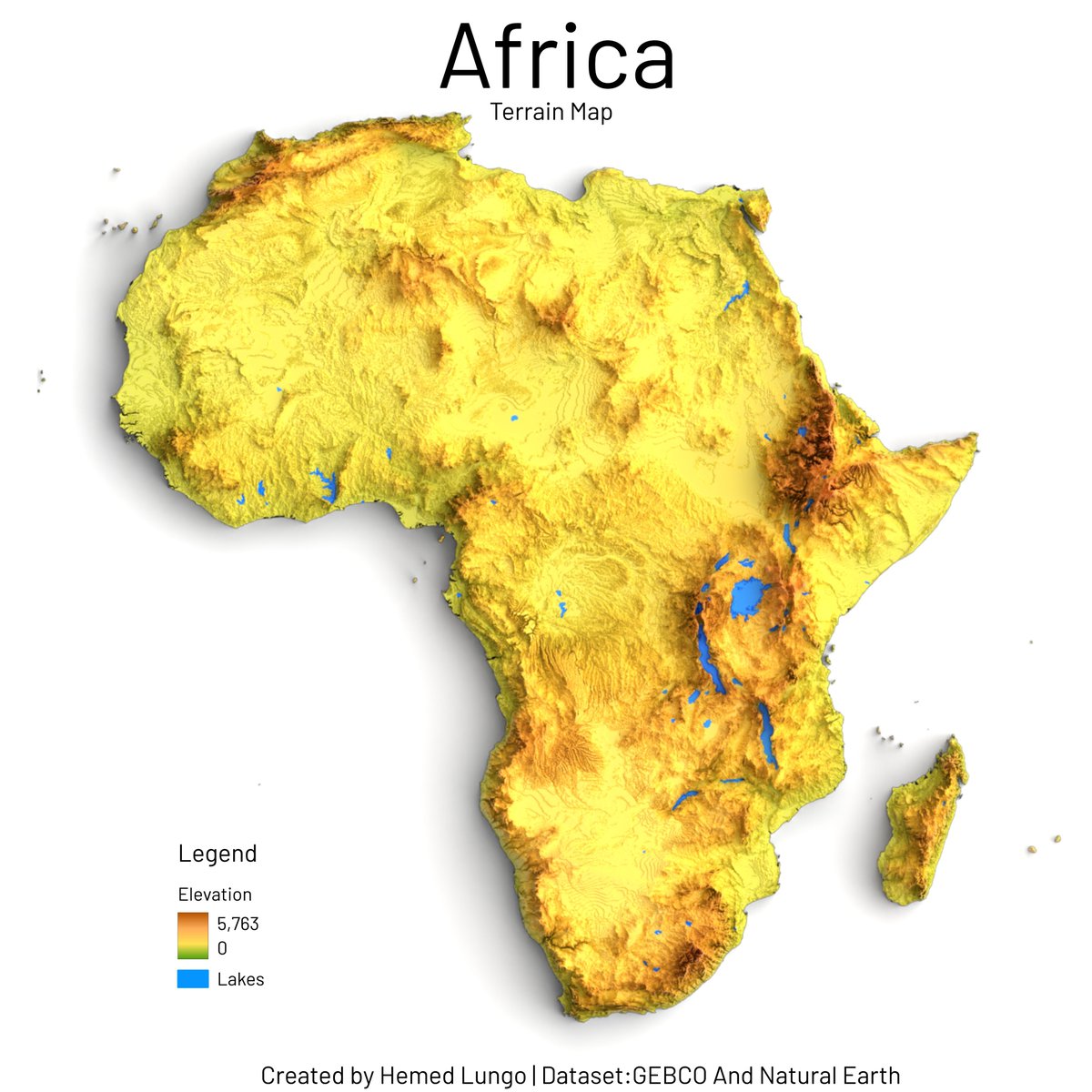
bringing this back to the tl: a map🗺️ showing Terrain Model of Africa, Dataset from GEBCO Bathymetry and Natural Earth #geospatial #gischat #Africa #dataviz #render #qgis #blender #b3d cc: @725Hemeed

#Python for #Geospatial Data Analysis and Location Intelligence: amzn.to/3DNT2bC ————— #Analytics #DataScience #Geoscience #GIS #Geoinformatics #AI #ML #MachineLearning #DataScientist #SpatialAnalysis


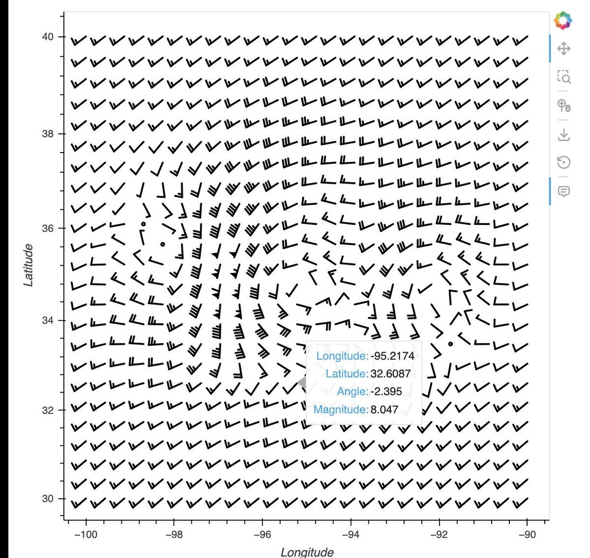
#30DayMapChallenge Day 17 – A new tool I finally crossed a major item off my #geospatial to-do list: making a dynamic flow map using ArcGIS Online! Inspired by @John_M_Nelson's iconic "Van Gogh" style tutorials, I visualized seasonal #windflow patterns over Indian subcontinent.

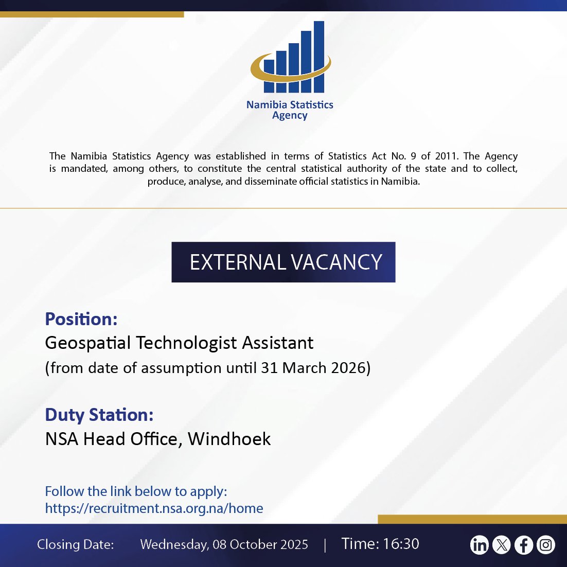
🔵 We're Hiring: Geospatial Technologist Assistant (Contract-Based) 🌍 Do you have at least 1 year of experience in #geospatial technologies? If yes... we're looking for you! This is a great opportunity to grow your skills, work with innovative tech, and be part of #TeamNSA

#interested >TODAY Nov 24, 2025 at 1-2pm< CET you'll meet three #students in our info Session 😍 #geospatial Erasmus Mundus Joint Master #EMJM co-funded by the European Union meeting link tinyurl.com/bdewr44c
#Geospatial Data Analysis with #Python — 3 books: 1) Applied Geospatial #DataScience: amzn.to/3YIgKi4 2) Learning GIS and #RemoteSensing Analysis: amzn.to/3HvTigy 3) Geospatial Data Analysis for Location Intelligence: amzn.to/3DNT2bC


😲Did you know mangroves in Hormozgan, Iran are under threat from human activities and natural factors? This study used a hybrid Fuzzy-DEMATEL-ANP model with #geospatial and #RemoteSensing data to find suitable areas for mangrove plantations. Results show 6.10% of the area is…

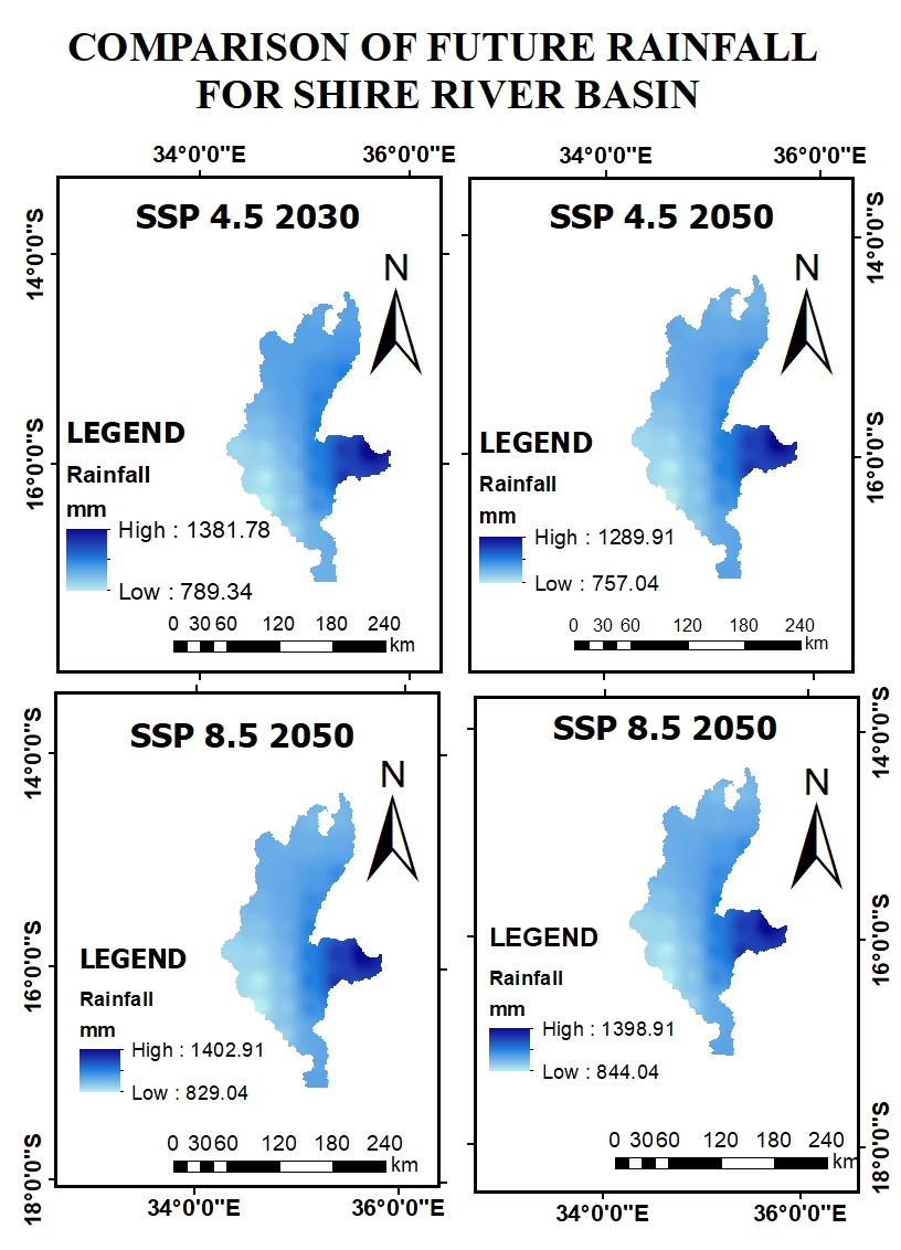
A compelling climate-focused #geospatial analysis contributed by @FGoloma . His work examines future rainfall projections in the Shire River Basin under the Shared Socioeconomic Pathway (SSP) 4.5 scenario, Details; linkedin.com/feed/update/ur…

كتاب مقدمة في برمجة GIS 📚 📖 أمازون: amazon.com/Introduction-G… 🌐 موقع الكتاب: gispro.gishub.org #GIS #Geospatial #Python #OpenSource #RemoteSensing


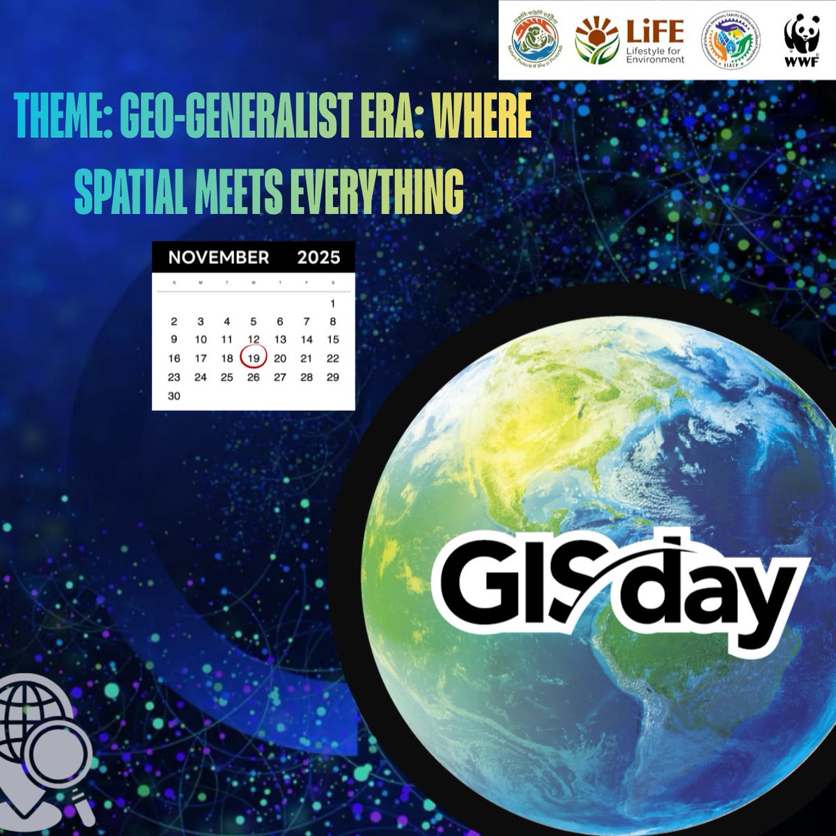
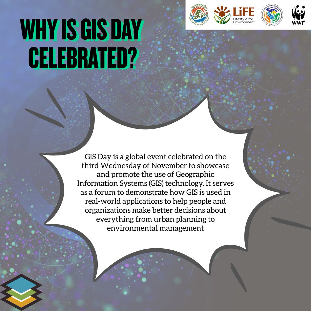
🌍 Happy #GISDay2025! Celebrating the Geo-Generalist Era—where spatial meets everything. From climate action to smart cities, GIS helps us understand and shape a better world. ✨🗺️ #GISDay #Geospatial #MappingTheFuture #SpatialThinking #FutureOfGIS

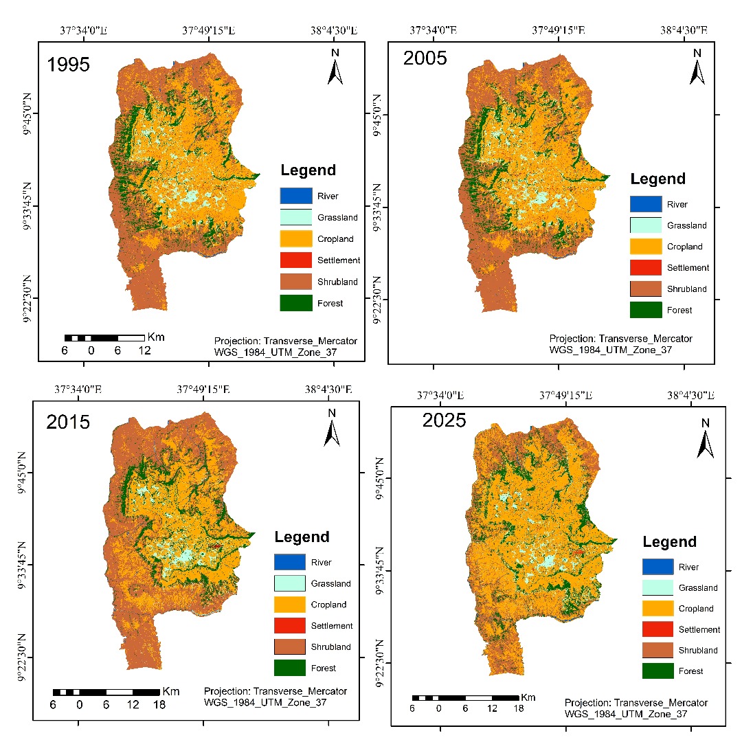
🗺️ Spotlight Map: Land Use/Land Cover Dynamics of Gindabart (1995–2025) This work illustrates how #geospatial technologies can reveal long-term environmental change. Details; linkedin.com/feed/update/ur… Map credit; Moibon Gabisa wekjira


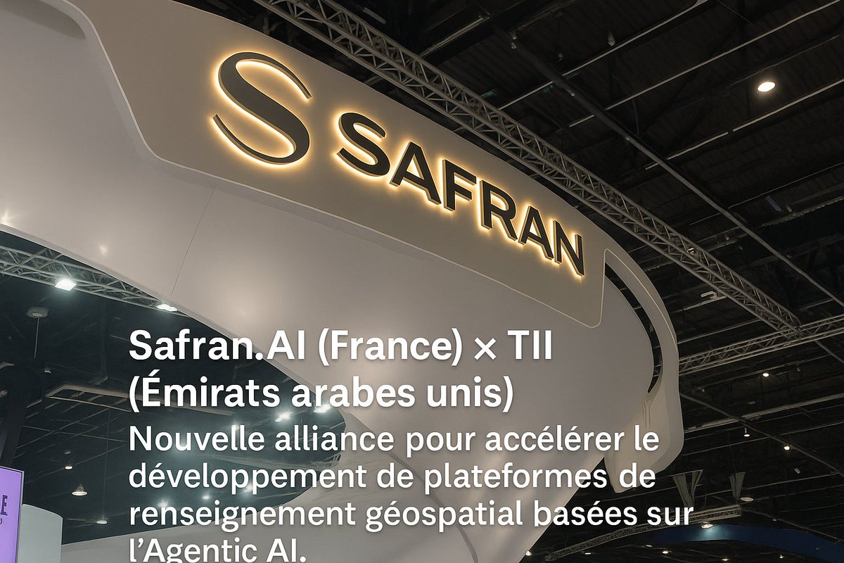
Safran.AI et le Technology Innovation Institute (#TII) scellent une alliance pour développer des #plateformes de renseignement #géospatial basées sur l’#AgenticAI. echosplus.com/2025/11/23/saf… #SafranAI #TII #GEOINT #Défense #DubaïAirshow


Safran.AI et le Technology Innovation Institute (#TII) scellent une alliance pour développer des #plateformes de renseignement #géospatial basées sur l’#AgenticAI. echosplus.com/2025/11/23/saf… #SafranAI #TII #GEOINT #Défense #DubaïAirshow

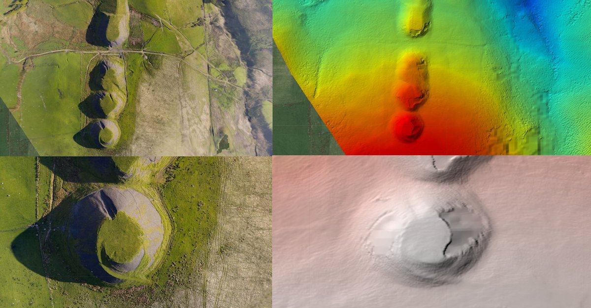
Relative Elevation Models (REMs) turn DEMs into visual stories 🌄🛰️! Spot hidden river channels, archaeological traces, and subtle terrain features. 🔗 geoawesome.com/from-dems-to-r… #REM #Geospatial #Cartography #TerrainVisualization #DEM #Geoawesome


Discover key takeaways from #GIS Pro in the Rockies 2025, including #Esri contributions & what’s next for the #geospatial community ow.ly/egNX30sRr04 #ArcGIS #GPN #spatial #map #location #NSGIC


📢 #CallForPapers 🎯 Special Issue "Integrating Remote Sensing, Geospatial Technologies, and AI for Sustainable Land and Soil System Management" 👥 Edited by: Dr. Carmine Massarelli 👉 brnw.ch/21wXM5s ⏰ Deadline: 31 December 2025 #remotesensing #geospatial #land #soil


A cold morning on site — but the setup is rock solid. The Survipod 𝗕𝗼𝗹𝘁𝗳𝗶𝘅 is bolted down beside the access route, 𝗲𝘅𝗮𝗰𝘁𝗹𝘆 𝘄𝗵𝗲𝗿𝗲 𝘆𝗼𝘂𝗿 𝘁𝗲𝗮𝗺 𝗻𝗲𝗲𝗱𝘀 𝗶𝘁. survipod.com #ConstructionManagement #Surveying #Geospatial #SettingOut

A compelling climate-focused #geospatial analysis contributed by @FGoloma . His work examines future rainfall projections in the Shire River Basin under the Shared Socioeconomic Pathway (SSP) 4.5 scenario, Details; linkedin.com/feed/update/ur…

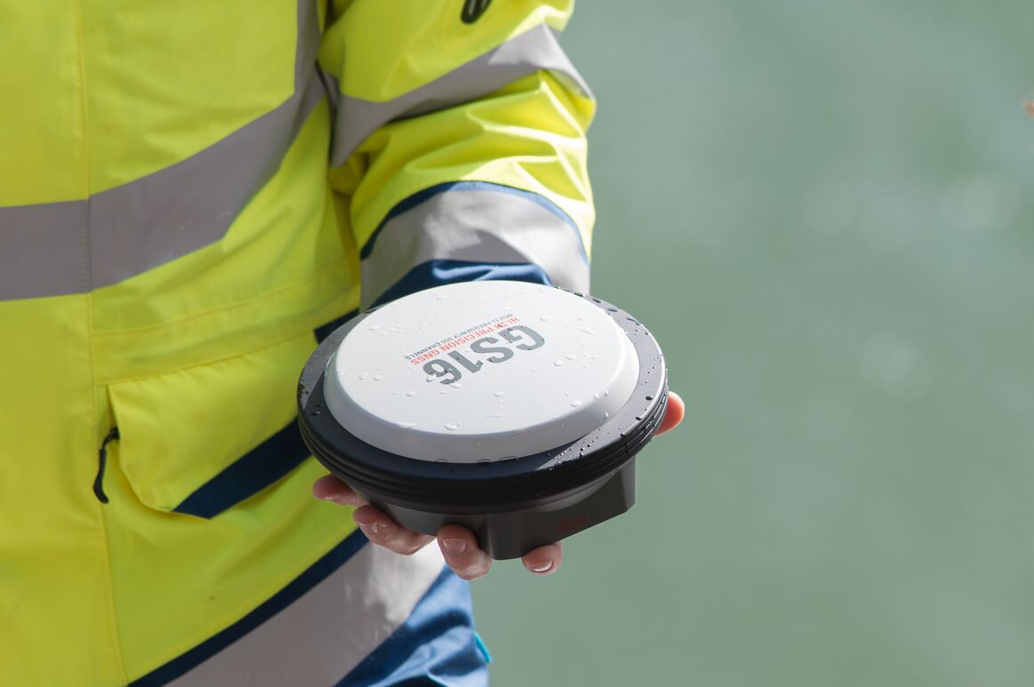
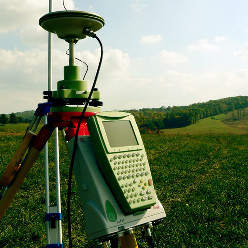
Leica GS16 delivers stable GNSS accuracy with adaptive RTK and strong satellite tracking. Ideal for construction, mapping and infrastructure teams across Saudi Arabia who need reliable performance in every environment. Explore sitml.com/product/leica-… #GNSS #Surveying #Geospatial
Safran.AI et le Technology Innovation Institute (#TII) scellent une alliance pour développer des #plateformes de renseignement #géospatial basées sur l’#AgenticAI. echosplus.com/2025/11/23/saf… #SafranAI #TII #GEOINT #Défense #DubaïAirshow
Michigan #GeoSpatial Applications! #BigData #Analytics #DataScience #AI #MachineLearning #IoT #IIoT #PyTorch #Python #RStats #TensorFlow #Java #ReactJS #GoLang #CloudComputing #Serverless #DataScientist #Linux #Programming #Coding #100DaysofCode geni.us/Michigan-GeoSp…

#interested >TODAY Nov 24, 2025 at 1-2pm< CET you'll meet three #students in our info Session 😍 #geospatial Erasmus Mundus Joint Master #EMJM co-funded by the European Union meeting link tinyurl.com/bdewr44c

🚀 GeoViews 1.15.0 is out — and it brings WindBarbs support! Perfect for anyone working with weather, climate, or geospatial visualization. 🌬️🗺️ Give it a spin! #python #dataviz #geospatial #opensource #datascience


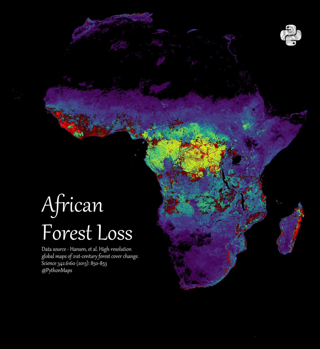

bringing this back to the tl: a map🗺️ showing Terrain Model of Africa, Dataset from GEBCO Bathymetry and Natural Earth #geospatial #gischat #Africa #dataviz #render #qgis #blender #b3d cc: @725Hemeed
🔵 We're Hiring: Geospatial Technologist Assistant (Contract-Based) 🌍 Do you have at least 1 year of experience in #geospatial technologies? If yes... we're looking for you! This is a great opportunity to grow your skills, work with innovative tech, and be part of #TeamNSA
FOSS4G Asia 2026 is heading to the captivating city of Nashik, Maharashtra, India! Nashik is a city that perfectly mirrors the spirit of open source: rooted in rich history, yet constantly evolving with modern innovation. #FOSS4GAsia2026 #FOSS4G #GeoSpatial #OSGeo #GIS
🧵 Ever wondered how to supercharge your geospatial analysis in R? Enter tidyterra: the game-changer bridging tidyverse magic with terra's powerhouse for handling spatial data! Let's dive in—what it is, what it does, and why it's a must for GIS pros. #RStats #GIS #Geospatial 1/6
🌍 Happy #GISDay2025! Celebrating the Geo-Generalist Era—where spatial meets everything. From climate action to smart cities, GIS helps us understand and shape a better world. ✨🗺️ #GISDay #Geospatial #MappingTheFuture #SpatialThinking #FutureOfGIS
#Python for #Geospatial Data Analysis and Location Intelligence: amzn.to/3DNT2bC ————— #Analytics #DataScience #Geoscience #GIS #Geoinformatics #AI #ML #MachineLearning #DataScientist #SpatialAnalysis

Tutorial about Geospatial Analysis with Python for Beginners to Advanced Level, Part 1 Tutorial Link: youtube.com/live/rSUhBf7XN… #Python #SpatialAnalysis #Geospatial #GIS #RemoteSensing #Geoinformatics #DataScience #MachineLearning #DeepLearning #BigData #SpatialStatistics

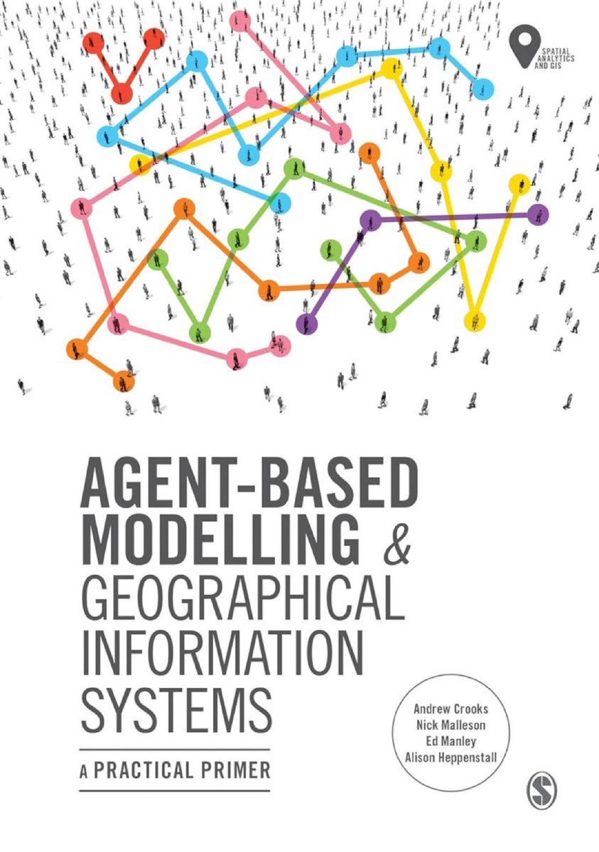
"Agent-Based Modelling and Geographical Information Systems: A Practical Primer (#GeoSpatial Analytics and #GIS)" amzn.to/3b26CK9 ————— #DataScience #AI #ComputationalScience #SocialScience #AgentBasedModeling #NetworkScience #SpatialAnalysis #Simulation

Celebrating GIS Day 2025! A global tribute to the power of maps, data & spatial thinking in solving real-world problems. This year’s theme - “Geo-Generalist Era.” #GISDay2025 #GIS #Geospatial #MappingTheFuture
#Geospatial Data Analysis with #Python — 3 books: 1) Applied Geospatial #DataScience: amzn.to/3YIgKi4 2) Learning GIS and #RemoteSensing Analysis: amzn.to/3HvTigy 3) Geospatial Data Analysis for Location Intelligence: amzn.to/3DNT2bC

Going with the flow and following the trend, our 3D Model is on its way for the NAKSHA Survey. #NAKSHA #DILRMP #geospatial #DoLR #landresources #technology #sustainability #landscape #LandOwnership #LandRecords

I just presented at the Fifth NASA OPERA Stakeholder Engagement Workshop today 🌍 You can view my slides here: tinyurl.com/OPERA-Leafmap Learn more about the workshop: jpl.nasa.gov/go/opera/opera… #leafmap #geospatial #nasa #opera

Learning #Geospatial Analysis with #Python — Unleash the power of Python with practical techniques for #GIS and #RemoteSensing (4th edition): amzn.to/3HvTigy v/ @PacktPublishing ———— #DataScience #Analytics #SpatialAnalytics #DataScientist

Tutorial about Monitoring Urban Heat Islands with LST & UTFVI Tutorial Link youtube.com/live/zmS_KBmXE… Reg. Info: studyhacksgeospatial.com/google-earth-e… #RemoteSensing #GIS #Geospatial #Geoinformatics #EarthObservation #GeospatialAnalysis #SatelliteImagery #ClimateChange #EnvironmentalMonitoring


From coastlines to communities, we’re using #geospatial data to map change, protect the environment & support innovation across Wales 🌍 Every pixel tells a story together we’re building a smarter, more sustainable future 🔗 infinityspace.org.uk/geospatial.html #Wales #Innovation


يشارك #مركز_القطر_للتدريب بملتقى GIS DAY 2025 بجامعة الملك سعود، مستعرضًا برامجه المتخصصة مطلقاً مبادرة "تأهيل سفراء القطاع الجيومكاني".حيث يقدّم خصمًا مقداره 70% لطلاب الجامعة ومنسوبيها دعمًا لتنمية الكفاءات الوطنية. #GISDay2025 #Geospatial #GIS #AlQotrTraining #GeospatialTech

Honored to join GIS Week on Tuesday 18th 2025 at my almer mater @TU_Kenya as a panelist discussing the geospatial career landscape skills, tools, and trends shaping our field. 🌍 #GISWeek25 #Geospatial
🌟 My YouTube channel just reached a major milestone: 📌 50,000 subscribers 🎬 860 videos published 📊 2.4 million total views ⏱️ 125,000+ watch hours Subscribe for updates on open source geospatial and GeoAI: 🔗 youtube.com/@giswqs #Geospatial #OpenSource #GeoAI #Python

All eyes on GPS jamming at India–Pakistan borders, but the real jam’s in parts of Myanmar & Thailand. War-fueled GPS interference spilled into Thailand, grounding 60+ flights. When electronic warfare takes off, civilian skies lose their signal. #Geospatial #EW #GNSS #GPS…
Something went wrong.
Something went wrong.
United States Trends
- 1. Comey 108K posts
- 2. Opus 4.5 4,368 posts
- 3. Mark Kelly 75.9K posts
- 4. Everton 56.8K posts
- 5. Thanksgiving 162K posts
- 6. Halligan 34.4K posts
- 7. Gueye 3,796 posts
- 8. #WooSoxWishList 10.3K posts
- 9. Hegseth 26.6K posts
- 10. Pentagon 16K posts
- 11. Department of War 22.1K posts
- 12. Dismissed 51.6K posts
- 13. Brosmer 2,323 posts
- 14. UCMJ 11.8K posts
- 15. Ja'Kobi Gillespie N/A
- 16. Jimmy Cliff 34.2K posts
- 17. Department of Defense 4,783 posts
- 18. #NutramentHolidayPromotion N/A
- 19. Statute 16.3K posts
- 20. TOP CALL 5,901 posts