#johnsonfire search results


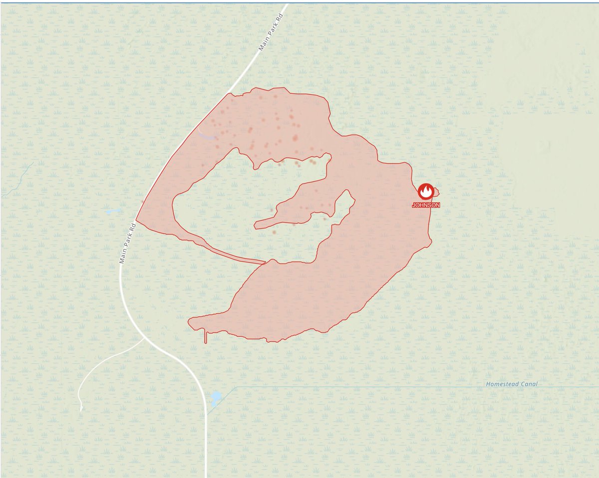
The Everglades National Forest continues to work on mopping up the #JohnsonFire, which was discovered on March 18th and is now 8,340 acres and 65% contained. Aircraft recently mapped the fire as seen below.

Critical day for #JohnsonFire in Southern Bitterroot. It’s burned over 200 acres. @SheriffRCSO has evac warnings for East Fork residents from Little East Fork to Teepee Cr. Type 3 team fighting on air & ground. Strong tstorms this PM. #MTfire. USFS photo


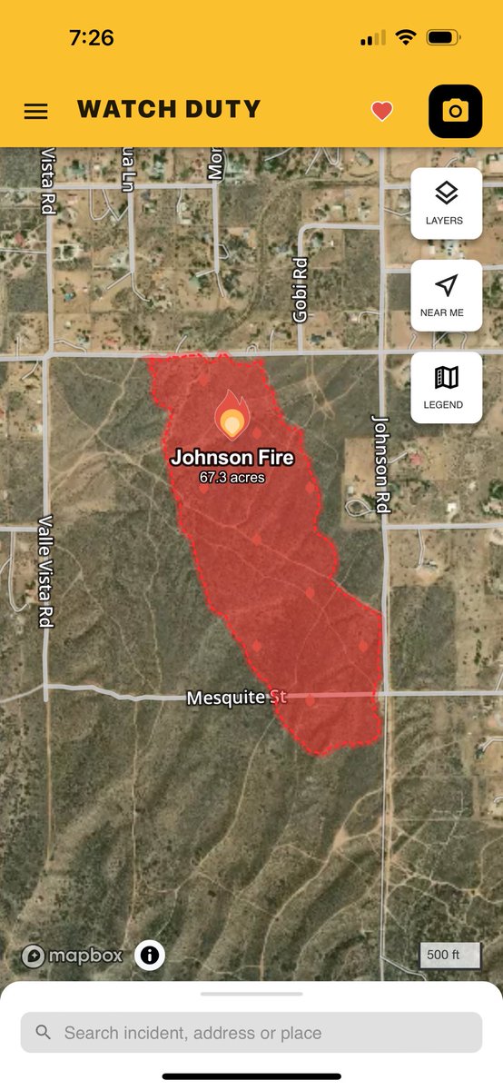
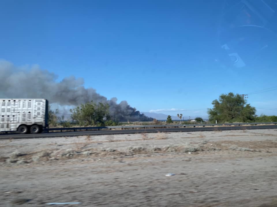
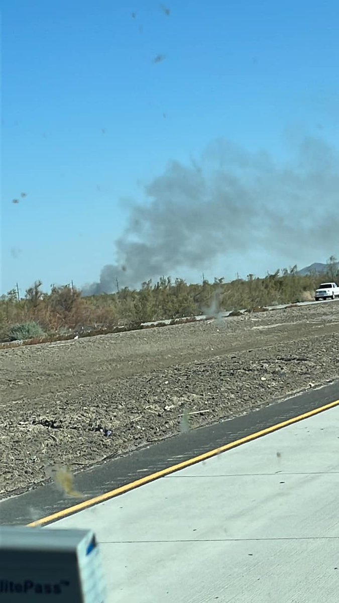
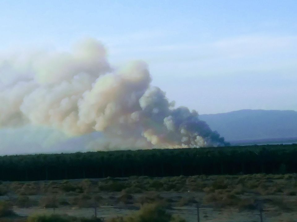
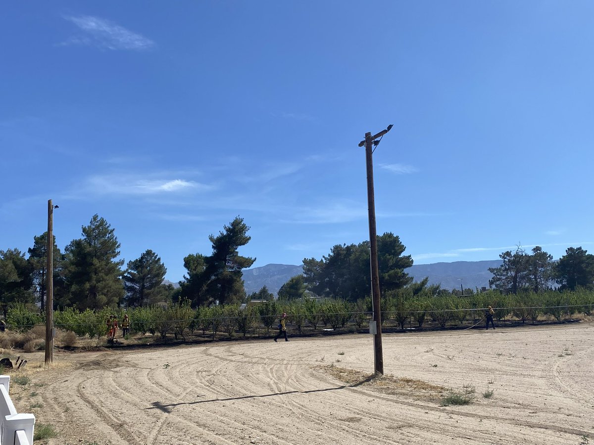
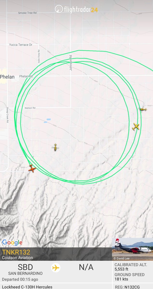
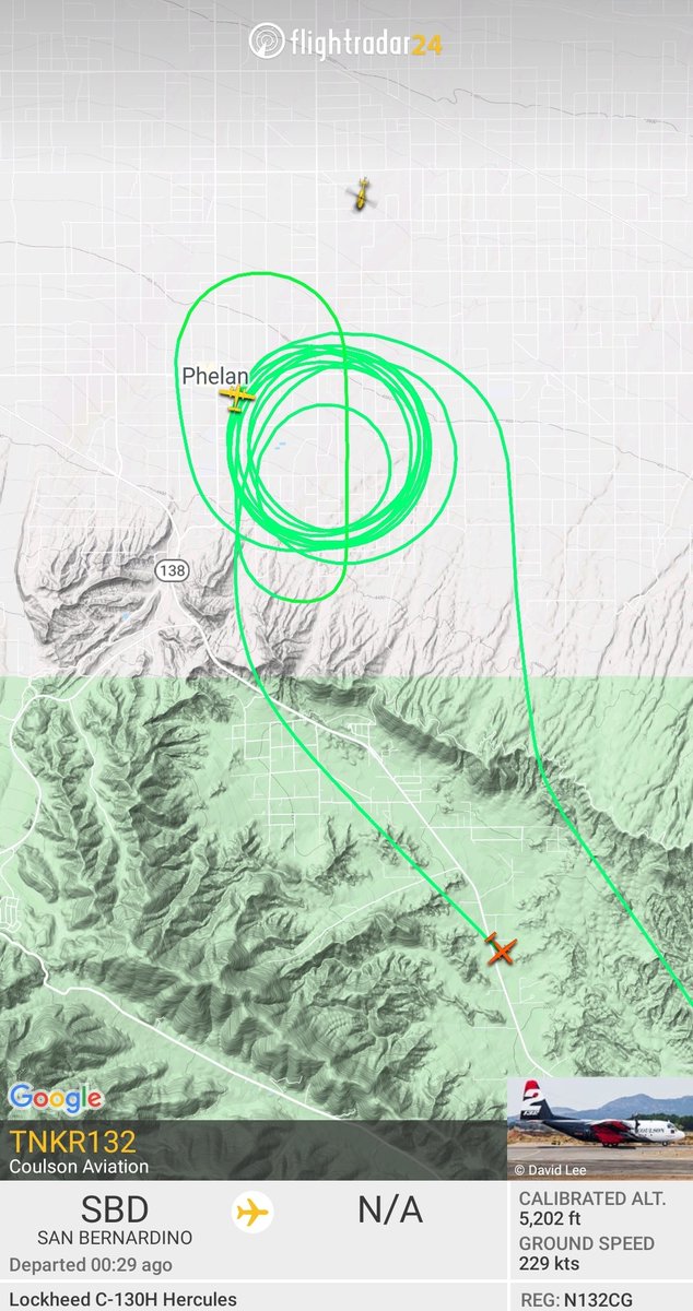
New start in San Bernardino County. 15 acres with a moderate to rapid rate of spread and structures threatened in a few minutes. Aircraft order was doubled and 5 additional type 3 engines requested. Its putting up a good size plume right now. #JohnsonFire off Johnson Rd.

This be the #JohnsonFire
New start San Bernardino County in Phelan at Johnson Rd & Snow Line Road. 15 acres and requested additional tankers and helicopters
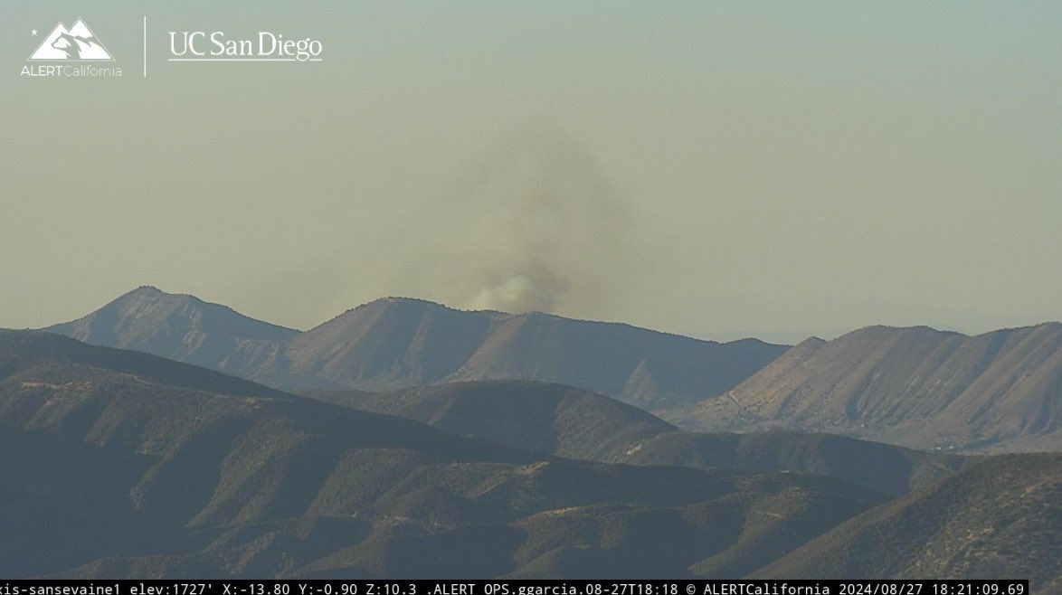
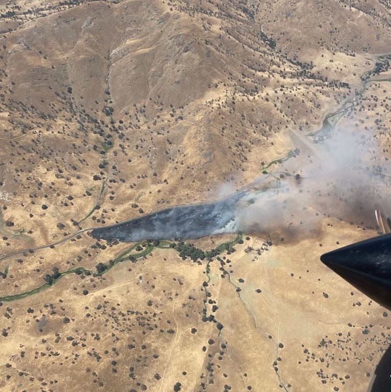
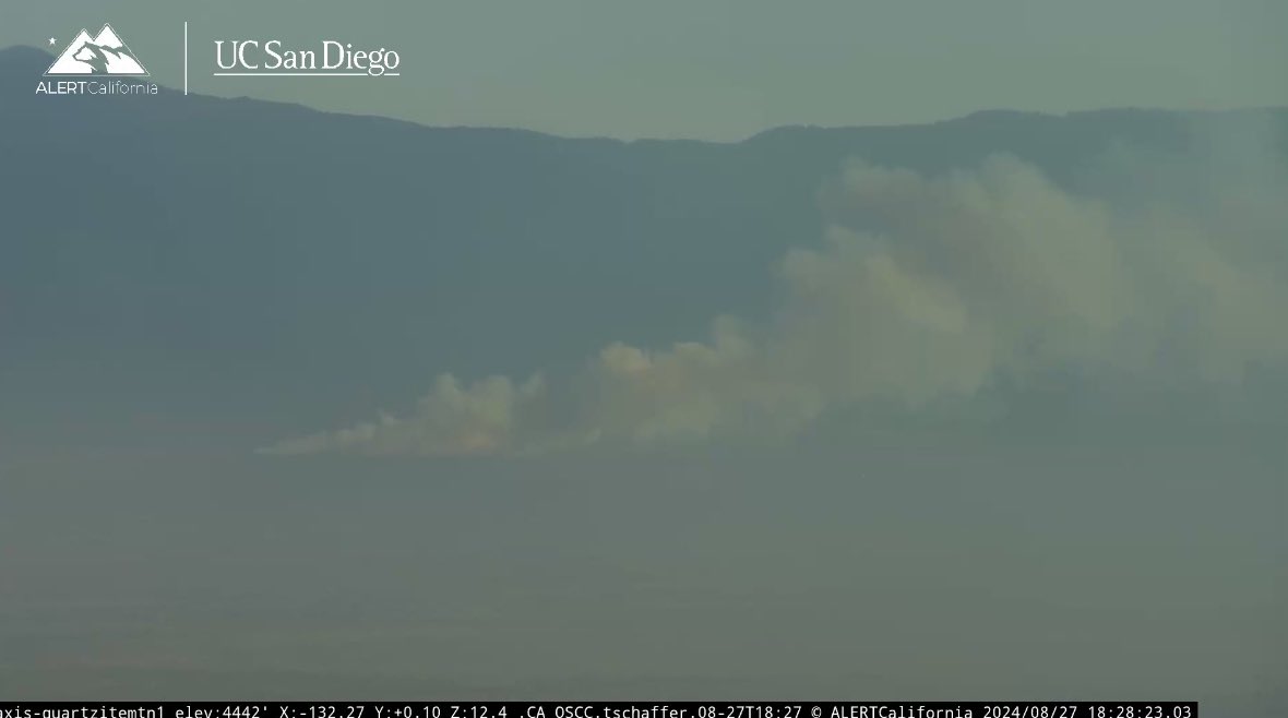
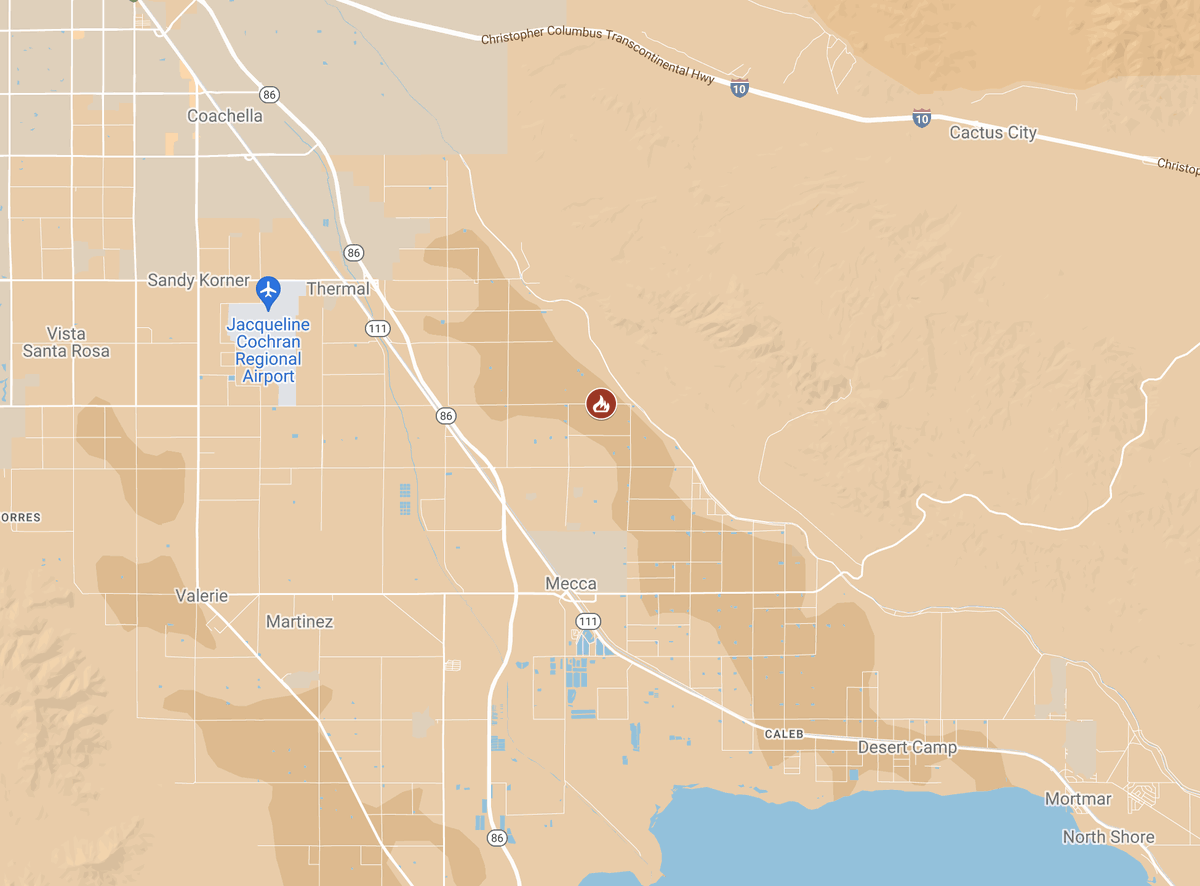
Vegetation Fire:rpt@4:22 p.m. 81000blk Johnson Street, south of Thermal. Firefighters arrived on scene of 10-15 acres burning at a rapid rate. The fire is approximately 150 acres. Multiple resources are assigned and there are no injuries or evacuations. #JohnsonFIRE
#JohnsonFire 7:06pm The forward rate of spread has been stopped at a final size of 1/4 acre. 7:01pm The Evacuation Warning has now been lifted for Zone: SIS-5120. 6:58pm Units at scene can handle. All additional resources have been canceled, along with all aircraft.
#JohnsonFire 6:46pm The fire is holding at 1/4 acre. Continuing all resources for now.
#JohnsonFire 6:40pm An Evacuation Warning has been issued for Zone: SIS-5120.
#JohnsonFire 6:35pm The fire is approx 1/4 acre with a slow rate of spread.
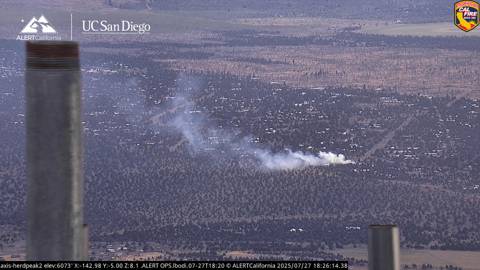
#JohnsonFire Near St George Dr & Johnson Rd, Shasta Vista, Siskiyou County. 6:26pm Resources are responding to a reported vegetation fire with smoke visible on the Herd Peak camera.

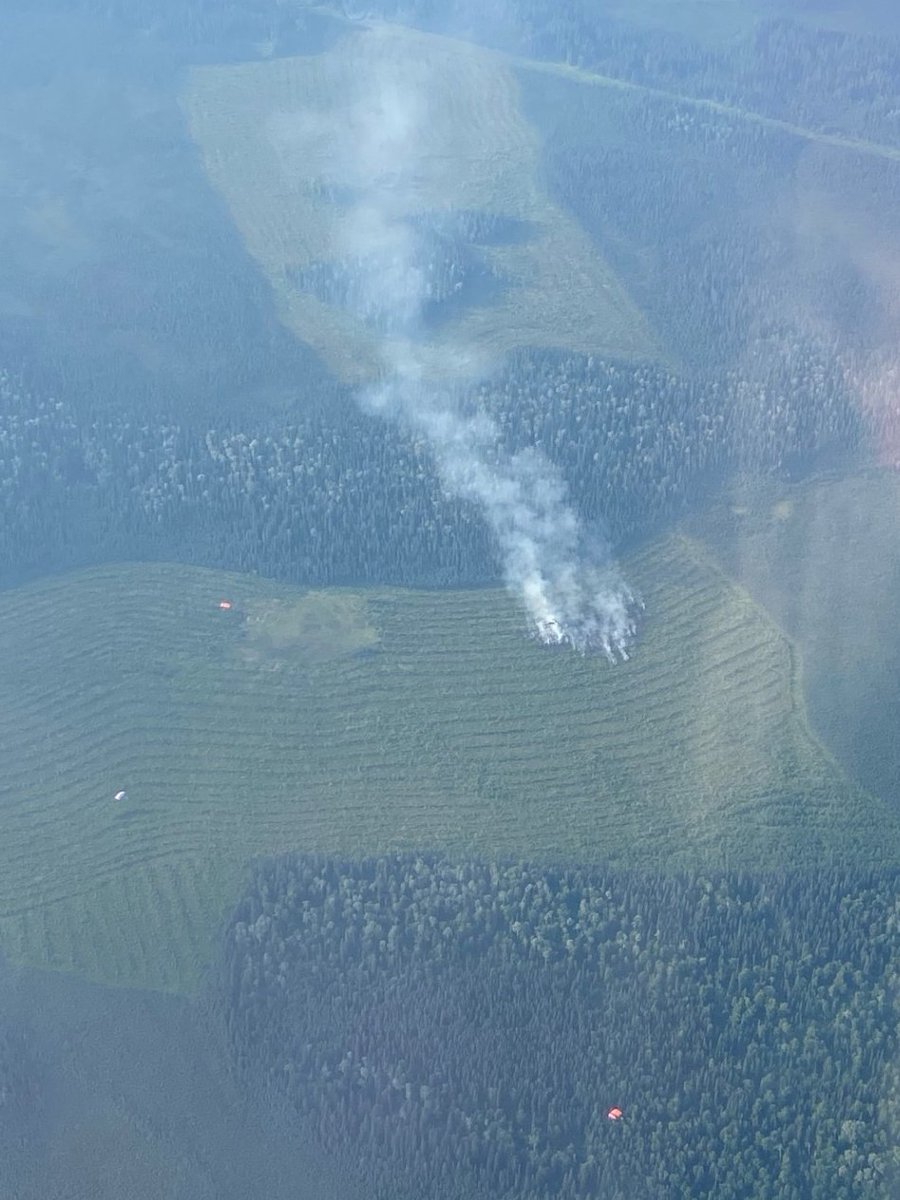
🔥July 14 #JohnsonFire Update🔥 Six smokejumpers and a helitack crew remained on the Johnson Fire overnight to continue suppression efforts. The fire is currently estimated at 1.3 acres. Visit AKFireInfo.com for more information. #2025AlaskaFireSeason #2025FireYear
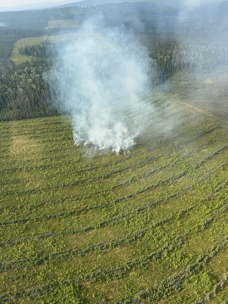
Firefighters are currently responding to a new fire start, called the #JohnsonFire, 4.5 miles east of Salcha and 2 miles south of Johnson Road. For updates, visit AKFireInfo.com #2025AlaskaFireSeason #Fireyear2025

#JohnsonFire Forward Rate of spread stopped. Cancelling the remaining incoming resources, including all dozers and rotary wing aircraft. @SBCOUNTYFIRE @sbcountysheriff @SBCounty #PHELAN
#JohnsonFire 1/2 acre, moderate rate of spread in flashy fuels. Hold aircraft.

Yermo (Final): #JohnsonFire held to two acres; crews will be in mop-up for approximately two hours. County Fire thanks cooperating agencies for the assistance.

#johnsonfire 2-3 acres in light fuel . #cafire #wildfire
Yermo: County Fire crews on scene of VEGETATION FIRE near Johnson Road north of I-15 freeway and the community of Yermo. Crews reporting 2-3 acres in light fuels with potential for five acres. No structures threatened. @MCLB_Barstow, @NTC_UPDATE and @BLMFire assisting. #SBCoFD
The Everglades National Forest continues to work on mopping up the #JohnsonFire, which was discovered on March 18th and is now 8,340 acres and 65% contained. Aircraft recently mapped the fire as seen below.
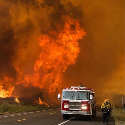
#JohnsonFire the fire has jumped containment lines, and a 1st alarm along with 2 strike teams have been requested to the scene.
#johnsonfire Resources are getting a knock down on the fire and making access to it, per incident command. 1 copter to continue their response. #cafire #wildfire
#JohnsonFire Per IC, crews making a knockdown on fire, one copter to stay en route.


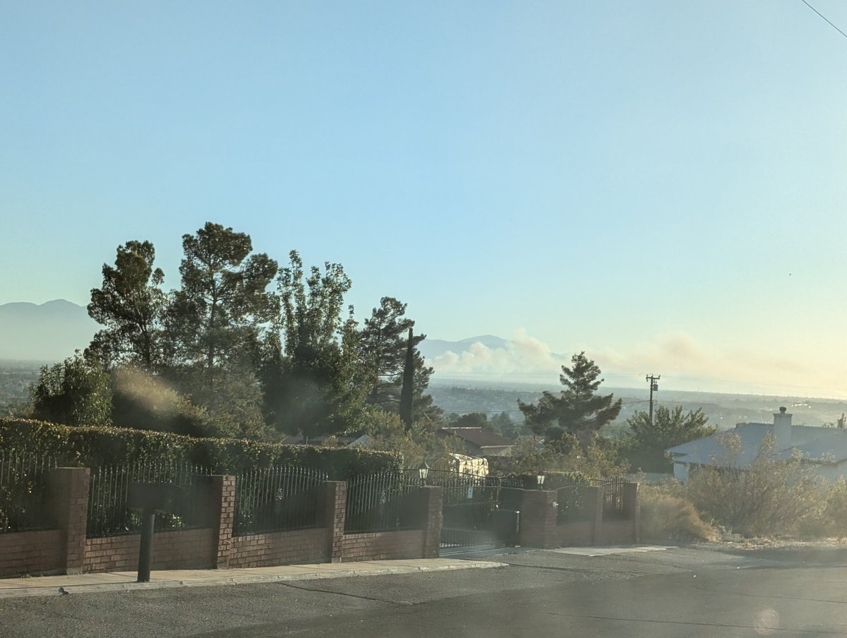
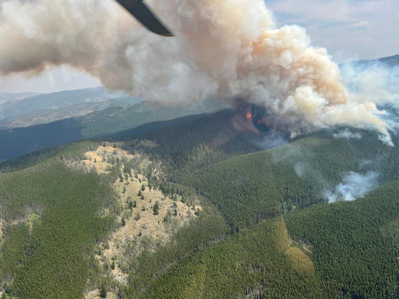
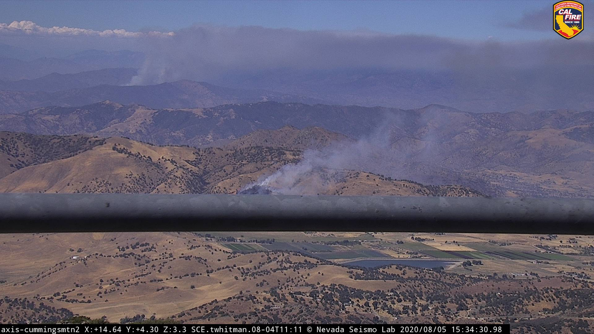
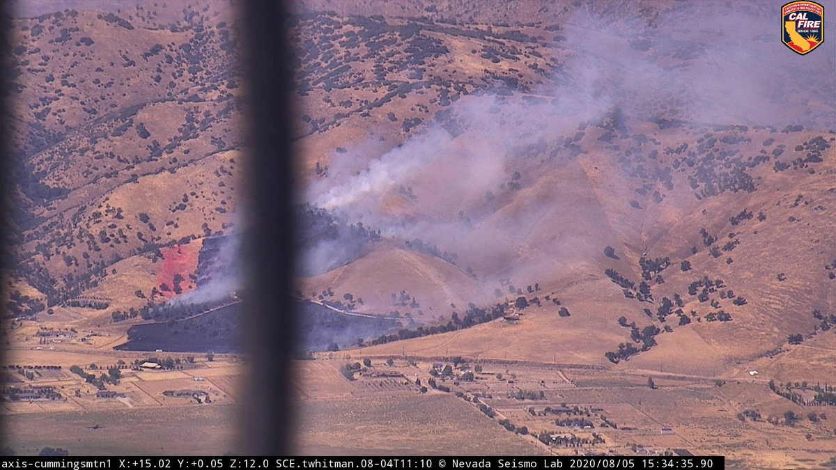
The #JohnsonFire has went nuclear this afternoon in southwestern New Mexico developing a massive pyrocumulus plume exceeding 30,000 feet at times. Fire season is really taking off across the Southwest. #NMwx


This be the #JohnsonFire
New start San Bernardino County in Phelan at Johnson Rd & Snow Line Road. 15 acres and requested additional tankers and helicopters

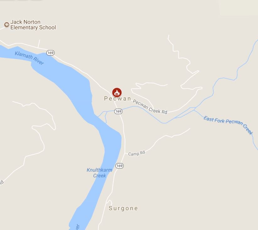
#RT @CAL_FIRE: #JohnsonFire [final] off Highway 169 in Pecwan (Humboldt County) is 100% contained at 16 acres.
![MarinBUZZ's tweet image. #RT @CAL_FIRE: #JohnsonFire [final] off Highway 169 in Pecwan (Humboldt County) is 100% contained at 16 acres.](https://pbs.twimg.com/media/DiPQDnbU0AApFri.jpg)
Firefighters are battling a 10 acre fire at Highway 169 in Pecwan (Humboldt County). #JohnsonFire Structures threatened.
New incident: #JohnsonFire off Johnson Street and Ave 82 in Riverside County is 25 acres. rvcfire.org/_Layouts/Incid…

#RT @CAL_FIRE: #JohnsonFire off Johnson Road and Limeridge Dr, East of Elizabeth Lake in Los Angeles County is 200 acres. Lead agency: @LACoFDPIO

#JohnsonFire off Johnson Street and Ave 82 in Riverside County is 75 acres and 85% contained. rvcfire.org/_Layouts/Incid…


#JohnsonFire; The forward progress of the fire has been stopped and crews have line around the fire. FF’s will remain on scene for about an hour mopping up. @VCFD @cityofventura #vcfd


#JohnsonFire off Johnson Street and Ave 82 in Riverside County is 75 acres and 30% contained. rvcfire.org/_Layouts/Incid…

Something went wrong.
Something went wrong.
United States Trends
- 1. Good Friday N/A
- 2. #FanCashDropPromotion N/A
- 3. Wart N/A
- 4. #FridayVibes N/A
- 5. #EmployeeAppreciationDay N/A
- 6. UNCONDITIONAL SURRENDER N/A
- 7. #OnlyFriendsDreamOnEP2 N/A
- 8. RED Friday N/A
- 9. Maradona N/A
- 10. Gerald N/A
- 11. Happy Friyay N/A
- 12. Shohei Ohtani N/A
- 13. #MaríaCorinaNoMeInteresas N/A
- 14. Russ N/A
- 15. Singletary N/A
- 16. Mighty Mouse N/A
- 17. Messi N/A
- 18. Etherean N/A
- 19. Remember the Alamo N/A
- 20. Flipper N/A