#wildfire search results

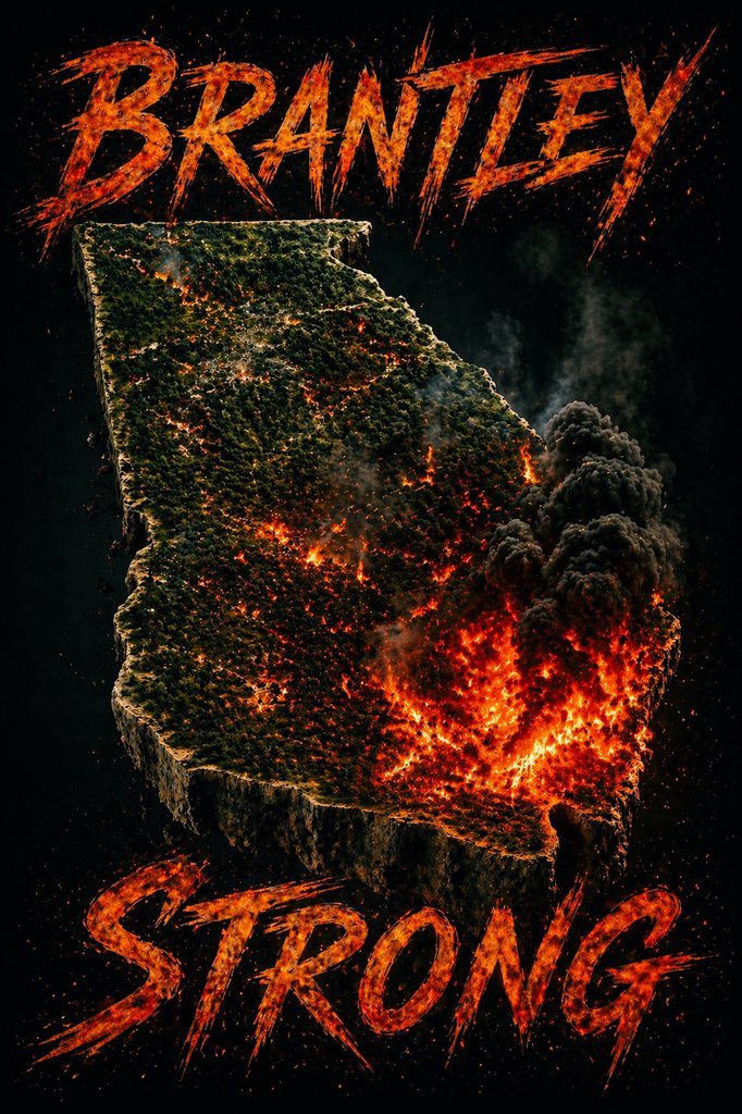
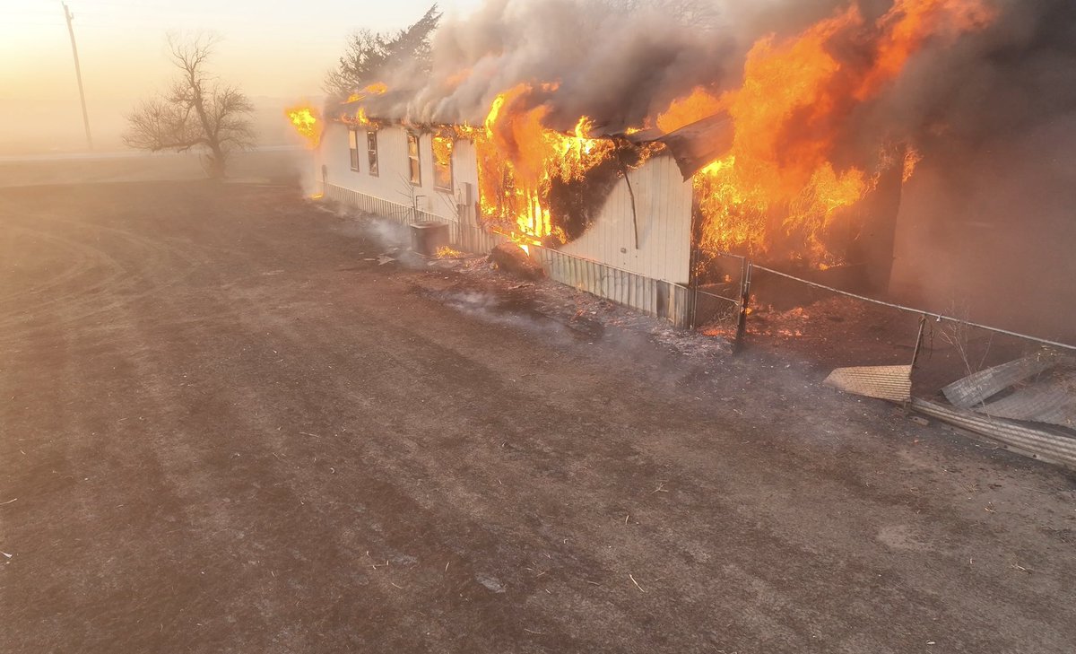
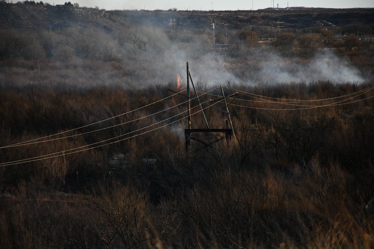
Day 3 - Brantley County, GA, #Wildfire. 5000 acres burned, 87 homes destroyed, no fatalities. (Video from Satilla River west by GeorgiaBoy)
Day 3 - Brantley County, GA, #Wildfire. One chopper loads water, another waits. Cycle keeps repeating. (Video from Satilla River west by GeorgiaBoy)

FIERY BATTLE 🔥: Members of the Chatham County Fire Department work diligently to combat the spread of flames in Georgia, which continue to scorch the landscape. #Georgia #Wildfire #Firefighters #FOXWeathe

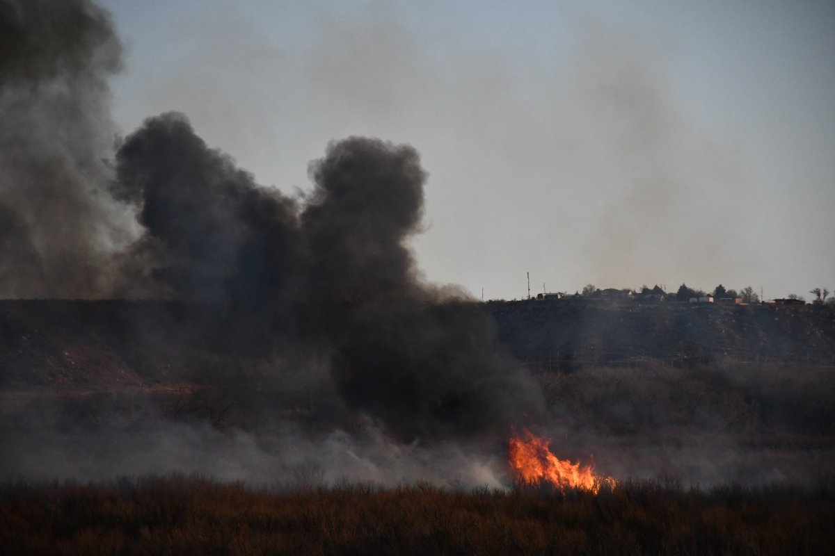
The Pineland Road Fire continues to burn in south Georgia this afternoon, and @NOAA's #GOESEast (#GOES19) has been tracking the smoke and heat from the blaze. According to @GaTrees, the #wildfire has scorched nearly 9,000 acres and is only 10% contained.

Here is Cordaro's explanation why the #Veluwe #natuurbrand #wildfire was soon detected by #magnetometers. I know he speaks from experience with these matters; been following his work here - especially regarding #earthquakes - for years now ⤵️ #ionosphere x.com/rrichcord/stat…

Any disturbance, even smoke, that rises high enough in our atmosphere will disturb the ionosphere. And any ionospheric disturbance will cause a magnetic anomaly on a ground-based magnetometer.

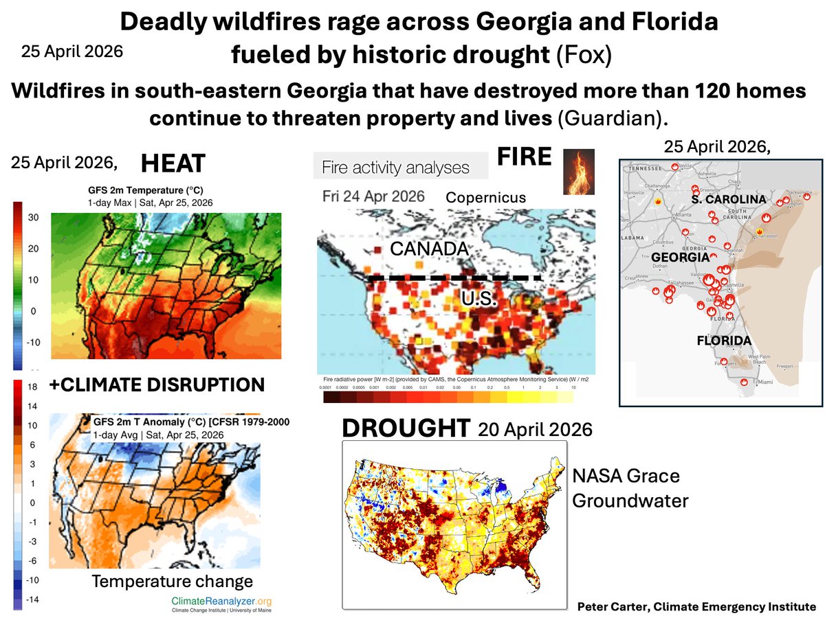
GEORGIA & FLORIDA FIRES RAGE ON- FUELLED BY HISTORIC DROUGHT Fires that destroyed 120 Georgia still a threat Historic cross U.S. drought Fox Weather #wildfire #climatechange #drought #globalwarming
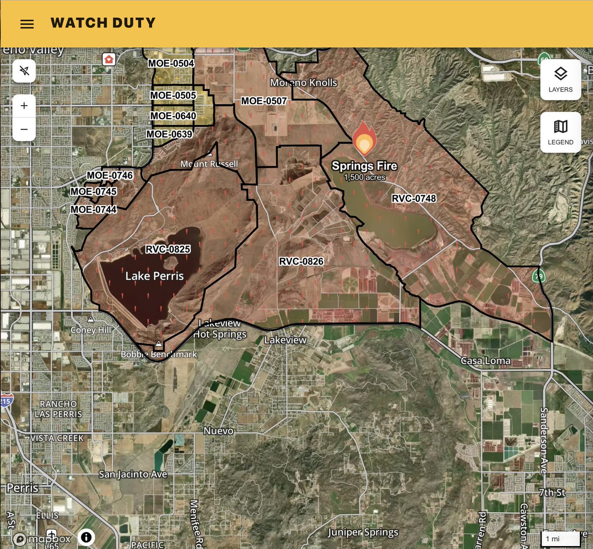
Yesterday’s #SpringsFire in Riverside County burned more than 4,100 acres resulting in evacuation orders and warnings, a reminder even in April #wildfire is a threat.

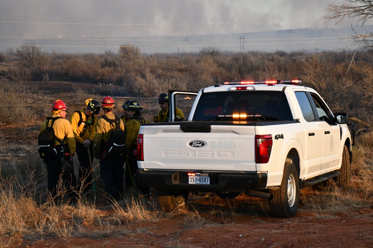
On the front line of the #CowCreekFire. Active #wildfire flames near Bronson, Florida. This is an active wildfire burning out of control in spots, with more than 1,400 acres already gone and containment still low. Crews with the Florida Forest Service are hitting it from the


🔥 Exposure to #wildfire smoke may increase risk for #BladderCancer, #BreastCancer and other malignancies, #AACR26 data show. As fires become more common & intense, the public must be better informed of these risks, Dr. Shuguang Leng @UNMCCC tells Healio. vist.ly/4zqvw


🚨 EVACUATION ALERT: A critical fire emergency is unfolding. The Pineland Road Fire has reached 16,000+ acres (10% contained), forcing active evacuations in Echols County, GA. A second 5,000-acre fire is also prompting evacuations nearby. #GAwx #FLwx #Wildfire

Din Dahade : जंगल में लगी भीषण आग , 24 घंटे से धधक रही आग #ForestFire #Wildfire #FireAlert #Environment #Disaster #ZeeMPCG For More Updates: rb.gy/5bw5y3
Georgia wildfires that destroyed more than 120 homes continue to threaten residents #Climate #Wildfire #Georgia seattletimes.com/nation-world/n…

Major #wildfire in the heart of #TheNetherlands. #Footage of a Chinook reloading water.

Organizational charts sound boring— until they start shaping wildfire response, research continuity, and field-level decision making. #Wildfire #PublicLands
GLOBAL WARMING NOW HAS EASTERN US BURNING (EXTRAORDINARY) In Georgia- Mass evacuations - 80 homes now destroyed (ABC News) Raging fires from extreme heating and drought across Eastern U.S. Only April. #wildfire #climatechange #globalwarming #drought


लापरवाही या साजिश, क्यों जल रहे 'देवभूमि' के जंगल? समझिए पहाड़ी इलाकों में आग फैलने की पूरी कहानी पूरी खबर🔗 timesnowhindi.com/explainer/utta… #WildFire #Devbhoomi #Uttarakhand

New #wildfire start #RiversideFire 04/24/26 2017 Espanola bosque maps.app.goo.gl/AzW5CJwrb5nBni… Coordinates: 35.998167, -106.064667 #NMFire 🔥🔥🔥

Here is Cordaro's explanation why the #Veluwe #natuurbrand #wildfire was soon detected by #magnetometers. I know he speaks from experience with these matters; been following his work here - especially regarding #earthquakes - for years now ⤵️ #ionosphere x.com/rrichcord/stat…
Any disturbance, even smoke, that rises high enough in our atmosphere will disturb the ionosphere. And any ionospheric disturbance will cause a magnetic anomaly on a ground-based magnetometer.

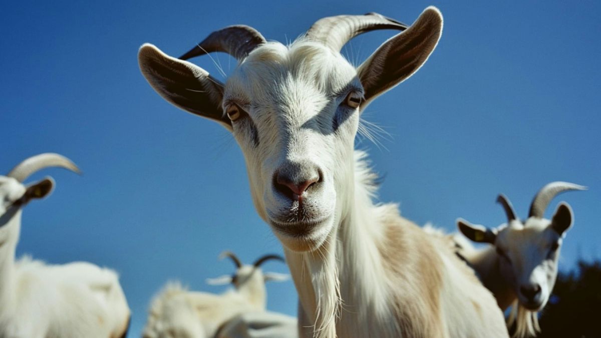
Goats to the rescue! 🐐 The Ventura County Goat Brigade just cleared hillside brush near Reagan Library. (continue reading: simi.clair.id/the-ventura-co…) @ReaganLibrary @VenturaCountyFire @CityofSimiValley #VenturaCounty #California #Wildfire

The man accused of sparking the Ditch 2 Fire has pleaded guilty to an arson charge. #sask #wildfire #weyakwin #laronge #court #crime #arson #rcmp cjme.com/2026/04/29/man…


The man accused of sparking the Ditch 2 Fire has pleaded guilty to an arson charge. #sask #wildfire #weyakwin #laronge #court #crime #arson #rcmp ckom.com/2026/04/29/man…
Major #wildfire in the heart of #TheNetherlands. #Footage of a Chinook reloading water.
Mora County mishandled more than $3 million in #wildfire #relief funds, including spending nearly $169,000 to renovate a privately owned theater, according to a special state audit. #Mora #NMFire 🔥🔥🔥 santafenewmexican.com/news/local_new…


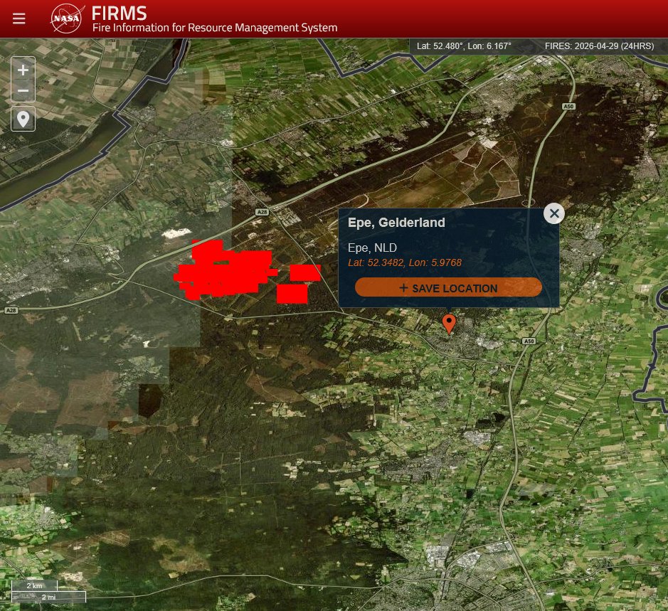
#Netherland > #wildfire ’t Harde / Epe / Gelderland - NL ALERT 6pm Dutch Public Warning System. Fire with a lot of smoke from the Veluwe. Stay out of the smoke! Close windows and doors. Switch ventilation systems off. For more details and updates, check veiligheidsregioflevoland.nl


In the U.S., 4.8M million homes are at high or extreme risk of #wildfire. @IBHS_org research on the impact of wildfires and other natural #disasters on homes helps protect property, save lives – and lower #insurance claims. insurancejournal.com/news/southeast…

🔥 🚒 #wildfire #Netherlands 😭 #Veluwe #natuurbrand detected also via #magnetometers !!! @Defensie @DefensieStas
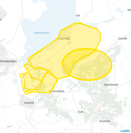
The fire at Nunspeet, Netherlands was detected by magnetic anomaly at three magnetometer stations within 300 km of the fire. It was first detected at Manhay, Belgium (Station MAB) because it was closest. Next, it was detected at Dourbes, Belgium (DOU), and finally at Wingst,


Webinar on Wildfire Risk 📅 12 May 2026 | 12:00–13:00 UTC Wildland-urban interface fires are a growing global concern. Join this webinar to hear how international collaboration can improve wildfire modelling and improve preparedness. Register: tinyurl.com/ss65twez #Wildfire


Watch | நீலகிரி வனப்பகுதிகளில் கடந்த ஒரு வாரமாக எரிந்த காட்டுத் தீயால், ஆயிரக்கணக்கான ஏக்கர் வனப்பகுதி நாசம் - சாம்பல் படிந்த தனது வாழ்விடத்தில் நடந்து சென்ற புலியின் காட்சி #SunNews | #Nilgiris | #WildFire | #Tiger
Volunteer #firefighters watch a #wildfire from the fire station in Otsuchi, #Iwate Prefecture, #Japan.


De Nederlandse overheid is zelf het grootste gevaar voor de natuur. En de boeren en bedrijven maar uitknijpen onder de noemer van 'natuurbescherming'. #tHarde #natuurbrand #wildfire


🐴 After prison, Kris starts over at a ranch where love, ambition and second chances collide. #Wildfire now streaming on STV Player.

Indeed (This #April #wildfire & #muirburn problems evident in the #Cairngorms area too)


The early wildfire season continues up here in the English Peak District Doesn't bode well for what could be blisteringly hot summer bbc.co.uk/news/articles/…


🚨Having a portable fire pump and hose system that sprays water from your pool is a must have these days if you live in a #wildfire prone area. Visit jjsfiresupply.com or 📞 772-284-4233 to order yours #floridawildfires #wildfireready #georgiawildfire


This comes as wildfires have sparked across the state. #drought #wildfire #Georgia wsbtv.com/news/local/atl…


North #SanDiegoCounty #wildfire alert from #Watchfire: Live Oak Fire in Northeast Fallbrook, CA: #EvacuationOrders in place. I don't grasp the 'shelter in place' hashed in light blue. Forward progress reported stopped per IC. share.watchduty.org/i/95812?ts=177…


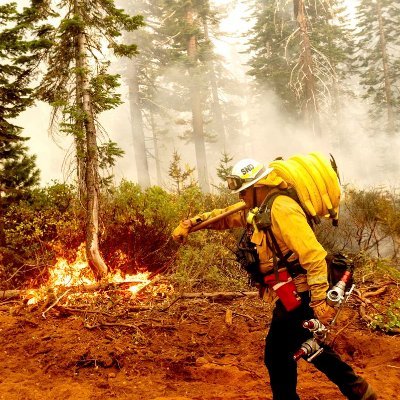


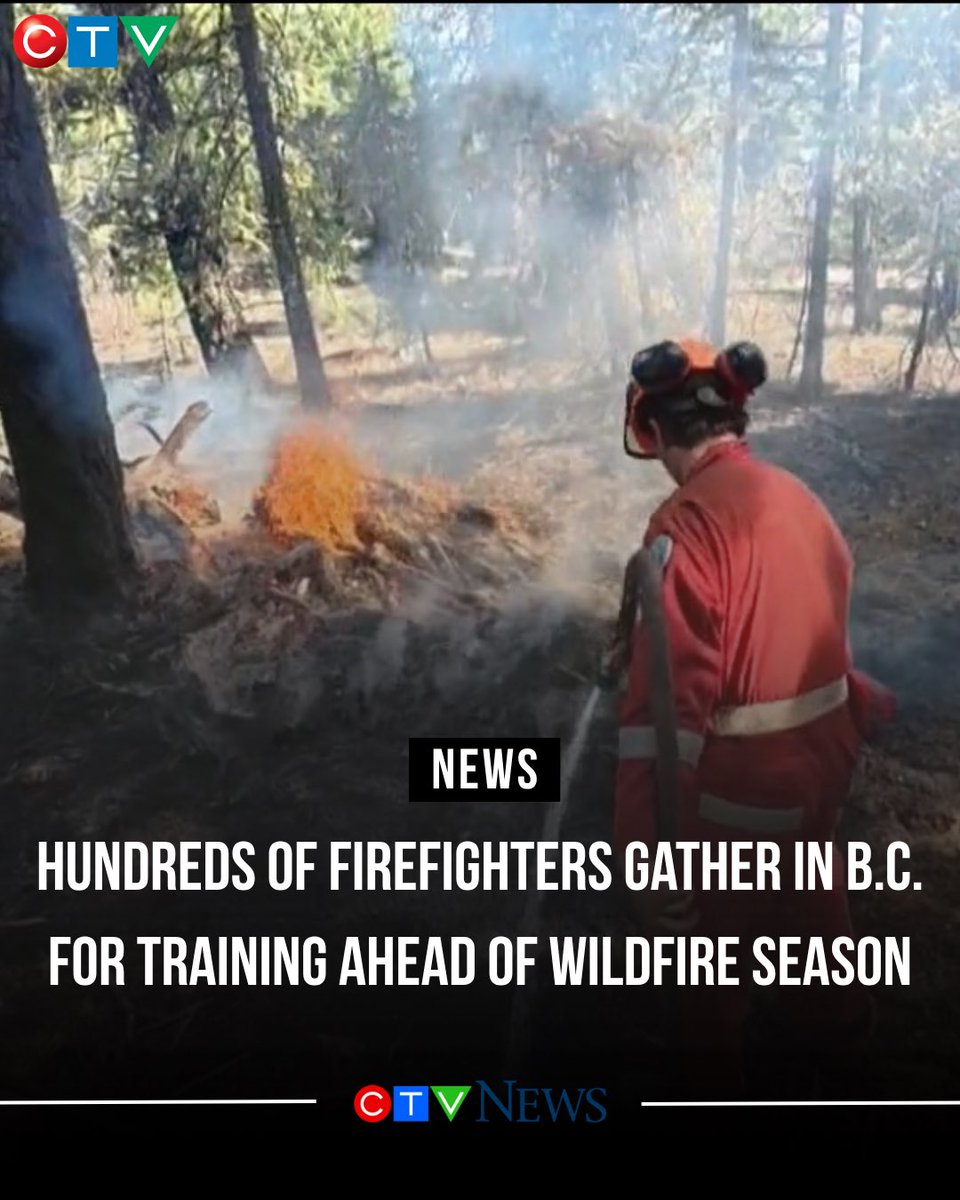
Hundreds of new recruits are in Merritt, participating in the BCWS bootcamp getting ready for the 2026 wildfire season. By the end of their training they will be well prepared to help protect our communities and forests. Let’s go team! ctvnews.ca/video/2026/04/… #wildfire
Indeed (This #April #wildfire & #muirburn problems evident in the #Cairngorms area too)
The early wildfire season continues up here in the English Peak District Doesn't bode well for what could be blisteringly hot summer bbc.co.uk/news/articles/…

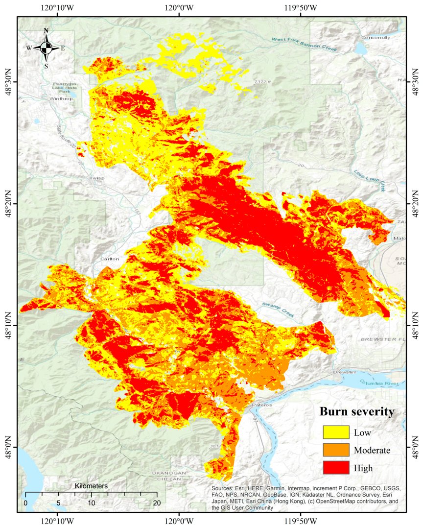
🔥🌳 Optimizing Stacked Ensemble #MachineLearning Models for Accurate #Wildfire Severity #Mapping ✍️ Linh Nguyen Van and Giha Lee 🔗 brnw.ch/21x1in6

A bunch of dairies and other cattle facilities are in the evacuation zone of the Springs Fire near Hemet, California. This is very concerning. Does anyone have any information on the ground? #onehealth #wildfire #springsfire #hemet #animalwelfare #animalrights #gotmilk
#Netherland > #wildfire ’t Harde / Epe / Gelderland - NL ALERT 6pm Dutch Public Warning System. Fire with a lot of smoke from the Veluwe. Stay out of the smoke! Close windows and doors. Switch ventilation systems off. For more details and updates, check veiligheidsregioflevoland.nl
GEORGIA & FLORIDA FIRES RAGE ON- FUELLED BY HISTORIC DROUGHT Fires that destroyed 120 Georgia still a threat Historic cross U.S. drought Fox Weather #wildfire #climatechange #drought #globalwarming

This week’s K‑State Agronomy eUpdate is packed with timely crop management info: #wheat topdressing and herbicide timing, first hollow stem updates, #wildfire recovery guidance, #canola fertility & more. Read it here: bit.ly/3MSIVJU #ksag

🌳🔥 Regional #Forest #Wildfire Mapping Through Integration of #Sentinel-2 and #Landsat 8 Data in #GoogleEarth #Engine with Semi-Automatic Training Sample Generation ✍️ Yue Chen et al. 🔗 brnw.ch/21wZXhJ


The BC Wildfire Service has seen 2,400 applicants for this season More equipment, 10 new structure protection units & mechanical assets, and more We are taking the necessary steps to prepare for whatever comes our way during wildfire season #wildfire youtu.be/nE1TFCtJkRU?si…
Webinar on Wildfire Risk 📅 12 May 2026 | 12:00–13:00 UTC Wildland-urban interface fires are a growing global concern. Join this webinar to hear how international collaboration can improve wildfire modelling and improve preparedness. Register: tinyurl.com/ss65twez #Wildfire

Photography I did for @NewsChannel10 during the fire near Borger earlier with @Annuh_wx @SparkServiceWX fire is now 80% contained burned nearly 300 acres in about 2 hours #txwx #wxtwitter #wildfire

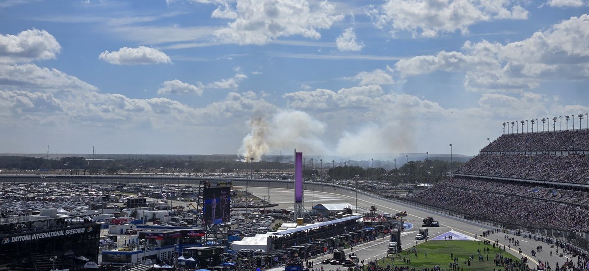
Appears to be a #wildfire beginning just off turn 1/2 of @DAYTONA. Very dry here on the east coast of FL and very windy today as well. #Daytona500 #flwx #nascarwx

5:36pm The county line wildfire in Avery County has grown to 50 acres, and they are sending fixed-wing air tankers in now. #wildfire #wncwx #ncwx


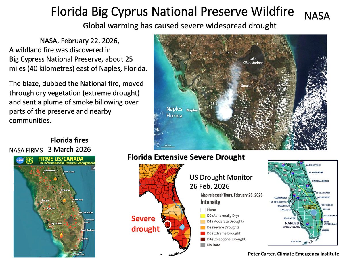
NASA, BIG CYPRUS PRESERVE FORIDA WILDFIRE NASA, February 22, 2026, A wildland fire in Big Cypress National Preserve. Dry vegetation in region of severe drought. science.nasa.gov/earth/earth-ob…. #wildfire #climatechange #globalwarming
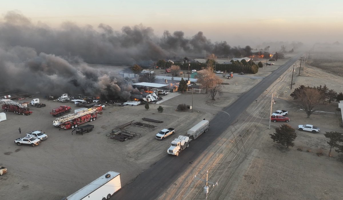
UPDATE: Ranger Road Fire in Beaver County, OK. • 283,000 acres burned • 15% contained • State of Emergency declared • Gusts 50-70 mph fueling spread Critical fire weather continues across the region. Stay vigilant. #OKwx #wildfire


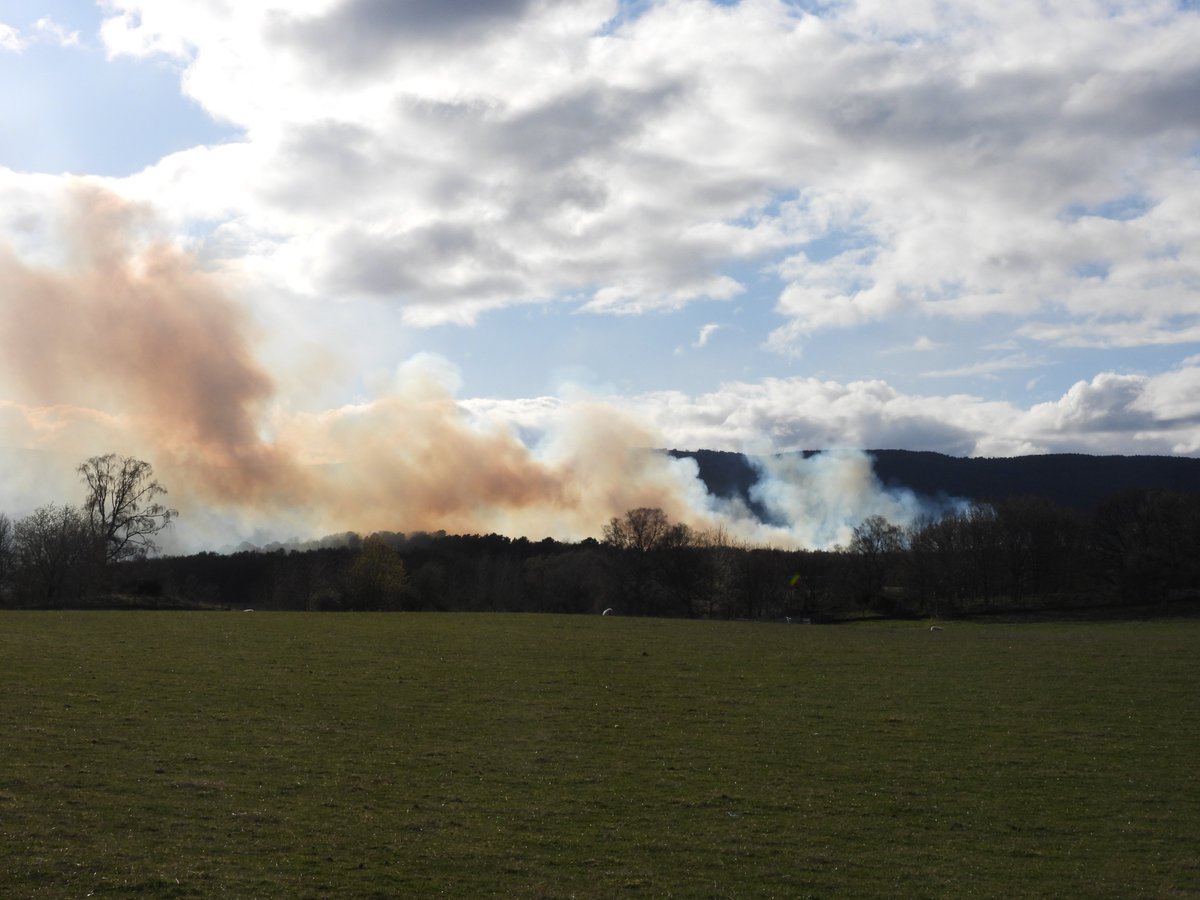
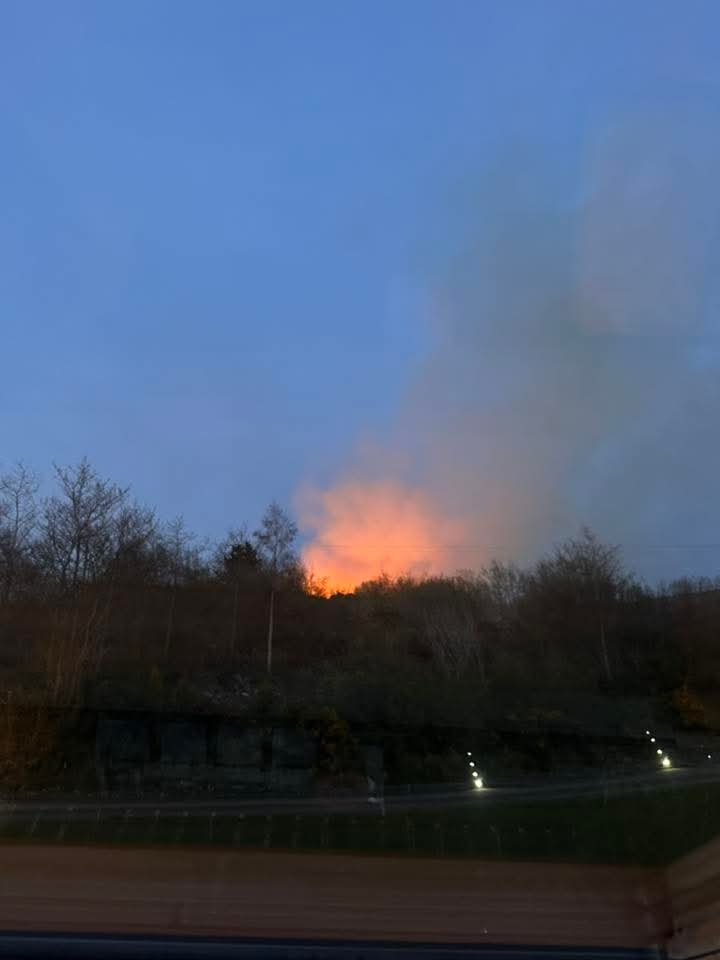
🔥 A wildfire this evening up Mountain Top, Letterkenny, Donegal This follow a condition orange fire risk issued this evening which is in place until the 27th of April. Image by Declan Mc Eleney #wildfire #Donegal #letterkenny #mountaintop #fire #wind #weather #fblifestyle
GLOBAL WARMING NOW HAS EASTERN US BURNING (EXTRAORDINARY) In Georgia- Mass evacuations - 80 homes now destroyed (ABC News) Raging fires from extreme heating and drought across Eastern U.S. Only April. #wildfire #climatechange #globalwarming #drought

FULL FORCE FRIDAY:🆕Feb 20 5⃣6⃣🎧 EXISTANCE - Wildfire 🇫🇷⚛️ 5th album from Clermont, French Heavy Metal outfit⚛️ BC➡️existance.bandcamp.com/album/wildfire…⚛️ #Existance #Wildfire #HeavyMetal #Verycords #FrenchMetal #FFFFeb20 #KMäN

Something went wrong.
Something went wrong.
United States Trends
- 1. Supreme Court N/A
- 2. Voting Rights Act N/A
- 3. SCOTUS N/A
- 4. Louisiana N/A
- 5. NBA Street N/A
- 6. FOMC N/A
- 7. Deshaun N/A
- 8. Comey N/A
- 9. Jim Crow N/A
- 10. Zambia N/A
- 11. Powell N/A
- 12. Section 2 N/A
- 13. Callais N/A
- 14. #You_Complete_Our_SevEN N/A
- 15. #HighInfidelityDay N/A
- 16. #questpit N/A
- 17. Garrett Crochet N/A
- 18. Vezina N/A
- 19. Bruce Bowen N/A
- 20. The VRA N/A