#journalofmaps search results

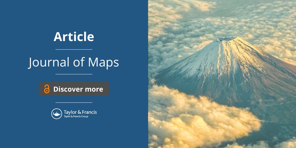
The geological mapping of Tindfjallajökull volcano, southern Iceland, gives insights into the evolution of stratovolcanoes in glaciated regions and the influence of ice in their development. Read the article from #journalofmaps : bit.ly/3efzHAK #Volcanomapping

The latest The Taylor & Francis Daily! paper.li/routledgebooks… Thanks to @tandfnewsroom @RoutledgeEd @tandfenviro #journalofmaps #transformation
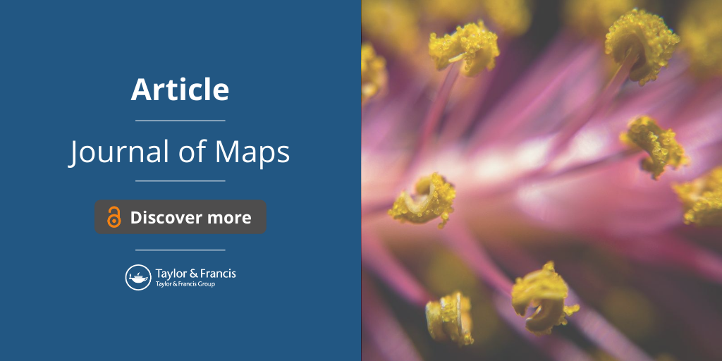
The European Pollen Database (EPD) is an effort to make pollen sequences available from across Europe. Maps based on 828 EPD sites are presented to give an overview of changes pollen assemblages over the past 15,000 years. Find out more: bit.ly/3kjp7wg #journalofmaps
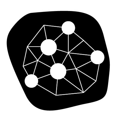
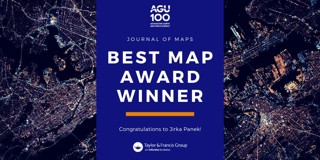
Congratulations to the winner of the #journalofmaps Best Map Award of 2019, announced earlier in the week at #agu19! @JirkaPanek impressed the judges with his innovative submission on #emotionalmaps. See the winning map here: bit.ly/2Pitbz3


The earth keeps shaking in Iceland - a good moment to enjoy this #openaccess paper showing some maps seriously deformed by #earthquakes that you can read while waiting for the next seismic event tandfonline.com/doi/full/10.10… #journalofmaps #visualisation #geography #maps
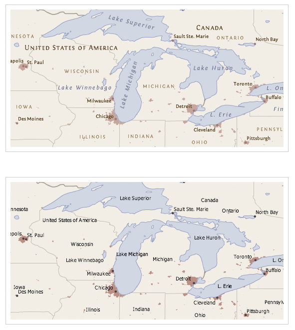
Happy Thanksgiving from Taylor & Francis! Explore the changing migration within the US through our interative flow map from #JournalofMaps: bit.ly/2OSrpU1 #ThanksGiving #USMigration

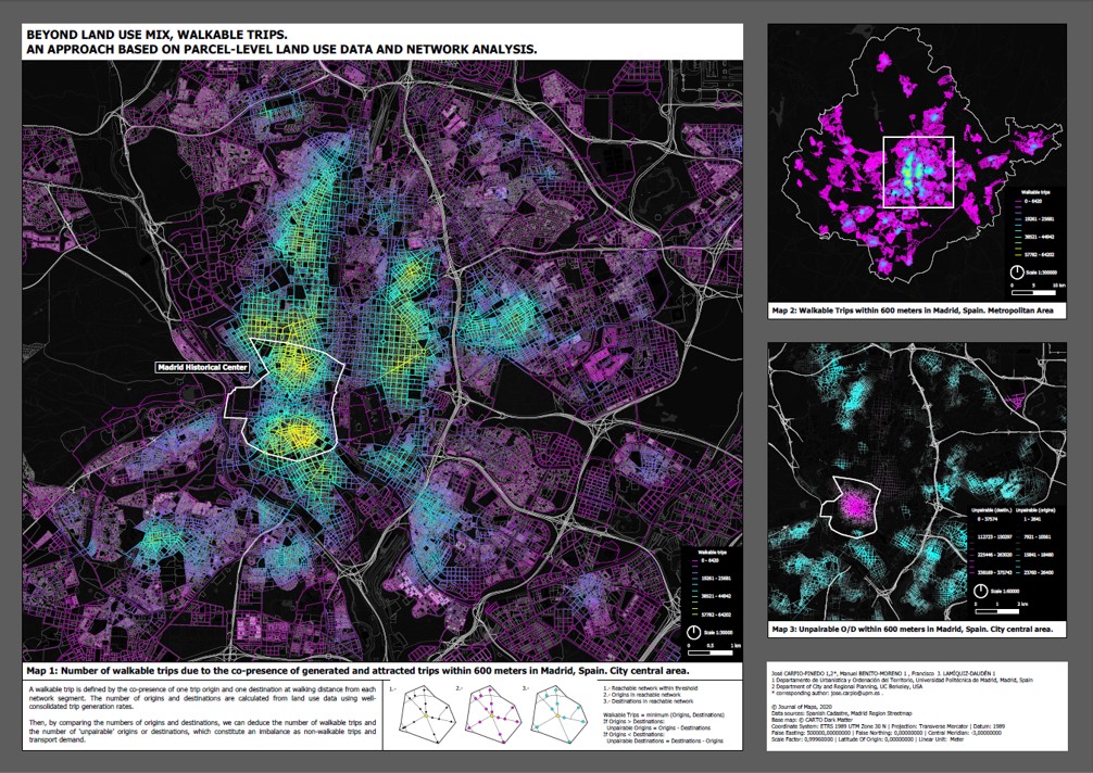
🗣️📰Nuevo artículo: Beyond land use mix, walkable trips. An approach based on parcel-level land use data and network analysis de @CarpioPi, Manuel Benito-Moreno y Patxi Lamíquiz-Daudén. Disponible en: tandfonline.com/doi/full/10.10… 👏 #Journalofmaps
Using socio-economic data from the United States census to cluster zip codes to identify and represent the locations of socio-economic diversity of the United States. Read the #openaccess article from #JournalofMaps: bit.ly/3by9ZWa
Mapping of population change enables study of the demographic dynamics of a country and provides a useful tool for planning. Read the #openaccess article from #JournalofMaps mapping the Spanish population between 1900–2011: bit.ly/33e6HGQ

🔴New #ResearchArticle in #JournalofMaps by González-Ávila, S.; Ortega, E. and Martín, B. 📰"Potential priority areas for forest-dwelling species based on the dree of forest fragmentation" 👉short.upm.es/47k77
With the aim of shifting towards a more sustainable urban transport model, cycling is being promoted in many cities. This article from Journal of Maps explores the diverse levels of use and cycling patterns in Madrid: bit.ly/2NI8JWW #JournalofMaps
"Visualising world population density as an interactive multi-scale map using the global human settlement population layer." Explore the #openaccess research from #JournalofMaps: bit.ly/3j1ffpE

Journal of Maps invites you to contribute to its latest Special Issue 'Geomorphological mapping tools for natural hazards'. Find out more and submit: bit.ly/2OcG518 #JournalofMaps

Even if research is taking a hit since we're all stuck at home, it looks like publishers are still hard at work. Pleased to announce my first sci. publication authored w/ current and past @CmichGeo personnel in @tandfonline #JournalOfMaps. Check it out! doi.org/10.1080/174456…
Submit your research to this special issue from Journal of Maps. Increase readership and citation publishing #openaccess: bit.ly/35NqR8o #JournalofMaps

'A high-resolution population grid map for Europe' from #JournalofMaps explores the use of finer datasets to improve accuracy of mapping. Read the #openaccess article today: bit.ly/34WxZ3y
"Climatic regionalisation of continental Chile"- The updated Köppen–Geiger climate classification for continental Chile is a cartographic product of great interest for climate research. Explore the #openaccess article from #journalofmaps: bit.ly/2CvGh8O

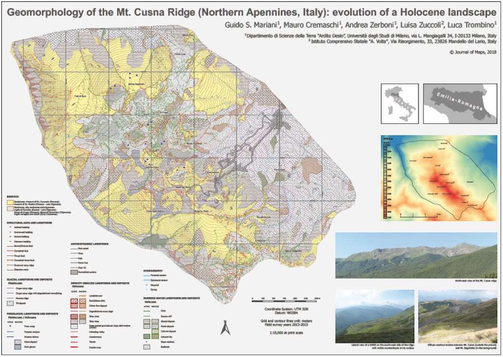
Starting the #SummerOfGeomorph with a geomorphological map published today!!!! Geomorphology of the #Cusna ridge in the Apennines of Northen Italy. Lovely place! @EGU_GM @OpenQuaternary #journalofmaps
"Geological map of Tuscany" covers the territory of the Tuscany Region, and shows the main stratigraphic and tectonic features of the internal part of the Northern Apennines. Explore the #openaccess paper from #Journalofmaps: bit.ly/33JwCWZ


#dataviz #presentation tags here Read and see this for a: Cartography Guide: A short, friendly guide to basic principles of map design #journalofmaps

From the Editors Desk: Improve your map submission by reading a great intro to the use of labeling and text on a map (axismaps.com/guide/labeling)
🔴New #ResearchArticle in #JournalofMaps by González-Ávila, S.; Ortega, E. and Martín, B. 📰"Potential priority areas for forest-dwelling species based on the dree of forest fragmentation" 👉short.upm.es/47k77
#dataviz #presentation tags here Read and see this for a: Cartography Guide: A short, friendly guide to basic principles of map design #journalofmaps
From the Editors Desk: Improve your map submission by reading a great intro to the use of labeling and text on a map (axismaps.com/guide/labeling)
The earth keeps shaking in Iceland - a good moment to enjoy this #openaccess paper showing some maps seriously deformed by #earthquakes that you can read while waiting for the next seismic event tandfonline.com/doi/full/10.10… #journalofmaps #visualisation #geography #maps
🗣️📰Nuevo artículo: Beyond land use mix, walkable trips. An approach based on parcel-level land use data and network analysis de @CarpioPi, Manuel Benito-Moreno y Patxi Lamíquiz-Daudén. Disponible en: tandfonline.com/doi/full/10.10… 👏 #Journalofmaps
Understanding fishing activities is essential for marine and maritime awareness and knowledge 🎣 Researchers produced a map in that identifies fishing activities at European scale through density points: bit.ly/3knIDXN #journalofmaps

"Geological map of Tuscany" covers the territory of the Tuscany Region, and shows the main stratigraphic and tectonic features of the internal part of the Northern Apennines. Explore the #openaccess paper from #Journalofmaps: bit.ly/33JwCWZ
"Visualising world population density as an interactive multi-scale map using the global human settlement population layer." Explore the #openaccess research from #JournalofMaps: bit.ly/3j1ffpE
The geological map of Piemonte Region (Italy) is a graphic representation of the geology of the region. Explore the #openaccess article from #JournalofMaps: bit.ly/3hias1F
"Interactive display of surnames distributions in historic and contemporary Great Britain" Discover the #openaccess paper from #journalofmaps: bit.ly/2YHz1OZ

"Climatic regionalisation of continental Chile"- The updated Köppen–Geiger climate classification for continental Chile is a cartographic product of great interest for climate research. Explore the #openaccess article from #journalofmaps: bit.ly/2CvGh8O
The European Pollen Database (EPD) is an effort to make pollen sequences available from across Europe. Maps based on 828 EPD sites are presented to give an overview of changes pollen assemblages over the past 15,000 years. Find out more: bit.ly/3kjp7wg #journalofmaps
Mapping of population change enables study of the demographic dynamics of a country and provides a useful tool for planning. Read the #openaccess article from #JournalofMaps mapping the Spanish population between 1900–2011: bit.ly/33e6HGQ
With the aim of shifting towards a more sustainable urban transport model, cycling is being promoted in many cities. This article from Journal of Maps explores the diverse levels of use and cycling patterns in Madrid: bit.ly/2NI8JWW #JournalofMaps
The geological mapping of Tindfjallajökull volcano, southern Iceland, gives insights into the evolution of stratovolcanoes in glaciated regions and the influence of ice in their development. Read the article from #journalofmaps : bit.ly/3efzHAK #Volcanomapping
2D and 3D geovisualization have revealed the growth of anthropogenic land forms since original mapping of the landscape in the middle of the 20th century: bit.ly/3dN0GmY #Geovisualization #JournalofMaps

Using socio-economic data from the United States census to cluster zip codes to identify and represent the locations of socio-economic diversity of the United States. Read the #openaccess article from #JournalofMaps: bit.ly/3by9ZWa
'A high-resolution population grid map for Europe' from #JournalofMaps explores the use of finer datasets to improve accuracy of mapping. Read the #openaccess article today: bit.ly/34WxZ3y
Even if research is taking a hit since we're all stuck at home, it looks like publishers are still hard at work. Pleased to announce my first sci. publication authored w/ current and past @CmichGeo personnel in @tandfonline #JournalOfMaps. Check it out! doi.org/10.1080/174456…
Submit your research to this special issue from Journal of Maps. Increase readership and citation publishing #openaccess: bit.ly/35NqR8o #JournalofMaps

'A high-resolution population grid map for Europe' from #JournalofMaps explores the use of finer datasets to improve accuracy of mapping. Read the #openaccess article today: bit.ly/34WxZ3y
The geological mapping of Tindfjallajökull volcano, southern Iceland, gives insights into the evolution of stratovolcanoes in glaciated regions and the influence of ice in their development. Read the article from #journalofmaps : bit.ly/3efzHAK #Volcanomapping
The European Pollen Database (EPD) is an effort to make pollen sequences available from across Europe. Maps based on 828 EPD sites are presented to give an overview of changes pollen assemblages over the past 15,000 years. Find out more: bit.ly/3kjp7wg #journalofmaps
Happy Thanksgiving from Taylor & Francis! Explore the changing migration within the US through our interative flow map from #JournalofMaps: bit.ly/2OSrpU1 #ThanksGiving #USMigration
"Climatic regionalisation of continental Chile"- The updated Köppen–Geiger climate classification for continental Chile is a cartographic product of great interest for climate research. Explore the #openaccess article from #journalofmaps: bit.ly/2CvGh8O
Mapping of population change enables study of the demographic dynamics of a country and provides a useful tool for planning. Read the #openaccess article from #JournalofMaps mapping the Spanish population between 1900–2011: bit.ly/33e6HGQ
The earth keeps shaking in Iceland - a good moment to enjoy this #openaccess paper showing some maps seriously deformed by #earthquakes that you can read while waiting for the next seismic event tandfonline.com/doi/full/10.10… #journalofmaps #visualisation #geography #maps
"Interactive display of surnames distributions in historic and contemporary Great Britain" Discover the #openaccess paper from #journalofmaps: bit.ly/2YHz1OZ
2D and 3D geovisualization have revealed the growth of anthropogenic land forms since original mapping of the landscape in the middle of the 20th century: bit.ly/3dN0GmY #Geovisualization #JournalofMaps
"Visualising world population density as an interactive multi-scale map using the global human settlement population layer." Explore the #openaccess research from #JournalofMaps: bit.ly/3j1ffpE
Using socio-economic data from the United States census to cluster zip codes to identify and represent the locations of socio-economic diversity of the United States. Read the #openaccess article from #JournalofMaps: bit.ly/3by9ZWa
Journal of Maps invites you to contribute to its latest Special Issue 'Geomorphological mapping tools for natural hazards'. Find out more and submit: bit.ly/2OcG518 #JournalofMaps
Congratulations to the winner of the #journalofmaps Best Map Award of 2019, announced earlier in the week at #agu19! @JirkaPanek impressed the judges with his innovative submission on #emotionalmaps. See the winning map here: bit.ly/2Pitbz3
The geological map of Piemonte Region (Italy) is a graphic representation of the geology of the region. Explore the #openaccess article from #JournalofMaps: bit.ly/3hias1F
Starting the #SummerOfGeomorph with a geomorphological map published today!!!! Geomorphology of the #Cusna ridge in the Apennines of Northen Italy. Lovely place! @EGU_GM @OpenQuaternary #journalofmaps
🗣️📰Nuevo artículo: Beyond land use mix, walkable trips. An approach based on parcel-level land use data and network analysis de @CarpioPi, Manuel Benito-Moreno y Patxi Lamíquiz-Daudén. Disponible en: tandfonline.com/doi/full/10.10… 👏 #Journalofmaps
We are delighted to announce at #AGU19 that the winner of the #journalofmaps Best Map Award of 2019 is @JirkaPanek with his research on #emotionalmaps! See the winning map here: bit.ly/2PvCJG6
With the aim of shifting towards a more sustainable urban transport model, cycling is being promoted in many cities. This article from Journal of Maps explores the diverse levels of use and cycling patterns in Madrid: bit.ly/2NI8JWW #JournalofMaps
"Geological map of Tuscany" covers the territory of the Tuscany Region, and shows the main stratigraphic and tectonic features of the internal part of the Northern Apennines. Explore the #openaccess paper from #Journalofmaps: bit.ly/33JwCWZ
Submit your research to this special issue from Journal of Maps. Increase readership and citation publishing #openaccess: bit.ly/35NqR8o #JournalofMaps
Something went wrong.
Something went wrong.
United States Trends
- 1. #Oscars N/A
- 2. #AEWRevolution N/A
- 3. Sinners N/A
- 4. Sean Penn N/A
- 5. Roman Anthony N/A
- 6. Aaron Judge N/A
- 7. Ryan Coogler N/A
- 8. Ludwig N/A
- 9. Ospreay N/A
- 10. Gunnar N/A
- 11. Frankenstein N/A
- 12. Severino N/A
- 13. Ronda Rousey N/A
- 14. Julio Rodriguez N/A
- 15. Skenes N/A
- 16. Amy Madigan N/A
- 17. Conan N/A
- 18. NATO N/A
- 19. Junior Caminero N/A
- 20. Delroy N/A