#kfor4 search results


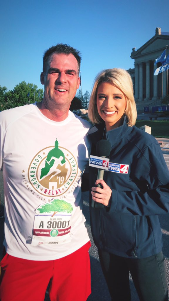
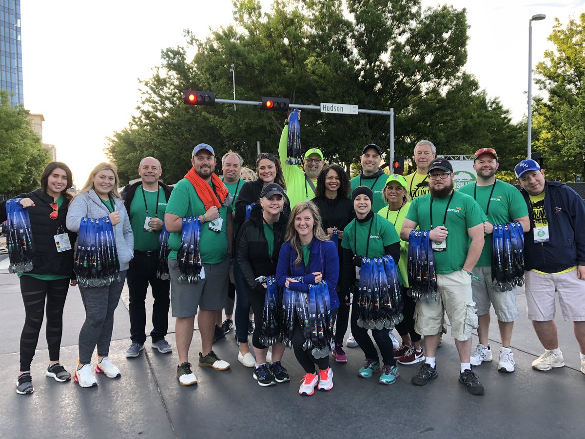
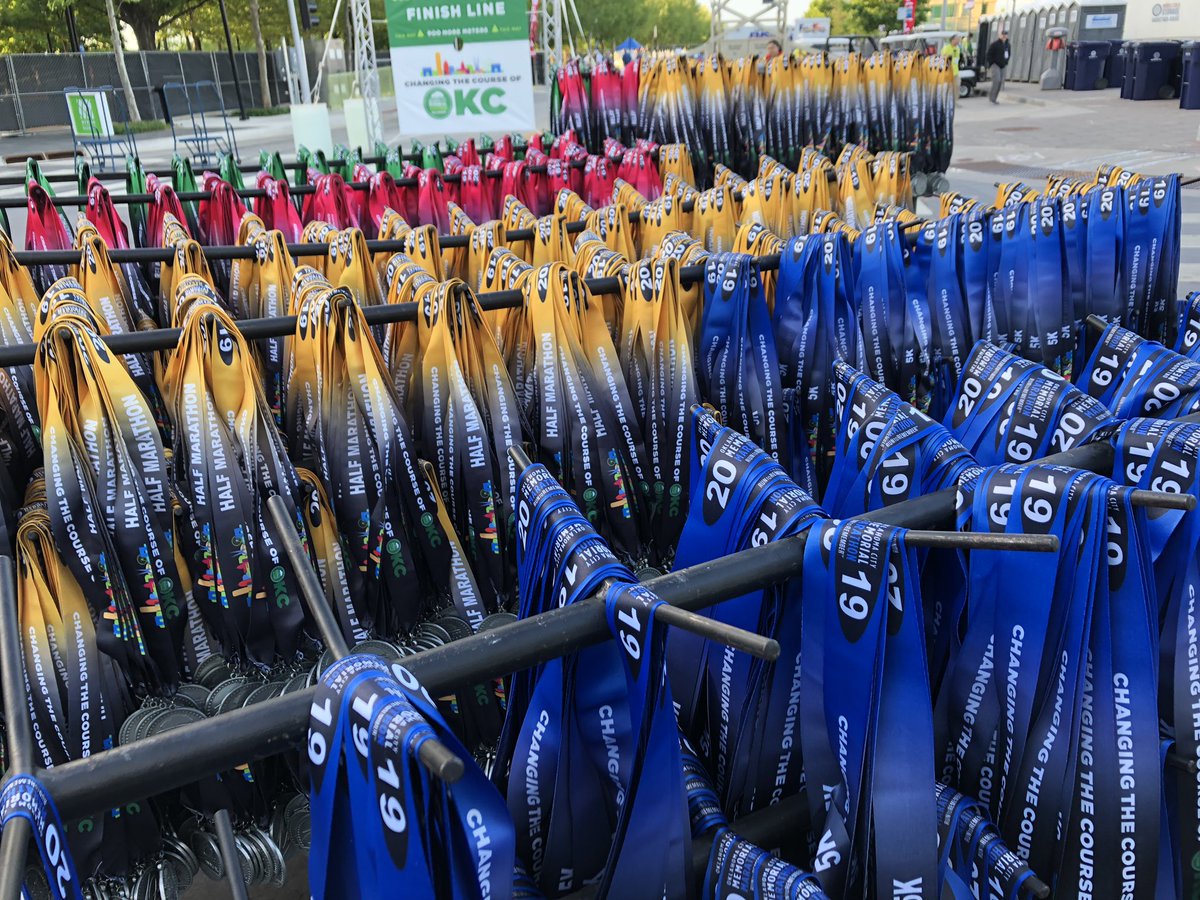
“How are you feeling @GovStitt?” “Peyton, I think I should’ve trained more.” 😂😂 All the runners did amazing today at the @OKCMarathon! I’m so proud to live in this city and work with my @kfor team! #RUNtoRemember #KFOR4


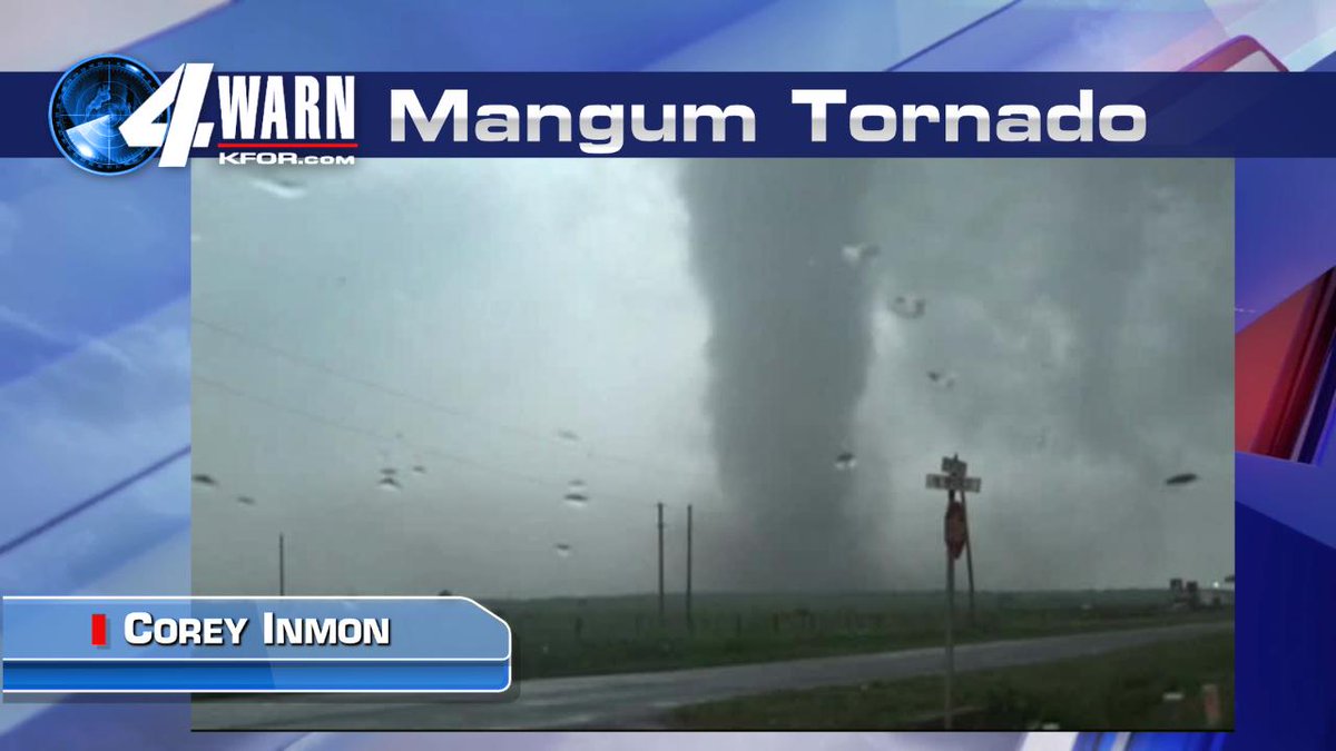
Preliminary Mangum Oklahoma. Tornadic winds estimated to be about 212MPH from Doppler on wheels. Just shy of the Moore May 20th, 2013 Tornado intensity of 220MPH. #OKWX #KFOR4 Mike

3PM look at Updraft spin in Supercells that may form this afternoon into Friday evening. Computer model estimate. #OKWX #KFOR4 @KFOR Mike


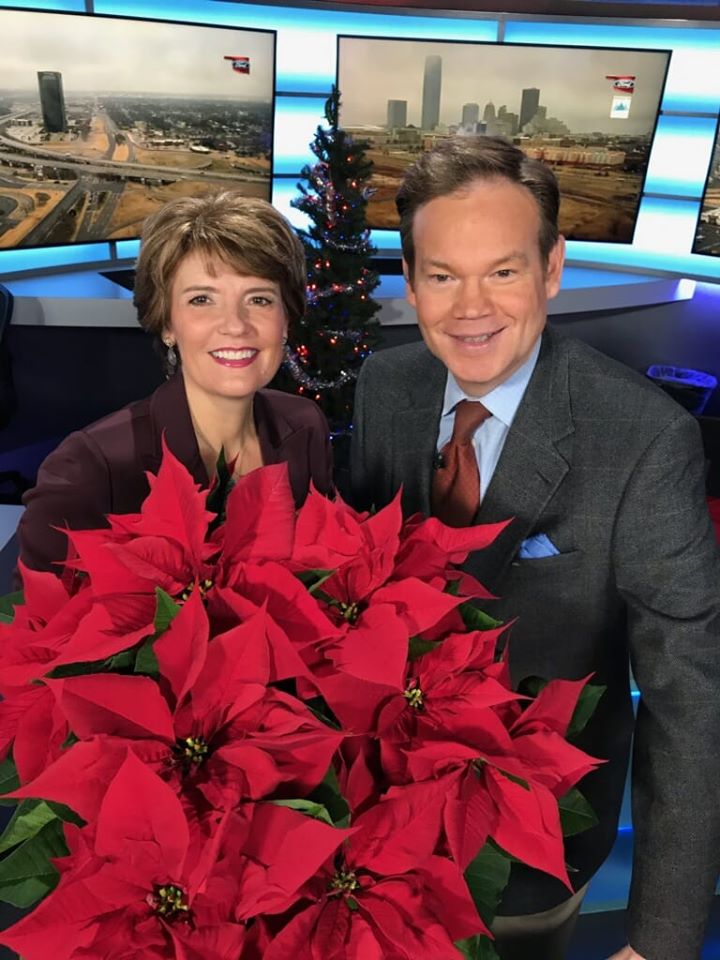
Merry Christmas and Happy Holidays from the Saturday AM News KFOR TV. Thanks for watching! #okwx #kfor4
Severe T-Storm Watch now in effect for Southern Oklahoma this Friday afternoon. Additional watches and warnings are likely deeper into this day. #OKWX @kfor #KFOR4 Mike

I can't believe it's been over 12 years since Sweet Brown didn't have any time for bronchitis, and that apartment fire she ran for her life from, after waking up needing a cold pop thinking somebody was barbecuing. #KFOR #KFORNews #KFOR4 #KFOR4News #4News #SweetBrown
3:10PM Monday: HEADS UP folks. Flood advisory West OKC now in effect. Lots of lightning with potential for 50-60MPH winds. More storms moving in from North this afternoon. Some Severe. @kfor #KFOR4 #OKWX #wxtwitter. Mike
My 7 day plus 4 more from our 10PM Wednesday news. Storm chances are over. Pleasant weather is heading our way! Cool nights and Mild days. @kfor #OKWX #KFOR4 Mike
Latest Supercell Updraft Spin forecast as of 10PM Monday for Tuesday and Wednesday. Some supercells appear likely. Two waves of energy heading our way. Locally heavy rainfall too. #OKWX @kfor #KFOR4 Mike
Slight risk of Severe T-Storms Tuesday into Tuesday night. Main threat is wind and hail, but PM Tuesday and Wednesday there is, at least a low tornado threat. Quite a bit of Jet Stream energy coming out. #OKWX @kfor #KFOR4 Mike
Severe T-Storm Watch is in effect for most of Western Oklahoma until 9PM. Hail to 2.5" winds to 75MPH, isolated tornadoes. #OKWX @kfor #KFOR4 Mike
Our weather is batting 1000 because it knows this is Friday evening during prom season! UGH! Only small hail with this, at 4:40PM. Some will get 2" plus rainfall this evening. Another line of storms will move in later this evening. Mike @KFOR #KFOR4 #OKWX
I can't believe it's been over 12 years since Sweet Brown didn't have any time for bronchitis, and that apartment fire she ran for her life from, after waking up needing a cold pop thinking somebody was barbecuing. #KFOR #KFORNews #KFOR4 #KFOR4News #4News #SweetBrown


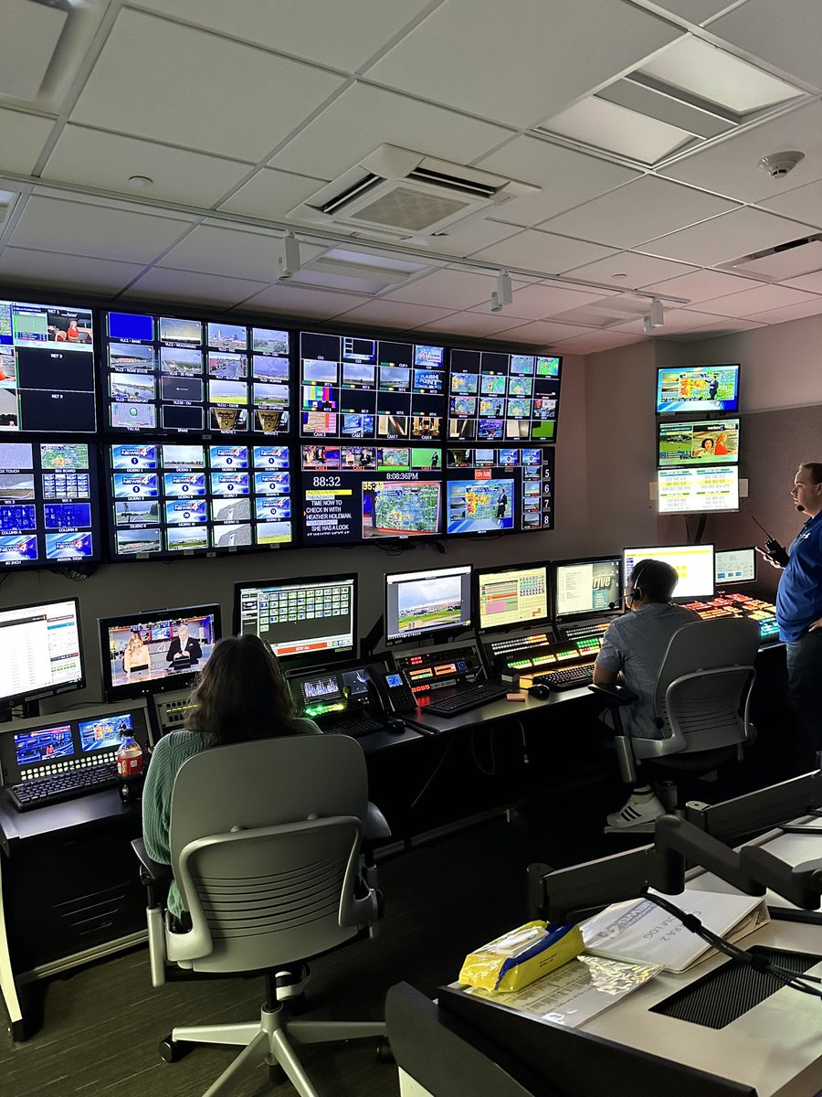
Severe storms coming through the OKC metro. @kfor is on the air & online at KFOR.com/live2 #okwx #kfor4

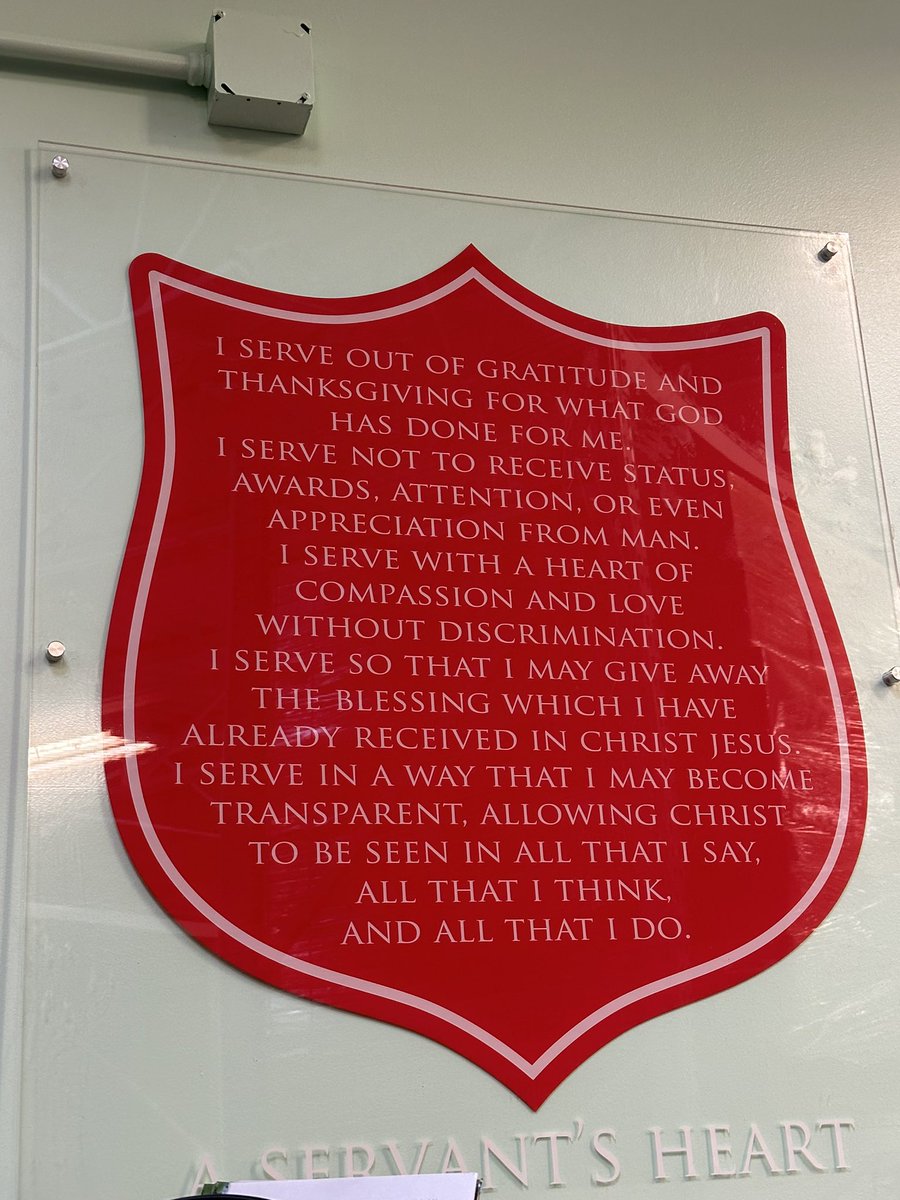
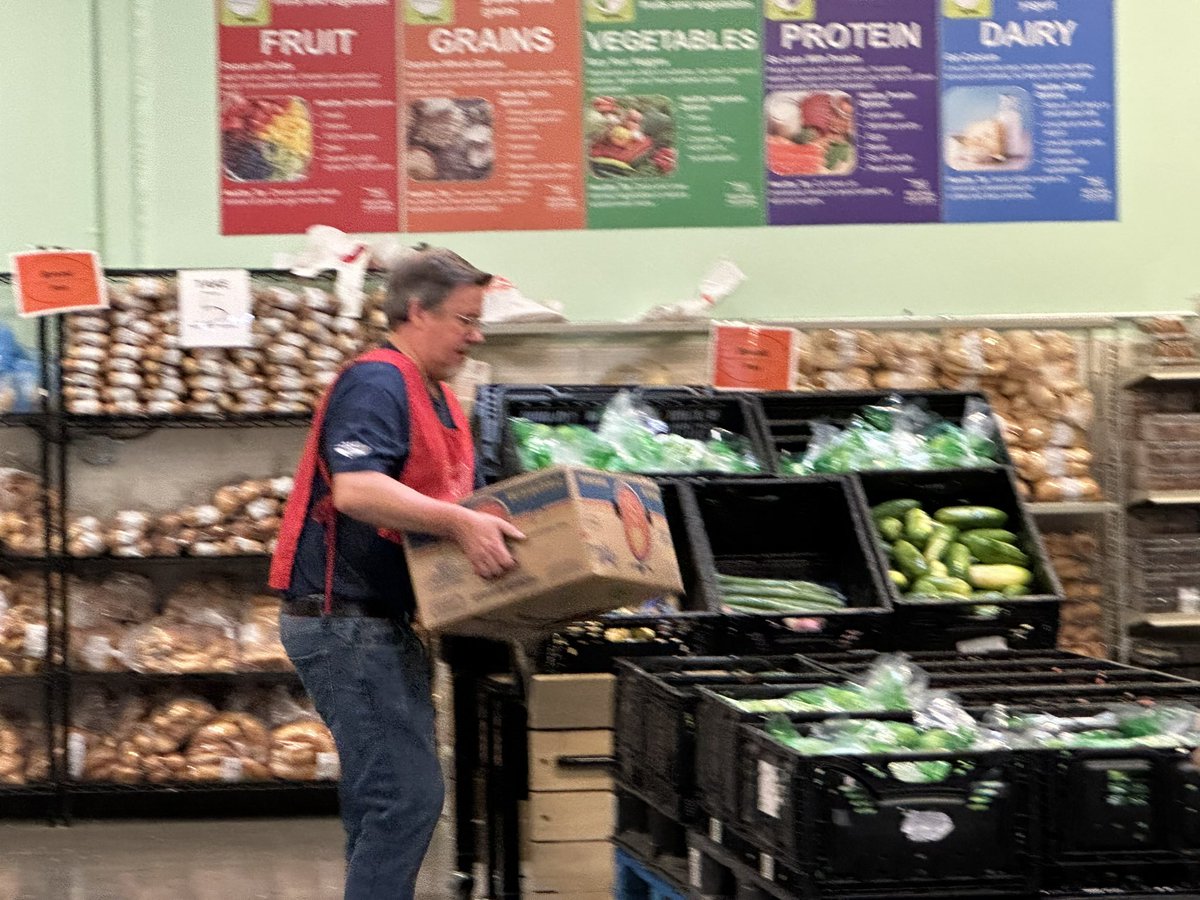
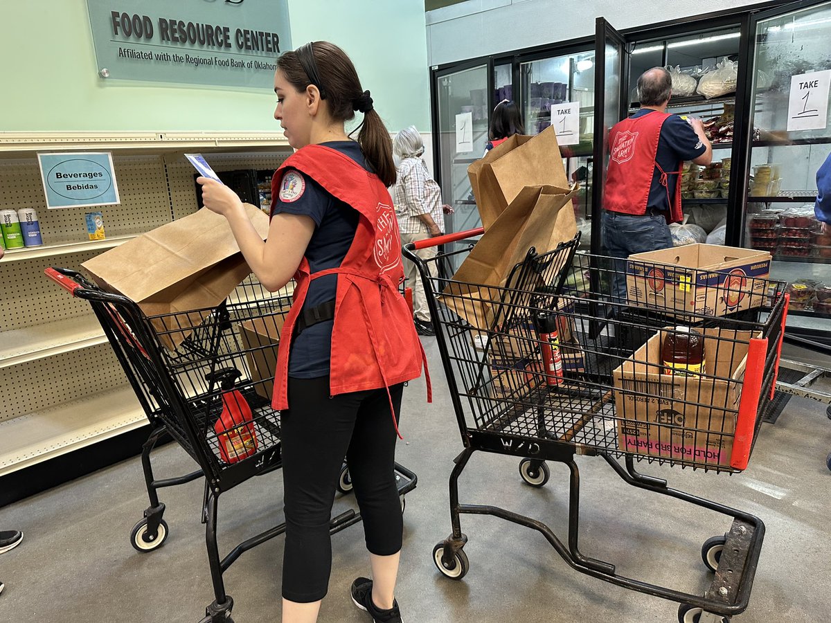
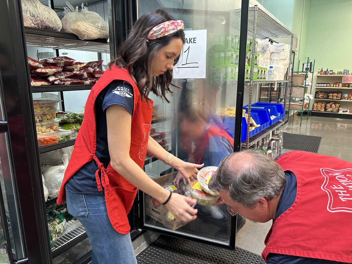
KFOR parent company @NXSTMediaGroup honored Founder's Day on Friday. Check out the way we at KFOR chose to give back to the community. trib.al/eI7YIf9 #NexstarCares #NexstarNation #KFOR4

Nexstar’s Founder’s Day may be over but our commitment to our community is strong. #NexstarNation #NexstarCares #kfor4 #kfortv4
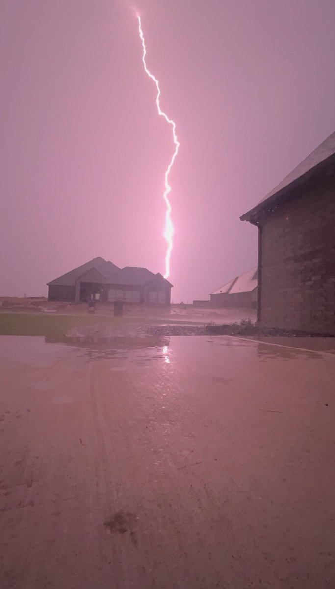
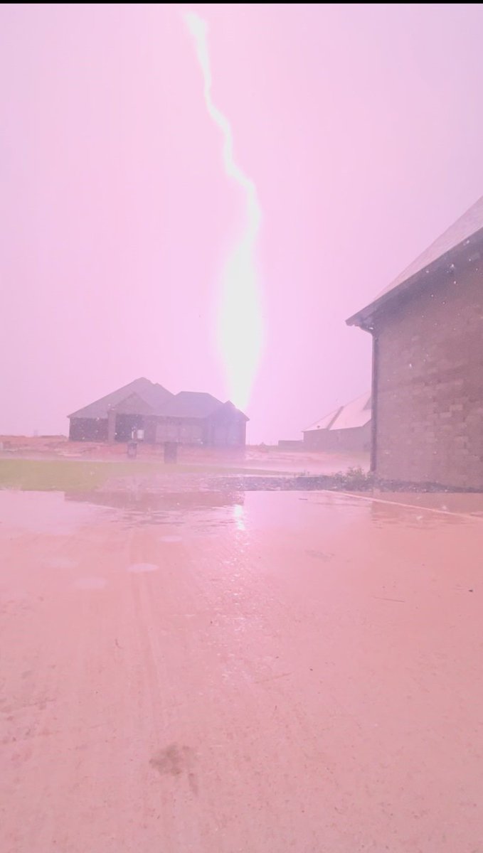
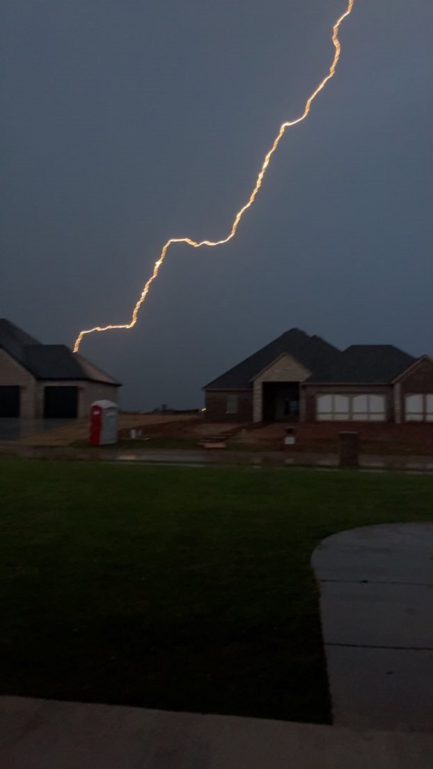
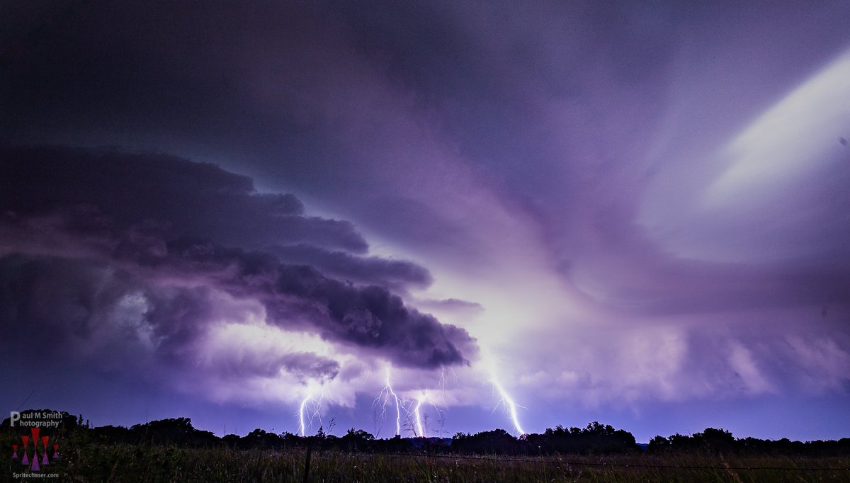
New lightning video coming in from Harrah, OK - this was around 8:30 Thursday night. Courtesy: Aerial Outdoors - Chris Coleman @kfor @4WarnStormTeam #okwx #kfor4 #NewsNation
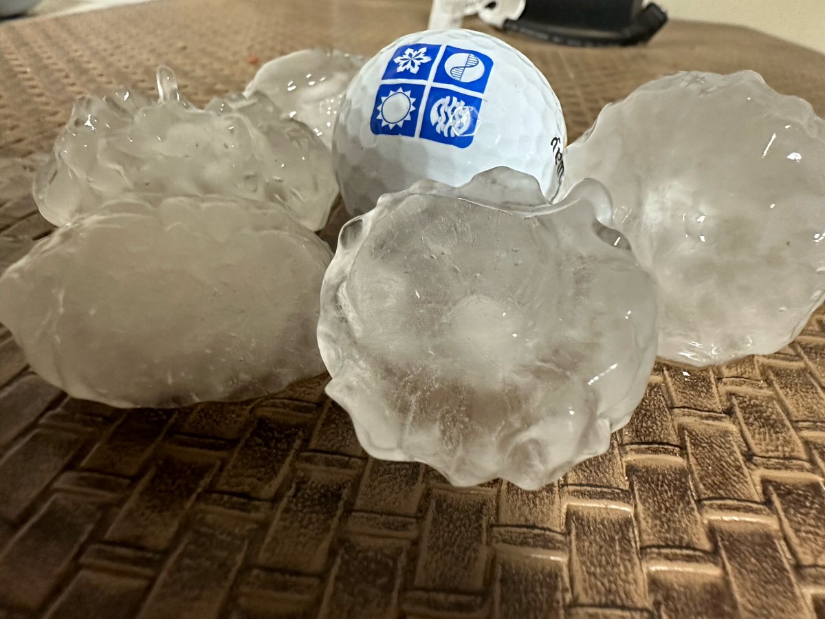
Hail larger than golf balls earlier tonight in Tuttle, OK @kfor @4WarnStormTeam #okwx #kfor4 #NewsNation
These storms are ELECTRIC! Check out this lightning from east of Tuttle, OK. Courtesy: Charles & Zach Waller @kfor @4WarnStormTeam #okwx #kfor4 #NewsNation
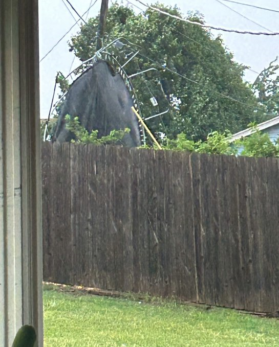
Trampoline tossed around in Lawton,OK. This is part of damage from a storm that hit earlier Thursday. Courtesy: Sydney Samuels @kfor @4WarnStormTeam #okwx #kfor4 #NewsNation
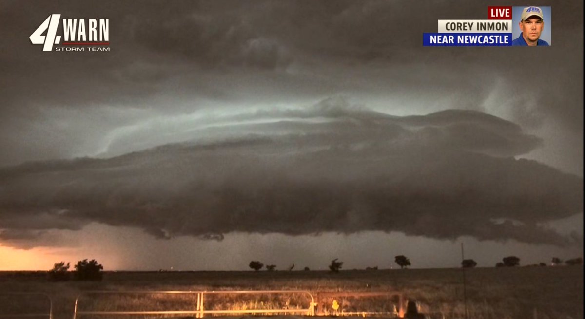
We are watching this storm near Newcastle. Expect strong winds and hail not out of the question. Corey says the winds have shifted to the northwest. Intense lightning. @kfor @4WarnStormTeam #okwx #kfor4 #NewsNation
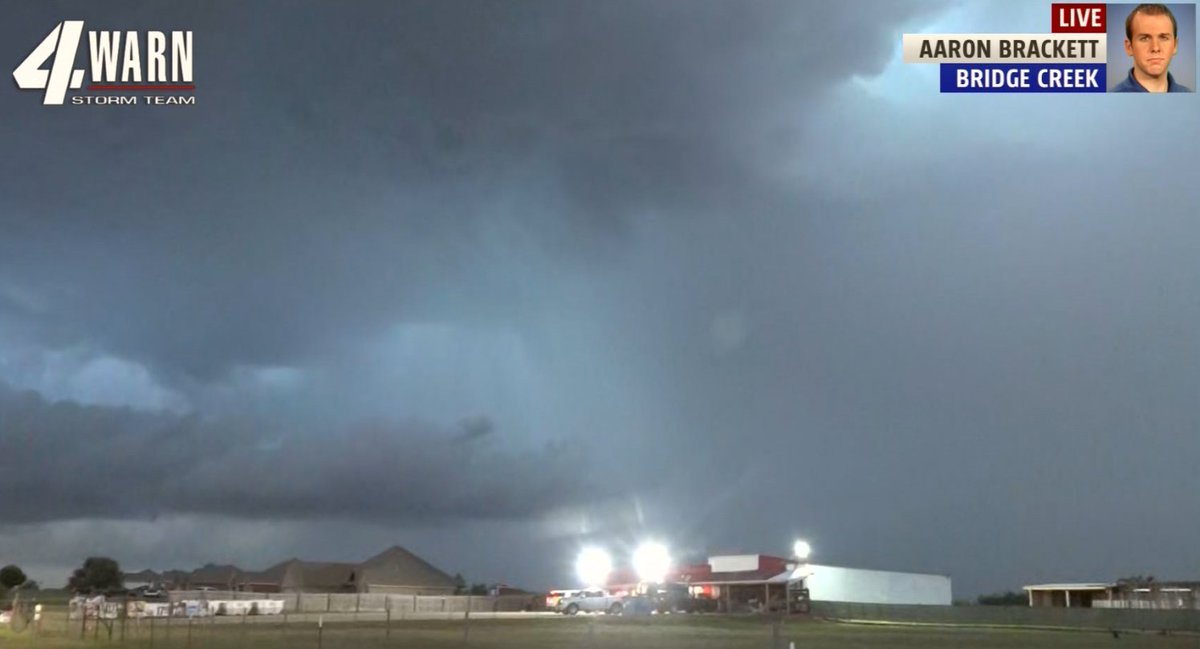
A look at the storm coming into the south metro. Quarter sized hail. Moving South/SE -- possibly headed toward Norman to Noble - Hail size could increase. Winds could go up to 70mph. @Aaron_Brackett is watching. @kfor @4WarnStormTeam #okwx #kfor4 #newsnation 8:35pm Thursday
A first look at tornado damage from Loco, OK - damage to roofs, trees stripped of their leaves. No reports of injuries. @McBeeWX is live on the scene. @kfor @4WarnStormTeam #okwx #kfor4 #NewsNation

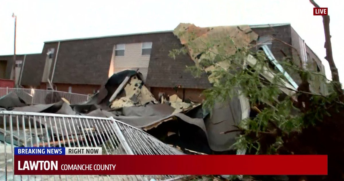
A look at more of the damage from Lawton, OK from the storm earlier Thursday evening. @natalieclydesTV is on the ground at the Candlewood Apartment. The roof torn off of one of the buildings & now in the swimming pool. @kfor @4WarnStormTeam #okwx #kfor4 #NewsNation
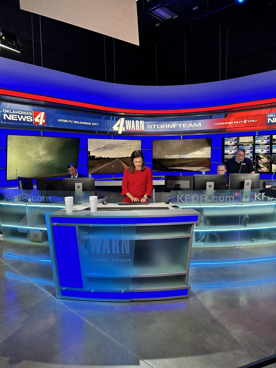
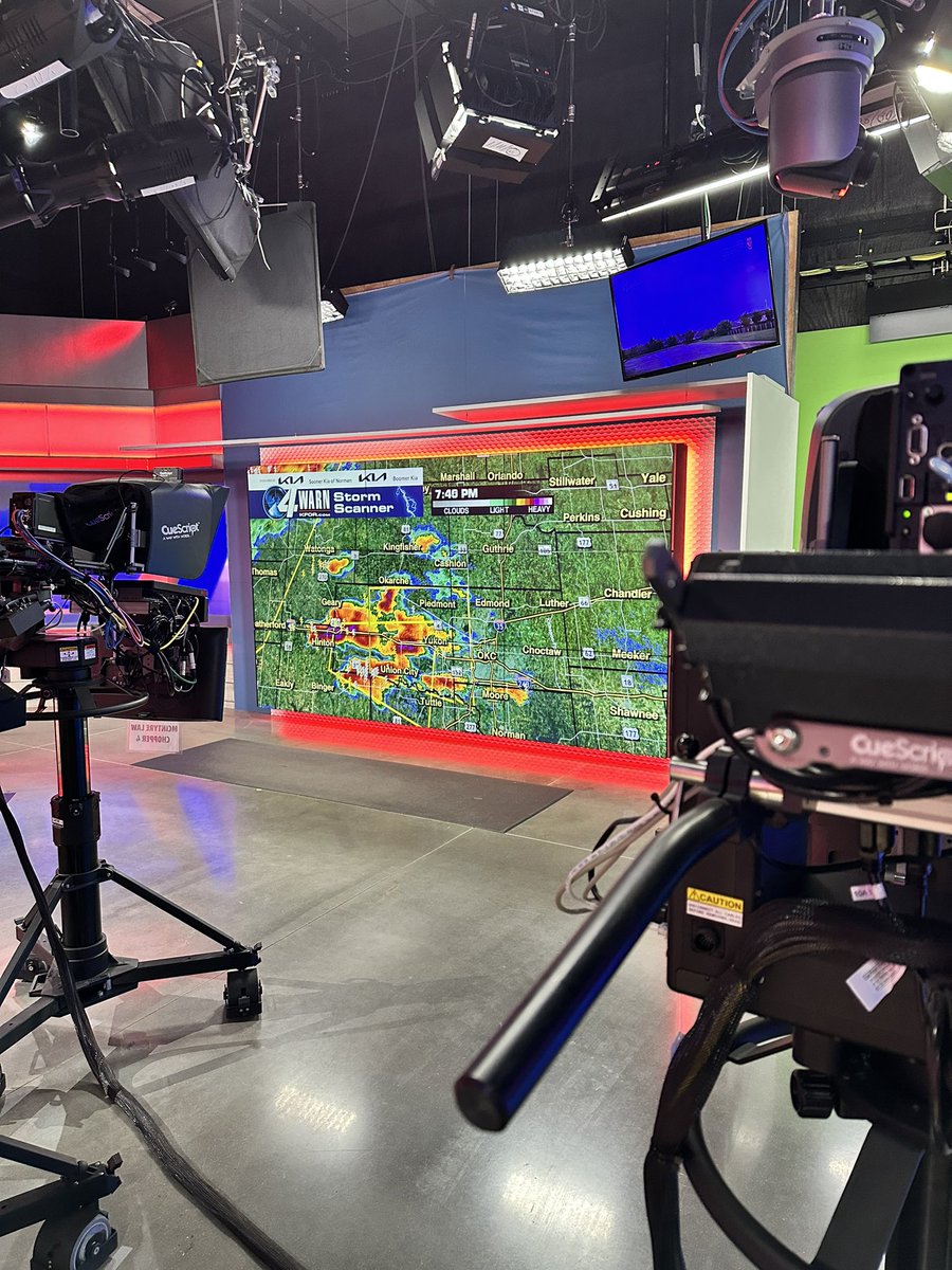
The team is all here! Tracking storms as they head into the OKC metro. @kfor @4WarnStormTeam @JoleenChaney @MikeMorganKFOR @F5Video @emilyrsutton @kforkevinogle @OKCWXMan #okwx #kfor4 #4warn

🔊🆙 A look at the storm earlier Thursday evening near Duncan, OK. Courtesy: Tory Keeter @kfor @4WarnStormTeam #okwx #kfor4 #newsnation
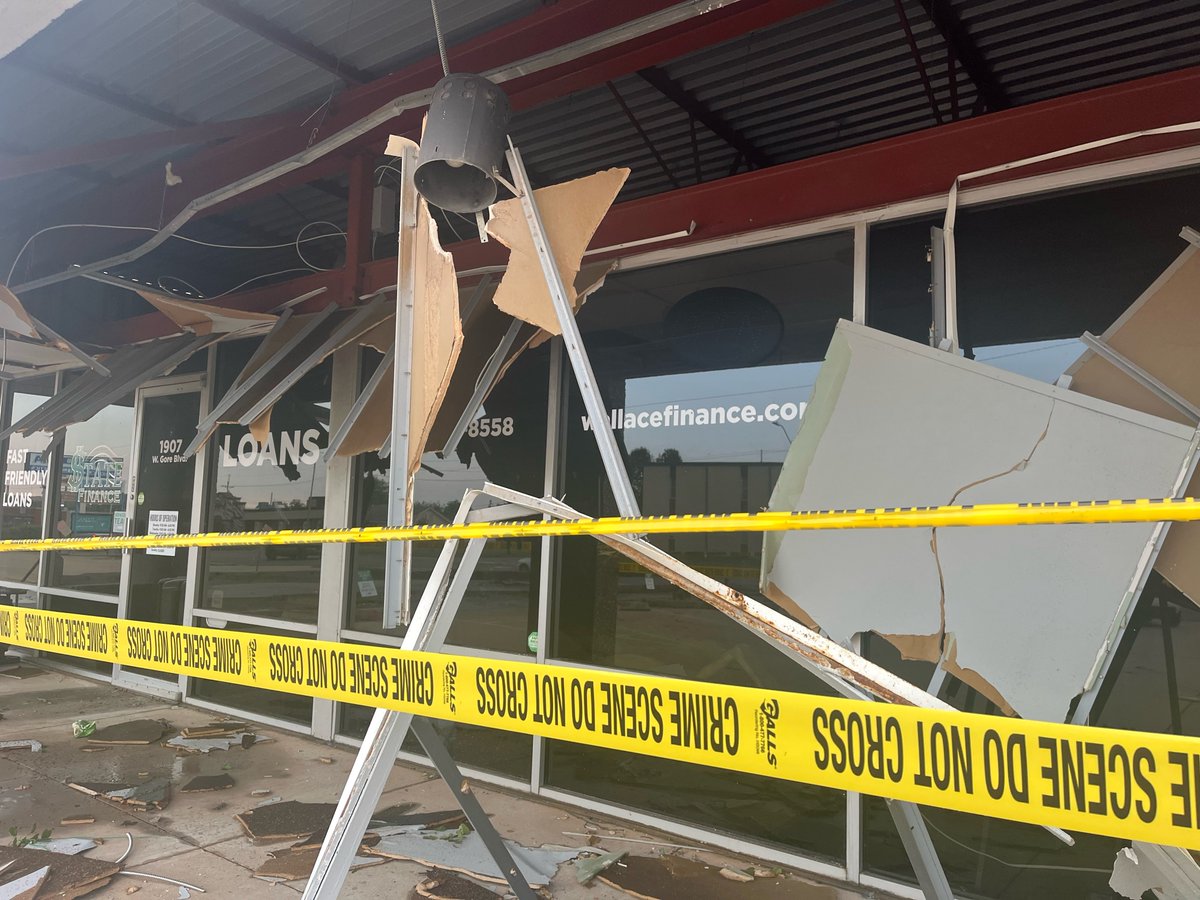
Getting a good look at damage from Lawton, OK from earlier this evening. @natalieclydesTV is there. This is from a business on W. Gore. @kfor @4WarnStormTeam #kfor4 #okwx #NewsNation


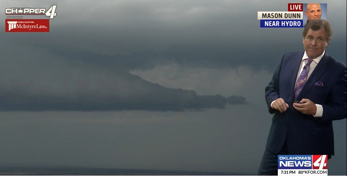
Chopper 4 watching this storm near the Hydro/Hinton area. Mike says these storms are racing east along I-40. Plan for high winds and hail. 7:31pm Thursday @kfor @4WarnStormTeam #okwx #kfor4 #NewsNation
Check out this lightning near Moore, OK from earlier this evening. Courtesy: Taylor Cusack @kfor @4WarnStormTeam #okwx #kfor4 #NewsNation #4warn
A look at the storm southeast of Duncan, OK Courtesy: Kaitlyn Jennings @kfor @4WarnWeather #okwx #kfor4 #NewsNation


“How are you feeling @GovStitt?” “Peyton, I think I should’ve trained more.” 😂😂 All the runners did amazing today at the @OKCMarathon! I’m so proud to live in this city and work with my @kfor team! #RUNtoRemember #KFOR4

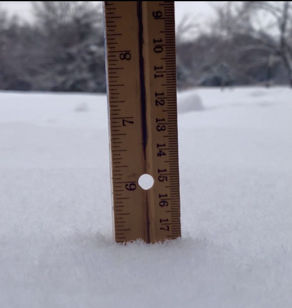
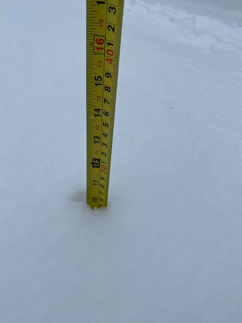
South of Woodward folks. 9.5" plus! From Cassie Hutchens. This is the most reported so far. Oklahoma has seen TONS of snow so far this Winter already. #OKWX #KFOR4 Mike
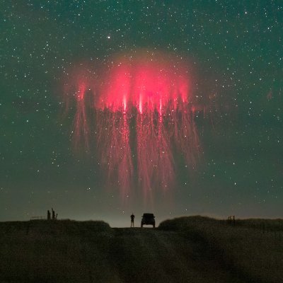
Tornado warned cell moving into Edmond last night 8/26. Constant lightning ahead of it and power flashes captured not long after this pic. #okwx @emilyrsutton @JimCantore @ReedTimmerAccu #stormhour #KFOR4 @MichaelSeger @spann


SE OKC at 8:25PM with mod. glaze ice from Brian W. Our temperature continues to not drop too much! Good News!! Only a few power outages but not many. Snow increasing in the West/SW Metro. Heavy snow and blowing snow moving in soon folks. Roads are only WET right now. #OKWX #KFOR4

Prepare folks...Most of OKC Metro. Lets hope the power outages are not too severe. Storm will move in from SW Oklahoma by mid/late this evening. #OKWX #KFOR4 Mike

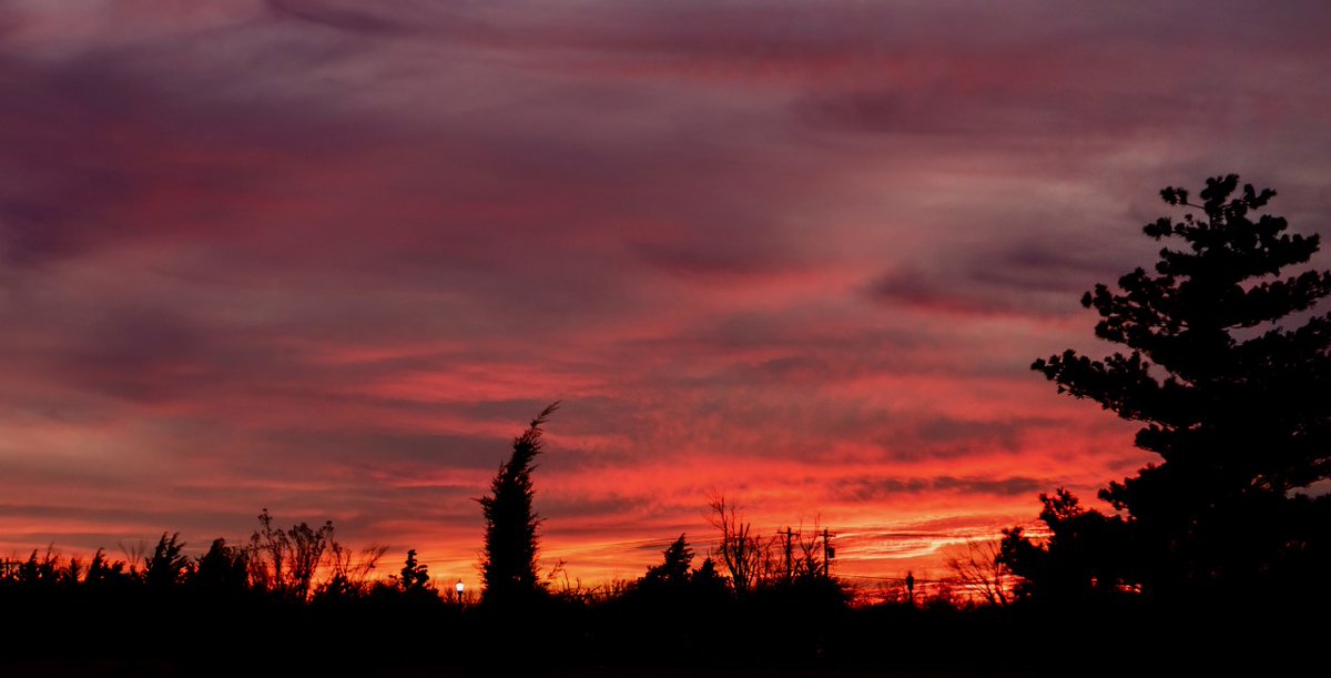
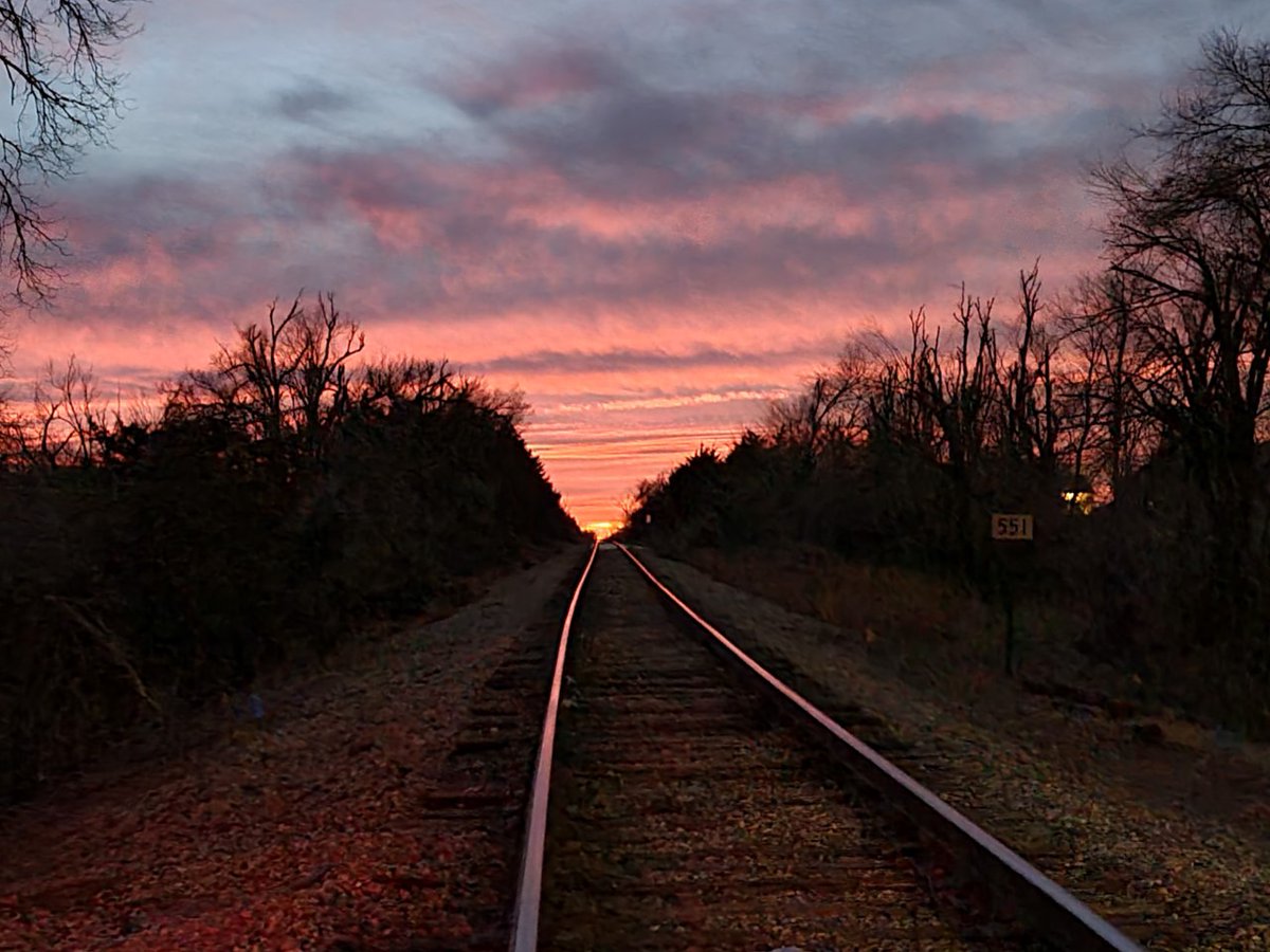
Tonight's Oklahoma Sunset from Stephen Coats. Much of Western Oklahoma had a pretty sunset this evening. 1.5.21 #OKWX #KFOR4 Mike
Nexstar’s Founder’s Day may be over but our commitment to our community is strong. #NexstarNation #NexstarCares #kfor4 #kfortv4
My PM Thurs. look at Winter Storm Mon. and Tues. of next week for Oklahoma. I have made NO CHANGES to my thinking on the track. Frzg rain/rain line in Central OK. Folks West and North of OKC see significant Winter Storm, OKC on edge. Heavy Moisture. #OKWX #KFOR4 @kfor Mike


Hail larger than golf balls earlier tonight in Tuttle, OK @kfor @4WarnStormTeam #okwx #kfor4 #NewsNation
Something went wrong.
Something went wrong.
United States Trends
- 1. Paramount N/A
- 2. #HSRxFortnite N/A
- 3. Sonny Styles N/A
- 4. #911onABC N/A
- 5. Hillary N/A
- 6. Warner Bros N/A
- 7. Domani N/A
- 8. Marco Cubio N/A
- 9. #OlandriaxRobertoCavalli N/A
- 10. Ellison N/A
- 11. Abigail N/A
- 12. Revis N/A
- 13. #CHANGBINxAUTRY N/A
- 14. Jack Dorsey N/A
- 15. Marathon N/A
- 16. Maxwell N/A
- 17. #RobertoCavalliFW2627 N/A
- 18. Tyrese Maxey N/A
- 19. Corey Kispert N/A
- 20. Taj Gibson N/A