#wxtwitter search results


highest rated intense+ tornado in every state since 2020 (states with just the windspeeds listed = there were more than one tornadoes given the same rating in said state since 2020) #wxtwitter


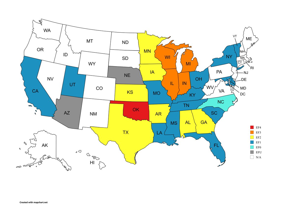
with the Enid, OK tornado being upgraded to EF4, here is a map of the strongest rated tornado in every state so far this year #wxtwitter
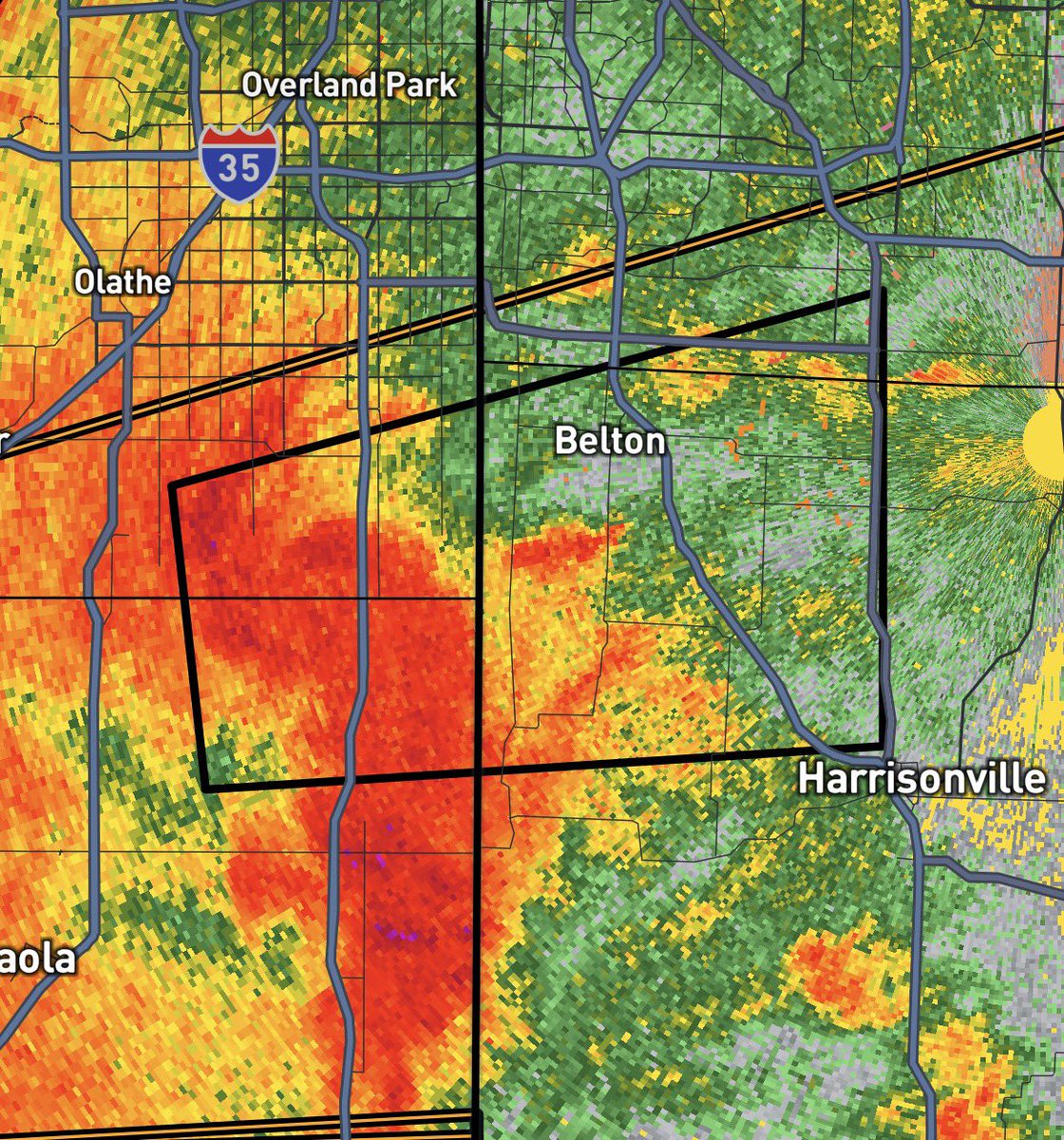
Tornado Warning for Cass, Jackson, MO, Johnson & Miami counties, KS until 5:30 PM CDT. Seek shelter now! #tornado #weather #wxtwitter #KSwx #MOwx


This is a threat: Next time I chase Im picking out a random car following the Dominator 3 and pit maneuvering them #wxtwitter


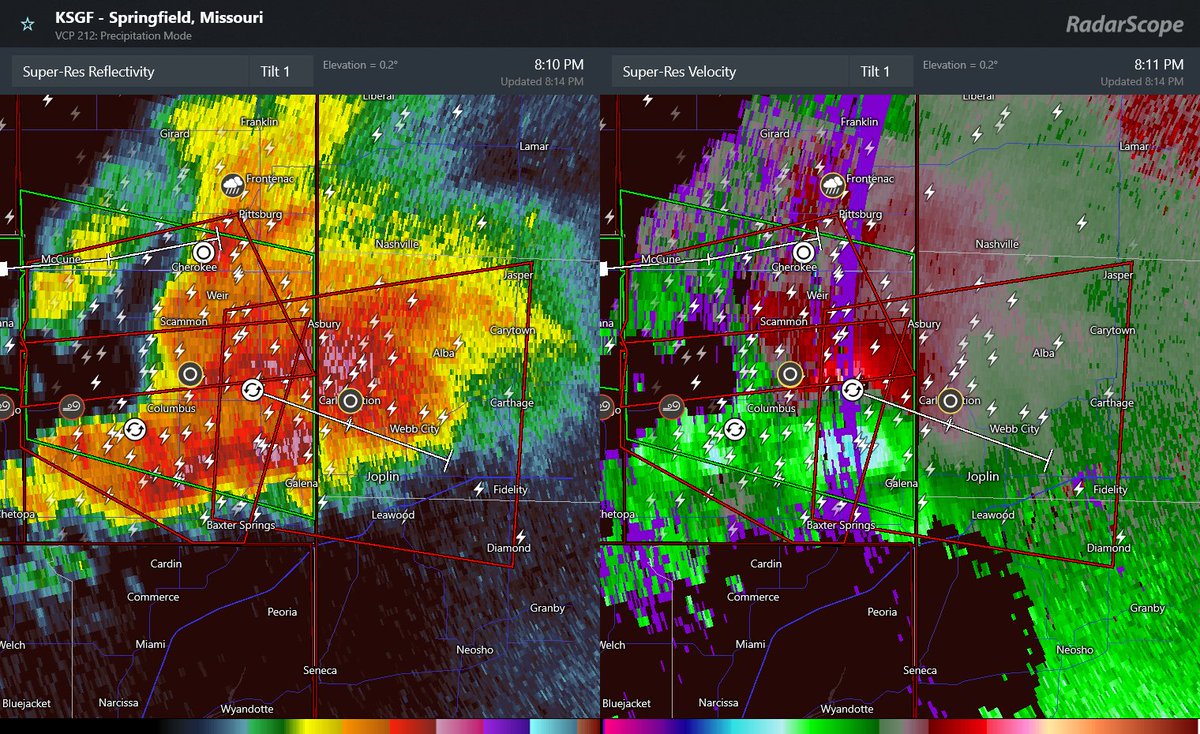
🚨🌪️PDS Tornado warning in effect. A confirmed tornado is on the ground moving toward Joplin, MO. TAKE COVER NOW! #tornado #wxX #wxtwitter #mowx #severewx

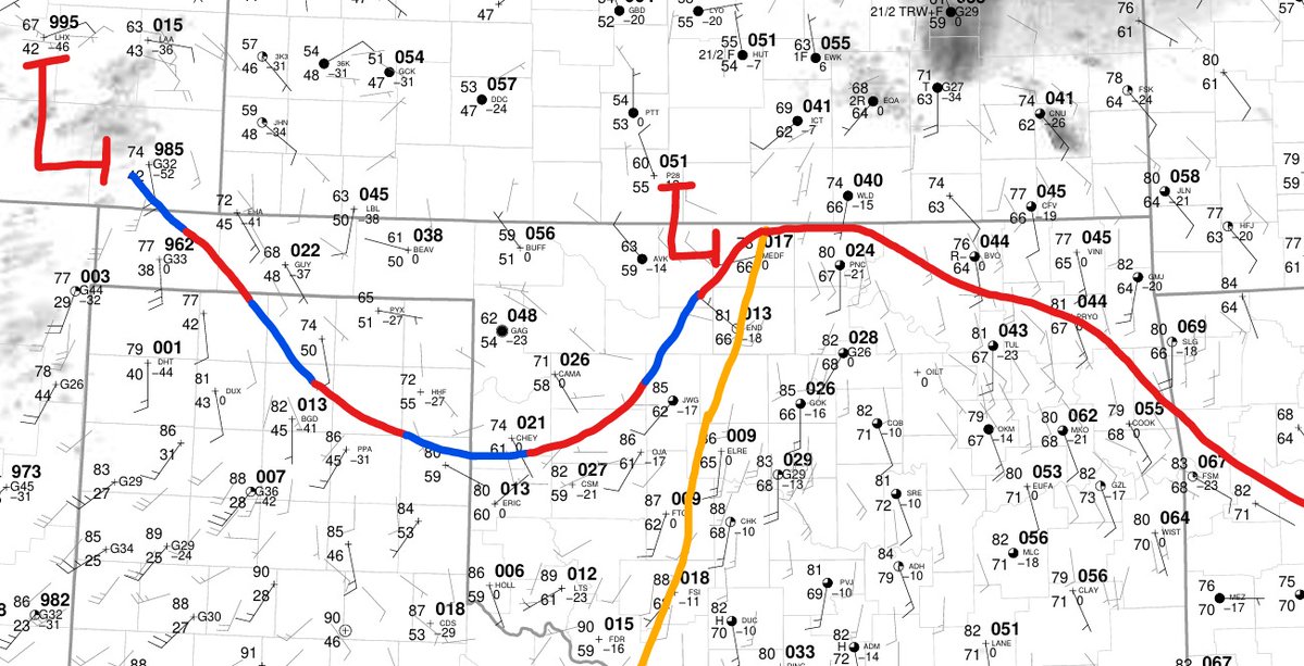
THREAD 1/6 Convective Initiation is likely in Northern OK in the next 1-2 hours. Looking at SFC OBS., a dryline exists throughout central OK with a warm front to the east. Bubbling cumulus exists south of the WF, with increasing convergence along the DL. #wxtwitter #tornado #wx

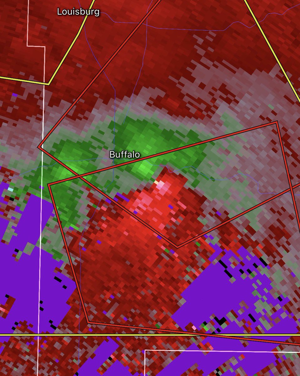
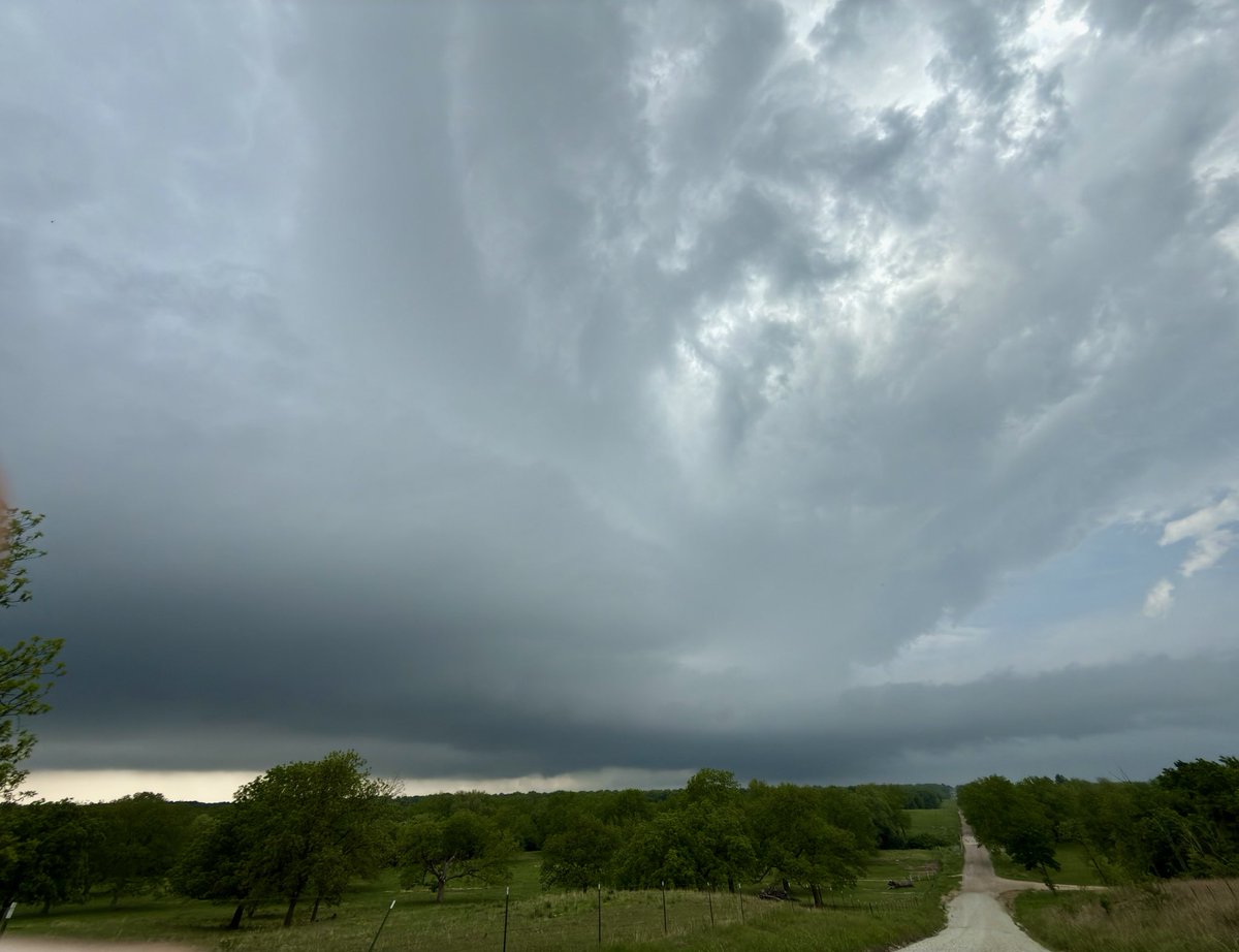
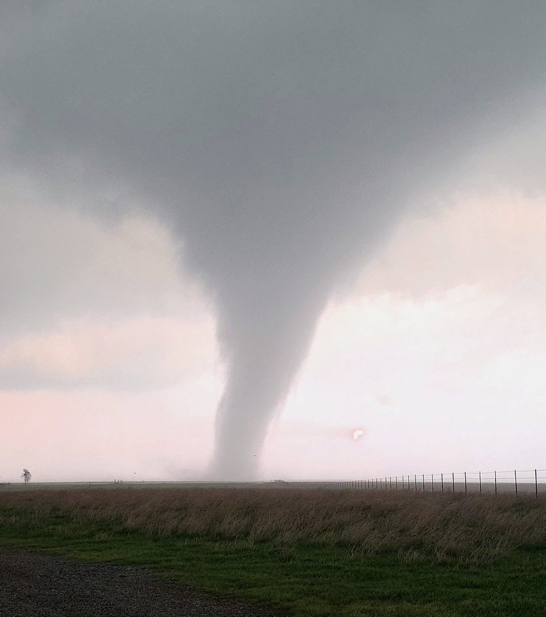
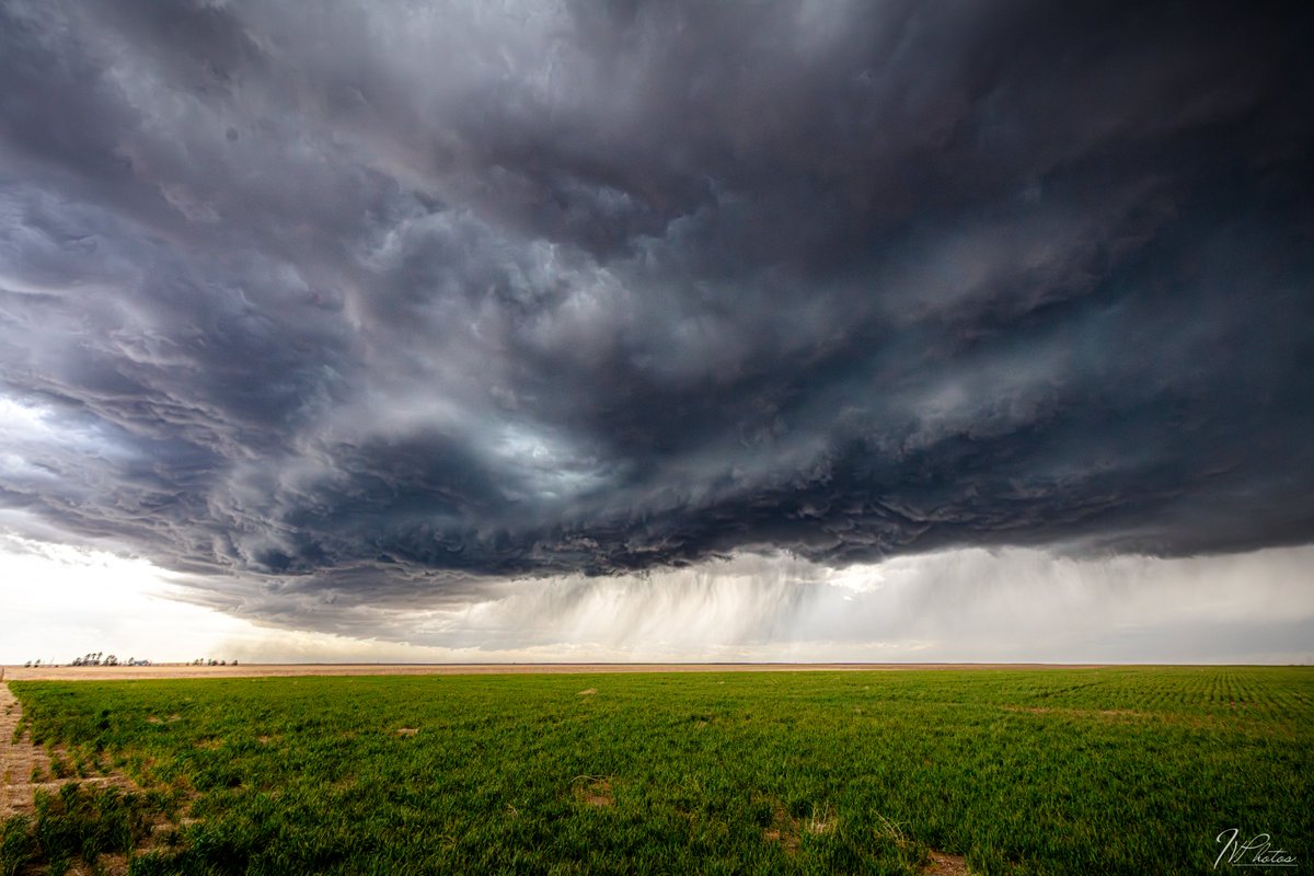
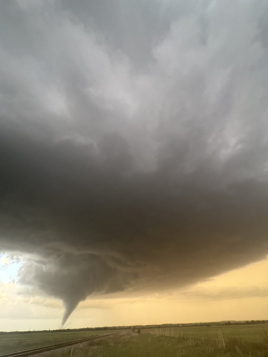
Tight couplet on this storm approaching Joseph H. Williams Tallgrass Prairie Preserve, Oklahoma. I would watch out for this in the long term, as its hook echo has been growing over the last 20 minutes. A strong #tornado cannot be ruled out. #wxtwitter #okwx


EXTREME WEATHER LATEST: More than a dozen WNC counties are now in an extreme drought, according to the latest from @USDA. Here’s what one of those counties is doing about it. #wx #wxtwitter #weather @WLOS_13

Joplin,MO just got spared. They did get hit with damaging winds but the Tornado to their E lifted and the circulation ended up going N of the city. #wxtwitter

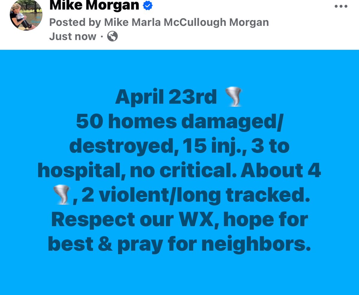


STAY SAFE EVERYONE! #wxtwitter #inwx
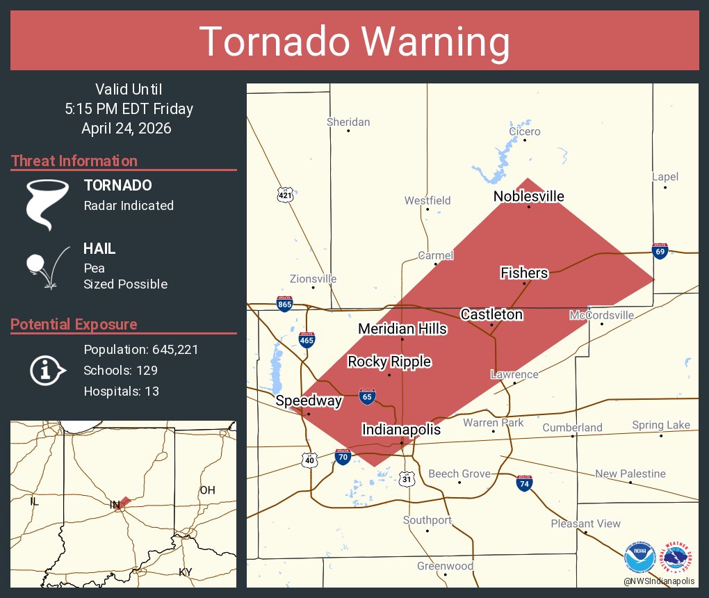
Tornado Warning including Indianapolis IN, Fishers IN and Noblesville IN until 5:15 PM EDT


One thing was for sure, that #storm near Wynnewood, #OK yesterday was sure putting out CGs. #wxtwitter


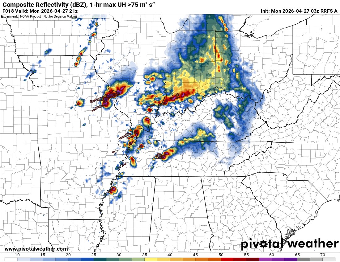
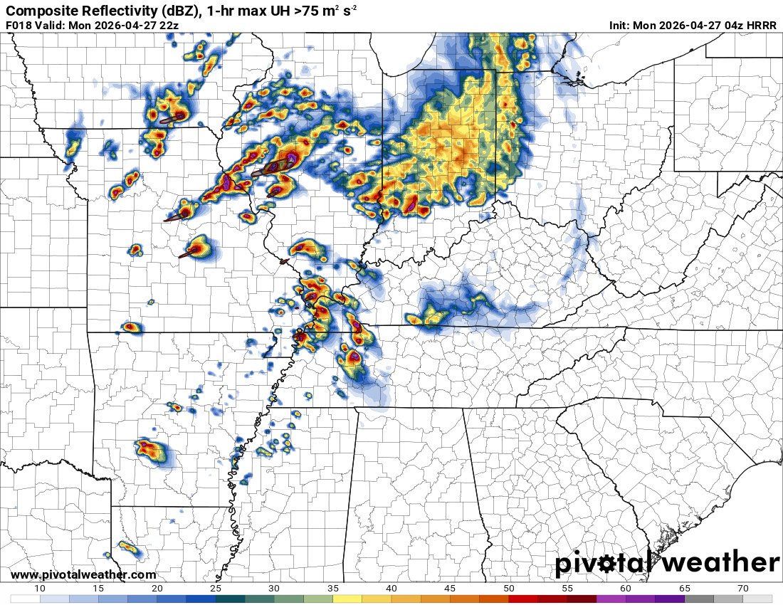
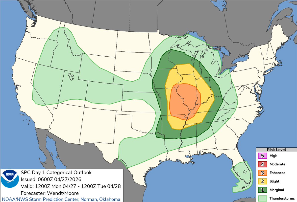
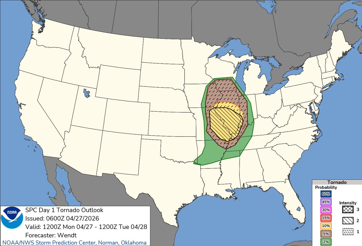
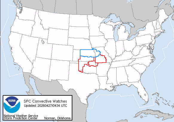
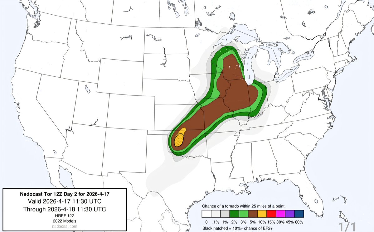
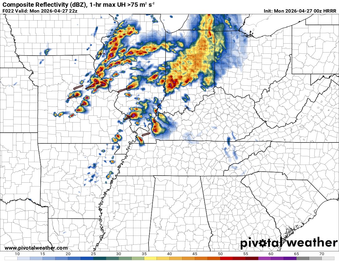
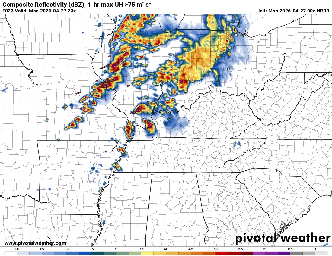
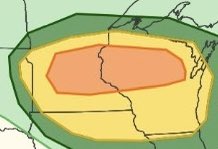
Few substantial changes from previous outlooks, denoting Enhanced all-hazard probability for the Mid MS Valley/Midwest region. A few strong tornadoes are possible, particularly in the Enhanced-Risk. #WxTwitter


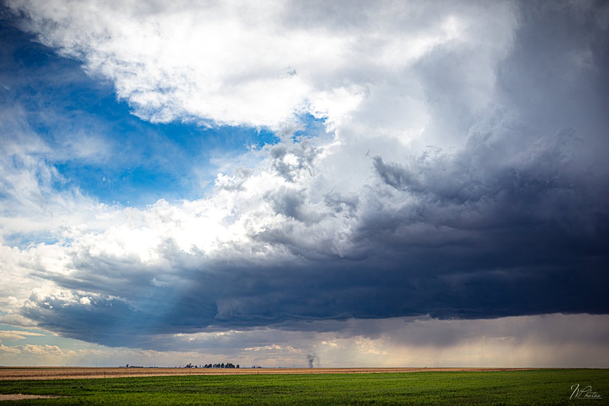
Tornado in Foraker, OK yesterday evening. Easily the most beautiful storm I have ever seen. #wxtwitter

04/27/26 is going to be a major event, but NOT a 04/27/11 situation. Chill. #wxtwitter #weather

You do realize that the "baby" tornado was a satellite tornado, right? They only occur with the most powerful tornadoes ever recorded. #wxtwitter

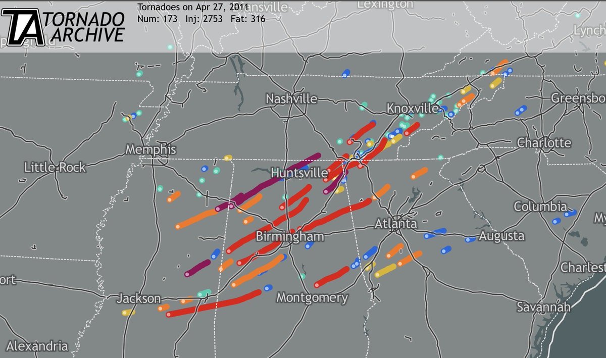
OTD in 2011: One of the worst weather events in modern history occurred across the Southern U.S as dozens of violent and deadly tornadoes touched down in the states of Mississippi, Alabama, Tennessee, and lastly Georgia. Never Forget. #wxtwitter


Does anyone know why this happens? Dew forms on the front and rear windshields but not on the side mirrors or windows. Is it some sort of interesting effect or just a coincidence? #wxtwitter

Stay weather aware to Watches and Warnings OVERNIGHT,I am headed off to bed to get some extra sleep to cover tomorrow's risk after work (3pm) #wxx #wxtwitter

We have SIGNIFICANT flooding with active water rescues in Joplin #wxtwitter @MesoMatt @ryanhallyall @WxFront

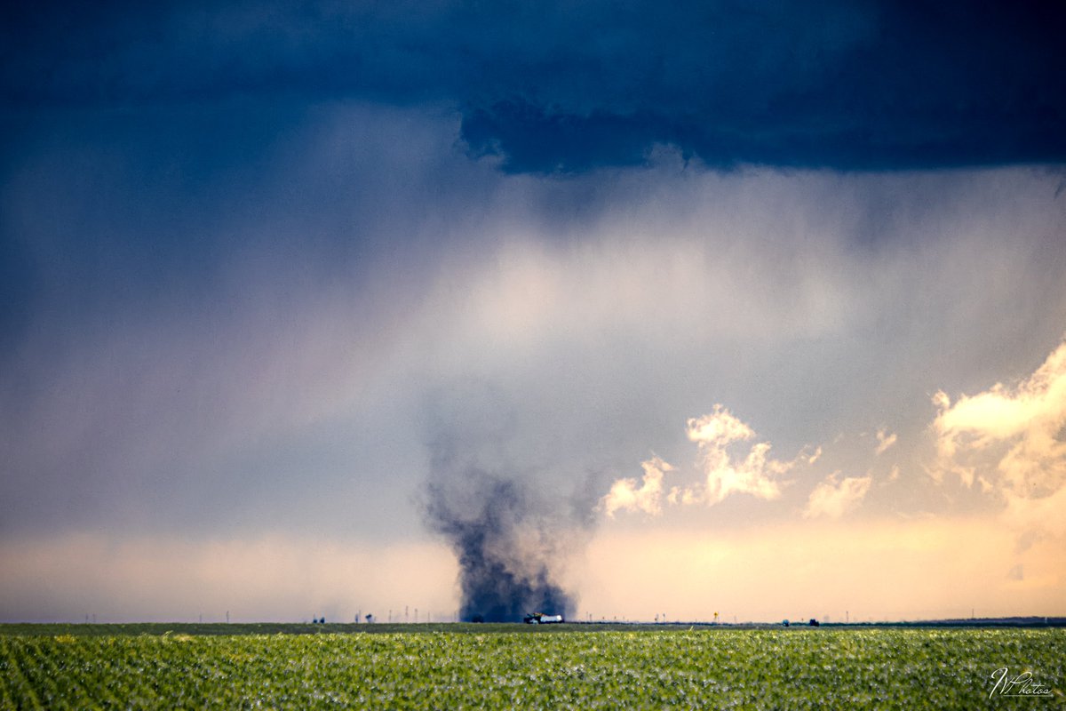
Chased a tornado warned supercell in Texas today! Despite multiple attempts, the storm failed to produce a tornado and I had to watch Oklahoma go nuts again 😭 #wxtwitter


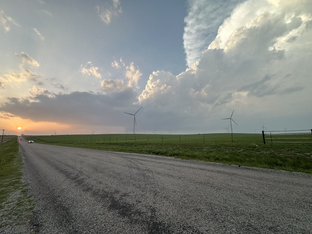
Today is an example of how things can change quickly. After looking at sat this morning I thought about making today a travel day. Glad I stuck it out. Roads made it hard to get extremely close but what a fun day. #wxtwitter #okwx


This is a threat: Next time I chase Im picking out a random car following the Dominator 3 and pit maneuvering them #wxtwitter

🔴 Live Storm Chasing tomorrow April 27th, 2026 in Illinois starting around noon #wxtwitter #wxx #ilwx youtube.com/live/nsyReTmRz…

youtube.com
YouTube
Storm Chaser Zim
***UNOFFICIAL NON-SPC*** Day 1 Prediction on the likely Tornado Outbreak Tomorrow... MODERATE RISK! 15## Tornado, several strong-intense, long-tracked tornadoes likely 45# Wind, some gusts >=75mph 45# Hail, some hail stones >=2.75" #wxtwitter #tornado #wx

Say hi to the Mark Twain national forest for me tomorrow #Wxtwitter

🌩️Colorado opened its eyes a little bit today and gave us a little spoot fest. Denver cyclone did what it does best, even with less than ideal conditions! Anton, CO 4/26/26 #cowx #wxtwitter #StormHour

Joplin,MO just got spared. They did get hit with damaging winds but the Tornado to their E lifted and the circulation ended up going N of the city. #wxtwitter

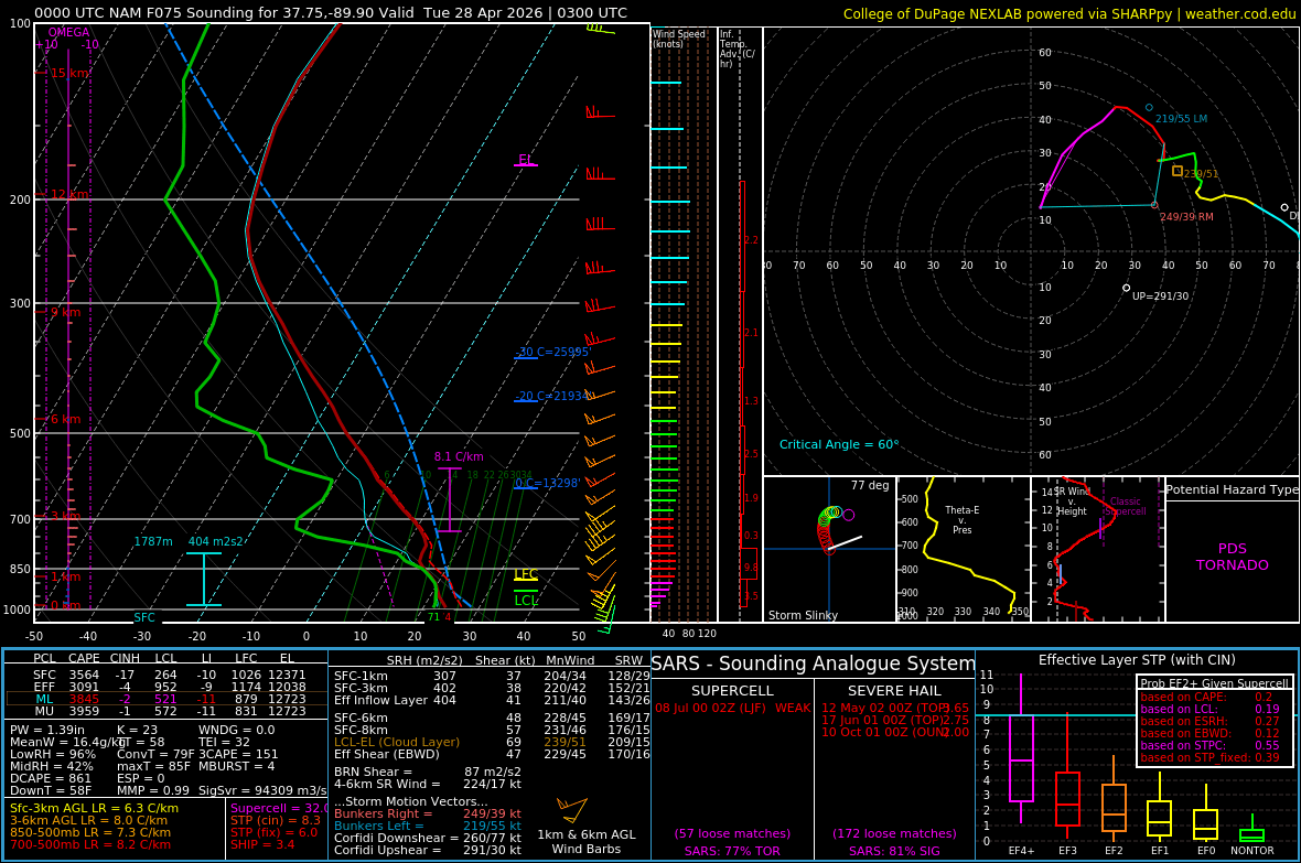
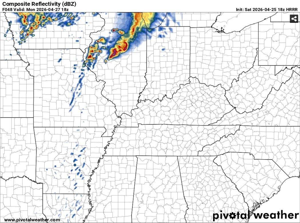
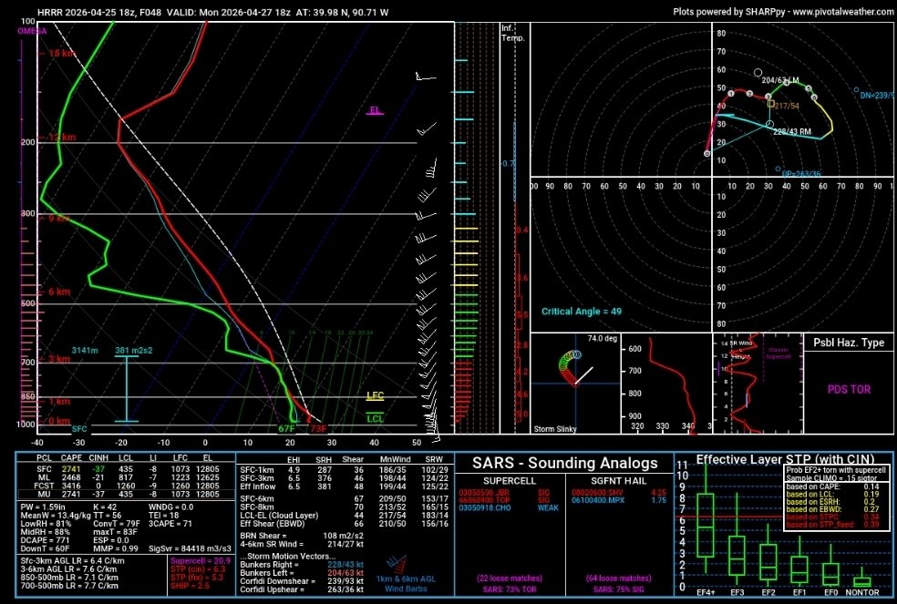
My goodness.. forecast sounding taken in the St. Louis, MO area around 6:00 Monday off of the latest 12km NAM. I seriously don't think enough people are recognizing the extremity of this environment and the potential for a major tornado outbreak. #wxtwitter #mowx #ilwx


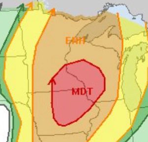
😳 Monday’s 30% Risk vs. CSU’s D4 Severe Risk Maxing Out 😨U can’t get any higher than this!! #wxtwitter #tornado


***UNOFFICIAL NON-SPC*** Day 2 Prediction on the likely Tornado Outbreak Monday... MODERATE RISK! 15% ## Tornado ... A few strong-intense tors 30% # Wind ... Widespread sig, damaging wind likely 45% # Hail ... Some hail stones >2.75" in diameter #wxtwitter #tornado #wx


highest rated intense+ tornado in every state since 2020 (states with just the windspeeds listed = there were more than one tornadoes given the same rating in said state since 2020) #wxtwitter


with the Enid, OK tornado being upgraded to EF4, here is a map of the strongest rated tornado in every state so far this year #wxtwitter

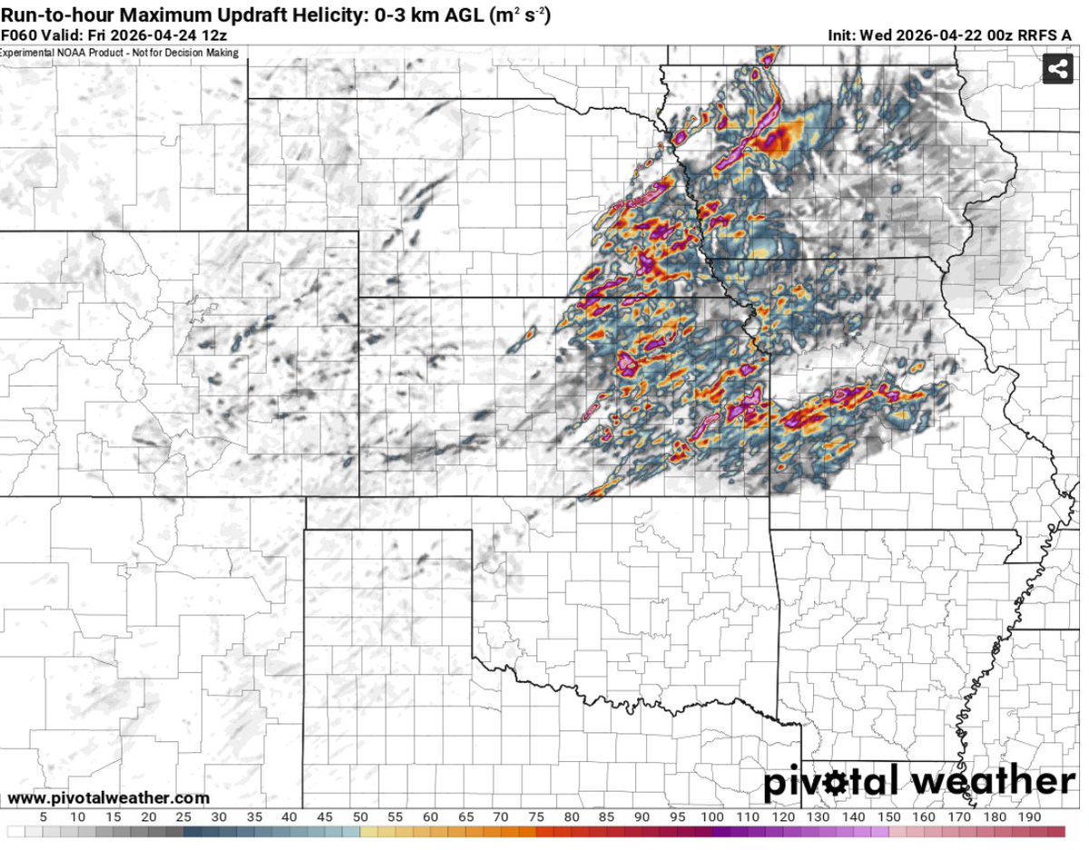
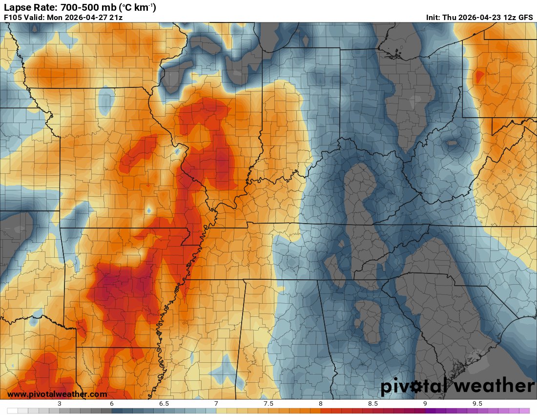
With new 12z suites coming in for 4/27, there is potential for a high-end event given current slowing trends. 1/5 500mb jet max atop OWS, 993mb SFC low in close proximity, Impressive plains-esq thermos >8.0 C/km EML broadly across OWS, and 40-50kt LLJ. #wxtwitter


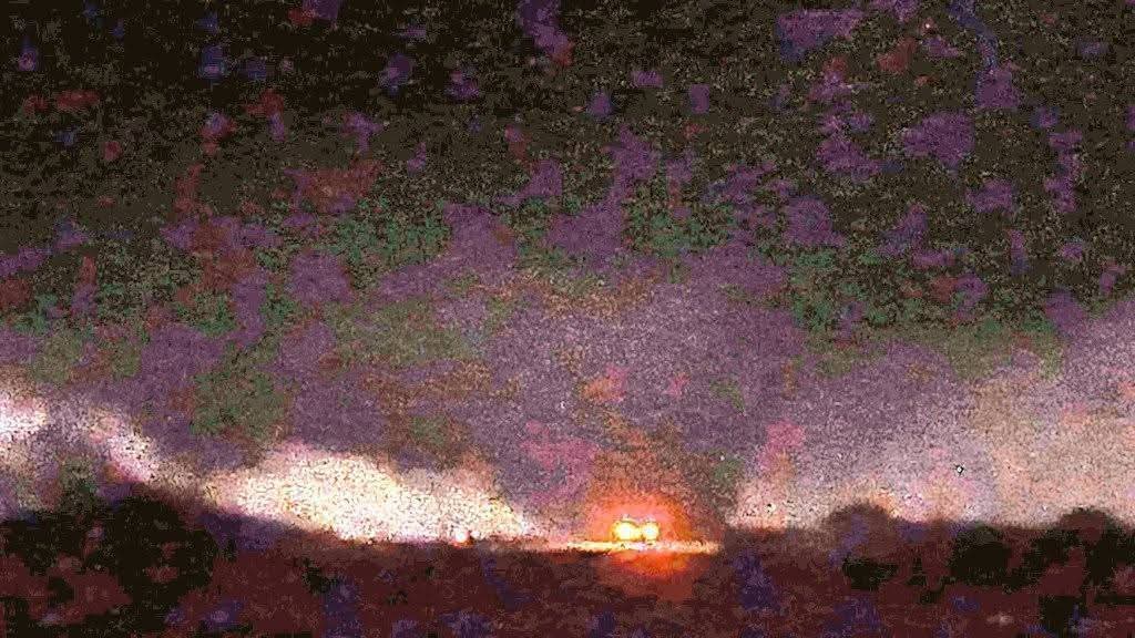
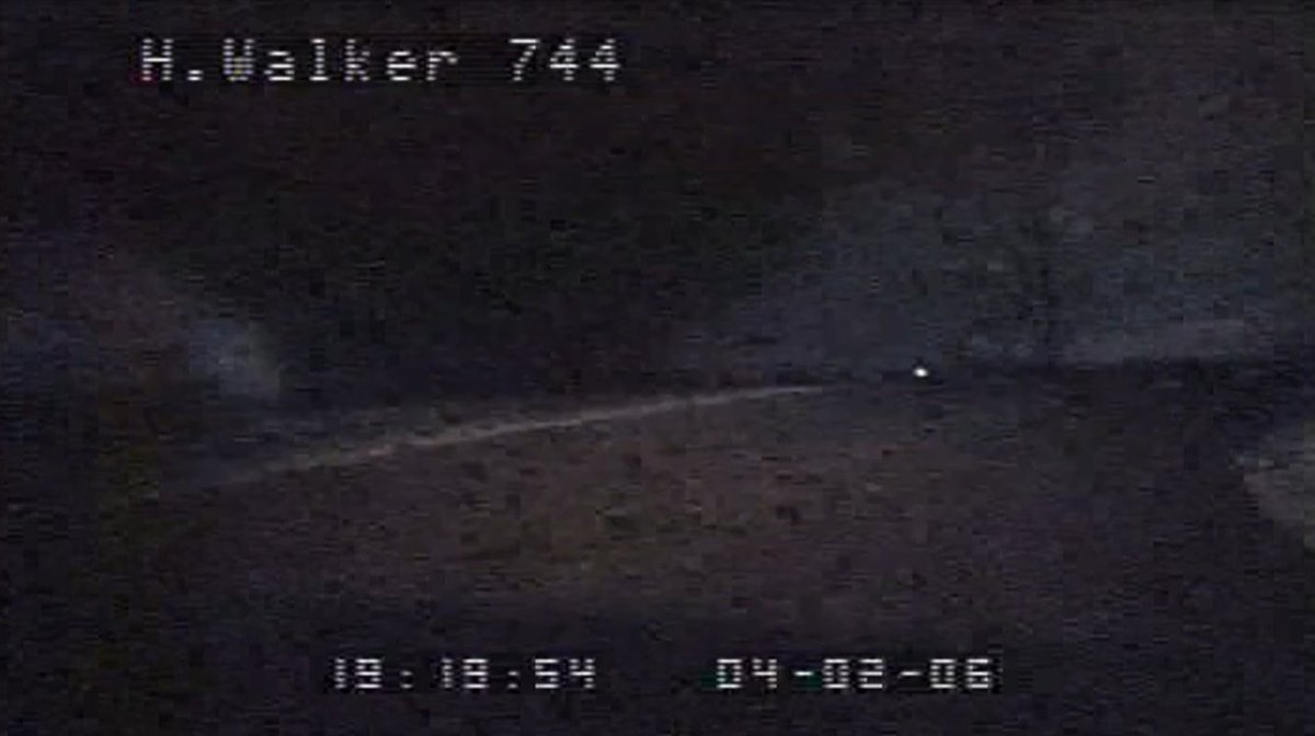
A rare and horrifying police dashcam capture of the likely violent Dyer County, Tennessee F3 during the obscure April 2, 2006 tornado outbreak. This was an extremely close encounter with the tornado shown in a newly surfaced video which will be linked below. #wxtwitter
18z HRRR is picking up on this as well. IF any storms can initiate in this environment, significant tornadoes are very much possible. Sounding is out of Kankakee, IL #wxtwitter #ilwx


2 years ago I got my RAV4 with 30K miles. Fast forward it’s going STRONG at 194K miles and runs like it’s new! #wxtwitter


***UNOFFICIAL NON-SPC*** Day 1 Prediction on the likely Tornado Outbreak Tomorrow... MODERATE RISK! 15## Tornado, several strong-intense, long-tracked tornadoes likely 45# Wind, some gusts >=75mph 45# Hail, some hail stones >=2.75" #wxtwitter #tornado #wx
Well... #wxtwitter
***UNOFFICIAL NON-SPC*** Day 2 Prediction on the likely Tornado Outbreak Monday... MODERATE RISK! 15% ## Tornado ... A few strong-intense tors 30% # Wind ... Widespread sig, damaging wind likely 45% # Hail ... Some hail stones >2.75" in diameter #wxtwitter #tornado #wx

There’s virtually no shear with this storm, but it has that classic look because it’s currently anchored to a boundary, allowing it to ingest enhanced low-level shear. A tornado could develop very soon if this continues to persist. #wxtwitter #okwx
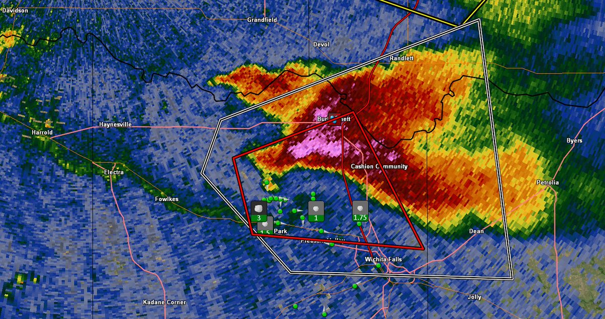
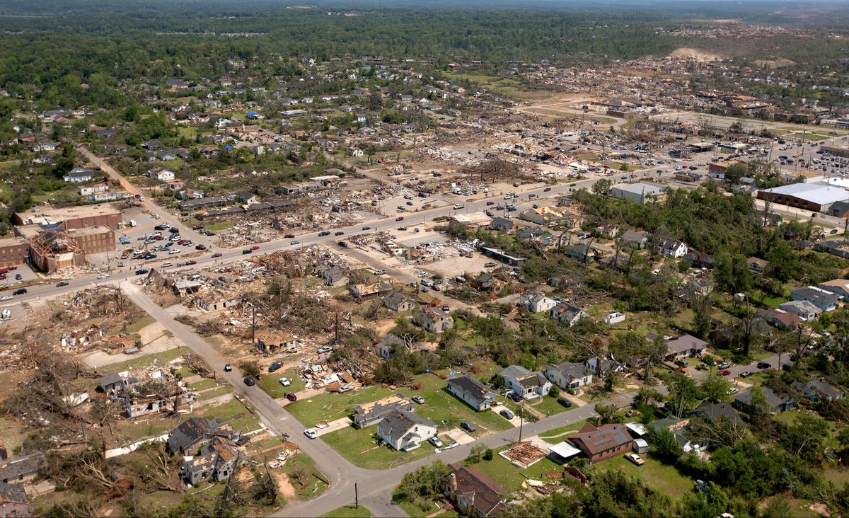
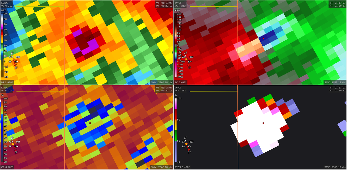
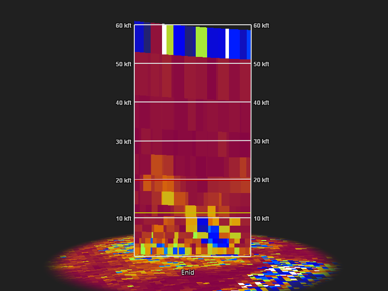
A truly horrifying scenario as a very likely violent (EF4+) tornado struck Vance AFB in Enid, #okwx and many residential areas. Debris was lofted from a range of 20,000-28,000ft ARL with a peak Vrot of 78.2 knots, and massive debris centrifuge akin to EF4+ tornadoes. #wxtwitter


Something went wrong.
Something went wrong.
United States Trends
- 1. #euphoria N/A
- 2. #bucciovertimechallenge N/A
- 3. Pied Piper N/A
- 4. Oilers N/A
- 5. Cassie N/A
- 6. #FlyTogether N/A
- 7. 60 Minutes N/A
- 8. Ducks N/A
- 9. Edmonton N/A
- 10. Ayton N/A
- 11. #metgala2026 N/A
- 12. Maddy N/A
- 13. #SupernovaGenesis N/A
- 14. James Williams N/A
- 15. Norah O'Donnell N/A
- 16. Jarry N/A
- 17. Lakers in 5 N/A
- 18. Alana N/A
- 19. Jules N/A
- 20. McDavid N/A