#lanefire kết quả tìm kiếm

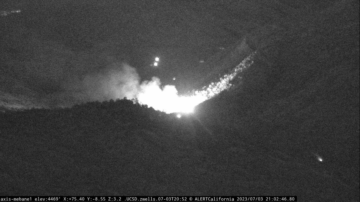
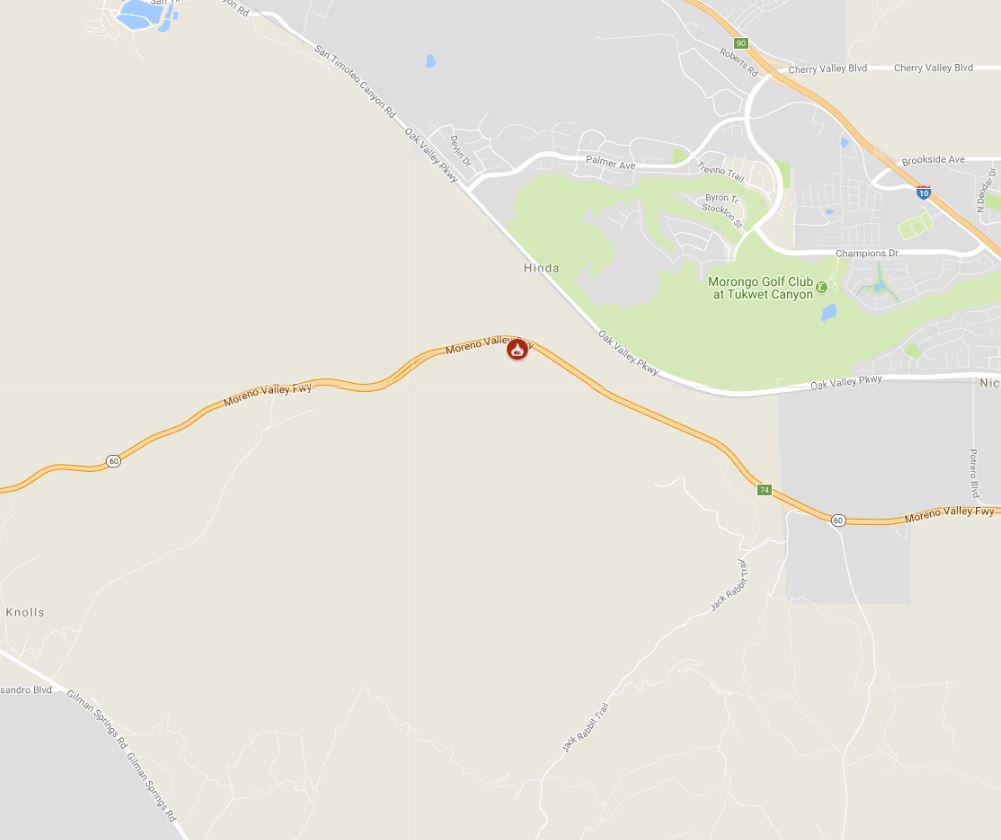
This is the #LaneFire. OES Intel 24 has mapped the fire at 21 acres, burning downhill on the side of HWY 178.
New Brush Fire Hwy 178 × Kern River Canyon Rd, East of Bakersfield in the hills.

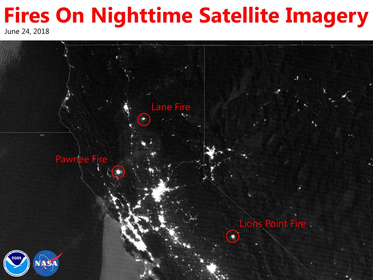
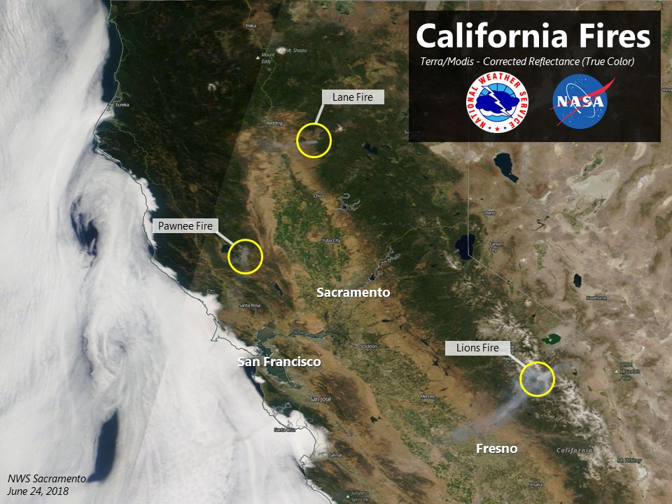
Plenty going on this morning across #NorCal, as viewed from space. Smoke originating from the #LaneFire #PawneeFire #LionsPointFire. And marine clouds expanding along the coast, bringing some cooling! #CAFire #cawx

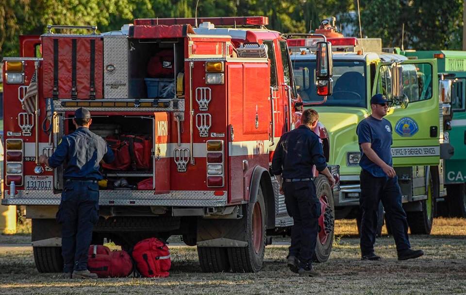
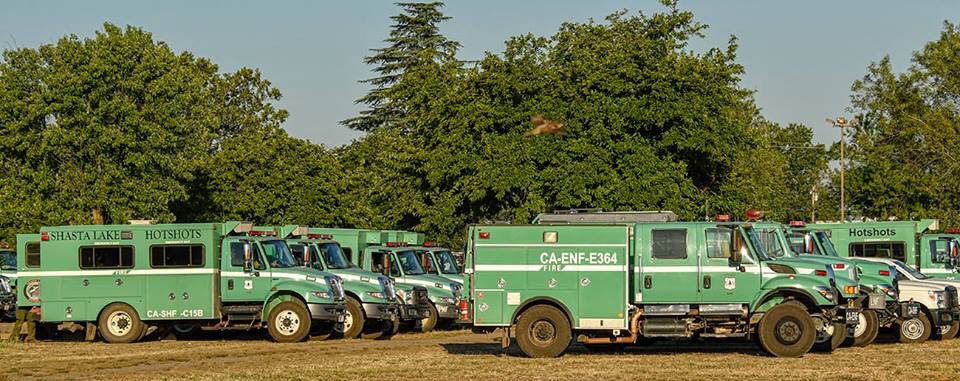
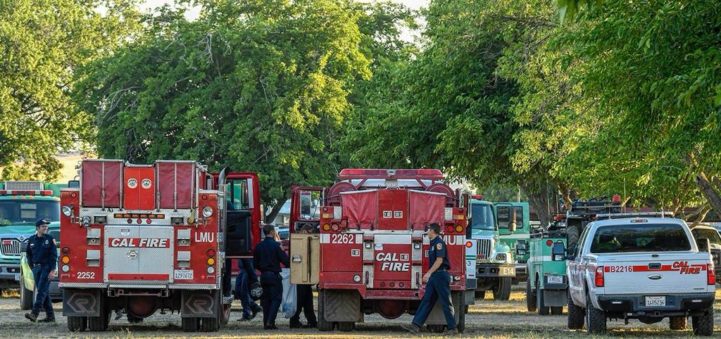
Presently two Fire Engines, two Dozers, one Hand Crew, and one Helicopter are involved with three Cal Fire fires. #LaneFire, #StollFire, #BascomFire

After 18 days on the road covering 3 major fires (#lanefire, #pawneefire, #countyfire) as well as covering the @napacountyfire unit, #Striketeam 9340C is on it's way home to #SLOcounty!
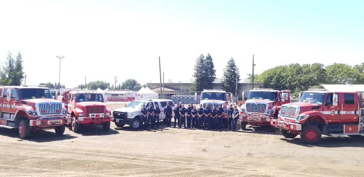
#ShastaTrinity has sent aerial resources, two fire engines, and a Hand Crew to support Cal Fire with the #LaneFire.

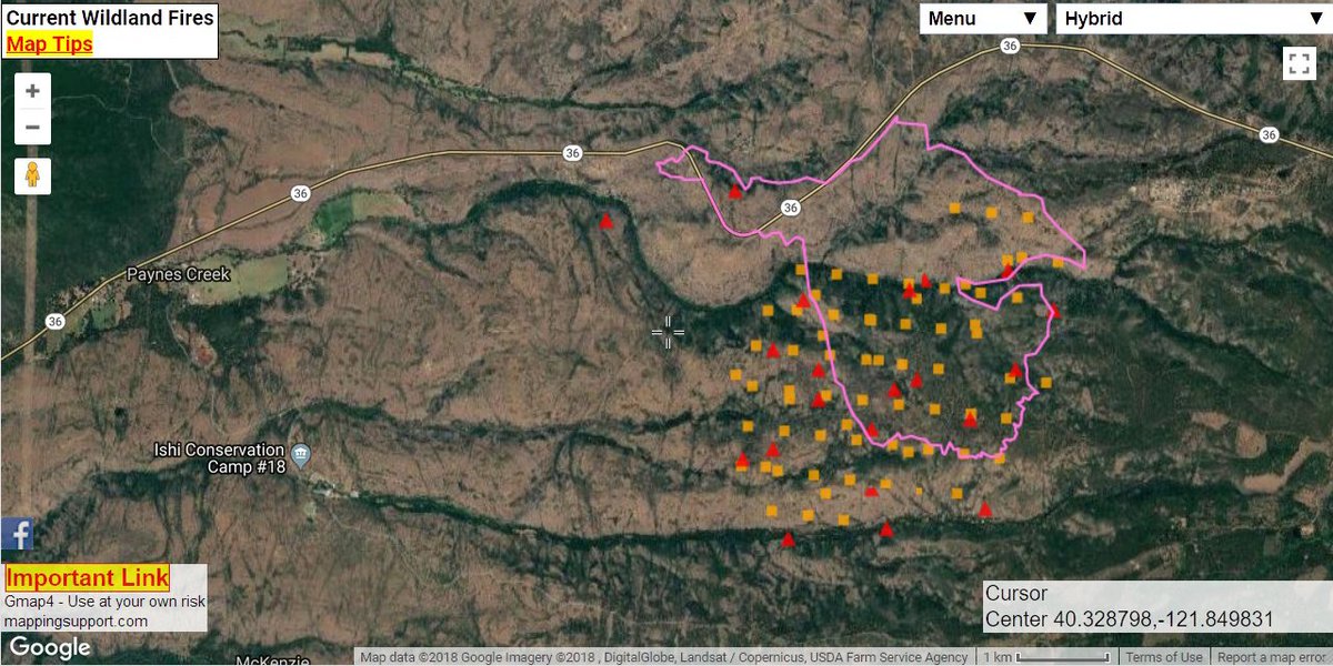
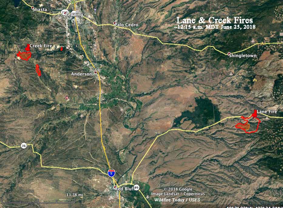
Google + GIS map with #LaneFire perimeter as of 10pm June 23, data from NIFC server. Hopefully there will be an infrared overflight tonight and new perimeter data available in the morning. Fire is much larger now. Map link: mappingsupport.com/p/gmap4.php?ll… #geospatial
Another view of the current #NorCal fires. Notice how the smoke plume from #LaneFire (SE of Redding) casts a shadow as the sun sets. #cawx #PawneeFire #StollFire

#CA @VCAPetHealth hospitals in N. California offer free boarding for small animals, including dogs, cats, birds and pocket pets to families impacted by the wildfires including #PawneeFire north of @SantaRosaCA, and the #LaneFire and #CreekFire around Redding. #DisasterAnimals

VCA Animal Hospitals Offers Free Boarding for Pets Affected by Northern California Wildfires dlvr.it/QYzP85

One of our high resolution weather satellites captured this image of #NorCal overnight, clearly showing #LaneFire #PawneeFire #LionsPointFire putting out an impressive amount of radiance. #cawx

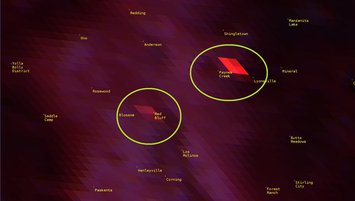
#LaneFire (Paynes Creek, Tehama Co) - Air attack reports 900 acres, fire starting to turn towards the south & potentially away from Sky Ranch. Additional evacs being ordered for Plum Creek Rd/Ponderosa Way area.

My first California wildfire Wikipedia article this year. The #LaneFire in Tehama County has burned 3k acres and 200+ evacuated en.wikipedia.org/wiki/Lane_Fire #Wildfires

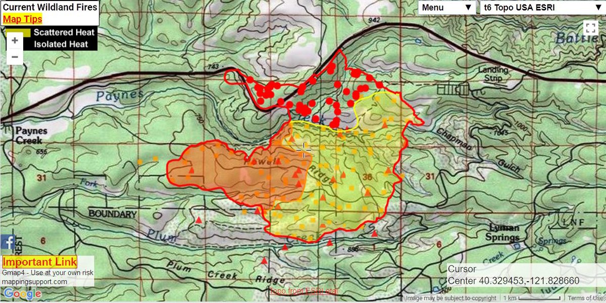
Overnight mapping of 2 #wildfires in N. California. #LaneFire (3,717 acres) and #CreekFire (approximately 1,145 acres)
#LaneFire (#RunningSprings, San Bernardino NF) - Copter overhead called it 3-4 acres w/ moderate rate of spread burning to the north. 2 addl water tenders + 4 type 1 handcrews requested. The fire is on south side of road & about to bump the road now.


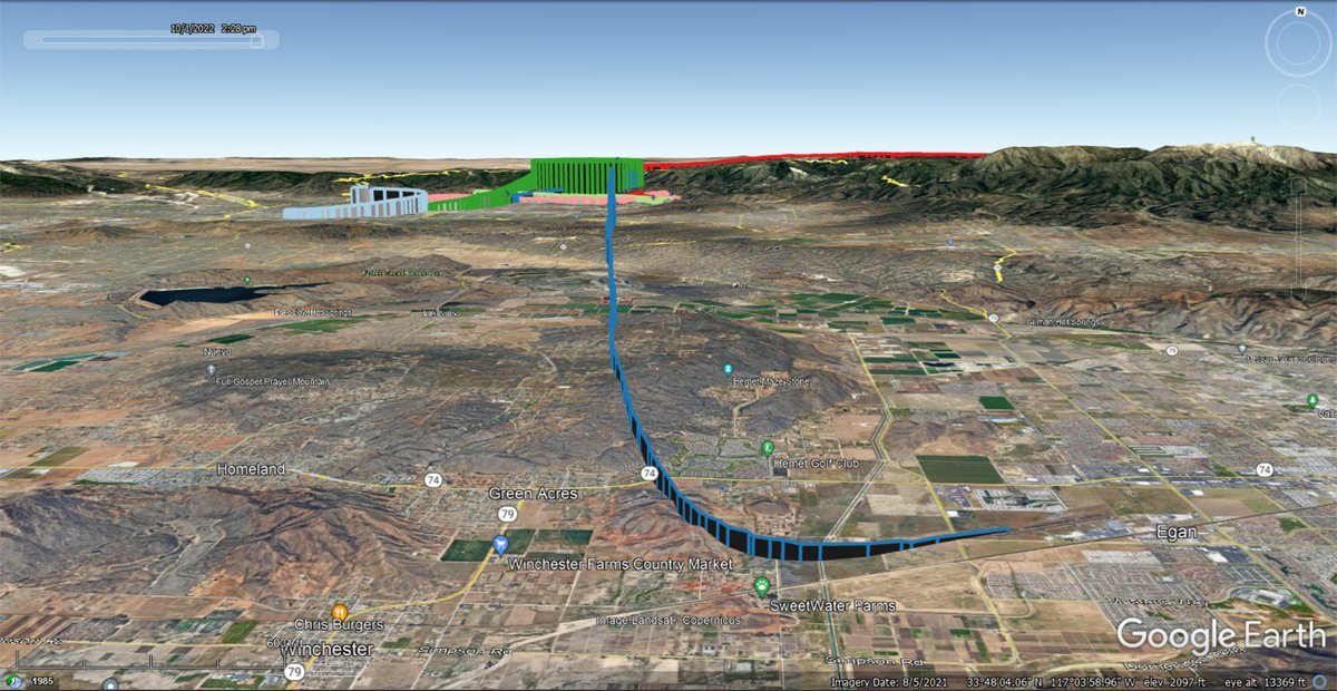
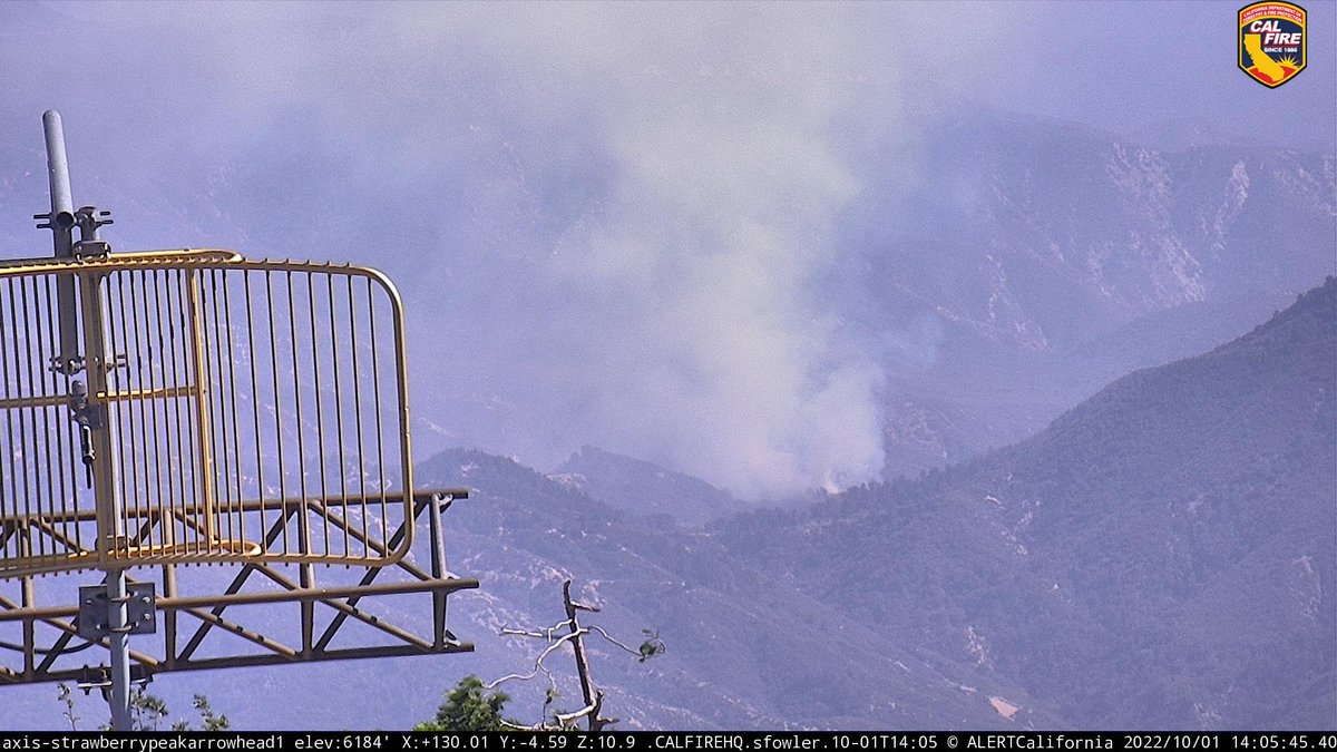
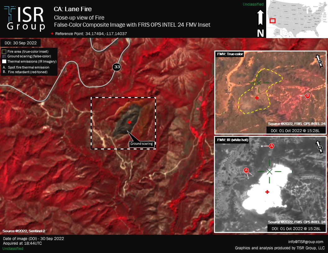
OES Intel 24, Oct 1st on the #LaneFire, BDF. Fire is mapped at 2.2 acres at 15:28 hours. Forward rate of spread has been stopped.
Google + GIS map #LaneFire. Monday a.m. 3,717 acres per infrared analysis by fire staff. Want legend? Need help? Click "Map tips". To change basemap click the “t6 topo...” button. Map link: mappingsupport.com/p/gmap4.php?ll… #geospatial

#LaneFire (Paynes Creek, Tehama Co) - 2000 acres. #StollFire (Red Bluff, Tehama Co) - 300 acres w/ forward progress stopped. 15-20 acres got across Walnut St to the south but is also stopped. Fixed wing released. Assessing structural losses.

Retweeted CAL FIRE (@CAL_FIRE): #LaneFire [update] off Hwy 36 in Paynes Creek (Tehama County) is now 2,000 acres. fire.ca.gov/current_incide…
![AWillowsDream's tweet image. Retweeted CAL FIRE (@CAL_FIRE):
#LaneFire [update] off Hwy 36 in Paynes Creek (Tehama County) is now 2,000 acres. fire.ca.gov/current_incide…](https://pbs.twimg.com/media/DgbRTYqVAAAK2fK.jpg)
#LaneFire (#RunningSprings, San Bernardino NF) - The fire is holding at 3-4 acres & there is now hose around the fire. Most aircraft being released. Resources will be committed for 4-6 hours. Final update unless something changes.

#LaneFire [update] off Hwy 36 in Paynes Creek (Tehama County) is now 3,000 acres & 5% contained.

#RT @CAL_FIRE: #LaneFire [update] off Hwy 36 in Paynes Creek (Tehama County) is now 3,000 acres & 5% contained. fire.ca.gov/current_incide…
![MarinBUZZ's tweet image. #RT @CAL_FIRE: #LaneFire [update] off Hwy 36 in Paynes Creek (Tehama County) is now 3,000 acres & 5% contained. fire.ca.gov/current_incide…](https://pbs.twimg.com/media/DgdoJ0HUwAQYxpl.jpg)
This is the #LaneFire. OES Intel 24 has mapped the fire at 21 acres, burning downhill on the side of HWY 178.
New Brush Fire Hwy 178 × Kern River Canyon Rd, East of Bakersfield in the hills.
OES Intel 24, Oct 1st on the #LaneFire, BDF. Fire is mapped at 2.2 acres at 15:28 hours. Forward rate of spread has been stopped.
#LaneFire (#RunningSprings, San Bernardino NF) - The fire is holding at 3-4 acres & there is now hose around the fire. Most aircraft being released. Resources will be committed for 4-6 hours. Final update unless something changes.

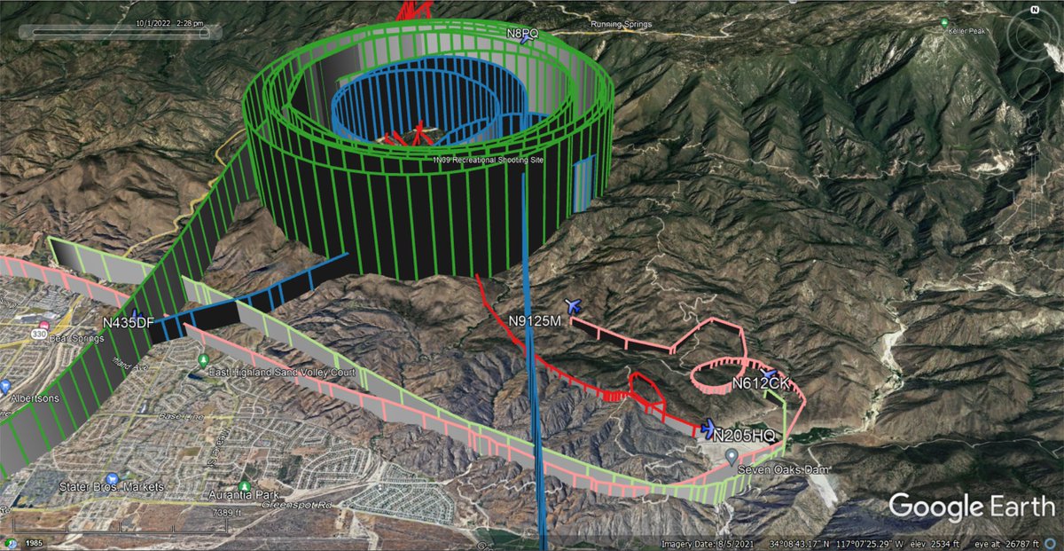
Additional firefighting aircraft fighting the 3-4 acres w/MROS #LaneFire SW of #RunningSprings #SanBernardinoCounty You can see the helicopters pulling water from the #SevenOaksReservoir broadcastify.com/webPlayer/12443 Tenax Aerospace #N24HD 🇺🇸❤️🔥

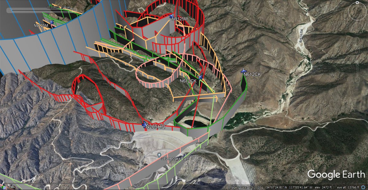

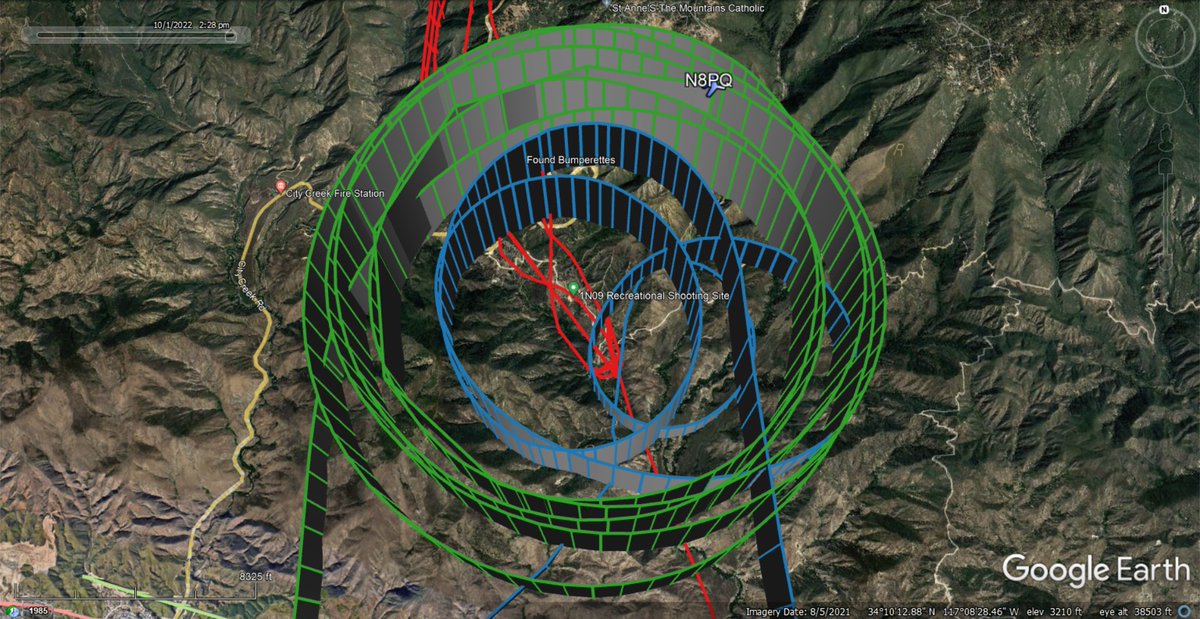
Active firefighting aircraft fighting the #LaneFire SW of #RunningSprings #SanBernardinoCounty broadcastify.com/webPlayer/12443 Elkhorn Aviation #N8PQ #CalFire #T72 #N435DF Siller Helicopters #HT781 #N9125M TVPX Aircraft #N205HQ Aero-Flite #TNKR169 #N325AC Croman #C702 #N612CK 🇺🇸❤️🔥

Wildfire - #LANEFire san bernardino county Map Link: napsg.maps.arcgis.com/apps/webappvie… #FireMappers
#LaneFire (#RunningSprings, San Bernardino NF) - Copter overhead called it 3-4 acres w/ moderate rate of spread burning to the north. 2 addl water tenders + 4 type 1 handcrews requested. The fire is on south side of road & about to bump the road now.

#LaneFire S/W of #RunningSprings in San Bernardino NF, near the Manzanita Fire from earlier this week: 3-5 acres, requesting 2nd alarm + aircraft. May be able to hold it to 10 acres if they get in quick. 1N09 Rd S/O Hwy 330. share.watchduty.org/incident/1439
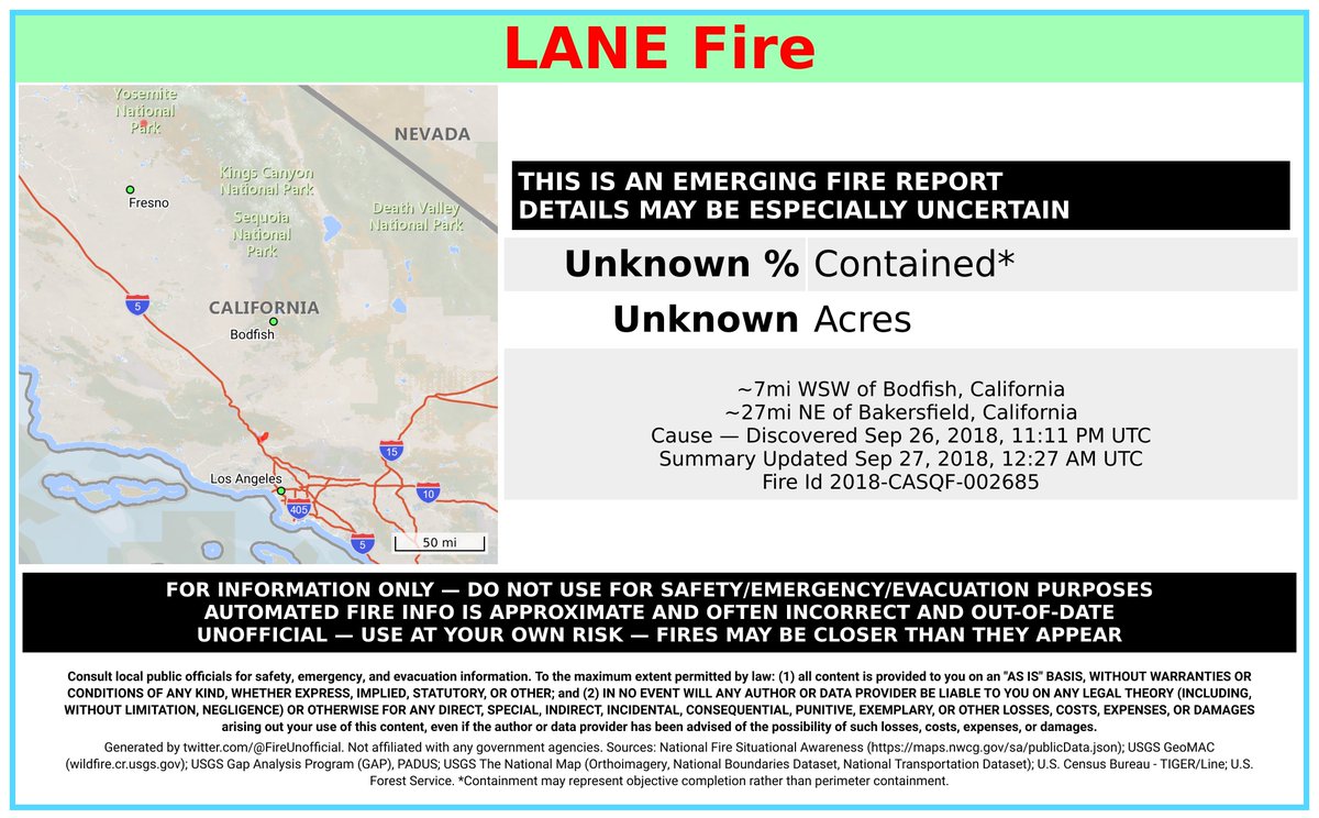
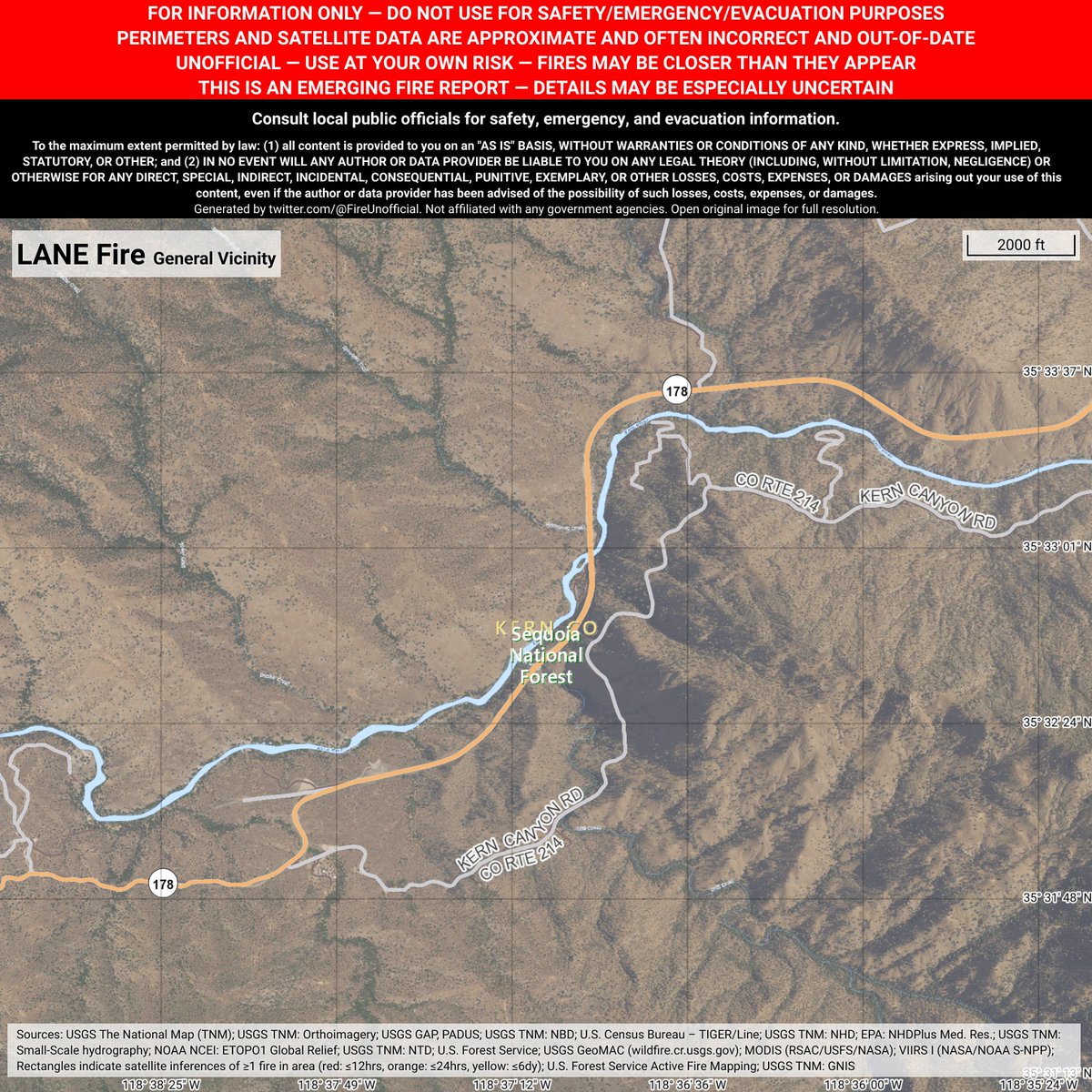
Unofficial emerging fire report for #LaneFire - details may be especially uncertain. ~7mi WSW of Bodfish, California. ~27mi NE of Bakersfield, California. May be incorrect. Consult officials for safety info. Disclaimers in images.

#LaneFire #Riverside Co NEW 20=>35 acre 0=>20% off #Hwy60/JackRabbitTrail #Beaumont GoodProgress/60 Was Closed/Rpt EB Closed/WB 1 Lane Open RivCoINFO:rvcfire.org/_Layouts/Incid… Heavy #Traffic 79 Divert fr 60W #SoCal #SoCalFire #CAFire

Firefighters are battling a 20 acre fire off Hwy 60 and Jack Rabbit Trail, Beaumont (Riverside County). #LandFire rvcfire.org/_Layouts/Incid…
After 18 days on the road covering 3 major fires (#lanefire, #pawneefire, #countyfire) as well as covering the @napacountyfire unit, #Striketeam 9340C is on it's way home to #SLOcounty!
#LaneFire FINAL 3,716 acre 100% perimeter containment #Hwy36 PaynesCrk #Tehama Co Start 23JUN2018/Final 4JUL2018 CalFireINFO:fire.ca.gov/current_incide… #NorCal #NorCalFire #CAFire #CALFire #TehamaFire #TehamaCounty
#RT @CAL_FIRE: #LaneFire [final] off Hwy 36 in Paynes Creek (Tehama County) is now 100% contained at 3,716 acres. fire.ca.gov/current_incide…
![MarinBUZZ's tweet image. #RT @CAL_FIRE: #LaneFire [final] off Hwy 36 in Paynes Creek (Tehama County) is now 100% contained at 3,716 acres. fire.ca.gov/current_incide…](https://pbs.twimg.com/media/DhTm0dNUwAIkNMc.jpg)

Google + GIS map with #LaneFire perimeter as of 10pm June 23, data from NIFC server. Hopefully there will be an infrared overflight tonight and new perimeter data available in the morning. Fire is much larger now. Map link: mappingsupport.com/p/gmap4.php?ll… #geospatial
#LaneFire [update] off Hwy 36 in Paynes Creek (Tehama County) is now 3,000 acres & 10% contained. fire.ca.gov/current_incide…
![CAL_FIRE's tweet image. #LaneFire [update] off Hwy 36 in Paynes Creek (Tehama County) is now 3,000 acres & 10% contained. fire.ca.gov/current_incide…](https://pbs.twimg.com/media/DggAc9tUwAAmeUd.jpg)

#LaneFire [update] off Hwy 36 in Paynes Creek (Tehama County) is now 3,716 acres and 98% contained. fire.ca.gov/current_incide…
![QuakeFactor's tweet image. #LaneFire [update] off Hwy 36 in Paynes Creek (Tehama County) is now 3,716 acres and 98% contained. fire.ca.gov/current_incide…](https://pbs.twimg.com/media/DhOWtZdUYAULLks.jpg)
#LaneFire [final] off Hwy 36 in Paynes Creek (Tehama County) is now 100% contained at 3,716 acres. fire.ca.gov/current_incide…
Active firefighting aircraft fighting the #LaneFire SW of #RunningSprings #SanBernardinoCounty broadcastify.com/webPlayer/12443 Elkhorn Aviation #N8PQ #CalFire #T72 #N435DF Siller Helicopters #HT781 #N9125M TVPX Aircraft #N205HQ Aero-Flite #TNKR169 #N325AC Croman #C702 #N612CK 🇺🇸❤️🔥
One of our high resolution weather satellites captured this image of #NorCal overnight, clearly showing #LaneFire #PawneeFire #LionsPointFire putting out an impressive amount of radiance. #cawx
Another view of the current #NorCal fires. Notice how the smoke plume from #LaneFire (SE of Redding) casts a shadow as the sun sets. #cawx #PawneeFire #StollFire
After 18 days on the road covering 3 major fires (#lanefire, #pawneefire, #countyfire) as well as covering the @napacountyfire unit, #Striketeam 9340C is on it's way home to #SLOcounty!
What's the two fires to the SE? The two on the far right seem have big concerns and one jumped Hwy.36. I think the far right is the #LaneFire

#RT @CAL_FIRE: #LaneFire [update] off Hwy 36 in Paynes Creek (Tehama County) is now 3,829 acres & 60% contained. fire.ca.gov/current_incide…
![MarinBUZZ's tweet image. #RT @CAL_FIRE: #LaneFire [update] off Hwy 36 in Paynes Creek (Tehama County) is now 3,829 acres & 60% contained. fire.ca.gov/current_incide…](https://pbs.twimg.com/media/DgqRaGfVQAA-k2y.jpg)
Plenty going on this morning across #NorCal, as viewed from space. Smoke originating from the #LaneFire #PawneeFire #LionsPointFire. And marine clouds expanding along the coast, bringing some cooling! #CAFire #cawx
Smoke from several fires can be seen today on satellite imagery across California. #PawneeFire #LaneFire #LionsFire #cawx


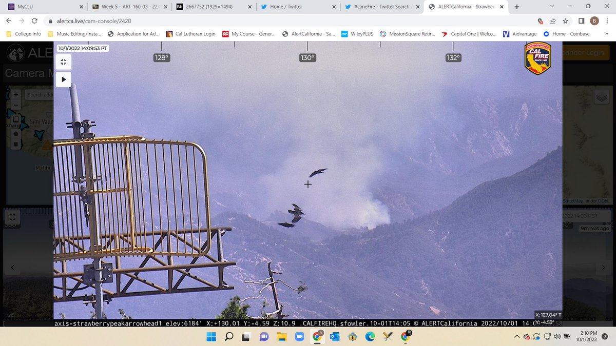
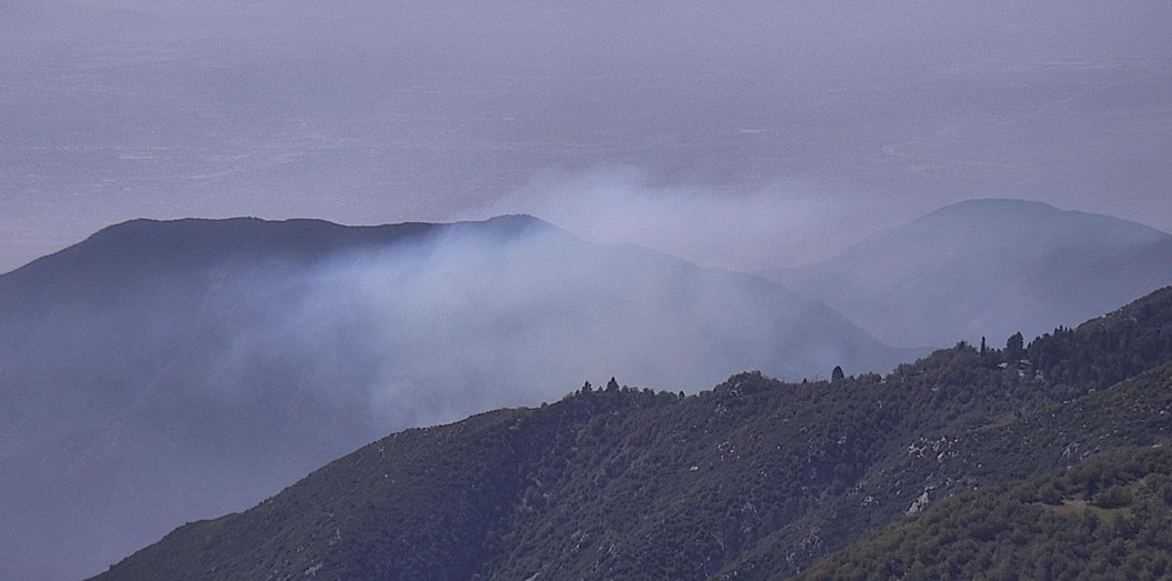
Close-up graphic of the #LaneFire from imgery collected on 30 September 2022 of a false-color composite. #lanefire
Retweeted CAL FIRE (@CAL_FIRE): #LaneFire [update] off Hwy 36 in Paynes Creek (Tehama County) is now 2,000 acres. fire.ca.gov/current_incide…
#LaneFire [final] off Hwy 36 in Paynes Creek (Tehama County) is now 100% contained at 3,716 acres. fire.ca.gov/current_incide…
#LaneFire [update] off Hwy 36 in Paynes Creek (Tehama County) is now 3,829 acres & 40% contained. fire.ca.gov/current_incide…
![CAL_FIRE's tweet image. #LaneFire [update] off Hwy 36 in Paynes Creek (Tehama County) is now 3,829 acres & 40% contained. fire.ca.gov/current_incide…](https://pbs.twimg.com/media/DglbQcOV4AAeLr5.jpg)
Something went wrong.
Something went wrong.
United States Trends
- 1. Joe Kent N/A
- 2. St. Patrick N/A
- 3. Chelsea N/A
- 4. Vini N/A
- 5. Tulsi N/A
- 6. Fortnite Showdown N/A
- 7. Dune N/A
- 8. Waddle N/A
- 9. Bernardo Silva N/A
- 10. #TSTheErasTour N/A
- 11. Ireland N/A
- 12. Kenyon N/A
- 13. Sporting N/A
- 14. Courtois N/A
- 15. Bodo N/A
- 16. AFCON N/A
- 17. #doordashfairy N/A
- 18. Achane N/A
- 19. Gunnar N/A
- 20. Lunin N/A