#lostfire search results

UPDATE (#LostFire): fire is now 20 acres with potential for 50 acres. Structures to the south have good weed abatement with structure protection groups established.

#LostFire The Fire is holding at 25 acres, No Valuables at Risk from Copter 4, Copters are working the Left Flank.
#LostFire Aircraft Assisting. VCFD Copter 4, OCFA Helitanker 47. LACoFD Copter 22, Helitanker 55. The Fire is 20 acres, Potential for 50 acres, Structure Protection is in place for nearby homes in the Area.


UPDATE (#LostFire): list of aircraft over the fire currently: QRF Helitanker 55 LA Fire 5 Ventura Copter 4
UPDATE (#LostFire): the fire is 5 acres burning in light fuels with moderate ROS to the E/SE and currently holding at a 2 track road. Engines are being positioned art Ditch and Sharp roads for structure protection. 2 mutual aid helicopters requested.
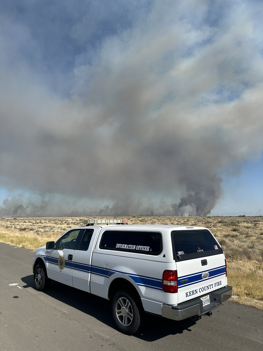
RUNDOWN (#LostFire): units are responding to a vegetation fire. Winds are currently out of the west to southwest at 4.2 miles per hour and gusts are up to 8.8 miles per hour. Temperatures are 70.5ºF and relative humidity is at 72.1%.
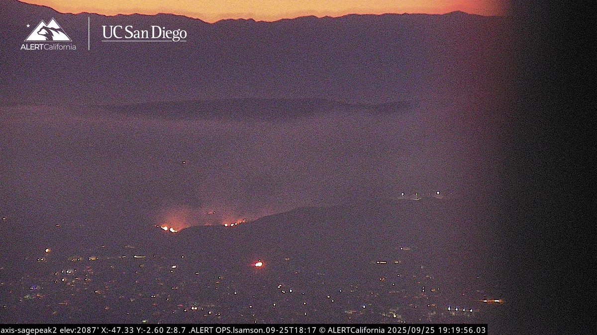
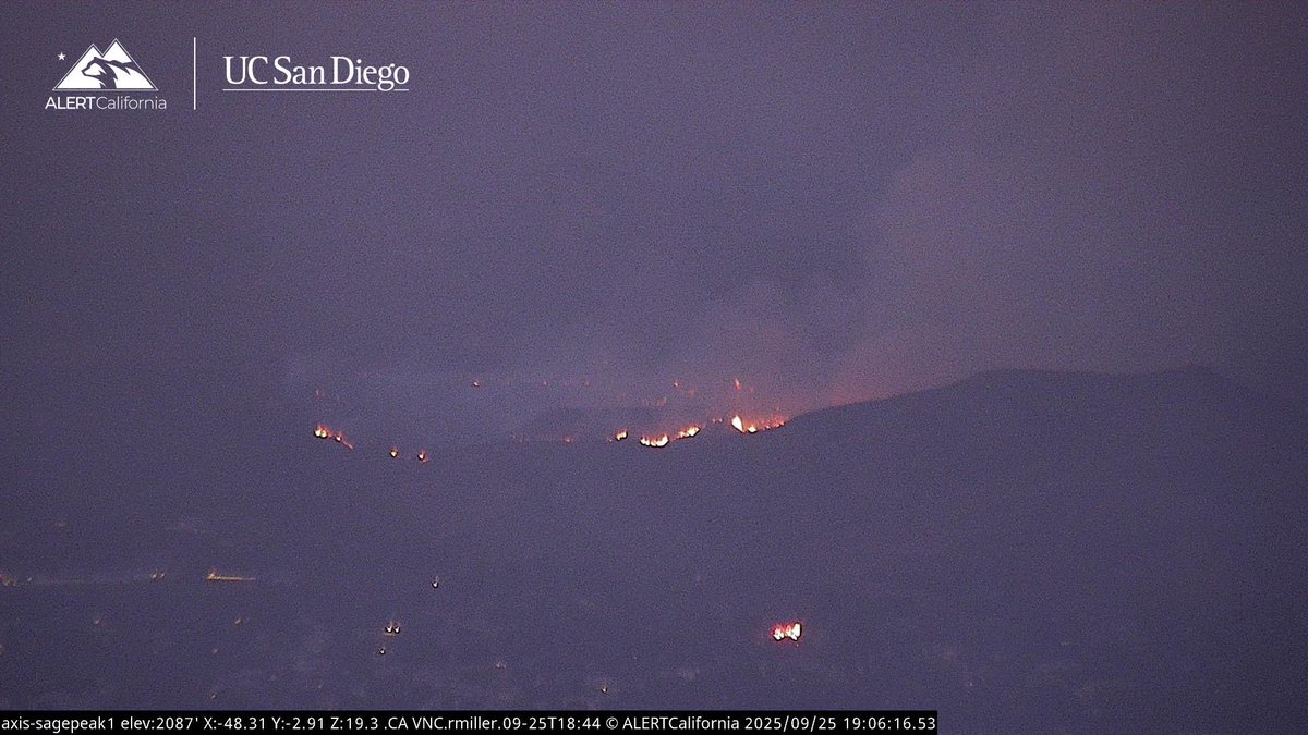
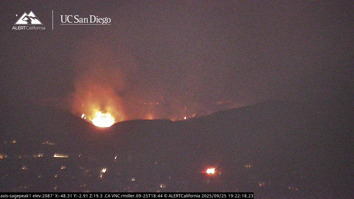
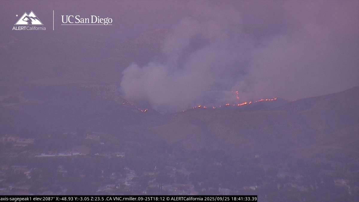
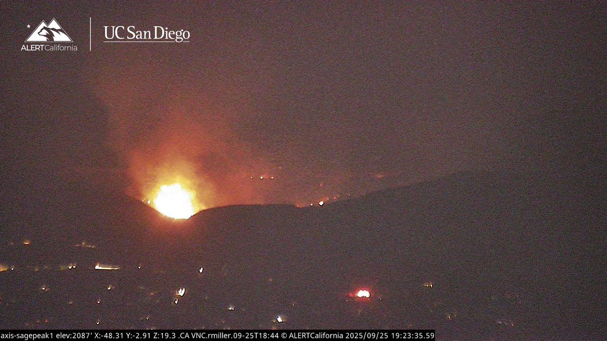
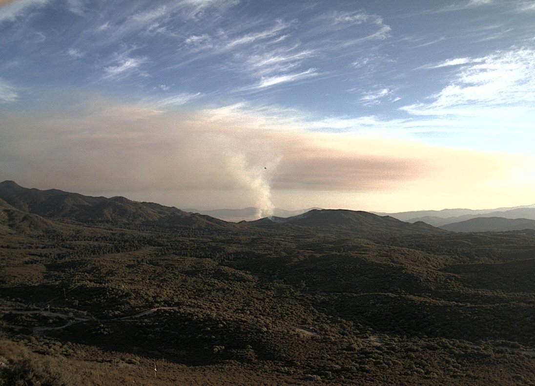
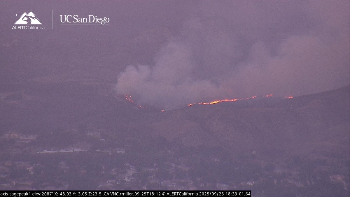
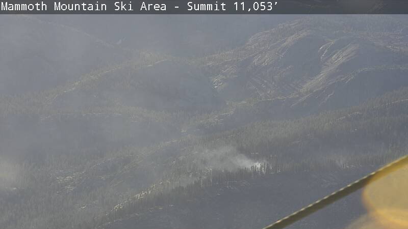
UPDATE (#LostFire): fire activity has greatly reduced. Resources being released with crews making good progress. Forward progress stopped at 25 acres. View of the fire from Sage Peak cam 1.

#lostfire back behind the north side of Simi Valley about a mile from Adventist Hospital. Of Lost Canyon Drive past Erringer. Erringer is the main road up there.
UPDATE (#LostFire): Due to minimal fire activity crews getting ready to go direct.
CAL FIRE CZU has sent dozer Strike Team 9178L to #SRFLightningComplex in Humboldt County to support @CALFIRE_HUU. Dozers 1741 & 1743, 4 dozer operators, 3 swampers (driving the tender & supporting the dozer op), and ST leader are fighting the #LostFire. They left unit Monday.⬇️

#LostFire is holding at 25 acres, structure protection groups remain established, multiple helicopters working the fire, good progress should be made in the next 15 mins per HELCO.
UPDATE (#LostFire): fire is holding at 25 acres with slow rate of spread. Structure defense established. Impact in the next 15-20 minutes per radio traffic.
#Brushfire #Lostfire North of 118 above Adventist hosp,
#lostfire back behind the north side of Simi Valley about a mile from Adventist Hospital. Of Lost Canyon Drive past Erringer. Erringer is the main road up there.

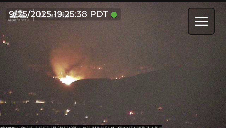
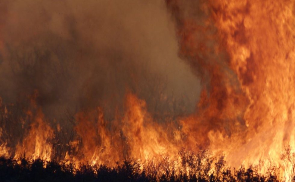
Some video from the #lostfire in Simi Valley @VCFD @VCFD_PIO @LAFDtalk @LAFDAirOps @LACOFD @LACoFireAirOps @LACoFDPIO youtu.be/1WR9Rv6N28A?si…
youtube.com
YouTube
66 Acre Brush Fire In Simi Valley Raw Footage

#LostFire Firefighters are on scene of a 3 acre vegetation fire in light fuels. There are roads surrounding the fire. 1 Mile West of Highway 33 & Delfern, McKittrick Kern County, CA

HAPPENING NOW #SimiValley / #California The #LostFire is now 7 acres and making a run towards Dry Canyon. 5 additional type 3 engines along with the QRF aircraft have been requested
UPDATE (#LostFire): from Ventura County Fire: "The fire is currently at 25 acres in medium fuels with a slow to moderate rate of spread. Approximately 100 firefighters are aggressively battling this fire from the ground and from the air. Currently, no structures are threatened
Some video from the #lostfire in Simi Valley @VCFD @VCFD_PIO @LAFDtalk @LAFDAirOps @LACOFD @LACoFireAirOps @LACoFDPIO youtu.be/1WR9Rv6N28A?si…
youtube.com
YouTube
66 Acre Brush Fire In Simi Valley Raw Footage
UPDATE (#LostFire): the fire’s forward progress was stopped at 66 acres.
UPDATE (#LostFire): fire activity has greatly reduced. Resources being released with crews making good progress. Forward progress stopped at 25 acres. View of the fire from Sage Peak cam 1.
UPDATE (#LostFire): from Ventura County Fire: "The fire is currently at 25 acres in medium fuels with a slow to moderate rate of spread. Approximately 100 firefighters are aggressively battling this fire from the ground and from the air. Currently, no structures are threatened
UPDATE (#LostFire): Due to minimal fire activity crews getting ready to go direct.

UPDATE (#LostFire): list of aircraft over the fire currently: QRF Helitanker 55 LA Fire 5 Ventura Copter 4
#LostFire The Fire is holding at 25 acres, No Valuables at Risk from Copter 4, Copters are working the Left Flank.
#LostFire Aircraft Assisting. VCFD Copter 4, OCFA Helitanker 47. LACoFD Copter 22, Helitanker 55. The Fire is 20 acres, Potential for 50 acres, Structure Protection is in place for nearby homes in the Area.
#LostFire is holding at 25 acres, structure protection groups remain established, multiple helicopters working the fire, good progress should be made in the next 15 mins per HELCO.
UPDATE (#LostFire): fire is holding at 25 acres with slow rate of spread. Structure defense established. Impact in the next 15-20 minutes per radio traffic.

#LostFire is 20 acres with potential for 50 acres, and structures are threatened
#LostFire Air Resources: Onscene: VCFD Copter 4 & Helitanker 55 E/r: LACoFD Copter 22 Spinning up: LAFD 5 & Helitanker 47
#LostFire Aircraft Assisting. VCFD Copter 4, OCFA Helitanker 47. LACoFD Copter 22, Helitanker 55. The Fire is 20 acres, Potential for 50 acres, Structure Protection is in place for nearby homes in the Area.
#LostFire VCFD Copter 4, LACoFD Helitanker 55 is enroute, Requesting Mutual Aid for Copters from LAFD, Helitanker 40 is out of service.

BREAKING #LostFire cause of possible arson
#LostFire structure protection is now requesting an investigator at the scene.
UPDATE (#LostFire): fire is now 20 acres with potential for 50 acres. Structures to the south have good weed abatement with structure protection groups established.
#Lostfire #Brushfire Simi Valley now at 20 acres with potential for 50. Some threatening. Req. for aid from LA County.


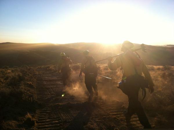


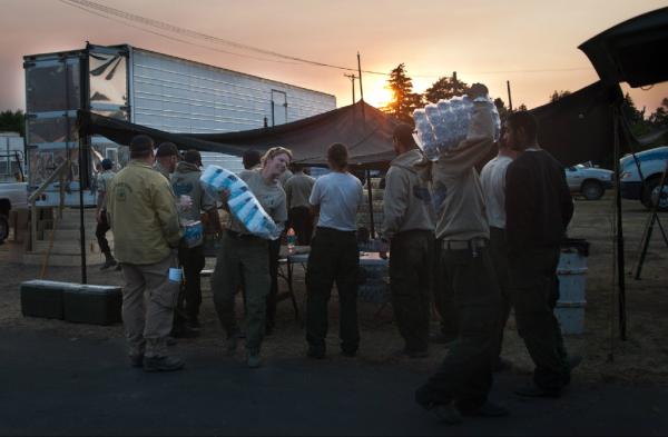
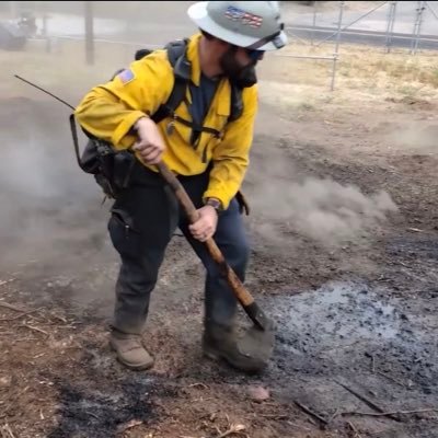
Firefighters from BLM's Folsom Lake Veterans Crew pick up supplies at sunrise in #LostFireBLM camp #LostFire
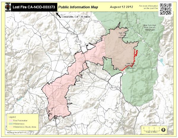
#LostFire [update] Fire is now 300 acres & 0% contained with no structures threatened; Unified Command w/USFS @ClevelandNF
![CALFIRESANDIEGO's tweet image. #LostFire [update] Fire is now 300 acres & 0% contained with no structures threatened; Unified Command w/USFS @ClevelandNF](https://pbs.twimg.com/media/DFYfRm0UQAI6har.jpg)

Cal Fire reports crews are gaining the upper hand on the #LostFire near Warner Springs on.nbc7.com/DZgE485
#LostFire [update] After better mapping fire is now 210 acres; forward rate of spread has slowed significantly Photo: Krystal Lynn Tronboll
![CALFIRESANDIEGO's tweet image. #LostFire [update] After better mapping fire is now 210 acres; forward rate of spread has slowed significantly Photo: Krystal Lynn Tronboll](https://pbs.twimg.com/media/DFY-ZJzXkAEu11v.jpg)

![InfernoWatch24's tweet image. NEW START #LostFire (Ventura Co., CA) [Simi Valley]](https://pbs.twimg.com/media/G1vFam9bAAA5TSg.jpg)

Something went wrong.
Something went wrong.
United States Trends
- 1. Good Thursday N/A
- 2. Happy Friday Eve N/A
- 3. Azerbaijan N/A
- 4. Chabad N/A
- 5. #ChávezPorAhoraYParaSiempre N/A
- 6. #thursdaymorning N/A
- 7. #OffWhitexZeeNunew N/A
- 8. #thursdaymotivation N/A
- 9. #GrabFoodMegaGalexจอสกวิน N/A
- 10. HS4 AT MIDNIGHT N/A
- 11. GF MEGA GALE X JOSSGAWIN N/A
- 12. Mooney N/A
- 13. Feliz Jueves N/A
- 14. Thankful Thursday N/A
- 15. Ming N/A
- 16. Hugo Chávez N/A
- 17. Upper N/A
- 18. Lyme N/A
- 19. Marine N/A
- 20. Brian McGinnis N/A