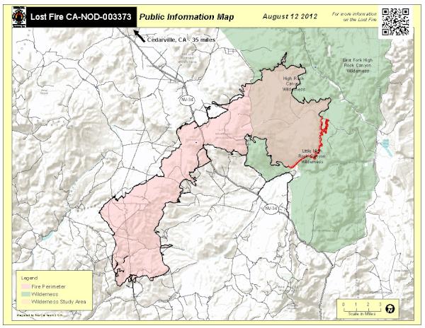
#lostfire search results

HAPPENING NOW #SimiValley / #California The #LostFire is now 7 acres and making a run towards Dry Canyon. 5 additional type 3 engines along with the QRF aircraft have been requested

New Brush Fire Lost Rd, Wildomar, Riverside County. Air Attack 310, Air Tankers 72, 73, Copter 608 is enroute. #LostFire
BREAKING #LostFire cause of possible arson

#LostFire structure protection is now requesting an investigator at the scene.
#lostfire back behind the north side of Simi Valley about a mile from Adventist Hospital. Of Lost Canyon Drive past Erringer. Erringer is the main road up there.
#Brushfire #Lostfire North of 118 above Adventist hosp,
#lostfire back behind the north side of Simi Valley about a mile from Adventist Hospital. Of Lost Canyon Drive past Erringer. Erringer is the main road up there.
Wednesday, August 30, 2023 -- Smoke Outlook -- Coastal NW California #SRFLightningComplex #LostFire californiasmokeinfo.blogspot.com/2023/08/wednes…
#LostFire Aircraft Assisting. VCFD Copter 4, OCFA Helitanker 47. LACoFD Copter 22, Helitanker 55. The Fire is 20 acres, Potential for 50 acres, Structure Protection is in place for nearby homes in the Area.
#LostFire VCFD Copter 4, LACoFD Helitanker 55 is enroute, Requesting Mutual Aid for Copters from LAFD, Helitanker 40 is out of service.

New Brush Fire Lost Canyons Dr/Swift Fox Ct, Simi Valley, Ventura County. 7 acres, Moderate Rate of Spread. The (QRF) Quick Reaction Force was Requested, Copter 76, Helitankers 40, 47, 55. #LostFire
#Brushfire #lostfire running north towards dry canyon. A QRF team has been requested and all units dispatched continue toward fire. Simi Valley, CA north of 118 mile + above Sycamore
#lostfire back behind the north side of Simi Valley about a mile from Adventist Hospital. Of Lost Canyon Drive past Erringer. Erringer is the main road up there.
Friday, September 1, 2023 -- Smoke Outlook -- Coastal NW California #SRFLightningComplex #LostFire californiasmokeinfo.blogspot.com/2023/09/friday…


Update on the #lostfire in Redwood Nat'l Park: 529 acres, 0% containment. Majority of fire is in previously logged, 2nd growth forest. Small portion of the fire has slowly spread downslope into old growth redwood forest, where higher humidity has reduced fire activity. #wildfire
#LostFire Air Resources: Onscene: VCFD Copter 4 & Helitanker 55 E/r: LACoFD Copter 22 Spinning up: LAFD 5 & Helitanker 47

Strike Team 1472C is on its way to the #LostFire in @CALFIRE_HUU. The strike team includes 5 type 3 engines from @CALFIRE_SLO E333 @ATAFireL3600 E7565 @templetonfd E7160 @PasoRoblesES E8163 & @SantaSmv7800 E7863 #Slocountyfire
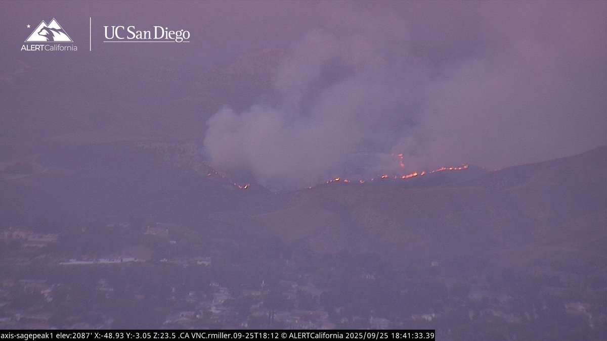
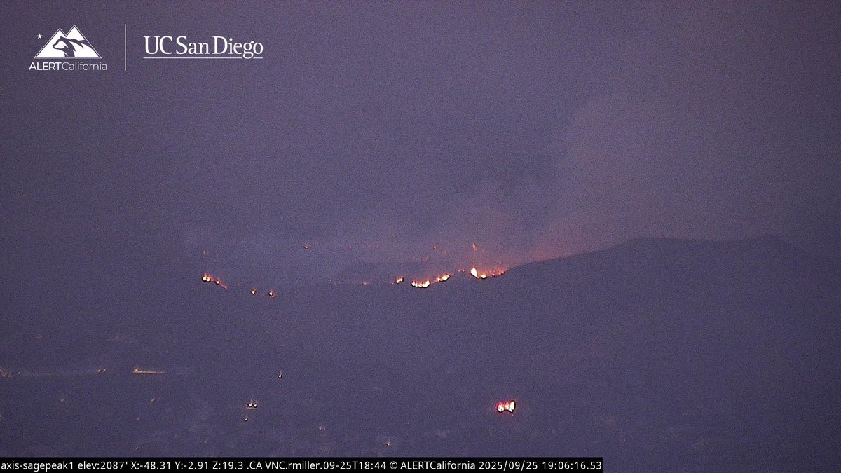
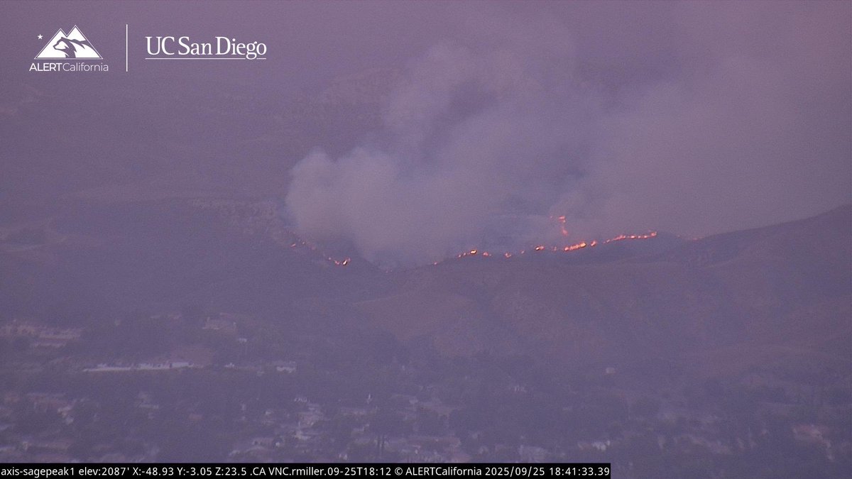
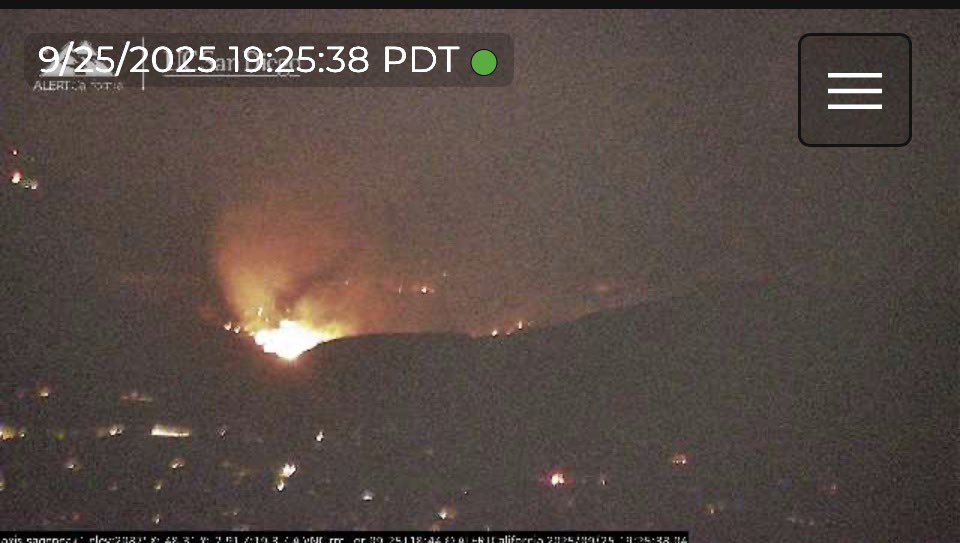
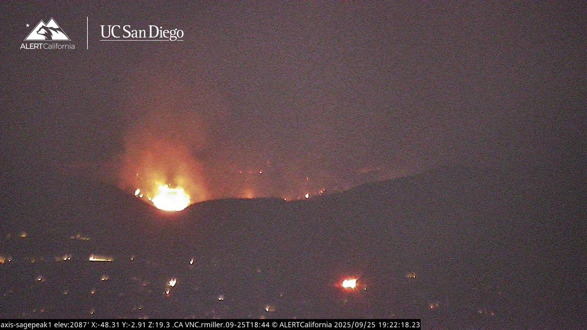
UPDATE (#LostFire): fire activity has greatly reduced. Resources being released with crews making good progress. Forward progress stopped at 25 acres. View of the fire from Sage Peak cam 1.
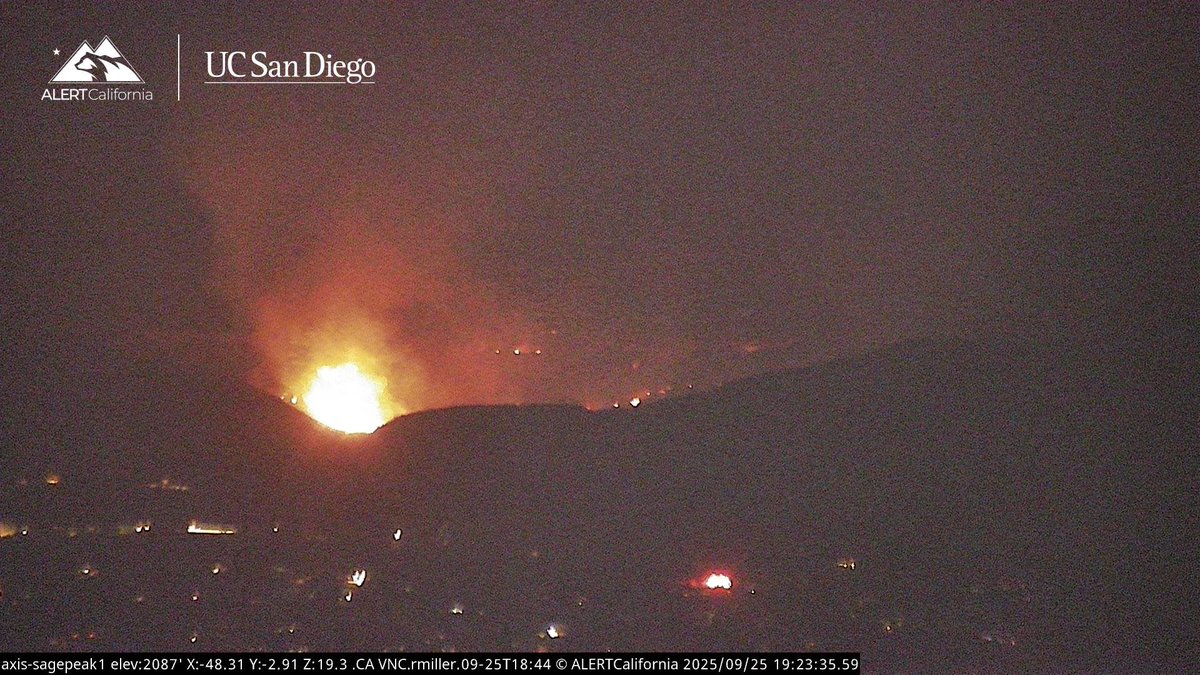
UPDATE (#LostFire): fire is holding at 25 acres with slow rate of spread. Structure defense established. Impact in the next 15-20 minutes per radio traffic.
UPDATE (#LostFire): list of aircraft over the fire currently: QRF Helitanker 55 LA Fire 5 Ventura Copter 4

Some video from the #lostfire in Simi Valley @VCFD @VCFD_PIO @LAFDtalk @LAFDAirOps @LACOFD @LACoFireAirOps @LACoFDPIO youtu.be/1WR9Rv6N28A?si…

youtube.com
YouTube
66 Acre Brush Fire In Simi Valley Raw Footage
UPDATE (#LostFire): the fire’s forward progress was stopped at 66 acres.
UPDATE (#LostFire): fire activity has greatly reduced. Resources being released with crews making good progress. Forward progress stopped at 25 acres. View of the fire from Sage Peak cam 1.
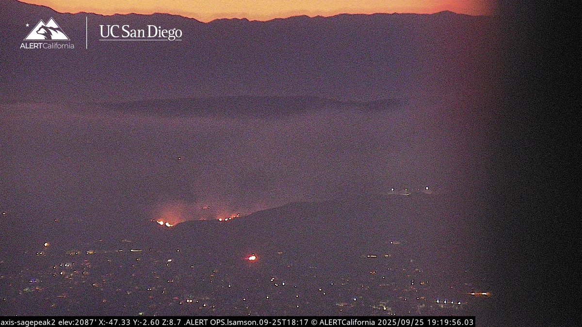
UPDATE (#LostFire): from Ventura County Fire: "The fire is currently at 25 acres in medium fuels with a slow to moderate rate of spread. Approximately 100 firefighters are aggressively battling this fire from the ground and from the air. Currently, no structures are threatened
UPDATE (#LostFire): Due to minimal fire activity crews getting ready to go direct.

UPDATE (#LostFire): list of aircraft over the fire currently: QRF Helitanker 55 LA Fire 5 Ventura Copter 4
#LostFire The Fire is holding at 25 acres, No Valuables at Risk from Copter 4, Copters are working the Left Flank.
#LostFire Aircraft Assisting. VCFD Copter 4, OCFA Helitanker 47. LACoFD Copter 22, Helitanker 55. The Fire is 20 acres, Potential for 50 acres, Structure Protection is in place for nearby homes in the Area.
#LostFire is holding at 25 acres, structure protection groups remain established, multiple helicopters working the fire, good progress should be made in the next 15 mins per HELCO.
UPDATE (#LostFire): fire is holding at 25 acres with slow rate of spread. Structure defense established. Impact in the next 15-20 minutes per radio traffic.

#LostFire is 20 acres with potential for 50 acres, and structures are threatened
#LostFire Air Resources: Onscene: VCFD Copter 4 & Helitanker 55 E/r: LACoFD Copter 22 Spinning up: LAFD 5 & Helitanker 47
#LostFire Aircraft Assisting. VCFD Copter 4, OCFA Helitanker 47. LACoFD Copter 22, Helitanker 55. The Fire is 20 acres, Potential for 50 acres, Structure Protection is in place for nearby homes in the Area.
#LostFire VCFD Copter 4, LACoFD Helitanker 55 is enroute, Requesting Mutual Aid for Copters from LAFD, Helitanker 40 is out of service.
BREAKING #LostFire cause of possible arson
#LostFire structure protection is now requesting an investigator at the scene.
UPDATE (#LostFire): fire is now 20 acres with potential for 50 acres. Structures to the south have good weed abatement with structure protection groups established.
#Lostfire #Brushfire Simi Valley now at 20 acres with potential for 50. Some threatening. Req. for aid from LA County.


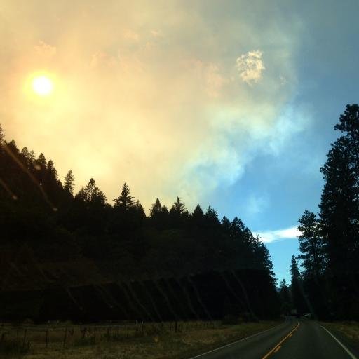
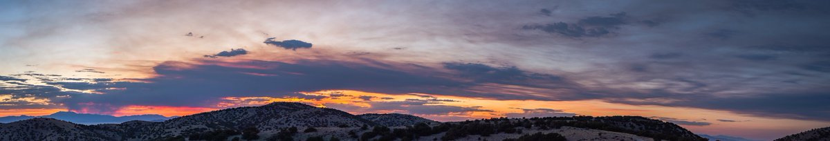
Not sure how twitter will handle the super wide image, but I shot this panorama of the smoke plume from the #LostFire all the way from the Grassy Mountains on the other side of the salt flats this evening. @NevadaFireInfo @blmnv
HAPPENING NOW #SimiValley / #California The #LostFire is now 7 acres and making a run towards Dry Canyon. 5 additional type 3 engines along with the QRF aircraft have been requested

Smoke pouring over the mountains into Montezuma Valley. Not sure the pic shows it exactly, but I got the goats on the left, so... 😐#LostFire

Save your home from wildfires. Install this on your swimming pool. jjsfiresupply.com #USC #DetwilerFire #LostFire #SantaClara #Pac12
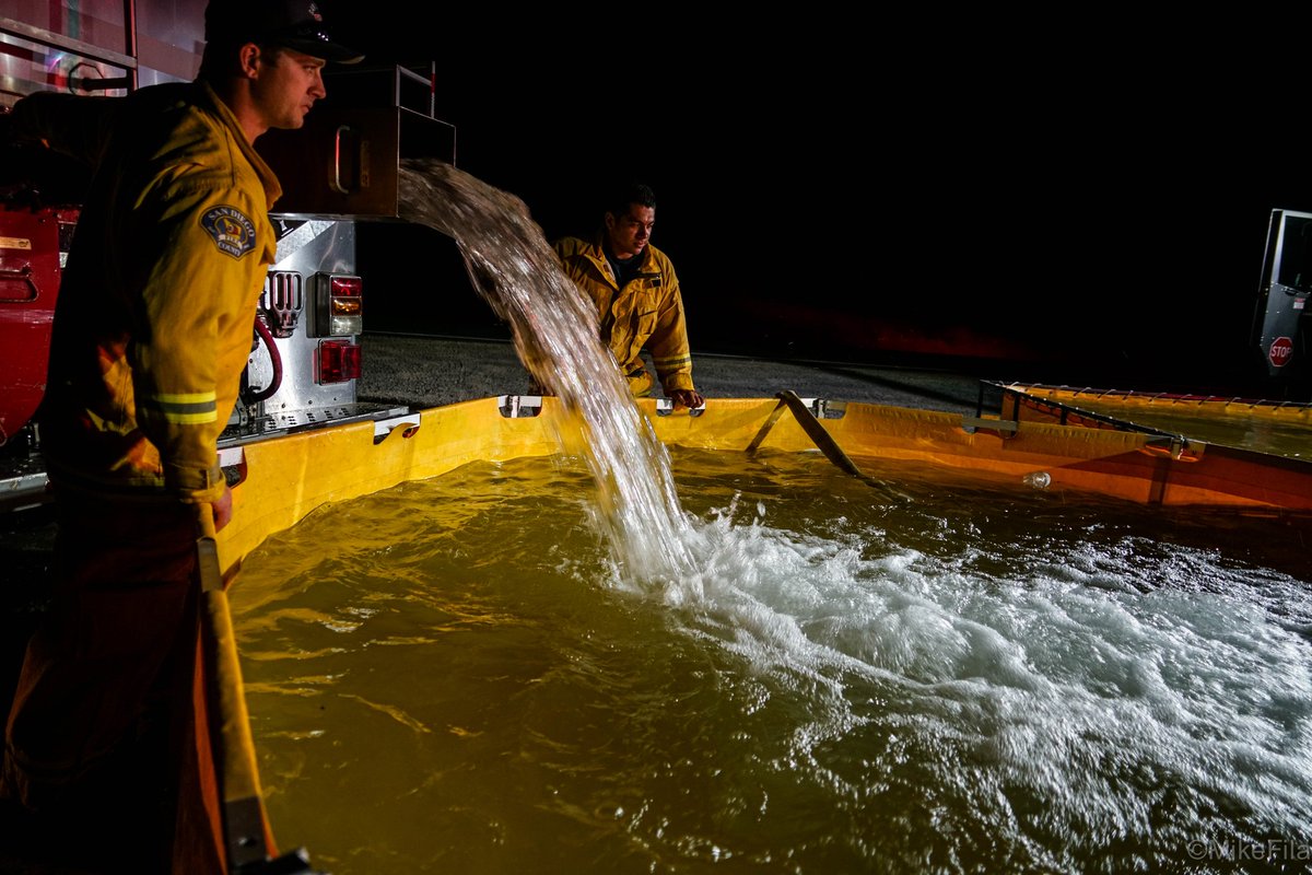
Evacuation warnings lifted & #LostFire 60% contained. Morning rain helped, I'm sure! Thanks for all your hard work, @CALFIRESANDIEGO, et al!
Few #LostFire updates today, but the sky looks ok from here. Our hills burned recently, so not much fuel this direction. Be safe, San Diego!

-Siskiyou County: #LavaFire 26,316 acres 77% contained -Tehama County: #ForkFire 43 acres 85% contained -Tulare County/Fresno County: #LostFire 106 acres 70% contained page 4

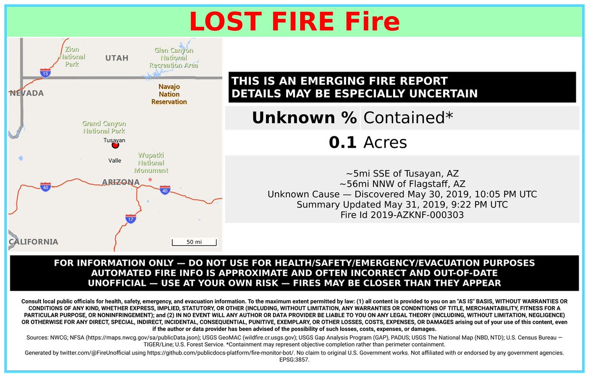
#LostFire 🔥 discovered May 30, 2019, 10:05 PM UTC - unofficial report. #CoconinoCounty Kaibab NF; ~5mi SSE of Tusayan, AZ. ~56mi NNW of Flagstaff, AZ. See officials for safety info. May be incorrect; disclaimers in images.

Final Update for #LostFire @ 7115 acres & 95% containment. Crews will continue to patrol and mop up, securing large islands where safe to do so. Rehab work on dozerline and containment lines will also continue. No further spread is anticipated. #FireSeason2020

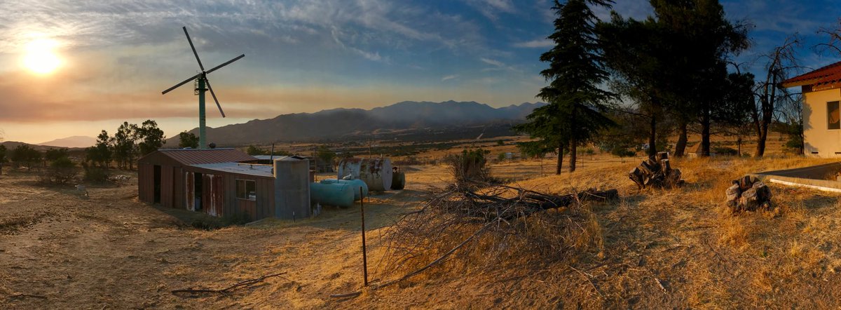
#LostFire [update] Fire is now 300 acres & 0% contained with no structures threatened; Unified Command w/USFS @ClevelandNF
![CALFIRESANDIEGO's tweet image. #LostFire [update] Fire is now 300 acres & 0% contained with no structures threatened; Unified Command w/USFS @ClevelandNF](https://pbs.twimg.com/media/DFYfRm0UQAI6har.jpg)
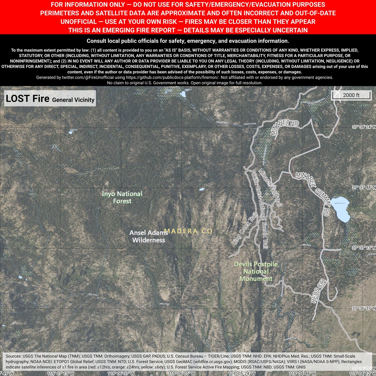
Unofficial emerging fire report for #LostFire - details may be especially uncertain. ~7mi W of Mammoth Lakes, California. ~69mi NNE of Fresno, California. May be incorrect. Consult officials for safety info. Disclaimers in images.

Firefighters working to put out #LostFire near I-80, 35 miles east of Wells, est 1200 acres. Cause unknown. @nvfirecams @alertwildfire #AxisKnoll via @NVSeismoLab

#LostFire Firefighters are on scene of a 3 acre vegetation fire in light fuels. There are roads surrounding the fire. 1 Mile West of Highway 33 & Delfern, McKittrick Kern County, CA
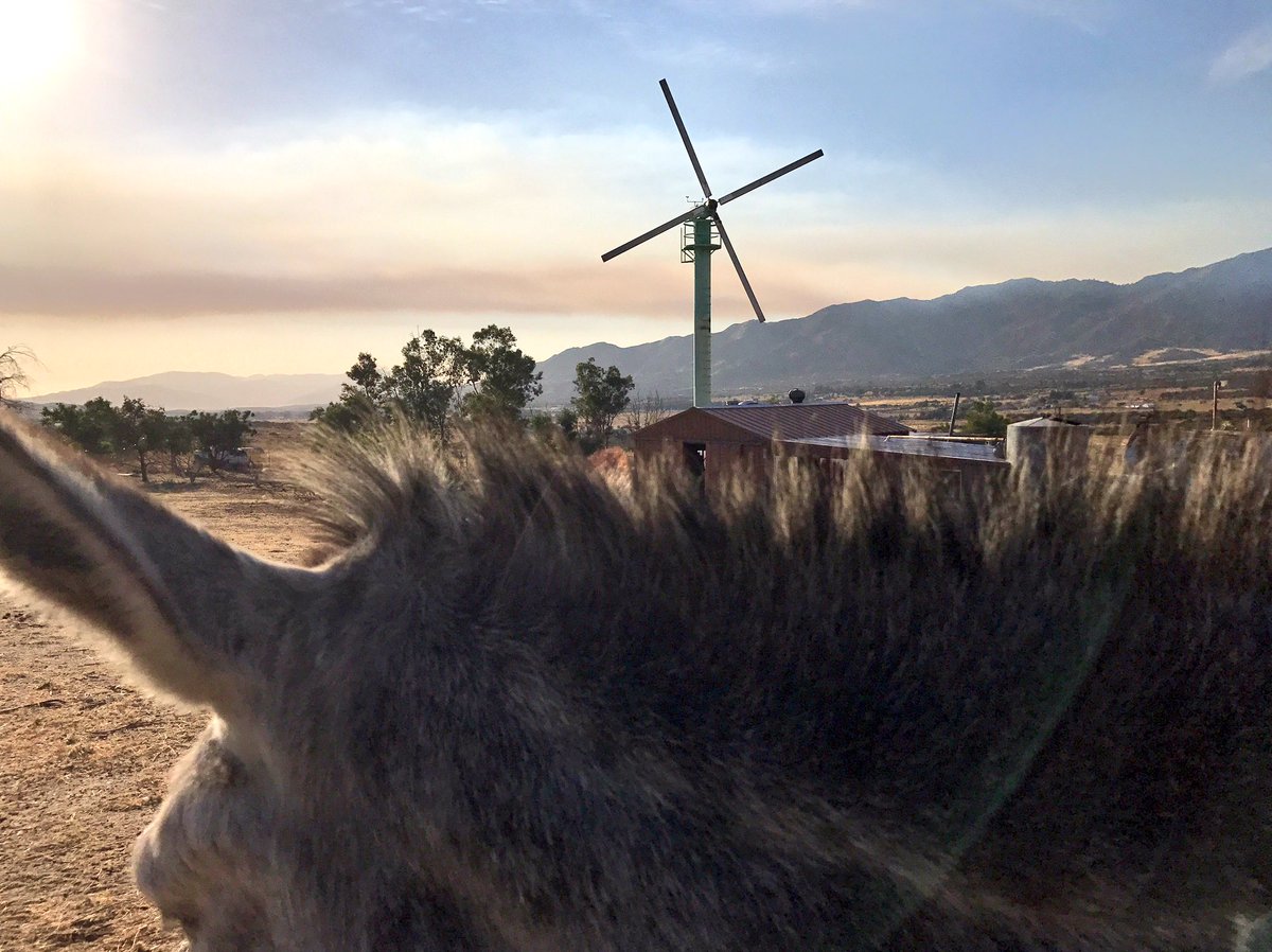
Harry & I have been watching #LostFire fill the sky with smoke for an hour. Fingers & hooves crossed for calm winds & cool temps overnight.

#LostFire west of Mammoth is now at 50 acres and 50% contained. Still a little smoke coming off of it.

-Siskiyou County: #LavaFire 26,316 acres 77% contained -Tehama County: #ElamFire 6.5 acres 75% contained -Tulare County/Fresno County: #LostFire 104 acres 0% contained Page 4
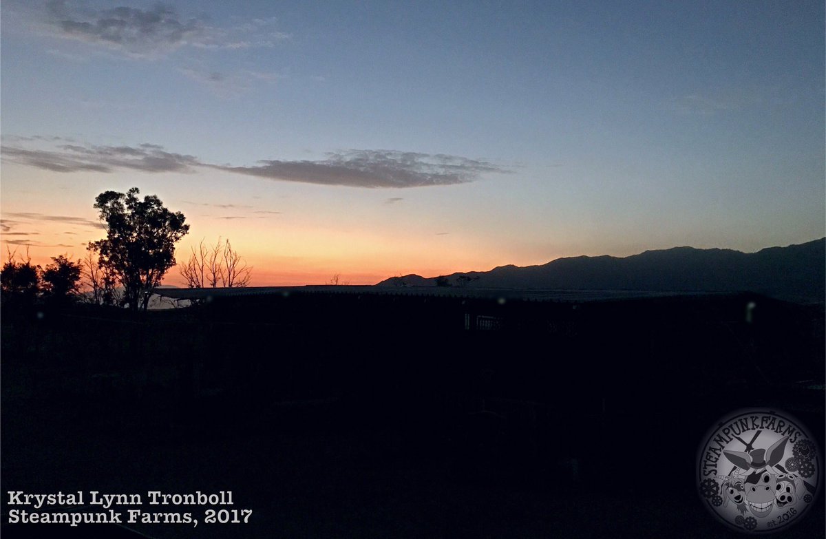
#LostFire [update] After better mapping fire is now 210 acres; forward rate of spread has slowed significantly Photo: Krystal Lynn Tronboll
![CALFIRESANDIEGO's tweet image. #LostFire [update] After better mapping fire is now 210 acres; forward rate of spread has slowed significantly Photo: Krystal Lynn Tronboll](https://pbs.twimg.com/media/DFY-ZJzXkAEu11v.jpg)
Something went wrong.
Something went wrong.
United States Trends
- 1. #WWERaw N/A
- 2. Roman Anthony N/A
- 3. Raiders N/A
- 4. Weights N/A
- 5. Aaron Gordon N/A
- 6. Paul Skenes N/A
- 7. Magic City N/A
- 8. Ajay Mitchell N/A
- 9. Cal Raleigh N/A
- 10. Dean N/A
- 11. Lyra N/A
- 12. Ivy Nile N/A
- 13. Bayley N/A
- 14. Raquel N/A
- 15. Lloyd N/A
- 16. Reed N/A
- 17. Greenlaw N/A
- 18. Luke Kornet N/A
- 19. Tomahawk N/A
- 20. Cuckoo N/A