#mappingireland search results


How do I map the thirty-two counties of Ireland in Tableau? #tableau #tableautips #mappingIreland @DanielLing13 @TableauDublin @aKevinLynch Grab a coffee and find out right here in this great video from @thevideoanalyst: youtu.be/-g23H7xA4ww
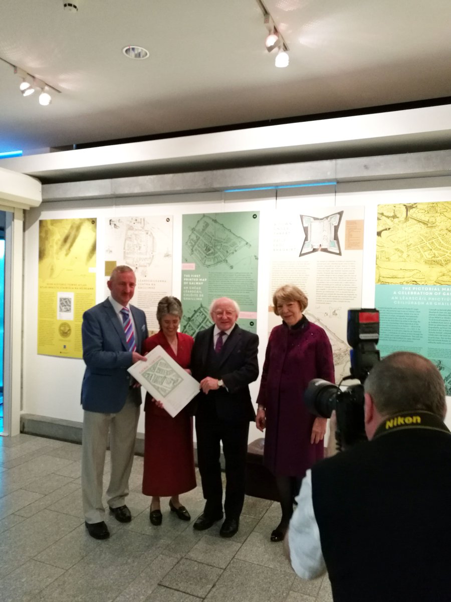
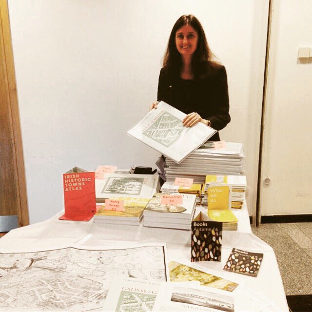
@PresidentIRL at launch of 'Galway' @IHTA_RIA today with authors Jacinta Prunty and Paul Walsh @GalwayMuseum #MappingIreland
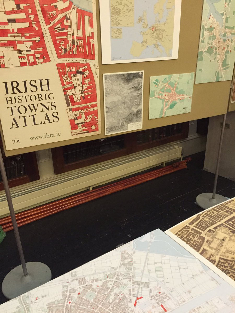
Find out how you can contribute to our OS Maps conservation project bit.ly/2b1rDlY @Library_RIA #MappingIreland
@IHTA_RIA 'Towns of Monastic Origin' now available FREE online #Twitterstorians #MappingIreland bit.ly/2eqJC8K


@heritagemapsIE #MappingIreland Donegal then had its due prominence. Now relegated to an offshore island by D4😐?


If you can share data of what was planted and where, we'll happily add it to @openstreetmap. #mappingIreland #opendata #biodiversity @osm_ie

A Reminder from @heritagemapsIE to take their survey - it will only take a few minutes of your time..#MappingIreland #HaveYourSay @HeritageHubIRE
Do you use HeritageMaps.ie? Do you have a few minutes to take a survey that will help improve the service? #mappingireland @heritagemapsIE @HeritageHubIRE
And what a journey it’s been! Join us on eve of 23rd Feb for this online event @ArmRLib #IrelandMapped #MappingIreland #HistoricMaps #LoveIrishResearch @ResearchArtsUL @ULGeog @QUBGeography
'A journey through maps', looking forward to this online lecture for @ArmRLib, featuring research from @QUBGeography with my @ULGeog colleague @CatSPorter 👍👇 royalhistsoc.org/calendar/a-jou…


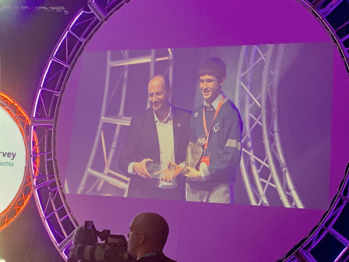
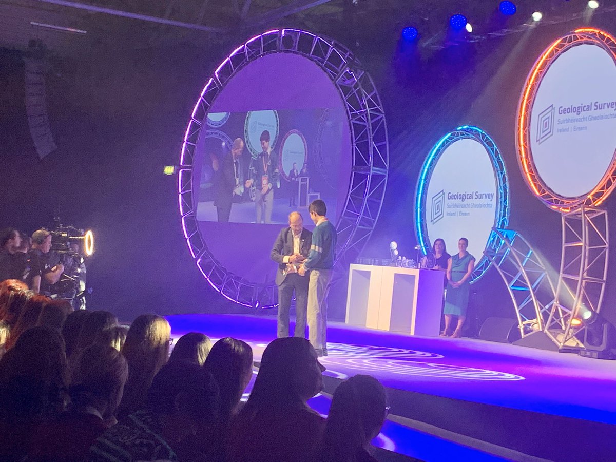
Congratulations to the winner of the Geological Survey Ireland @Dept_CCAE prize - Liam Cotter from Coláiste Choilm, @colaistechoilm Cork, for his project “Determining the fastest route between two control points on an orienteering map.” #Cartography #MappingIreland
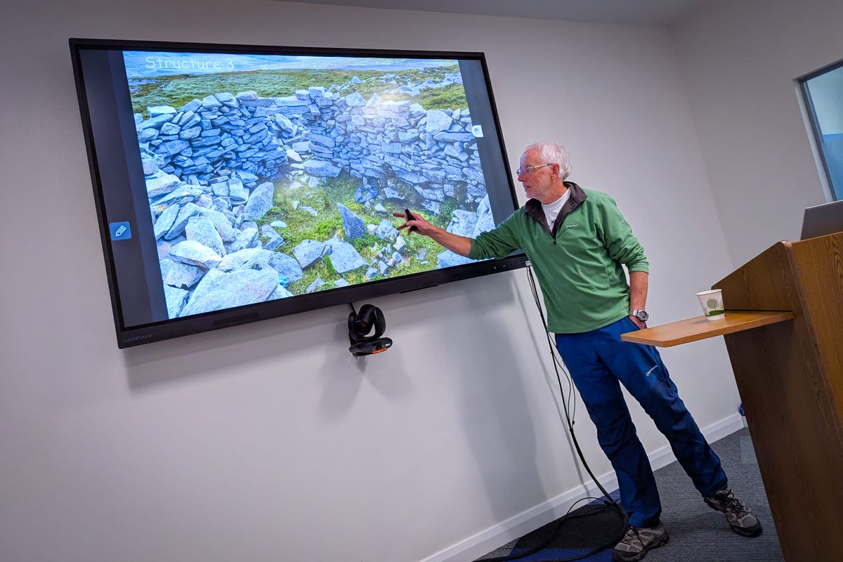
🗺️ OSNI was delighted to host Dr Peter Wilson for a captivating talk on Slieve Snaght’s role in Colby’s 1820s Ordnance Survey work. From summit camps to stone shelters, he highlighted its key place in Ireland’s mapping history. #OrdnanceSurveyNI #IrishHistory #MappingIreland

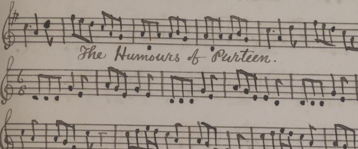
ITMA/Heritage Council putting traditional music on the map! Tunes with HUMOURS OF titles have now been plotted by @HeritageHubIre & ITMA on heritagemaps.ie linking to notation & ITMA's PORT playback platform. itma.ie/blog/mapping-t… #MappingIreland @logainm_ie
@Kroutons with Sabina Higgins at launch of @IHTA_RIA Publication 'Galway' #MappingIreland @President_Irl


Brilliant programme on tv last night #mappingireland thank god for sky plus :)
🗺️ OSNI was delighted to host Dr Peter Wilson for a captivating talk on Slieve Snaght’s role in Colby’s 1820s Ordnance Survey work. From summit camps to stone shelters, he highlighted its key place in Ireland’s mapping history. #OrdnanceSurveyNI #IrishHistory #MappingIreland
And what a journey it’s been! Join us on eve of 23rd Feb for this online event @ArmRLib #IrelandMapped #MappingIreland #HistoricMaps #LoveIrishResearch @ResearchArtsUL @ULGeog @QUBGeography
'A journey through maps', looking forward to this online lecture for @ArmRLib, featuring research from @QUBGeography with my @ULGeog colleague @CatSPorter 👍👇 royalhistsoc.org/calendar/a-jou…
ITMA/Heritage Council putting traditional music on the map! Tunes with HUMOURS OF titles have now been plotted by @HeritageHubIre & ITMA on heritagemaps.ie linking to notation & ITMA's PORT playback platform. itma.ie/blog/mapping-t… #MappingIreland @logainm_ie
A Reminder from @heritagemapsIE to take their survey - it will only take a few minutes of your time..#MappingIreland #HaveYourSay @HeritageHubIRE
Do you use HeritageMaps.ie? Do you have a few minutes to take a survey that will help improve the service? #mappingireland @heritagemapsIE @HeritageHubIRE
@heritagemapsIE #MappingIreland Donegal then had its due prominence. Now relegated to an offshore island by D4😐?
If you can share data of what was planted and where, we'll happily add it to @openstreetmap. #mappingIreland #opendata #biodiversity @osm_ie
Congratulations to the winner of the Geological Survey Ireland @Dept_CCAE prize - Liam Cotter from Coláiste Choilm, @colaistechoilm Cork, for his project “Determining the fastest route between two control points on an orienteering map.” #Cartography #MappingIreland
How do I map the thirty-two counties of Ireland in Tableau? #tableau #tableautips #mappingIreland @DanielLing13 @TableauDublin @aKevinLynch Grab a coffee and find out right here in this great video from @thevideoanalyst: youtu.be/-g23H7xA4ww
@Kroutons with Sabina Higgins at launch of @IHTA_RIA Publication 'Galway' #MappingIreland @President_Irl
@PresidentIRL at launch of 'Galway' @IHTA_RIA today with authors Jacinta Prunty and Paul Walsh @GalwayMuseum #MappingIreland
@IHTA_RIA 'Towns of Monastic Origin' now available FREE online #Twitterstorians #MappingIreland bit.ly/2eqJC8K
Find out how you can contribute to our OS Maps conservation project bit.ly/2b1rDlY @Library_RIA #MappingIreland
Brilliant programme on tv last night #mappingireland thank god for sky plus :)
@IHTA_RIA 'Towns of Monastic Origin' now available FREE online #Twitterstorians #MappingIreland bit.ly/2eqJC8K
Congratulations to the winner of the Geological Survey Ireland @Dept_CCAE prize - Liam Cotter from Coláiste Choilm, @colaistechoilm Cork, for his project “Determining the fastest route between two control points on an orienteering map.” #Cartography #MappingIreland
@heritagemapsIE #MappingIreland Donegal then had its due prominence. Now relegated to an offshore island by D4😐?
@PresidentIRL at launch of 'Galway' @IHTA_RIA today with authors Jacinta Prunty and Paul Walsh @GalwayMuseum #MappingIreland
🗺️ OSNI was delighted to host Dr Peter Wilson for a captivating talk on Slieve Snaght’s role in Colby’s 1820s Ordnance Survey work. From summit camps to stone shelters, he highlighted its key place in Ireland’s mapping history. #OrdnanceSurveyNI #IrishHistory #MappingIreland
ITMA/Heritage Council putting traditional music on the map! Tunes with HUMOURS OF titles have now been plotted by @HeritageHubIre & ITMA on heritagemaps.ie linking to notation & ITMA's PORT playback platform. itma.ie/blog/mapping-t… #MappingIreland @logainm_ie
@Kroutons with Sabina Higgins at launch of @IHTA_RIA Publication 'Galway' #MappingIreland @President_Irl
Something went wrong.
Something went wrong.
United States Trends
- 1. Camavinga N/A
- 2. Real Madrid N/A
- 3. Olise N/A
- 4. Luis Diaz N/A
- 5. Vini N/A
- 6. Neuer N/A
- 7. Arbeloa N/A
- 8. Lunin N/A
- 9. Live Nation N/A
- 10. Arda Guler N/A
- 11. #BTEMailbag N/A
- 12. Harry Kane N/A
- 13. Thragg N/A
- 14. #ChampionsLeague N/A
- 15. #BAYRMA N/A
- 16. Tax Day N/A
- 17. Tyler Wells N/A
- 18. Haitians N/A
- 19. Jackie Robinson N/A
- 20. Rudiger N/A