#midmo ผลการค้นหา

Monday Update: Today is now a First Alert Weather Day due to the potential of a couple of strong to severe storms this evening. While widespread thunderstorms are expected, only a couple will become severe. This is NOT a repeat of last week’s storms. #MidMoWx #MoWx #MidMo


MONDAY: Temperatures will climb into the lower 80s under a mix of sun and clouds. I can’t rule out a stray shower but most of today will remain dry. Winds will be out of the southwest at 10-20 mph, gusting up to 30 mph. #midmowx #midmo #mowx @KOMUnews

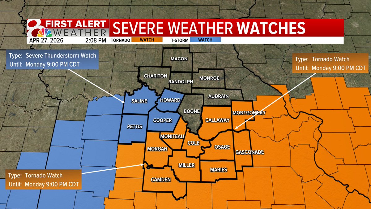
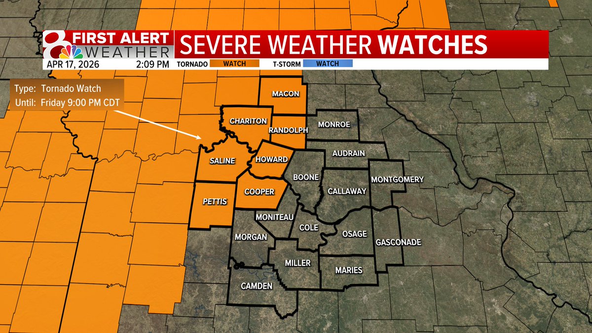
Tornado Watch in effect for parts of the KOMU 8 viewing area, mainly along and south of I-70, until 9PM Monday. Any tornadoes that form could potential be strong. Take all warnings seriously and seek shelter if a warning is issued. #MidMoWx #MoWx #MidMo

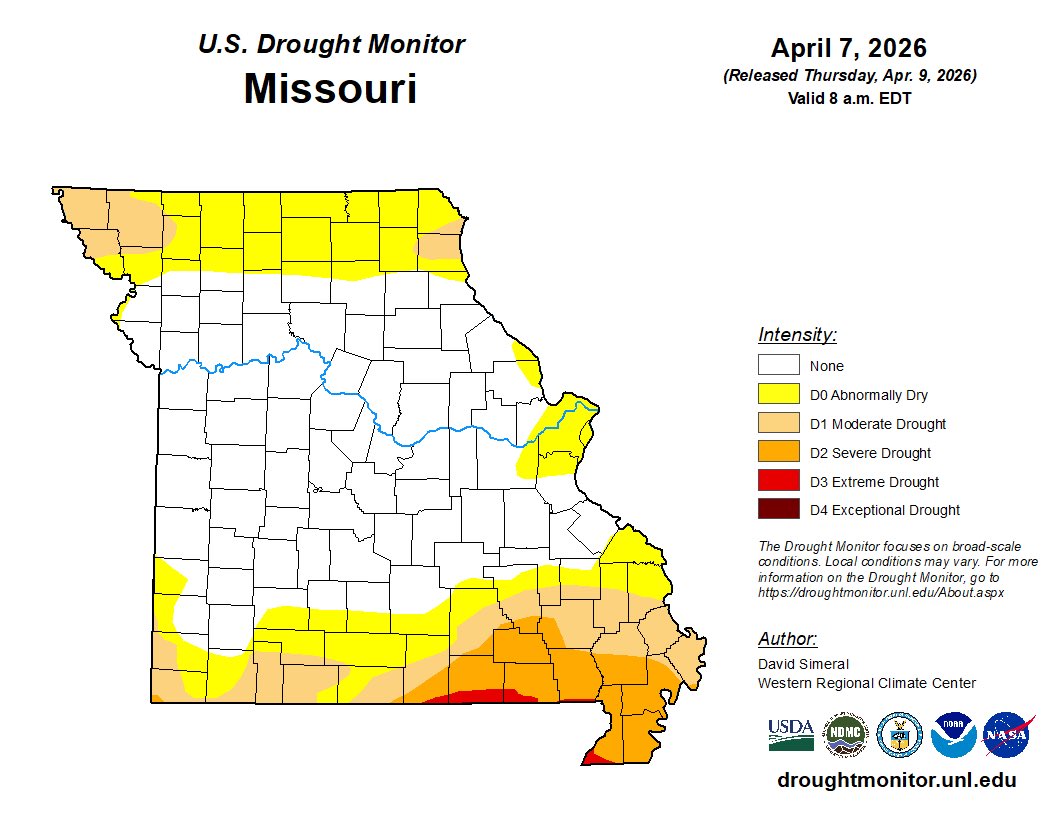
Good News! The latest drought monitor, released today, shows massive improvement with all of mid-Missouri cleared from drought and abnormally dry conditions. 43% of the state remains at least abnormally dry. 20% of the state is in some kind of drought. #MidMoWx #MoWx #MidMo
2PM Monday UPDATE: A Severe Thunderstorm Watch has been added in addition to the tornado watch. Please note, that while Boone County might not be under a watch officially, we should act like it is... I can't rule out any kind of warning. #MidMoWx #MoWx #MidMo
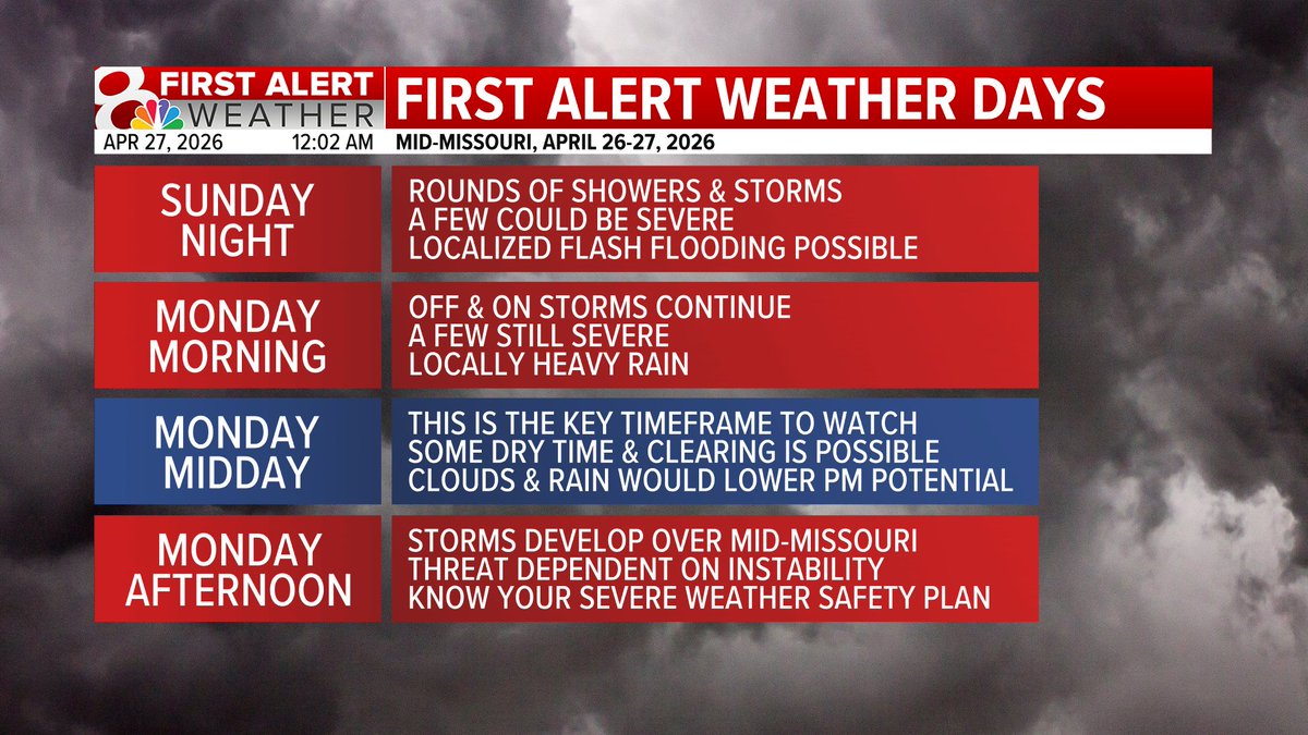
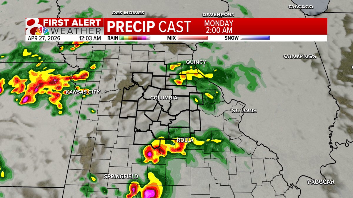
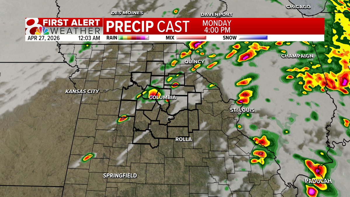
Midnight Update: Tonight & Monday AM: Off & on storms, occasionally severe. Monday Midday: The key time frame to watch. If we're dry... that enhances our potential Monday afternoon. Monday Afternoon: Developing storms, moving east. #MidMoWx #MoWx #MidMo


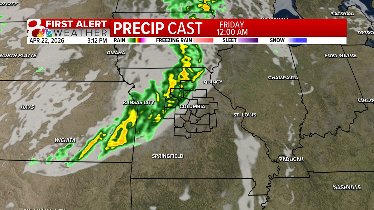
Friday is a First Alert Weather Day for storms this evening and overnight. Most of Friday will be dry, warm, and breezy with isolated storms possible this afternoon and widespread storms past sunset. #midmowx #Midmo #Mowx

FIRST ALERT: Friday will be another First Alert Weather Day and could be our best chance at severe weather this week. Storms will begin as a hail threat midafternoon and will transition to a hail threat through the evening. #midmowx #midmo #mowx


5PM Tuesday: Discovery Parkway is looking BUSY! Probably going to look like that a lot over the next few months with the northbound ramps at Grindstone and New Haven Road are closed due to construction. #MidMoWx #MoWx #MidMo

2PM Friday: A Tornado Watch is in effect until 9PM Friday for areas along and west of Highway 63. Additional watches are likely later this evening across more of the KOMU 8 Viewing area. #MidMoWx #MoWx #MidMo
I hope you all are having a great Sunday! It's a tad on the breezy side, but overall pretty great to take dinner outside, a jacket might be wanted if you run cool. I'll have a full look to the week ahead on KOMU 8 News! #MidMoWx #MoWx #MidMO

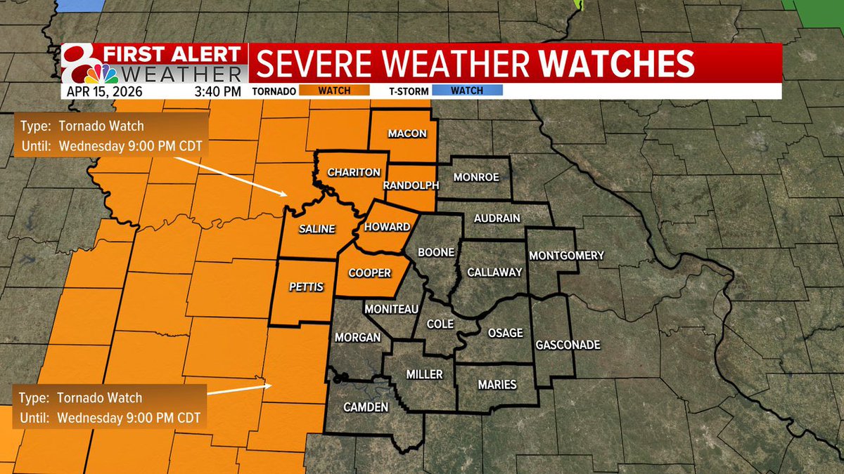
A Tornado Watch for areas along and west of Highway 63 until 9PM Wednesday. While the tornado watch is in effect and a few tornadoes are possible, the main threats remain to be large hail and damaging winds. @kesley_wx & @ethanbeanwx will keep you updated #MidMowx #Mowx #MidMo
Hi everyone! Twitter is limiting my posts due to so many in the last 24 hours. Please don’t rely on social media for weather warnings #MidMoWx #MoWx #MidMo
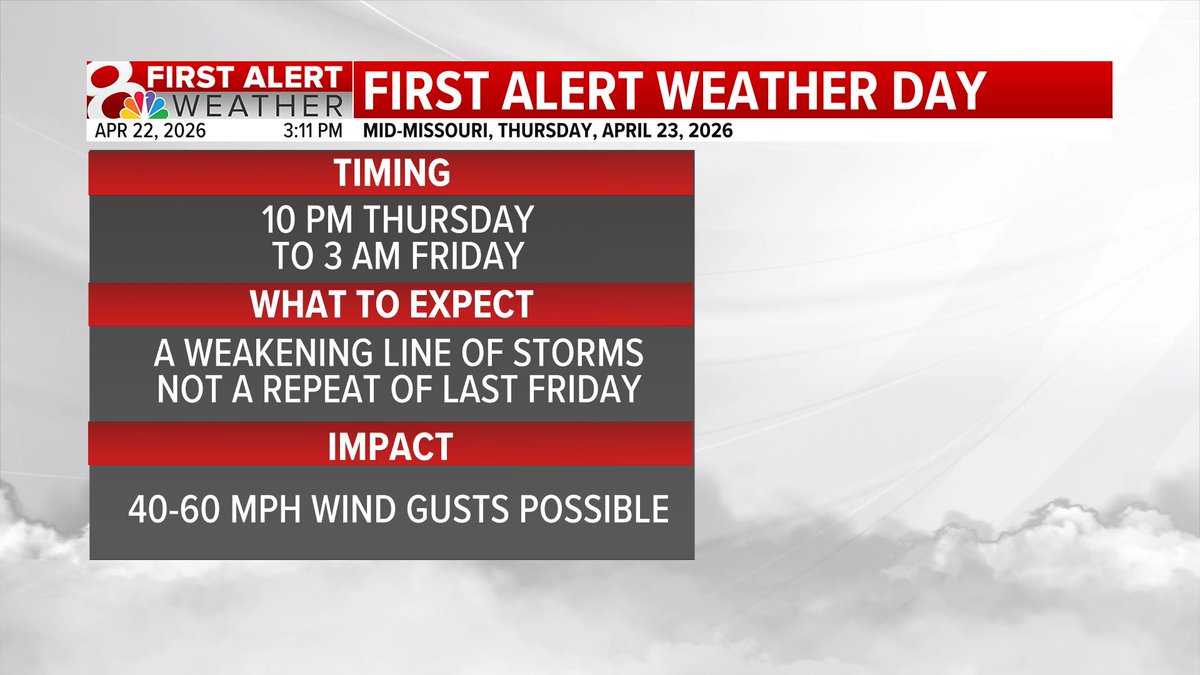
FIRST ALERT: Thursday night/early Friday morning will be a First Alert Weather Day as a weakening line of storms will move through mid-MO. This will NOT be a repeat of last Friday, but more similar to other storm chances earlier this spring. #midmowx #Midmo #Mowx


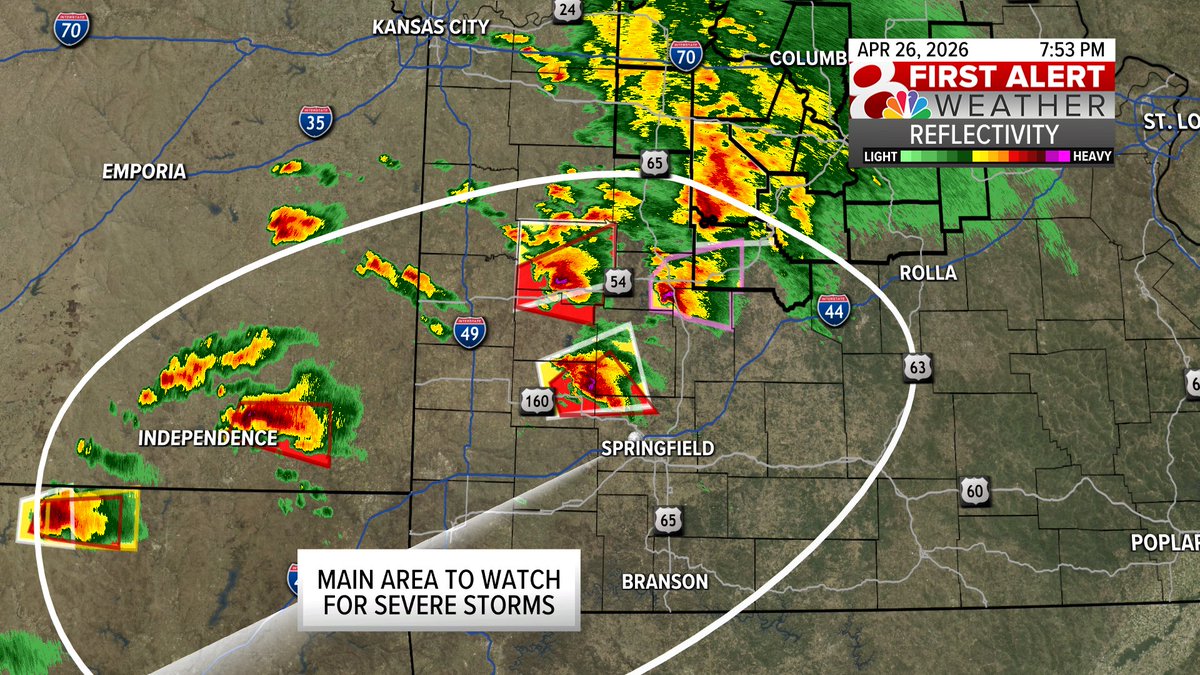
7:53PM Sunday: The main area to watch for severe weather this evening remains south of Hwy 50. Southwest Missouri has several ongoing severe weather and tornado warnings. Farther north, most of Mid-Missouri has a much lower chance of a severe storms. #MidMoWx #MidMo #MoWx


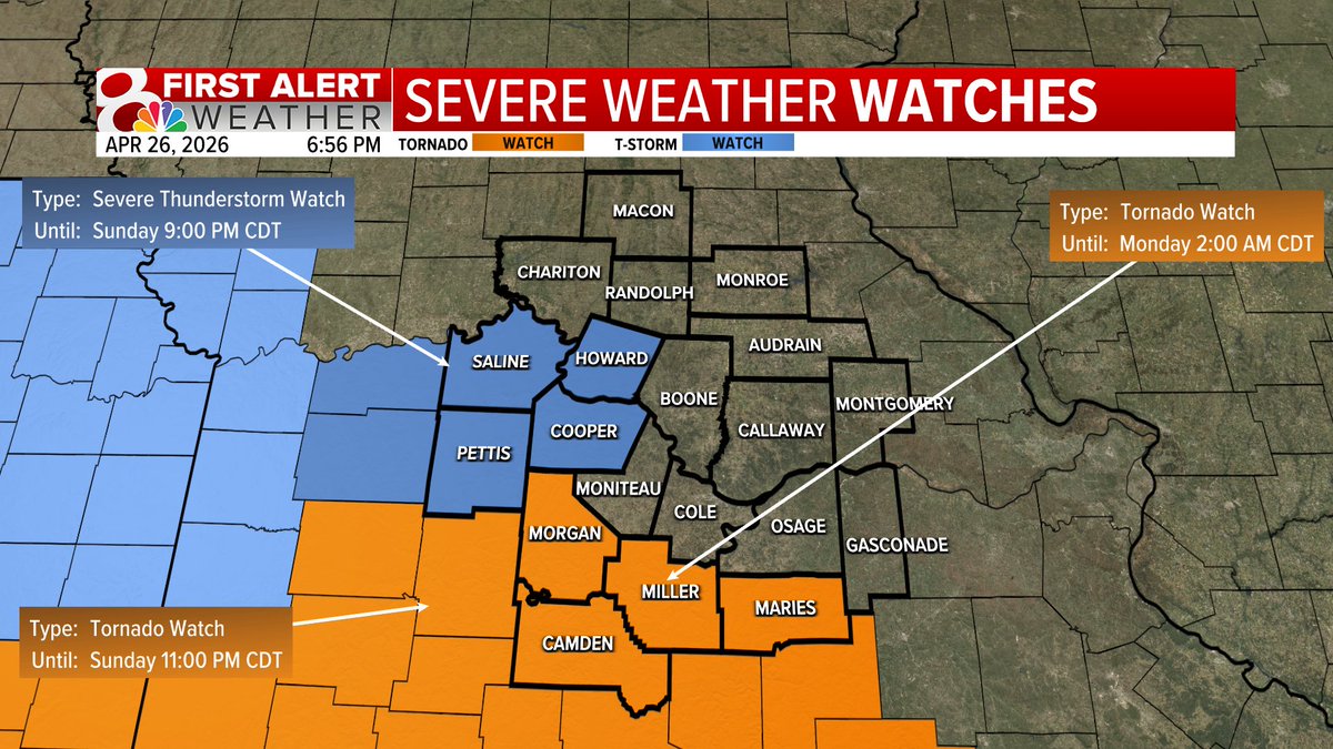
6:56PM Sunday: A Tornado Watch has been issued for Camden, Morgan, Miller, and Maries County until 2AM Monday. A Severe Thunderstorm Watch is in effect for Howard, Cooper, Saline. & Pettis County until 9PM Sunday.#MidMoWx #MoWx #MidMo
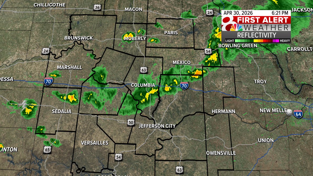
9PM Sunday: A few isolated thunderstorms this evening. These could produce a little small hail or a 40-60MPH wind gust. Storms stay isolated, the severe weather threat stays low. #MidMoWx #MoWx #MidMo

UPDATE: An EF0 tornado has been confirmed by the National Weather Service during Friday's storms. The weather service says that it is likely that the tornado touched down and uplifted multiple times along the track. #MidMoWx #MoWx #MidMo


I've been tracking scattered showers this morning. Here's a look at rainfall totals as of noon. Some areas could expect to see another quarter to half inch. #midmowx #midmo #mowx


The Helias Crusaders had seven golfers finish in the top 15 individuals Monday in taking team honors in the Jefferson City Invitational. #MoPreps #JCMO #MidMo newstribune.com/news/2026/may/…

The Helias Lady Crusaders scored a goal in each half Monday in a 2-0 victory against the Union Lady Wildcats. #MoPreps #JCMO #MidMo newstribune.com/news/2026/may/…
The Capital City Lady Cavaliers finished with a pair of hat tricks Monday night in an 8-0 victory against the Owensville Dutchgirls. #MoPreps #JCMO #MidMo newstribune.com/news/2026/may/…
Facing each other twice in a span of six days, the Helias and Capital City boys tennis teams showed they were evenly matched. Access the News Tribune for the story and photo gallery. #MoPreps #JCMO #MidMo newstribune.com/news/2026/may/…

The Moberly Spartans scored a pair of runs in the bottom of the first inning, which proved to be enough to get past the Blair Oaks Falcons for a 3-1 victory Monday night. #MoPreps #BlairOaks #MidMo newstribune.com/news/2026/may/…
Jefferson City used a 1-2 punch from Katie Mullen and Chloe Crane on the offensive end to post a 5-0 win against the Rolla Lady Bulldogs. Access the News Tribune for the story and photo gallery. #MoPreps #JCMO #MidMo newstribune.com/news/2026/may/…

The Calvary Lutheran Lions dropped their final home game of the season Monday night, a 4-1 decision to the Fayette Falcons at Calvary Lutheran High School. #MoPreps #JCMO #MidMo newstribune.com/news/2026/may/…
Capital City’s pairing of Grant Chojnacki and Hayden Carney came in second place Monday to lead the Cavaliers in the Battle Cinco de Mayo Tournament at Lake of the Woods Golf Course. #MoPreps #JCMO #MidMo newstribune.com/news/2026/may/…
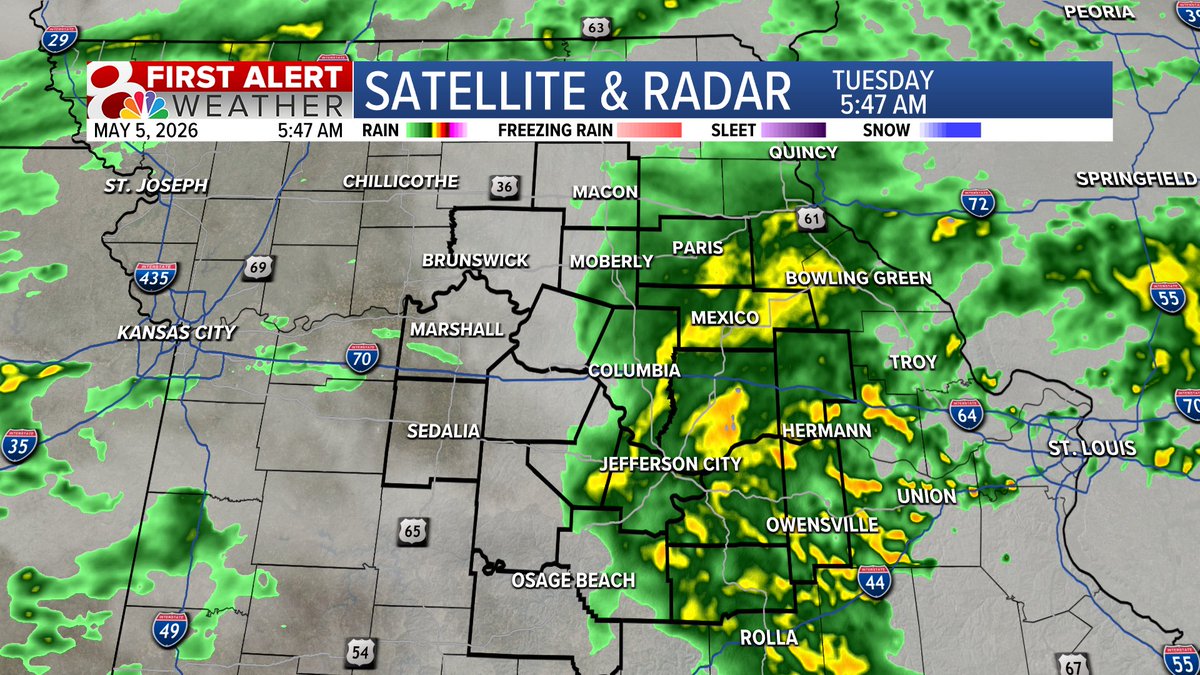
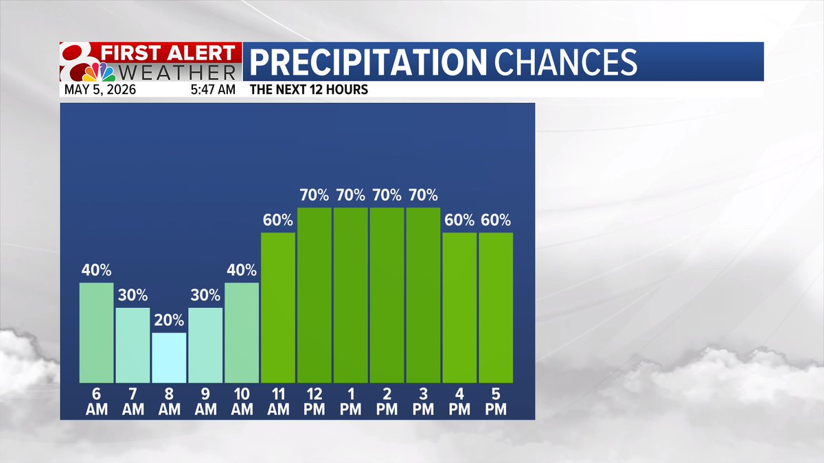
Good morning and happy Tuesday! Scattered showers and a few rumbles of thunder are likely though the day, but there is no threat for severe weather at any point today. #midmowx #Midmo #mowx
The Belle Tigers and Lady Tigers each took third place in the team standings Saturday in the Gasconade Valley Conference championships. #MoPreps #BelleMo #MidMo newstribune.com/news/2026/may/…

7PM Monday: Showers and thunderstorms are starting to develop across northwest Missouri! These could initially produce some hail through the evening hours, before transitioning to off and on thunderstorms (non severe) late tonight and through Tuesday. #MidMoWx #MoWx #MidMo

Monday Update: Today is now a First Alert Weather Day due to the potential of a couple of strong to severe storms this evening. While widespread thunderstorms are expected, only a couple will become severe. This is NOT a repeat of last week’s storms. #MidMoWx #MoWx #MidMo
Four Jefferson City-area high school graduates received all-conference honors during the Mid-America Intercollegiate Athletics Association outdoor track and field championships. Check the News Tribune for details. #MoPreps #JCMO #MidMo newstribune.com/news/2026/may/…

Lincoln’s performance on Senior Day wasn’t indicative of what the Blue Tigers accomplished this season. But the huge crowd in attendance sure was. Access the News Tribune for the story and photo gallery. #BlueTigers #JCMO #MidMo newstribune.com/news/2026/may/…

The Lincoln University men came in third place out of 13 teams and the women’s team finished fourth in the Great Lakes Valley Conference outdoor track and field championships. Check the News Tribune for results. #BlueTigers #JCMO #MidMo newstribune.com/news/2026/may/…

MONDAY: Temperatures will climb into the lower 80s under a mix of sun and clouds. I can’t rule out a stray shower but most of today will remain dry. Winds will be out of the southwest at 10-20 mph, gusting up to 30 mph. #midmowx #midmo #mowx @KOMUnews
9PM Sunday: A few isolated thunderstorms this evening. These could produce a little small hail or a 40-60MPH wind gust. Storms stay isolated, the severe weather threat stays low. #MidMoWx #MoWx #MidMo
The Helias Lady Crusaders and the Jefferson City Jays both earned team honors Saturday at the Brusca-Strobach Invitational hosted by Ladue High School. #MoPreps #JCMO #MidMo newstribune.com/news/2026/may/…

The Lincoln University softball team earned an 8-0 win Saturday in the opener of a Great Lakes Valley Conference doubleheader against the William Jewell Cardinals. Access the News Tribune for the story. #BlueTigers #JCMO #MidMo newstribune.com/news/2026/may/…


Monday Update: Today is now a First Alert Weather Day due to the potential of a couple of strong to severe storms this evening. While widespread thunderstorms are expected, only a couple will become severe. This is NOT a repeat of last week’s storms. #MidMoWx #MoWx #MidMo
7PM Monday: Showers and thunderstorms are starting to develop across northwest Missouri! These could initially produce some hail through the evening hours, before transitioning to off and on thunderstorms (non severe) late tonight and through Tuesday. #MidMoWx #MoWx #MidMo
2PM Monday UPDATE: A Severe Thunderstorm Watch has been added in addition to the tornado watch. Please note, that while Boone County might not be under a watch officially, we should act like it is... I can't rule out any kind of warning. #MidMoWx #MoWx #MidMo
Friday is a First Alert Weather Day for storms this evening and overnight. Most of Friday will be dry, warm, and breezy with isolated storms possible this afternoon and widespread storms past sunset. #midmowx #Midmo #Mowx
2PM Friday: A Tornado Watch is in effect until 9PM Friday for areas along and west of Highway 63. Additional watches are likely later this evening across more of the KOMU 8 Viewing area. #MidMoWx #MoWx #MidMo
MONDAY: Temperatures will climb into the lower 80s under a mix of sun and clouds. I can’t rule out a stray shower but most of today will remain dry. Winds will be out of the southwest at 10-20 mph, gusting up to 30 mph. #midmowx #midmo #mowx @KOMUnews
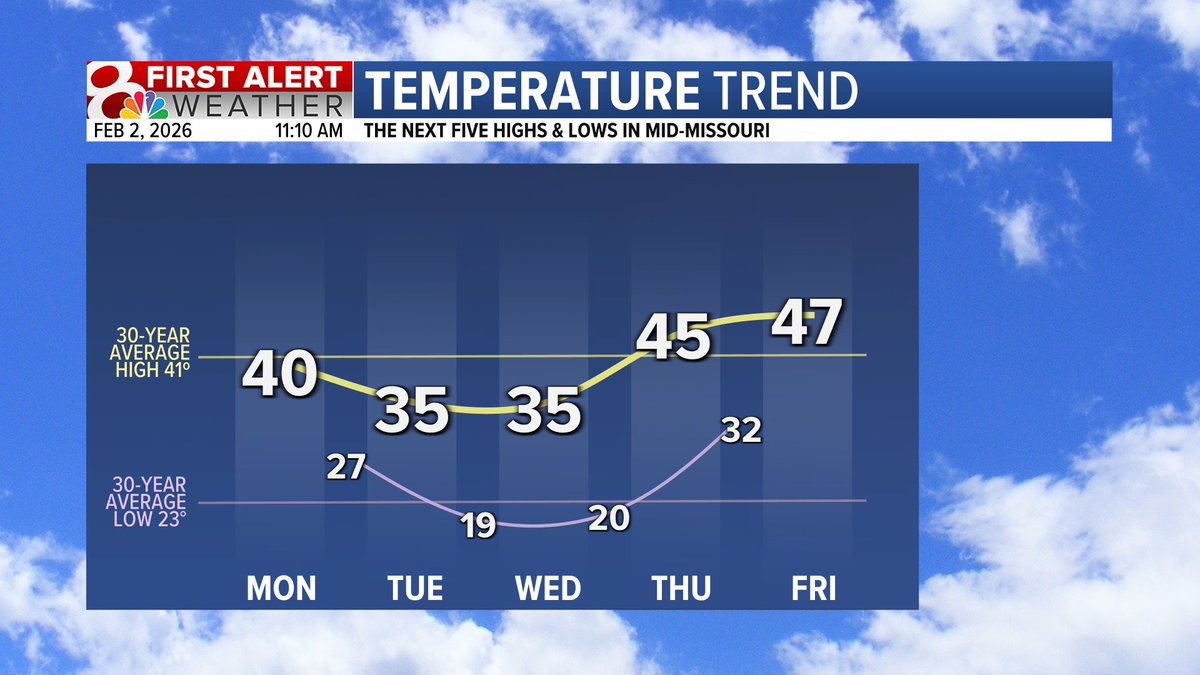
Phil may be saying six more weeks of winter, but I'm forecasting temps above freezing this week! Feeling much less winter-like than the past few weeks... #midmowx #midmo #mowx
A Tornado Watch for areas along and west of Highway 63 until 9PM Wednesday. While the tornado watch is in effect and a few tornadoes are possible, the main threats remain to be large hail and damaging winds. @kesley_wx & @ethanbeanwx will keep you updated #MidMowx #Mowx #MidMo

Find the G Pen and @stundenglass team at the MidMO Canna Expo this 4/20. Stop by and enter to win a "spin" with the Stündenglass and G Pen Hyer, and to take home other free prizes! bit.ly/43uQ5HO #missouri #midmo #midwest #gpen #gpenhyer #stundenglass

Good morning and happy Monday! I'm filling in for Beth this week so I'm up early! Temperatures today will be seasonal with highs in the lower to middle 60s this afternoon with plenty of sunshine. #midmowx #midmo #Mowx

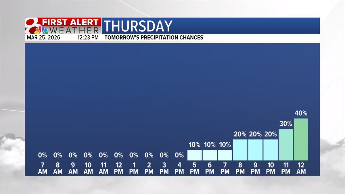
Our next chance for showers and storms happens on Thursday night. Rain chances increase after midnight. A few storms could have win gusts of 40-60MPH and/or quarter-sized hail, but this is a very low possibility. Widespread severe weather is not expected. #midmowx #mowx #midmo

7:53PM Sunday: The main area to watch for severe weather this evening remains south of Hwy 50. Southwest Missouri has several ongoing severe weather and tornado warnings. Farther north, most of Mid-Missouri has a much lower chance of a severe storms. #MidMoWx #MidMo #MoWx
Winter Storm Watches are expanding throughout the state and now includes most of Mid-MO south of I-70. Higher snow totals are expected south of I-70. More details to come. #midmowx #midmo #mowx

Good morning and happy Tuesday! Scattered showers and a few rumbles of thunder are likely though the day, but there is no threat for severe weather at any point today. #midmowx #Midmo #mowx
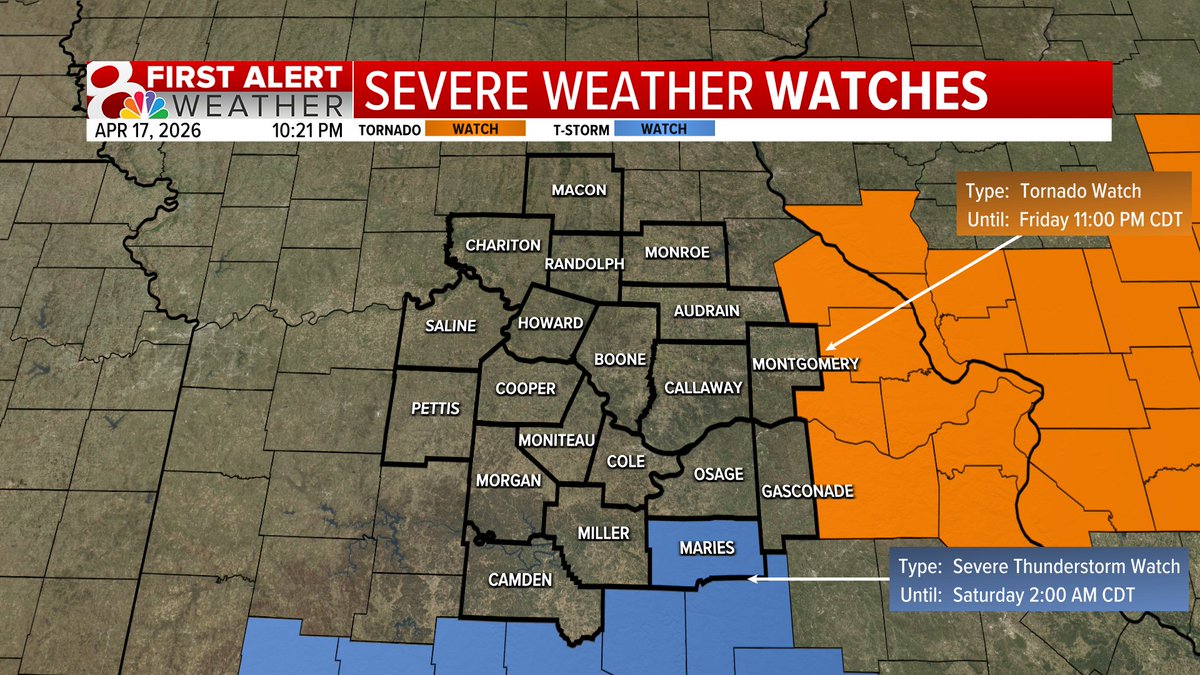
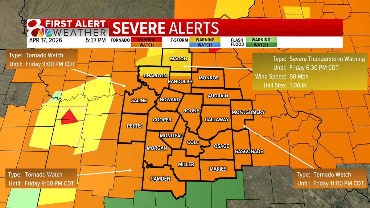
5:37PM Friday: Tornado Watch now includes all of mid-Missouri until 9PM in our western counties & 11PM in our eastern counties. #MidMoWx #MoWx #MidMo @kesley_wx @EthanBeanWx
9PM Sunday: A few isolated thunderstorms this evening. These could produce a little small hail or a 40-60MPH wind gust. Storms stay isolated, the severe weather threat stays low. #MidMoWx #MoWx #MidMo
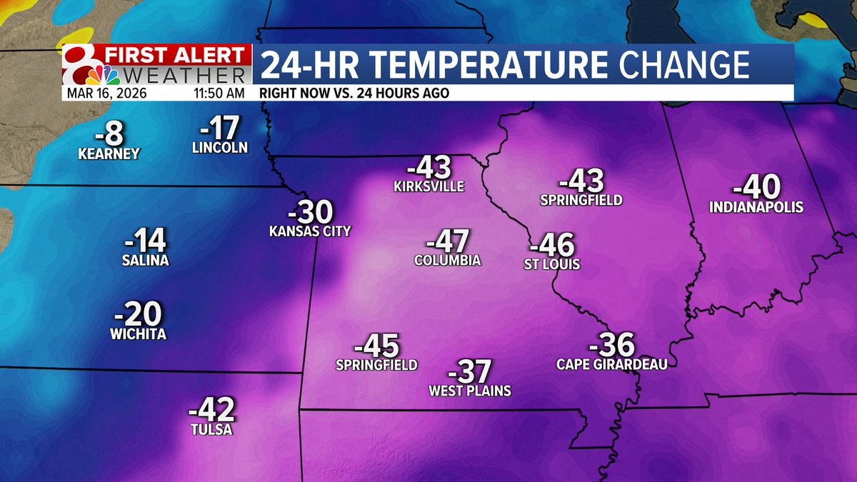
I spent several hours this weekend sitting on a patio with friends. Today, the lock on my car door was frozen shut. #midmowx #midmo #mowx
Something went wrong.
Something went wrong.
United States Trends
- 1. Cinco de Mayo N/A
- 2. Draymond N/A
- 3. Marco Rubio N/A
- 4. Austin Rivers N/A
- 5. #ARSATM N/A
- 6. Tanner Horner N/A
- 7. Zoey 101 N/A
- 8. Vivek N/A
- 9. Posey N/A
- 10. Athena Strand N/A
- 11. #COYG N/A
- 12. #ChampionsLeague N/A
- 13. Coinbase N/A
- 14. DJ Reader N/A
- 15. The Odyssey N/A
- 16. #We_Will_Fight_1009_Times N/A
- 17. Gary Player N/A
- 18. #Heeseung_Absence_Echoes N/A
- 19. Nolan N/A
- 20. Bukayo Saka N/A