#geologicmapping search results
Join our team at the UGS as Senior #GIS Analyst and resident expert in GeMS (Geologic Map Schema) using photogrammetry, and map cartography with cutting edge 2D and 3D #geologicmapping. governmentjobs.com/careers/utah/j…


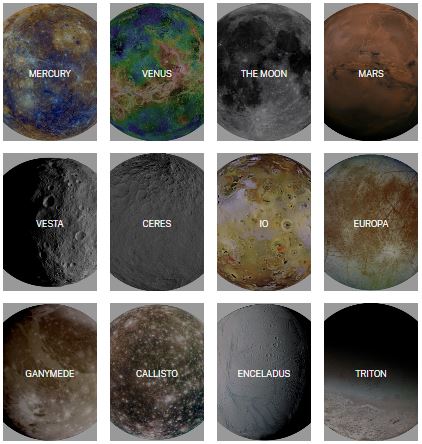
Interested in planetary maps? 🪐🌑 The USGS-NASA Planetary Geologic Mapping Program has updated their map search tools and now it's easier than ever to look for published maps (and maps in progress): ow.ly/nIrC50KtZBg #MappingMonday #GeologicMapping
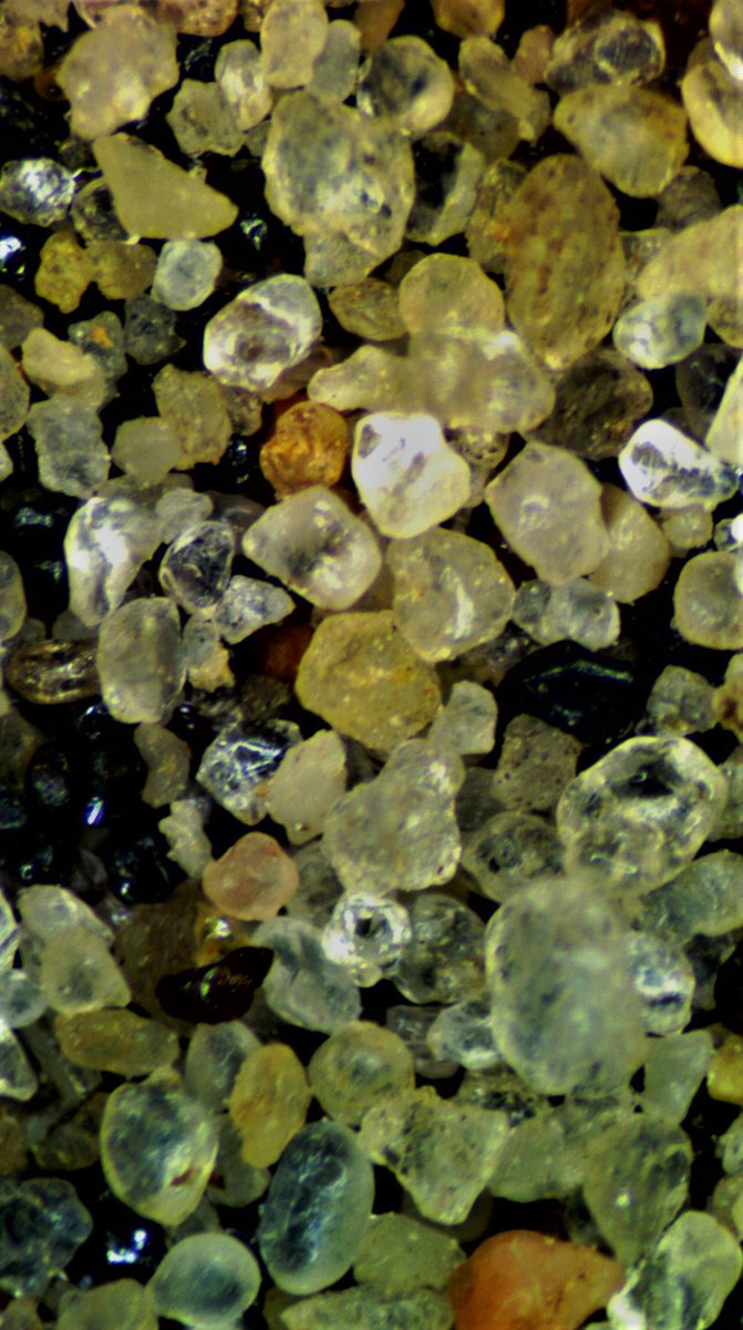
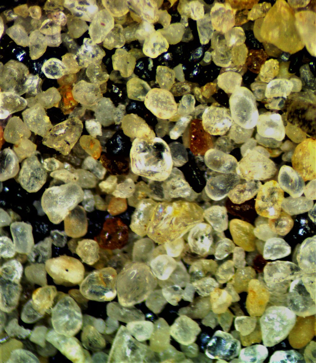
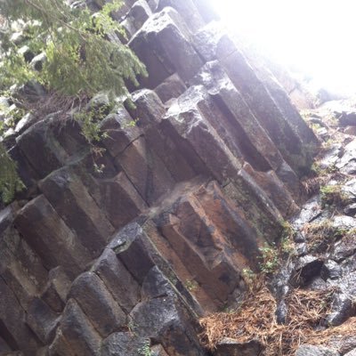
Heavy minerals in alluvial sand of Coles Creek in Jefferson, County Mississippi. #microscopemonday #geology #geologicmapping #Mississippi #sedimentology

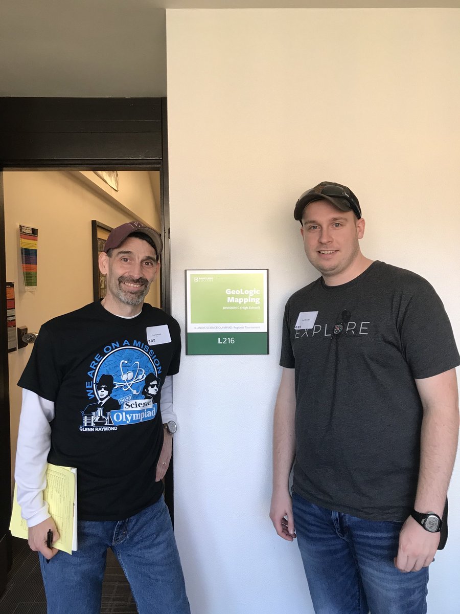
Hey Joe & Michelle @IllinoisSO No #remotesensing you know what that means?…two happy event supervisors 😉 #geologicmapping #wheelhouse 🪨⚒ @13rhoane

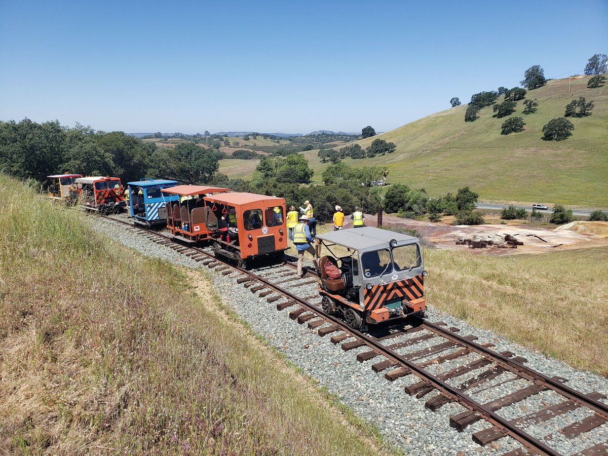
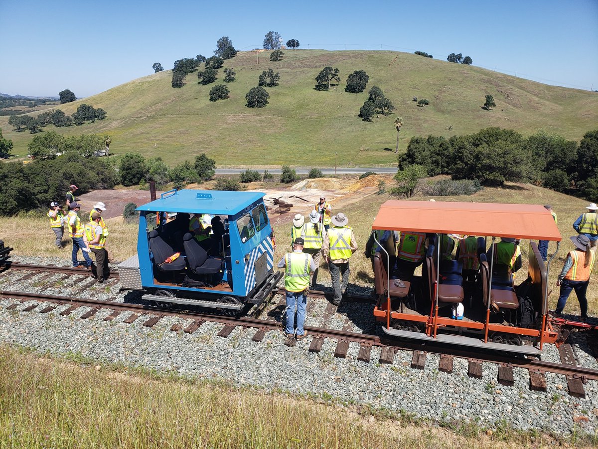
Several geologists from our Sacramento, San Mateo, & Los Angeles offices got to get OUT of the office and INto the Sierra foothills in Amador County today. (New geologic maps of this area are coming this summer!) #geologicmapping #CAgeology
Yes! 👍 Our first professional geology fieldtrip on the Amador Central Railroad. This inaugural trip is for the mapping group of the California Geological Survey. We're looking at terrific outcrops of Mesozoic and Tertiary sections thru Sierra Foothills. Great day in the field!
[PUB] - Planetary Geologic Mapping Protocol—2022 Techniques and Methods 11-B13 ow.ly/X2gE50JYp2n #SolarSystem #GeologicMapping
![USGS's tweet image. [PUB] - Planetary Geologic Mapping Protocol—2022 Techniques and Methods 11-B13
ow.ly/X2gE50JYp2n
#SolarSystem #GeologicMapping](https://pbs.twimg.com/media/FYCDBpuXkAEu0VK.jpg)
College funding for geologic mapping: the @USGS EDMAP Program accepting funding proposals to support upper-level grad or grad students. Due: Nov 19, 2019. Details: ow.ly/zgPc50wf6GE #geology #mapping #geologicmapping

Always fun to work w/former student, @IllinoisSO State Champ & current @ILGeoSurvey geologist @13rhoane in running #GeoLogicMapping Event! ⚒ #GRStradition #GRSpride

Still in shock that I medalled at states! #geologicmapping #scioly #scienceolympiad
The Seamless Integrated Geologic Mapping (SIGMa) Extension to the Geologic Map Schema (GeMS) SIR 2022-5115. The Geologic Map Schema (GeMS) is the publication and archive database standard for geologic map data ow.ly/GlhV50M1kqC #geologicMapping


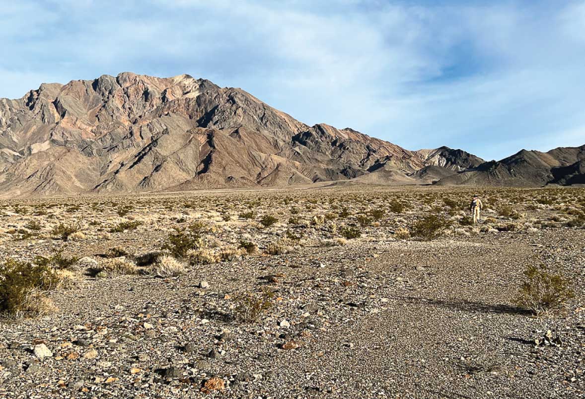
Student-Fund Research for Geologic Mapping of the protected Tecopa 7.5' quadrangle in California: A Pleistocene lake, a river and a canyon. Read Full Story: ow.ly/ilgJ50PYBCu #GeologicMapping #Tecopa #GIS
Looking forward to presenting #geologicmapping …always a good workshop & networking opportunity 😉
Calling all geoscience faculty conducting research or teaching geologic mapping! The USGS EDMAP Program is accepting funding proposals focusing on #geologicmapping to support upper-level undergraduate and graduate students. Apply here: ow.ly/xu5l50GJnph #geology #mapping
#IGWSgeologists are drilling for unconsolidated & bedrock core today in Johnson County. Follow our video updates to see what we uncover in the field. #GeologicMapping

Me so ready sa part 2! Le do diz! #QuadMapping #geologicmapping… instagram.com/p/BDiwkwQFqB_x…
#RoadTrip w/ @13rhoane getting material for @IllinoisSO #geologicmapping & #fossils Some traditions just need to continue 😉 @SOAlumniNetwork

This geophysical survey will give much needed insights to better understand the structure and composition of rocks within this study area on the Burin Peninsula, #NewfoundlandAndLabrador #Geoscience #GeologicMapping #ProspectingNL @MiningNL #Minerals4Society

Sander Geophysics is pleased to be flying a high resolution horizontal gradient aeromagnetic, gamma-ray spectrometric and VLF survey in Newfoundland and Labrador (NL). See gov.nl.ca/releases/2021/…

Put some #GeologicMapping in your hands! #IndyLabs shows you how 2 make a sextant Mark Watney style! #EdChat #SciFi youtube.com/watch?v=i4993J…
youtube.com
YouTube
Homemade Martian Sextant - Indy Labs #7 (At Home DIY Science)

Calling all geoscience faculty conducting research or teaching geologic mapping! The USGS EDMAP Program is accepting funding proposals focusing on #geologicmapping to support upper-level undergraduate and graduate students. Apply here: … bit.ly/3kATEXZ
Check out materials such as the 2018 Earth inspired #geologicmapping activities & the #GeologicMapDay poster - included in the Earth Science Week 2018 Toolkit. Order your 2018 Toolkit here: earthsciweek.org/materials


Just finished a geologic mapping session in the Rockies!����Layered basalt flows tell a story of ancient eruptions. Tip: Use GIS for precise data integration!��#GeologicMapping #EarthScience

Our August 2025 edition of Field Notes is out! Check the blog to see Mike demonstrate new additions to our Attitude Tool for field geologists, recent bug fixes and other enhancements to the app. touchgis.app/blog/field-not… #geologicmapping #fieldmapping #fieldgeologist #geology

Just finished a geologic mapping session in the Rockies!����Fault lines & strata tell an epic Earth story. Pro tip: Use GIS for precision!��#GeologicMapping #EarthScience #RockHound

Just finished a geologic mapping session in the Rockies!����Fault lines & strata tell an epic Earth story. Pro tip: Use GIS tools for precision!��#GeologicMapping #EarthScience #RockHound

Just finished a geologic mapping session in the Rockies!��✨Layered sediments tell epic Earth stories. Pro tip: Use GIS for precision. Loving this rocky adventure! #GeologicMapping #EarthScience #RockHound
Just finished mapping a stunning fault zone in the Rockies!��The intricate folds tell a story of ancient collisions. Geologic mapping is like decoding Earth's diary.��#GeologicMapping #EarthScience #FieldWork
🌒 Ready to explore the Earth and Moon like never before? Join us on Wednesday, October 16 for a fascinating webinar on advanced geologic mapping and planetary exploration. 🌙 Register here: shorturl.at/1G5Q9 #geologicmapping #lunarimpacts #lunaranalogsites

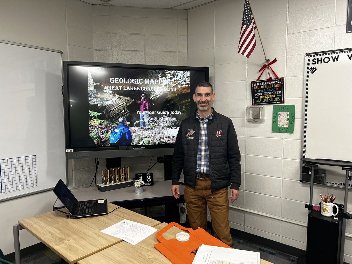
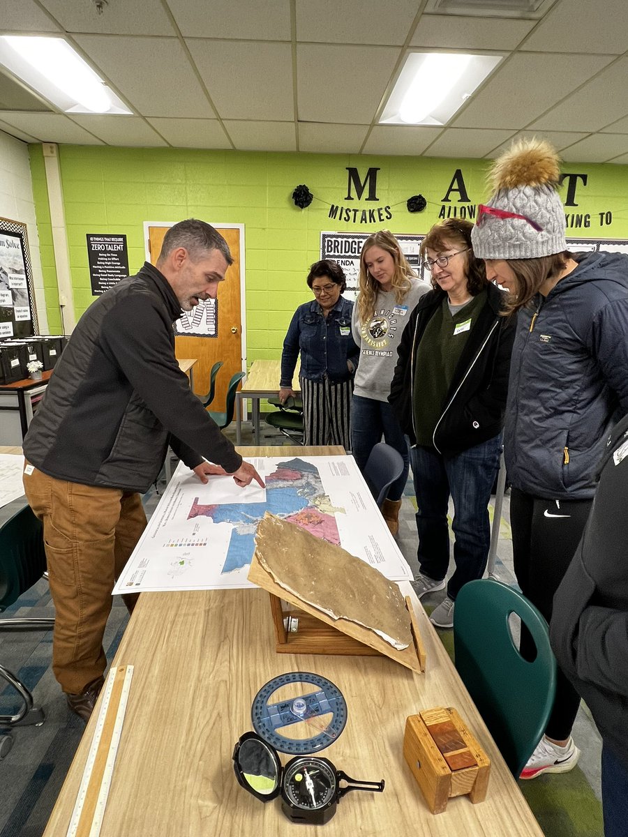
Another great time presenting #GeologicMapping ⚒ & #DynamicPlanet 🌎 during @IllinoisSO Great Lakes Coaches Clinic today! Guess it’s time to get started 😉 #WJHtradition #GoTeam @SOAlumniNetwork
Student-Fund Research for Geologic Mapping of the protected Tecopa 7.5' quadrangle in California: A Pleistocene lake, a river and a canyon. Read Full Story: ow.ly/ilgJ50PYBCu #GeologicMapping #Tecopa #GIS
We’ll be there presenting #GeologicMapping ⚒ & #RunningEvent101 😉 Always a Great Time! #WJHtradition

Great Lakes Coaches Clinic is a month away! The schedule and final details will be posted next week... register TODAY! illinoisolympiad.com

Looking forward to presenting #geologicmapping …always a good workshop & networking opportunity 😉
#RoadTrip w/ @13rhoane getting material for @IllinoisSO #geologicmapping & #fossils Some traditions just need to continue 😉 @SOAlumniNetwork
Hey Joe & Michelle @IllinoisSO No #remotesensing you know what that means?…two happy event supervisors 😉 #geologicmapping #wheelhouse 🪨⚒ @13rhoane
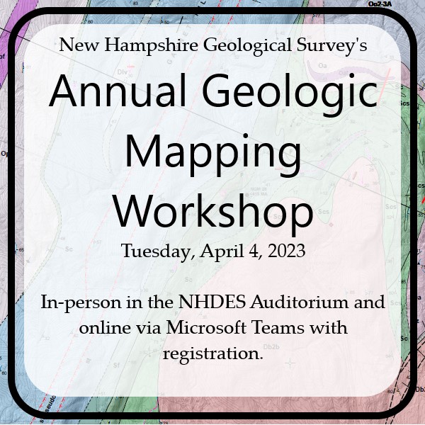
You are invited to NHGS' Annual Geologic Mapping Workshop! Registration is required, please email [email protected] for more information. #nhgeologicalsurvey #geologicmapping

The Seamless Integrated Geologic Mapping (SIGMa) Extension to the Geologic Map Schema (GeMS) SIR 2022-5115. The Geologic Map Schema (GeMS) is the publication and archive database standard for geologic map data ow.ly/GlhV50M1kqC #geologicMapping
The Seamless Integrated Geologic Mapping (SIGMa) Extension to the Geologic Map Schema (GeMS) SIR 2022-5115. The Geologic Map Schema (GeMS) is the publication and archive database standard for geologic map data bit.ly/3W8L7vC #geologicMapping bit.ly/3hkZH4v
The Seamless Integrated Geologic Mapping (SIGMa) Extension to the Geologic Map Schema (GeMS) SIR 2022-5115. The Geologic Map Schema (GeMS) is the publication and archive database standard for geologic map data ow.ly/GlhV50M1kqC #geologicMapping
Interested in planetary maps? 🪐🌑 The USGS-NASA Planetary Geologic Mapping Program has updated their map search tools and now it's easier than ever to look for published maps (and maps in progress): ow.ly/nIrC50KtZBg #MappingMonday #GeologicMapping

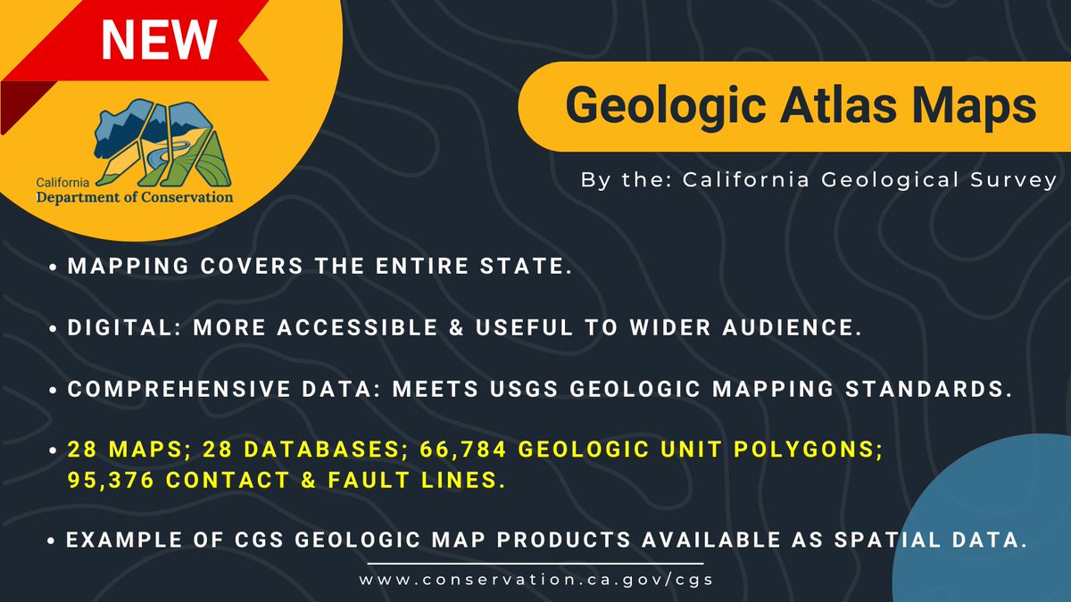
🚨NEW digital GIS geologic mapping shapefiles and geodatabase files of for the entire state of California now available. #GIS #geologicmapping
🌎The California Geologic Atlas 250K Map Series is now available for direct download on our website. The new files are completely digitized, spatially corrected, & Level 3 @USGS GeMS compliant. #GIS #mapping conservation.ca.gov/cgs/publicatio… 1/2
[PUB] - Planetary Geologic Mapping Protocol—2022 Techniques and Methods 11-B13 ow.ly/X2gE50JYp2n #SolarSystem #GeologicMapping
Join our team at the UGS as Senior #GIS Analyst and resident expert in GeMS (Geologic Map Schema) using photogrammetry, and map cartography with cutting edge 2D and 3D #geologicmapping. governmentjobs.com/careers/utah/j…
Just finished a geologic mapping session in the Rockies!��✨Layered sediments tell epic Earth stories. Pro tip: Use GIS for precision. Loving this rocky adventure! #GeologicMapping #EarthScience #RockHound
Our August 2025 edition of Field Notes is out! Check the blog to see Mike demonstrate new additions to our Attitude Tool for field geologists, recent bug fixes and other enhancements to the app. touchgis.app/blog/field-not… #geologicmapping #fieldmapping #fieldgeologist #geology
You are invited to NHGS' Annual Geologic Mapping Workshop! Registration is required, please email [email protected] for more information. #nhgeologicalsurvey #geologicmapping
Just finished a geologic mapping session in the Rockies!����Stunning fault lines & sedimentary layers revealed Earth's story. Pro tip: Use GIS for precision!��#GeologicMapping #EarthScience #RockHound
Just finished a geologic mapping session in the Rockies!����Layered basalt flows tell a story of ancient eruptions. Tip: Use GIS for precise data integration!��#GeologicMapping #EarthScience
Just finished a geologic mapping session in the Rockies!����Fault lines & strata tell an epic Earth story. Pro tip: Use GIS for precision!��#GeologicMapping #EarthScience #RockHound

Heavy minerals in alluvial sand of Coles Creek in Jefferson, County Mississippi. #microscopemonday #geology #geologicmapping #Mississippi #sedimentology
Heads up! The @USGS EDMAP Program is accepting funding proposals to support upper-level undergrad or grad students who like looking at the ground 👀🗺️ Due: Nov 6, 2018. Details: go.usa.gov/xPCh5 #geology #mapping #geologicmapping
Check out materials such as the 2018 Earth inspired #geologicmapping activities & the #GeologicMapDay poster - included in the Earth Science Week 2018 Toolkit. Order your 2018 Toolkit here: earthsciweek.org/materials
🌒 Ready to explore the Earth and Moon like never before? Join us on Wednesday, October 16 for a fascinating webinar on advanced geologic mapping and planetary exploration. 🌙 Register here: shorturl.at/1G5Q9 #geologicmapping #lunarimpacts #lunaranalogsites
[PUB] - Planetary Geologic Mapping Protocol—2022 Techniques and Methods 11-B13 ow.ly/X2gE50JYp2n #SolarSystem #GeologicMapping
The Seamless Integrated Geologic Mapping (SIGMa) Extension to the Geologic Map Schema (GeMS) SIR 2022-5115. The Geologic Map Schema (GeMS) is the publication and archive database standard for geologic map data ow.ly/GlhV50M1kqC #geologicMapping
College funding for geologic mapping: the @USGS EDMAP Program accepting funding proposals to support upper-level grad or grad students. Due: Nov 19, 2019. Details: ow.ly/zgPc50wf6GE #geology #mapping #geologicmapping
Interested in planetary maps? 🪐🌑 The USGS-NASA Planetary Geologic Mapping Program has updated their map search tools and now it's easier than ever to look for published maps (and maps in progress): ow.ly/nIrC50KtZBg #MappingMonday #GeologicMapping

Illinois Geologic Mapping Advisory Committee, hard at work. Good advice today! #ISGS #geologicmapping #StateMap

Check out the 2017 #geologicmapping activity "Karst, Sinkholes, and Human Activity" & #GeologicMapDay poster at: earthsciweek.org/content/karst-…

Calling all geoscience faculty conducting research or teaching geologic mapping! The USGS EDMAP Program is accepting funding proposals focusing on #geologicmapping to support upper-level undergraduate and graduate students. Apply here: … bit.ly/3kATEXZ
Something went wrong.
Something went wrong.
United States Trends
- 1. Vrabel N/A
- 2. Mall of Louisiana N/A
- 3. Patriots N/A
- 4. #NFLDraft N/A
- 5. GPT-5.5 N/A
- 6. Jacob Webb N/A
- 7. Taylor Jenkins N/A
- 8. Pickens N/A
- 9. $INTC N/A
- 10. Brandon Marsh N/A
- 11. JR Ritchie N/A
- 12. Baton Rouge N/A
- 13. Pats N/A
- 14. Waldron N/A
- 15. Brad Keller N/A
- 16. Michael N/A
- 17. Rolling Stone N/A
- 18. Skubal N/A
- 19. Tork N/A
- 20. Rickey N/A