#gistecwebinarseries kết quả tìm kiếm

This is the last week of #gistecWebinarSeries. Don't miss out on the last 2 sessions on how to use #ArcGIS 1⃣How to Create and Modify #3D Features in ArcGIS Pro bit.ly/41w4EZD 2⃣Improving Data Integrity with #Geodatabase Structure in #ArcGISPro bit.ly/41fpGfr

Don't miss out on the chance to learn more about spatial analysis, map layout, and map series in this week's #gistecWebinarSeries 1⃣Perform #SpatialAnalysis Using #ModelBuilder bit.ly/3MAofnz 2⃣ Designing #MapLayout and #MapSeries bit.ly/3ZYTVps

We hope you enjoyed the 1st week of our #gistecWebinarSeries ! We are excited to announce the 2nd week of the series is now open for registrations. #ArcGIS 1⃣How to Design an ArcGIS Dashboard bit.ly/3zHaEmN 2⃣Creating stories with ArcGIS StoryMaps bit.ly/3U4u6mz

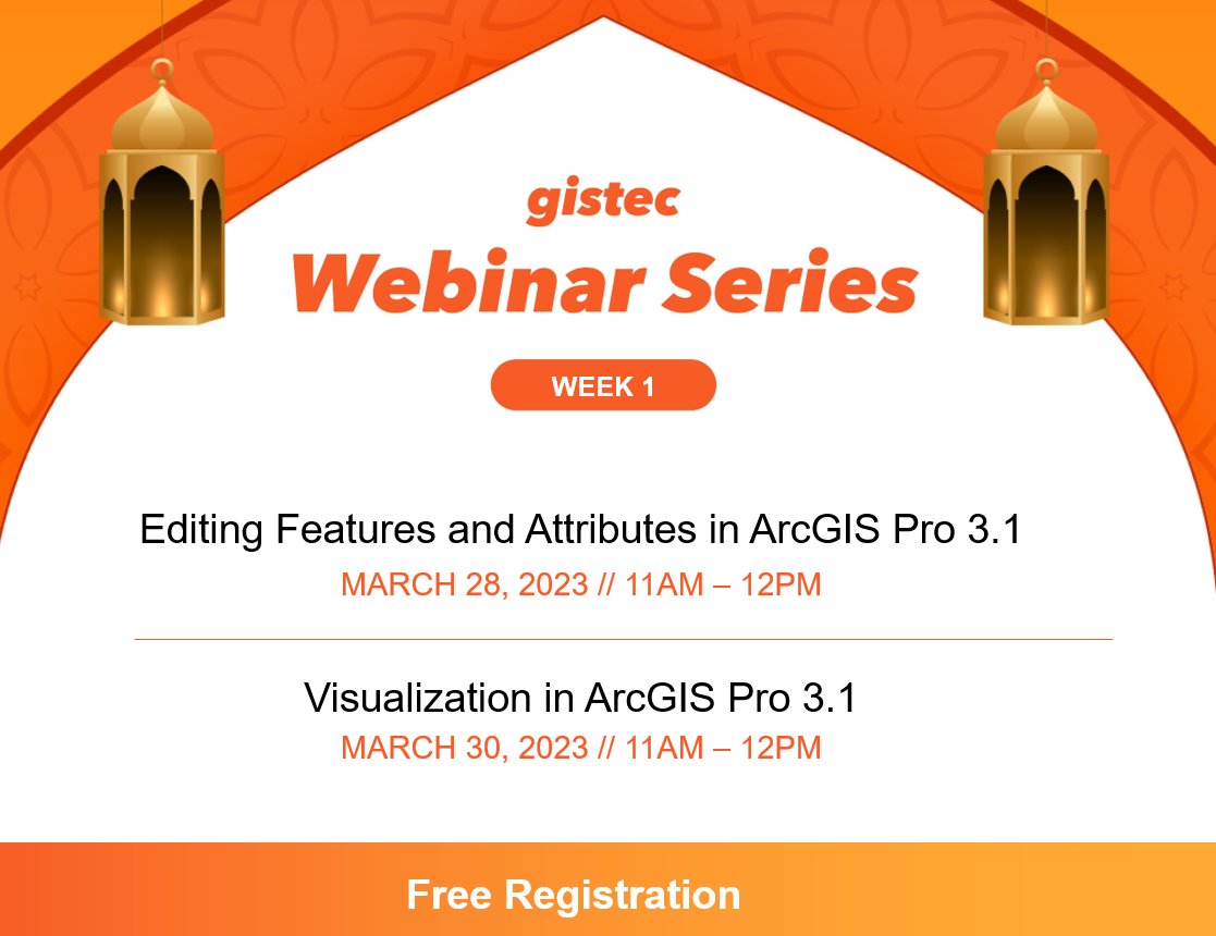
gistec Webinar Series are back! featuring a broad range of topics on how to apply #ArcGIS system tools & functions. #gistecWebinarSeries This week: 1⃣Editing Features & Attributes in ArcGIS Pro 3.1 bit.ly/3JGCbJg 2⃣Visualization in ArcGIS Pro 3.1 bit.ly/3TDzsF5
Two more vidoes were added to #gistecWebinarSeries playlist on YouTube! Watch interesting sessions featuring open data, machine learning, and deep learning in the #ArcGIS platform. Subscribe to our channel for more updates: youtube.com/c/gistecommuni…

Survey123 for ArcGIS also supports GPS devices for high-accuracy data collection #gistecWebinarSeries #datacollection #smartsurveys #data

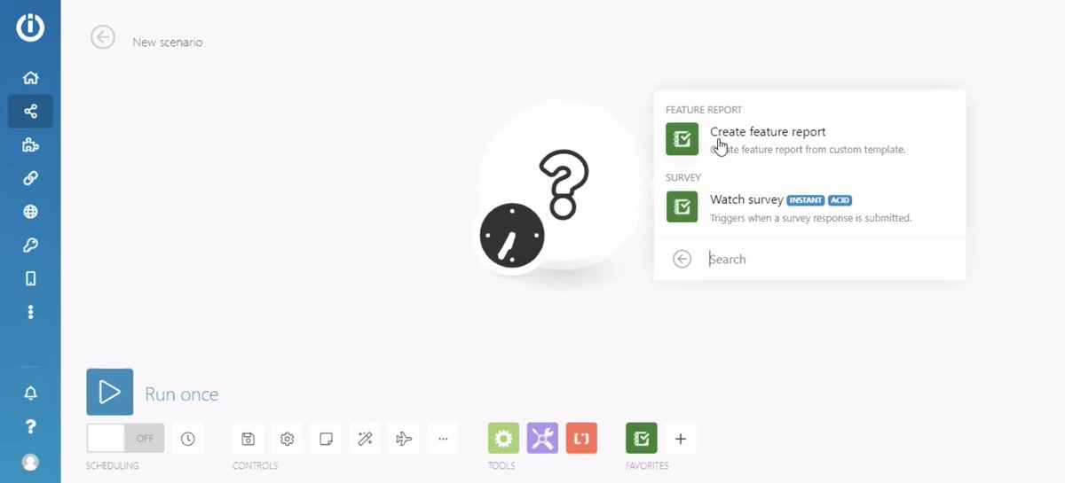
Feature reports can be generated automatically from Survey123 for ArcGIS using webhooks #gistecWebinarSeries #smartsurvey #datacollection
Among the different uses of Survey123 for ArcGIS, it can also be helpful in monitoring current events, as shown in the live demo #gistecWebinarSeries

Survey123 for ArcGIS provides two flexible ways in conducting surveys: online and offline #gistecWebinarSeries

[Happening Now] Smart Surveys that Work Online and Offline on Any Device - Webinar Stay tuned in this thread for more updates. #gistecWebinarSeries
![gistec's tweet image. [Happening Now] Smart Surveys that Work Online and Offline on Any Device - Webinar
Stay tuned in this thread for more updates.
#gistecWebinarSeries](https://pbs.twimg.com/media/Eb2a3tuWoAES3HM.jpg)
Join our #webinar tomorrow, July 1, and learn all the things you need to know about creating smart #surveys. Reserve your slot today at gistec.com/training/webin… #gistecWebinarSeries

Data is the wealth of the future and #ArtificialIntelligence relies on the accuracy of the data #gistecwebinarseries
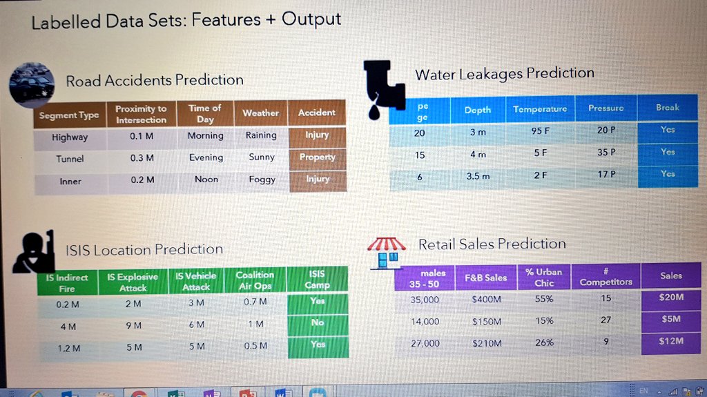
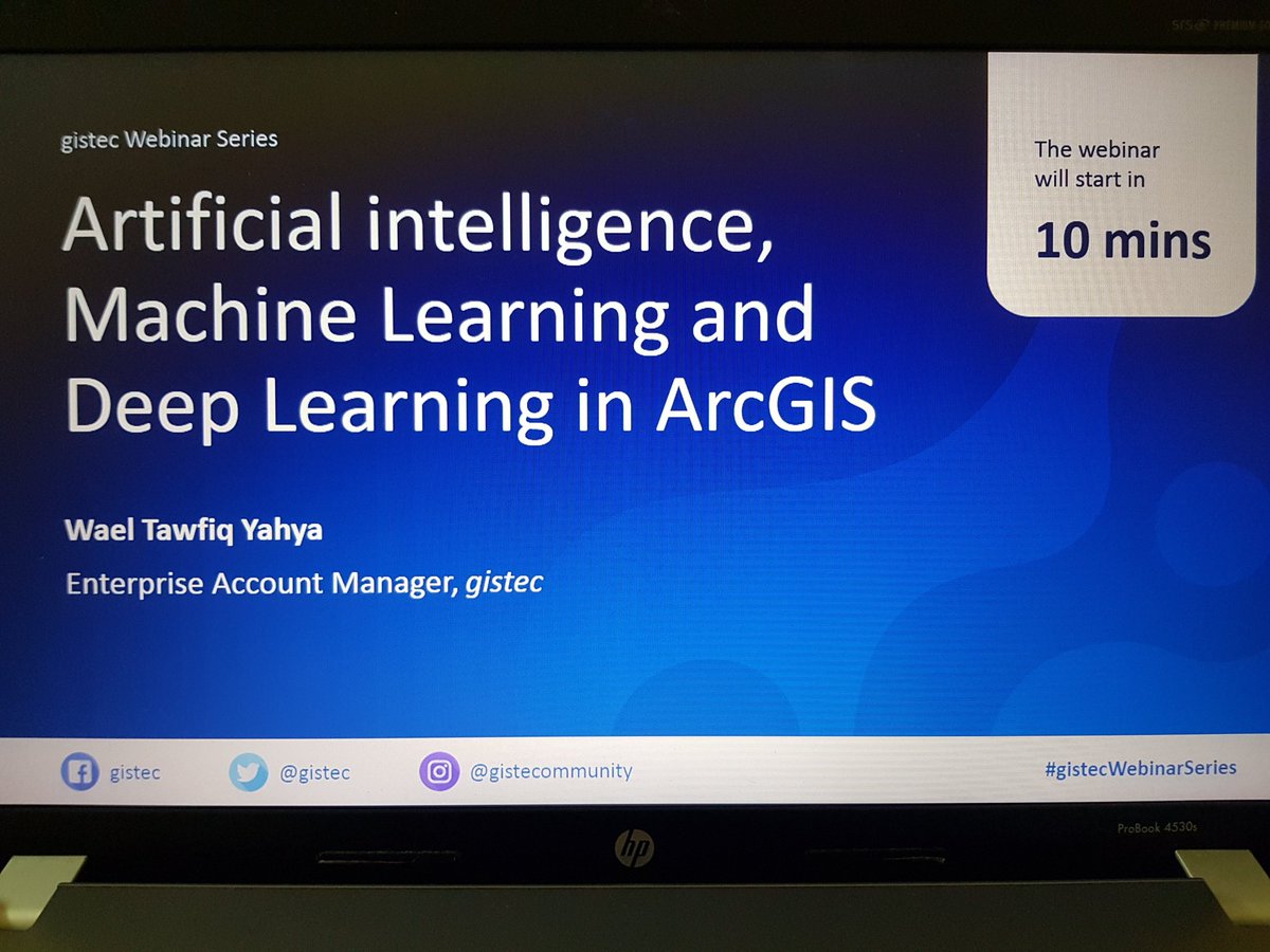
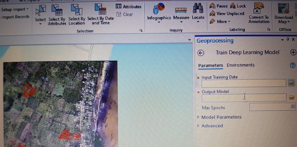

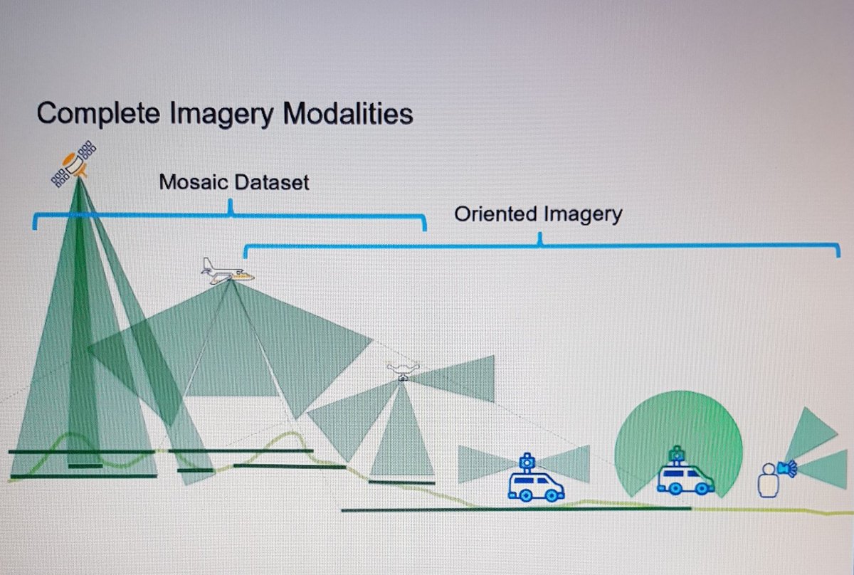
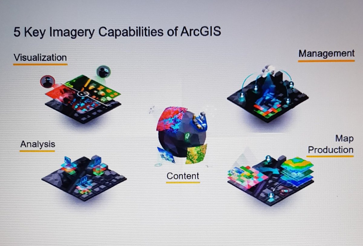
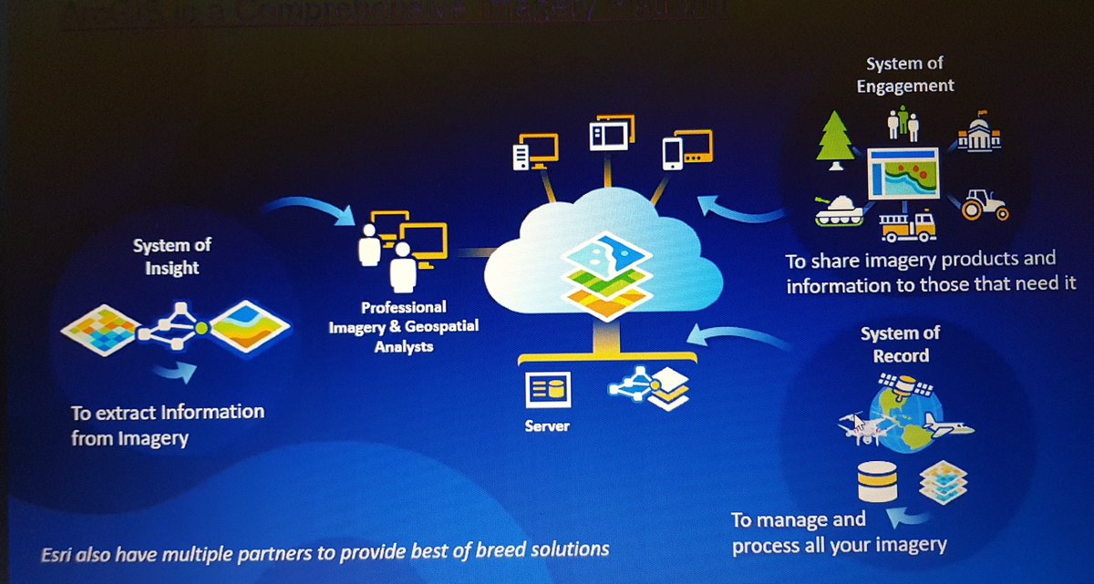
We have just started the webinar on machine learning and deep learning with ArcGIS imagery #gistecwebinarseries
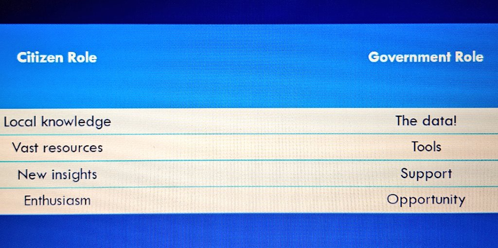
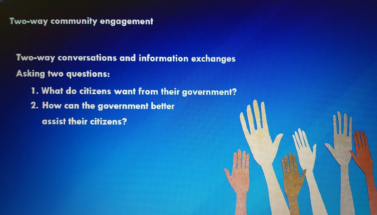
The different roles between government and citizens in community engagement through open data #gistecwebinarseries
Survey123 for ArcGIS provides two flexible ways in conducting surveys: online and offline #gistecWebinarSeries
We have just started the webinar on machine learning and deep learning with ArcGIS imagery #gistecwebinarseries
The different roles between government and citizens in community engagement through open data #gistecwebinarseries
Among the different uses of Survey123 for ArcGIS, it can also be helpful in monitoring current events, as shown in the live demo #gistecWebinarSeries
Two more vidoes were added to #gistecWebinarSeries playlist on YouTube! Watch interesting sessions featuring open data, machine learning, and deep learning in the #ArcGIS platform. Subscribe to our channel for more updates: youtube.com/c/gistecommuni…
[Happening Now] Smart Surveys that Work Online and Offline on Any Device - Webinar Stay tuned in this thread for more updates. #gistecWebinarSeries
Survey123 for ArcGIS also supports GPS devices for high-accuracy data collection #gistecWebinarSeries #datacollection #smartsurveys #data
Feature reports can be generated automatically from Survey123 for ArcGIS using webhooks #gistecWebinarSeries #smartsurvey #datacollection
Don't miss out on the chance to learn more about spatial analysis, map layout, and map series in this week's #gistecWebinarSeries 1⃣Perform #SpatialAnalysis Using #ModelBuilder bit.ly/3MAofnz 2⃣ Designing #MapLayout and #MapSeries bit.ly/3ZYTVps
gistec Webinar Series are back! featuring a broad range of topics on how to apply #ArcGIS system tools & functions. #gistecWebinarSeries This week: 1⃣Editing Features & Attributes in ArcGIS Pro 3.1 bit.ly/3JGCbJg 2⃣Visualization in ArcGIS Pro 3.1 bit.ly/3TDzsF5
We hope you enjoyed the 1st week of our #gistecWebinarSeries ! We are excited to announce the 2nd week of the series is now open for registrations. #ArcGIS 1⃣How to Design an ArcGIS Dashboard bit.ly/3zHaEmN 2⃣Creating stories with ArcGIS StoryMaps bit.ly/3U4u6mz
To those who attended #gistecWebinarSeries, certificates of attendance are now available online! Log in to my.gistec.com to download your certificate PDF

More videos from #gistecWebinarSeries are now up on YouTube! View the updated playlist and catch up on the webinars you might have missed. Subscribe to our channel for more updates: bit.ly/gistec-youtube…

Something went wrong.
Something went wrong.
United States Trends
- 1. Thanksgiving 1.93M posts
- 2. Packers 33.6K posts
- 3. Thankful 378K posts
- 4. Wicks 3,857 posts
- 5. Jordan Love 5,108 posts
- 6. #GoPackGo 5,440 posts
- 7. Goff 5,615 posts
- 8. #GBvsDET 2,214 posts
- 9. Turkey 253K posts
- 10. #OnePride 4,797 posts
- 11. Tom Kennedy N/A
- 12. Amon Ra 1,813 posts
- 13. Brian Branch N/A
- 14. Cece Winans N/A
- 15. LaFleur 1,611 posts
- 16. Romeo Doubs N/A
- 17. David Montgomery N/A
- 18. Ray J 2,664 posts
- 19. Josh Jacobs 1,646 posts
- 20. #ProBowlVote 28.9K posts