#rollingfire search results
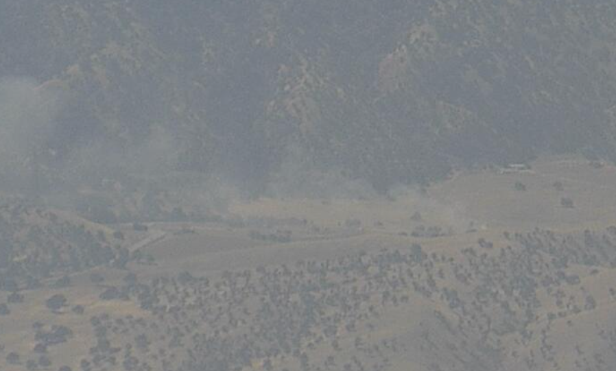
#RollingFire Priority is the northern flank per radio traffic. 2 separate fires about 5 acres per Air Atrack Carver Ranch Road, Woody, Kern County, CA


Update 3 on #Rollingfire. Fire mapped out at 3.87 acres, full containment expected by mid nite tonite. @VCFD

#RollingFire About 5 acres, two separate fires close proximity, no exposures with a slow rate of spread, per air attack.

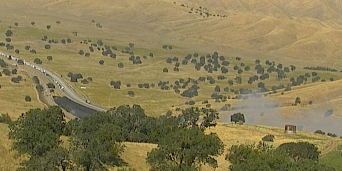
Firefighters are battling a 1,000 acre fire off Hwy 41 & Road 145, northwest of Friant (Madera County). #RollingFire
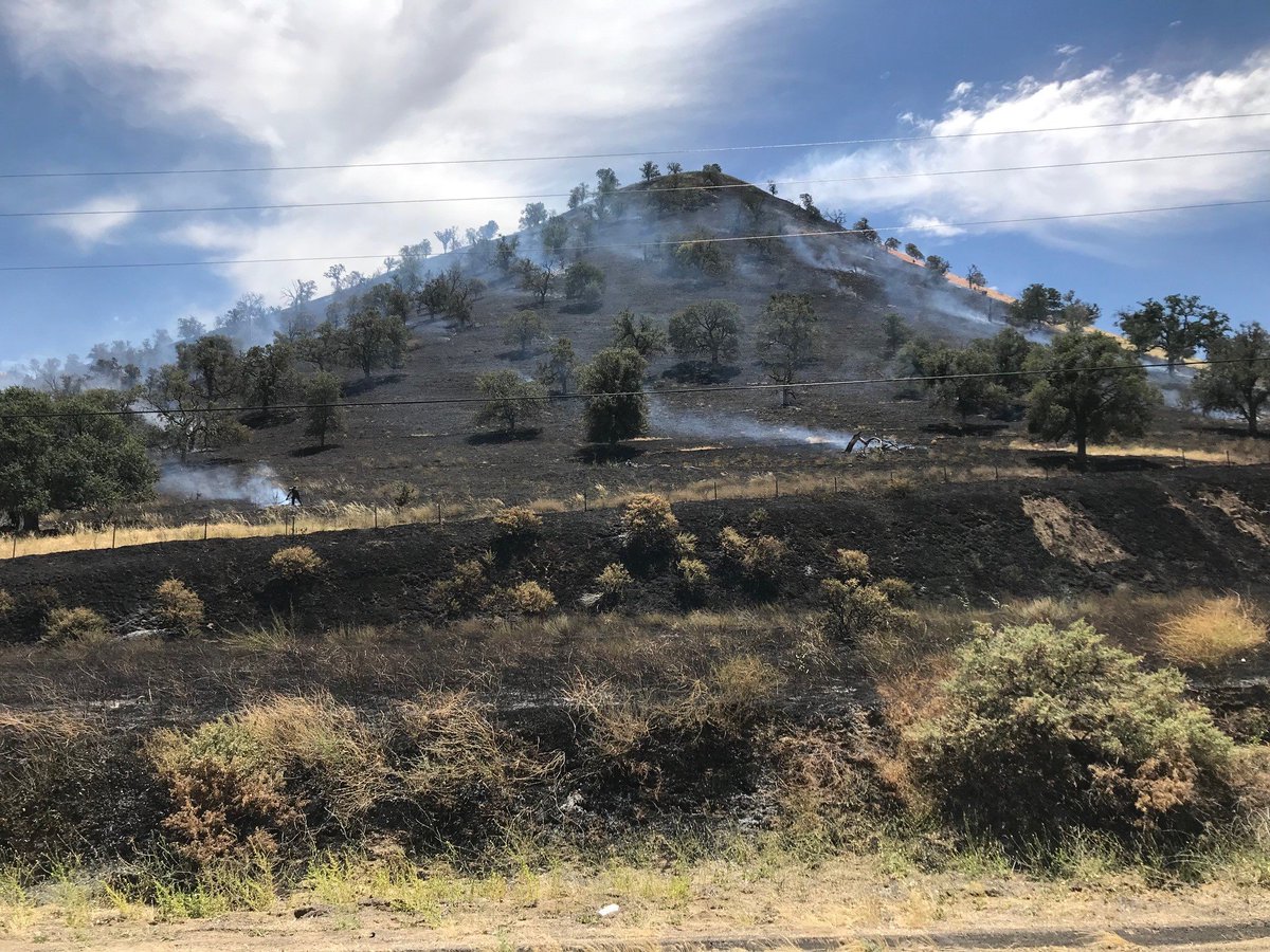
#RollingFire [final] off Bena Road, east of Bakersfield (Kern County) is now 100% contained at 184 acres.
![CAL_FIRE's tweet image. #RollingFire [final] off Bena Road, east of Bakersfield (Kern County) is now 100% contained at 184 acres.](https://pbs.twimg.com/media/DMQ-NpgUIAA2tvO.jpg)

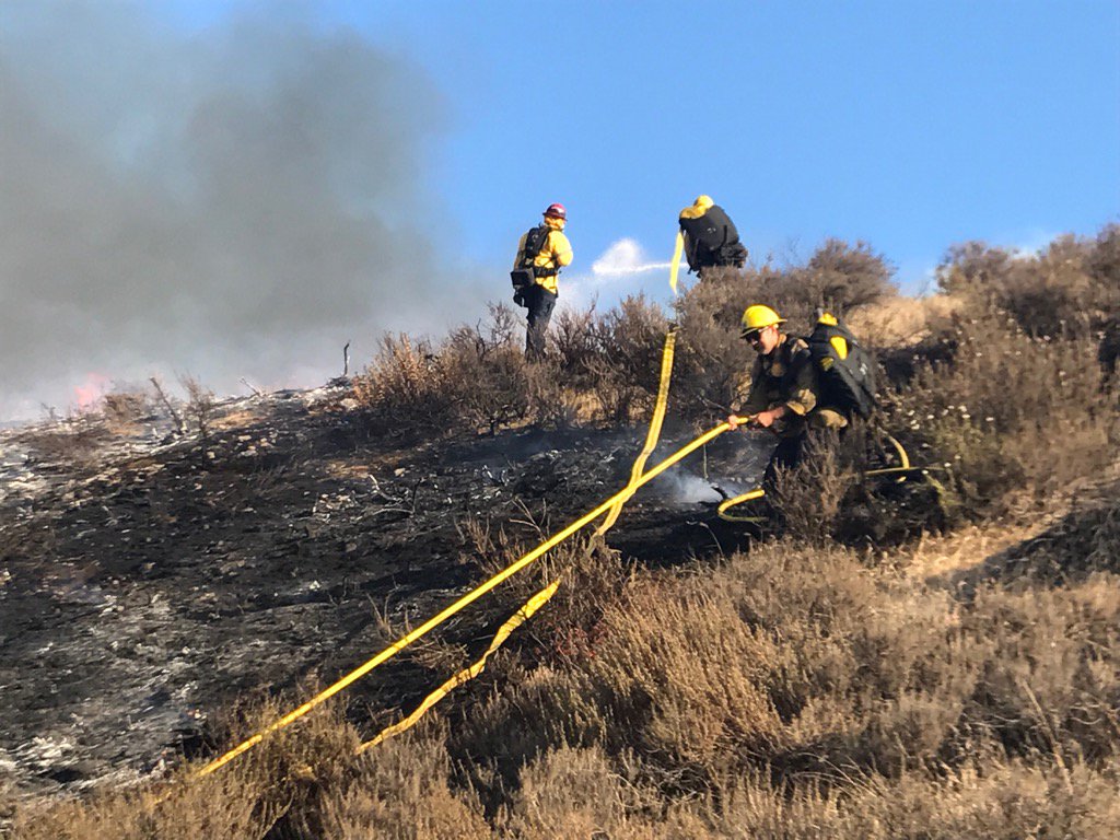
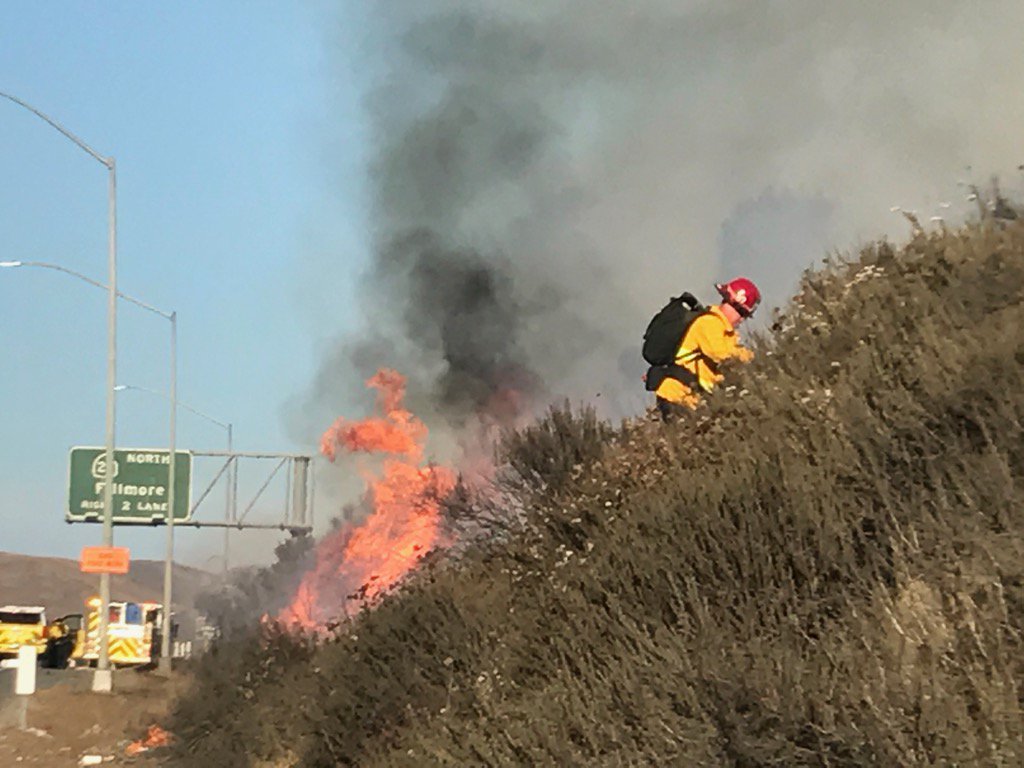
BRUSH FIRE: #DiamondBar #RollingFire 1 acre burning uphill in medium brush. Structure Defense mode. Another spot fire 1/4 mile west of fire
Update 1 on #Rollingfire, holding at 3-4 acres, handcrews cutting containment lines. Mop up next several hours @VCFD
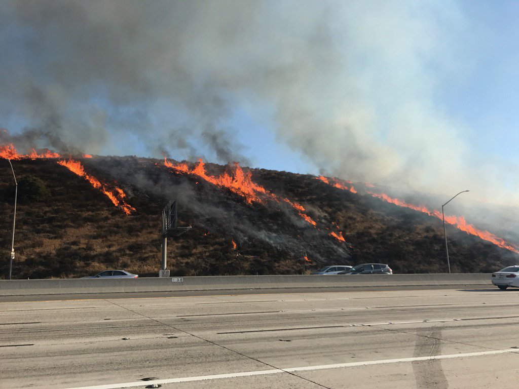
#RollingFire: Approx 2+ #brushfire on hillside off Hwy 101 @ Moorpark Rd. Motorists expect delays @CHPMoorpark


#PHOTOS Central California Wildfires | ow.ly/me6GU #CarstensFire #RollingFire #YLP
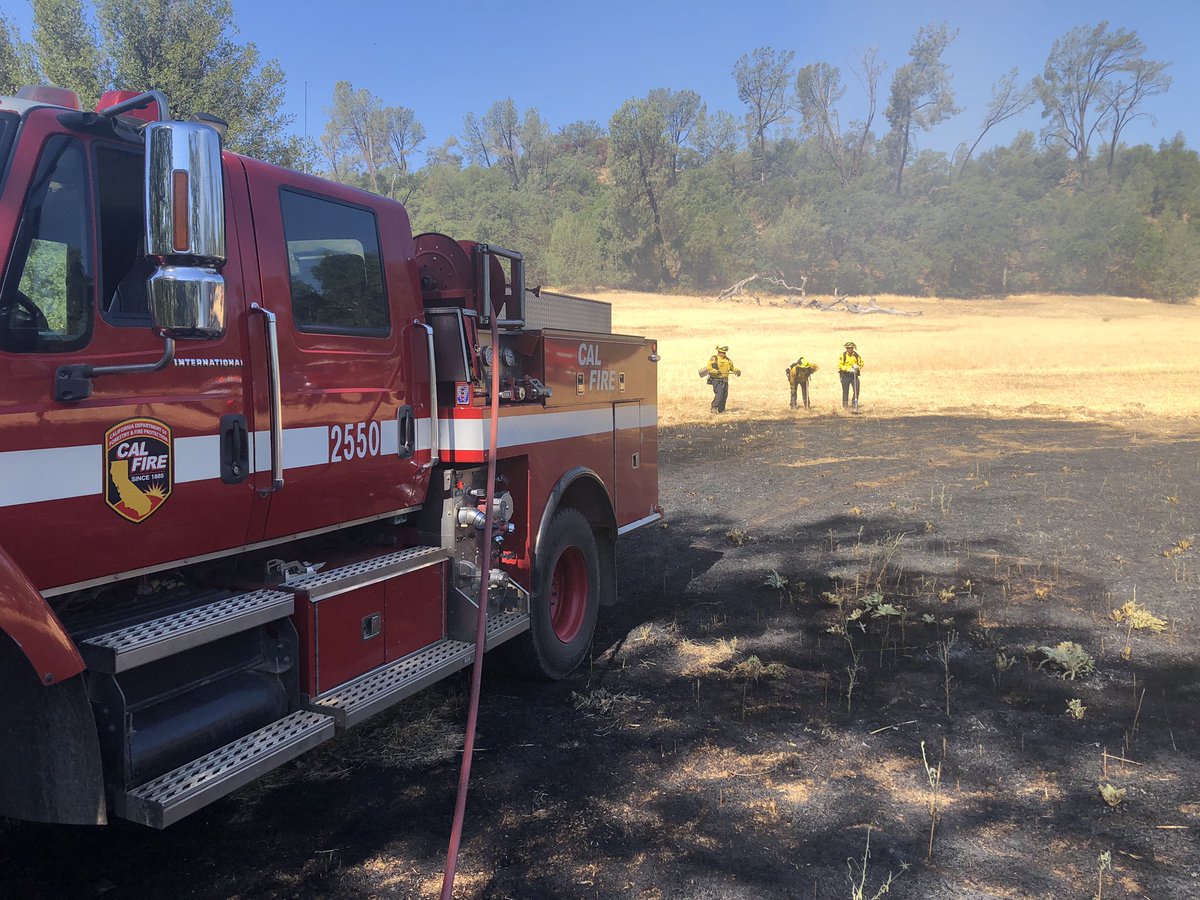
Crews on #Rollingfire have hose lines 100% around approx 4 acre brush fire. Handcrews cutting containment line @VCFD
UPDATE: #RollingFire 2.5 acres with forward progress stopped
Update on #Rollingfire, fire stopped at just under 4 acres. Another great job by your @VCFD crews
#RollingFire [final] off Hwy 41 & Road 145, northwest of Friant (Madera County) is now 100% contained at 482 acres. cdfdata.fire.ca.gov/incidents/inci…
#RollingFire [update] off Hwy 41 & Road 145, northwest of Friant (Madera County) is now 950 acres & 25% contained.
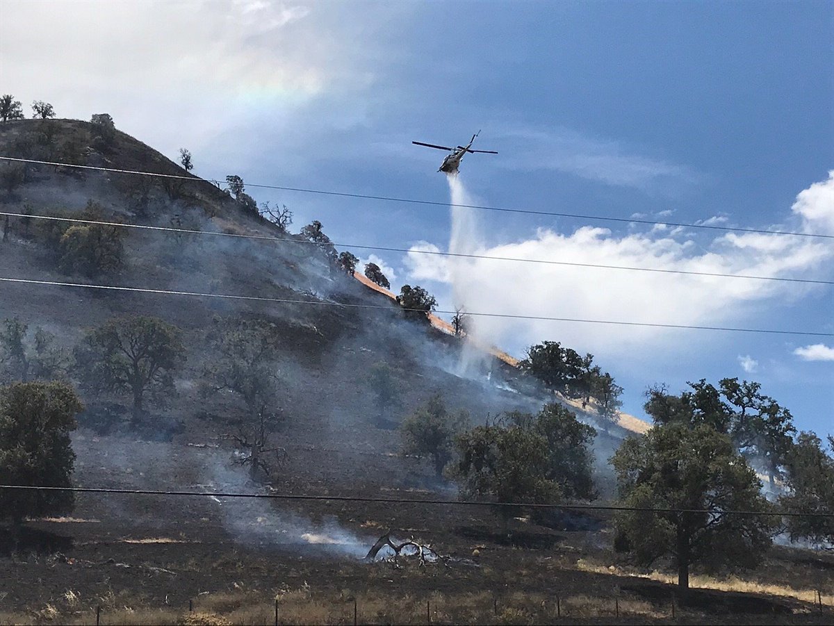
#RollingFire VC Sheriff's Air Unit making water drop on blaze. Fire grew to between 3 to 4 acres according to Fire. @VCAirUnit Video Aaron D

Yes @thesocalmama wildfire threat is high. Today's #Rollingfire is a good #ReadySetGo reminder. Download a plan: VCReadySetGo.org

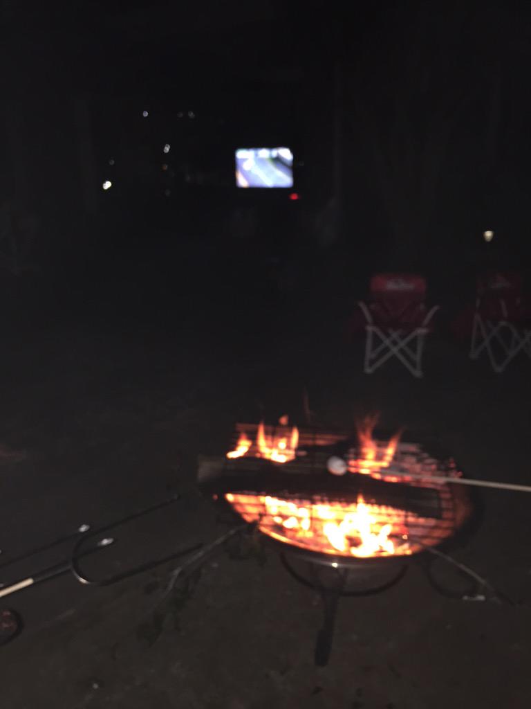
Got a sober reminder on a hike tonight that wildlife is not the only thing to be on the lookout for. So grateful for the fast acting @VCFD
#RollingFire Priority is the northern flank per radio traffic. 2 separate fires about 5 acres per Air Atrack Carver Ranch Road, Woody, Kern County, CA
#RollingFire About 5 acres, two separate fires close proximity, no exposures with a slow rate of spread, per air attack.

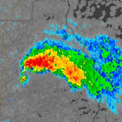
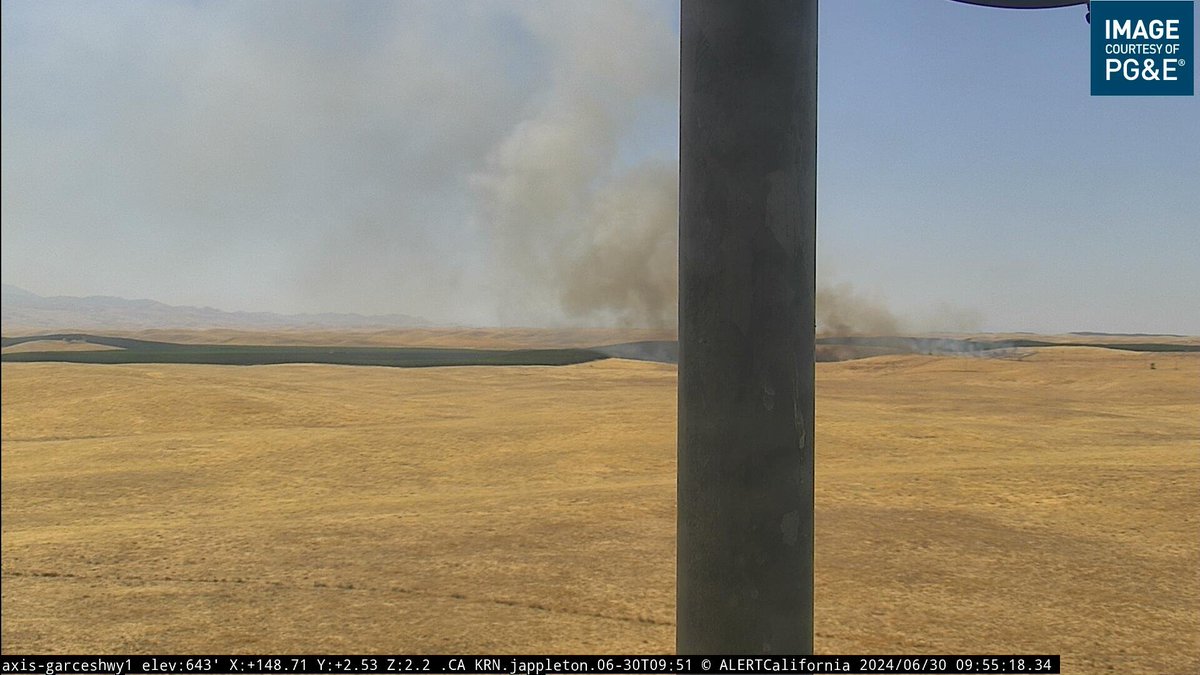
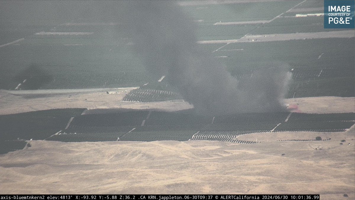
#RollingFire app.watchduty.org/i/12279#allow-… Unknown size vegetation fire with smoke visible on the cameras. Resources at scene and enroute. 29000 block of Rolling Hills Rd - Caliente, CA


Update/Final #RollingFire is an 1/2 acre and 100% contained. The cause is under investigation. #CALFIRETGU2021


#rollingfire available now #distressed #online #promocode #clickthelinkinmybio @ Bloomfield, New Jersey instagram.com/p/B-z63Tqn8G4/…
#rollingfire #availablenow #clickthelinkinbio #fuckcorona #sale @ NASA instagram.com/p/B-IShfSH9-F/…

(Final update, 10:42 pm) #RollingFire is out, Engines to remain on scene to do a small amount of overhaul. IC terminated.
(Update 4, 10:32 pm) #RollingFire Fire is contained to a small pile of construction debris. Engine 5 and 6 to handle with 1 water tender and Battalion 1. Canceling the CAL FIRE response as well as additional REDCOM units.
(Update 3, 10:27 pm) #RollingFire Engine 6 on scene of a large building under construction with smoke showing. Battalion 1 just arriving on scene stating it does not appear there is any threat to the vegetation, keeping CAL FIRE coming code 3 for now.
(Update 2, 10:24 pm) #RollingFire CAL FIRE is dispatching this a structure fire with threat to the vegetation.

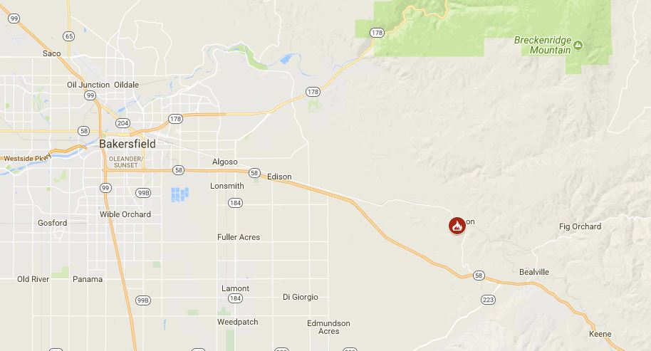
Kern County Fire is currently fighting a brush fire, dubbed the Rolling Fire, that started in the area of Hwy. 223 and Hwy. 58. It has burned approximately 40 acres and is 30% contained at this time. #rollingfire #kerncountyfire


This was too cool...Glassblowing workshop! #makingthememories #hotterthanhottabata #rollingfire… instagram.com/p/BfW85wgjGza/


#RollingFire Priority is the northern flank per radio traffic. 2 separate fires about 5 acres per Air Atrack Carver Ranch Road, Woody, Kern County, CA
Crews on #Rollingfire have hose lines 100% around approx 4 acre brush fire. Handcrews cutting containment line @VCFD
#RollingFire About 5 acres, two separate fires close proximity, no exposures with a slow rate of spread, per air attack.
Update 2 #Rollingfire, fire began adjacent fwy on ramp at Moorpark Rd and moved uphill. Smoke advisory in area @VCFD
Update 1 on #Rollingfire, holding at 3-4 acres, handcrews cutting containment lines. Mop up next several hours @VCFD
#RollingFire: Approx 2+ #brushfire on hillside off Hwy 101 @ Moorpark Rd. Motorists expect delays @CHPMoorpark
#RollingFire [final] off Bena Road, east of Bakersfield (Kern County) is now 100% contained at 184 acres.

#RT @CAL_FIRE: #RollingFire [final] off Bena Road, east of Bakersfield (Kern County) is now 100% contained at 184 …

#RollingFire US 101 S/B, Moorpark Road, all fwy lanes now OPEN. @VCFD personnel and equipment working ALL night 🚒. Drive with caution.


#RollingFire 🔥 Location: #Kern County off of Bena Road, east of #Bakersfield 184 acres 0 containment #CaliforniaWildfires


Looks like crews are mopping up at brush fire off S. Hwy 101 near Moorpark Rd. Read more at VCStar.com. #rollingfire @vcstar


#RollingFire [final] off Bena Road, east of Bakersfield (Kern County) is now 100% contained at 184 acres.... fb.me/1Hekp4jG5
Firefighters are battling a 50 acre wildfire at Bena Road, east of Bakersfield (Kern County) #RollingFire


#RollingFire [final] off Bena Road, east of Bakersfield (Kern County) is now 100% contained at 184 acres.


Something went wrong.
Something went wrong.
United States Trends
- 1. Good Monday N/A
- 2. #MondayMotivation N/A
- 3. Hobi N/A
- 4. #MondayVibes N/A
- 5. Xavi N/A
- 6. #Wordle1724 N/A
- 7. IPTV N/A
- 8. Palworld N/A
- 9. Ends in 24h N/A
- 10. Laporta N/A
- 11. #youraislopboresme N/A
- 12. Miku N/A
- 13. Mojtaba Khamenei N/A
- 14. Jim Cramer N/A
- 15. Rihanna N/A
- 16. Donna Kelce N/A
- 17. #Trackblazer N/A
- 18. Mummies Alive N/A
- 19. Library N/A
- 20. SUGA N/A