#smithfire search results

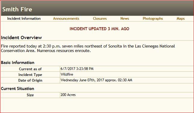
A new wildfire has been located in southern Arizona. The #SMITHFire has burned 200 acres near Sonoita. bit.ly/2shvY14


#SkunkFire: 620 Acres | 100% Containment #SmithFire: 76 Acres | 80% Containment #SpragueFire 91 Acres | 50% Info Source @inciweb at inciweb.nwcg.gov State EOC: Level 3 Operations


#SmithFire in Stanislaus Co @ Hwy 4 & Milton Rd: AA440 reporting 10-15 acres of grass, left flank is moving slowly, right flank has moderate-dangerous ROS moving S/E. Potential for 25 acres. Started as a vehicle collision w/ fire. share.watchduty.org/incident/1152
#SmithFire has been contained at 1,350 acres. Control is set for this evening (7/14) at 6 p.m. #BLMTFDFire

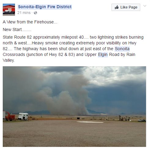
Crews are responding to multiple fires due to possible lightning w/storm. @ArizonaDOT reports 82 closed near #Sonoita #SmithFire @BLMAZFire

#smithfire is now 10 acres w/ moderate rate of spread #cafire #wildfire

Update: the #SmithFire is estimated to be 1,000 acres and 40% contained. #txfire


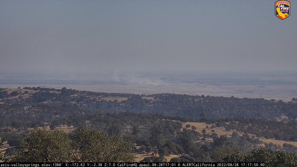
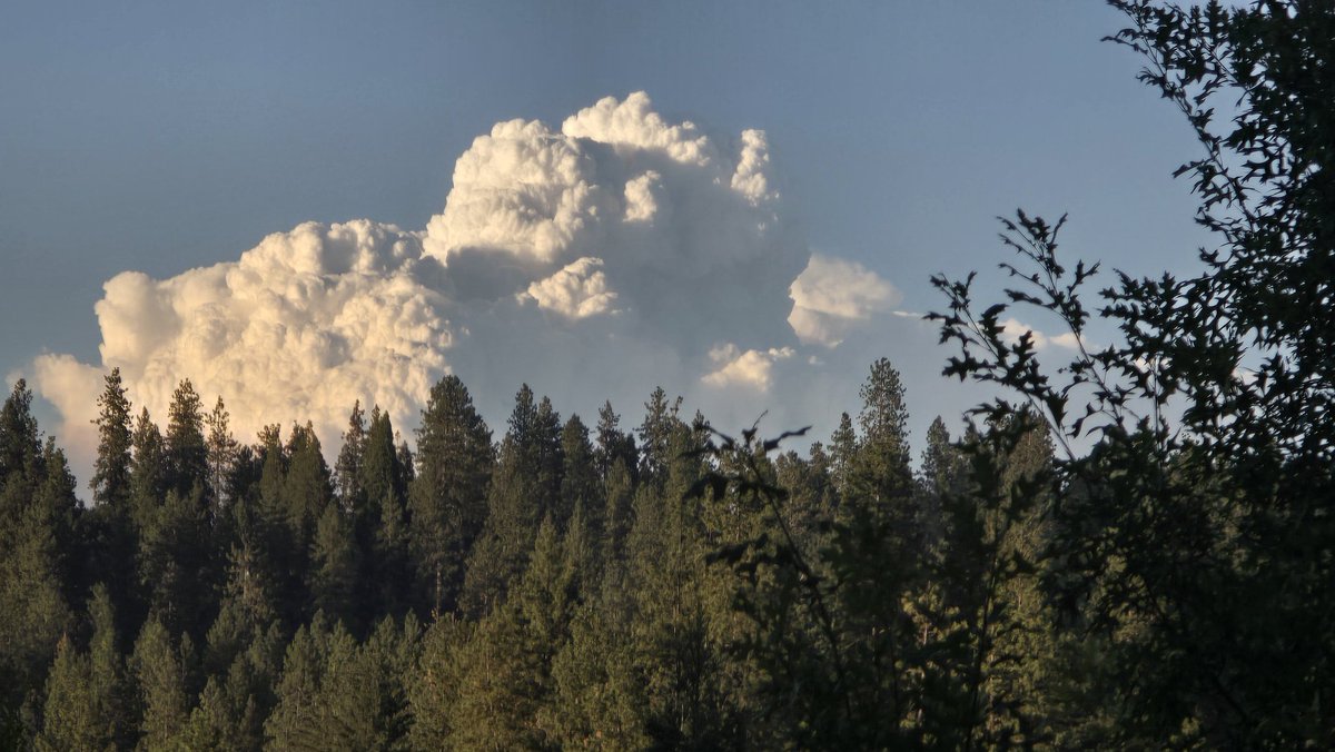
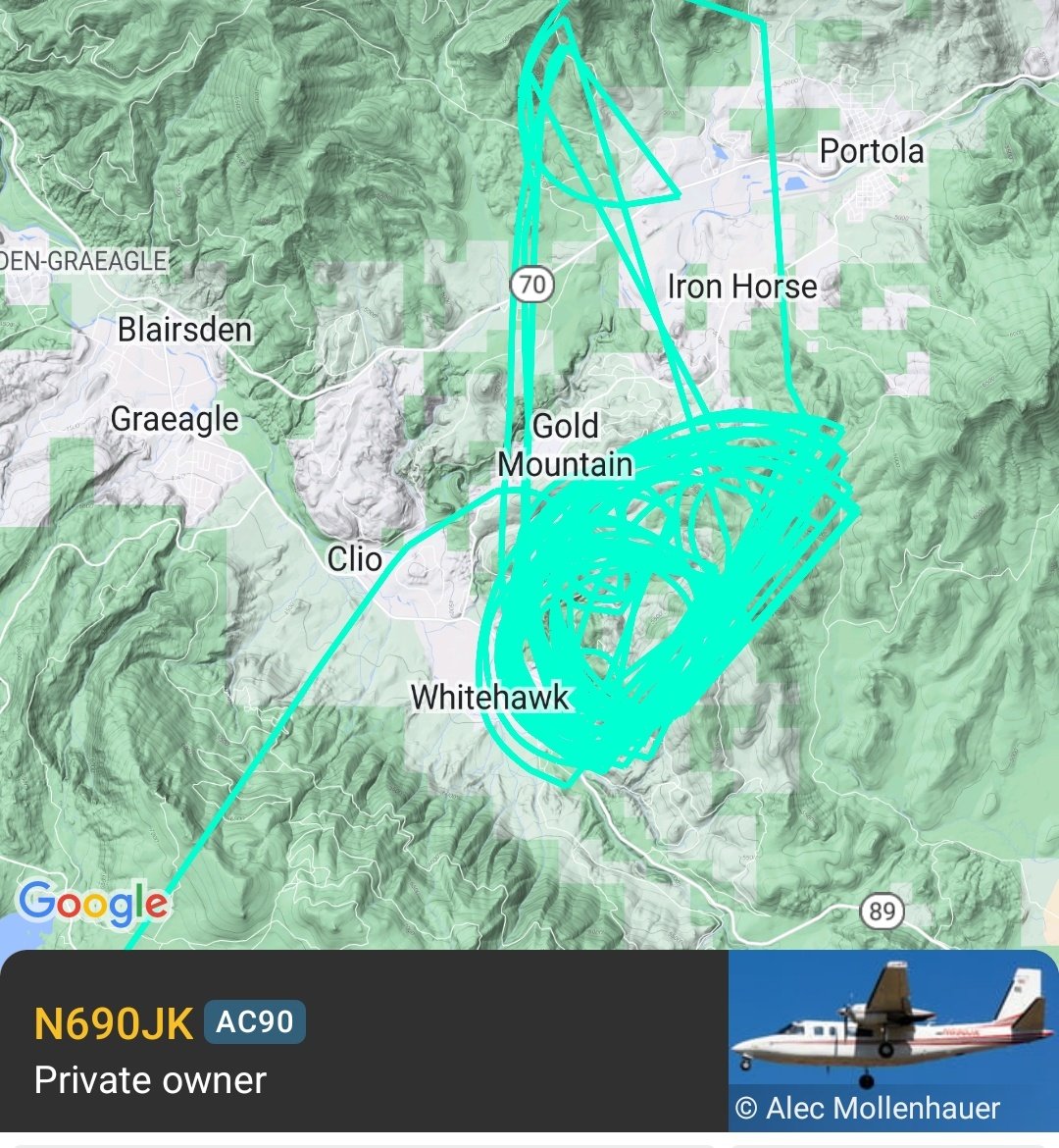
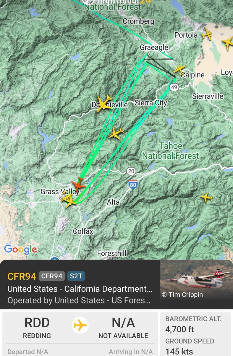
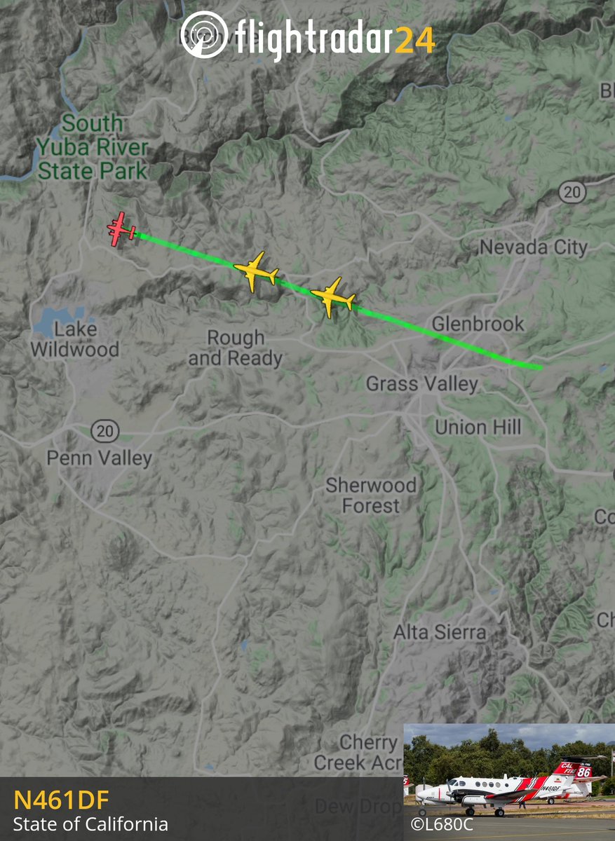
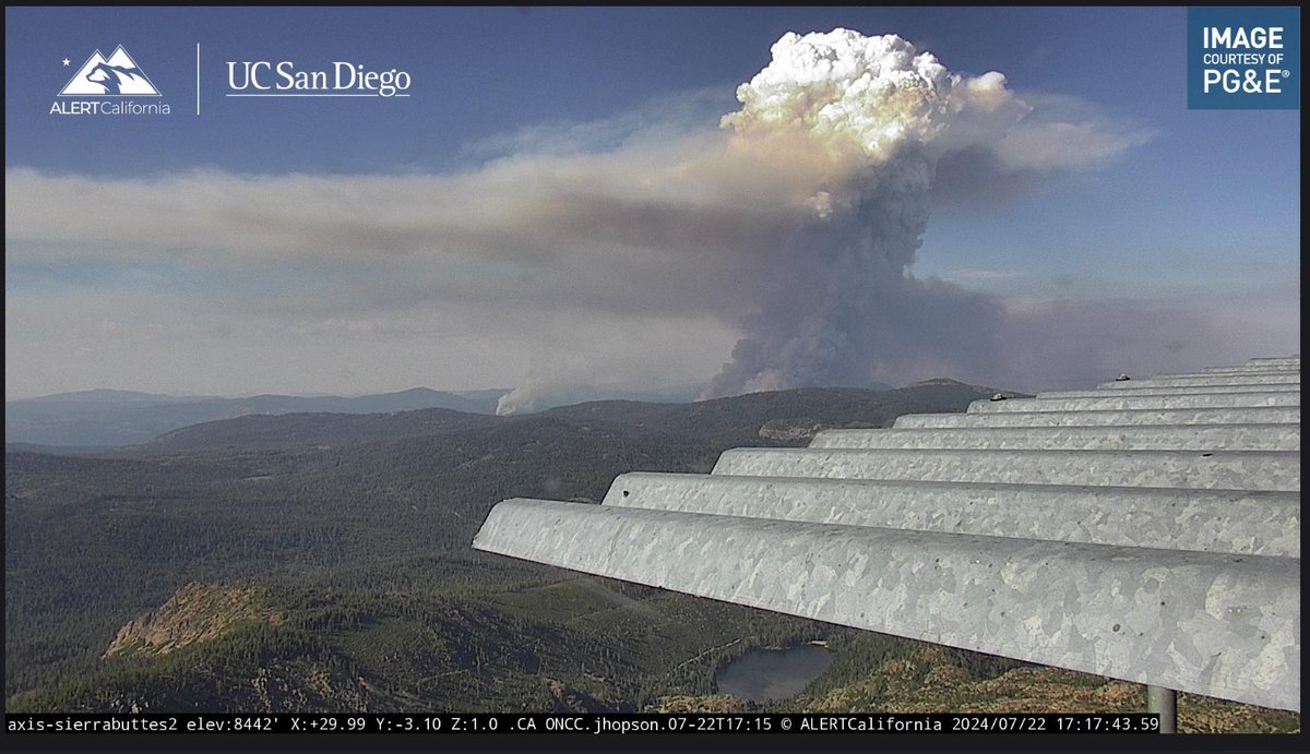
Looks like Cal Fire air tankers 93, 95, 89 in bound at GV AA base from the #MillFire and #SmithFire in Plumas Co. Tanker 89 loaded on retardant and headed back. Mill fire sized up at almost 800 acres. #fireseason2024 #theunionnow @TheUnion Pyrocumulus visible from Grass Valley.
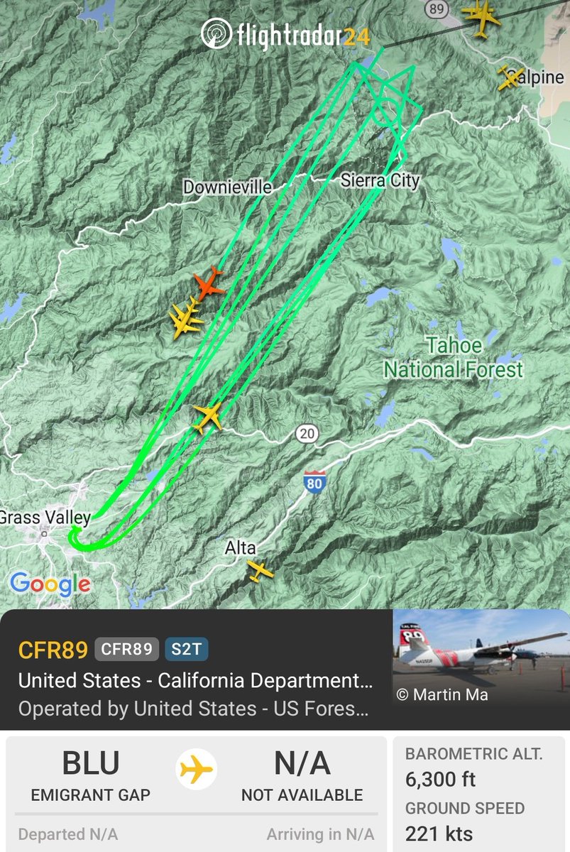

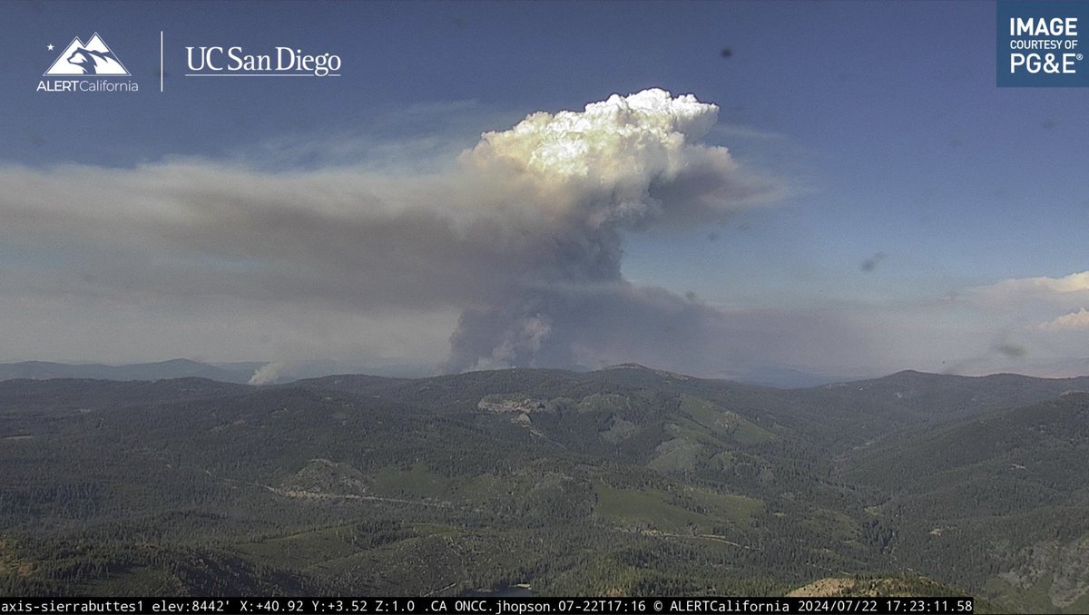
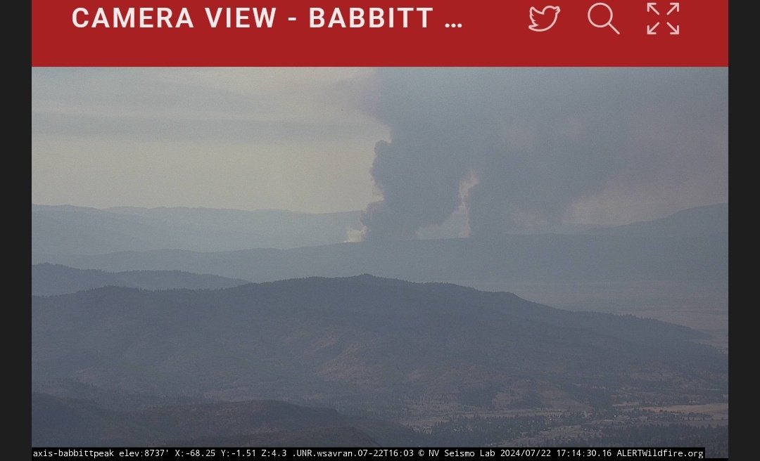
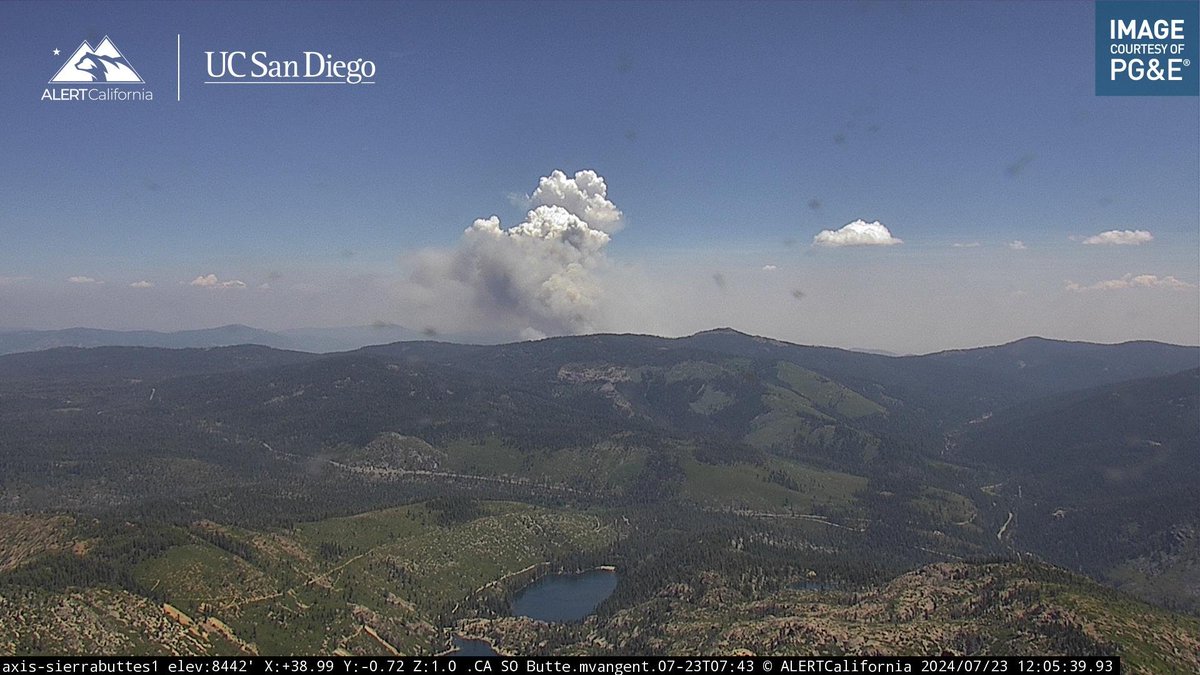
The newly started #MillFire and #SmithFire in Plumas County are visible on multiple ALERTCalifornia cameras. Watch live at: bit.ly/3LA7aZa Follow @USFSPlumas for updates.


Our local air tankers and TNF air Attack 17 working the #MillFire and #SmithFire in the Plumas National Forest. Pyrocumulous status. Tankers 88 and 89 reloading retardant from Reno air attack base. Others reloading from GV AA base. #theunionnow #fireseason2024 @TheUnion

#SmithFire Correction location is approx 7 mi NE of Sonoita. #AZFire
#SmithFire (Stanislaus Co) - Forward progress stopped & all aircraft have been released. The fire was holding at 15 acres. Final update unless something changes.

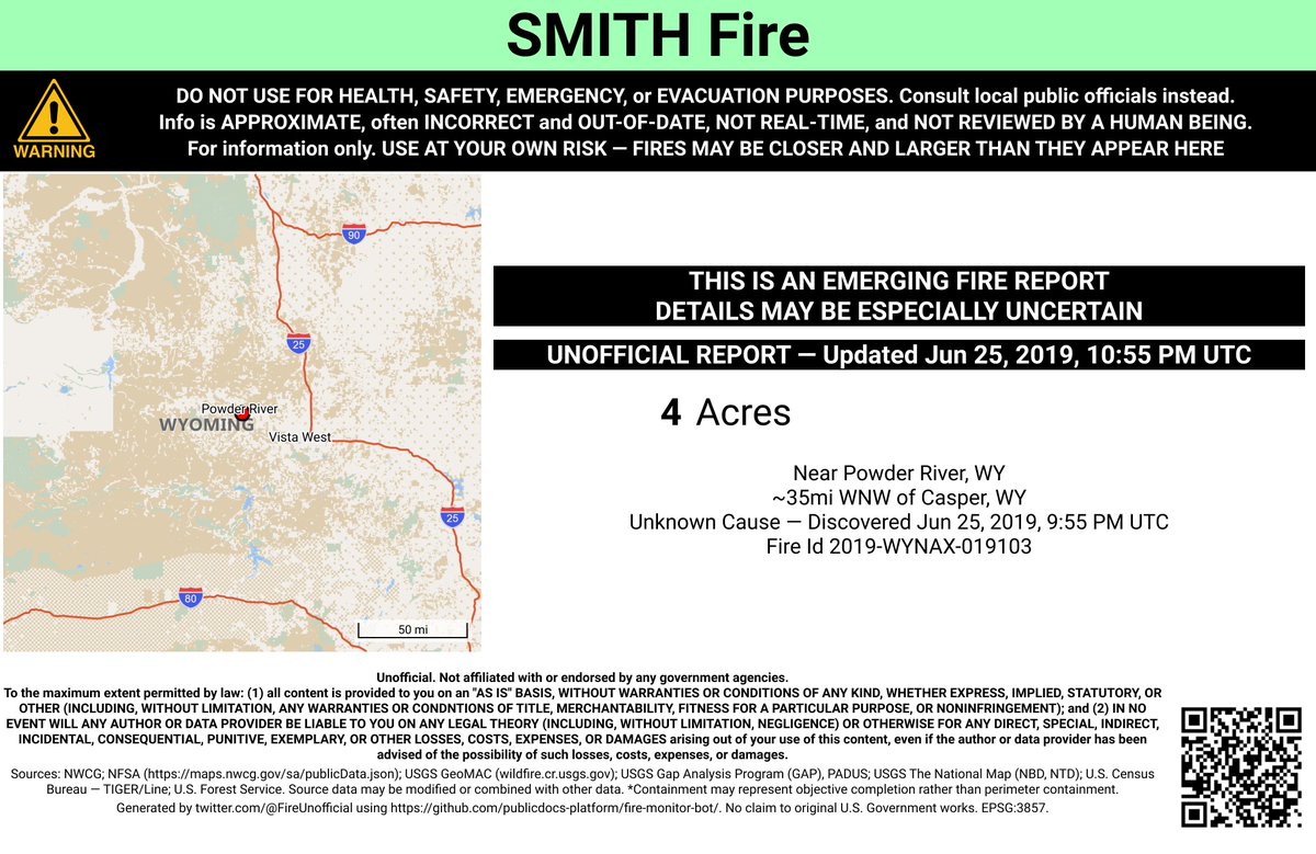
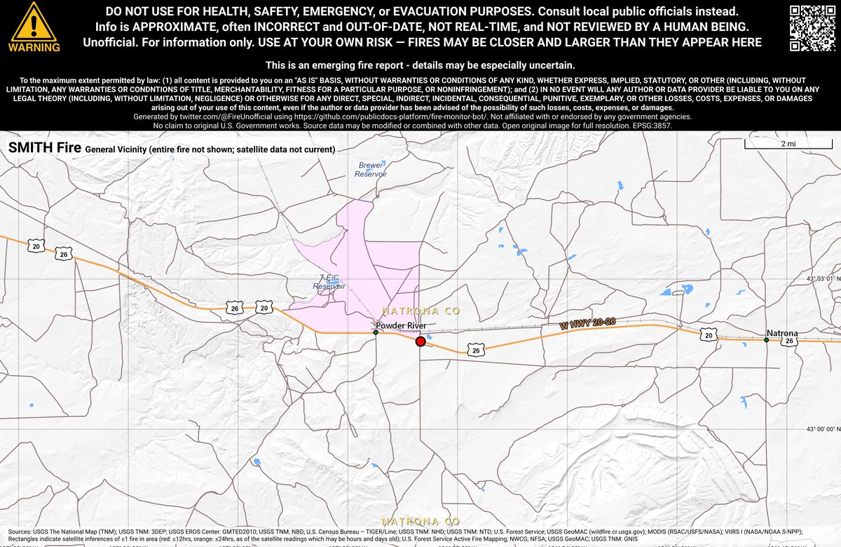
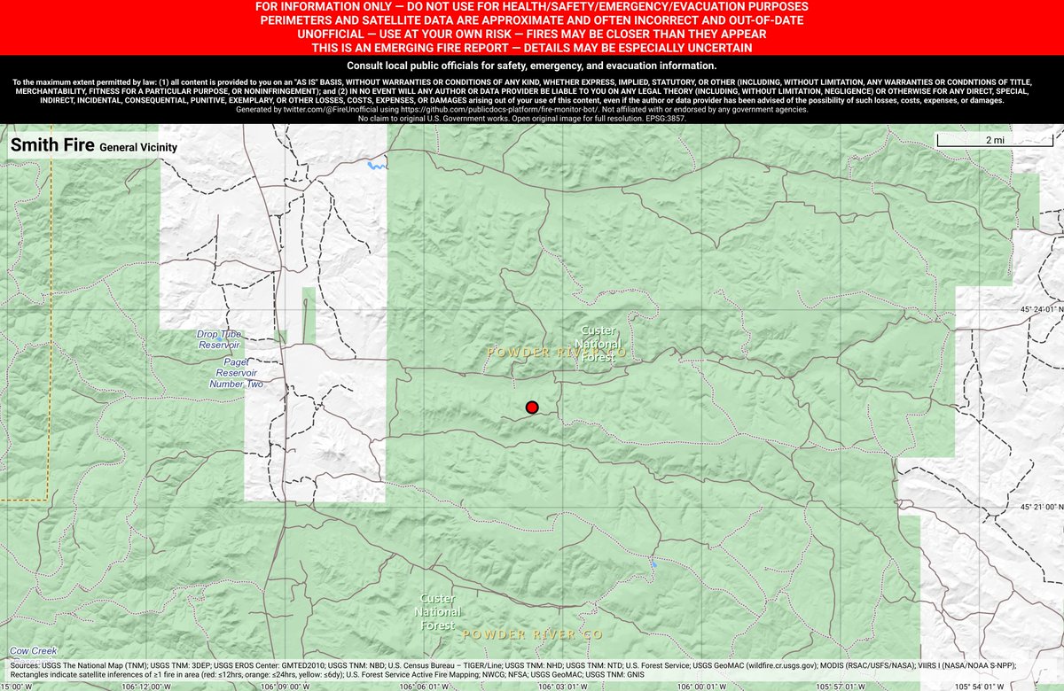
#SmithFire 🔥 unofficial new fire report. Near Powder River, WY. ⚠️ DO NOT USE FOR SAFETY PURPOSES - See officials instead. May be incorrect; disclaimers in images.
#smithfire structure threat as been mitigated 3-5 acres #cafire #wildfire
#SmithFire is now 3-5 acres, winds from south, structure threat mitigated.
#SmithFire As we continue get information we will post to Inciweb: inciweb.nwcg.gov/incident/5212/ #AZFire
CA-SQF- #SmithFire - 100 ac., rapid ROS. Type 2 Incident Management Team ordered. #CAFire
The #SmithFire is near two small fires: Gate 3 (Mills County), 5 acres and 100% contained, and Gate 8 (Brown County), 15 acres and 0% contained. #txfire

New #wildfire start #SmithFire 02/17/26 1722 Off NM-39, Mosquero 3797 acres Coordinates: 35.796667, -103.887294 #NMFire 🔥🔥🔥
#SmithFire is 50% contained. Engines and hand crews will work today to strengthen containment lines and extinguish any hot spots in preparation for anticipated winds gusting up to 25mph today. No longer in unified command with @SBCOUNTYFIRE

#smithfire is forward progress stopped resources will remain on scene to construct containment and extinguish hot areas #cafire #wildfire
Forward rate of spread has been stopped. Resources will remain at scene throughout the night and tomorrow to construct containment lines and extinguish hot areas of the fire.
#smithfire is now 10 acres w/ moderate rate of spread #cafire #wildfire
#SmithFire now in Unified Command with @SBCOUNTYFIRE - IC reporting 10 acres with additional ground resources on order.
#smithfire structure threat as been mitigated 3-5 acres #cafire #wildfire
#SmithFire is now 3-5 acres, winds from south, structure threat mitigated.
#SmithFire is now 3-5 acres, winds from south, structure threat mitigated.
#smithfire responding units #cafire #wildfire
[New Incident] Vegetation Fire Phelan. Smith Rd and Neilson Rd. Rpt time 9:06pm IC reporting 2 acres, moderate rate of spread, structure threat, potential for 10 acres. #SmithFire @SBCOUNTYFIRE
![CALFIREBDU's tweet image. [New Incident] Vegetation Fire Phelan. Smith Rd and Neilson Rd. Rpt time 9:06pm IC reporting 2 acres, moderate rate of spread, structure threat, potential for 10 acres.
#SmithFire
@SBCOUNTYFIRE](https://pbs.twimg.com/media/Gw1jk7lbEAAYDTL.jpg)
#smithfire is now 3 acres w/ structure threat in approximately 10 minutes, burning in light to medium fuels w/ moderate rate of spread per Incident Command. #cafire #wildfire

[New Incident] Vegetation Fire Phelan. Smith Rd and Neilson Rd. Rpt time 9:06pm IC reporting 2 acres, moderate rate of spread, structure threat, potential for 10 acres. #SmithFire @SBCOUNTYFIRE


#SmithFire 13100 block of South Indian Road, Smith River, Del Norte County. 12:20PM The fire's size has been revised to 0.3 acres. 10:24AM Some local agency resources have been released from the fire.
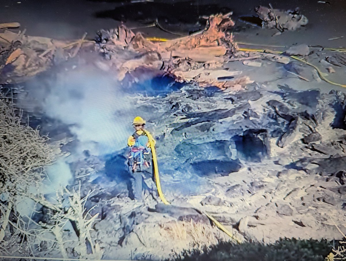
#SmithFire 13100 block of South Indian Road, Smith River, Del Norte County. 9:27AM Multiple fire agencies quickly contained a wind-whipped driftwood fire on Dat-naa-svt Beach below the Howonquet Indian Cemetery that was reported around 6:30am. No structures were threatened.
#SmithFire 13100 block of South Indian Road, Smith River, Del Norte County. [watchduty] 7:00AM Resources are on scene of a vegetation fire estimated at one acre, burning at a slow rate of spread, per resources on scene. Additional resources have been requested, per radio traffic.
![CodeRed001Blue's tweet image. #SmithFire 13100 block of South Indian Road, Smith River, Del Norte County. [watchduty]
7:00AM Resources are on scene of a vegetation fire estimated at one acre, burning at a slow rate of spread, per resources on scene. Additional resources have been requested, per radio traffic.](https://pbs.twimg.com/media/Gsc_riBa8AAnVYM.jpg)


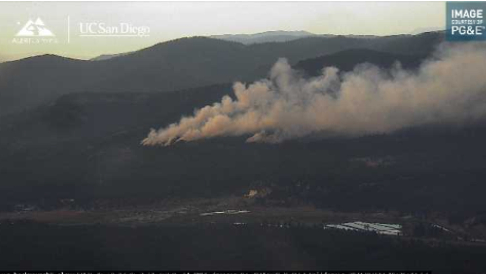
Pyrocumulus from the #MillFire/#SmithFire as viewed from Lake Tahoe near sunset 7/22. KRGX Reno radar shows tstorms setting off the fires near 2:30 and 3pm respectively at 1 & 2. @NWSReno #CAwx #NVwx


Looks like Cal Fire air tankers 93, 95, 89 in bound at GV AA base from the #MillFire and #SmithFire in Plumas Co. Tanker 89 loaded on retardant and headed back. Mill fire sized up at almost 800 acres. #fireseason2024 #theunionnow @TheUnion Pyrocumulus visible from Grass Valley.


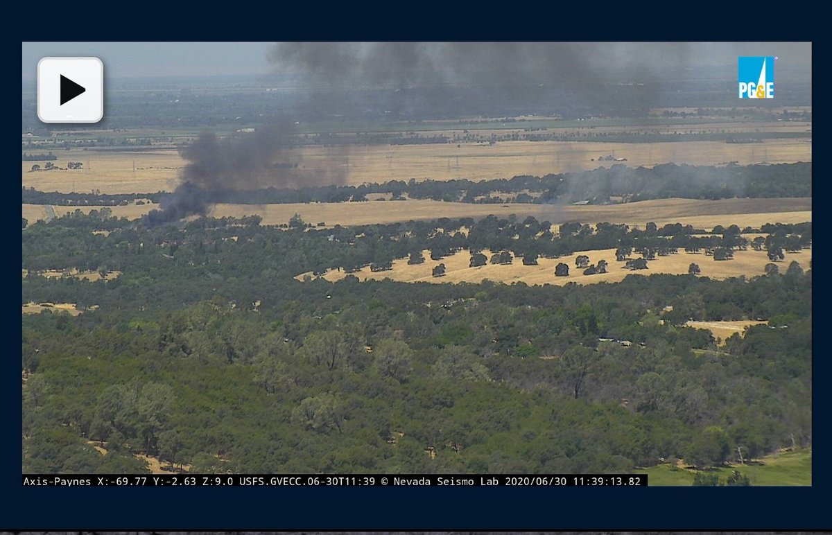
Grass Valley air attack and air tankers 88 and 89 headed towards an incident between Loma Rica and Bangor. #smithfire #smithincident #fireseason2020 @TheUnion


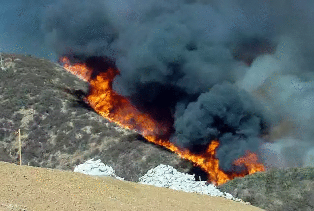
#SmithFire, #MillFire are currently sending smoke plumes extremely high into the air allowing it to be seen for miles. Mill is 780 Acres, Smith is at nearly 44 Acres. Many Evacuations have been issued for both fires. Smith Fire has ordered an EVAC for the entire town.

AZS-4453 #AzFire #SMITHFire Resource Order HWY 82 MM 40 31.719 x -110.537 #Update from #RainValleyFire

#SmithFire 🔥 unofficial new fire report. Near Powder River, WY. ⚠️ DO NOT USE FOR SAFETY PURPOSES - See officials instead. May be incorrect; disclaimers in images.

This portion of State Route 82 was shut down earlier. #SmithFire reported at 200 acres, rain has been on and off @kgun9 #Sonoita


#SmithFire 🔥 unofficial, automated update. ~14mi SE of Minidoka, ID. ⚠️ DO NOT USE FOR SAFETY PURPOSES - See officials instead. May be incorrect; disclaimers in images.
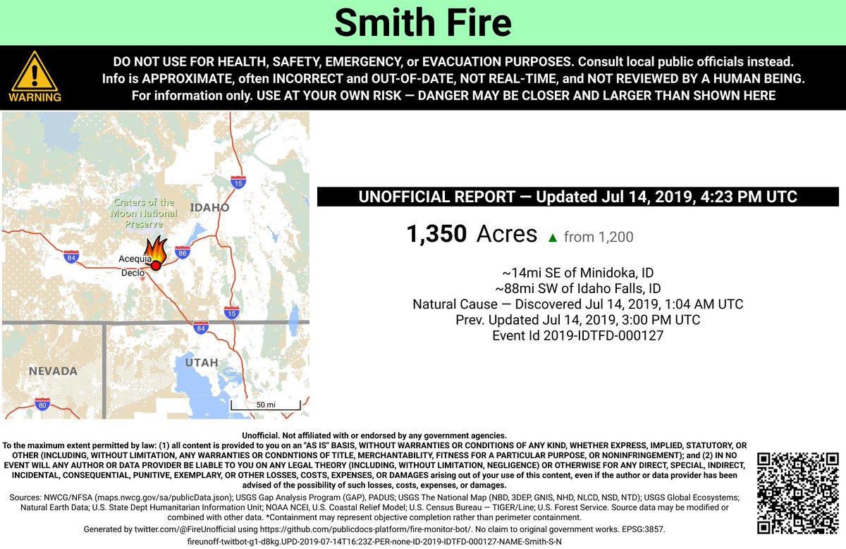

#SmithFire has been contained at 1,350 acres. Control is set for this evening (7/14) at 6 p.m. #BLMTFDFire
#SmithFire 🔥 discovered Jun 12, 2019, 11:34 PM UTC - unofficial report. #PowderRiverCounty Miles City Field Office; ~19mi SE of Ashland, MT. ~80mi NNW of Gillette, WY. See officials for safety info. May be incorrect; disclaimers in images.

Here are initial perimeter maps of the #MillFire and #SmithFire, burning near Portola, Ca. Heat mapped by FIRIS at 6:30pm, 7/22/2024.


Y por último, para cerrar con broche de oro, les presento a mis hermosuras :3 Ellas son #SmithFire&LesPaul ☺


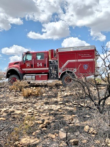
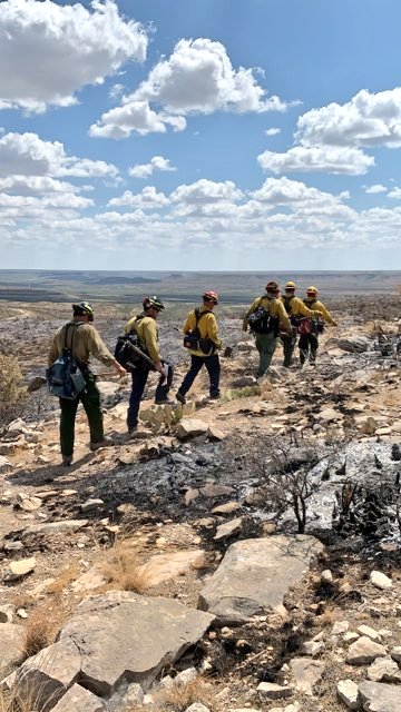
The @DFRWildlandTeam has demobilized and are headed back to the @CityOfDallas after a week fighting the #DeepCreek fire outside of @cityofcisco and the #SmithFire in #PecosCounty. Great work by all who gave of themselves to help! #ServiceFirst @DallasFireRes_q


#AzFire #SmithFire #closed due to brush fire #SR82, East-bound from mile post 40.0, 12.0 miles West of #SR90 #ADOT #AzDPS


#MillFire(bigger in WhiteHawk) and #SmithFire Plumas county -Entire town of Delleker told to Evacuate =GO cameras.alertcalifornia.org/?pos=39.7344_-…
Something went wrong.
Something went wrong.
United States Trends
- 1. Star Fox N/A
- 2. #OpeningDay N/A
- 3. Smash Bros N/A
- 4. Will Wade N/A
- 5. Fox McCloud N/A
- 6. NC State N/A
- 7. $NRED NovaRed Mining Inc. N/A
- 8. #CopperBull N/A
- 9. #HardRockBet N/A
- 10. Good Thursday N/A
- 11. Jarvis Butts N/A
- 12. #CriticalMinerals N/A
- 13. Nintendo Cinematic Universe N/A
- 14. Bad News Brown N/A
- 15. #BringThemBack N/A
- 16. Happy Friday Eve N/A
- 17. Nicolás Maduro N/A
- 18. Samus N/A
- 19. Jackson Chourio N/A
- 20. Fannie Mae N/A