
Anna Meyers
@Anna_Weather
Meteorologist | CMU and IU Alum | B.S. in Meteorology and Master of Environmental Sustainability
You might like


Episodic thunderstorms the past three days resulted in patches 1.5 to 4 inches of rain in West Michigan. The Holland area had 3 to 4 inch totals the last three days, a big turnaround compared to the 4 to 5 inch totals from the entire three-month span of June, July, and August.

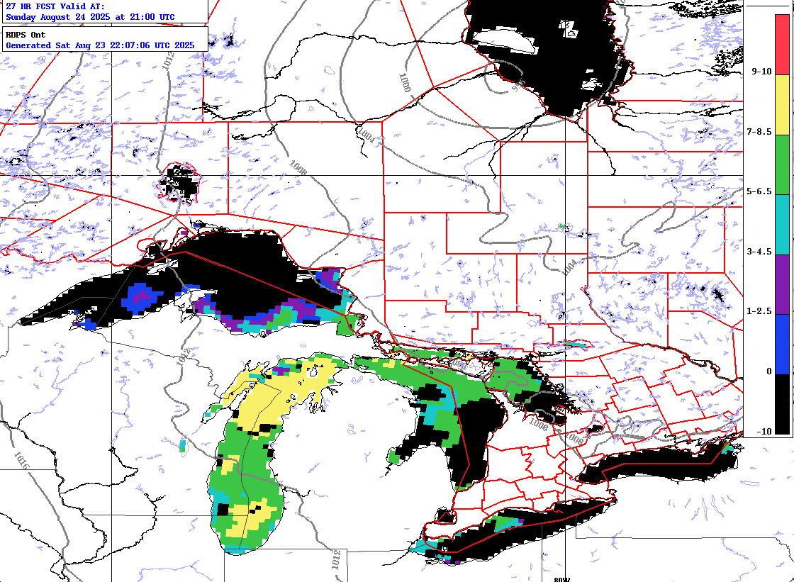
Waterspouts are possible on Lake Michigan today.
Callout to all waterspout hunters around Lake Michigan. We expect numerous waterspouts over the lake on Sunday. Send us your reports! Below is the waterspout potential forecast map for 5 pm EDT. icwr.ca #miwx #wiwx @NWSIWX @NWSGrandRapids @NWSGaylord
A severe thunderstorm watch is in effect for portions of the area. Stay weather aware this afternoon.

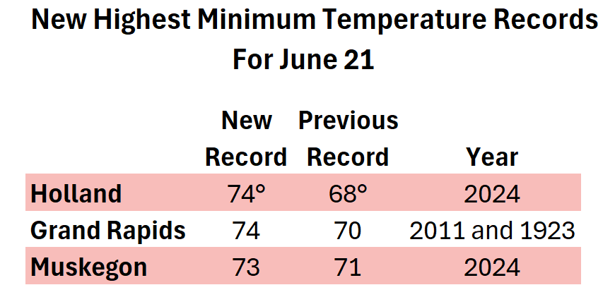
@NWSGrandRapids , @CityofMuskegon_ and @CityofHolland all established their highest low temperature for the day on June 21. #miwx #wmiwx #puremichigan

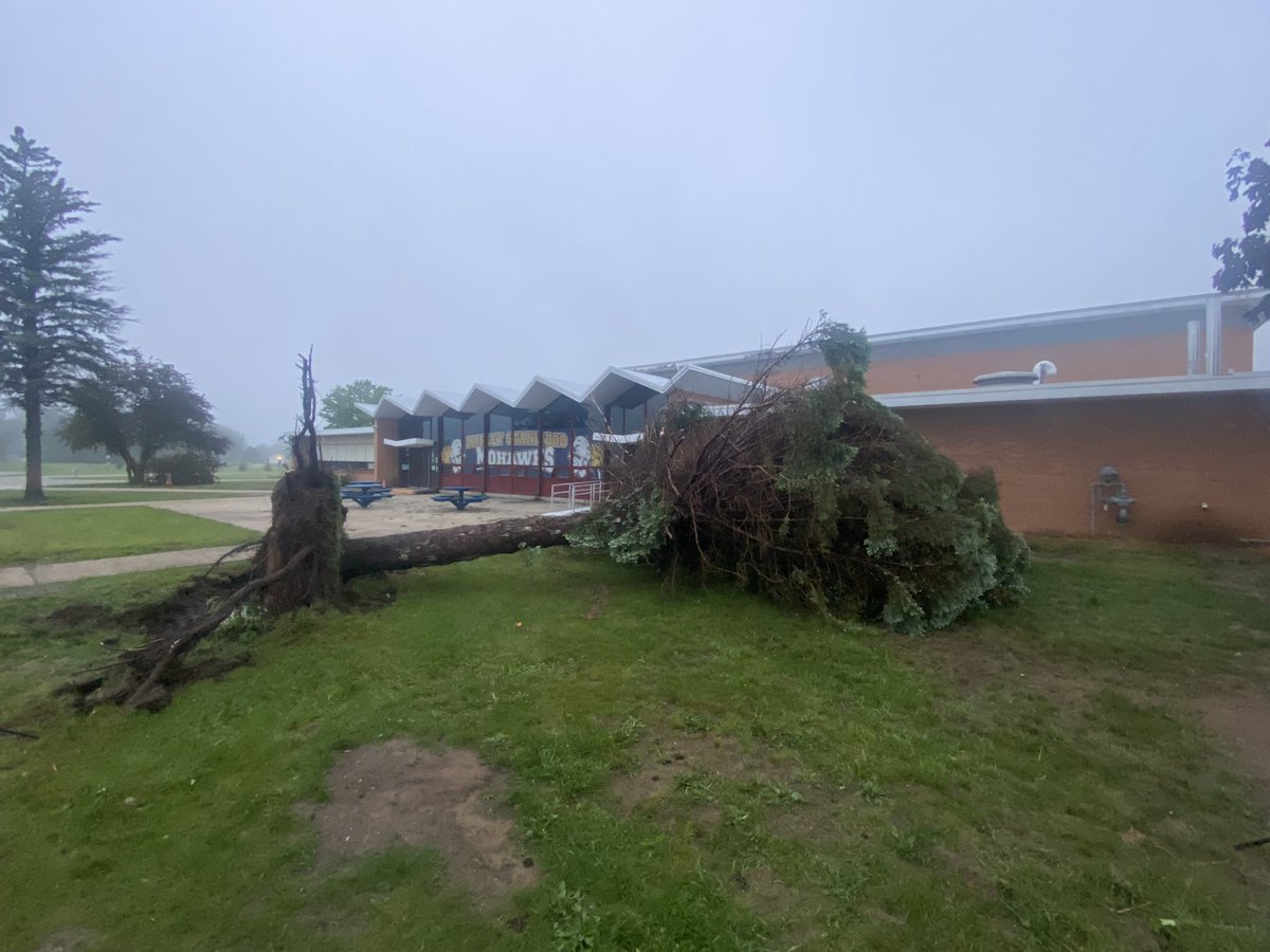
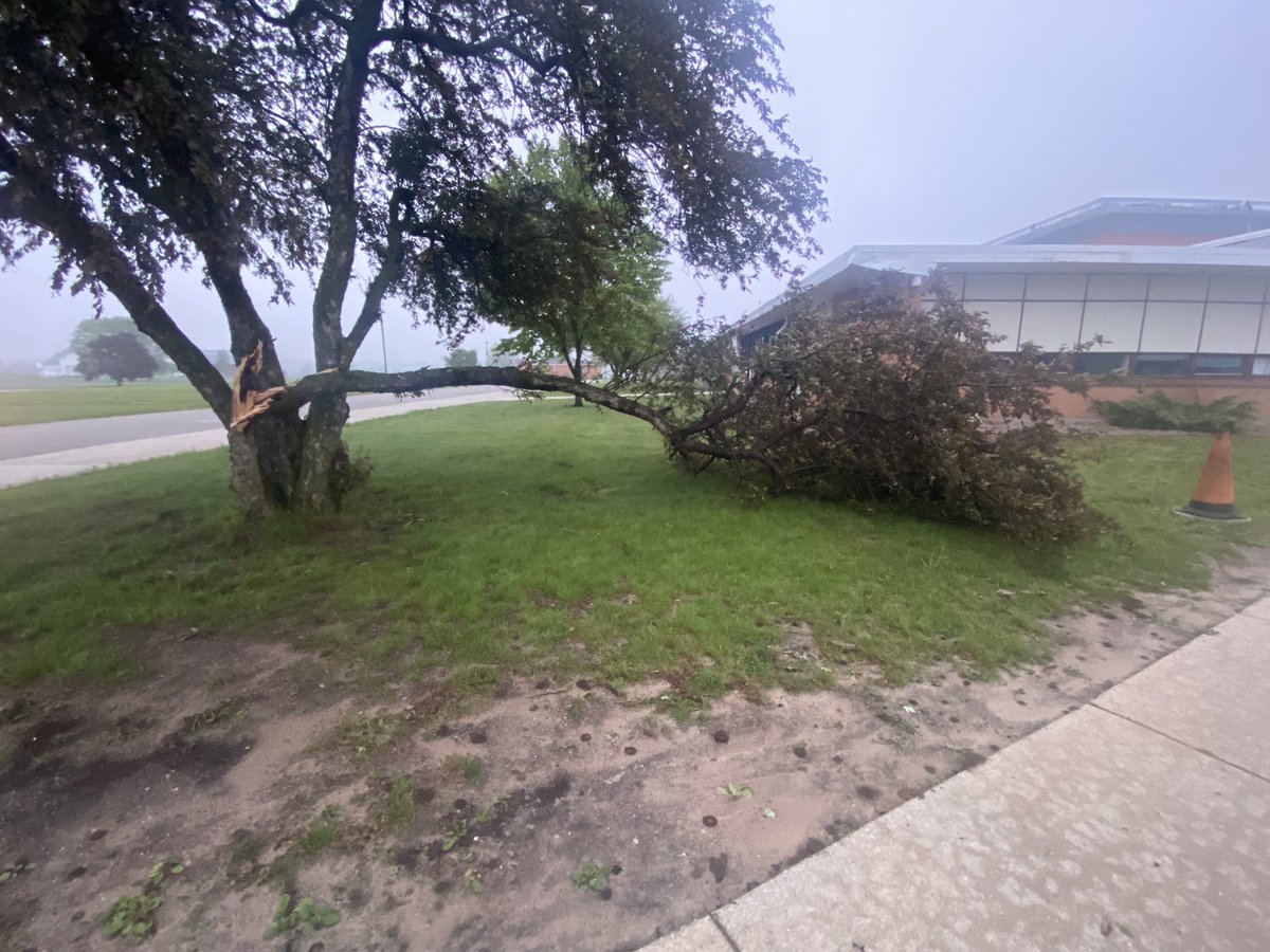
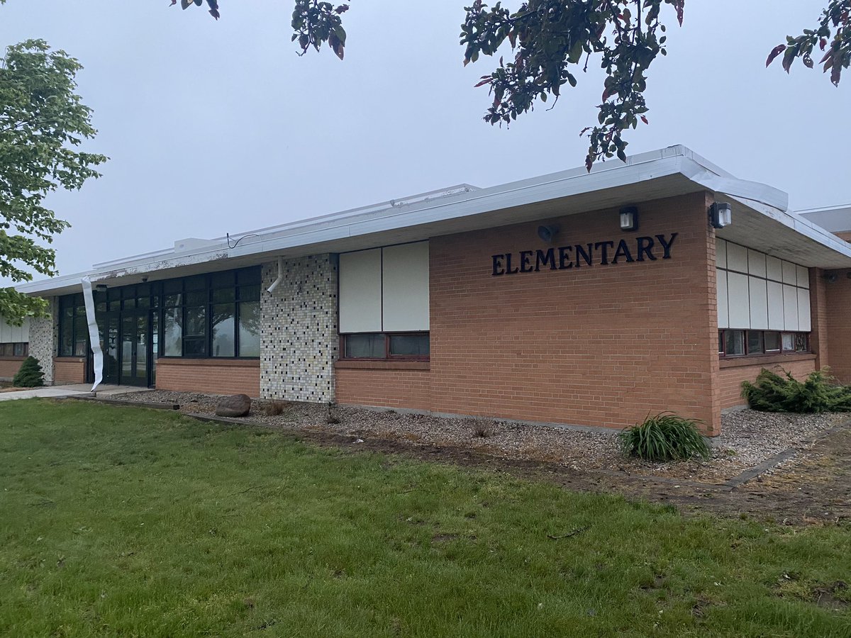
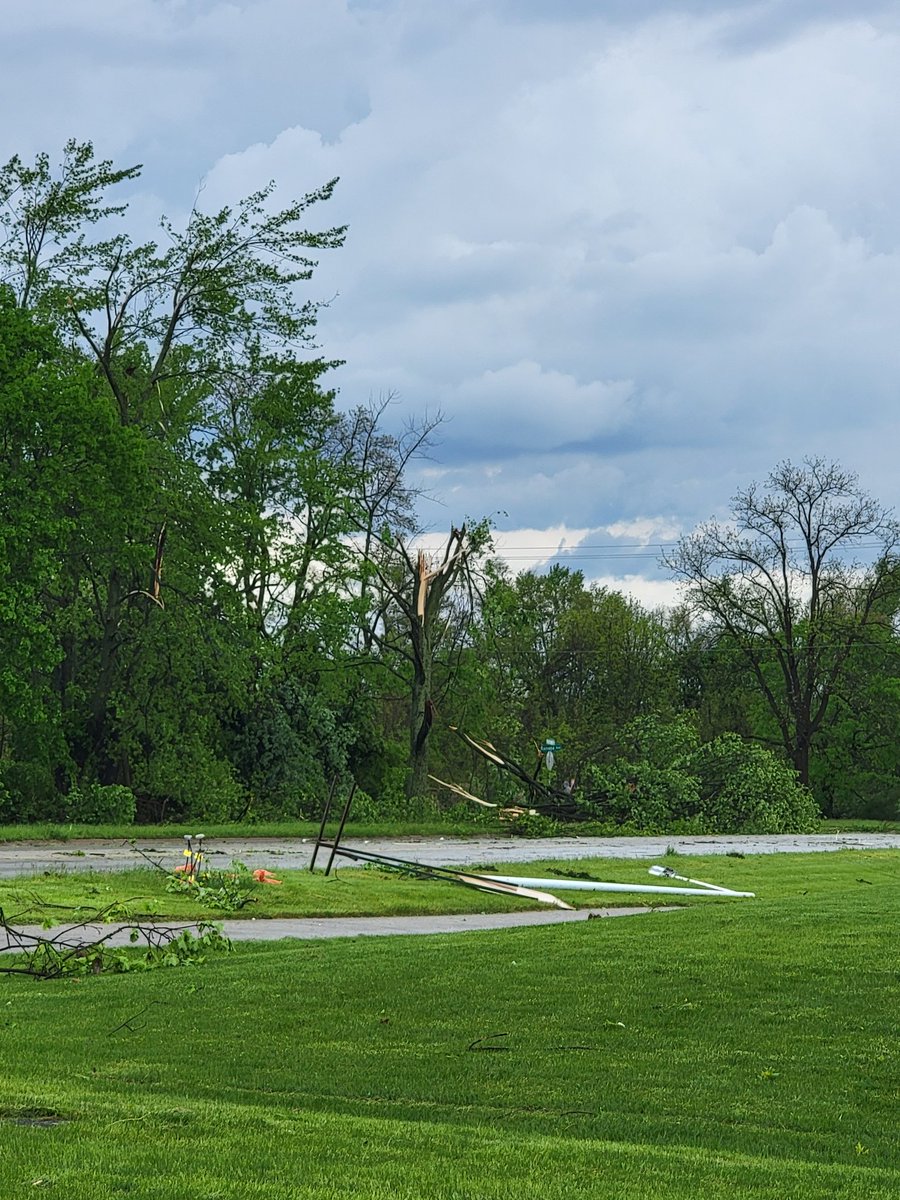
Sporadic tree damage on the grounds of Morley-Stanwood Community Schools. One particular pine uprooted, some minor roof/siding damage at the elementary school. @NWSGrandRapids

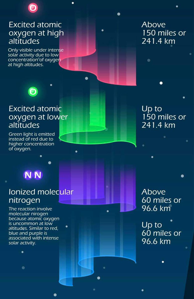
In case you were wondering what the colors of the Aurora Borealis mean and how high up in the atmosphere they area, here is an informational graphic.

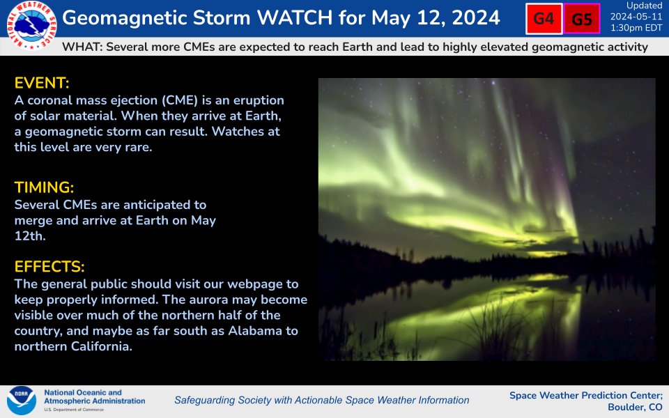
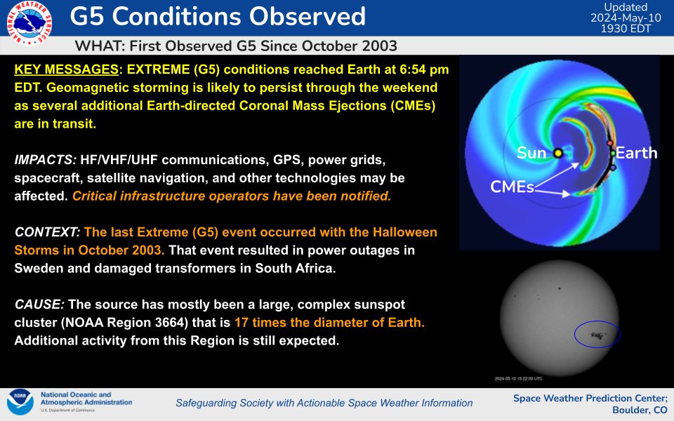
Additional Aurora sightings (weather permitting) may be possible this evening into tomorrow! A Geomagnetic Storm Watch has been issued for Sunday, May 12th. Periods of G4-G5 geomagnetic storms are likely! 👀
Another series of CMEs associated with flare activity from Region 3664 over the past several days are expected to merge and arrive at Earth by midday (UTC) on 12 May. Periods of G4-G5 (Severe-Extreme) geomagnetic storms are likely to follow the arrival of these CMEs.

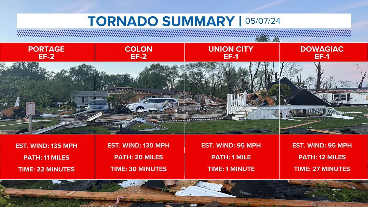
A fourth tornado has now been confirmed for Michigan on Tuesday. A second EF-2 in Colon with winds at 130 mph with a 20-mile-long path that lasted on the ground for 30 minutes. @wzzm13

Important update
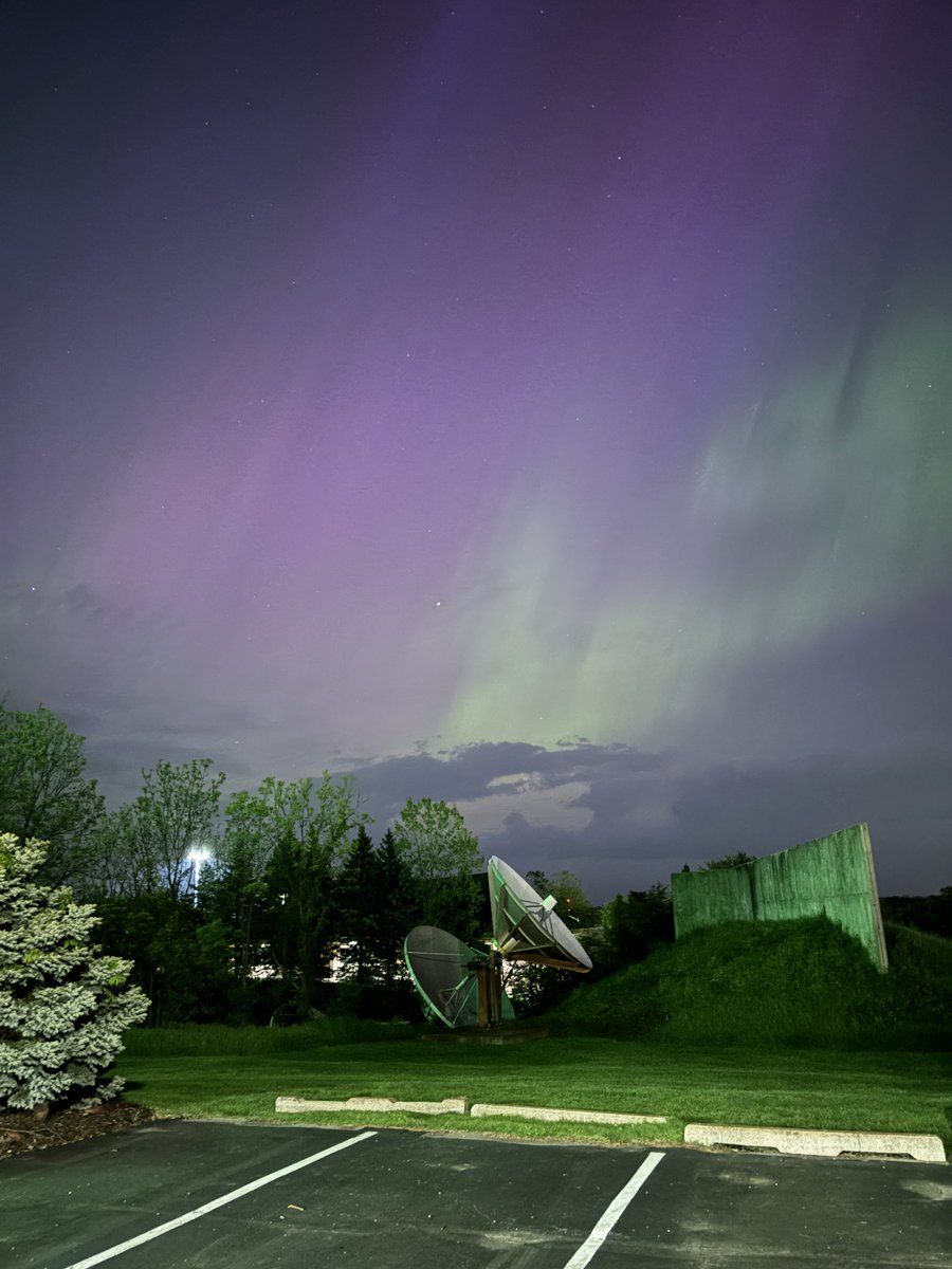
Extreme (G5) geomagnetic conditions have been observed!

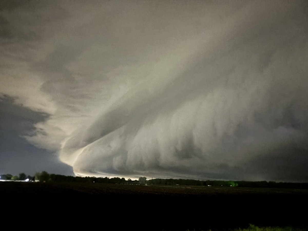
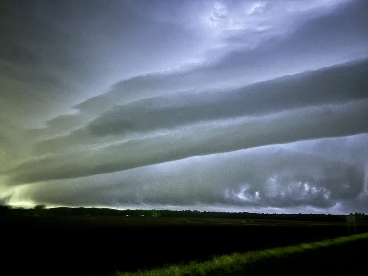
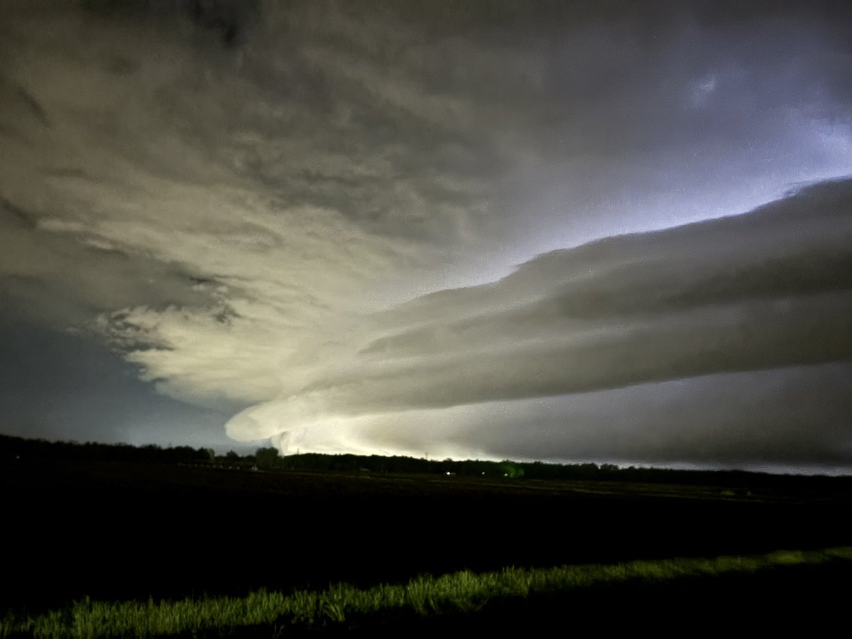
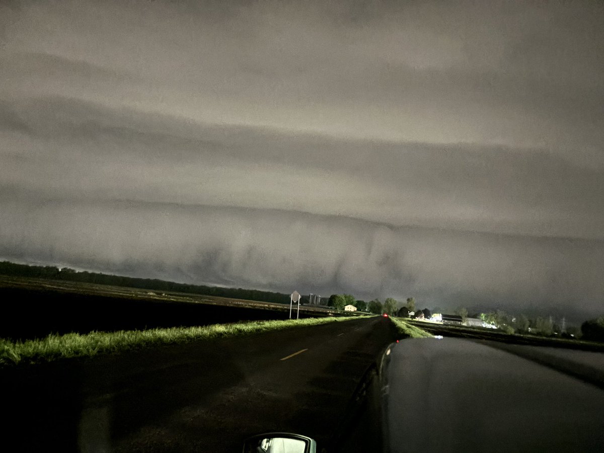
WOW JUST WOW! Humongous shelf cloud in Ottawa County, MI 📍Allendale, MI @MiStormChasers @NWSGrandRapids @wxblakeharms @ReedTimmerUSA #miwx


Here are the rotation tracks (NROT) of the tornadic supercells from Tuesday. Notice the two distinct rotation tracks that followed nearly the same path from Decatur through Portage to Battle Creek. #miwx

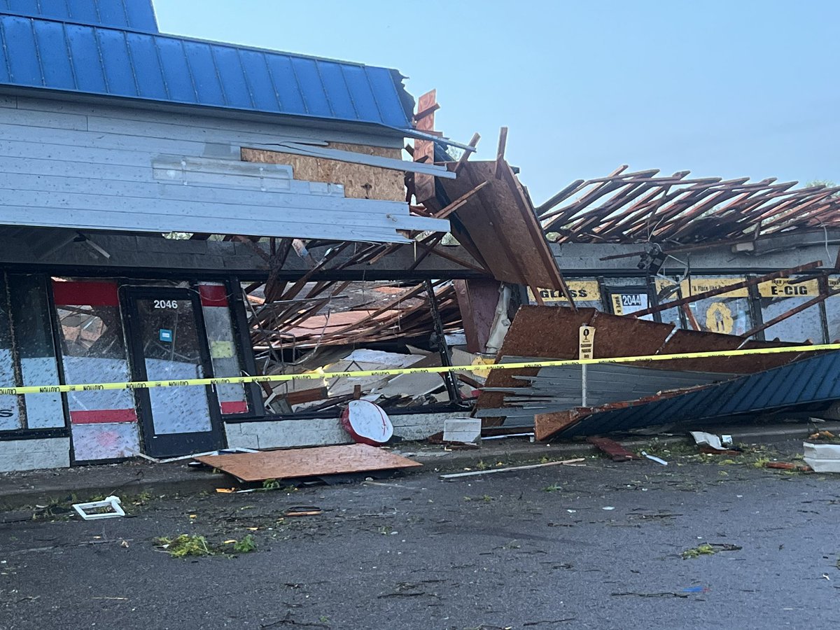
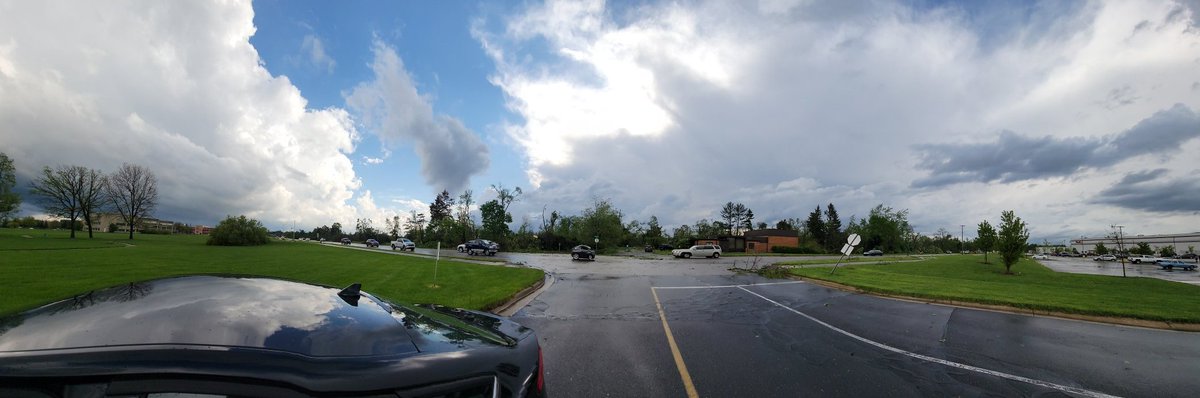
This is all that’s left of a strip mall at the corner of Oakland and Centre in Portage after a #tornado this evening. @JuliaGorman10 just spoke with a man who was INSIDE this building when it collapsed around him. We’ll share that interview with you as soon as we can on @wzzm13


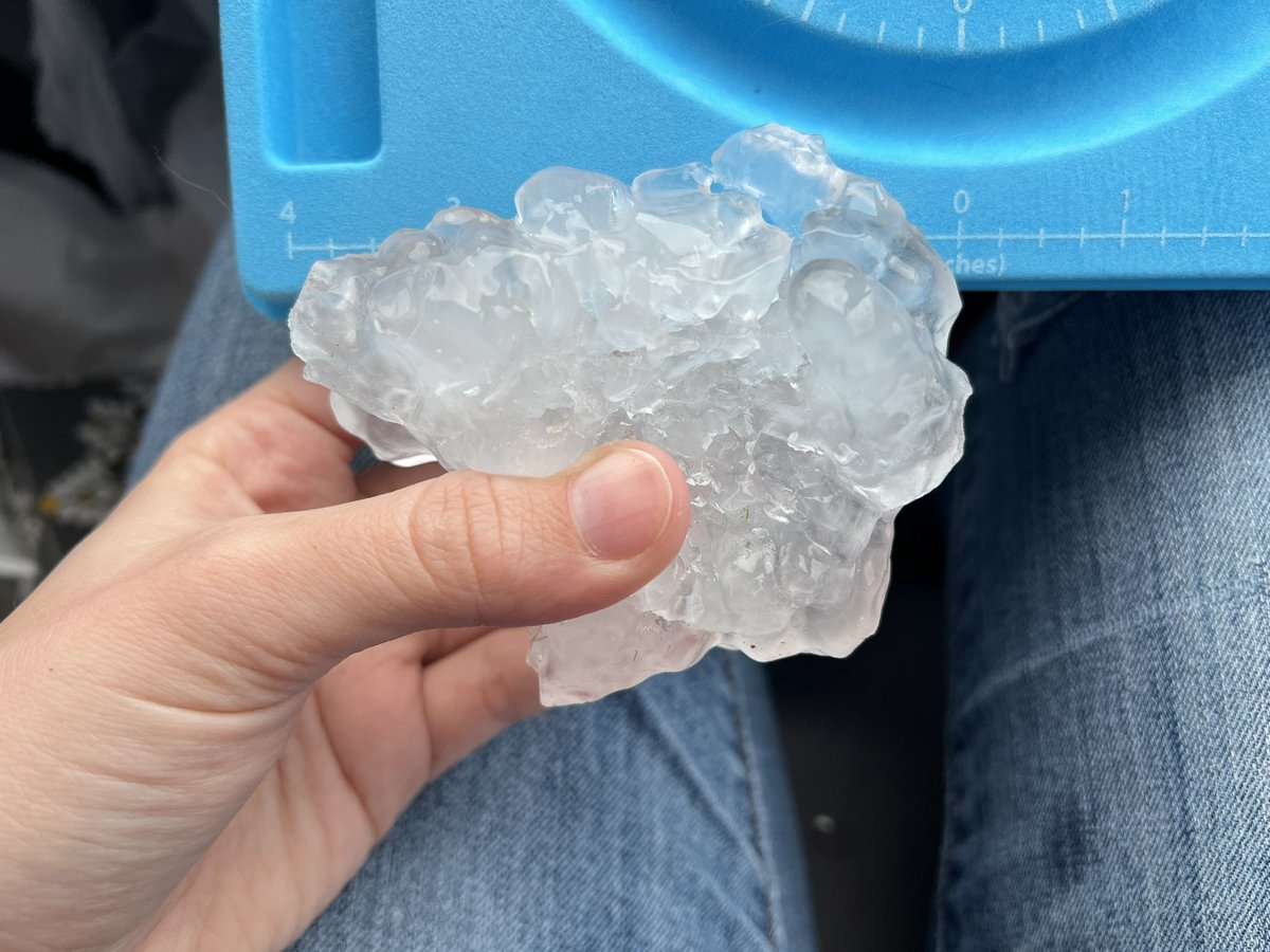
Here’s the largest hailstone I found today! ⛈ It measured 4” in diameter and fell just east of Leonidas, MI around 6:08pm @NWSIWX @NWSGrandRapids #miwx

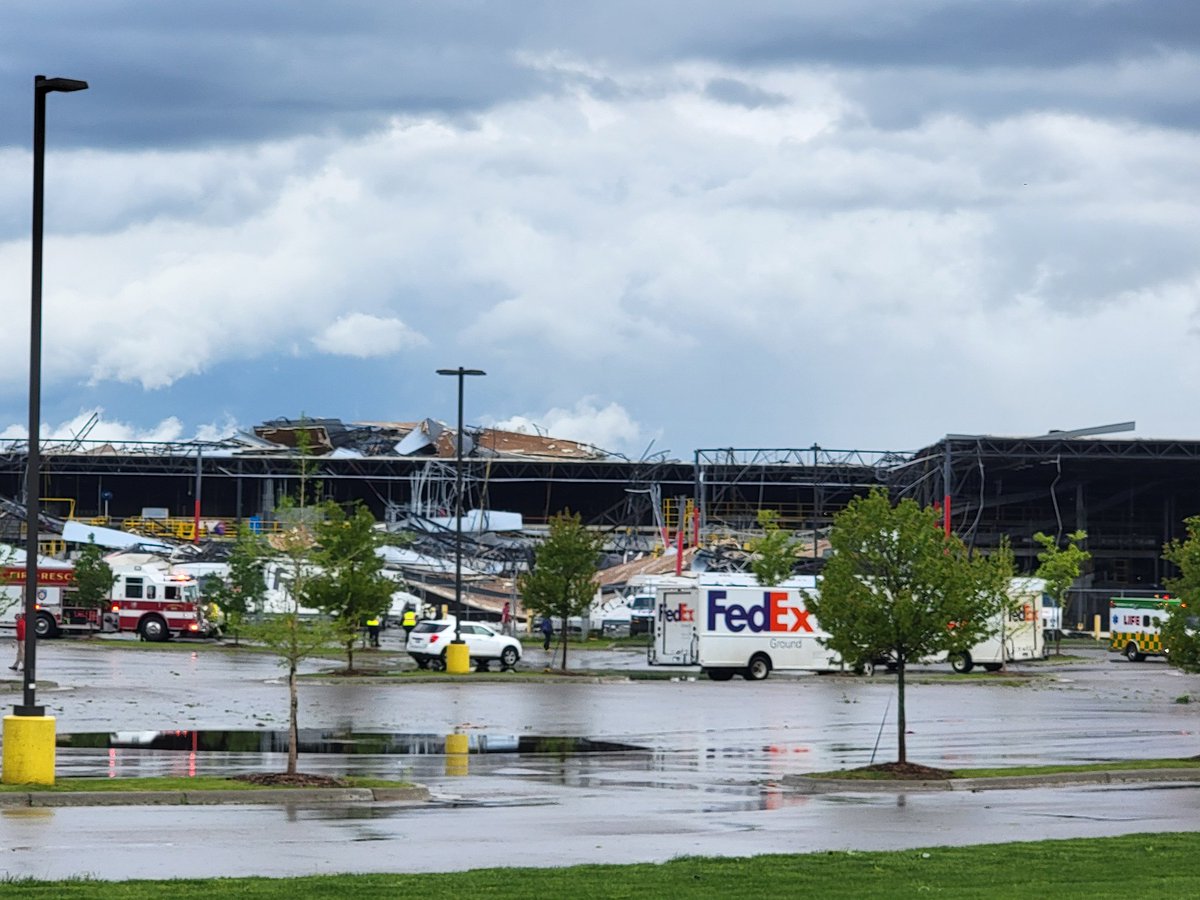
@NWSGrandRapids significant damage in Portage. On Portage Road just north of Romence Road at the FedEx facility.

13 On Your Side WEATHER ALERT: A Tornado Warning has been issued for Van Buren until May 07 5:45PM. Take cover now! More at: bit.ly/Tornado_Warnin… #wmiwx #miwx #WestMichigan #13OYS @wzzm13 @13OYSwx
A good reminder of a watch vs warning as we have a tornado watch in effect for a portion of West Michigan until later tonight.
As we have chances for severe thunderstorms today & tomorrow it is a good time to review the difference between a watch and a warning. A WATCH means the ingredients are present for severe weather to develop A WARNING means it is happening and you should take action.

⚠️Tornado Watch issued for a portion of W. Michigan until 9 PM. Included in the watch is the possibility of large hail (upwards of 2.5") and gusts upwards of 70 mph.
13 On Your Side WEATHER ALERT: A Tornado Watch has been issued until May 07 9:00PM. More at: bit.ly/Severe_Weather… #wmiwx #miwx #WestMichigan #13OYS @wzzm13 @13OYSwx
Happy Earth Day! A great way to take care of our planet is remember to reduce our impact, reuse what we can, and recycle when we can. #EarthDay


United States Trends
- 1. Good Sunday N/A
- 2. #KarinaxPradaFW26 N/A
- 3. Venus Williams N/A
- 4. 49ers N/A
- 5. Seahawks N/A
- 6. Cooks N/A
- 7. finn N/A
- 8. Niners N/A
- 9. #ALGS N/A
- 10. #JimmyGraduationDay N/A
- 11. Congratulations Jack N/A
- 12. Stidham N/A
- 13. baekhyun N/A
- 14. #Mashle N/A
- 15. #Toonami N/A
- 16. Smart Money N/A
- 17. Purdy N/A
- 18. Jake Lang N/A
- 19. Lenoir N/A
- 20. Korda N/A
You might like
-
 Lexie Horvath
@WXwithLex -
 Melissa Meeder
@melissameederwx -
 Amber Kulick ⛈️
@AmberKulick_wx -
 Meteorologist Megan Hanna
@meganhanna_wx -
 Whitney Williams
@WhitneyWX3 -
 Meteorologist Kailah Gordon
@KailahGordon -
 Meteorologist Sheena Martin
@WxSheena -
 Jessica Burns WSBT
@JessicaBurnsWX -
 Gracie Morris
@graciemorris_wx -
 Haley Fitzpatrick
@HFitzpatrickWX -
 Sawyer McElroy
@SawyerMcElroyWx -
 Maggye McCallie
@maggyejoWX -
 Jessica Camuto
@CamutoWHNT -
 Caroline Castora
@carolinecastora -
 Alex Schneider
@AlexSchneiderWx
Something went wrong.
Something went wrong.