
CHC Navigation
@CHCNavigation
Founded in 2003, CHC Navigation (CHCNAV) is a publicly-listed company creating Innovative GNSS Navigation and Positioning Solutions.
You might like


⏰One week left to our UK Open Day! 🚀 CHC Navigation is excited to invite you to a full-day geospatial tech showcase, in partnership with Tri-Site, in Burnley, UK🇬🇧! Register here: bit.ly/4lmpVz6
In the latest firmware update for H3 monitoring GNSS receivers, we have introduced a brand new Hybrid Trigger feature. Learn more: geospatial.chcnav.com/products/chcna… #mining #monitoring #chcnav

The X500 UAV is engineered for data acquisition in complex environments. Equipped with payloads such as the AA10 LiDAR + RGB system, the X500 delivers high-precision mapping results even over challenging topographies like mountainous regions. Learn more: bit.ly/4krwW1Y

Introducing the 360° Panoramic Camera Kit for NX612 systems - your solution for comprehensive machinery visibility. Upgrade your NX612 equipment with complete situational awareness for safer, smarter agricultural work.
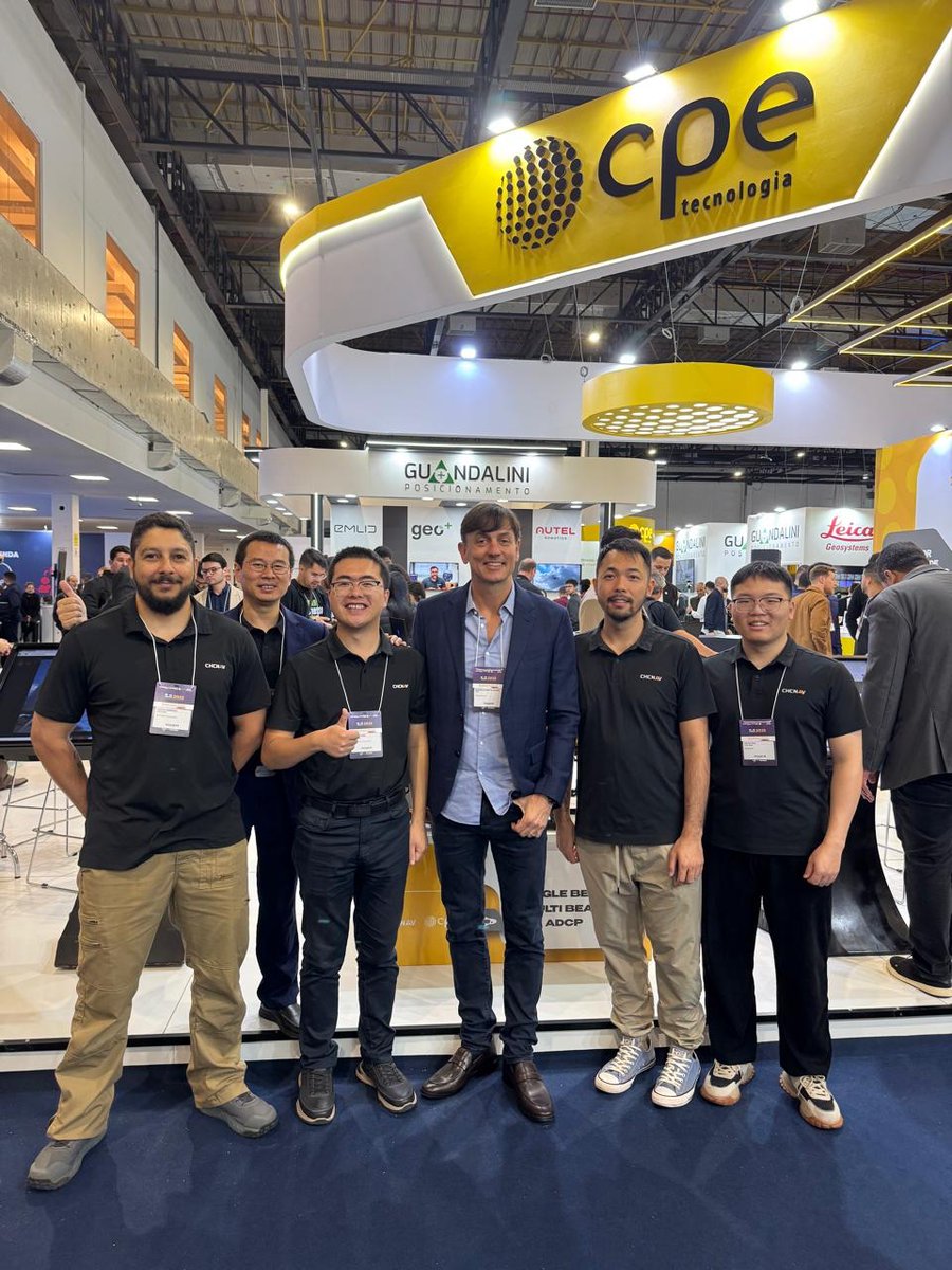
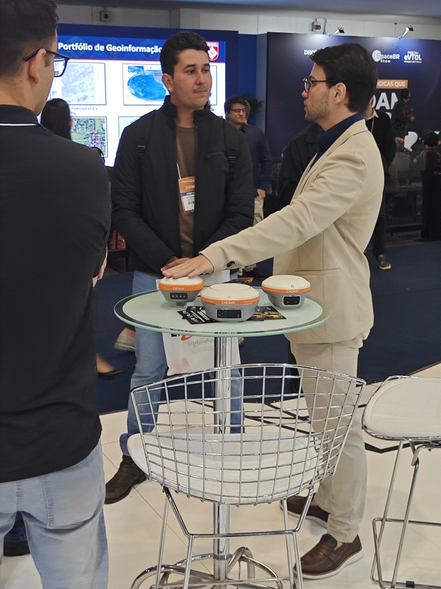
Visit us at MundoGeo to discuss the latest advancements in geospatial technology with CHCNAV and our partner CPE Tecnologia. This year, we are presenting solutions including the RS10 SLAM Scanner, AU20 LiDAR, and i93 GNSS Receiver. Meet us at booth #304 to learn more. 🌍📡🤝


The CHCNAV X500 UAV, with its 5kg payload capacity, enables easier airborne mapping using the AU20 LiDAR, operating simultaneously with the C30 RGB camera for efficient data collection. Discover how the X500 improves mapping efficiency: bit.ly/3GuAiSg

Planning to store your GNSS receiver long-term? Charge the battery to ~80% beforehand and recharge every two months to protect its lifespan. In daily use, simply avoid prolonged low-charge periods. #GNSS #BatteryCare

Adelaide ✓ Melbourne ✓ Next stop: Perth for our final Roadshow in this series! Discover our advanced Drone, LiDAR, SLAM Scanner & Marine solutions. DM us to talk with our professionals. #CHCNAV #Geospatial


In this video, our partner Mark shares his appreciation for the coordinate system capabilities in LandStar8 with our product manager Rachel, highlighting how this functionality streamlines the surveying process. Learn more:bit.ly/3R5a3DW #chcnav #surveying #landstar
In line with our commitment to transparency, our new ESG report offers an in-depth look at our efforts in environmental stewardship, social engagement, and robust governance. You can review the report and our progress here: bit.ly/43gTtXy


United States Trends
- 1. Purdy 22.3K posts
- 2. #WWERaw 42.3K posts
- 3. Panthers 28.6K posts
- 4. Mac Jones 4,337 posts
- 5. 49ers 30.4K posts
- 6. Penta 6,510 posts
- 7. Jaycee Horn 2,070 posts
- 8. Gunther 12K posts
- 9. #KeepPounding 4,511 posts
- 10. Melo 17.3K posts
- 11. Canales 10.6K posts
- 12. #FTTB 4,060 posts
- 13. Niners 4,332 posts
- 14. #RawOnNetflix 1,694 posts
- 15. #MondayNightFootball N/A
- 16. Kittle 3,093 posts
- 17. Mark Kelly 158K posts
- 18. 3 INTs 2,123 posts
- 19. Joe Buck N/A
- 20. Rico Dowdle 1,118 posts
You might like
-
 DesertRotor
@DesertRotor -
 LAND SURVEYORS UNITED ✊ ɢʟᴏʙᴀʟ sᴜʀᴠᴇʏɪɴɢ ᴄᴏᴍᴍᴜɴɪᴛʏ
@LandSurveyorsU -
 ComNav Technology
@ComNav_Tech -
 Ukrainian Grain Association
@UkrGrain -
 RPLS
RPLS
@RPLScommunity -
 Dianna Guevara✨
@ladiannita -
 Everything is Somewhere
@surveying -
 GIM International
@gim_intl -
 Emlid
Emlid
@emlid -
 EFIX Geomatics
@EFIX_Geomatics -
 Schiebel Group
@SchiebelGroup -
 Carlson Software
@CarlsonSoftware -
 Eos Positioning Systems
@EosGNSS -
 Tersus GNSS RTK
@TersusGNSS -
 DeTect
@DeTect__Inc
Something went wrong.
Something went wrong.