
Geoapify
@geoapify
Location Platform to create location-aware apps! Try our APIs, online tools, tutorials. #maps #maptiles #geocoding #routing #isolines #routeoptimization
Vous pourriez aimer


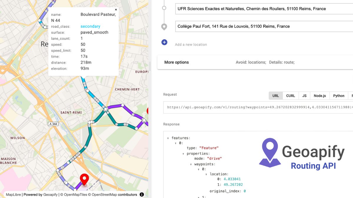
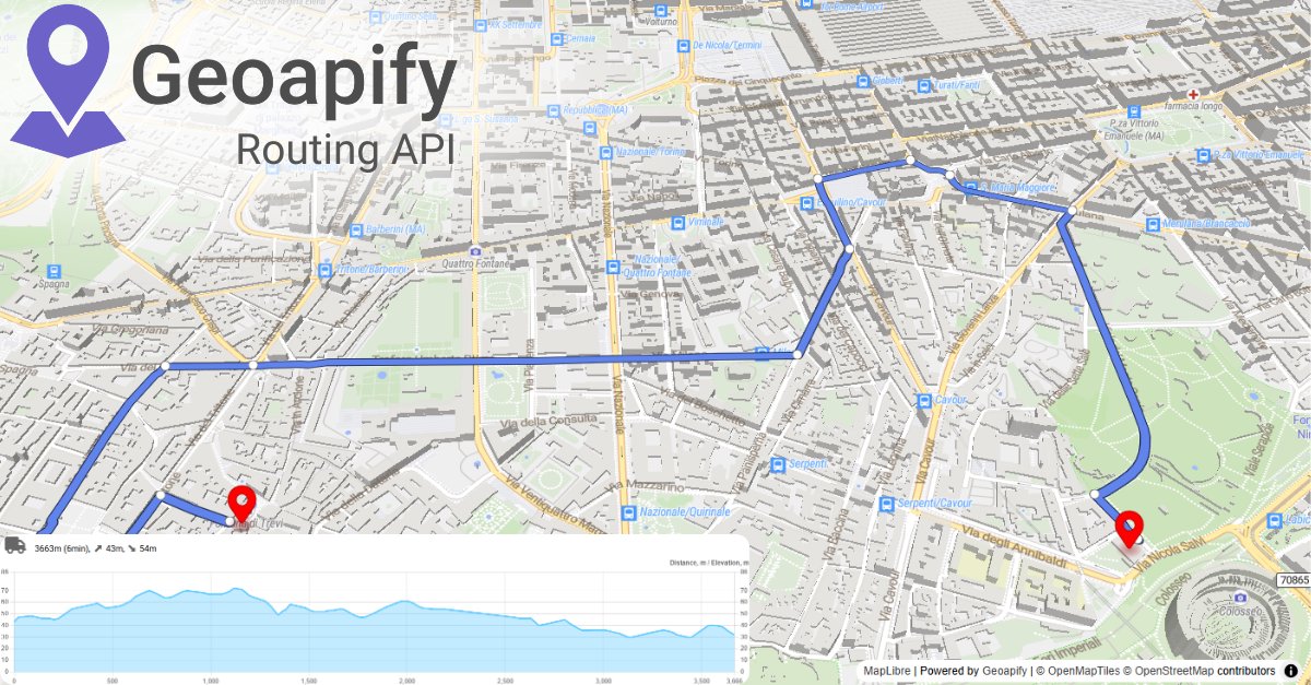
Need to know road surface or road class along your route? 🛣️ Geoapify Routing API provides detailed segment info – perfect for bike apps, logistics, or fleet planning. Plan smarter, ride smoother! Explore now → geoapify.com/routing-api/ #RoutingAPI #RoadData #CyclingApps…
🌍 Only want reverse-geocoding results from one country? No problem. This Python reverse geocode code sample lets you filter by country code (US , DE , FR, ...) so you don’t get noisy results from across the border. #Python #ReverseGeocoding #Geoapify #GeoDev #GIS…
Need all the world’s cities, towns, and villages in one dataset? 🌍 Download structured, ready-to-use data for any country — free from Geoapify. 👉 geoapify.com/download-all-t… #Geoapify #OpenData #Developers #Geospatial #DataScience

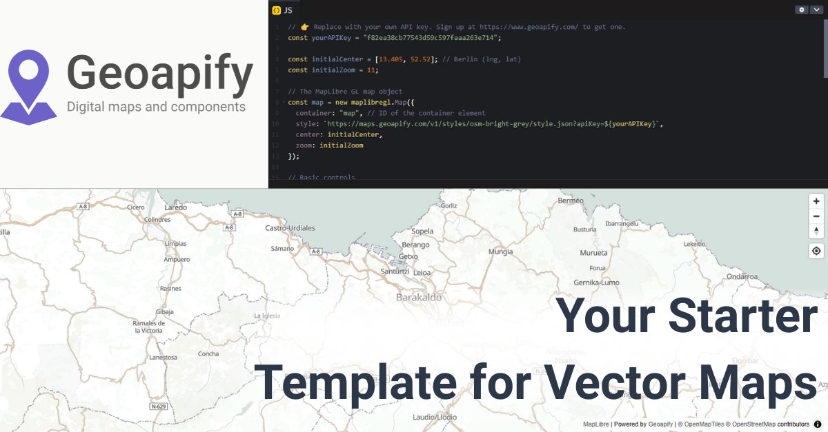
Need a blank-slate map to build on? 🗺️ Fork this MapLibre + Geoapify template: • preset center/zoom • metric scale • geolocate control Go from “hello map” → “prod-ready” fast. 👉 codepen.io/geoapify/pen/G… #Geoapify #MapLibre #WebDev #Mapping #DevTools
Build reachability maps in your favorite libraries! 🗺️ Geoapify Isoline API returns GeoJSON – perfect for Leaflet, MapLibre, or OpenLayers. Quick to integrate, easy to visualize. Explore → geoapify.com/isoline-api/ #IsolineAPI #GeoJSON #MappingSolutions #Developers #Geoapify
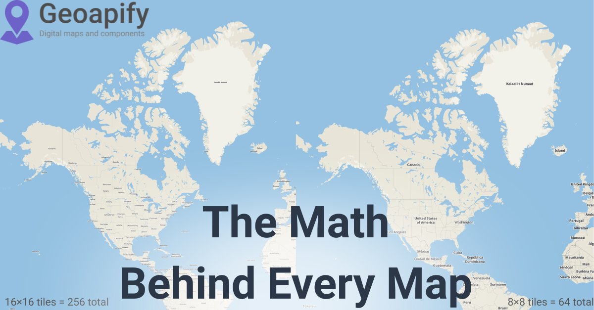
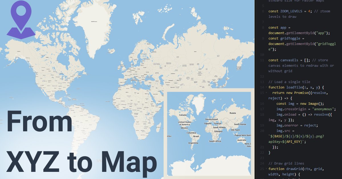
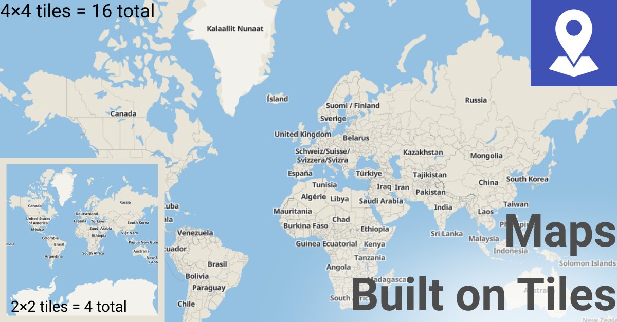
From basemaps to vector tiles — every web map runs on XYZ tile coordinates. 🧩 Understand zoom levels → build smarter, faster maps. 👉 dev.to/geoapify-maps-… #Geoapify #Mapping #Developers #WebDev #Geospatial
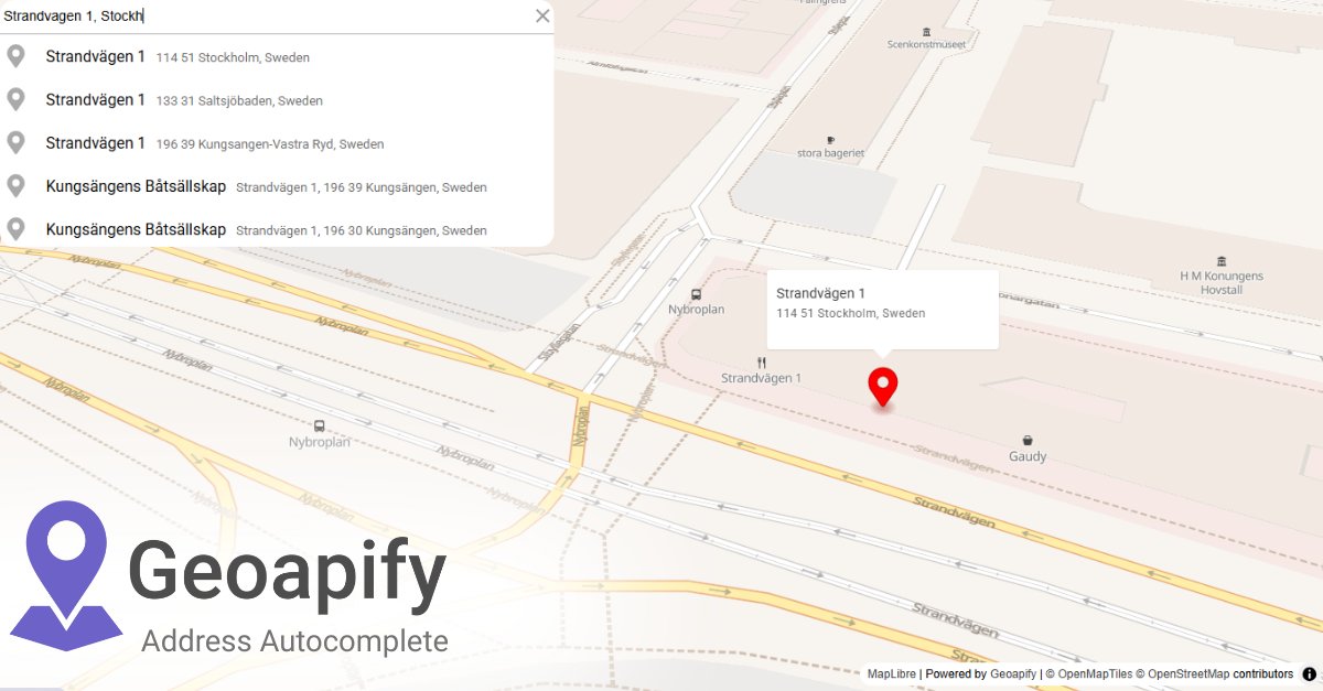
Instead of cleaning addresses after they’re stored, validate them while typing. Address Autocomplete API → structured results (street, city, postcode, country). 👉 apidocs.geoapify.com/playground/geo… #Geoapify #APIs #WebDev
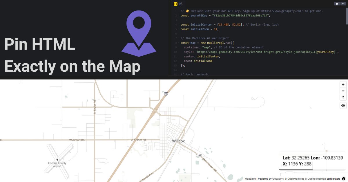
Stop guessing overlay positions ✋ Use MapLibre’s map.project() to anchor DOM elements exactly where your features are. Example 👉 codepen.io/geoapify/pen/x… #Geoapify #MapLibre #WebDev #GIS #Developers
Confused by map tile math? 🤔 Our guide breaks down how zoom levels and XYZ coordinates turn the globe into loadable map tiles. 🌍 👉 dev.to/geoapify-maps-… #Geoapify #Mapping #Geospatial #WebDev #Developers
ETAs without traffic context = misleading. 🛑 The Geoapify Routing API simulates rush-hour conditions to provide more realistic travel times than “empty road” routing. Try it here 👉 apidocs.geoapify.com/playground/rou… #Geoapify #Routing #WebDev #APIs #Geospatial
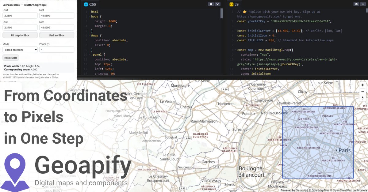
Custom charts, infoboxes, or DOM elements on a map? 🖼️ Convert geographic bounds → pixel width & height using map zoom + viewport size formulas. Live demo 👉 codepen.io/geoapify/pen/d… #Geoapify #MapLibre #Geospatial #Mapping #DevTools #WebDev
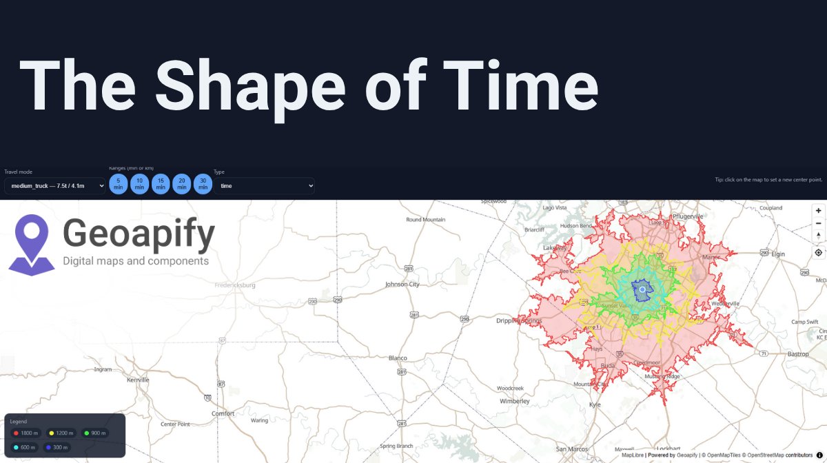
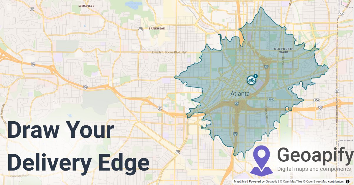
From delivery zones 🚚 to real-estate search 🏠 — multi-range isolines give users a clear picture of travel times. Build them with Geoapify Isoline API + MapLibre → 👉 dev.to/geoapify-maps-… #Geoapify #Isolines #UX #WebMapping #Developers
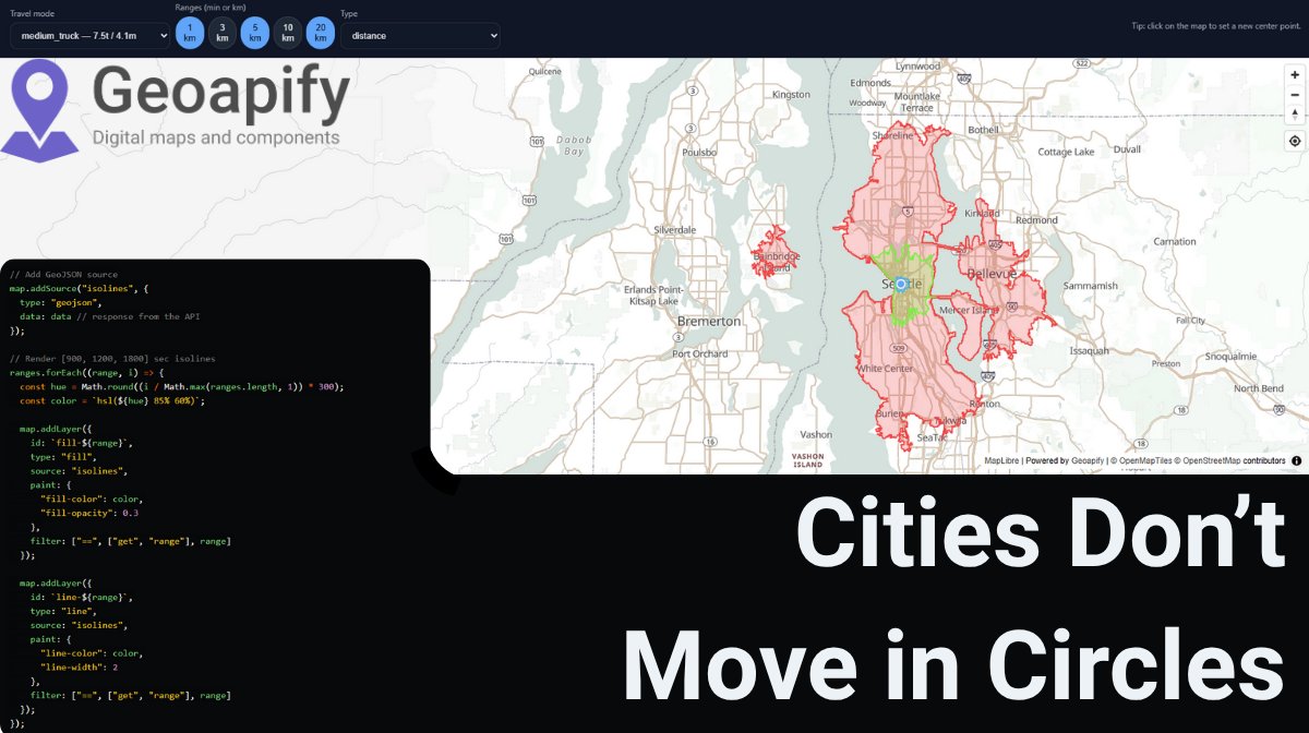
Circles lie. 🚫 A 10-km circle ≠ a 10-km drive. The Isoline API builds reachability polygons from real routing data (roads, modes, traffic). 👉 codepen.io/geoapify/pen/B… #Geoapify #Isolines #Routing #Geospatial #Developers

Got multiple technicians or drivers? 🛠️ The Route Matrix API computes travel times & distances between many origins and destinations — the data you need to: 📅 Schedule visits 🚚 Assign drivers efficiently 📉 Cut wasted time & distance 👉 geoapify.com/route-matrix-a… #Geoapify…

Zoom in = more tiles. Zoom out = fewer tiles. Behind every web map is a grid of XYZ coordinates. 🧩 Learn how it works → dev.to/geoapify-maps-… #Geoapify #Mapping #Geospatial #WebDev #Developers
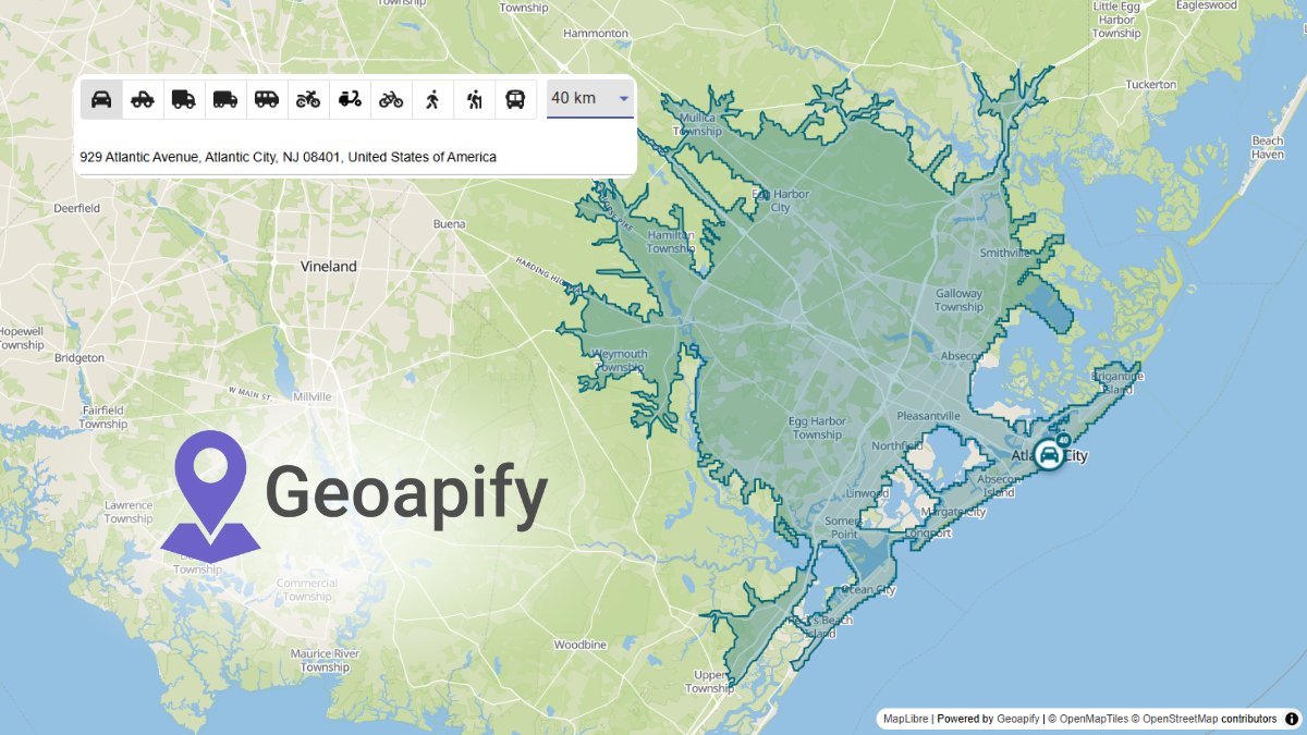
Choosing a store location? 🏪 The Isoline API shows how many people are within a 10-minute walk, bike, or drive. Make decisions with real reachability, not circles. 👉 geoapify.com/isoline-api/ #Geoapify #Isolines #RetailTech #Developers #Geospatial
Every web map runs on XYZ tiles. 🧩 Zoom in → more tiles. Zoom out → fewer tiles. See it in action 👉 codepen.io/geoapify/pen/z… #Geoapify #Mapping #WebDev #Developers #Geospatial

“How far can I go in 5…10…15 minutes?” Multi-range isolines answer that in one map. 🗺️ 👉 dev.to/geoapify-maps-… #Geoapify #Isolines #Geospatial #WebDev #Developers
Need address to latitude/longitude results in the format your app understands? 🛠️ Geoapify Geocoding API supports multiple output formats: ➡️ format=json → default JSON ➡️ format=geojson → GeoJSON for mapping ➡️ format=xml → XML for legacy systems Flexible for any workflow!…


United States Tendances
- 1. Wemby 77.3K posts
- 2. Spurs 49.8K posts
- 3. #QueenRadio 19.9K posts
- 4. Cooper Flagg 13.5K posts
- 5. Clippers 11.6K posts
- 6. Mavs 18.1K posts
- 7. Victor Wembanyama 23.7K posts
- 8. Anthony Edwards 6,279 posts
- 9. Dillon Brooks 1,200 posts
- 10. Maxey 11.4K posts
- 11. Anthony Davis 6,364 posts
- 12. VJ Edgecombe 25.4K posts
- 13. #PorVida 2,625 posts
- 14. Suns 16.1K posts
- 15. Embiid 14.2K posts
- 16. Sixers 24.5K posts
- 17. Blazers 3,955 posts
- 18. Lavine 1,418 posts
- 19. #AEWDynamite 24.6K posts
- 20. Klay 8,040 posts


Something went wrong.
Something went wrong.