#webmapping search results

Our research team is currently looking for a Web Map Developer to join our team in designing an open #webmapping and GIS platform to account and track the emergence and spread of #invasiveweeds🍀in order to support their efficient management. Please see the attached offer 👇


Incredible 5 cm/px resolution aerial imagery for Prague on the MapTiler Satellite map. From Charles Bridge and Prague Castle to Old Town Square and the Dancing House, see the city in remarkable detail. Check the update at maptiler.link/3Hlic69 #AerialImagery #WebMapping
Upload spatial raster files directly to MapTiler Cloud! We’re making it easy to add your GIS data to web maps; try one of these key formats: GeoTIFF, GeoJPEG2000, MrSID, ECW. Find out more here: maptiler.link/3BkKVnW #webmaps #webmapping
Converting your #drone imagery or other data into #map tiles gets complicated. We’ve enhanced how you can save, update, & load tasks in MapTiler Engine, letting you adapt your processes rather than starting from scratch. Learn more: maptiler.link/3UYbNB2 #WebMapping #MapTiling
Our Elevation API lets you look up the elevation of a single location, a batch of points, a GeoJSON LineString, or a GeoJSON MultiLineString. Get all the parameters and see how it works here: maptiler.link/4lKryGE #WebMapping #GeoAPIs


#Webmapping apps shouldn't feel like you're stuck in rush hour traffic. Explore 8 powerful strategies to optimize #geospatialdata performance and create seamless, fast-loading maps that elevate user experience. Read our blog now! bit.ly/4gMxvAY

All great ideas from Bern: 10 ArcGIS Online New Year's resolutions: Here are ten ways to improve 2023 with ArcGIS Online! #arcgis #webmapping ow.ly/CG6P50Mib5b

🗺🛠 Deux nouveaux tutos @qgis réalisés par les M2 @E_Sigat ! 🌐qgis2web pour faire du #webmapping facilement depuis QGIS docs.google.com/presentation/d… 🏔 Récupérer directement dans QGIS des #MNT partout dans le monde docs.google.com/presentation/d…


7.5 cm/px aerial imagery of the Netherlands on MapTiler Satellite. From Amsterdam’s canals to the North Sea coastline, every feature is now sharper than ever. Check the update at maptiler.link/479B1nf #AerialImagery #WebMapping

2024 aerial data for the Netherlands is now available on MapTiler's Satellite map. Explore cities, countryside, and coastline with the latest imagery. Read more at maptiler.link/479B1nf #AerialImagery #WebMapping

Finally finished client-side raster symbolizer on-the-fly with OpenLayers. It works like vector-tiles now. Next step is to add ColorBrewer functionality. #webgis #GIS #webmapping


📷 A través de Web Mapping, puedes explorar indicadores sociales por provincia, municipio y sección, facilitando la toma de decisiones en políticas públicas, investigaciones y programas de protección social. #DatosParaDecidir #WebMapping


Meet members of the #K12 group @OAGEEOntarioGeo on Friday @YorkUEUC. Check out our workshops on how to navigate the world of #geospatialdata, #webmapping, field #datacollection, +#geographicanalysis w/#ArcGISOnline! Visit us at the @esricanada booth! @GIS4Teachers

New 2024 aerial imagery for Prague on MapTiler’s Satellite map. With vibrant colors and sharper details, it will bring the city to life in your webmaps and apps. Read more at maptiler.link/3Hlic69 #WebMapping #AerialImagery

Get the height above sea level for any location using our Elevation API. Find out how you can use this with your maps in our documentation: maptiler.link/3UKNrKN #WebMapping #GeoAPIs


Enable placename searches in your #React maps! Let users search your map for States, Cities, Streets, Addresses, POIs, and more. Check out the latest video in our #MapsInReact YouTube series, which walks you through the code: maptiler.link/4emfEit #WebMapping #Maps #JavaScript


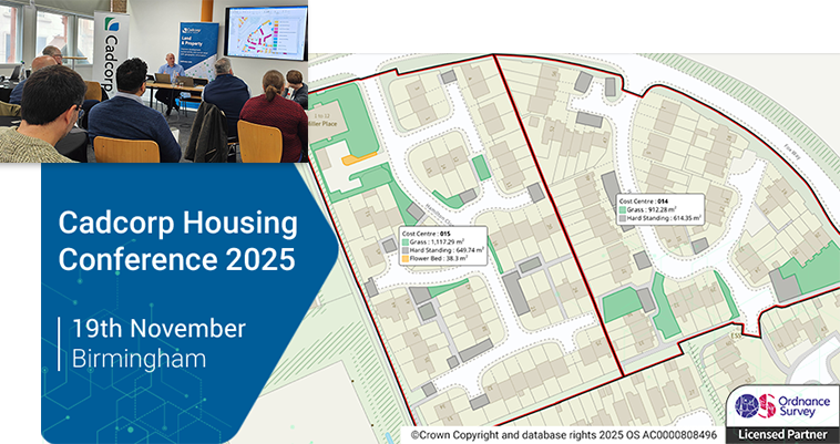
** Nearing capacity ** - we have a few places remaining at the @Cadcorp Housing Conference 2025 - Join us for demos and real-world use cases showing how to use #GIS and #WebMapping for daily operations and long-term planning in #SocialHousing - mailchi.mp/cadcorp.com/hc…

Heatmaps can be made on the fly in #React using MapTiler #SDK helpers! Watch this tutorial and try it on your point data. Learn how to add a switch to flip between showing points and the heatmap, and how to add weightings based on attributes: maptiler.link/3NETnkS #WebMapping…

WEBINAR: Succeeding at community engagement - See how #HousingAssociations can improve tenant satisfaction with #GIS and #WebMapping - mailchi.mp/cadcorp.com/su…

** Nearing capacity ** - we have a few places remaining at the @Cadcorp Housing Conference 2025 - Join us for demos and real-world use cases showing how to use #GIS and #WebMapping for daily operations and long-term planning in #SocialHousing - mailchi.mp/cadcorp.com/hc…

Thrilled to share my Spatial Intelligence Platform, a POI web app for exploring, analyzing and visualizing spatial data. Check out the demo below. #GIS #SpatialIntelligence #WebMapping #DataVisualization #Geospatial #Mapping #OpenData #Innovation #SmartMapping #LocationIntelli

Leaflet + Geoapify Places API demo: pick categories, move the map, and watch markers stream in. Try it → codepen.io/geoapify/pen/M… (via @CodePen) #Leaflet #Geoapify #WebMapping #OpenStreetMap #JavaScript

Agenda now online for the @Cadcorp Housing Conference 2025 - Join us to hear from #HousingAssociations that use #GIS and #WebMapping to successfully manage day-to-day housing operations, expand resident engagement, and inform longer-term planning - mailchi.mp/cadcorp.com/hc…
7.5 cm/px aerial imagery of the Netherlands on MapTiler Satellite. From Amsterdam’s canals to the North Sea coastline, every feature is now sharper than ever. Check the update at maptiler.link/479B1nf #AerialImagery #WebMapping


Join this @SafeSoftware webinar tomorrow @ 4pm Irish Time, "Web Mapping 101: Creating Dynamic Web Maps with Geospatial Data", & learn how to create interactive web maps using FME, OpenLayers, Leaflet & more. Register now: zurl.co/q3uxA #WebMapping #FME #GIS


This is huge news for emersive online #maps! #WebMapping #GaussianSplats #GIS #geospatial
1 BILLION GAUSSIAN SPLATS (or more 🤫) in online maps! One of the biggest innovations in recent years is coming your way. Want to know more? Join MapTiler Connect on October 21st! maptiler.link/4nii5rL Data source: Andrii Shramko #MapTilerConnect #gaussiansplatting #splats
Our Elevation API lets you look up the elevation of a single location, a batch of points, a GeoJSON LineString, or a GeoJSON MultiLineString. Get all the parameters and see how it works here: maptiler.link/4lKryGE #WebMapping #GeoAPIs
Incredible 5 cm/px resolution aerial imagery for Prague on the MapTiler Satellite map. From Charles Bridge and Prague Castle to Old Town Square and the Dancing House, see the city in remarkable detail. Check the update at maptiler.link/3Hlic69 #AerialImagery #WebMapping


Be the web mapping pro in your team! 🌐 Master tiles, zoom levels, scale, coordinate systems, and projections. Dive into the essentials for better #maps with our 4-part YouTube series Web Mapping Basics: maptiler.link/3RbuLmQ 🚀 #WebMapping

Leaflet + Geoapify Places API demo: pick categories, move the map, and watch markers stream in. Try it → codepen.io/geoapify/pen/M… (via @CodePen) #Leaflet #Geoapify #WebMapping #OpenStreetMap #JavaScript
Our research team is currently looking for a Web Map Developer to join our team in designing an open #webmapping and GIS platform to account and track the emergence and spread of #invasiveweeds🍀in order to support their efficient management. Please see the attached offer 👇
All great ideas from Bern: 10 ArcGIS Online New Year's resolutions: Here are ten ways to improve 2023 with ArcGIS Online! #arcgis #webmapping ow.ly/CG6P50Mib5b

Little-known expressions are some of the most powerful tools to use on your Mapbox map. This example shows you how to use a "within" expression to style points depending on whether or not they are inside of Colorado: buff.ly/44lowAa #mapdesign #webmapping

Our "coalesce" expression lets developers run through a priority list of images and select the first valid option. In this example, learn to use coalesce expressions so that all of your points of interest have a fallback icon: buff.ly/3PDEZvA #webmap #webmapping


3 years of Leaflet love! 🔥 This lightweight mapping library makes creating interactive maps a breeze. Just used it to visualize digital land properties – way easier to understand! #LeafletJS #WebMapping


Our dark & light #map styles just got a serious #cartography update! Check out the new icons for points of interest on your favorite map: Dark styles: buff.ly/4afvk5v Light styles: buff.ly/4a9M0eG #WebMapping #Cartography

Join the hunt! We’ve hidden #EasterEggs in some appropriately named places all around the world! Solve the clues and zoom in to reveal them. 🐇 🐣 🗿 🌷 buff.ly/49lJwZW #Easter #Webmapping

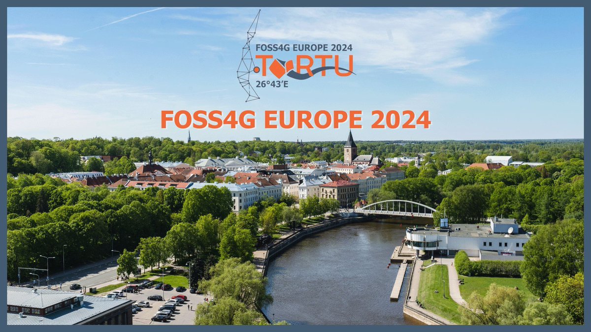
Don't forget @JachymCepicky's talk at #FOSS4G Europe about #WebMapping starts at 14:30 in room 301. The live stream is here: bit.ly/3xCFv6i #FOSS4GE #FOSS4GE2024
Do you need to integrate automatic conversion between coordinate systems or search for EPSG codes? Coordinates API offers both from high-availability infrastructure with fast and reliable servers. Explore the API at buff.ly/3wkd2kT #geodata #webmapping

Our Elevation API lets you look up the elevation of a single location, a batch of points, a GeoJSON LineString, or a GeoJSON MultiLineString. Get all the parameters and see how it works here: maptiler.link/4lKryGE #WebMapping #GeoAPIs
Get the height above sea level for any location using our Elevation API. Find out how you can use this with your maps in our documentation: maptiler.link/3UKNrKN #WebMapping #GeoAPIs
🗺🛠 Deux nouveaux tutos @qgis réalisés par les M2 @E_Sigat ! 🌐qgis2web pour faire du #webmapping facilement depuis QGIS docs.google.com/presentation/d… 🏔 Récupérer directement dans QGIS des #MNT partout dans le monde docs.google.com/presentation/d…
Meet members of the #K12 group @OAGEEOntarioGeo on Friday @YorkUEUC. Check out our workshops on how to navigate the world of #geospatialdata, #webmapping, field #datacollection, +#geographicanalysis w/#ArcGISOnline! Visit us at the @esricanada booth! @GIS4Teachers
📷 A través de Web Mapping, puedes explorar indicadores sociales por provincia, municipio y sección, facilitando la toma de decisiones en políticas públicas, investigaciones y programas de protección social. #DatosParaDecidir #WebMapping
Leaflet + Geoapify tiles = map in minutes. 🗺️ This template sets up: ✔️ Map view ✔️ Retina tile support ✔️ Clean attribution Code 👉 codepen.io/geoapify/pen/g… #DevTools #WebMapping #APIs

Enable placename searches in your #React maps! Let users search your map for States, Cities, Streets, Addresses, POIs, and more. Check out the latest video in our #MapsInReact YouTube series, which walks you through the code: maptiler.link/4emfEit #WebMapping #Maps #JavaScript
GPX track too big? Compress it without losing shape! 📉 We simplify tracks to <1000 points for @Geoapify Map Matching API and visualize with MapLibre GL 🗺️ Code → github.com/geoapify/maps-… #WebMapping #JS #GPXTools #OpenSourceGIS #GeoTech

New 2024 aerial imagery for Prague on MapTiler’s Satellite map. With vibrant colors and sharper details, it will bring the city to life in your webmaps and apps. Read more at maptiler.link/3Hlic69 #WebMapping #AerialImagery
Something went wrong.
Something went wrong.
United States Trends
- 1. #GivingTuesday 14.4K posts
- 2. The BIGGЕST 426K posts
- 3. #ALLOCATION 233K posts
- 4. #JUPITER 233K posts
- 5. Lucario 12.8K posts
- 6. #NXXT_NEWS N/A
- 7. #csm222 N/A
- 8. Michael Dell 3,106 posts
- 9. Good Tuesday 38.2K posts
- 10. NextNRG Inc 1,042 posts
- 11. Costco 37.3K posts
- 12. Michael and Susan 1,448 posts
- 13. Taco Tuesday 13.2K posts
- 14. Hoss Cartwright N/A
- 15. Dart 42.4K posts
- 16. Trump Accounts 7,075 posts
- 17. Kanata 28.9K posts
- 18. Mainz Biomed N.V. N/A
- 19. King Von 1,048 posts
- 20. Pentagon 65.5K posts